 Use Marker Groups
 Wolf 2002
Piru 2003
Day 2006
Zaca 2007
Gap 2008
La Brea 2009

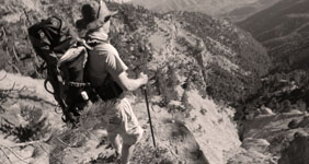
1,257 Miles of Trails on 1,762,400 Acres, with 875,000 Acres of Protected Wilderness to Explore.
Thank you for taking the time to visit the Hike Los Padres Community. This website was created with the mission of being a source of shared information on trails, camps, and locations across the entire Northern and Southern portions of the Los Padres National Forest. The more information we all share and catalog, the better we can track the conditions of the forest network and figure out what sections, trails, and locations are safe to use and which need maintenance.
A good portion of the interior of Los Padres National Forest gets very little use by the public, so any information on these areas will ensure that these places remain accessible for future generations of hikers, backpackers, trail runners, equestrians, O.H.V, hunters, cyclists, and explorers. Many of the trails listed may be unmaintained. Know your level of ability, and always remember to bring extra water.
In partnership with the Los Padres Forest Association (LPFA). The LPFA’s mission is to care for the Los Padres Forest, ensuring it thrives and remains safe and open for the people to use and enjoy. LPFA volunteers work to keep trails open, report and assess forest conditions and provide public education on how to use the forest safely. If you are interested in becoming a member or volunteering, please visit www.lpforest.org to learn more.
Location specific weather reports, recent camp and trail surveys, water data and much more.
 Ballinger Route 19 OHV… Ballinger Route 54 OHV… Ballinger Route 10 OHV… Queen Bee OHV Trail Ballinger Route 49 OHV…
| Location | Date ▾ | Surveyor | Water Report |
|---|---|---|---|
| Sykes Hot Springs | 10-1-1996 | Los Padres Forest Association | Flowing |
| Mono Campground | 1-1-2024 | Los Padres Forest Association | Flowing |
| Chorro Grande Camp | 04-28-2025 | Anonymous Surveyor | Trickle |
| White Ledge Camp - Red Reef Trail | 04-27-2025 | Anonymous Surveyor | Flowing |
| Matias Potrero Camp | 04-19-2025 | Brian King | Dry |
| Mansfield Camp | 04-19-2025 | Randy Lahey | Flowing |
| South Fork Camp - Sisquoc | 04-19-2025 | Randy Lahey | Flowing |
| Pine Mountain Lodge Camp | 04-18-2025 | Brandon Steets | Flowing |
| Fishbowls Camp | 04-18-2025 | Brandon Steets | Flowing |
| Alcove Camp | 04-18-2025 | Randy Lahey | Trickle |
| Bear Creek Camp | 04-17-2025 | Daniel J. Hall | Flowing |
| Manzana Schoolhouse Camp | 04-15-2025 | BJ | Flowing |
| Estrella Camp | 04-12-2025 | Anonymous Surveyor | Flowing |
| Heath Camp | 04-12-2025 | Antonio Calderon | Flowing |
| South Fork Camp - Sisquoc | 04-12-2025 | Antonio Calderon | Flowing |
| Gridley Springs Camp | 04-06-2025 | Anonymous Surveyor | Trickle |
| Ant Camp | 04-06-2025 | Rick Hayes | Flowing |
| Painted Rock Camp | 04-06-2025 | Dave Bourgeois | Flowing |
| Oak Camp | 04-03-2025 | Chris Houlberg - Scoutmaster Troop119 | Flowing |
| Cow Spring Camp | 03-30-2025 | Laura Clay | Flowing |
| Valley View Camp | 03-29-2025 | Gio | Flowing |
| 19 or Nineteen Oaks Camp | 03-28-2025 | Jen Smith | Trickle |
| Sheep Camp | 03-27-2025 | Anonymous Surveyor | Flowing |
| Manzana Narrows Camp | 03-24-2025 | Anonymous Surveyor | Flowing |
| Fish Creek Camp | 03-24-2025 | Anonymous Surveyor | Flowing |
| Rays Camp | 03-24-2025 | Anonymous Surveyor | Flowing |
| Manzana Camp | 03-24-2025 | Anonymous Surveyor | Flowing |
| Lion Den Camp | 03-24-2025 | Josh | Flowing |
| West Fork Lion Camp | 03-23-2025 | Andy | Flowing |
| Lost Valley Camp | 03-23-2025 | Patrick R. Morgan | Flowing |
| Fish Creek Camp | 03-23-2025 | Patrick R. Morgan | Flowing |
| Rays Camp | 03-23-2025 | Patrick R. Morgan | Flowing |
| Manzana Narrows Camp | 03-23-2025 | Patrick R. Morgan | Flowing |
| Alcove Camp | 03-23-2025 | Patrick R. Morgan | Flowing |
| Lady Bug Camp | 03-22-2025 | Rick Hayes | Flowing |
| Middle Camuesa Camp | 03-21-2025 | Los Padres Forest Association | Dry |
| Log Cabin Camp | 03-16-2025 | Laura Clay | Flowing |
| South Fork Camp - Sisquoc | 03-12-2025 | Paul Costales | Flowing |
| Cottam Camp | 03-08-2025 | Omar Eff | Flowing |
| Piedra Blanca Camp | 03-08-2025 | Jose Fuentes | Flowing |
| Mono Campground | 03-08-2025 | Braulio Aguilera | Flowing |
| Rock Campground | 03-08-2025 | Braulio Aguilera | Flowing |
| Pine Mountain Lodge Camp | 03-07-2025 | Anonymous Surveyor | Flowing |
| Nira Campground | 03-02-2025 | j0nny | Flowing |
| Manzana Narrows Camp | 03-02-2025 | Paul Costales | Flowing |
| Twin Forks Camp | 03-01-2025 | Alex Perry | Flowing |
| Piedra Blanca Camp | 03-01-2025 | Jon Bain | Flowing |
| Llly Meadows Camp | 03-01-2025 | Anonymous Surveyor | Flowing |
| Sheep Camp | 03-01-2025 | Anonymous Surveyor | Flowing |
| Mission Pine Springs Camp | 03-01-2025 | Paul Costales | Flowing |
| Mission Pine Basin Camp | 03-01-2025 | Paul Costales | Trickle |
| Mansfield Camp | 03-01-2025 | Paul Costales | Flowing |
| Cottam Camp | 02-28-2025 | Rob Guzzon | Flowing |
| McKinley Spings Camp | 02-28-2025 | Paul Costales | Trickle |
| McKinley Spings Camp | 02-23-2025 | Anonymous Surveyor | Trickle |
| Hidden Potrero Camp | 02-22-2025 | Antonio Calderon | Dry |
| Santa Cruz Camp | 02-22-2025 | Antonio Calderon | Flowing |
| Gridley Springs Camp | 02-17-2025 | Anonymous Surveyor | Flowing |
| Shady Camp | 02-16-2025 | Shaddus Maximus | Flowing |
| Cove Camp | 02-15-2025 | Shaddus Maximus | Flowing |
Please click on a report below to view the survey
 Sykes Hot Springs Survey - 10-1-1996 - by Los Padres Forest Association
| Link: | Sykes Hot Springs |
| Date: | 10-1-1996 |
| Surveyor Name: | Los Padres Forest Association |
| Camp Description: | A story about a missed chance at visiting Sykes from 1996. Worth a read: https://www.latimes.com/lifestyle/story/2025-03-03/big-sur-wildfire-threat-camping-survival-story-between-a-rock |
| Water Source: | Flowing |
| Water Source Details: | |
| Weather Conditions: |
Mono Campground Survey - 1-1-2024 - by Los Padres Forest Association| Link: | Mono Campground |
| Date: | 1-1-2024 |
| Surveyor Name: | Los Padres Forest Association |
| Camp Description: | Historic video showing the construction of the Mono Debris Dam from 1936, enjoy! https://archive.org/details/CCCAtMono1936 |
| Water Source: | Flowing |
| Water Source Details: | |
| Weather Conditions: |
Chorro Grande Camp Survey - 04-28-2025 - by Anonymous Surveyor| Link: | Chorro Grande Camp |
| Date: | 04-28-2025 |
| Surveyor Name: | Anonymous Surveyor |
| Camp Description: | One fire box and one stone fire ring were setup at the camp. A bit of snow was left on the ground the first day. I could hear significant wind gusts in the trees during the night, however the campsite is very well sheltered from the wind so it was not a problem. |
| Water Source: | Trickle |
| Water Source Details: | Plenty for filling water bottles |
| Weather Conditions: | 60F during the day and low 30s at night |
White Ledge Camp - Red Reef Trail Survey - 04-27-2025 - by Anonymous Surveyor| Link: | White Ledge Camp - Red Reef Trail |
| Date: | 04-27-2025 |
| Surveyor Name: | Anonymous Surveyor |
| Camp Description: | Camp is in good condition. Fallen trees are not in the way of placing a few tents. Stream is flowing nicely |
| Water Source: | Flowing |
| Water Source Details: | >1gal/min |
| Weather Conditions: | Overcast and drizzly |
Matias Potrero Camp Survey - 04-19-2025 - by Brian King | Link: | Matias Potrero Camp |
| Date: | 04-19-2025 |
| Surveyor Name: | Brian King |
| Camp Description: | is challenging to find. there was some orange trail tape on some small oaks that helped to go in the direction, but trail is overgrown. |
| Water Source: | Dry |
| Water Source Details: | |
| Weather Conditions: | suuny 70 degrees |
Mansfield Camp Survey - 04-19-2025 - by Randy Lahey| Link: | Mansfield Camp |
| Date: | 04-19-2025 |
| Surveyor Name: | Randy Lahey |
| Camp Description: | The trail between South Fork and Mansfield is bad. Walk the creek between 34.754830, -119,763220 and 34.754041, -119.757091 as well as 34.754233, -119.755075 and 34.752182, -119.750182. |
| Water Source: | Flowing |
| Water Source Details: | Good flow |
| Weather Conditions: |
South Fork Camp - Sisquoc Survey - 04-19-2025 - by Randy Lahey| Link: | South Fork Camp - Sisquoc |
| Date: | 04-19-2025 |
| Surveyor Name: | Randy Lahey |
| Camp Description: | The trail between South Fork and Mansfield is bad. Walk the creek between 34.754830, -119,763220 and 34.754041, -119.757091 as well as 34.754233, -119.755075 and 34.752182, -119.750182. |
| Water Source: | Flowing |
| Water Source Details: | Good flow |
| Weather Conditions: |
Pine Mountain Lodge Camp Survey - 04-18-2025 - by Brandon Steets| Link: | Pine Mountain Lodge Camp |
| Date: | 04-18-2025 |
| Surveyor Name: | Brandon Steets |
| Camp Description: | |
| Water Source: | Flowing |
| Water Source Details: | |
| Weather Conditions: |
Fishbowls Camp Survey - 04-18-2025 - by Brandon Steets| Link: | Fishbowls Camp |
| Date: | 04-18-2025 |
| Surveyor Name: | Brandon Steets |
| Camp Description: | |
| Water Source: | Flowing |
| Water Source Details: | |
| Weather Conditions: |
Alcove Camp Survey - 04-18-2025 - by Randy Lahey| Link: | Alcove Camp |
| Date: | 04-18-2025 |
| Surveyor Name: | Randy Lahey |
| Camp Description: | Water can be found away from camp on the other side of the main trail towards the falls. Water tastes yucky. |
| Water Source: | Trickle |
| Water Source Details: | |
| Weather Conditions: |
Please click on a report below to view the survey
Alamar Trail Survey - 04-27-2025 - by Horner | Link: | Alamar Trail |
| Date: | 04-27-2025 |
| Surveyor Name: | Horner |
| Trail description: | Trail overall is severely overgrown, washed out in some spots, and in need of maintenance. -Alamar Saddle to Unnamed Camp at the bottom of the switchbacks (34.68899, -119.60778) is overgrown with whitethorn ceanothus but mostly followable with alternating periods of smooth sailing, crawling, and everything in between. The tread on some of the switchbacks and steeper slopes is very faint and narrow. -Unnamed Camp to Bill Farris is severely overgrown and slow going with lots of crawling. -The creek crossing just south of Bill Farris washed out (trail crosses a tributary that comes in from the east). Trail was difficult to pick up here, it looks like water/debris got very high and gouged out new banks, taking out any crossings or trail markers that were here before. This crossing looks very similar to damage I observed in Montecito after the 2022/23 storms. Stay high here and do not cross the main creek. -Bill Farris to Dutch Oven involves less crawling as the trail moves higher into slower growing vegetation types. Still brushy and still needs work, but the chaparral here is easier to move through. There are many small washouts in this section where brush on the uphill side pushes hikers off the tread. Spot treading would be very helpful in this area. -Dutch Oven to Rollins to Lower Alamar/Tin Shack is severely overgrown and difficult to follow. There are a few sections where you can pick up the trail and make decent time, but we spent most of this section wandering the creek bed looking for signs of the trail. In some places the riparian vegetation is so thick and the banks are so high that the only logical path was the creek bed. I would estimate over 50% of the trail is completely gone between Dutch Oven and Lower Alamar. We planned for slow going and it was even slower than expected. Never exceeded 1 mile per hour. It took our group of experienced backpackers and bushwhackers a full day of very hard work to travel downhill from Alamar Saddle to Dutch Oven, and most of an additional long day to reach Lower Alamar. All camps had good flowing water. Every inch of the Alamar Trail needs maintenance. With that said, it is still somewhat followable in sections that are above recent high water levels. We couldn’t help but marvel at the effect that quality trail building and maintenance can have - even in the worst of the brush, a wide trail corridor that was cut in years past is still visible to the attuned eye. While crawling through whitethorn is always tough, it is still significantly easier and faster to crawl along the trail than to travel off trail in the thick chaparral. |
| Mode of transport: | Hike |
| Trail condition: | Hard to follow |
Red Reef Trail Survey - 04-27-2025 - by Anonymous Surveyor| Link: | Red Reef Trail |
| Date: | 04-27-2025 |
| Surveyor Name: | Anonymous Surveyor |
| Trail description: | Light rain. Road and trail are in good condition. |
| Mode of transport: | Hike |
| Trail condition: | Good shape and easy to follow |
Sisquoc Trail Upper Survey - 04-20-2025 - by Antonio Calderon | Link: | Sisquoc Trail Upper |
| Date: | 04-20-2025 |
| Surveyor Name: | Antonio Calderon |
| Trail description: | |
| Mode of transport: | Hike |
| Trail condition: | Needs some work |
Last Chance Trail Survey - 04-19-2025 - by Laura Clay| Link: | Last Chance Trail |
| Date: | 04-19-2025 |
| Surveyor Name: | Laura Clay |
| Trail description: | Hiked in 4/19 with intent to stay at Jackson Camp. After splitting from the Santa Paula Canyon Trail, things became increasingly difficult and after crossing the water at Cross Camp, the trail wasn't terrible but there eventually became so many instances of losing the trail and bushwhacking that we gave up short of camp and hiked all the way back to the trailhead. Plenty of water in the creek right now though |
| Mode of transport: | Hike |
| Trail condition: | Needs some work |
| Condition details: | Very tough to find after Cross Camp |
Hurricane Deck Trail Survey - 04-17-2025 - by BJ| Link: | Hurricane Deck Trail |
| Date: | 04-17-2025 |
| Surveyor Name: | BJ |
| Trail description: | Did Manzana loop from Lower Manzana to Potrero, then Hurricane to
Schoolhouse. It was very strenuous. Weather was overcast and 60
degrees, and with a pack I don't think I'd recommend even a small amount
warmer or cloudless. Saw zero humans from start to finish on this
portion. The uphill is rigorous. Trail was decent enough,
though the final 2 miles going down to the schoolhouse was completely
overgrown and the ground gave way. That was the worst maintained of the
trail. Plenty of poison oak. No water of course. Did this April 15
2025. First solo backpack. I expected to see rattlers on the trail,
but I never did. Continued from schoolhouse on day 2 on the Manzana
trail down to the lower manzana start. 37 water crossings. |
| Mode of transport: | Hike |
| Trail condition: | Needs some work |
| Condition details: | Hurrican Deck Trail from Potrero |
Sespe River Trail Survey - 04-17-2025 - by Daniel J. Hall| Link: | Sespe River Trail |
| Date: | 04-17-2025 |
| Surveyor Name: | Daniel J. Hall |
| Trail description: | Went only from Piedra Blanca Trailhead to Bear Creek. Trail is in generally good shape and easy to follow. No blowdowns across the trail, nor catastrophic rutting or slides. However, there are a few areas where the brush is starting to grow over the trail. For more detail, see captioned photos at https://tinyurl.com/258mpag9 |
| Mode of transport: | Hike |
| Trail condition: | Needs some work |
Manzana Trail West (Lower) Survey - 04-16-2025 - by BJ| Link: | Manzana Trail West (Lower) |
| Date: | 04-16-2025 |
| Surveyor Name: | BJ |
| Trail description: | Did Manzana loop from Lower Manzana to Potrero, then Hurricane to
Schoolhouse. It was very strenuous. Weather was overcast and 60
degrees, and with a pack I don't think I'd recommend even a small amount
warmer or cloudless. Saw zero humans from start to finish on this
portion. The uphill is rigorous. Trail was decent enough,
though the final 2 miles going down to the schoolhouse was completely
overgrown and the ground gave way. That was the worst maintained of the
trail. Plenty of poison oak. No water of course. Did this April 15
2025. First solo backpack. I expected to see rattlers on the trail,
but I never did. Camped at schoolhouse, had my pick of spots
as there were only 3 people there. Skinny dipped in the creek, which
was nice after the grueling day 1. Fire pits at each site, and a shovel
at many so you could smother. Logs stacked at many of them, but they
were mostly too big to fit in the pit, or freshly cut and didn't burn
well. Still managed a fire for an hour or 2. Hung my food bag for bear proofing, but never really saw any signs of bear activity on the trail. Continued from schoolhouse on day 2 on the Manzana
trail down to the lower manzana start. 37 water crossings. I
kept my Tevas on all day so as not to constantly change shoes, but that
ended up giving me substantial blisters and near the end I slipped on
some rocks and fell face first, full immersion into the creek.
Fortunately only had 1.5 miles to go after that so didn't have to be
soaked for too terribly long. The trail is not easy to follow
at places, mostly after creek crossings. Some tags here and there-
shoutout to Brad whom I met on the trail and was placing some markers
for people- I know I needed it! Lots of poison oak. Quite pretty, and
plenty of flowing water- some of the crossings were up to my knees. I
saw a total of 4 people and 1 dog on the trail day 2 (Manzana) but far
more cars in the parking lot at trailhead. |
| Mode of transport: | Hike |
| Trail condition: | Needs some work |
| Condition details: | Schoolhouse to Lower Manzana |
Judell Trail Survey - 04-14-2025 - by Antonio Calderon| Link: | Judell Trail |
| Date: | 04-14-2025 |
| Surveyor Name: | Antonio Calderon |
| Trail description: | |
| Mode of transport: | Hike |
| Trail condition: | Needs some work |
Horse Pasture Trail Survey - 04-13-2025 - by Sam Graves| Link: | Horse Pasture Trail |
| Date: | 04-13-2025 |
| Surveyor Name: | Sam Graves |
| Trail description: | Crossing Tassajara Creek from Marble Peak trail is easy with a shallow wade and slow water. From then on the trail is designated only by occasional cairns and pink tape. The general contours could be followed but there was no clean, obvious trail. Rough going with little maintenance, deadfalls, and a stagnant spring running down the ravine which is crossed and crisscrossed repeatedly. We got close to the Tassajara Cutoff before deciding we were spending too much time navigating and turned back to Marble Peak Trail. Also, for anyone coming from Arroyo Seco be aware that the Horse Pasture Bridge is washed out; you'll need to wade in water that can get deep for some folks (up to my waist and I'm a little over six-foot). |
| Mode of transport: | Hike |
| Trail condition: | Hard to follow |
Pothole Trail Survey - 04-13-2025 - by Anonymous Surveyor| Link: | Pothole Trail |
| Date: | 04-13-2025 |
| Surveyor Name: | Anonymous Surveyor |
| Trail description: | The trail is in good condition. The only note is that if a person is hiking ccw then there is a small intersection at the top of the ridge on the descent to the cars that shows a faint trail and a trail with flagging. DO NOT follow the flagging!! This leads to a dead end and having to bushwhack across the hill to find the other trail. The flagging should be removed. No water except for along Aqua Blanca. Very little wildflowers. Missed the bloom by a month or so. Some lupine and poppies. |
| Mode of transport: | Hike |
| Trail condition: | Needs some work |
| Condition details: | pretty good condition |
 Little Sur Trail
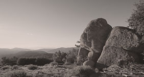
 Pine Valley Camp
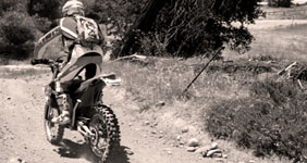
 Lime Canyon - Forest…
  Puerto Del Suelo Peak
  Chokecherry Spring