 Use Marker Groups
 Wolf 2002
Piru 2003
Day 2006
Zaca 2007
Gap 2008
La Brea 2009

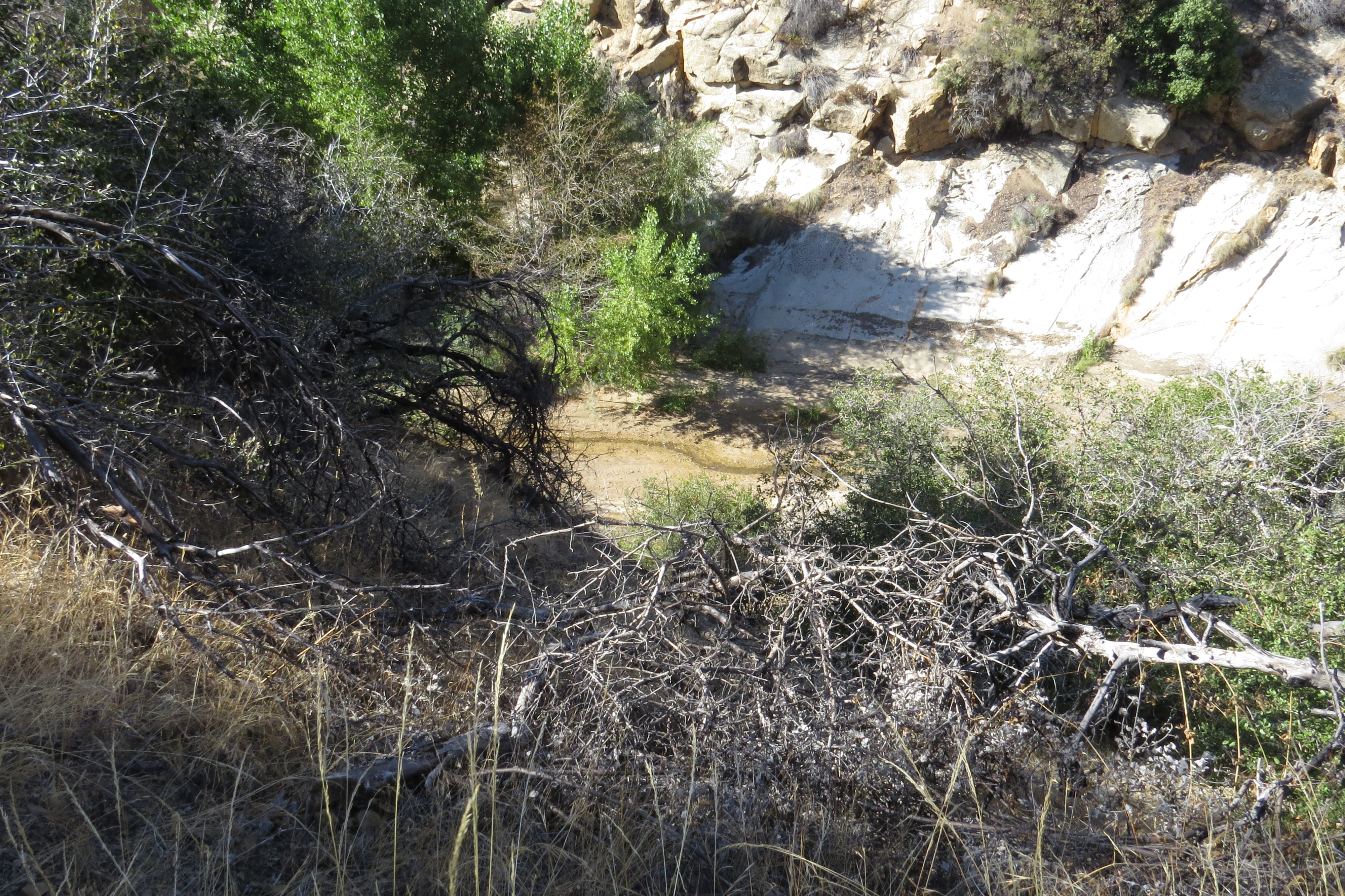
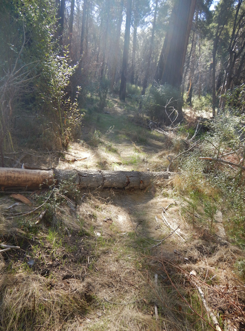
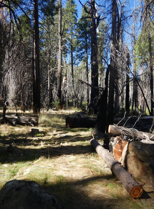
The Upper Sisquoc Trail is located in the San Rafael Winderness and extends from South Fork Camp to Alamar Saddle and Alamar Saddle Camp.
This trail follows back and forth across the Sisquoc River from the junction with Horse Gulch, below the Manzana School House, up to its head at Alamar Saddle on the north side of Big Pine Mountain. The Sisquoc River flows through the Sisquoc Ranch and finally joins the Cuyama River to become the Santa Maria River which empties into the Pacific Ocean southwest of Guadalupe.
About the Sisqouc River or Arroyo De Siquico
The Sisquoc River is a westward flowing river in northeastern Santa Barbara County, California. It is a tributary of the Santa Maria River, which is formed when the Sisquoc River meets the Cuyama River at the Santa Barbara County and San Luis Obispo County border just north of Garey. The river is 57.4 miles (92.4 km) long and originates on the north slopes of Big Pine Mountain, at approximately 6,320 feet (1,930 m). Big Pine Mountain is part of the San Rafael Mountains, which are part of the Transverse Ranges.
Sisquoc" is a Chumash word meaning "quail". The river is shown on an 1846 diseño of the Rancho Cuyama grant as Arroyo de Siquico.
The Sierra Madre Mountains form the watershed's boundary to the north, while the San Rafael Mountains form the southern boundary. The first half of the river, in the Los Padres National Forest, specifically the San Rafael Wilderness, travels roughly northwest. Outside of the National Forest, the river flows roughly west to its confluence with the Cuyama River, about 20 miles upstream from the Pacific Ocean. The river is completely free flowing and does not have any diversions. Its sole dam is a 3-meter dam on Horse Canyon, one of its tributaries, but it is filled with sediment and causes little restriction to the river's overall flow. It is designated as a wild and scenic river in the National Wild and Scenic Rivers System.
The watershed has a Mediterranean climate and chaparral vegetation. Annual precipitation in the watershed varies from 13 to 38 inches, 95% of which falls between November and April. This means that the river is dry part of the year, as there are no reservoirs to store water. The lack of rain also causes the vegetation to get very dry and the fire hazard can be very high during the summer.
Ecology
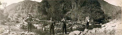
Stringer of Steelhead Trout on Upper Sisquoc River in 1916
Southern Steelhead trout (Oncorhynchus mykiss) are thought to represent about 1% of the historic population and most of the Santa Maria River run is thought to have continued up the Sisquoc River to spawn. Major dams on the Santa Ynez, Ventura, and Santa Clara Rivers prevent steelhead from accessing hundreds of miles of habitat and have drastically reduced the steelhead runs. The construction of Twitchell Dam on the Cuyama River in the late 1950s blocked at least 264 miles of stream and more than 60% of the Santa Maria River watershed and tributary habitat found upstream. This makes the Sisquoc River, which remains undammed, an important stream for surviving southern steelhead populations. Removal of dams on Sisquoc River tributaries expands the potential for restoration of steelhead. One tributary, Horse Creek (Horse Canyon), was dammed in 1968 and the 4.5 foot high, 60 foot wide dam eventually created a scour pool, increasing the drop to over 8 feet and creating an impassable barrier to spawning steelhead. The dam had completely silted in and no longer served to restrain sediment flows so was dynamited in 2006, and its sediment naturally eroded by 2011. A beaver dam created a large pool at the confluence of Horse Creek and the Sisquoc River and abundant steelhead trout were noted in a snorkel survey by fish biologist Matt Stoecker, including three fish 9 to 14 inches in size. The discovery of a male adult California Golden beaver (Castor canadensis subauratus) specimen collected as "wild caught" in 1906 "along the Sespe River in Ventura County" is physical evidence that Golden beaver were historically extant in coastal streams in southern California. The Sisquoc River used to receive steelhead running up from the Pacific Ocean via the Santa Maria River, but water removed by Twitchell Reservoir has interrupted the connection.


 Sisquoc Trail Upper Survey - 02-24-2026 - by Los Padres Forest Association
| Link: | Sisquoc Trail Upper |
| Date: | 02-24-2026 |
| Surveyor Name: | Los Padres Forest Association |
| Trail description: | Article by Chuck Graham about hiking the Upper Sisquoc from South Fork up to Alamar Saddle: https://www.independent.com/2026/02/24/a-sojourn-along-the-sisquoc-river/ |
| Mode of transport: | Hike |
| Trail condition: | Hard to follow |
Sisquoc Trail Upper Survey - 01-27-2026 - by Anonymous Surveyor| Link: | Sisquoc Trail Upper |
| Date: | 01-27-2026 |
| Surveyor Name: | Anonymous Surveyor |
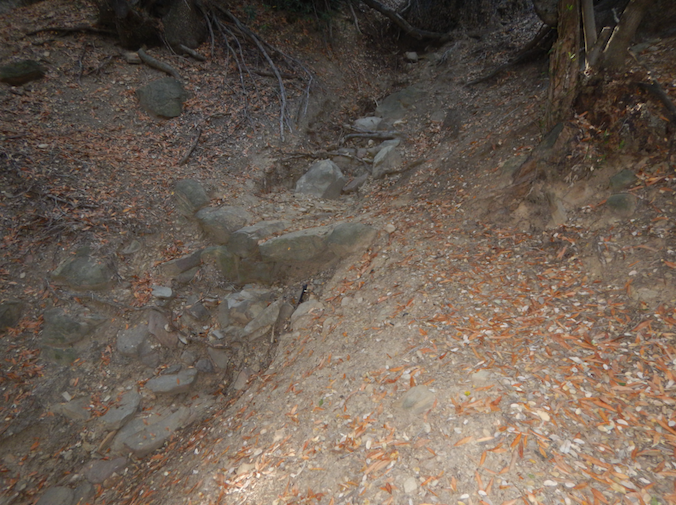
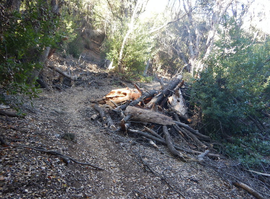
| Trail description: | Good tread until the first crossing, then the trail becomes very difficult to follow--trying to connect crossings, lots of deadfall and overgrowth of poison oak, Spiny Ceanothus, blackberry, rose, etc. Clearly it's been a while since any maintenance was done on this trail. Some sections are faintly apparent and follow-able, if you can find them. I used a dowloaded Gaia Map showing my location to navigate which was very helpful in route-finding. Looked for Skunk Camp but found no trace of it. |
| Mode of transport: | Hike |
| Trail condition: | Hard to follow |
Sisquoc Trail Upper Survey - 04-30-2025 - by Ian Jackson| Link: | Sisquoc Trail Upper |
| Date: | 04-30-2025 |
| Surveyor Name: | Ian Jackson |
| Trail description: | Report from Mansfield to Alamar Saddle: - From Heath to Lower Bear, the trail is easy to follow, just getting a bit overgrown in spots. Nothing too bad. - The Devil's Slide zone is in pretty good shape. Could use tread work in some spots. - From just before Middle Bear to Upper Bear is a bit of an obstacle course. Quite a bit of deadfall and brush to navigate. -Trail is good from Upper Bear to Alamar saddle |
| Mode of transport: | Hike |
| Trail condition: | Needs some work |
Sisquoc Trail Upper Survey - 04-20-2025 - by Antonio Calderon | Link: | Sisquoc Trail Upper |
| Date: | 04-20-2025 |
| Surveyor Name: | Antonio Calderon |
| Trail description: | |
| Mode of transport: | Hike |
| Trail condition: | Needs some work |
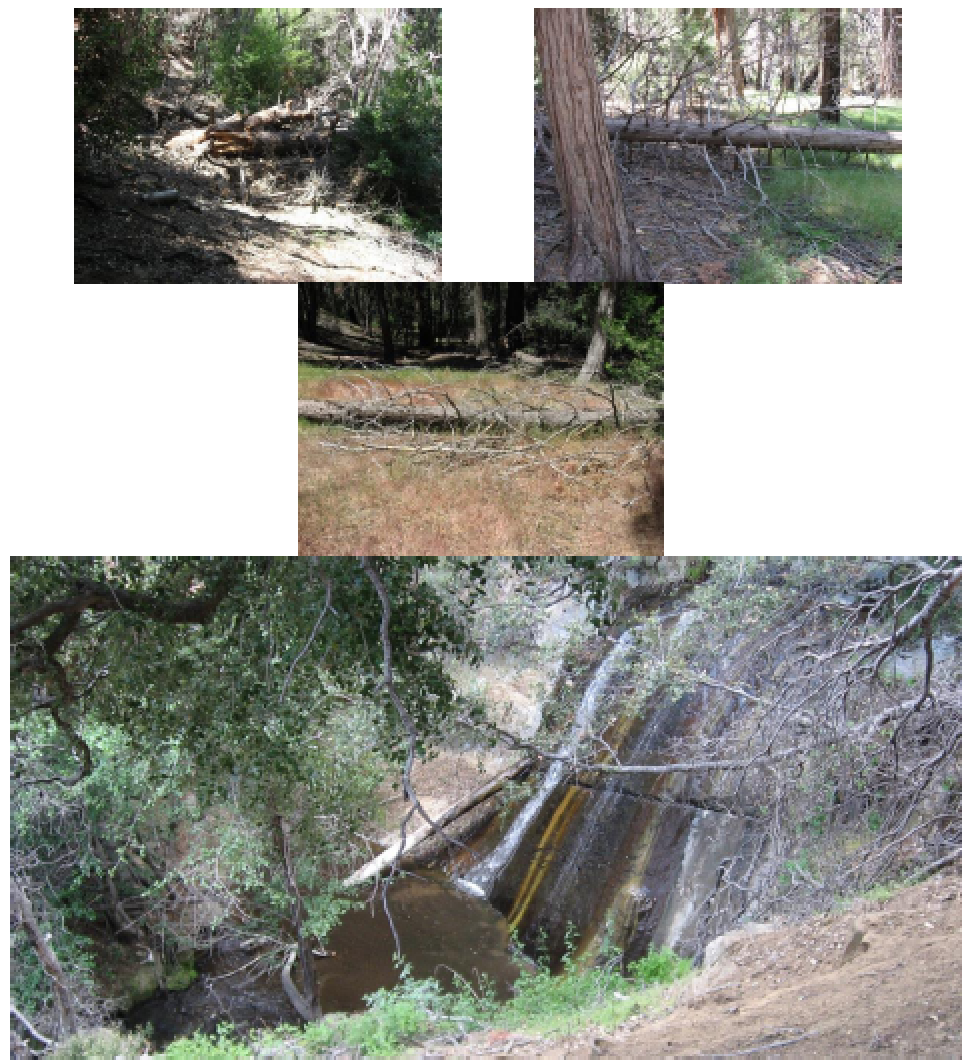
| Images: | Fall Canyon Trail Junction Skunk Camp Rattlesnake Falls |
Sisquoc Trail Upper Survey - 01-01-2025 - by Brian D'Amour| Link: | Sisquoc Trail Upper |
| Date: | 01-01-2025 |
| Surveyor Name: | Brian D'Amour |
| Trail description: | Started at South Fork at 6:30. Trail past Skunk and to Mansfield was generally in good shape with minimal river crossings. Between Mansfield and Heath, travel was slow due to some issues relocating trail after river crossings and not wanting to hike in the river. There is a trail, you just have to work to find it sometimes. After Heath, the trail became easier to follow again at crossings. This was a really great stretch of forest. Water in river all the way up to the falls but not above. Upper Bear had water flowing from the springs. Made it to Alamar Saddle at 12:30. |
| Mode of transport: | Hike |
| Trail condition: | Needs some work |
| Condition details: | Hiked entire trail on 1/1/25. Good flow in river all the way up to the falls. |
| Images: | Sign showing locatgion of "Trail" at one of many crossings Cottonwood Camp Heath Camp Falls |
Sisquoc Trail Upper Survey - 04-20-2024 - by Erin Carroll| Link: | Sisquoc Trail Upper |
| Date: | 04-20-2024 |
| Surveyor Name: | Erin Carroll |
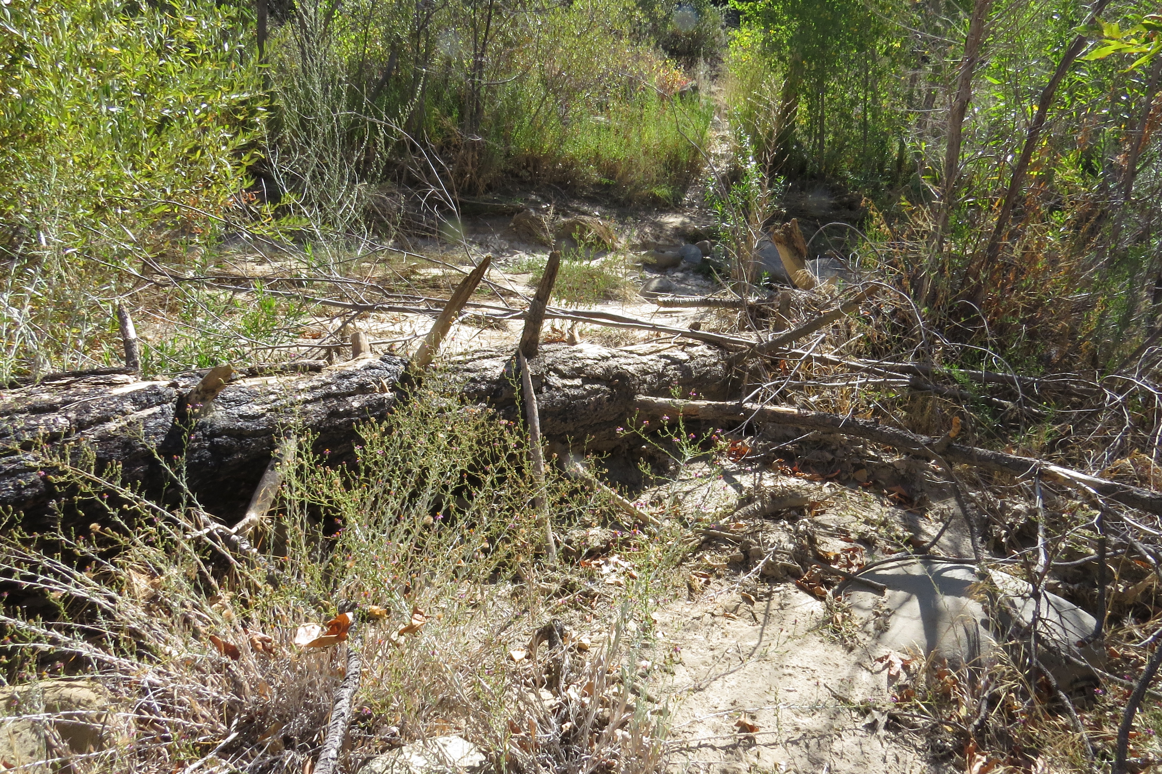
| Trail description: | I have a lot of respect for Michael McGurk completing this entire trail earlier this year. We wanted to make it up to Alamar from South Fork, but we only made it about 1 mile upstream of South Fork before we gave up. We did see some brush trimmings after climbing up out of south fork, so someone has been trying to do a little work in that section. Then we crossed the river where we saw a pink flag, but no trail anywhere near the flag. We spent about 30 minutes in that location and then we hiked up a secondary stream bed and found the trail again. We crossed the river one more time and found the trail. Then the crossing after that also had a flag but it was just nothing but overgrown poison oak and I didn't see any sign of the trail. My legs are all red from the poison oak as I write this (and I was wearing long pants and long sleeve shirt). Even my dog got poison oak! I might have gone further up this trail if I was by myself but I had my dog with me and my friend who was hiking with me didn't want to go further and I couldn't fault him for that decision. We turned around and hiked back to Nira instead of doing the bigger loop we had planned to do. Sometimes you have to know when to cut your losses and turn around. |
| Mode of transport: | Hike |
| Trail condition: | Non existent |
| Condition details: | Needs a massive amount of work. Tons of poison oak. |
| Images: | |
Sisquoc Trail Upper Survey - 03-11-2024 - by Michael McGurk| Link: | Sisquoc Trail Upper |
| Date: | 03-11-2024 |
| Surveyor Name: | Michael McGurk |
| Trail description: | The trail is very rough from alamar saddle to halfway between lower bear and heath. it is flagged and easy to follow. there are numerous blowdowns and log jams. the worst section of the Sisqouc is from the Sisqouc falls drainage to .75 miles before South fork. Classic Los Padres Bushwack and backpacker tetris blowdowns. a lot of crawling through brush. Needs a lot of work and im not sure if walking the river would be faster. |
| Mode of transport: | Hike |
| Trail condition: | Hard to follow |
Sisquoc Trail Upper Survey - 06-02-2023 - by Anonymous Surveyor| Link: | Sisquoc Trail Upper |
| Date: | 06-02-2023 |
| Surveyor Name: | Anonymous Surveyor |
| Trail description: | Be prepared to "Zion Narrows that sh-" because the trail is so overgrown and it was easier to follow by just waling up the river. Made it to Fall Cyn then turned back towards South Fork. |
| Mode of transport: | Hike |
| Trail condition: | Hard to follow |
| Condition details: | Very overgrown and difficult to follow. |
Sisquoc Trail Upper Survey - 04-26-2023 - by Matt Inman - Ojai Valley School| Link: | Sisquoc Trail Upper |
| Date: | 04-26-2023 |
| Surveyor Name: | Matt Inman - Ojai Valley School |
| Trail description: | |
| Mode of transport: | Hike |
| Trail condition: | Needs some work |
| Condition details: | Tons of blown down limbs and fallen trees. Needs brushing but tread was decent away from river crossings. Requires route finding skills. |
Sisquoc Trail Upper Survey - 04-25-2023 - by Carl Pecvich| Link: | Sisquoc Trail Upper |
| Date: | 04-25-2023 |
| Surveyor Name: | Carl Pecvich |
| Trail description: | We backpacked from Nira Campground to South Fork Campground in two days, arriving at the Upper Sisquoc Trail. From South Fork Campground, we day hiked to Sisquoc Falls the next day. We did the hike to Sisquoc Falls without our heavy packs, carrying only water and snacks and a few essentials. The round trip was six to seven miles but it took us most of the day to arrive back to our South Fork base camp, The reason it took us most of the day is because of the poor to nonexistent condition of the trail.The first half mile or so past South Fork Campground there is a faint but relatively easy to follow trail. As it nears the river, the trail becomes hard to follow, impassable, or nonexistent. We saw occasional trail signage, but passage was so difficult because of brush, fallen trees, and washouts, we spent a lot of time criss crossing the river and wading through the water to reach our destination.For the most part, the Sisquoc River was our trail. The tributary stream that goes to the falls has no trail and is a challenging scramble over boulders, and downed trees. The poor condition of the trail has deterred most hikers from entering this area. We saw no other hikers in our two days at South Fork. The sense of isolation was palpable. |
| Mode of transport: | Hike |
| Trail condition: | Hard to follow |
Sisquoc Trail Upper Survey - 05-20-2022 - by Addison Jerlow| Link: | Sisquoc Trail Upper |
| Date: | 05-20-2022 |
| Surveyor Name: | Addison Jerlow |
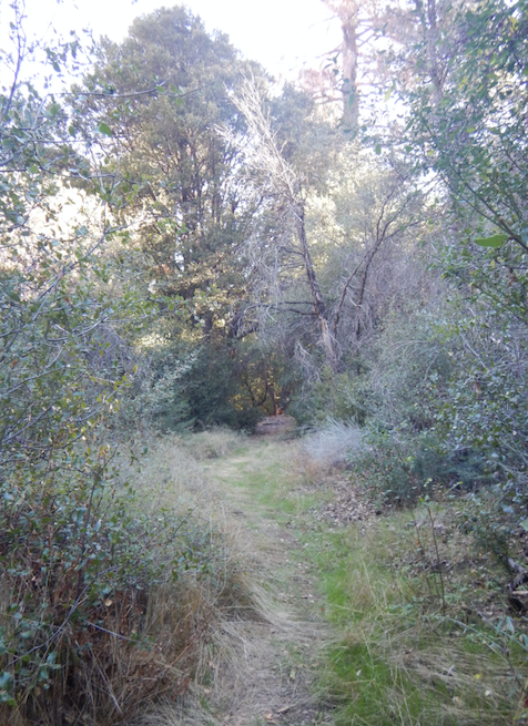
| Trail description: | Trail is in great shape from Mansfied to Alamar Saddle. As to be expected, some minor overgrown sections with poison oak along the creek, the worst about a mile downstream of Lower Bear. A few manageable downed trees below Lower Bear and through the meadow between Middle Bear and Upper Bear. Saw two bears! |
| Mode of transport: | Hike |
| Trail condition: | Good shape and easy to follow |
Sisquoc Trail Upper Survey - 04-19-2021 - by Los Padres Forest Association| Link: | Sisquoc Trail Upper |
| Date: | 04-19-2021 |
| Surveyor Name: | Los Padres Forest Association |
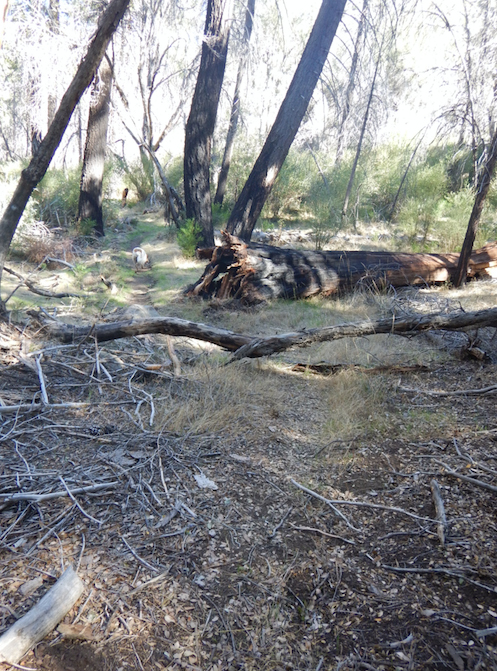
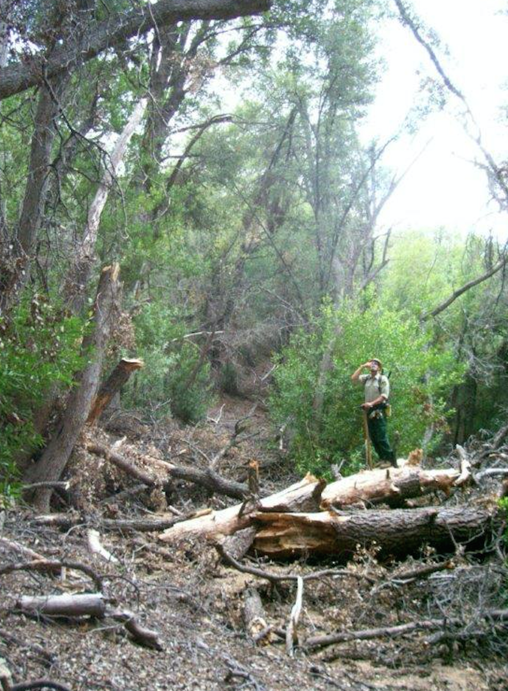
| Trail description: | 4-day LPFA volunteer project focused on clearing downed trees and brush from Alamar Saddle down towards Heath Camp. All trees were cleared and brushing was accomplished as time allowed. Trail was in good shape - ready to ENJOY! |
| Mode of transport: | Array |
| Trail condition: | Good shape and easy to follow |
Sisquoc Trail Upper Survey - 11-27-2021 - by Diane Soini| Link: | Sisquoc Trail Upper |
| Date: | 11-27-2021 |
| Surveyor Name: | Diane Soini |
| Trail description: | Trail in good shape. Near Alamar it is a little faint. There are a few brushy sections and some places where ducks are useful but overall it's in great shape. There was water in places all along the way. I did not see any water at Heath but someone was camped there so maybe there was a stagnant pool nearby, or maybe they got water from the creek where it was flowing. I saw no water at Skunk, but Skunk is a terrible campsite anyway. Otherwise, all the official campsites seemed to still have water all the way to South Fork, which also had water. |
| Mode of transport: | Hike |
| Trail condition: | Good shape and easy to follow |
Sisquoc Trail Upper Survey - 04-28-2021 - by Ted Merrill| Link: | Sisquoc Trail Upper |
| Date: | 04-28-2021 |
| Surveyor Name: | Ted Merrill |
| Trail description: | A lot of hard work by volunteers has gone into this trail... still the terrain makes for difficult hiking. Along the river, the trail has man rocks to manuever one's feet over. Between South Fork and Heath Camps, there are numerous river crossings and it is often hard to see where to go on the other side... I actually would like to see some bright targets on the opposing shores... this may be controversial. We were able to make all of the crossings by rock hopping. The tread was largely clear of fallen trees and impinging brush... thanks, volunteers! The slide area above Lower Bear Camp has been beautifully reinforced recently. One odd thing was regarding my maps on my phone app (osmand) which are based on Open Street Map. They had Skunk Camp off by a mile, Bear Camp identified as Lower Bear Camp, and Lower Bear Camp not on the map at all... I'll see if I can figure out how to get this changed on Open Street Map. |
| Mode of transport: | Hike |
| Trail condition: | Needs some work |
| Condition details: | Frequent river crossings are often confusing |
Sisquoc Trail Upper Survey - 04-05-2021 - by Oak Titmouse| Link: | Sisquoc Trail Upper |
| Date: | 04-05-2021 |
| Surveyor Name: | Oak Titmouse |
| Trail description: | Generally, the trail is in good shape. I found it easy to follow. There is a lot of deadfall between Heath and Lower Bear. Navigation was still easy but it did slow me down. |
| Mode of transport: | Hike |
| Trail condition: | Needs some work |
Sisquoc Trail Upper Survey - 07-08-2020 - by Nathan Seaford| Link: | Sisquoc Trail Upper |
| Date: | 07-08-2020 |
| Surveyor Name: | Nathan Seaford |
| Trail description: | Hard to follow at some points, non-existent at others. Fifty percent or more of this section of trail was completely overgrown. Most of the river crossings are difficult to impossible to spot because the crossings are overgrown. I tried to follow the trail to Skunk, but on the way back to South Fork (I only went towards Skunk to try to see the Falls) I found it much easier to walk in the river. Encountered a rattlesnake a mile East from South Fork. |
| Mode of transport: | Hike |
| Trail condition: | Hard to follow |
| Condition details: | South Fork to Skunk Camp. |
Sisquoc Trail Upper Survey - 08-21-2018 - by Los Padres Forest Association| Link: | Sisquoc Trail Upper |
| Date: | 08-21-2018 |
| Surveyor Name: | Los Padres Forest Association |
| Trail description: | LPFA volunteer project focused on brushing and crosscut work between Alamar Saddle and Bear Camp along the Sisquoc Trail. Water at Upper Bear and Lower Bear, no water at Bear Camp |
| Mode of transport: | Hike |
| Trail condition: | Needs some work |
| Images: | |
Sisquoc Trail Upper Survey - 07-05-2019 - by Los Padres Forest Association| Link: | Sisquoc Trail Upper |
| Date: | 07-05-2019 |
| Surveyor Name: | Los Padres Forest Association |
| Trail description: | LPFA trail survey on July 5, 2019 to assess trail needs from Alamar Saddle down to Lower Bear. Trail was in good shape down to Upper Bear and then rough shape down to Lower Bear with around 20+ downed trees, some major ceonothus tunnels, lack of trail tread and overall not much traffic along the trail to beat down the grasses and kick off the branches. Lots of work needed and LPFA is planning major work along this stretch for late summer and early fall. - Water as usual at Upper Bear, never goes dry - Surprisingly water in the meadow at Bear Camp - Water along the Devils Slide, waterfalls and also at Lower Bear Camp |
| Mode of transport: | Hike |
| Trail condition: | Needs some work |
| Images: | This is the biggest downed tree located between Bear and Upper Bear Downed trees everywhere and more to come...... Bear Camp Bear Meadow Steep side slope and lack of tread just below Bear Camp and above the Devils Slide |
Sisquoc Trail Upper Survey - 04-21-2019 - by Los Padres Forest Association| Link: | Sisquoc Trail Upper |
| Date: | 04-21-2019 |
| Surveyor Name: | Los Padres Forest Association |
| Trail description: | Fun YouTube video by "Over the Hills" showing a nice Upper Sisquoc Loop out of NIRA going up the Manzana to the Upper Sisquoc and back along Mission Pine and Big Cone Spruce. Enjoy! |
| Mode of transport: | Hike |
| Trail condition: | Needs some work |
Sisquoc Trail Upper Survey - 10-15-2018 - by Los Padres Forest Association| Link: | Sisquoc Trail Upper |
| Date: | 10-15-2018 |
| Surveyor Name: | Los Padres Forest Association |
| Trail description: | LPFA and Student Conservation Association (SCA) partnered on a week long project doing tread work from Alamar Saddle down to Upper Bear. The trail looks great along that top half mile. There was water at Upper Bear Camp and Lower Bear Camp - no water at Bear Camp. |
| Mode of transport: | Hike |
| Trail condition: | Needs some work |
| Images: | |
Sisquoc Trail Upper Survey - 04-20-2018 - by Daniel J. Hall| Link: | Sisquoc Trail Upper |
| Date: | 04-20-2018 |
| Surveyor Name: | Daniel J. Hall |
| Trail description: | From Sycamore Camp upstream to South Fork Station and on up to Buckhorn Road/Alamar Saddle: the trail is easy to follow; the tread generally good, but with some minor slides and rutting in places it normally occurs; many brushy sections, but the trail is still easy to see.  Those traveling by foot can easily find and hike the trail. Sliding sections are just a reason to slow down and take extra care; obstructions from blowdowns are only a nuisance. For stock, however, the section from Heath to Lower Bear is blocked by numerous blowdowns across the trail. More detail in captioned photos at http://tinyurl.com/y8xns6gz Good water flowing in the Sisquoc at all camps, but low enough to make for easy river crossings. |
| Mode of transport: | Hike |
| Trail condition: | Needs some work |
Sisquoc Trail Upper Survey - 04-22-2017 - by Mike Maki| Link: | Sisquoc Trail Upper |
| Date: | 04-22-2017 |
| Surveyor Name: | Mike Maki |
| Trail description: | Covers entire trail from Alamar Saddle to South Fork. Trail is fair enough to follow but dozens of downed trees on the upper section. A small slide is a little difficult to get around just above Lower Bear Camp. Poison Oak present but avoidable. A bit west of Logan Cyn the trail crew that has been working out of South Fork Station has completed some great work. Great trail from there on into South Fork. I'll also note it's difficult to get a good view of Sisquoc Falls from the trail. At least I was unable to see anything but the very top. I should have researched it more to find a good viewing spot. Still a wonderful trail. I was solo and did not see anyone on this section. All pics from my Condor Section hike from Santa Barbara Cyn to Manzana and out to NIRA. |
| Mode of transport: | Hike |
| Trail condition: | Needs some work |
| Condition details: | Dozens of downed trees in the upper section. Good trail work complete in the lower. |
| Images: | One of dozens slowing you down. One of the easier ones Not so fast... When the going gets good! It is a beautiful Trail |
Sisquoc Trail Upper Survey - 11-15-2016 - by Los Padres Forest Association| Link: | Sisquoc Trail Upper |
| Date: | 11-15-2016 |
| Surveyor Name: | Los Padres Forest Association |
| Trail description: | Report covers the Sisquoc Trail from South Fork to Cottonwood. No water at South Fork, first water is 30-40mins up towards Cottonwood. Â There was water at Skunk. Â No water between Skunk and Cottonwood. Â There was water at Cottonwood. Â 27 downed trees between South Fork and Cottonwood. Report LGomes |
| Mode of transport: | Hike |
| Trail condition: | Needs some work |
Sisquoc Trail Upper Survey - 04-09-2016 - by Sonia Connors| Link: | Sisquoc Trail Upper |
| Date: | 04-09-2016 |
| Surveyor Name: | Sonia Connors |
| Trail description: | We hiked this trail from Heath Camp to South Fork Camp, camping at Skunk. Â Spring was in full bloom with so many wild flowers! Â Most of the river crossings were easy to find the trail on the other side - many marked with cairns or flagging. Â Some had overgrown poison oak in the way. Â The grass was knee to hip high in some places, and we continued down stream just looking for a little "U" among the grasses to see where the trail could be. Â Although it seemed likely to miss the trail in these conditions, we were able to keep on it. Â Just upstream from South Fork there is a section with many, Â many downed Alders - really tough for our pup to get through, as her paws slipped through all the branches. Â Saw one rattlesnake snoozing by the river when we were trying to find an alternate route past some poison oak. Â Thank you to all of the people working so hard to keep this trail and the campsites in such great condition !!! |
| Mode of transport: | Hike |
| Trail condition: | Needs some work |
| Images: | Trail in the grass to the left of the giant burned out Oak trunk Trail camouflaged in short grasses Crossing between Skunk and South Fork Trail upstream from South Fork |
Sisquoc Trail Upper Survey - 07-12-2015 - by Los Padres Forest Association| Link: | Sisquoc Trail Upper |
| Date: | 07-12-2015 |
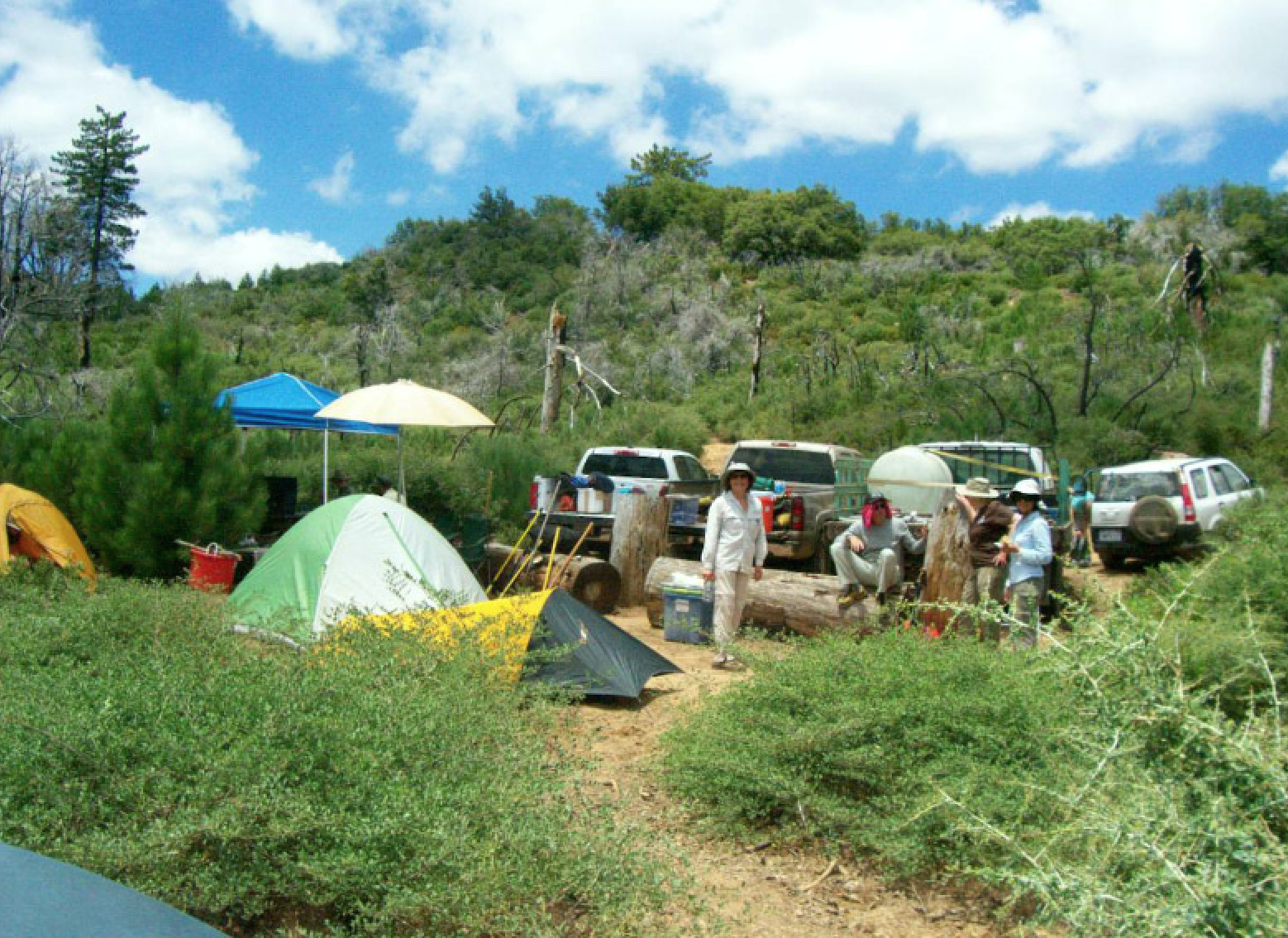
| Surveyor Name: | Los Padres Forest Association |
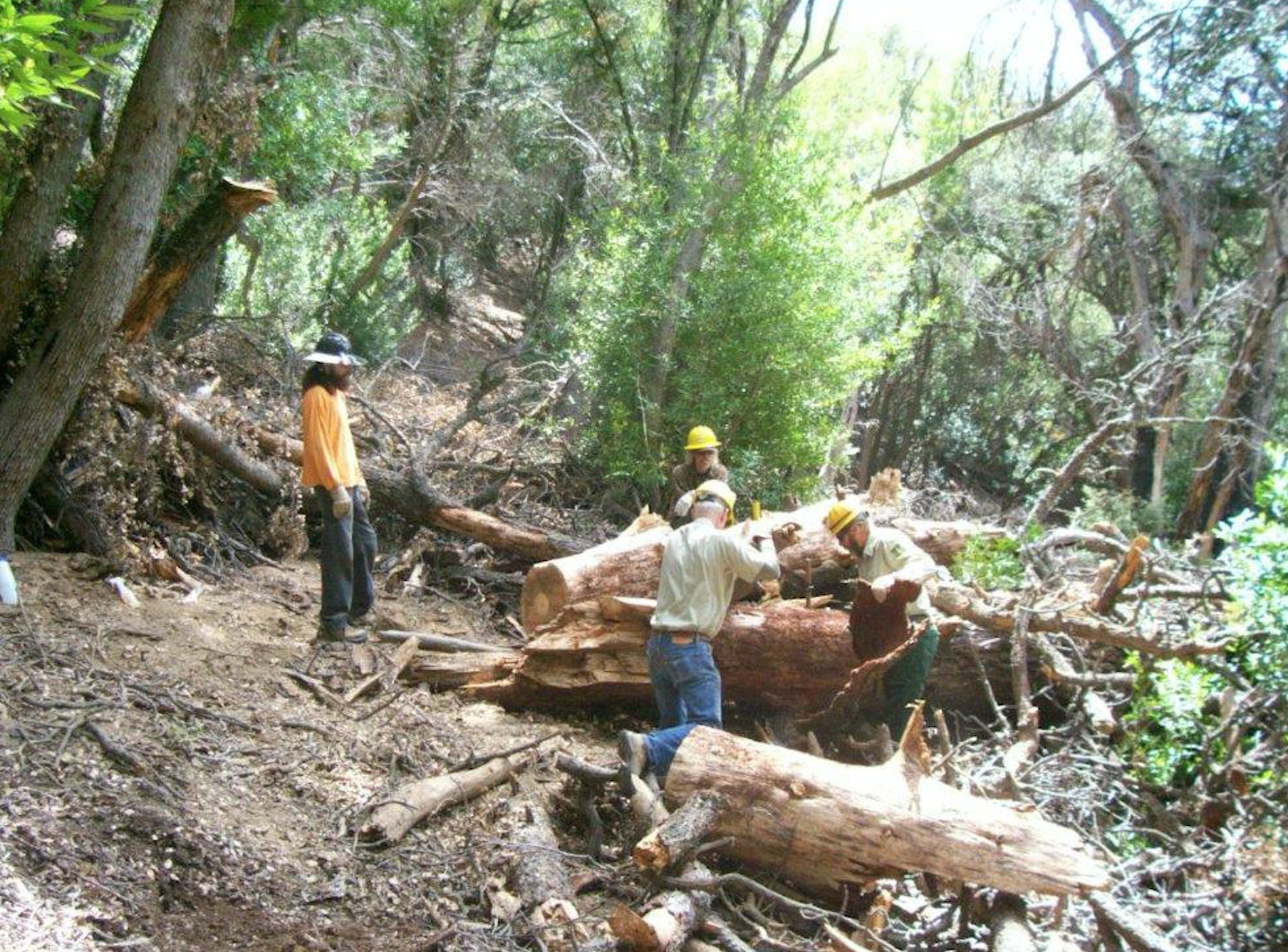
| Trail description: | LPFA 3-day trail project to clear the trail from Alamar Saddle down to Lower Bear. Â We removed 20 trees, including one very large one that was causing a substantial reroute and erosion concerns. Â We also spent a substantial amount of time clearing the trail through the ceonothus jungle just upstream from Bear Camp. Â Trail is in good shape. Water was found at Upper Bear and Lower Bear, no water at Bear Camp. |
| Mode of transport: | Array |
| Trail condition: | Good shape and easy to follow |
| Images: | The big tree BEFORE The big tree DURING The big tree AFTER Some more cleared trees The trail project base camped at Alamar Camp |
Sisquoc Trail Upper Survey - 09-25-2015 - by Los Padres Forest Association| Link: | Sisquoc Trail Upper |
| Date: | 09-25-2015 |
| Surveyor Name: | Los Padres Forest Association |
| Trail description: | LPFA VWR Patrol to check on the work needed along the trail from Alamar Saddle down to Bear Meadow. Â There were about 4 downed trees, nothing massive. Â The work done by the earlier trail project was really good. |
| Mode of transport: | Array |
| Trail condition: | Needs some work |
| Images: | Rock water support along trail above Upper Bear Trail Corridor Downed Trees Downed Trees Downed Trees |
Sisquoc Trail Upper Survey - 10-04-2015 - by Los Padres Forest Association| Link: | Sisquoc Trail Upper |
| Date: | 10-04-2015 |
| Surveyor Name: | Los Padres Forest Association |
| Trail description: | Trail in "relatively good shape" from Heath down to South Fork. Â No slides or extreme obstacles to report. There is water just below Heath, at Cottonwood and at Skunk Camp. |
| Mode of transport: | Hike |
| Trail condition: | Needs some work |
Sisquoc Trail Upper Survey - 09-06-2015 - by LKasko| Link: | Sisquoc Trail Upper |
| Date: | 09-06-2015 |
| Surveyor Name: | LKasko |
| Trail description: | We walked only a few miles, from Heath camp to Skunk camp. Just E of Skunk camp there was a washed-out dry crossing which, despite 2 plastics hung, was confusing. Closer to Mansfield than to Skunk, there was water at a stream crossing which went underground immediately both up and downstream. Near Mansfield, there was a downed tree on the E side of the river just before a dry stream crossing when headed W. E of Mansfield, from the high bluff above the river, I could see water below. |
| Mode of transport: | Hike |
| Trail condition: | Good shape and easy to follow |
| Images: | downed tree near Mansfield E of Mansfield, water below |
Sisquoc Trail Upper Survey - 06-07-2015 - by Los Padres Forest Association| Link: | Sisquoc Trail Upper |
| Date: | 06-07-2015 |
| Surveyor Name: | Los Padres Forest Association |
| Trail description: |
VWR PATROL We hiked from Alamar Saddle to Lower Bear Camp. We encountered about a dozen trees down across the trail and very thick ceanothus in the meadow near Middle Bear. There is a hazard tree located near the top of the switchbacks leading down to Lower Bear. Portions of the switchbacks between Middle and Lower Bear need tread work. The waterfalls near Lower Bear has some water flowing. |
| Mode of transport: | Hike |
| Trail condition: | Needs some work |
| Images: | Downed trees and waterfalls, Jenkins |
Sisquoc Trail Upper Survey - 03-02-2015 - by Los Padres Forest Association| Link: | Sisquoc Trail Upper |
| Date: | 03-02-2015 |
| Surveyor Name: | Los Padres Forest Association |
| Trail description: | Hiked the Sisquoc Trai from Mansfield to Alamar Saddlel as part of a LPFA trail patrol and recon for future trail projects. Â The trail is very followable but there are quite a few downed trees to deal with. Â More information at the following link: |
| Mode of transport: | Hike |
| Trail condition: | Needs some work |
| Images: | |
Sisquoc Trail Upper Survey - 02-27-2015 - by Steve Cypher| Link: | Sisquoc Trail Upper |
| Date: | 02-27-2015 |
| Surveyor Name: | Steve Cypher |
| Trail description: |
I hiked the Lower Sisquoc Loop 2/27/15 – 3/1/15. Heading
upstream from Manzana Schoolhouse the trail becomes faint quickly. There is a
lot of brush that needs to be cut back, and fresh, flourishing vegetation in
the tread made it faint. There are several places where the original trail
followed an old road bed up the sides of the valley – these are becoming very
faint and sketchy in places where the trail traverses steep hillsides. It
appears most of what little foot traffic this route gets follows social trails
along the riverbed. These social paths disappear at each crossing, and sometimes
exist on both sides of the river. Remnants of old pieces of flagging tape are
more obvious than trail tread in many places. The trail is just too long and
remote to conduct effective volunteer maintenance projects. That said, I really love this hike because the route is so beautiful and remote. There are great places to camp all along. The Sisquoc is dry at the Schoolhouse, but was flowing well just below Water Canyon Camp. I stayed at Miller Canyon Base the first night and South Fork Station the second. The trail is easy to follow east of Sycamore Camp, but still rough and sketchy in spots. |
| Mode of transport: | Hike |
| Trail condition: | Hard to follow |
| Condition details: | Trail is faint due to lack of use & maintenance. |
Sisquoc Trail Upper Survey - 05-11-2013 - by Los Padres Forest Association| Link: | Sisquoc Trail Upper |
| Date: | 05-11-2013 |
| Surveyor Name: | Los Padres Forest Association |
| Trail description: | - Trail was in good shape but there are about a dozen downed trees from Alamar down to South Fork. - Saw a bear at Lower Bear Camp - 4 rattlers along the trail - Water at Upper Bear - None at Bear - Water at Lower Bear - Water along the trail and camps the rest of the way from Lower Bear to South Fork Information gathered by James Wapotich as part of a VWR Patrol.  Visit James' blog at: http://songsofthewilderness.wordpress.com/ |
| Mode of transport: | Hike |
| Trail condition: | Needs some work |
| Number of trees down: | 12 |
| People Seen: | 0 |
Sisquoc Trail Upper Survey - 05-25-2014 - by Los Padres Forest Association| Link: | Sisquoc Trail Upper |
| Date: | 05-25-2014 |
| Surveyor Name: | Los Padres Forest Association |
| Trail description: |
Manzana School House to Lorna No water until close to Lorna where it turns into sparse water, mainly standing pools trail in good condition Lorna to Cliff No water except standing pool at Cliff Trail was navigable if followed flagging markers; more difficult route finding as flag markers were not always visible from the marker before Cliff to Sycamore* Minimal water but got better the closer to Sycamore Trail difficult to navigate as markers were scarce via trail on map; another trail that was not on map was better with markers, yet still hard to navigate. Most difficult section en route Sycamore to South Fork* Water was reliable Trail was well traveled and straight forward--easy to navigate South Fork to Mansfield* Water was reliable Trail was easy to navigate Mansfield to Heath* Water was reliable Trail was easy to navigate |
| Mode of transport: | Hike |
 Survey / Report Form - Please click this box to open the form.