 Use Marker Groups
 Wolf 2002
Piru 2003
Day 2006
Zaca 2007
Gap 2008
La Brea 2009

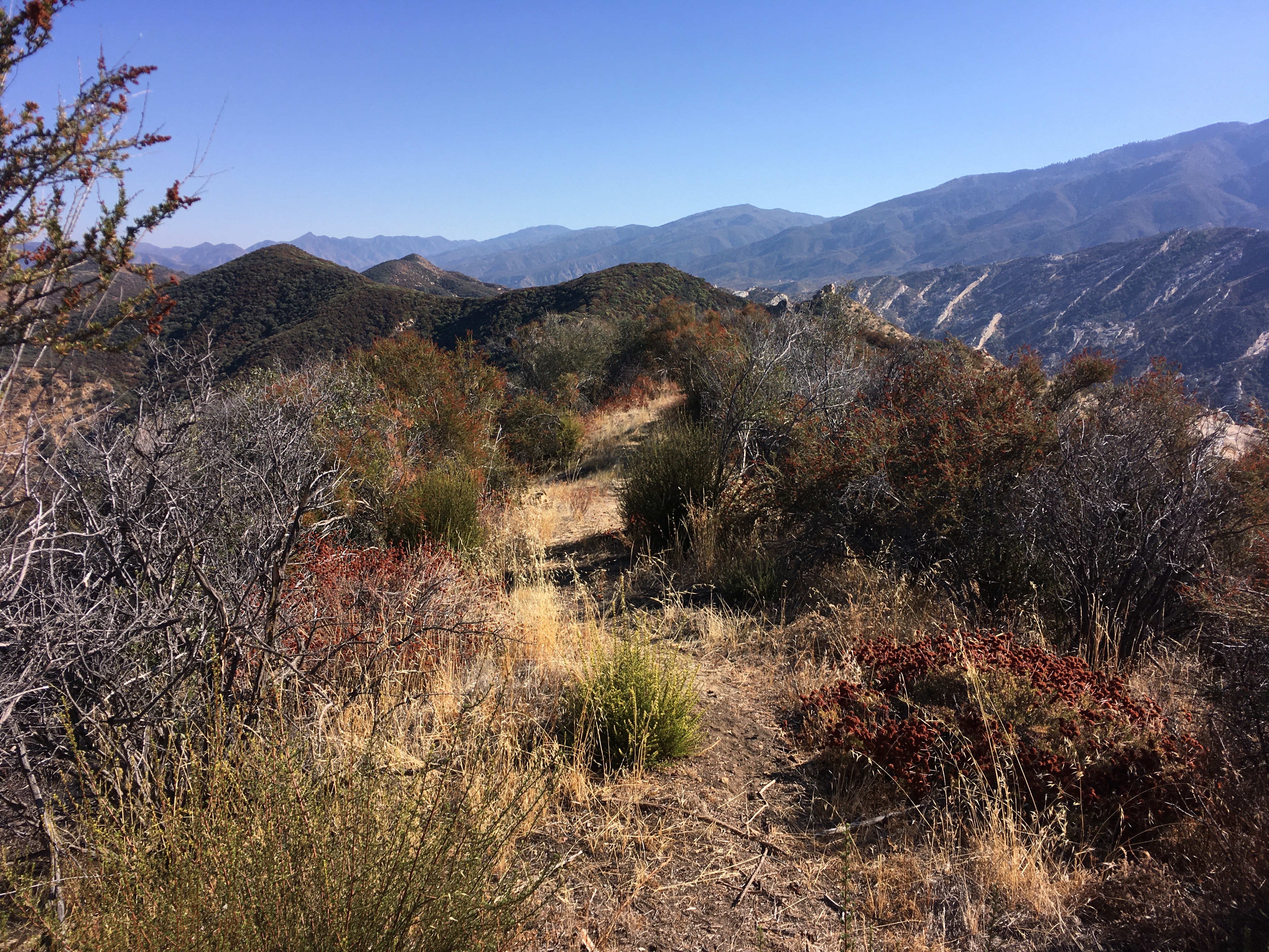
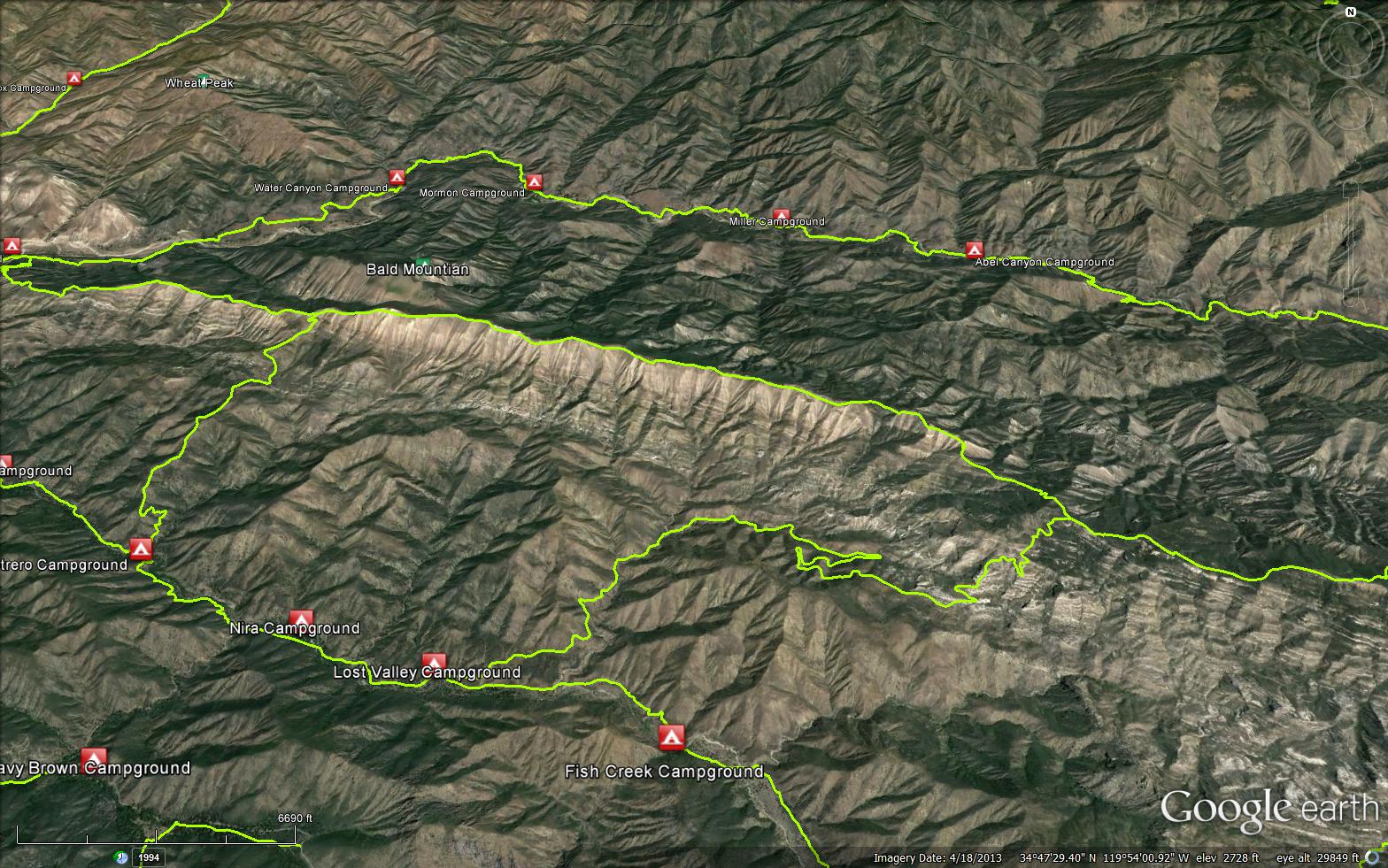
The Hurricane Deck Trail was constructed in the 1930's. The trail starts near the Manzana Schoolhouse on the Sisquoc Trail (30W12) and after climbing to the crest of the Hurricane Deck, the trail follows along the crest of the deck until it ends at White Ledge Camp on the Manzana Trail (30W13). No water is available for the entire length of the trail and brush has covered the trail in many places.


 Hurricane Deck Trail Survey - 04-17-2025 - by BJ
| Link: | Hurricane Deck Trail |
| Date: | 04-17-2025 |
| Surveyor Name: | BJ |
| Trail description: | Did Manzana loop from Lower Manzana to Potrero, then Hurricane to
Schoolhouse. It was very strenuous. Weather was overcast and 60
degrees, and with a pack I don't think I'd recommend even a small amount
warmer or cloudless. Saw zero humans from start to finish on this
portion. The uphill is rigorous. Trail was decent enough,
though the final 2 miles going down to the schoolhouse was completely
overgrown and the ground gave way. That was the worst maintained of the
trail. Plenty of poison oak. No water of course. Did this April 15
2025. First solo backpack. I expected to see rattlers on the trail,
but I never did. Continued from schoolhouse on day 2 on the Manzana
trail down to the lower manzana start. 37 water crossings. |
| Mode of transport: | Hike |
| Trail condition: | Needs some work |
| Condition details: | Hurrican Deck Trail from Potrero |
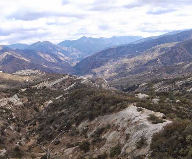
| Images: | Most of the trail looks like this view from the trail can see the water below |
Hurricane Deck Trail Survey - 12-07-2024 - by Kevin w| Link: | Hurricane Deck Trail |
| Date: | 12-07-2024 |
| Surveyor Name: | Kevin w |
| Trail description: | Ran from lower manzana to the schoolhouse and back. Trail is very easy to follow but needs tread work on the switchbacks above the schoolhouse, the ground mammals have done a lot of work. |
| Mode of transport: | Array |
| Trail condition: | Good shape and easy to follow |
Hurricane Deck Trail Survey - 05-18-2024 - by Adam Donald| Link: | Hurricane Deck Trail |
| Date: | 05-18-2024 |
| Surveyor Name: | Adam Donald |
| Trail description: | I hiked along the Deck about a mile to the east from the top of Potrero Trail. The trail was nonexistent in much of this segment with a fair amount of bushwhacking, but the ridge is only about 30-40ft wide so if you stay high you can't get lost. I then went back the way I came but continued down the west section of the Deck to Manzana Schoolhouse. Huge props to the LPFA group that did so much work along this section of the trail. Other than one last little section of brush remaining in the middle, it is super open and easy to follow. The final switchbacks above Manzana Schoolhouse are full of poison oak, which made for slow going dodging around the plants. I hope whoever tied pink flagging tape to poison oak down near the river crossing used gloves... |
| Mode of transport: | Hike |
| Trail condition: | Needs some work |
| Condition details: | Western segment is good, the rest not so much |
Hurricane Deck Trail Survey - 04-21-2024 - by Ian Evans| Link: | Hurricane Deck Trail |
| Date: | 04-21-2024 |
| Surveyor Name: | Ian Evans |
| Trail description: | I took the Deck trail from White Ledge to Lost Valley, and had to do some significant bushwhacking in sections, most with head high closed-in growth. I had long sleeves and pants and shoe gaiters, which were pretty much required to not get shredded. Hiking poles are strongly recommended to push through the densest patches. I used a navigation app (Gaia) to make sure I was on the right track, which was occasionally very useful. The views were great when it opened up, but this trail isn't much fun right now. |
| Mode of transport: | Hike |
| Trail condition: | Needs some work |
| Condition details: | East section quite overgrown |
Hurricane Deck Trail Survey - 03-25-2024 - by Casey Horgan| Link: | Hurricane Deck Trail |
| Date: | 03-25-2024 |
| Surveyor Name: | Casey Horgan |
| Trail description: | Trail was in better shape than I was expecting and was easy to follow apart from a few locations. Briefly lost the trail once. The trial was generally overgrown with moderate bushwhacking needed in spots. Some mud in locations also made the tread slick. Don't recommend hiking immediately following large storms. |
| Mode of transport: | Hike |
| Trail condition: | Needs some work |
| Condition details: | Hiked east portion of Hurricane Deck from White Ledge to Lost Valley Trail on 3/23 |
| Images: | Power Poles Engaged |
Hurricane Deck Trail Survey - 01-28-2024 - by BB| Link: | Hurricane Deck Trail |
| Date: | 01-28-2024 |
| Surveyor Name: | BB |
| Trail description: | Overgrown! Mostly thigh-high with grasses and low shrubs. In some places, overgrown with ceanothus taller than me. The trail was not that difficult to follow. |
| Mode of transport: | Hike |
| Trail condition: | Needs some work |
| Condition details: | Overgrown on mid-Deck above Potrero |
Hurricane Deck Trail Survey - 12-17-2023 - by Nathan Seaford| Link: | Hurricane Deck Trail |
| Date: | 12-17-2023 |
| Surveyor Name: | Nathan Seaford |
| Trail description: | Hiked the Eastern Deck from Lost Valley to White Ledge. The trail was well-tread, just a lot of bush to squeeze through. Lots of bear sign, too. |
| Mode of transport: | Hike |
| Trail condition: | Needs some work |
| Condition details: | Easy enough to follow, but needs some trimming back. |
Hurricane Deck Trail Survey - 11-27-2023 - by Casey Horgan| Link: | Hurricane Deck Trail |
| Date: | 11-27-2023 |
| Surveyor Name: | Casey Horgan |
| Trail description: | Hiked the western portion of
the deck from the Potrero Trail junction to the Sisquoc Trail. Much of the
trail was faint, but easy enough to follow. There were a few overgrown sections
with over head high chaparral that required full body effort to push through.
These areas had some flagging marking the way, but we lost the trail for a
roughly 200 yards. Acquired six ticks along the way. The most western portion
of the trial (roughly 2 miles) was welcomed smooth sailing from the recent Los
Padres Forest Association trail work efforts. Thanks LFPA! |
| Mode of transport: | Hike |
| Trail condition: | Hard to follow |
| Condition details: | Mostly overgrown with vegetation, over head high in some spots. The most western section (2 miles) is in good shape. |
| Images: | |
Hurricane Deck Trail Survey - 05-31-2023 - by Anonymous Surveyor| Link: | Hurricane Deck Trail |
| Date: | 05-31-2023 |
| Surveyor Name: | Anonymous Surveyor |
| Trail description: | We lost the trail multiple times on the western half of the deck because the trail goes through dense pointy bushes and trees. I strongly recommend against attempting this trail unless you are very experienced with trail following. We had to give up and cut south on Lost Valley trail which was a bit better and easier to follow. |
| Mode of transport: | Hike |
| Trail condition: | Hard to follow |
| Condition details: | Very hard to follow |
Hurricane Deck Trail Survey - 04-21-2022 - by Anonymous Surveyor| Link: | Hurricane Deck Trail |
| Date: | 04-21-2022 |
| Surveyor Name: | Anonymous Surveyor |
| Trail description: | Hiked as part of a loop from Nira - Potrero - Hurricane Deck - Lost Valley - Manzana - Nira. The deck from Potrero to Lost Valley was easy to follow, although pretty overgrown in some spots. There was a section about 1 mile west of the Lost Valley junction where the trail dead ends into a pretty steep washed out rock scree. It is right by the pick axe lodged into the hill if you are familiar. It was navigable but a bit sketchy. Saw some very recent bear scat and tracks for several miles. Saw a beautiful velvet buck. An awesome but long and brutal day up on the deck. The sections that skirt the sides rather than go up and over are pretty thick in the brush and manzanita. |
| Mode of transport: | Hike |
| Trail condition: | Good shape and easy to follow |
Hurricane Deck Trail Survey - 04-17-2022 - by Kristi KirkPatrick| Link: | Hurricane Deck Trail |
| Date: | 04-17-2022 |
| Surveyor Name: | Kristi KirkPatrick |
| Trail description: | The trail is brushy but not too difficult to follow. Nice variety of flowers right now. Waterless hike with no shade. Water can be had at Potrero but not at the Schoolhouse. |
| Mode of transport: | Hike |
| Trail condition: | Needs some work |
| Condition details: | Western end from Schoolhouse to Potrero |
Hurricane Deck Trail Survey - 04-16-2022 - by Diane Soini| Link: | Hurricane Deck Trail |
| Date: | 04-16-2022 |
| Surveyor Name: | Diane Soini |
| Trail description: | We hiked the eastern section from Lost Valley to Whiteledge. The trail is in better shape than Lost Valley except for a portion in the middle that is a bit brushy and stabby. Overall it's way better than it ever was in the past and you can do a nice loop with Lost Valley and Whiteledge. I encourage more people to do this loop to keep the trail open. There is no water on Hurricane Deck so make sure you get water either at Whiteledge or at the last small creek 1/2 mile before Oak tree camp on Lost Valley or if you are doing the western section, get water at the Schoolhouse or Portrero camp. |
| Mode of transport: | Hike |
| Trail condition: | Needs some work |
| Condition details: | For Hurricane Deck the trail is in good shape and easy to follow |
Hurricane Deck Trail Survey - 04-27-2021 - by Ted Merrill| Link: | Hurricane Deck Trail |
| Date: | 04-27-2021 |
| Surveyor Name: | Ted Merrill |
| Trail description: | We hiked from Lost Valley to White Ledge. Trail in good shape, we had no problems... thanks, volunteers! The trail undulates up and down with some great views, before descending to White Ledge Camp. |
| Mode of transport: | Hike |
| Trail condition: | Good shape and easy to follow |
Hurricane Deck Trail Survey - 03-30-2021 - by Diane Soini| Link: | Hurricane Deck Trail |
| Date: | 03-30-2021 |
| Surveyor Name: | Diane Soini |
| Trail description: | Hiked the section from Schoolhouse to Potrero. It was a little brushy in some small sections and there were a couple of turns you could possibly miss, but over all the trail was good and easy to follow. It was a lot of hard work going up and over every hill, and already was getting hot up there. The post at the junction still stands but there is no sign. |
| Mode of transport: | Hike |
| Trail condition: | Good shape and easy to follow |
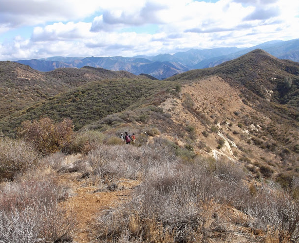
| Images: | Ridge walking Junction with Potrero |
Hurricane Deck Trail Survey - 02-10-2021 - by Kevin Varga| Link: | Hurricane Deck Trail |
| Date: | 02-10-2021 |
| Surveyor Name: | Kevin Varga |
| Trail description: | Just hiked from White Ledge to Lost Valley and down. Ran into the LPFA trail crew not far from White Ledge. The first mile out of White Ledge is nice and cleared. The next mile involves some trail finding through shrubs and some steep side hilling, especially on the north faces. The next 2 miles to the Lost Valley trail are wonderful! I recommend the Manzana-White Ledge-Lost Valley loop, especially with the awesome trail crew work. |
| Mode of transport: | Hike |
| Trail condition: | Needs some work |
| Condition details: | Trail crew is currently working the east deck |
Hurricane Deck Trail Survey - 01-02-2021 - by John Doe | Link: | Hurricane Deck Trail |
| Date: | 01-02-2021 |
| Surveyor Name: | John Doe |
| Trail description: | From lost valley to white ledge: smooth sailing for the first few miles, becoming gradually more overgrown as the trail gets closer to white ledge. Last mile could use a bit of brushing, nothing major. Patchy snow and mud make for quite a few slippery spots on the northern slopes. You can see the imprints of people who have fallen in the mud. You do not want to fall out here, it’s a long way down. Use caution or better yet, wait for it to dry out. |
| Mode of transport: | Hike |
| Trail condition: | Good shape and easy to follow |
Hurricane Deck Trail Survey - 06-09-2020 - by Ryan Anderson| Link: | Hurricane Deck Trail |
| Date: | 06-09-2020 |
| Surveyor Name: | Ryan Anderson |
| Trail description: | This is more of a PSA so you don't end up in a position like I did. I hiked from Manzana Schoolhouse to White Ledge Camp on Hurricane Deck. it was a very hot day, and had I not packed enough water, I would have been in big trouble. Be warned, the trail is exposed to the sun most of the way, and even if there is a breeze, it will blow the hot air form the face of the deck up to the top where you are hiking. Around mile 5 there is a lot of bushwhacking and can be very tough to find and remain on the trail. There is also a lot of yucca dotted through portions of the trail that will stab through whatever clothes you are wearing and is mostly hard to avoid while wearing a pack. Pack lots of water, especially if you think its going to be a warm day. i brought 6 liters, which I thought was overkill, but ended up cherishing every drop near the end. Getting lost is also a very real posiblity, and happened to me multiple times even with GPS. There were moments where I would find a tiny bit of shade and sit down and marvel at the extreme heat and ferocity of the trail. It might be best to wait for the shoulder seasons before committing to this hike. There were some parts where it felt like I was walking through hell, and started thinking how easy it would be for someone to get stuck up there due to lack of physical abilities or supplies. I did not bring a PLB with me, but if I were to do this hike again if it were warm out, I would absolutely bring one. Dehydration and the resulting cramping and inability to press on is a possibility. Remember to pack electrolytes. Be warned, this is no joke! |
| Mode of transport: | Hike |
| Trail condition: | Needs some work |
| Condition details: | Bushwhacking through some areas. Very hot and unforgiving. |
| Images: | |
Hurricane Deck Trail Survey - 05-03-2020 - by Anonymous Surveyor| Link: | Hurricane Deck Trail |
| Date: | 05-03-2020 |
| Surveyor Name: | Anonymous Surveyor |
| Trail description: | Hiked schoolhouse to Potrero. Beginning section is a little tricky to find trail in the grass. Once found it’s pretty clear all the way up as long as the grass is trampled down. Most sections are brushy so long sleeves and pants are highly recommended. Hiked with 3.5 liters of water. Begin at sunrise to try and beat some of the heat. Jumping into the creek at Potrero was a nice end to the hike and a way to cool off from a day in the sun. Great views! |
| Mode of transport: | Hike |
| Trail condition: | Needs some work |
| Images: | |
Hurricane Deck Trail Survey - 05-02-2020 - by Paul M| Link: | Hurricane Deck Trail |
| Date: | 05-02-2020 |
| Surveyor Name: | Paul M |
| Trail description: | Trail was decent in parts but definitely lots of bushwhacking and scraping shins through brush. Strenuous! Got off-trail a few times but had GPS markers pre loaded for any major course corrections. Really enjoyed the views - incredible! Saw a bear, deer, horny toads, lots of birds. White Ledge to Lost Valley was mostly good. Lost Valley to Potrero was the most challenging trail-finding. The last section down into the schoolhouse was also very challenging in terms of finding a "trail" in the grass, but not challenging exertion-wise.Enjoy, carry plenty of water and sun protection. |
| Mode of transport: | Hike |
| Trail condition: | Hard to follow |
| Condition details: | Did the whole thing from White Ledge to the Manzana Schoolhouse |
Hurricane Deck Trail Survey - 04-22-2020 - by Jeff Wheelwright| Link: | Hurricane Deck Trail |
| Date: | 04-22-2020 |
| Surveyor Name: | Jeff Wheelwright |
| Trail description: | I hiked the eastern portion from Lost Valley to White Ledge. Due to recent brushing the first part is like a freeway, but the last two miles before White Ledge are getting sketchy. Best done from west to east at this time. East to west, climbing, might put you in a bad mood. |
| Mode of transport: | Hike |
| Trail condition: | Needs some work |
Hurricane Deck Trail Survey - 01-13-2020 - by Tony G.| Link: | Hurricane Deck Trail |
| Date: | 01-13-2020 |
| Surveyor Name: | Tony G. |
| Trail description: | We hiked the western portion of the trail from Manzana Schoolhouse to Potrero trail and then down to the Manzana trail. This section of the Deck was in good shape with only a few brushy sections. Weather was good, 60's, sunny and a slight breeze, Shout out to Matt and Hillary and their dogs who led on the trail this day. |
| Mode of transport: | Hike |
| Trail condition: | Good shape and easy to follow |
Hurricane Deck Trail Survey - 11-23-2019 - by Paul Cronshaw| Link: | Hurricane Deck Trail |
| Date: | 11-23-2019 |
| Surveyor Name: | Paul Cronshaw |
| Trail description: | Two weeks ago I hiked the Eastern section of the Hurricane Deck Trail from White Ledge to Lost Valley Trail under a full moon light. It was spectacular!  For my hike of the Sisquoc Loop, I decided to hike this same section in the daylight. Again, it was spectacular. I do believe that hiking the same trail section in opposite directions is like hiking a different trail in each direction.  Thanks to LPFA's eorking vacation in August, 2019, the brushy sections that slowed the pace of many prior section hikers, were now opened and like a freeway. This will easily become favorable route when there is high water in the upper Manzana River drainage. |
| Mode of transport: | Hike |
| Trail condition: | Needs some work |
| Condition details: | The section from White Ledge Camp to the end of working vacation brushing in 2016 needs to be rebrushed |
| Images: | Section of trail showing open corridor conditions A rock formation that I have dubbed as "The Couch" The "Kissing Dolphin's" Rock formation |
Hurricane Deck Trail Survey - 11-11-2019 - by Paul "The Beeman" Cronshaw| Link: | Hurricane Deck Trail |
| Date: | 11-11-2019 |
| Surveyor Name: | Paul "The Beeman" Cronshaw |
| Trail description: | I hiked from SouthFork Station to Cowboy Camp as a night hike under a full moon. Took approximately 4 hours. Thanks to recent LPFA traiwork, the green tunnels had been cleared and the trail was easy to follow with a headlamp to the Lost Valley Junction.  Camped at Cowboy Camp which is located about half mile down the Lost Valley Trail from the Deck junction. |
| Mode of transport: | Hike |
| Trail condition: | Needs some work |
| Condition details: | In 2017 LPFA worked on the section from White Ledge Camp to high point. This section needs some rebrushing |
| Images: | Sign at White Ledge Camp. Full Moon rising over the Eastern Hurricane Decm Cowboy Camp on the Lost Valley Trail |
Hurricane Deck Trail Survey - 06-17-2019 - by Louis Tremblay| Link: | Hurricane Deck Trail |
| Date: | 06-17-2019 |
| Surveyor Name: | Louis Tremblay |
| Trail description: | Hiked from Manzana Schoolhouse to Portero Canyon. Trail is followable thanks to light foot traffic trampling the grass, but many sections have become entirely overgrown and required pushing through miles of bushes; might be most served with some flagging near Manzana. Anyone attempting this section should absolutely wear pants and long sleeves. Awesome views the whole way though of Castle Rock and surroundings. Tons of wildflowers. Special trail! |
| Mode of transport: | Hike |
| Trail condition: | Needs some work |
Hurricane Deck Trail Survey - 06-02-2019 - by Tony G.| Link: | Hurricane Deck Trail |
| Date: | 06-02-2019 |
| Surveyor Name: | Tony G. |
| Trail description: | Hiked from the eastern end at White Ledge camp to Lost Valley trail and then down to Nira. The trail was in good shape with some sections growing in with grass and brush. Clear evidence in sections of recent trail maintenance. The weather was perfect in the 70's with fog rolling up below us on both the Sisquoc and the Manzana making for awesome views! |
| Mode of transport: | Hike |
| Trail condition: | Good shape and easy to follow |
Hurricane Deck Trail Survey - 12-22-2018 - by Los Padres Forest Association| Link: | Hurricane Deck Trail |
| Date: | 12-22-2018 |
| Surveyor Name: | Los Padres Forest Association |
| Trail description: | LPFA Trail Crew spent 2 days brushing the Hurricane Deck Trail from the Lost Valley junction towards White Ledge Camp. This was the first 2 days of what will be many spent along the Deck this coming season with the goal of getting the Eastern Deck 100% cleared of brush. Stay tuned...... |
| Mode of transport: | Hike |
| Trail condition: | Needs some work |
Hurricane Deck Trail Survey - 12-30-2018 - by Erin C.| Link: | Hurricane Deck Trail |
| Date: | 12-30-2018 |
| Surveyor Name: | Erin C. |
| Trail description: | We only hiked from the top of Lost Valley Trail to White Ledge Campground. Trail conditions were good, then terrible, then good again. The eastern side of the trail just needs about 1.5 miles of heavy brush clearing, then it will be in good shape. Paul from LPFA said this is on the "To Do" list for 2019, which is good to hear.  |
| Mode of transport: | Hike |
| Trail condition: | Needs some work |
| Images: | |
Hurricane Deck Trail Survey - 11-20-2018 - by Paul Cronshaw| Link: | Hurricane Deck Trail |
| Date: | 11-20-2018 |
| Surveyor Name: | Paul Cronshaw |
| Trail description: | Hiked the Eastern section of this trail from White Ledge Camp to Lost Valley Trail Junction down to Lost Valley Camp. Trail needs work in the sections identified in photo labeled " LPFA 1/28/18". The trail is easy to follow from White Ledge to the "one tree" hill at which point it passes to a north facing traverse where the 2015 brushing project started clearing out this green tunnel section. This section of the Hurricane Deck and down the Lost Valley makes for a alternative route back to Nira Trailhead from SouthFork. Bring lots of water! |
| Mode of transport: | Hike |
| Trail condition: | Needs some work |
| Condition details: | A few green tunnels need brushing from end of 2015 trail project and junction with Lost Valley Trail |
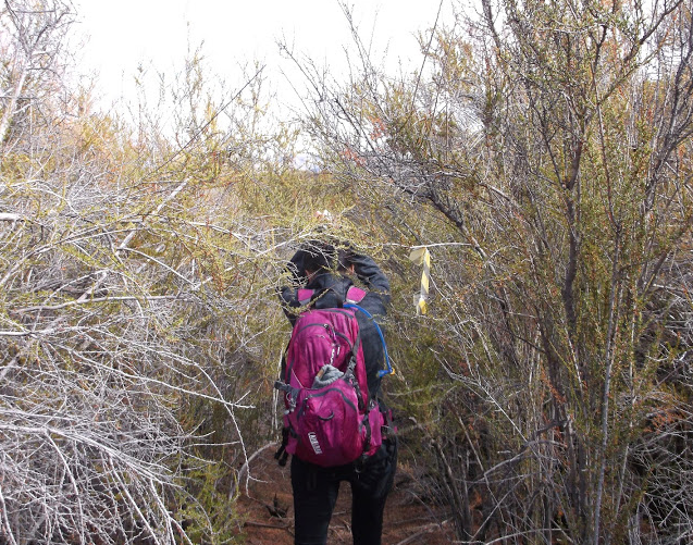
| Images: | Trail corridor remains open after 2015 brushing project Demonstrating hiking technique passing through the brush sections Grassy trail tread section near junction with Lost Valley "Green Tunnel" section |
Hurricane Deck Trail Survey - 1-12-2018 - by Los Padres Forest Association| Link: | Hurricane Deck Trail |
| Date: | 1-12-2018 |
| Surveyor Name: | Los Padres Forest Association |
| Trail description: | Scouted the Eastern Deck Trail from Lost Valley to White Ledge, see map: - From Lost Valley the trail is super brushy for 2 miles. You should be able to follow the trail but expect to push through lots of brush. There are a couple odd turns but you shouldn't have to crawl. - At the 2 mile mark is starts to open up from where a LPFA Crew worked in 2015. This continues to stay open compared to the first section until White Ledge. - That being said, the trail does become harder to follow the final push to White Ledge but still way better than the Super Brushy section. - Watch for trail flags, cairns, epic views and footprints to assist your travel. |
| Mode of transport: | Hike |
| Trail condition: | Hard to follow |
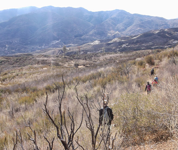
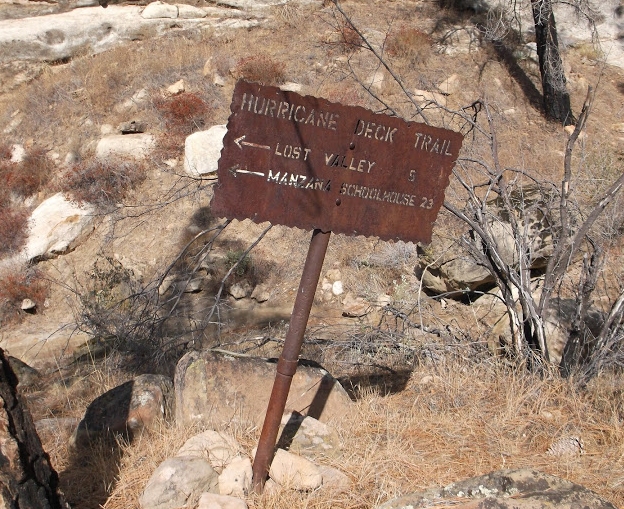
| Images: | Map of Conditions Jan 2018 Super Brushy Section Area worked in 2015 Bear helping keep the trail open Hurricane Deck Sign at White Ledge Junction |
Hurricane Deck Trail Survey - 01-15-2018 - by David Herrig| Link: | Hurricane Deck Trail |
| Date: | 01-15-2018 |
| Surveyor Name: | David Herrig |
| Trail description: | |
| Mode of transport: | Hike |
| Trail condition: | Needs some work |
| Condition details: | Hiked the ~4.5 mile section from White Ledge camp to Lost Valley trail. The first 1.5-2 miles the trail is in the open. There are a couple right turns where it would be easy to get off trail if you aren't mindful of ducks, pink ribbons, and sticks marking the correct route. Next 3 miles were mostly overgrown with bushes. The route was easily visible but slow going due to shoulder-height branches across the trail. |
Hurricane Deck Trail Survey - 04-19-2017 - by Los Padres Forest Association| Link: | Hurricane Deck Trail |
| Date: | 04-19-2017 |
| Surveyor Name: | Los Padres Forest Association |
| Trail description: | Good article in the SB Independent about the NIRA - White Ledge - Deck - Lost Valley Loop. By Richie Demaria http://www.independent.com/news/2017/apr/20/white-ledgehurricane-deck-loop-weekend-warrior/ |
| Mode of transport: | Hike |
| Trail condition: | Needs some work |
Hurricane Deck Trail Survey - 04-08-2017 - by Jim Blakley| Link: | Hurricane Deck Trail |
| Date: | 04-08-2017 |
| Surveyor Name: | Jim Blakley |
| Trail description: | The trail has great views but is rather barren. Chaparral is still low after burning in Zaca Fire, but beginning to grow back thickly in spots. About 2 miles west of the Potrero Trail junction the trail is lost in brush on a steep west-facing slope. Watch for the trail to switchback to south near top of slope. Follow this to the ridge to the south and then bushwhack straight down that ridge to the cut and flagged piece of trail at the bottom of the slope. This trail leads back north to where the trail continues west along the ridge top. Further on, the trail enters an oak savanna and begins its final descent to the Sisquoc River. Here, the trail was hidden by lush grass in the upper, less steep part of the savanna. |
| Mode of transport: | Hike |
| Trail condition: | Hard to follow |
| Condition details: | A faint path is visible in open areas, but it is hard to follow to non-existent in two spots |
| Images: | East up trail with Bald Mountian West along trail and out over Sisquoc |
Hurricane Deck Trail Survey - 03-25-2017 - by Los Padres Forest Association| Link: | Hurricane Deck Trail |
| Date: | 03-25-2017 |
| Surveyor Name: | Los Padres Forest Association |
| Trail description: | A 6" goat trail has been cut across the slide 1-mile west of Lost Valley Trail along the Hurricane Deck Trail. Â It remains sketchy to cross at best. |
| Mode of transport: | Hike |
| Trail condition: | Hard to follow |
| Images: | |
Hurricane Deck Trail Survey - 03-08-2017 - by Jim Blakley| Link: | Hurricane Deck Trail |
| Date: | 03-08-2017 |
| Surveyor Name: | Jim Blakley |
| Trail description: | The first 2 miles of trail west from White Ledge are relatively easy to follow although it is occasionally necessary to cast around a bit to find the trail. The terrain is mostly south facing and open, with brush encroaching at times. The trail is wide open for the half mile it is on the north face of hill 4101. After that it becomes quite brushy, with branches continually reaching across the trail. It isn't hard to get through, there are just a lot of branches to push aside. West of the Lost Valley junction the trail is more open. However, it is completely impassible about 1 mile west of the junction, where it turns sharply north, crosses a saddle, and climbs a steep hill. Where the trail crossed the eastern face of this hill a landslide has carried away the tread leaving a shear drop down a hundreds of foot high cliff. The western side of the hill and the ridge between are also too steep and exposed, especially as they are composed of rotten shale, to allow safe passage. |
| Mode of transport: | Hike |
| Trail condition: | Hard to follow |
| Condition details: | White Ledge to Lost Valley passable, western 2 miles quite brushy, trail totally gone 1 mile west of Lost Valley Junction |
| Images: | Hill where slide carried away the trail |
Hurricane Deck Trail Survey - 03-08-2017 - by Los Padres Forest Association| Link: | Hurricane Deck Trail |
| Date: | 03-08-2017 |
| Surveyor Name: | Los Padres Forest Association |
| Trail description: | Got two reports last week from different sides of the Deck. Â Lets start from the west (Schoolhouse) and head east: - George reported a large snarl of downed trees just as you start the Deck coming from the Sisquoc side, see photo below. Â The rest of the trail out to Potrero was in good (normal) shape. - Blakley reported that there is an impassable washout/slide located about 1mile west of the Lost Valley Trail on the Deck. Â See photo below. Â If you've hiked the Deck, you know this section. Â It's been scary to cross for years now. Â It would be nice to establish a way around the slide. Â Careful if you head out there. Â The rest of the Deck out to White Ledge is as usual, brushy but better than it has been. |
| Mode of transport: | Hike |
| Trail condition: | Hard to follow |
| Images: | George Williams - 34.8250322,-119.9936887 photo Blakley |
Hurricane Deck Trail Survey - 05-28-2016 - by Cameron D| Link: | Hurricane Deck Trail |
| Date: | 05-28-2016 |
| Surveyor Name: | Cameron D |
| Trail description: | From the Manzana Schoolhouse, the first mile or so is overgrown but followable. Then small pieces of blue marker start appearing (occasionally) as the trail rapidly disappears. It was possible, but difficult, to follow and involved a lot of backtracking, searching for markers or cut branches, and "feeling" the tread with hiking poles. I was hoping the brush would thin and the trail would become more obvious near the top, but no such luck. I followed the trail to where it seemed to wrap around the finger of the ridge a bit and leveled off; I'm not sure if it was the top of the main ridge or a sub ridge. Worse than the trail finding were the fox tails or whatever type of grass has the small spiky seeds. I gave up clearing them within the first few minutes on the trail. By the time I got back down my feet resembled a porcupine turned inside out. I had to cut the mesh on my shoes just to get all of them out and they sliced up my ankles. Wear shoes with no mesh if you want to try the trail! |
| Mode of transport: | Hike |
| Trail condition: | Hard to follow |
| Condition details: | Very difficult & time consuming to follow. Hardly passible (if at all) |
Hurricane Deck Trail Survey - 02-27-2016 - by Steve Cypher| Link: | Hurricane Deck Trail |
| Date: | 02-27-2016 |
| Surveyor Name: | Steve Cypher |
| Trail description: | Hiked the middle portion of the Deck from Potrero to Lost valley Trails. This was the first time I've done this hike when there was a tread with footprints to follow. Hardy individuals have been lopping the brushy parts, and I wasn't even bleeding when I got to the end. Still a very challenging hike with several opportunities to get off trail. |
| Mode of transport: | Hike |
| Trail condition: | Needs some work |
| Condition details: | Not as epically brutal as it used to be. |
Hurricane Deck Trail Survey - 12-18-2015 - by LPFA : Bard| Link: | Hurricane Deck Trail |
| Date: | 12-18-2015 |
| Surveyor Name: | LPFA : Bard |
| Trail description: | RAIN! Â Forecasted, and meterologists were correct. No water problem on this HD trip. Cold, had to keep moving. Â Hiked in the clouds, fun, but limited views. Trail tread easy to follow. Â Muddy/slippery after continuous rain squalls. Slept in rain, ate in rain, hiked in rain. AWESOME trip! |
| Mode of transport: | Hike |
| Trail condition: | Needs some work |
| Condition details: | H.D. Trail from Portrero to Sisquoc River |
| Images: | |
Hurricane Deck Trail Survey - 11-20-2015 - by LPFA : Bard| Link: | Hurricane Deck Trail |
| Date: | 11-20-2015 |
| Surveyor Name: | LPFA : Bard |
| Trail description: | No Water! Â Ever. Trail tread easy to follow. Â Thanks for trail ribbon markers. Â Lost trail a few times, got down on the ground and looked for saw cuts on chapparal. Â Not easy to do with a 4 day backpack loaded with H20. Unreal views with clear air. Strong commitment with friends. Â Safe trip. Spring on Lost Valley Trail; murky |
| Mode of transport: | Hike |
| Trail condition: | Needs some work |
| Condition details: | H.D. Trail from White Ledge to Lost Valley |
| Images: | |
Hurricane Deck Trail Survey - 10-30-2015 - by Los Padres Forest Association| Link: | Hurricane Deck Trail |
| Date: | 10-30-2015 |
| Surveyor Name: | Los Padres Forest Association |
| Trail description: | SECTION FROM POTRERO TO MANZANA SCHOOLHOUSE Report from BQJ:Trail disappears for about 1/8 mile at midway spot. Flagging provides
some direction here but brush work needed to reestablish trail route.
One steep section close to Potrero Trail could stand to be rerouted to
avoid excessive erosion (not sure if this is allowed). Switchbacks down
into the river valley are fairly clear but some treadwork may be helpful
in spots. |
| Mode of transport: | Hike |
| Trail condition: | Needs some work |
Hurricane Deck Trail Survey - 05-17-2015 - by Julie| Link: | Hurricane Deck Trail |
| Date: | 05-17-2015 |
| Surveyor Name: | Julie |
| Trail description: | Hiked from Nira to White Ledge along Manzana Trail. Next day hiked Hurricane Deck to Lost Valley trail back to Nira. Water in Manzana Creek up to Big Spruce turn off, then only standing water to White Ledge. The first 2 miles of Hurricane deck were clear and easy to follow. The last last 1-2 miles was very overgrown and not well marked - to the point I contemplated whether I was on an actual trail any longer. No water along this whole section. Lost valley trail in good condition. No water along here either. |
| Mode of transport: | Hike |
| Trail condition: | Needs some work |
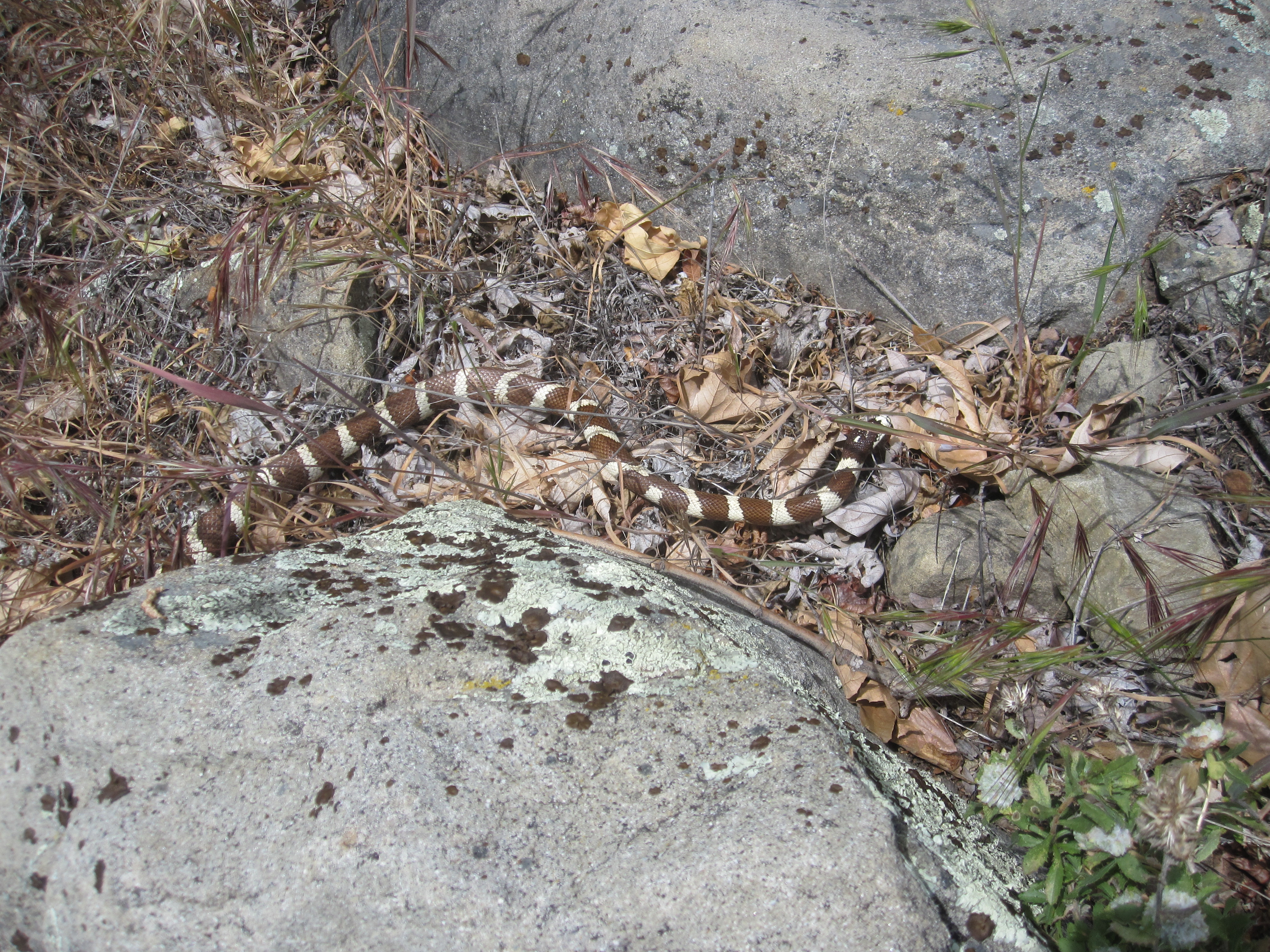
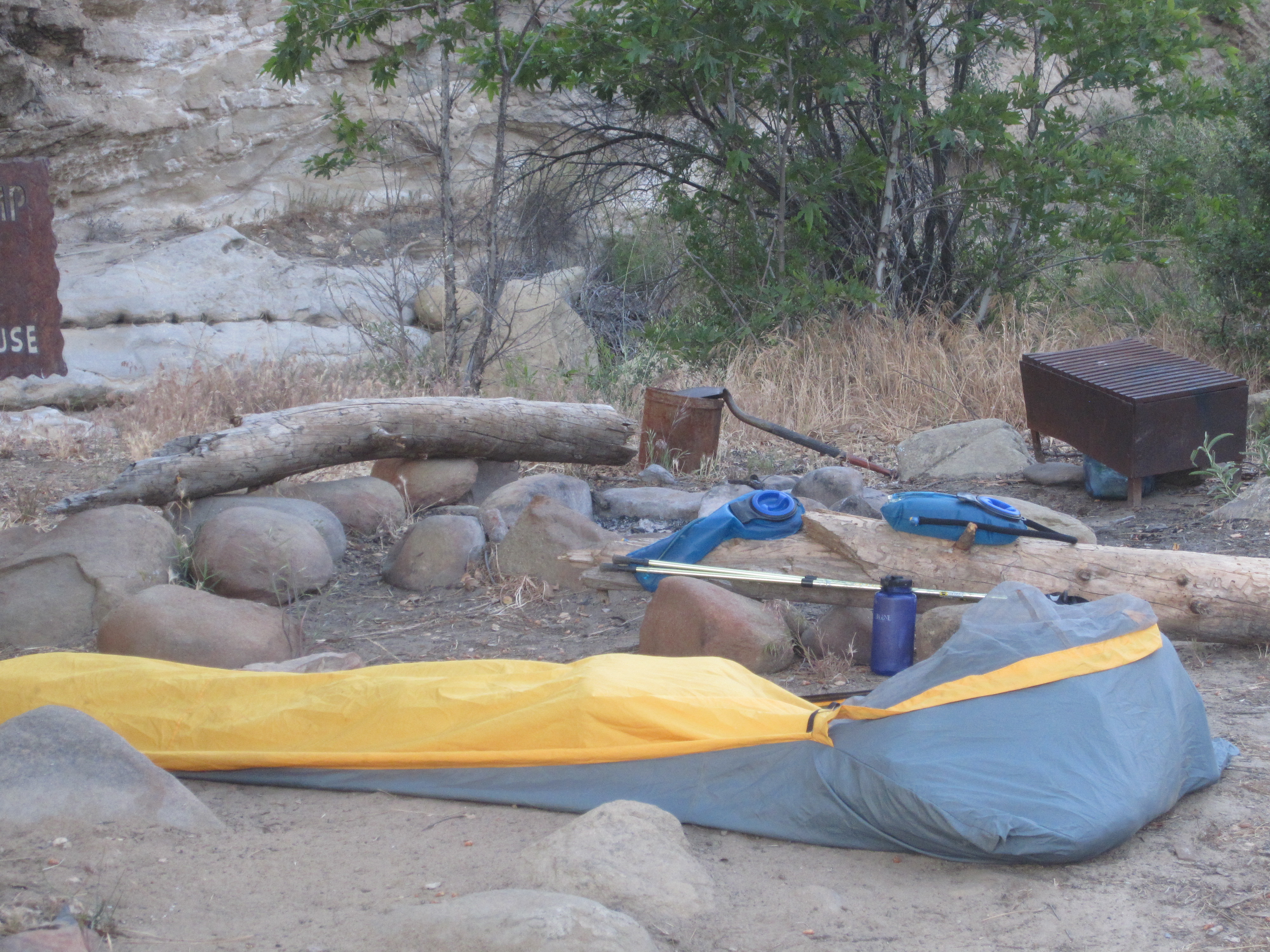
| Images: | King Snake along Manzana Creek White Ledge Camp |
Hurricane Deck Trail Survey - 12-22-2014 - by Anonymous Surveyor| Link: | Hurricane Deck Trail |
| Date: | 12-22-2014 |
| Surveyor Name: | Anonymous Surveyor |
| Trail description: | Beautiful hike. Â Trail easy to follow. Â Bummer that someone had ridden a Mountain Bike on the Portrero Trail and left deep tire ruts. |
| Trail condition: | Good shape and easy to follow |
| Condition details: | Great trip in excellent weather |
Hurricane Deck Trail Survey - 12-26-2014 - by Andrew Jackman| Link: | Hurricane Deck Trail |
| Date: | 12-26-2014 |
| Surveyor Name: | Andrew Jackman |
| Trail description: | Hiked the White Ledge Loop up through the Manzana River Trail to White Ledge, and then over the Hurricane Deck to the Lost Valley Trail and back down to Nira. Plenty of water all the way to White Ledge. The Hurricane Deck was passable, although waterless, and you will have to push through lots of brush. Recommend loppers for this portion. Lost Valley Trail was very clear and easy to follow with plenty of water. Overall it was a very pleasant hike! |
| Mode of transport: | Hike |
| Trail condition: | Needs some work |
Hurricane Deck Trail Survey - 11-01-2014 - by Los Padres Forest Association| Link: | Hurricane Deck Trail |
| Date: | 11-01-2014 |
| Surveyor Name: | Los Padres Forest Association |
| Trail description: | EASTERN DECK Report from Curt CraggThe brush tunnel at the east end of the deck heading down toward White
Ledge is still a tunnel. The transition to the trail heading into White
Ledge was hard to find and needs some better marking and brush clean
up. In general the trail is hard but followable. Â Expect to bushwhack excessively. Photos by Toejam |
| Mode of transport: | Hike |
| Trail condition: | Hard to follow |
| Images: | Hurricane Deck tunnels View from one of the openings Coming down towards White Ledge Great views up-canyon Sisquoc Sign at White Ledge Camp junction |
Hurricane Deck Trail Survey - 03-22-2014 - by Valerie Norton| Link: | Hurricane Deck Trail |
| Date: | 03-22-2014 |
| Surveyor Name: | Valerie Norton |
| Trail description: | Hiked from White Ledge to Lost Valley. Some good views, once out of the high brush areas. In the high brush areas, the trail is a highly slanted leaf covered surface with a few branches across, but generally clear. Some cairns and old flagging is present, but not particularly required as any wrong turns will not get far in the brush. |
| Mode of transport: | Hike |
| Trail condition: | Needs some work |
| Condition details: | East Deck: some brushing needed, but generally surprisingly good on |
 Survey / Report Form - Please click this box to open the form.