 Use Marker Groups
 Wolf 2002
Piru 2003
Day 2006
Zaca 2007
Gap 2008
La Brea 2009

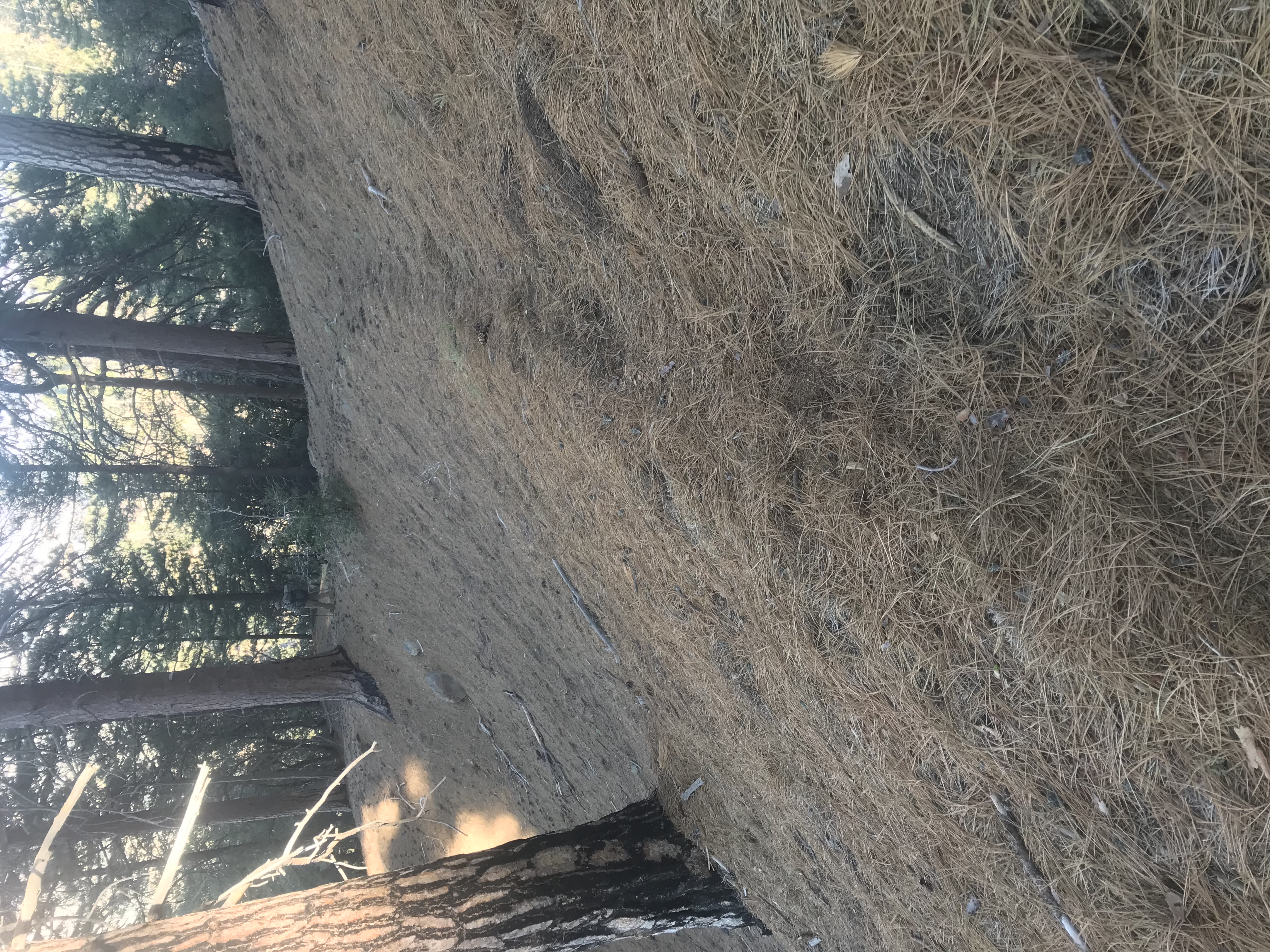
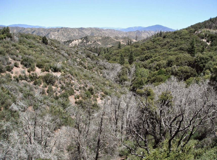
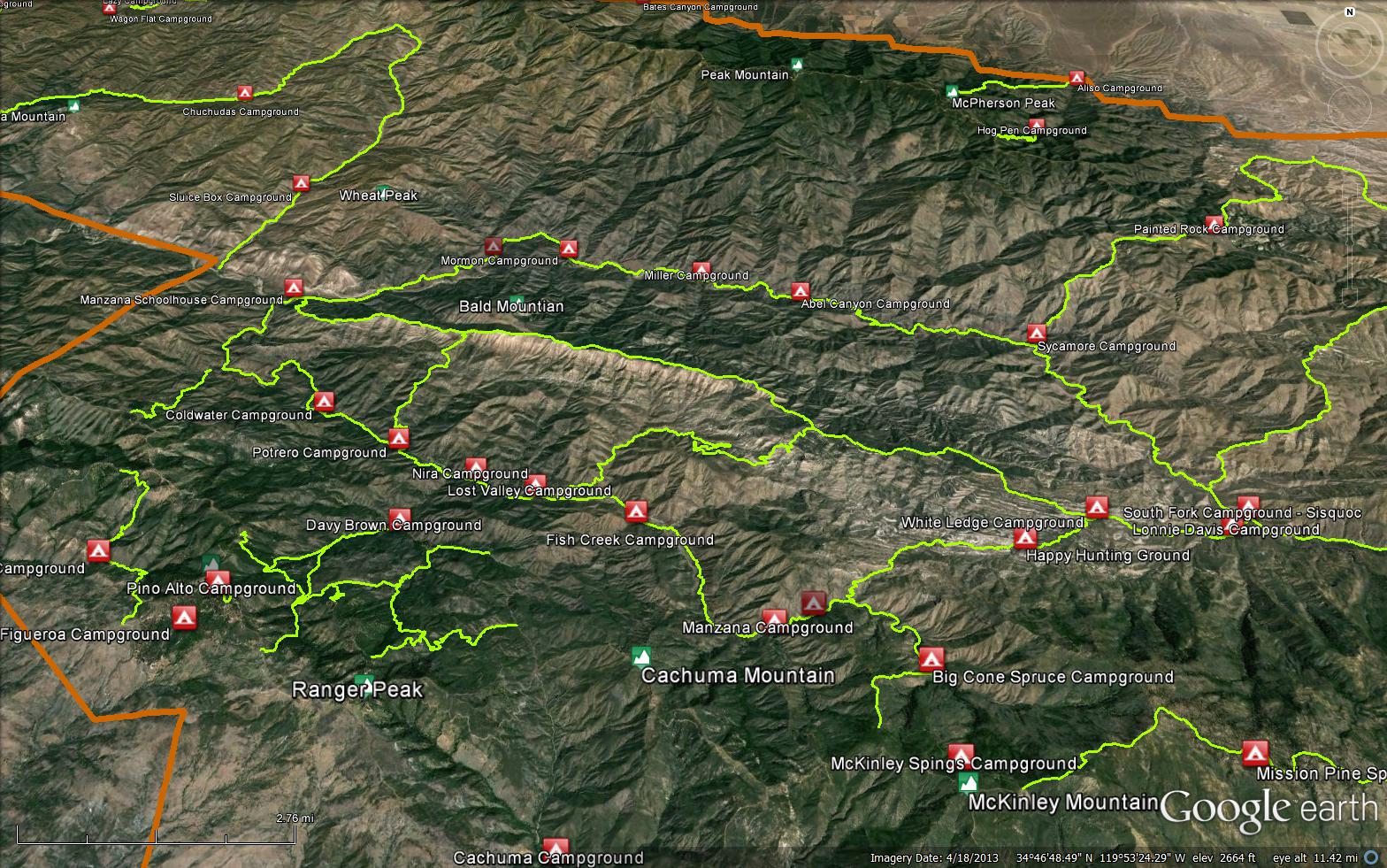
The Madulce Trail is a scenic 3.51 mile trail in the Dick Smith Wilderness in Santa Barbara County. The trail connects the Buckhorn Road (9N11.3) to 3 Dick Smith Wilderness trails, the Don Victor Trail (25W03), the Santa Barbara Canyon Trail (25W02), and the Madulce Peak Trail (28W10). Best way to access the trail is from Santa Barbara Canyon Trail (25W02). Please let us know if you have explored this trail recently.
A squatter called Old Marlow built the first log cabin in the late 1880's. In 1890 until 1929 this old cabin was used as a station for summer fire guards. In 1929, the old log cabin was removed and in 1930 a new frame cabin was built. In the early 1940's, with the completion of the Big Pine Buckhorn Administration Road built by the CCC, the old cabin was no long used for fire guards. The cabin was burnt down and only remains of the foundation are visible. There are wild strawberries growing behind the cabin site.
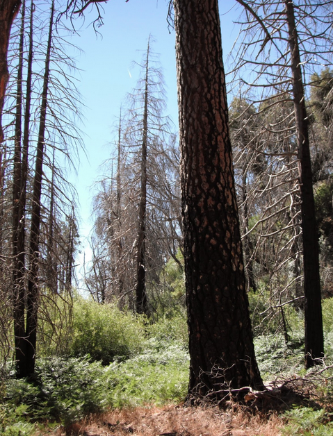
On the 1905 topographic map, the peak is called Strawberry Peak because of the wild strawberries that grow on Pine Creek at its north base. The name Madulce was substituted because the U. S. Geological map makers were told to use local names. A fire tower was constructed on top of the peak at the end of side Trail 25W13.1. A storm severely damaged the tower so that Forest Service burned it to the ground.
Madulce Trail was and still is an important link between the Sisquoc River area and the Santa Barbara Canyon Trail to the Cuyama or down the Alamar and Mono Canyons to the coast.


 Madulce Trail Survey - 05-24-2024 - by Clancy
| Link: | Madulce Trail |
| Date: | 05-24-2024 |
| Surveyor Name: | Clancy |
| Trail description: | Hard to find the trail from Madulce Camp. We found the trail 1/10th of a mile later and from there was generally easy to follow up to Buckhorn Rd. Some pushing through brush was needed. Amazing view from the ridge. |
| Mode of transport: | Hike |
| Trail condition: | Needs some work |
Madulce Trail Survey - 04-30-2022 - by Mojo| Link: | Madulce Trail |
| Date: | 04-30-2022 |
| Surveyor Name: | Mojo |
| Trail description: | Had some trouble finding the start of the trail from the junction with SB Canyon. Once I had the trail it was in good condition. A couple downed trees that were easily navigable. Some water at all crossings ranging from a trickle to small murky puddles. Lots of wild strawberry around the creek, none fruiting yet. By SB Backcountry standards the trail is in very good shape. Clear and easy to follow. I did not have any issues with overgrowth and did not note any particularly narrow sections of trail, there are areas with steep drop offs but that is to be expected based on the topography. Some areas where the Zaca burn scar is evident but many saplings are well overhead now. Nice views out to the islands once you're up to the ridge. A pleasant section on the whole. |
| Mode of transport: | Hike |
| Trail condition: | Good shape and easy to follow |
Madulce Trail Survey - 03-12-2022 - by Anonymous Surveyor| Link: | Madulce Trail |
| Date: | 03-12-2022 |
| Surveyor Name: | Anonymous Surveyor |
| Trail description: | The upper portion of the trail is narrow with severe drop offs. Hiked From the peak junction down to madulce camp. The middle part is very brushy. There are down logs once you get closer to madulce camp which you have to climb over or under. A lot of clearing needs to be done. To ease the trail work that needs to be done one could also let the plants just overtake the trail and have it disappear forever. |
| Mode of transport: | Hike |
| Trail condition: | Needs some work |
Madulce Trail Survey - 04-19-2021 - by Los Padres Forest Association| Link: | Madulce Trail |
| Date: | 04-19-2021 |
| Surveyor Name: | Los Padres Forest Association |
| Trail description: | LPFA Volunteers spent another weekend hammering on the Madulce Trail. This time we came from the top Buckhorn side and worked clearing downed trees and some narrow sections down towards Madulce Camp. The upper section to the Lookout Trail is in great shape as is the pine section below that. We cleared some of the middle chaparral tunnel section but didn't finish that up. As of now the Madulce Trail should be good through the lower creek section, a little brushy in the middle chaparral zone and then smooth sailing above that. Good work by all the tireless volunteers! THANK YOU. Enjoy..... |
| Mode of transport: | Array |
| Trail condition: | Good shape and easy to follow |
Madulce Trail Survey - 03-29-2021 - by Los Padres Forest Association| Link: | Madulce Trail |
| Date: | 03-29-2021 |
| Surveyor Name: | Los Padres Forest Association |
| Trail description: | LPFA Volunteers descended upon the Madulce Trail and kicked some trail butt clearing downed trees and brush. We worked up from Madulce Camp and cleared the creek section of the Madulce Trail and started brushing some of the chaparral section. The upper pine portion remains in good shape as does the upper chaparral section. MUCH IMPROVED, you won't be crawling but more work needed in the middle zone. We'll be back! Thanks to our AWESOME VOLUNTEERS. Join us next time: VOLUNTEER@LPForest.org |
| Mode of transport: | Array |
| Trail condition: | Needs some work |
Madulce Trail Survey - 02-22-2021 - by Los Padres Forest Association| Link: | Madulce Trail |
| Date: | 02-22-2021 |
| Surveyor Name: | Los Padres Forest Association |
| Trail description: | LPFA survey of the Madulce Trail in Feb 2021. Unfortunately the trail was thrashed and extremely hard to follow through the creek section. It took us 4hrs to hike the three miles from Madulce Camp to Buckhorn Road. We were able to clear some of the smaller trees and flagged the trail where needed and will be coming back soon to clear the trail. Amazing how much damage the snow caused on the Zaca Fire snags. |
| Mode of transport: | Array |
| Trail condition: | Hard to follow |
Madulce Trail Survey - 04-24-2021 - by Addison Jerlow| Link: | Madulce Trail |
| Date: | 04-24-2021 |
| Surveyor Name: | Addison Jerlow |
| Trail description: | Thank you LPFA! Highway for a mile from camp, then a short overgrown chaparral section before another highway to the junction with Madulce Peak trail. Didn't continue to Alamar but I imagine the second section of cleared trail was from a crew who started at the saddle and the clear trail continues. |
| Mode of transport: | Hike |
| Trail condition: | Good shape and easy to follow |
Madulce Trail Survey - 03-29-2021 - by Mike Maki| Link: | Madulce Trail |
| Date: | 03-29-2021 |
| Surveyor Name: | Mike Maki |
| Trail description: | Part of a 9 person LPFA crew camped at Madulce 3 nights. Cleared many trees and much brush for almost a mile of trail west of camp. Still some brushy spots past our work and some trees but easy to get over. Camp is in great shape. Lots of water in creek and spring. |
| Mode of transport: | Hike |
| Trail condition: | Needs some work |
| Condition details: | FIrst Mile from Madulce Camp a Highway |
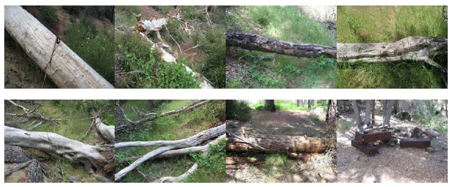
| Images: | Highway for a little while! Typical tree further up. Cleaned up for easy crossing. A big mess cleared. |
Madulce Trail Survey - 03-25-2021 - by Sonia| Link: | Madulce Trail |
| Date: | 03-25-2021 |
| Surveyor Name: | Sonia |
| Trail description: | Trail in the upper reaches were in great shape, amazing views easy to follow. Still some snow pack on the north facing slopes, a little sketchy but not too bad. As you get down closer to Madulce Camp, the last 2 miles had many downed trees and lots of overgrown brush - had to belly crawl a few places. LPFA were on their way up for some much needed work - thanks LPFA! |
| Mode of transport: | Hike |
| Trail condition: | Needs some work |
Madulce Trail Survey - 06-22-2020 - by John Doe | Link: | Madulce Trail |
| Date: | 06-22-2020 |
| Surveyor Name: | John Doe |
| Trail description: | Trail between madulce camp and the lookout trail is easy to follow, but very overgrown. I lost count of the downed trees, which at times are grouped like charred rungs on a ladder. Took 3-4 hours to hike the 2 miles, although granted I stopped to clear brush in a few sections. In many of the more overgrown sections where one would want to crawl, the trail is littered with the small, dead clippings of some @$$hole who (presumably) cut their way through without giving a second thought to leaving a trail of debris in their wake. It is harder/more painful to push through the brittle clippings than it would be if they were still on the bush. Please, if you are going to clear brush, do it right and throw your cuttings away from the trail. |
| Mode of transport: | Hike |
| Trail condition: | Needs some work |
| Condition details: | Easy to follow but slow going due to downed trees and thorny brush |
Madulce Trail Survey - 05-25-2020 - by Bingo Wathen| Link: | Madulce Trail |
| Date: | 05-25-2020 |
| Surveyor Name: | Bingo Wathen |
| Trail description: | Trail is evident but gets more overgrown the farther you get from Madulce camp. Lots of bushwhacking and climbing over/through at least a dozen downed trees. Had to army crawl through spiny Ceanothus at one point. Last mile towards Buckhorn Road trail is clear and easy to follow. |
| Mode of transport: | Hike |
| Trail condition: | Needs some work |
| Condition details: | Hiked from Madulce Camp to Buckhorn Road |
Madulce Trail Survey - 05-06-2019 - by Diane Soini| Link: | Madulce Trail |
| Date: | 05-06-2019 |
| Surveyor Name: | Diane Soini |
| Trail description: | Trail is in good shape. |
| Mode of transport: | Hike |
| Trail condition: | Good shape and easy to follow |
Madulce Trail Survey - 01-02-2019 - by Brad Anderson| Link: | Madulce Trail |
| Date: | 01-02-2019 |
| Surveyor Name: | Brad Anderson |
| Trail description: | Approximately 5 large tree down trail to Buckhorn Road. There's two to four inches of snow/ice near the top of the trail, trekking poles would be good. |
| Mode of transport: | Hike |
| Trail condition: | Good shape and easy to follow |
| Images: | Snow/ice is found near junction with Lookout Trail in January. |
Madulce Trail Survey - 05-16-2018 - by Valerie Norton| Link: | Madulce Trail |
| Date: | 05-16-2018 |
| Surveyor Name: | Valerie Norton |
| Trail description: | Seemed a little faint among the grasses, but no question of if a game trail might be the trail instead of the real trail. One drainage tempted me, but looking up it, it was quickly obvious it was a tiny creek sometimes. There were three little trees that were a nuisance and a couple rather large trees that weren't hard to get over/past. Noted the old single wire phone line in one oak. From Madulce Peak to the road is smooth sailing with the smallest twig of a tree down on the trail right at the end. A little water in all the creek crossings. |
| Mode of transport: | Hike |
| Trail condition: | Good shape and easy to follow |
Madulce Trail Survey - 03-19-2018 - by Los Padres Forest Association| Link: | Madulce Trail |
| Date: | 03-19-2018 |
| Surveyor Name: | Los Padres Forest Association |
| Trail description: | The Madulce Trail is in great shape. There are two crosscut size downed trees along the middle section and a couple smaller snags across the trail in the lower section but all in all the trail is doing great! All the work we've accomplished over the past 3 years between two working vacations and three weekend projects is doing the job. We're winning right now! |
| Mode of transport: | Hike |
| Trail condition: | Good shape and easy to follow |
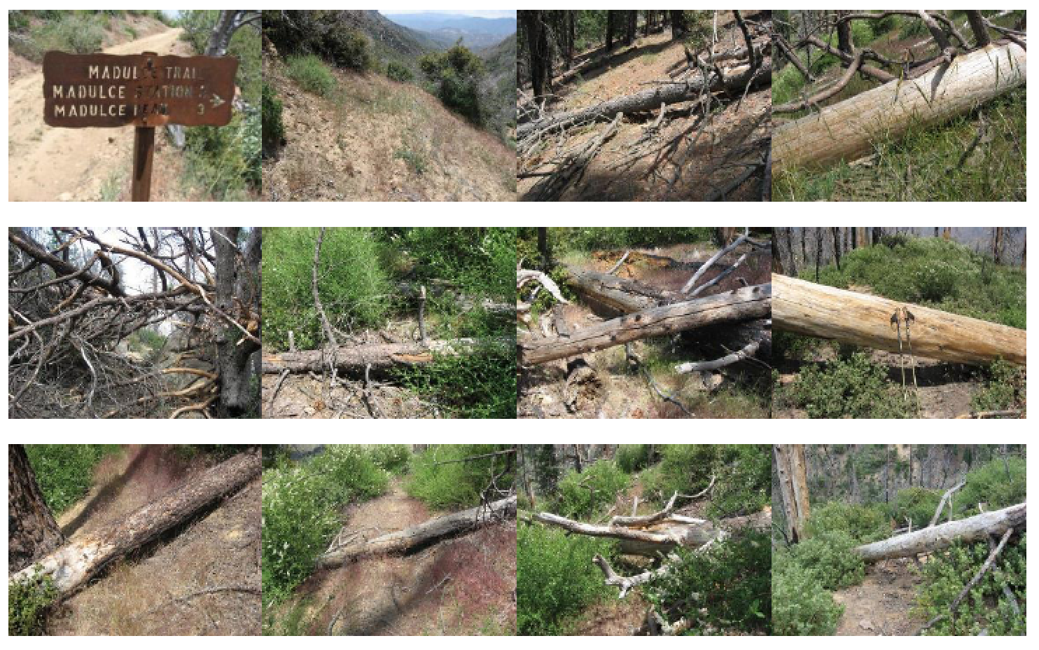
| Images: | Nice wide open trail along the top chaparral section. Snowy trail junction. One of the two downed trees along the middle. The middle chaparral stretch is beautiful! The creek section, as scenic as always! GO GET IT! |
Madulce Trail Survey - 08-6-2017 - by Los Padres Forest Association| Link: | Madulce Trail |
| Date: | 08-6-2017 |
| Surveyor Name: | Los Padres Forest Association |
| Trail description: | LPFA Trail Project focused on brushing the top mile of the Madulce Trail, it had become very overgrown. We brushed and did some tread repair from the Buckhorn to the junction of the Lookout Trail. |
| Mode of transport: | Hike |
| Trail condition: | Good shape and easy to follow |
Madulce Trail Survey - 08-14-2016 - by Los Padres Forest Association| Link: | Madulce Trail |
| Date: | 08-14-2016 |
| Surveyor Name: | Los Padres Forest Association |
| Trail description: | LPFA trail project along the Madulce Trail from Buckhorn Rd down to Madulce Camp. We cleared the trail of close to a dozen downed trees and worked on some of the narrower tread sections. The trail is in really nice shape, especially compared to what it was like earlier this year.  Come out and volunteer with us, it's fun! |
| Mode of transport: | Hike |
| Trail condition: | Good shape and easy to follow |
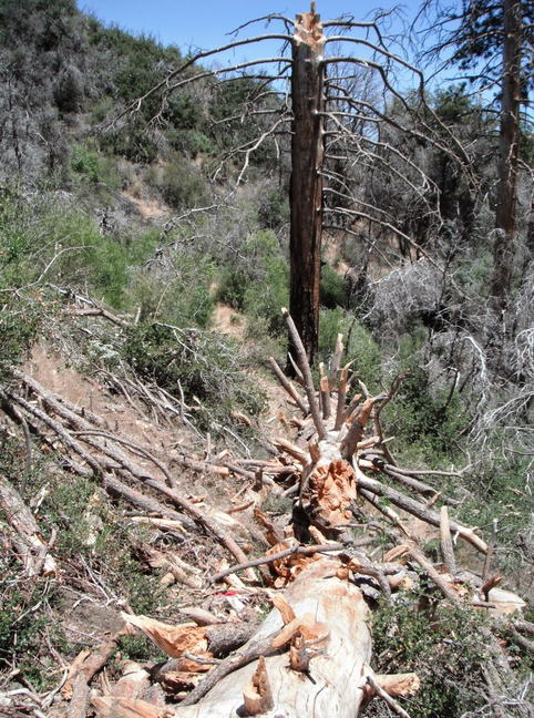
| Images: | Some of the best views are along the Madulce Trail. Rootball from hell in the middle of the trail! GONE. Before & After showing a few larger crosscut trees. |
Madulce Trail Survey - 03-19-2017 - by Los Padres Forest Association| Link: | Madulce Trail |
| Date: | 03-19-2017 |
| Surveyor Name: | Los Padres Forest Association |
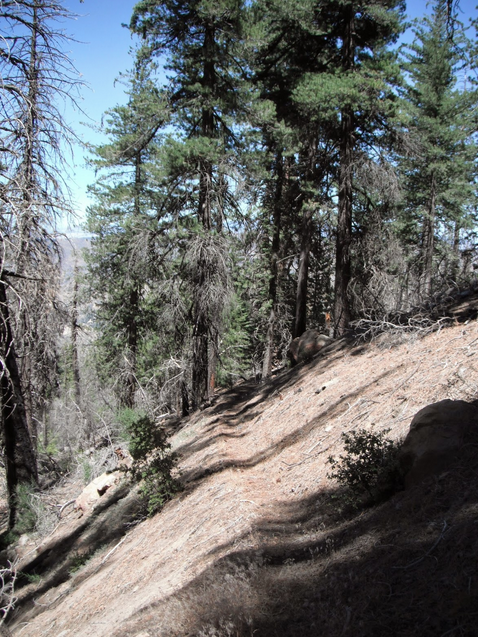
| Trail description: | Trail is littered with dead limbs and trees along the canyon section of the Madulce Trail. Â The brush along the chaparral section is well under control and in good shape. Â Only a few downed trees along the pine section climb. Â The final section from the Lookout Trail to the Buckhorn could use some brushing but is also in fine shape. Beautiful trail and in really fine condition at the moment. Trail report from SB Cyn TH up to Alamar Saddle: http://arcg.is/2qcBErX |
| Mode of transport: | Hike |
| Trail condition: | Needs some work |
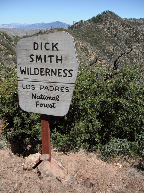
| Images: | Most complicated downed tree in the creek section. Some tread from 2016 Working Vacation is looking good. Largest downed pine along upper-middle section, not that big. Small cribwall failure towards the top. Dick Smith sign at the Madulce trailhead off Buckhorn Saddle. |
Madulce Trail Survey - 04-21-2017 - by Mike Maki| Link: | Madulce Trail |
| Date: | 04-21-2017 |
| Surveyor Name: | Mike Maki |
| Trail description: | Trail in good shape and easy to follow. A little patience need after leaving Madluce Camp but you'll find it. A few tress down but nothing significant. Easy to get around. This is a tough little trail. It's a good climb from Madule Camp to Buckhorn Big Pine Road. Be ready to do a little climbing, but the trail is good. Enjoyed the views to the south when the trail crested. First day of four day Condor Trail section hike from Santa Barbara Canyon to Manzana and out at NIRA Camp. Pics here. Good water at Madluce Camp. |
| Mode of transport: | Hike |
| Trail condition: | Good shape and easy to follow |
| Images: | Sign across creek from Madluce Camp Some of the obstructions Good climb! Trail coming up on side of ridge to left. There are switchbacks down there (thankfully!). View back to the southeast down Alamar Cyn at Madluce Peak |
Madulce Trail Survey - 05-28-2016 - by Steve Cypher| Link: | Madulce Trail |
| Date: | 05-28-2016 |
| Surveyor Name: | Steve Cypher |
| Trail description: | LPFA volunteers spent several days clearing the lower part of the trail out of Madulce Camp. It is easy to follow now until the brush grows again next winter. There are several logs across the trail in the pine forest below the intersection with Maducle Peak Trail. |
| Mode of transport: | Hike |
| Trail condition: | Needs some work |
| Condition details: | Many fallen logs on upper trail |
Madulce Trail Survey - 06-07-2015 - by Los Padres Forest Association| Link: | Madulce Trail |
| Date: | 06-07-2015 |
| Surveyor Name: | Los Padres Forest Association |
| Trail description: |
VWR Patrol Hiked the trail from the Buckhorn Road to Madulce Camp and flagged any bad spots. We encountered at least 18 downed trees across the trail, with the largest diameter at approximately 36 inches. Mostly pine, but some hardwood as well. The first mile needs occasional tread work and brushing. The second mile has the majority of the downed trees with spots of very thick brush. The third mile needs the most brushing. We found a 350 lb bear lounging in the middle of the trail in the meadow about a quarter mile above camp. The foxtail was the thickest I’ve seen in a while, so gaiters are highly recommended. All the creek crossings were dry. |
| Mode of transport: | Hike |
| Trail condition: | Needs some work |
| Images: | Trail collage, Jenkins Trail collage, Jenkins |
Madulce Trail Survey - 06-27-2014 - by Los Padres Forest Association| Link: | Madulce Trail |
| Date: | 06-27-2014 |
| Surveyor Name: | Los Padres Forest Association |
| Trail description: | Still about a dozen downed trees. Â Here is a trail report map: http://www.arcgis.com/apps/MapTour/index.html?appid=405d93a1872f47a99f9ebf24202c1006 |
| Mode of transport: | Array |
| Trail condition: | Needs some work |
| Images: | |
Madulce Trail Survey - 06-21-2014 - by Los Padres Forest Association| Link: | Madulce Trail |
| Date: | 06-21-2014 |
| Surveyor Name: | Los Padres Forest Association |
| Trail description: | Tread is good, just need to clear the downed trees. |
| Mode of transport: | Hike |
| Trail condition: | Needs some work |
| Condition details: | The trail is good from the road down into the creek, but from there to the camp are about a dozen downed trees. Needs work. |
| Number of trees down: | 12 |
| People Seen: | 0 |
 Survey / Report Form - Please click this box to open the form.