 Use Marker Groups
 Wolf 2002
Piru 2003
Day 2006
Zaca 2007
Gap 2008
La Brea 2009

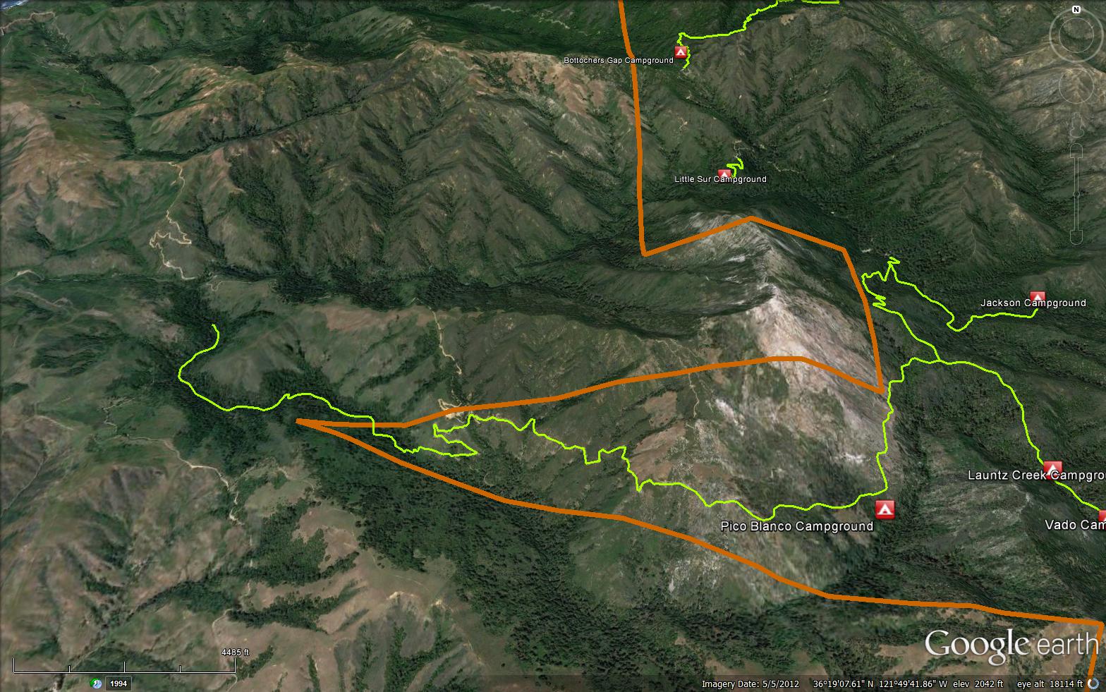
The Little Sur Trail is a senic 6.06 mile trail in Monterey County . The trail head is located off the Coast Road at 36.32595, -121.8599. Please let us know if you have explored this trail recently.
Pico Blanco Camp (1300 feet)
 Little Sur Trail Survey - 05-18-2021 - by Anonymous Surveyor
| Link: | Little Sur Trail |
| Date: | 05-18-2021 |
| Surveyor Name: | Anonymous Surveyor |
| Trail description: | The sign on Old Coast Road said dangerous. About a mile in, a landslide has taken the trail out. Work has been done, and maybe undone. Alone, I chose to turn around. |
| Mode of transport: | Hike |
| Trail condition: | Needs some work |
| Condition details: | Dangerous |
Little Sur Trail Survey - 04-22-2020 - by Anonymous Surveyor| Link: | Little Sur Trail |
| Date: | 04-22-2020 |
| Surveyor Name: | Anonymous Surveyor |
| Trail description: | Lots of flagging is in place as a guide in places where the trail is lost because of encroaching brush. Walk 5 miles from the end of the closed Palo Colorado road to reach the north-easternd end of the trail. This report is for the north east portion of trail between Pico blanco Boy scout camp and Duvenecks (1/4 mile west of the Mt Manuel trail intersection). |
| Mode of transport: | Hike |
| Trail condition: | Hard to follow |
| Condition details: | passable from the North-east end |
Little Sur Trail Survey - 01-02-2018 - by Anonymous Surveyor| Link: | Little Sur Trail |
| Date: | 01-02-2018 |
| Surveyor Name: | Anonymous Surveyor |
| Trail description: | I would not recommend this trail unless you have a GPS unit and are an experienced mountaineer. Seriously. The trail is pretty nice until the first river crossing, with only one downed tree/landslide over the trail in a 50 ft spot that forces you to cross the stream onto the edge of private property for 50 ft then cross back to the trail. Then it's clear and very pleasant until the river crossing. After that, it gets progressively worse, and you have to bushwack through thick and tall grass that has grown over the trail. It was honestly miserable. You could not keep on the trail without a GPS, at many points. There are a few sketchy landslides to tiptoe across too. After you wrap around Pico and come over the ridge, it gets better. The trail is clear of brush but is obscured by thick leaf litter, and there are a number of fallen trees. The last 1-2 miles before the boyscout camp are like that, then of course from there up to Botchers it's a road. Be very cautious if you go and take extra water because the bushwacking is exhausting and takes a long time. I hope more experienced people can go back and start working on the sketchy spots, it's a beautiful area and it wouldn't take much work for it to be accessible again. |
| Mode of transport: | Hike |
| Trail condition: | Hard to follow |
 Survey / Report Form - Please click this box to open the form.