 Use Marker Groups
 Wolf 2002
Piru 2003
Day 2006
Zaca 2007
Gap 2008
La Brea 2009

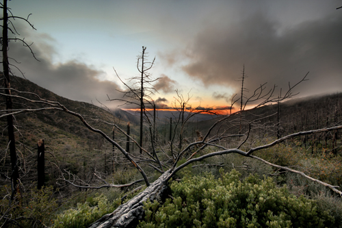
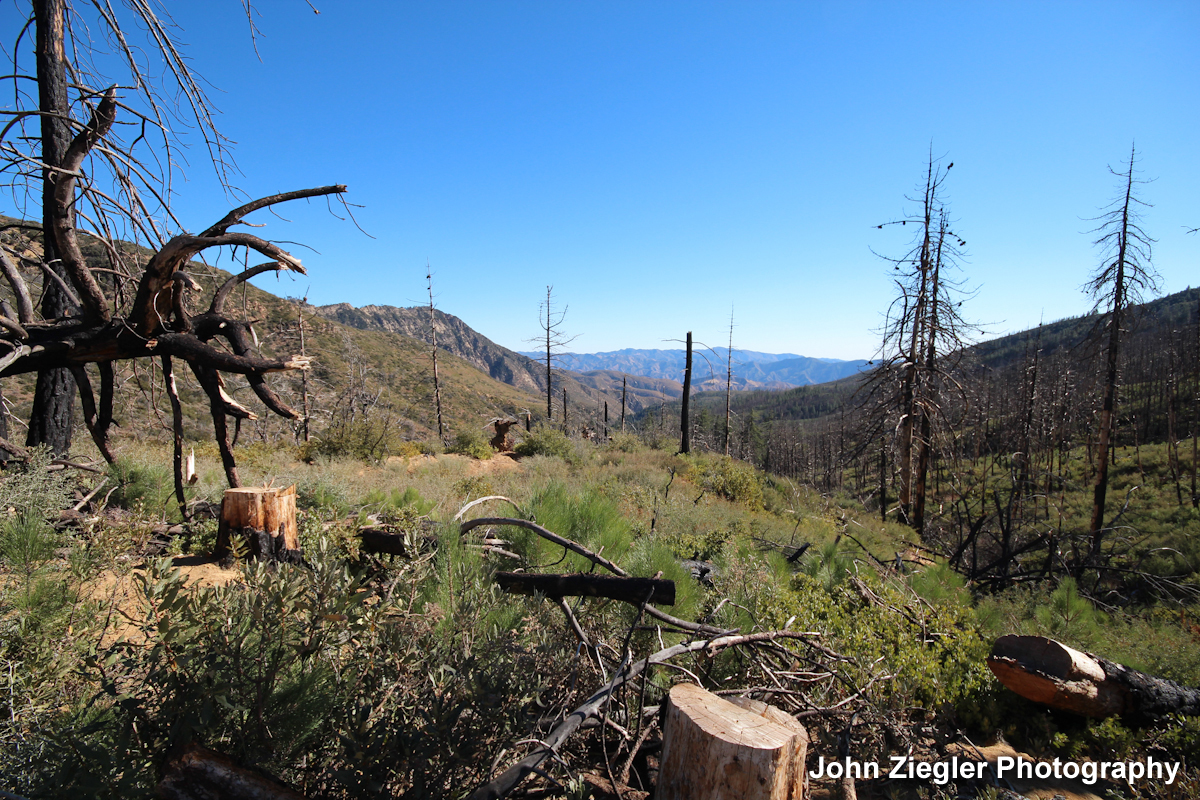
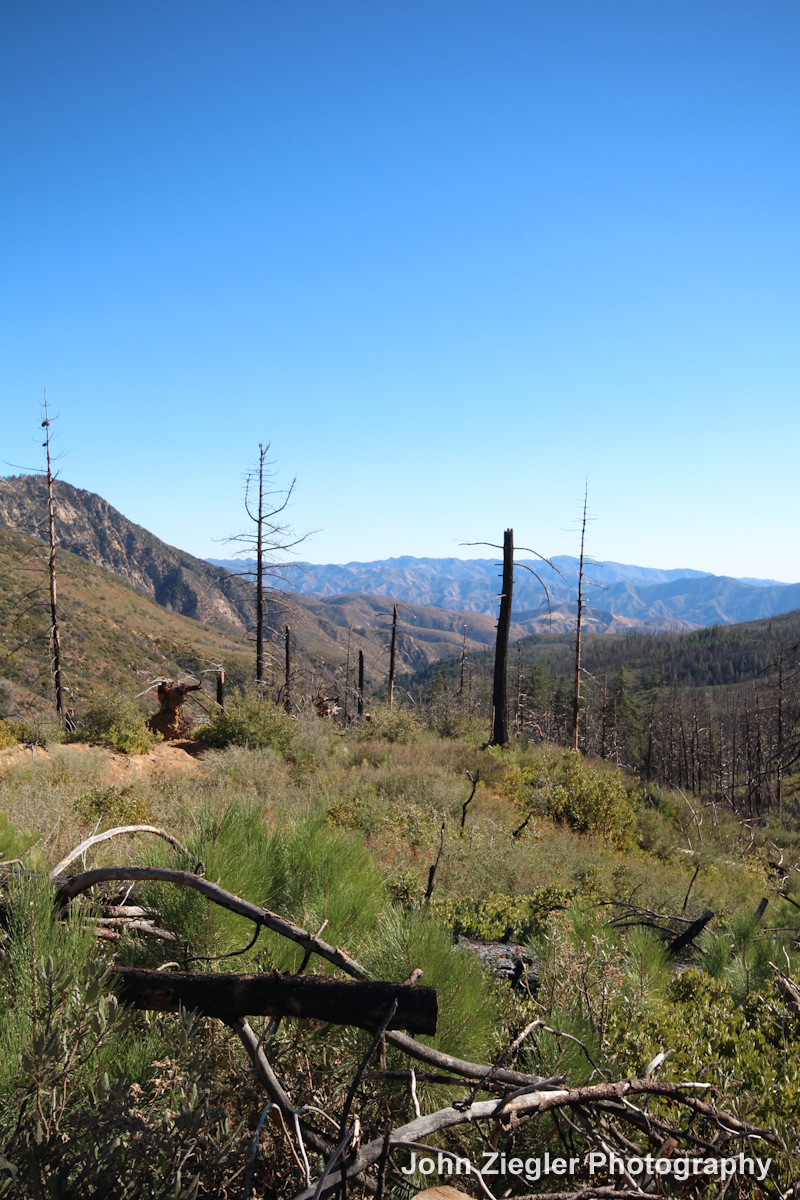
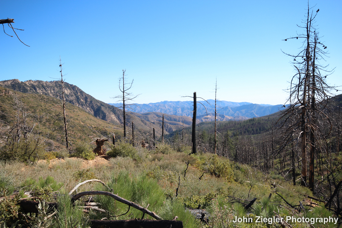
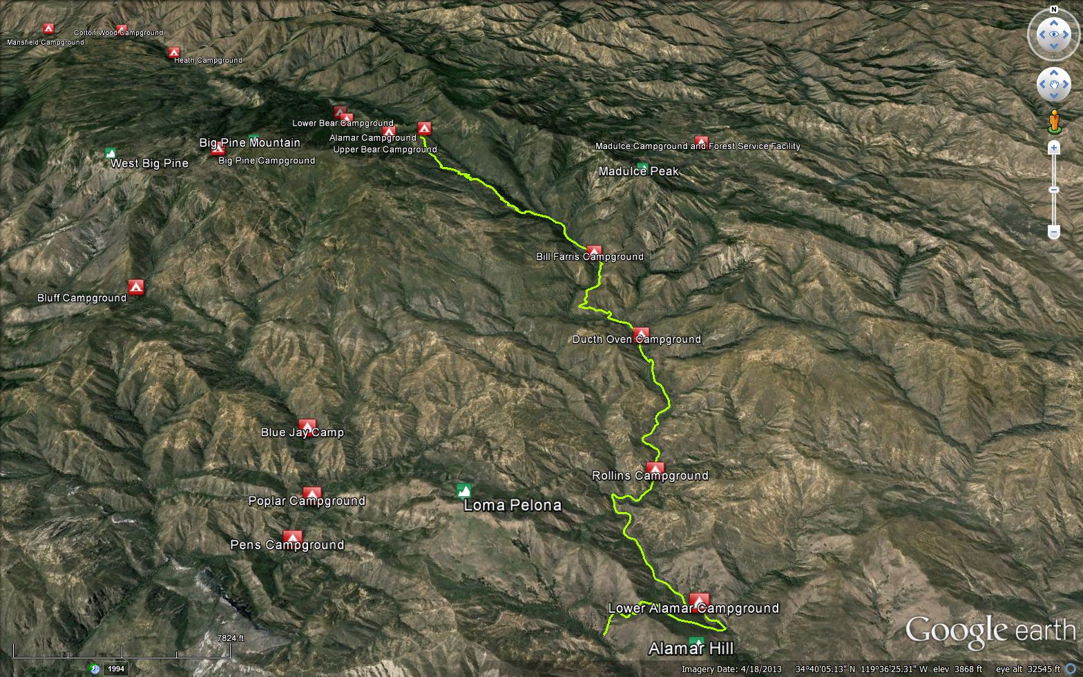
The Alamar trail begins at Alamar Saddle Campground (5673 feet) which is on the Buckhorn Road (Forest Route 9N11), the trail is located in the Dick Smith Wilderness. No water at the trail head except at Bear Camp which is about a mile down the Sisquoc Trail (27W07) into the San Rafael Wilderness. The upper portion was burnt in the Zaca Fire, so expect a lot of down trees across the trail.
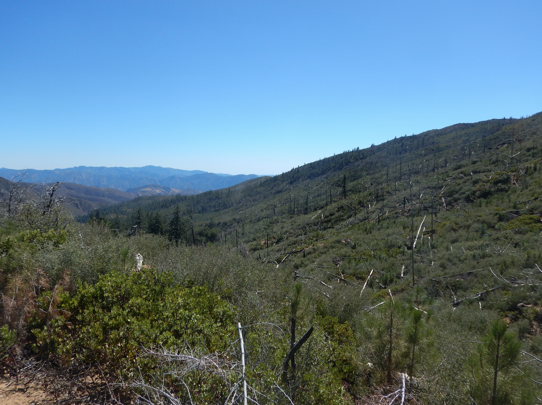
The Alamar trail quickly descends from the Alamar Saddle (5673 feet) into a unnamed drainage, as you descend you are rewarded with spectacular views of Malduce Peak and the Malduce Peak Trail.
A small creek at the bottom of the switchbacks provides dependable water, this is about a mile up from Bill Farris Camp (4206 feet). After this point, the trail is not flagged and is in bad shape and basically non existent. But if you continue to follow the drainage down to Bill Farris Camp you can make it to the Puerta Suelo Trail (26W20) and to the grassy plateau to Dutch Oven Camp at (3700 feet). From here travel through oak woodlands to Rollins Camp (3158 feet), the trail then intersects with Loma Peloma Don Victor Road (Forest Route 7N05), at this point you exit the Dick Smith Wilderness, follow the road 0.3 miles to where the trail starts again. The trail continues to follow a seasonal creek down to Lower Alamar Camp at (2888 feet). If you continue down trail, the trail intersects with the Mono-Alamar or Alamar Hill Trail (Trail# 26W07) and the Roblar Trail (25W05).


 Alamar Trail Survey - 04-27-2025 - by Horner
 | Link: | Alamar Trail |
| Date: | 04-27-2025 |
| Surveyor Name: | Horner |
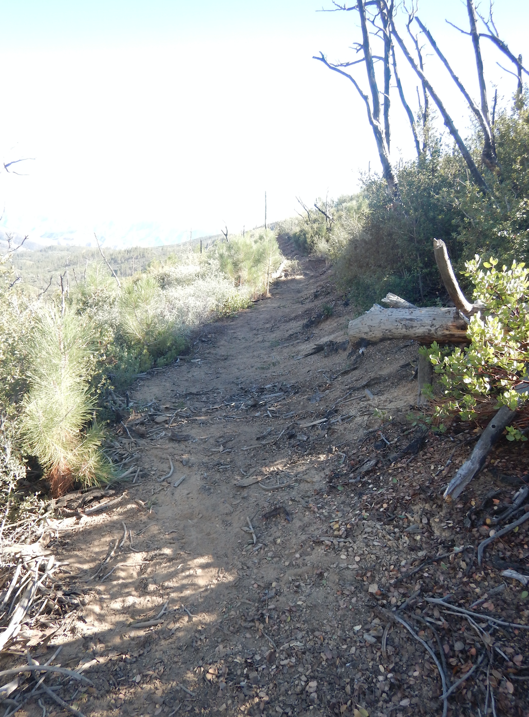
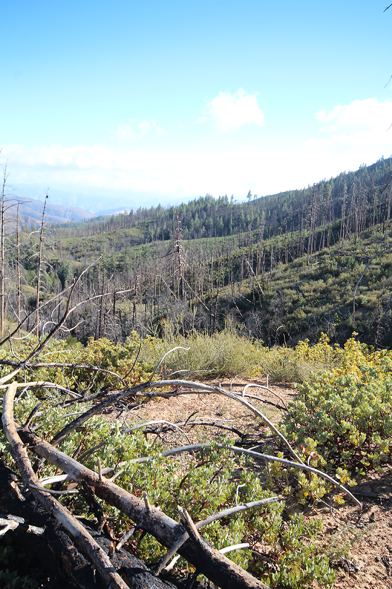
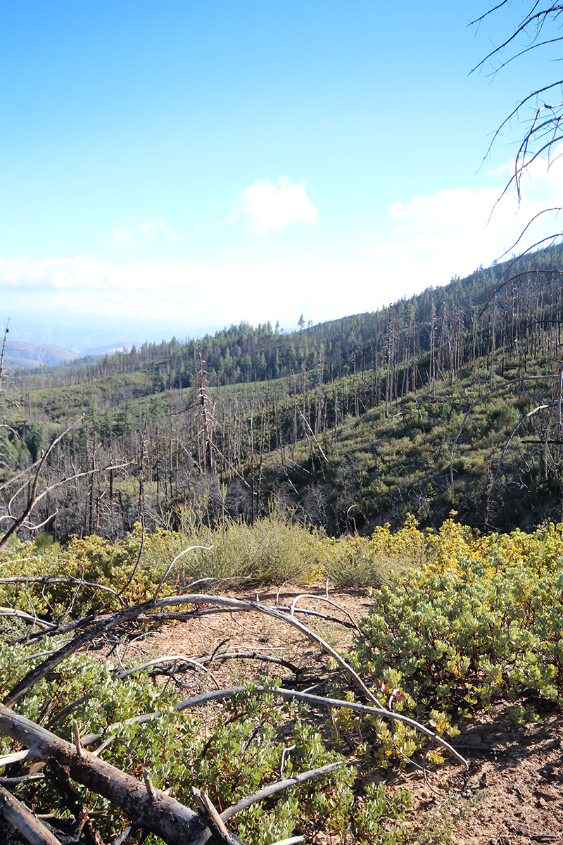
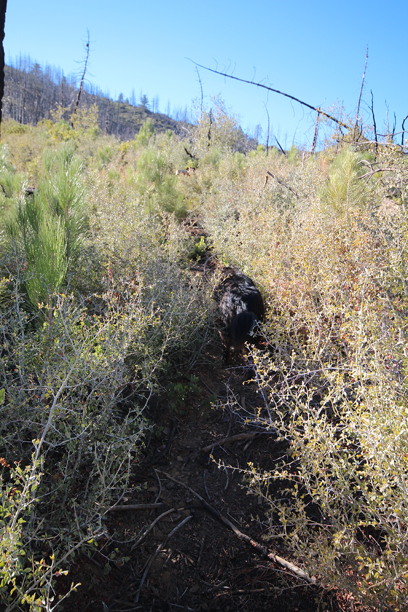
| Trail description: | Trail overall is severely overgrown, washed out in some spots, and in need of maintenance. -Alamar Saddle to Unnamed Camp at the bottom of the switchbacks (34.68899, -119.60778) is overgrown with whitethorn ceanothus but mostly followable with alternating periods of smooth sailing, crawling, and everything in between. The tread on some of the switchbacks and steeper slopes is very faint and narrow. -Unnamed Camp to Bill Farris is severely overgrown and slow going with lots of crawling. -The creek crossing just south of Bill Farris washed out (trail crosses a tributary that comes in from the east). Trail was difficult to pick up here, it looks like water/debris got very high and gouged out new banks, taking out any crossings or trail markers that were here before. This crossing looks very similar to damage I observed in Montecito after the 2022/23 storms. Stay high here and do not cross the main creek. -Bill Farris to Dutch Oven involves less crawling as the trail moves higher into slower growing vegetation types. Still brushy and still needs work, but the chaparral here is easier to move through. There are many small washouts in this section where brush on the uphill side pushes hikers off the tread. Spot treading would be very helpful in this area. -Dutch Oven to Rollins to Lower Alamar/Tin Shack is severely overgrown and difficult to follow. There are a few sections where you can pick up the trail and make decent time, but we spent most of this section wandering the creek bed looking for signs of the trail. In some places the riparian vegetation is so thick and the banks are so high that the only logical path was the creek bed. I would estimate over 50% of the trail is completely gone between Dutch Oven and Lower Alamar. We planned for slow going and it was even slower than expected. Never exceeded 1 mile per hour. It took our group of experienced backpackers and bushwhackers a full day of very hard work to travel downhill from Alamar Saddle to Dutch Oven, and most of an additional long day to reach Lower Alamar. All camps had good flowing water. Every inch of the Alamar Trail needs maintenance. With that said, it is still somewhat followable in sections that are above recent high water levels. We couldn’t help but marvel at the effect that quality trail building and maintenance can have - even in the worst of the brush, a wide trail corridor that was cut in years past is still visible to the attuned eye. While crawling through whitethorn is always tough, it is still significantly easier and faster to crawl along the trail than to travel off trail in the thick chaparral. |
| Mode of transport: | Hike |
| Trail condition: | Hard to follow |
| Images: | One of the better sections One of the worse sections. That’s the trail |
Alamar Trail Survey - 04-25-2022 - by Ojai Valley School Lower Campus| Link: | Alamar Trail |
| Date: | 04-25-2022 |
| Surveyor Name: | Ojai Valley School Lower Campus |
| Trail description: | This trail leaves the Admin. Rd. and is in decent shape until you reach the first, unnamed camp off on the west. From this camp down into Bill Farris and Dutch Oven, there is tons of brush, route finding, and regular crawling. The trail is not passable by stock at this time. We flagged with red and orange from the ridge down to Rollins. |
| Mode of transport: | Hike |
| Trail condition: | Hard to follow |
| Condition details: | Route Finding Required |
Alamar Trail Survey - 04-01-2022 - by Addison Jerlow| Link: | Alamar Trail |
| Date: | 04-01-2022 |
| Surveyor Name: | Addison Jerlow |
| Trail description: | Pretty rough with lots of downed trees and overgrowth from Lower Alamar to Loma Pelona Road. Most crossings flagged but a few have deadfall blocking the opposite trail. There is flagging but it is fading/breaking apart. The "road" from the trail junction to Rollins is not much better than the trail. Stay to the left of the creek (not on the road) after the first few hundred yards to find the camp. Good flow in creek. This section of trail, as well as the road, need some work for sure. |
| Mode of transport: | Hike |
| Trail condition: | Hard to follow |
Alamar Trail Survey - 02-24-2021 - by Los Padres Forest Association| Link: | Alamar Trail |
| Date: | 02-24-2021 |
| Surveyor Name: | Los Padres Forest Association |
| Trail description: | LPFA trail survey along the Alamar Trail from Alamar Saddle down to just above Dutch Oven. The trail is brushy in spots but passable for the time being. That being said, it's going to get more and more overgrown every year and please plan on the trail being rough for long stretches and requiring both route finding and occasional crawling. We cleared most of the smaller trees and the thickest brushy sections we encountered along the way but more are waiting. The Alamar Canyon remains wild and scenic with great views and incredibly diverse vegetation on all sides of the trail. Certainly worth a visit for the adventurous backpackers, just be prepared for brush and route finding. |
| Mode of transport: | Array |
| Trail condition: | Hard to follow |
Alamar Trail Survey - 04-28-2020 - by Noah Nydam| Link: | Alamar Trail |
| Date: | 04-28-2020 |
| Surveyor Name: | Noah Nydam |
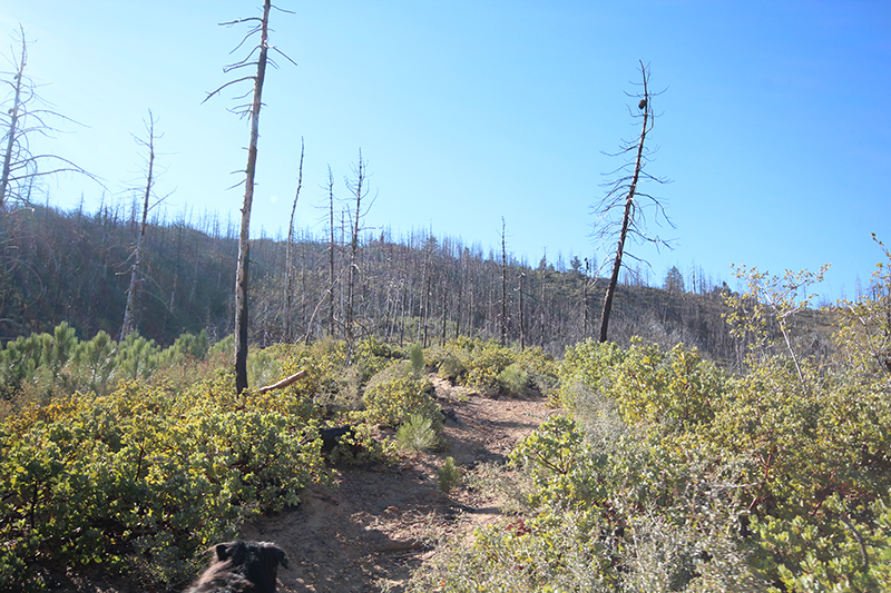
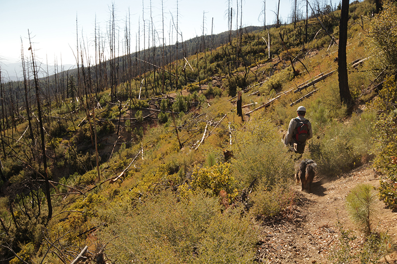
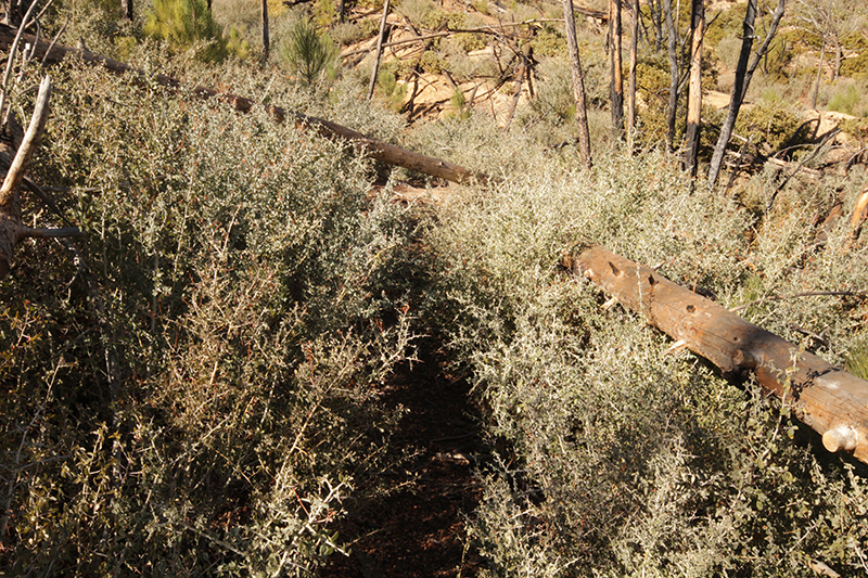
| Trail description: | I went up the alamar trail as part of a trip to big pine mountain. Just like the mono-alamar trail that I had already been up, the alamar trail was in ugly shape with lots of search for tape and bushwhacking. But unlike the mono-alamar trail there was actually a section on the alamar trail where crawling under whitethorn thickets was required. From the beginning of the trail at the junction with mono-alamar, it wasn't too bad going up alamar hill and down to lower alamar camp. Just some hard to find switchbacks going up and down the grassy hill, it would not have been bad at all during the day time (I was stuck finding the trail at night which was pretty bad). After lower alamar camp to dutch oven camp, the trail began a crisscross of the creek with lots search for tape. There were some overgrown sections and countless downed trees, but no crawling required on this part except for one really bad tree. There was even a quarter mile on road right after Rollins camp up to the Dick Smith Wilderness sign, this was short respite from the normal trail. After reaching dutch oven camp, the trail winds its way up a knoll and actually opened up pretty good (I think LPFA did some good work on this part recently). Once it crests this hill it drops down towards Bill Faris camp it starts to get a little more overgrown with a few badly overgrown sections right before Bill Faris. After Bill Faris the trail begins the worst section. Whitethorn was growing profusely over the trail and there are many downed trees mixed in with the whitethorn. Crawling and breaking down dead tree limbs was required to get passed this section. Eventually the trail nears the creek again and improves somewhat before taking some steep switchbacks up the hillside. There were a few large downed trees on this section, but other than this it was passable and much better than the whitethorn tunnels. After these switchbacks the trail opens way up and is in great shape for the most part (a few downed trees and whitethorn encroachment but not bad) all the way up to the alamar saddle and big pine/buckhorn road. |
| Mode of transport: | Hike |
| Trail condition: | Hard to follow |
| Images: | These are some nasty thorn bushes that grow near the creek, they have completely overtaken the trail. This section after dutch oven was better. This was soon after Bill Faris, there was whitethorn growing all around this downed tree so the only option was to break it down and wriggle through it. Again, soon after Bill Faris, the only option was to crawl under the whitethorn and downed tree. lt gets better as it climbs towards alamar saddle, this was a particularly open part. |
Alamar Trail Survey - 06-08-2018 - by Los Padres Forest Association| Link: | Alamar Trail |
| Date: | 06-08-2018 |
| Surveyor Name: | Los Padres Forest Association |
| Trail description: | As part of a LPFA volunteer trail project we surveyed the trail from Alamar Saddle to the knoll overlooking Dutch Oven Camp. The focus of our work was to crosscut out 3-4 trees along the initial descent and then focus on tread work down the switchbacks above Double Bay Camp. As of June 2018: - Trail is really good from Alamar Saddle down to Bill Faris - Brushy but passable down to know 1/2 mile above Dutch Oven - Bad from that knoll to Dutch Oven - Passable and okay from Dutch Oven to Mono-Alamar Trail junction |
| Mode of transport: | Hike |
| Trail condition: | Needs some work |
| Images: | Alamar Trailhead at Alamar Saddle Volunteers hiking down Alamar towards our spike camp Working tread above Double Bay Admiring completed tread above Double Bay Example of brushed section between Bill Faris and Dutch Oven. Passable but another round of brushing and treading will be needed. |
Alamar Trail Survey - 11-12-2018 - by Los Padres Forest Assocation| Link: | Alamar Trail |
| Date: | 11-12-2018 |
| Surveyor Name: | Los Padres Forest Assocation |
| Trail description: | The SCA (Student Conservation Association) spent two weeks working Alamar from the saddle to just above Bill Farris. The crew was lined out and supported by LFPA. They grubbed out chamise and yerba santa in the trail as well as cut back the encroaching white thorn. Great work crew. We appreciate your hard work! |
| Mode of transport: | Hike |
| Trail condition: | Needs some work |
| Condition details: | Overall trail is in good shape, with minor sections that need brushing and tread work. |
| Images: | Grubbed out chamise White thorn gone The SCA crew! Staying warm with the comfort of fully charged cell phones on Alamar Saddle. |
Alamar Trail Survey - 03-19-2018 - by Los Padres Forest Association| Link: | Alamar Trail |
| Date: | 03-19-2018 |
| Surveyor Name: | Los Padres Forest Association |
| Trail description: | LPFA flagged the Alamar Trail from Dutch Oven to Bill Faris and then continued on out to Alamar Saddle. The trail is really brushy from Dutch Oven to Bill Faris but has a new layer of flagging that should help get anyone along the trail. We are hoping to get a trail crew to work this section in May 2018. From Bill Faris to Alamar Saddle is in good shape and poses no troubles for hikers. There are a few downed trees, some narrow tread and some brush but if you've made it this deep into the backcountry you'll have no trouble getting from Alamar Saddle to Bill Faris. Stay tuned, hopefully it'll be wide open by end of May 2018. |
| Mode of transport: | Hike |
| Trail condition: | Hard to follow |
| Images: | Follow the flagging rainbow from DO to BF. The stunning Madulce view with Bill Faris center low and the trail along the right. The trail that we worked in 2016 remains open but is getting yerba santa regrowth. Now is the time. The upper section of Alamar remains in good shape, still some downed trees to remove. The trailhead along Buckhorn Rd. Looking good, but could use some help clearing the yerba santa as well. |
Alamar Trail Survey - 05-30-2016 - by Los Padres Forest Association| Link: | Alamar Trail |
| Date: | 05-30-2016 |
| Surveyor Name: | Los Padres Forest Association |
| Trail description: | LPFA led two trail projects in 2016 to work the Alamar Trail. Â First was in April 2016 focused on clearing the top 2miles of the trail. Â We logged out dozens of fallen dead coulter pines and brushed as much spiny ceonothus as we could get our hands on. The second project was completed in May 2016 and involved an 8-person ACE Crew who spent three weeks working the trail above and below Bill Faris. Â For complete report of conditions check the Facebook link below: https://www.facebook.com/LosPadresForestAssociation/posts/614186805372914 |
| Mode of transport: | Array |
| Trail condition: | Needs some work |
| Images: | |
Alamar Trail Survey - 09-27-2015 - by Los Padres Forest Association| Link: | Alamar Trail |
| Date: | 09-27-2015 |
| Surveyor Name: | Los Padres Forest Association |
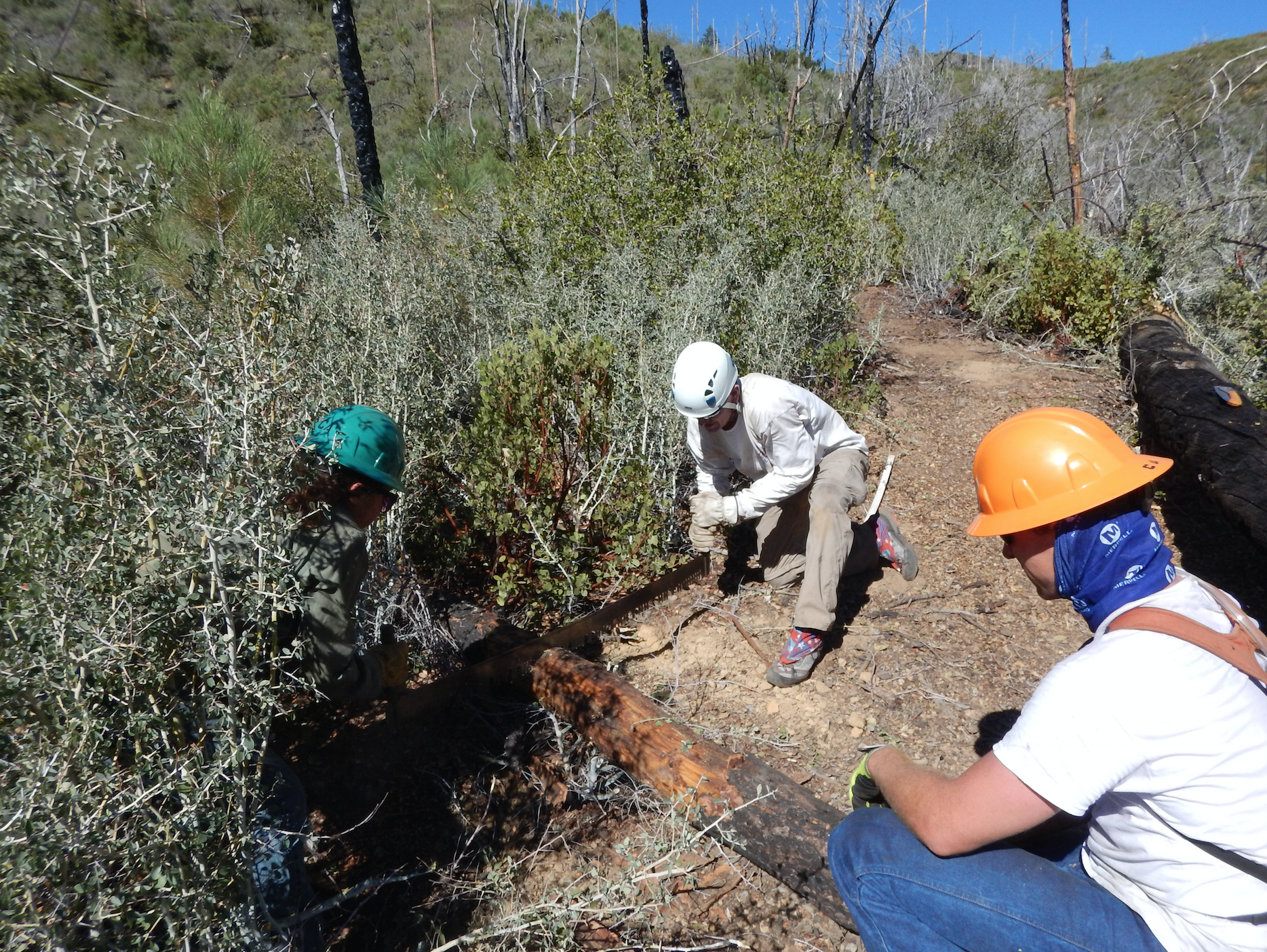
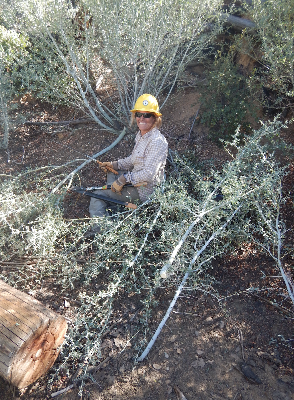
| Trail description: | LPFA Trail Project as part of National Public Lands Day on September 24-27 We worked the trail from Alamar Saddle down about 2 miles into the canyon.  The trail beforehand was a mess of armor piercing spiny ceonothus.  Over the course of the weekend we cut out 239 trees and brushed the trail to standard for approximately 1.5miles.  Still more work is needed to make the trail perfect but we made a HUGE dent. Future trail projects are scheduled to continue work down the entire length of Alamar Canyon.  Stay tuned and thanks to all the volunteers! |
| Mode of transport: | Array |
| Trail condition: | Needs some work |
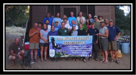
| Images: | Happy volunteers at basecamp, Bluff Cabin Alamar Canyon, showing the matchsticks of downed coulter pines and thick brush First we sent down sawyer teams, who cleared 239 trees from the trail Next came the brushing and tread team End result.... Boo yay! |
Alamar Trail Survey - 10-02-2014 - by Los Padres Forest Association| Link: | Alamar Trail |
| Date: | 10-02-2014 |
| Surveyor Name: | Los Padres Forest Association |
| Trail description: | test |
| Trail condition: | Good shape and easy to follow |
| Condition details: | test |
 Survey / Report Form - Please click this box to open the form.