 Use Marker Groups
 Wolf 2002
Piru 2003
Day 2006
Zaca 2007
Gap 2008
La Brea 2009

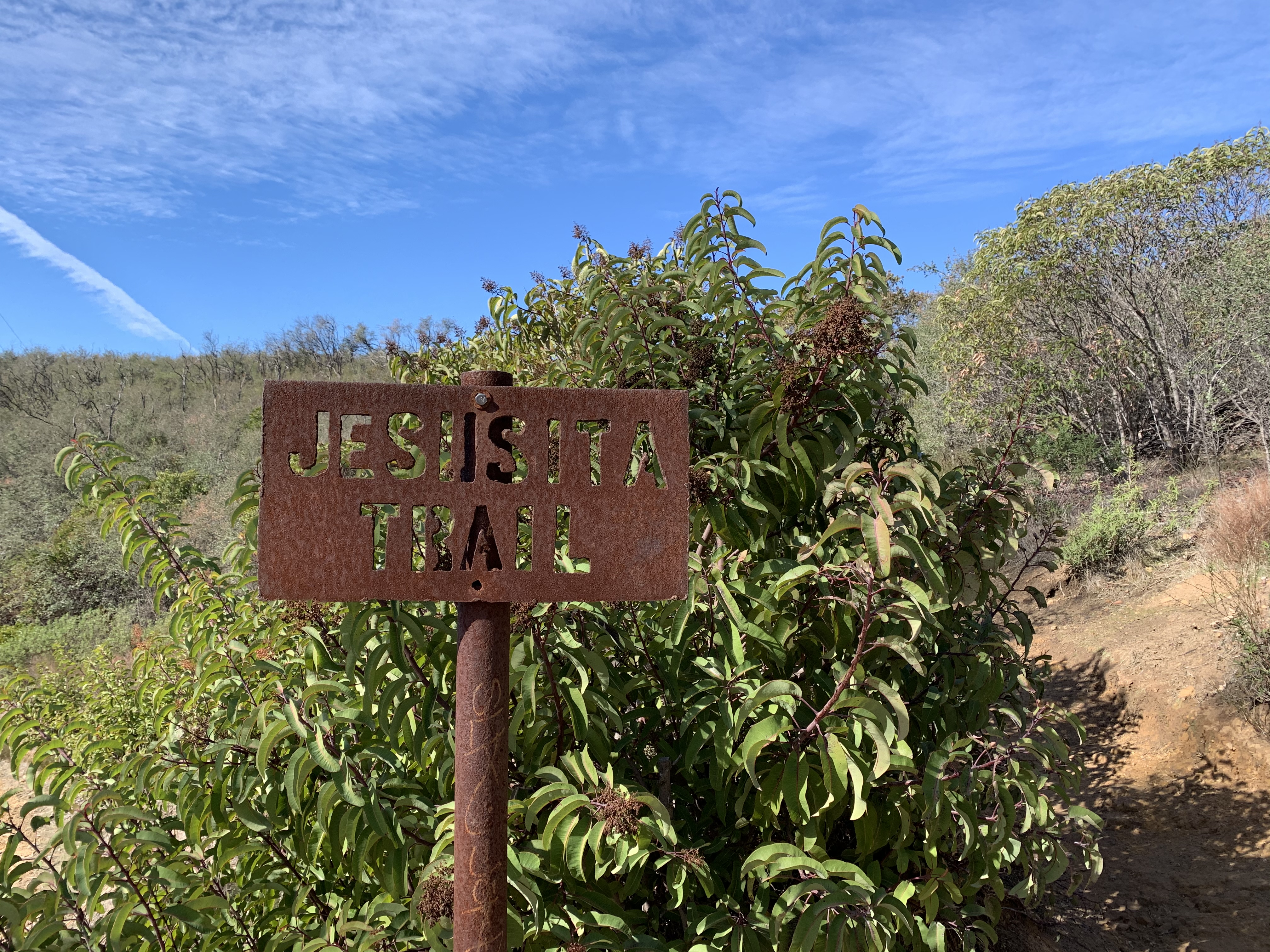
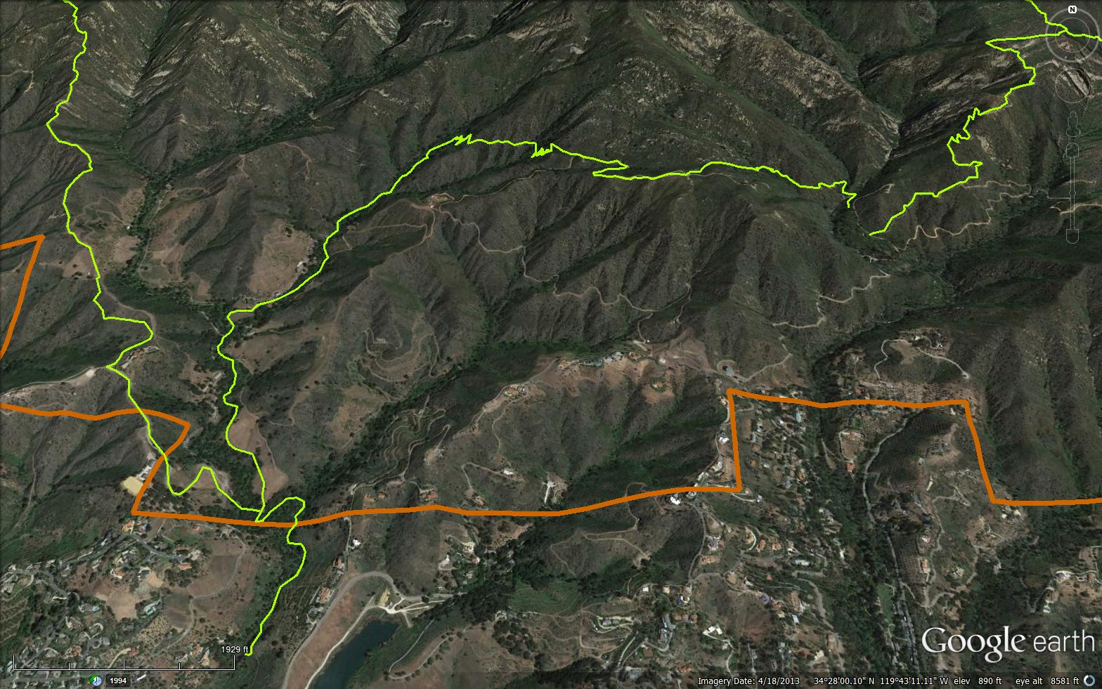
Provides a variety of environments. Oak woodlands, avocado orchards, and even views of newly built homes. Switchbacks take you through dense chaparral until you reach Inspiration Point. Inspiration Point is just south of the Jesusita Trail. Please stay on the trail, portions of the trail cross private property. Directions: In Santa Barbara, take Foothill Road (Hwy 192), turn north on San Roque Road. At approximately 1/2 mile from Foothill Road, look for the trail head sign on the left just past the filtration plant. Easy hike. In Santa Barbara front country. Please stay on the trail, portions of the trail cross private property.


 Jesusita Trail Survey - 08-15-2023 - by Anonymous Surveyor
| Link: | Jesusita Trail |
| Date: | 08-15-2023 |
| Surveyor Name: | Anonymous Surveyor |
| Trail description: | We started at Stevens Park then picked up the Jesusita hoping to go up to Inspiration Point. (There is still lots of water in the creek, by the way, and the trail up to the ranch gate is in excellent condition). We have not done this hike since last December, prior to the rains, in deference to the "closed" signs (re)posted physically and online, which indicated trail damage at the switchbacks above the ranch, despite many others blogging and telling us trails were fine and it was ok to go. After seeing the "closed at the switchbacks" notice recently disappear from the websites (including Hike Los Padres and AllTrails), we were eager to get back on this much loved front country trail and head up to the Point! Yay! Although there is no mention of it on the county parks, All Trails, or Los Padres websites, the rancher at the gate (just before you head up into the switchbacks), is adamant that "the trail is still closed" and is upset about signs being torn down at the gate. We were met at the gate and told (politely) not to trespass and that the info on the websites is "confusing" and "wrong." This apparently is not based on trail conditions, but rather a disagreement about where the trail is located (easement issues). We mentioned that all the websites now indicate it is open the entire length, but he was adamant that it is a hard closure. Hike mindset already spoiled, and not wanting to trespass, we turned around (though I do feel we could have continued without any real problem other than a guilty conscience; it wasn't a negative encounter, really just more disappointing than anything). It would be great if the concerned parties could agree on where the easement allows the trail to pass and enable hikers access without worry. Or maybe it's all a simple misunderstanding. We've hiked this trail 25+ years with no idea that there was an issue with the easement. Have we been trespassing all this time and the owners have finally said "enough?" Has the switchback portion shifted off-easement? The rancher told us that even the gate itself was not part of the trail. If there is an easement issue, the websites should indicate this (for those who want to avoid potential negatives) and hopefully an acceptable agreement can be reached quickly. Sigh. |
| Mode of transport: | Hike |
| Trail condition: | Good shape and easy to follow |
Jesusita Trail Survey - 04-15-2023 - by Anonymous Surveyor| Link: | Jesusita Trail |
| Date: | 04-15-2023 |
| Surveyor Name: | Anonymous Surveyor |
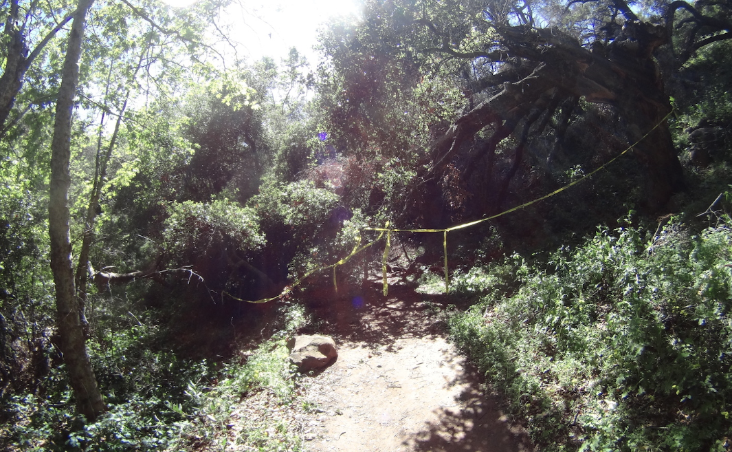
| Trail description: | Trail mostly in good shape, but a few downed trees and narrow areas near creeks. Near the fire road there's a substantial slide near end of a switchback, that people have bypassed by going straight up. |
| Mode of transport: | Hike |
| Trail condition: | Needs some work |
| Condition details: | Generally good, but a few places that need work |
| Images: | Big slide near fire road, no scale in photo; it's about 10' across downed tree near trailhead/in creek small slide/near houses |
Jesusita Trail Survey - 03-18-2021 - by Los Padres Forest Association| Link: | Jesusita Trail |
| Date: | 03-18-2021 |
| Surveyor Name: | Los Padres Forest Association |
| Trail description: | The LPFA worked along with a SCA Trail Crew for three weeks on the Jesusita Trail in spring 2021 clearing brush, removing downed trees and repairing larger tread issues. The trail is almost always in great shape but this additional time spent allowed us to hit some of the problem areas that might not normally be worked. Enjoy..... |
| Mode of transport: | Array |
| Trail condition: | Good shape and easy to follow |
Jesusita Trail Survey - 02-03-2021 - by Antonio Calderon| Link: | Jesusita Trail |
| Date: | 02-03-2021 |
| Surveyor Name: | Antonio Calderon |
| Trail description: | From trailhead made my way to inspiration point where views are amazing. Worked my way down to mission creek. There was stagnant water at the seven pools section, but further upstream at three pools the water was gushing nicely. Nice deep pools to relax In. Great trail overall. |
| Mode of transport: | Hike |
| Trail condition: | Good shape and easy to follow |
Jesusita Trail Survey - 03-01-2020 - by Jasonn Beckstrand| Link: | Jesusita Trail |
| Date: | 03-01-2020 |
| Surveyor Name: | Jasonn Beckstrand |
| Trail description: | There are multiple trees down along the trail The two biggest ones can be accessed by parking on Ontare and hiking down near arroyo burro turn off. The others are up past the ranch with the drinking fountain and can be cut out with hand tools. |
| Mode of transport: | Hike |
| Trail condition: | Needs some work |
| Images: | 34.459N 119.728W, chainsaw required, down from arroyo burro Chainsaw Required, up from arroyo burro Silky Size past the drinking fountain Silky Silky |
Jesusita Trail Survey - 05-17-2019 - by Los Padres Forest Association| Link: | Jesusita Trail |
| Date: | 05-17-2019 |
| Surveyor Name: | Los Padres Forest Association |
| Trail description: | SB Trails Council organized a trail project to help clear the lower portion of the Jesusita Trail. Details can be seen here: |
| Mode of transport: | Array |
| Trail condition: | Needs some work |
Jesusita Trail Survey - 08-03-2017 - by Los Padres Forest Association| Link: | Jesusita Trail |
| Date: | 08-03-2017 |
| Surveyor Name: | Los Padres Forest Association |
| Trail description: | We got a report from the trail running community of downed oak branches on the Jesusita Trail. Â We cleared some rather large ones at the junction of Jesusita and Arroyo Burro and headed home after a good hours work. Â Once back at home we realized that the reported downed oak was further up the trail. Â Oh well, guess a return trip is in order. There was a little flowing water at the junction of AB and Jesusita and a few stagnant pools lower down. Â Brushing and grassing is needed in sections. Â Lots of people out enjoying the trail on a warm Thursday evening. |
| Mode of transport: | Hike |
| Trail condition: | Good shape and easy to follow |
| Images: | #BeforeandAfterLP |
Jesusita Trail Survey - 03-13-2015 - by Los Padres Forest Association| Link: | Jesusita Trail |
| Date: | 03-13-2015 |
| Surveyor Name: | Los Padres Forest Association |
| Trail description: | 3/13/15 JUST INJesusita Trail is closed due to a large hazard oak tree that has fallen (and has more falling to do) across the trail. Â Crews are expected to clear the hazard tree early next week. Â Until then, please choose a different trail. |
| Mode of transport: | Array |
| Trail condition: | Hard to follow |
| Images: | |
 Survey / Report Form - Please click this box to open the form.