 Use Marker Groups
 Wolf 2002
Piru 2003
Day 2006
Zaca 2007
Gap 2008
La Brea 2009

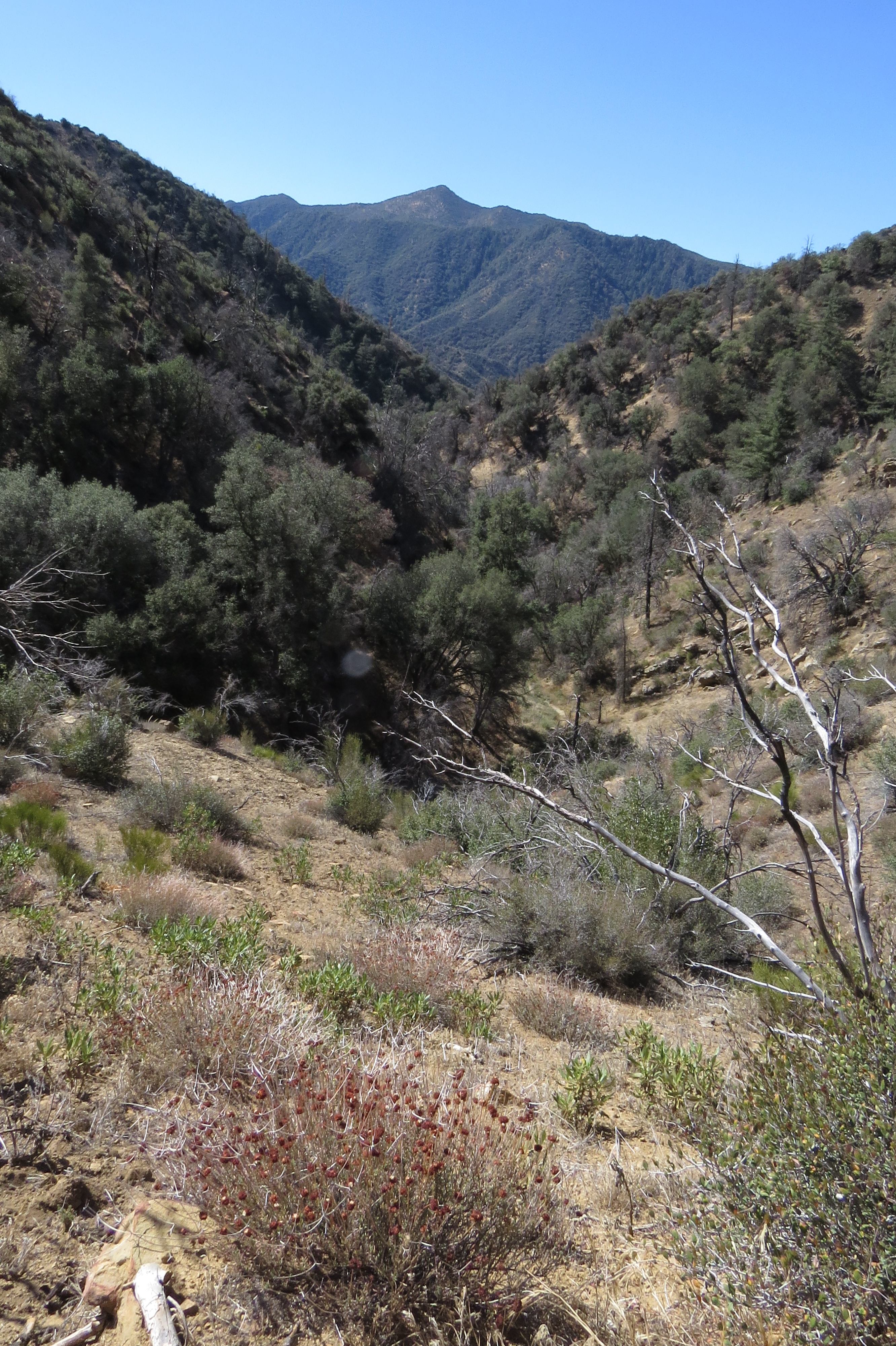
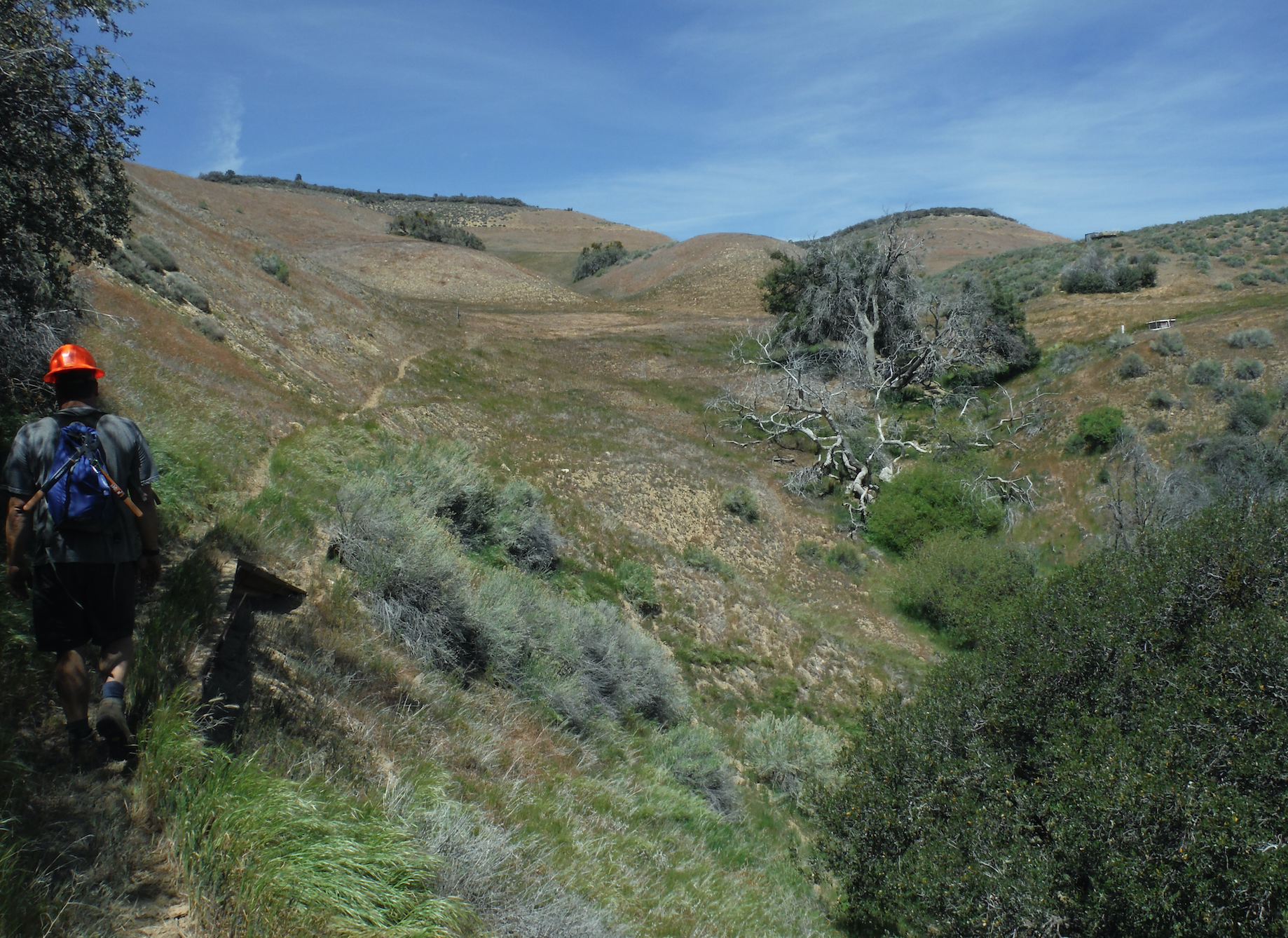
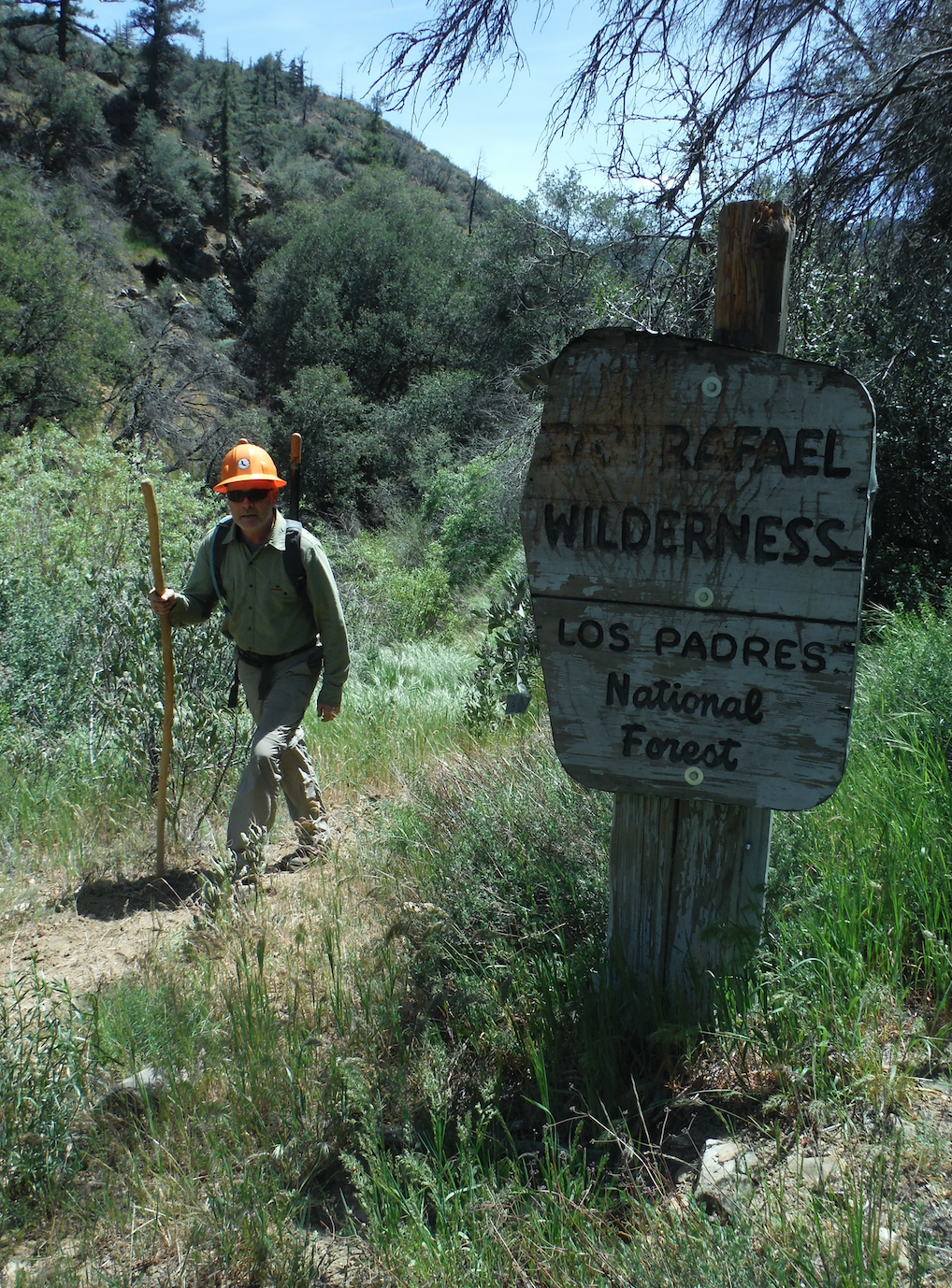
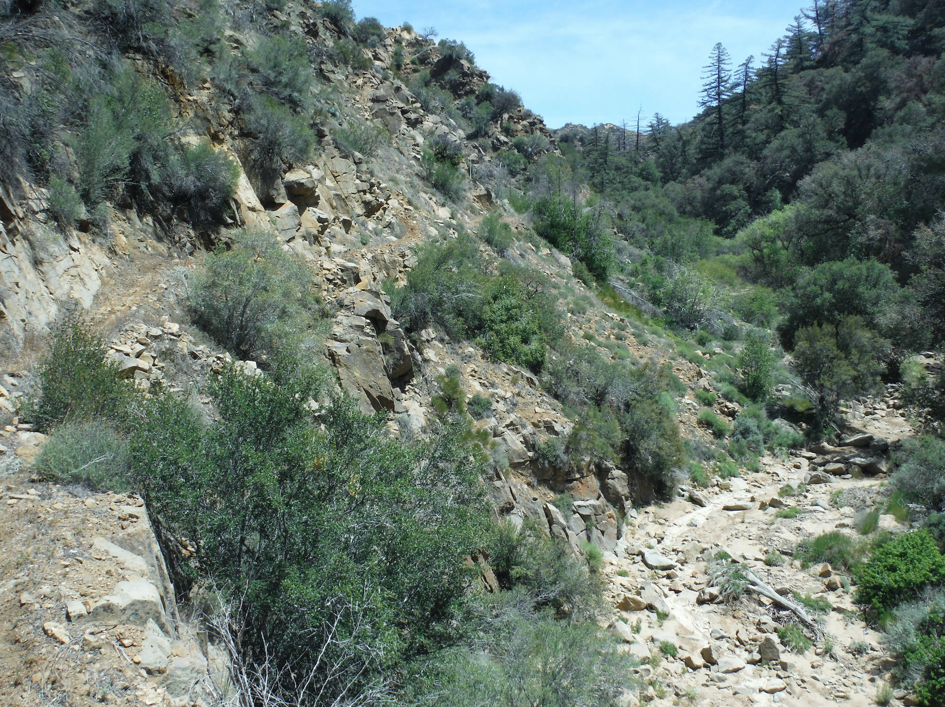
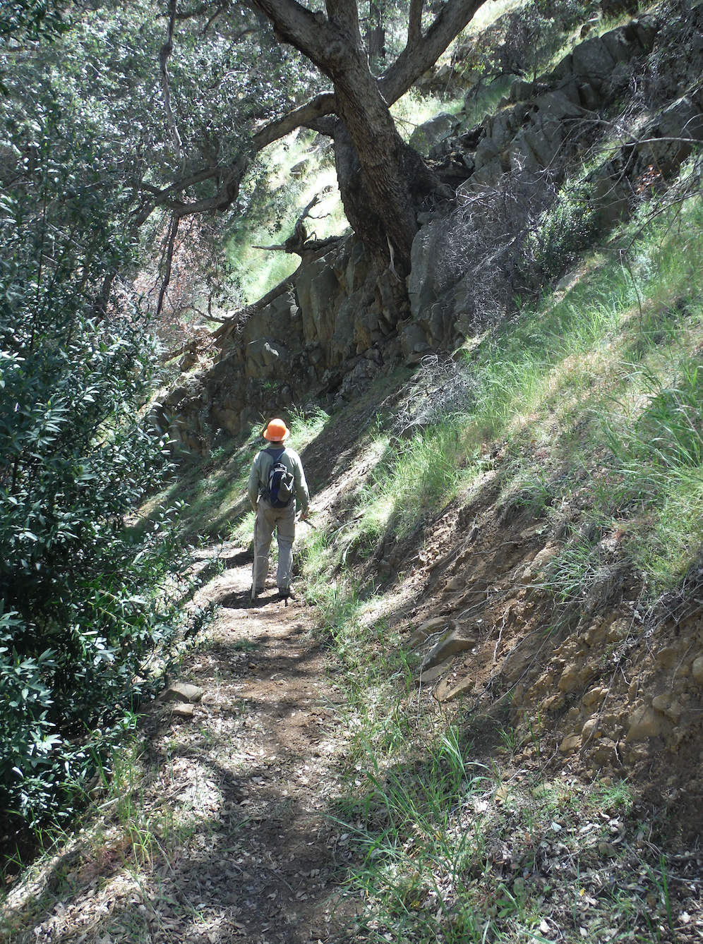
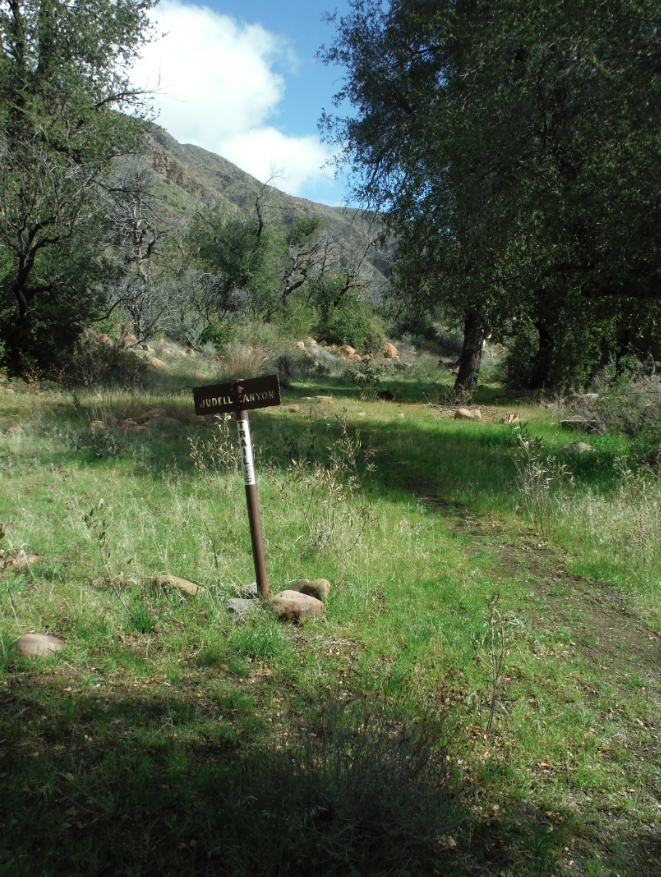
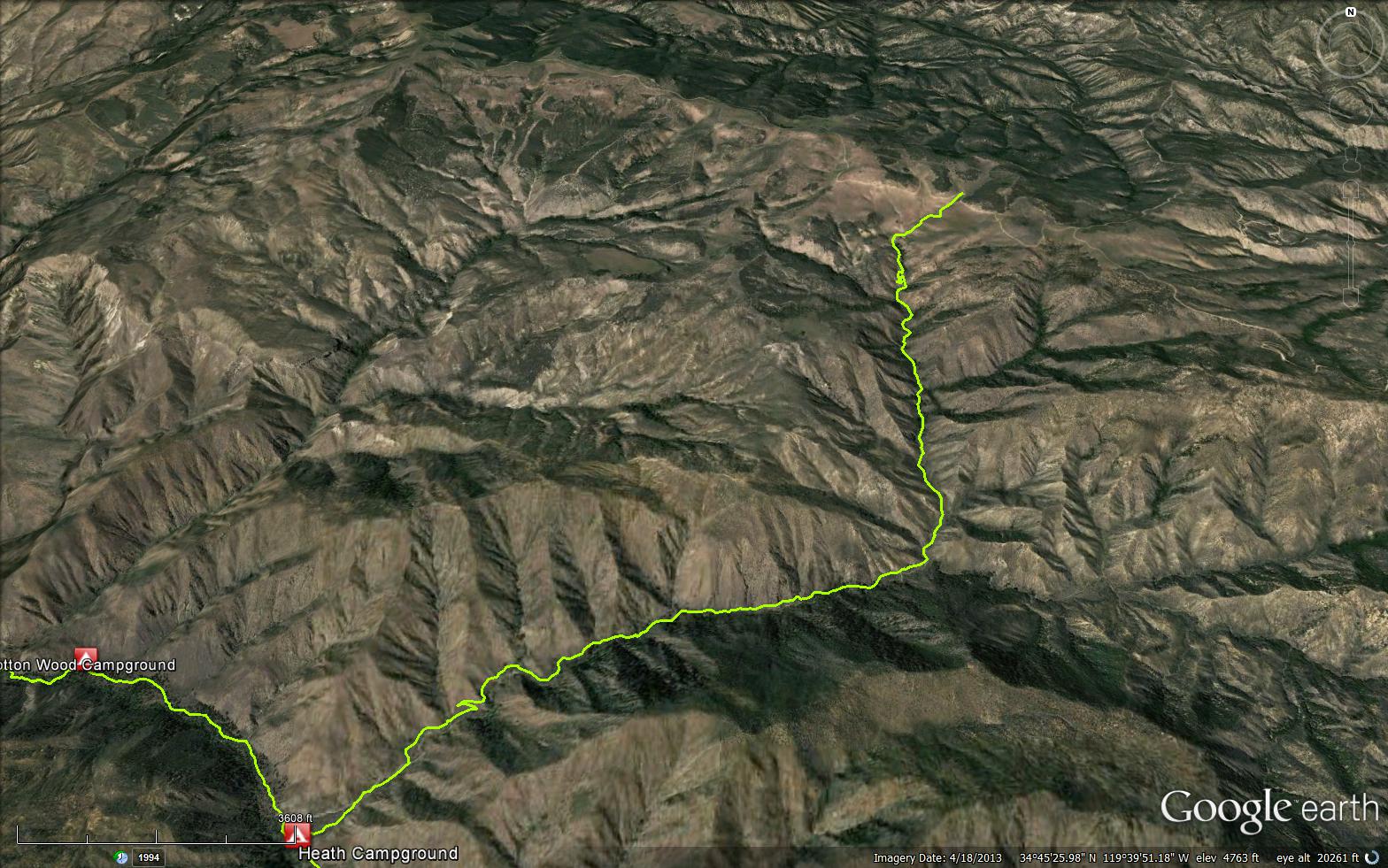
The Judell Trail descends from Santa Barbara Potrero into the San Rafael Wilderness to its terminus at the junction with the Sisquoc Trail. The trail has seen quite a bit of LPFA and VWR attention after the 2007 Zaca Fire but sees little traffic. As a result you should expect the trail to be very followable but overgrown in places. There are a few large washouts as you get closer to the Sisquoc but they have established reroutes that you can follow to get around them. The trail is very scenic and well designed. If you like trail design, this has it all from switchbacks to narrow gorges, cree crossings and big views. The upper part of the trail is regularly damaged by stock grazing and can make finding the start of the trail difficult. From the spring trough at Oak Spring, head west to the far side of the canyon and look for the tread dropping from that side. After a short ways you'll find the trail proper and from there you are off and running. Cattle follow the trail for the first mile or so into the canyon but stop after that, just about where you pass the wilderness sign. Speaking of the wilderness sign, it is a beauty. The sign along Judell is 'bearly' readable anymore due to the bear scratches that proliferate all over the sign. Very cool sign!
Judell is a great canyon, a very scenic with a wild feel and best of all it takes you to the splendor that is the Upper Sisquoc. It's a must for any Los Padres explorer. Make it happen!
Heath Camp, located at the junction of the Judell and Sisquoc Trails


.JPG)


 Judell Trail Survey - 04-14-2025 - by Antonio Calderon
| Link: | Judell Trail |
| Date: | 04-14-2025 |
| Surveyor Name: | Antonio Calderon |
| Trail description: | |
| Mode of transport: | Hike |
| Trail condition: | Needs some work |
| Images: | Water Flowing in Judell Canyon Switchbacks Judell and Sisquoc Trail Junction Signage |
Judell Trail Survey - 06-15-2024 - by Duane Waite| Link: | Judell Trail |
| Date: | 06-15-2024 |
| Surveyor Name: | Duane Waite |
| Trail description: | I didn't come prepared with the proper mindset for this trail, so I made it only halfway down. Overgrown fox tails will burrow into most trail running shoes in the first mile. Wear leather hiking shoes/boots with gaiters. Several blow downs 6-12" in the first two miles, including one full tree with multiple branches. Watch for washouts, and watch for sections of the trail on the edge of a particular washout two miles down. Don't slip and fall into the washed out creek bed. Trail disappears in sections due to washouts and overgrowth. I was able to route-find, but after a while, it was taking too long to get down, so I turned back. Cow plop prevalent near the spring, and the ground is wet. Plan accordingly. On the other hand, the spring is running at about four liters a minute. It's really gushing! Also on the other hand, there are flat spots along the ranch road near the trailhead that are perfect places to set up a tent. I will make another attempt wearing the proper gear and with more knowledge of conditions. |
| Mode of transport: | Hike |
| Trail condition: | Hard to follow |
| Condition details: | Foxtails and wet manure at the top / Blowdowns and washouts as you descend the canyon |
| Images: | Missing Judell Trail sign The spring is running well! Serious blow down The wilderness sign is missing Trail can be difficult to find and follow |
Judell Trail Survey - 06-03-2023 - by Jimmy Cooper| Link: | Judell Trail |
| Date: | 06-03-2023 |
| Surveyor Name: | Jimmy Cooper |
| Trail description: | Trail bed is in good condition. There are a few places with downed trees. She photo of the manuevering around a dead tree which is typical on this trail. |
| Mode of transport: | Hike |
| Trail condition: | Needs some work |
| Condition details: | Hiked from Santa Barbara Potrero to Heath |
| Images: | |
Judell Trail Survey - 04-27-2023 - by Matt Inman - Ojai Valley School| Link: | Judell Trail |
| Date: | 04-27-2023 |
| Surveyor Name: | Matt Inman - Ojai Valley School |
| Trail description: | |
| Mode of transport: | Hike |
| Trail condition: | Needs some work |
| Condition details: | Considering our huge winter, this trail was in really good shape... just needs a little work with a saw |
Judell Trail Survey - 05-19-2022 - by Addison Jerlow| Link: | Judell Trail |
| Date: | 05-19-2022 |
| Surveyor Name: | Addison Jerlow |
| Trail description: | Easy to follow all the way down. Flowing water in the creek right before the renegade camp about halfway down as the trail bends into a new canyon. Water in clear pools throughout the shaded section in middle Judell Canyon. |
| Mode of transport: | Hike |
| Trail condition: | Good shape and easy to follow |
Judell Trail Survey - 04-26-2022 - by Ruth Cooper| Link: | Judell Trail |
| Date: | 04-26-2022 |
| Surveyor Name: | Ruth Cooper |
| Trail description: | |
| Mode of transport: | Hike |
| Trail condition: | Good shape and easy to follow |
Judell Trail Survey - 03-11-2022 - by Anonymous Surveyor| Link: | Judell Trail |
| Date: | 03-11-2022 |
| Surveyor Name: | Anonymous Surveyor |
| Trail description: | Oak spring was dry. Didn’t see any cattle but as the trail description states it is a bit torn up. Many dry creek crossings. Lower on the trail there was some ponded/slowly flowing water. I’d only refill a bottle in the Sisquoc River. No wildflowers. No wilderness sign. A new trail sign was present up on the road. I’d recommend going down the trail and not up. |
| Mode of transport: | Hike |
| Trail condition: | Good shape and easy to follow |
| Images: | |
Judell Trail Survey - 03-28-2021 - by Louis Tremblay| Link: | Judell Trail |
| Date: | 03-28-2021 |
| Surveyor Name: | Louis Tremblay |
| Trail description: | few down small/minor trees, and 1 bushy large tree that forces some bush wacking about 1 mile from Heath. Cleared a few myself. Otherwise in great shape, water haflway down the canyon, and the spring at the top has a trickle. |
| Mode of transport: | Hike |
| Trail condition: | Needs some work |
| Condition details: | minor work |
Judell Trail Survey - 01-11-2020 - by Stephen S| Link: | Judell Trail |
| Date: | 01-11-2020 |
| Surveyor Name: | Stephen S |
| Trail description: | Hiked down and back up for an overnight at Cottonwood and there were probably a dozen downed trees along Judell trail. Some were small and able to be hopped over with others being quite large and bushy making us go off the trail in order to get around. The trail itself was in good shape and was easy to follow. The new wilderness sign posted by LPFA in 2017 looks like the one posted by Duane earlier in 2017 and is mostly destroyed again. |
| Mode of transport: | Hike |
| Trail condition: | Good shape and easy to follow |
Judell Trail Survey - 11-24-2019 - by Los Padres Forest Association| Link: | Judell Trail |
| Date: | 11-24-2019 |
| Surveyor Name: | Los Padres Forest Association |
| Trail description: | Got a report from a backpacker who spent 4 days along the Upper Sisquoc and came in via Judell and SB Potrero. The quick report: - One downed tree on Judell but otherwise in great shape and easy to follow. - Three downed trees on the Sisquoc all in the Cottonwood vicinity. - Sisquoc Trail from Judell down to Skunk in good shape and easy to follow. - Water in the Sisquoc at all locations. - Didn't see a soul but lots of bear signs and tracks. |
| Mode of transport: | Hike |
| Trail condition: | Good shape and easy to follow |
Judell Trail Survey - 10-13-2019 - by Los Padres Forest Association| Link: | Judell Trail |
| Date: | 10-13-2019 |
| Surveyor Name: | Los Padres Forest Association |
| Trail description: | LPFA weekend volunteers spent some time clearing the Judell Trail. Judell was hot and swarms of little black flies were quite annoying. A large 12 inch diameter branch, fell from an oak across the trail at -119.67593 34.74309 (WGS84). It is lying flat on the ground so it isn’t much of an obstruction now that we cut away the smaller branches. We cleared perennial shrubs at various places where they were becoming obstacles. We also did concerted brushing on the quarter mile of trail that was most overgrown. The trails were in good shape overall. Shrubs are already starting to grow back. A quick pass to trim ambitious shrubs and grub sprouting staubs would go a long way toward slowing the invasion of new growth over the long term. |
| Mode of transport: | Hike |
| Trail condition: | Good shape and easy to follow |
Judell Trail Survey - 01-04-2019 - by Brad Anderson| Link: | Judell Trail |
| Date: | 01-04-2019 |
| Surveyor Name: | Brad Anderson |
| Trail description: | Good shape! ~6 trees down over the trail. |
| Mode of transport: | Hike |
| Trail condition: | Good shape and easy to follow |
Judell Trail Survey - 06-18-2018 - by Steve Cypher| Link: | Judell Trail |
| Date: | 06-18-2018 |
| Surveyor Name: | Steve Cypher |
| Trail description: | The week after Duane's survey a TrailSmith led project did significant work on this trail. The thick brush and poison oak sections were blown out by the crew. This is still a brushy trail, poison oak is going to be an issue, there's some narrow tread on hillsides, and the meadows at the top will never have an obvious hiker path. But the trail is now good for stock and it won't be a bushwhack for a while. |
| Mode of transport: | Hike |
| Trail condition: | Good shape and easy to follow |
| Images: | Volunteer trail crew work on middle section of Judell Trail. Volunteer trail crew work on middle section of Judell Trail. |
Judell Trail Survey - 06-10-2018 - by Duane Waite| Link: | Judell Trail |
| Date: | 06-10-2018 |
| Surveyor Name: | Duane Waite |
| Trail description: | After my misadventure last year where I attempted to descend the Judell after dark, I decided to hike down in the day. Turns out, it's a lot easier! The top third is lousy with converging and diverging cow paths, but once you cross into the wilderness those go away. The middle third needs brushing, particularly the poison oak, but the tread is solid. The bottom third has been reworked and it shows. If you don't mind full sun exposure, you will have no problem with the trail. There is a trail camp 15-30 minutes downhill from the wilderness sign. Water is present, but it was iffy. I used two chlorine tablets per liter of water to make sure it was purified. All in all, it took me three hours to descend the trail from the potreros to the Sisquoc River and 3 1/2 to go back up. Literally rubbing tech-nu over all exposed parts of my body saved me from a severe poison oak rash. Word to the wise. |
| Mode of transport: | Hike |
| Trail condition: | Needs some work |
| Condition details: | Diverging cow paths and poison oak, but followable. |
Judell Trail Survey - 05-21-2018 - by Nate| Link: | Judell Trail |
| Date: | 05-21-2018 |
| Surveyor Name: | Nate |
| Trail description: |  The trail is in a very beautiful area, but it is not easy to access with the gate near Dry Canyon locked. It added an additional 11 miles to our trip, which is pretty inconvenient. A 9 mile hike down the Judell wound up being over 20 miles.     About 2 miles down the Judell, the trail starts to get pretty overgrown with poison oak and sage. I bushwacked what I could along the way, but a lot more work would be needed by a crew to clear the trail completely. The Judell creek is stagnant in the upper portion, but flowing in others. The Sisquoc River is flowing nicely at the bottom   |
| Mode of transport: | Hike |
| Trail condition: | Needs some work |
Judell Trail Survey - 05-09-2018 - by Jeff Wheelwright| Link: | Judell Trail |
| Date: | 05-09-2018 |
| Surveyor Name: | Jeff Wheelwright |
| Trail description: | Excellent recent maintenance. There is some damage at creek and wash crossings from hooves of stock parties. Poison oak beginning to encroach again but only at the middle section. Glorious flowering shrubs as of early May: whitebark ceanothus, bush poppies, prickly phlox, blue witch, lupine, clematis. Nice to see big cone spruce here and there. The Zaca fire must have burned hot in here, because several tall oaks and conifers were turned into skeletons, but the recovery is almost complete. Water in the creek should be sporadically available for another month. |
| Mode of transport: | Hike |
| Trail condition: | Good shape and easy to follow |
Judell Trail Survey - 12-03-2017 - by Los Padres Forest Association| Link: | Judell Trail |
| Date: | 12-03-2017 |
| Surveyor Name: | Los Padres Forest Association |
| Trail description: | LPFA led a three day trail maintenance project down the Judell Trail from December 1-3, 2017. We were joined by Ventura based Scout Troop 111 and Mt Pinos Ranger District Volunteers. We accomplished solid trail work covering the top half of the trail, approx 2.5 miles. Work included removing downed trees from the trail corridor, extensive brushing, tread repair, proactive felling of hazard trees and the installation of a new San Rafael Wilderness sign (see photo). The bear seem to REALLY love the wilderness signs in this canyon, lets hope this one fares better than the previous ones and we get at least a decade of use from it. |
| Mode of transport: | Hike |
| Trail condition: | Needs some work |
| Images: | Trail restoration along the upper portion of the Judell, photo Subbotin Looking sweet! You can see the flood debris from the Summer 2015 storms in the drainage, photo Subbotin BAM, new wilderness sign, photo Subbotin |
Judell Trail Survey - 07-04-2017 - by Duane Waite| Link: | Judell Trail |
| Date: | 07-04-2017 |
| Surveyor Name: | Duane Waite |
| Trail description: | Ignorance is bliss. I'm one of those people who enjoys hiking at night, so I wasn't too concerned when I headed out to SB Canyon from LA in late afternoon instead of early in the morning as I'd planned. After a hike up Sierra Madre Road, I arrived at the trail head as the sun was setting. I had hiked the trail several years before, but with the recent storms, finding the trail through the washouts and overgrowth in increasing darkness became more and more difficult as I descended. By the time I made it to the wilderness sign, I knew there was no way I could continue, even with my bright headlamp and trail finding skills. After 45 minutes, I I turned back at the bear clawed wilderness sign. It took me nearly two hours to find my way back up the maze of trails, washouts and blind turns to the trail head. At midnight, I laid out my tent right there on Sierra Madre Road and thought to myself, "a misadventure is still an adventure." About a billion coyotes howled, barked and yipped the rest of the night in response. |
| Mode of transport: | Hike |
| Trail condition: | Hard to follow |
| Condition details: | Aborted attempt to hike down the Judell at night. But I will be back (when the sun's out!) |
| Images: | Turnaround Point |
Judell Trail Survey - 05-20-2016 - by Mark LaFevers| Link: | Judell Trail |
| Date: | 05-20-2016 |
| Surveyor Name: | Mark LaFevers |
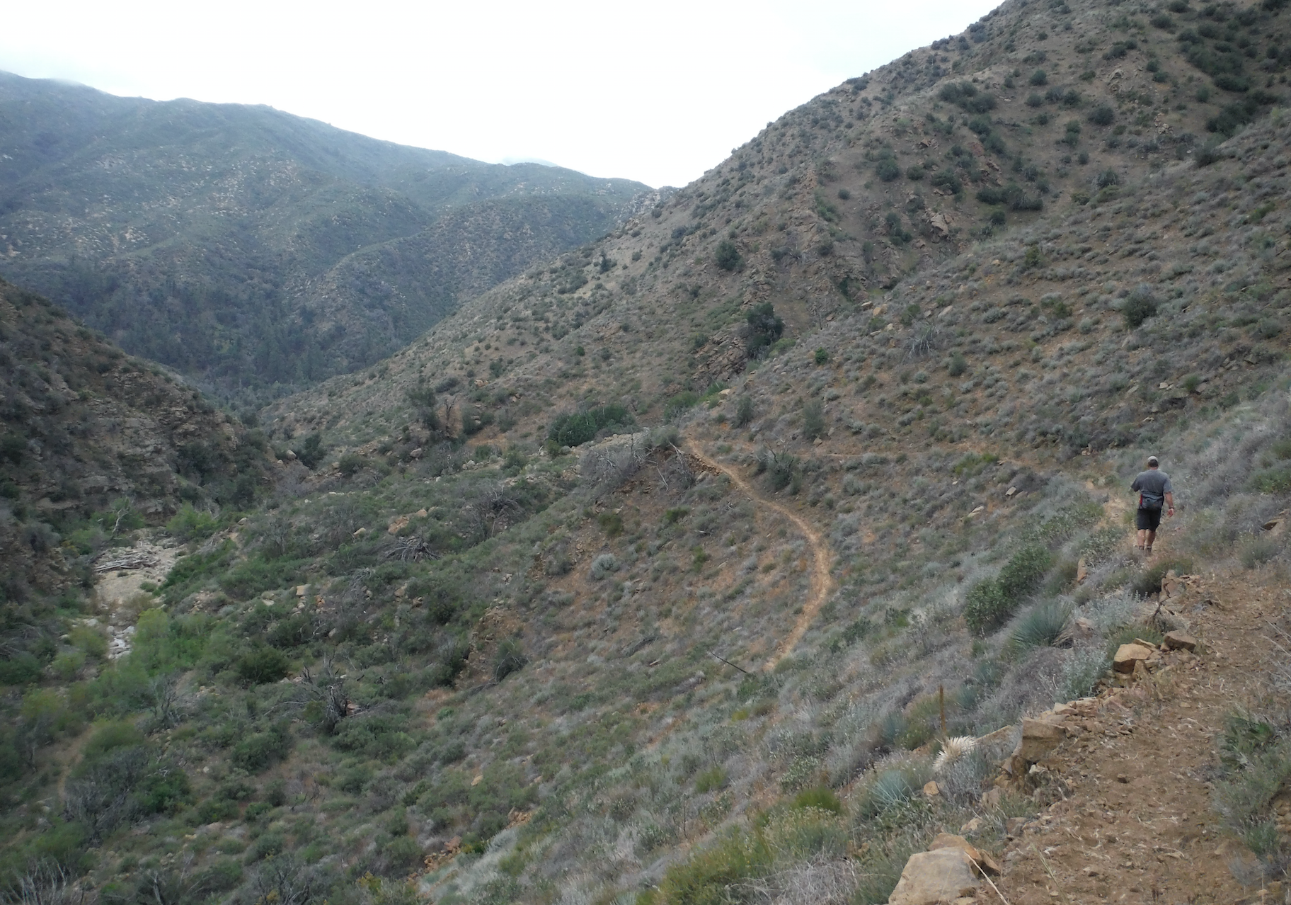
| Trail description: | Blind footing in much of the upper trail in tall grass, just turning brown. The Spring is dry, water is flowing at crossings about 3 miles down. From mile 2.5 down, half a dozen tree falls await sawyers, and a solid wall of poison oak requires dropping off trail into the creek to bypass. The rockslide and deep wash areas are passable to hikers, but the trail is hard to follow in sections for heavy ovegrowth and little apparent use. Despite the thigh high contact with brush the three of us picked up only two ticks between Santa Barbara Potrero and Heath Camp. No snakes, lots of bear scat from mile 3 down to Heath and beyond to Mansfield. Lots of poison oak on the Sisquoc Trail between the camps down stream to Skunk Camp, but passable, campsites in good condition with clearing tools in place at some. The Sisquoc is flowing and the pools at Cottonwood Camp are particularly nice. We enjoyed a 2 1/2 hour hike between S.B. Potrero and Heath, and 4 1/2 hours on the uphill leg between Cottonwood and S.B. Potrero, in mild temperatures high 70s and breezes. |
| Mode of transport: | Hike |
| Trail condition: | Needs some work |
| Condition details: | 3 days 2 nights backpack |
| Images: | Tall grass Detour to bypass poison oak Water at crossings in lower half Lots of widlflowers |
Judell Trail Survey - 03-28-2016 - by Sonia Connors| Link: | Judell Trail |
| Date: | 03-28-2016 |
| Surveyor Name: | Sonia Connors |
| Trail description: | Upper half of trail was in excellent shape. Â Green grasses and wildflowers abundant, as well as plenty of bear scat and a rattler. Â Occasional water in creek in the lower half. Â There is an established campsite about half way down (we named it Hail Flat because is was hailing while we stayed there). Â Lower half has a few sections of fallen trees and overgrown poison oak. Â Watch out for the alluring sandy creek bed - I sunk thigh deep in "quick sand" !!! |
| Mode of transport: | Hike |
| Trail condition: | Good shape and easy to follow |
| Images: | Upper Judell Rattlesnake on upper Judell Hail Flat Campground (we named this) Judell Trail sign from Heath Camp |
Judell Trail Survey - 04-26-2015 - by Los Padres Forest Association| Link: | Judell Trail |
| Date: | 04-26-2015 |
| Surveyor Name: | Los Padres Forest Association |
| Trail description: | April 2015 |
| Mode of transport: | Array |
| Trail condition: | Good shape and easy to follow |
| Images: | Top of Judell, outside the wilderness Best San Rafael sign Trail along a higher section above the creek The famous Judell oak Switchbacks into Rattlesnake Alley |
Judell Trail Survey - 10-04-2015 - by Los Padres Forest Association| Link: | Judell Trail |
| Date: | 10-04-2015 |
| Surveyor Name: | Los Padres Forest Association |
| Trail description: | Trail is very passable and in good shape. Â Some stagnant water in Judell Creek. |
| Mode of transport: | Hike |
| Trail condition: | Good shape and easy to follow |
Judell Trail Survey - 09-05-2015 - by LKasko| Link: | Judell Trail |
| Date: | 09-05-2015 |
| Surveyor Name: | LKasko |
| Trail description: | Beautiful trail! Thanks for all the maintenance. No trouble following the trail; had to look around from Oak Spring (dry) but picked out the trail easily. Good signs. Walked down the canyon on Saturday, Sept 5, and back up on Monday, Sept 7. At Heath camp found good water in a fairly deep pool (about 1 foot+ deep) about 100 yds downstream from Heath. There was also scummy water in the Judell canyon, most noticeably at the 4th trail crossing of the canyon stream north of Heath camp (photo below.) |
| Mode of transport: | Hike |
| Trail condition: | Good shape and easy to follow |
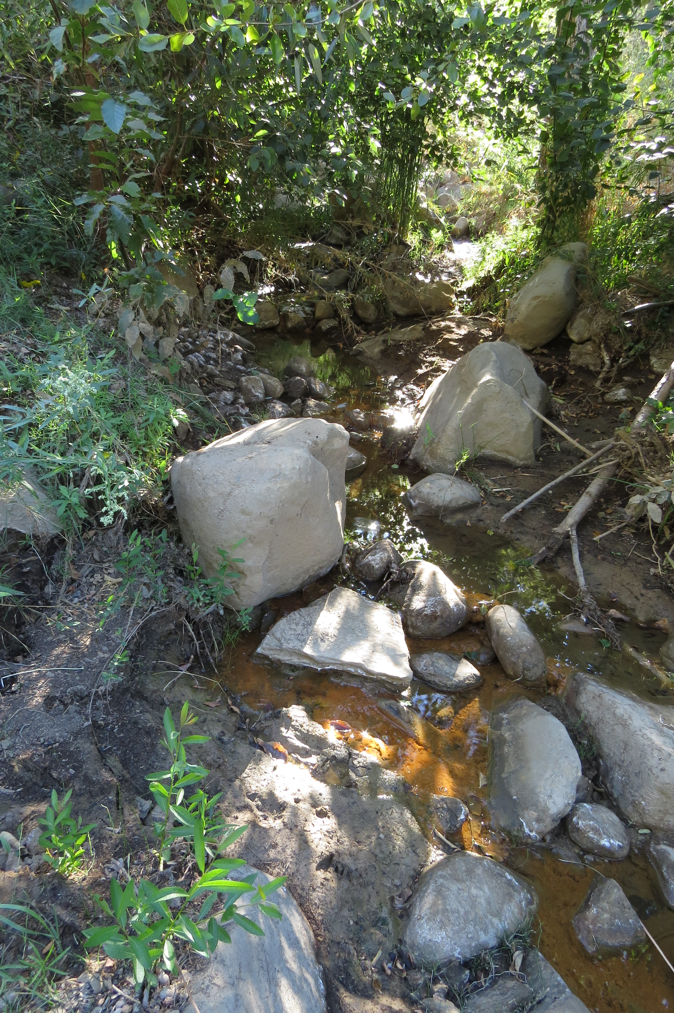
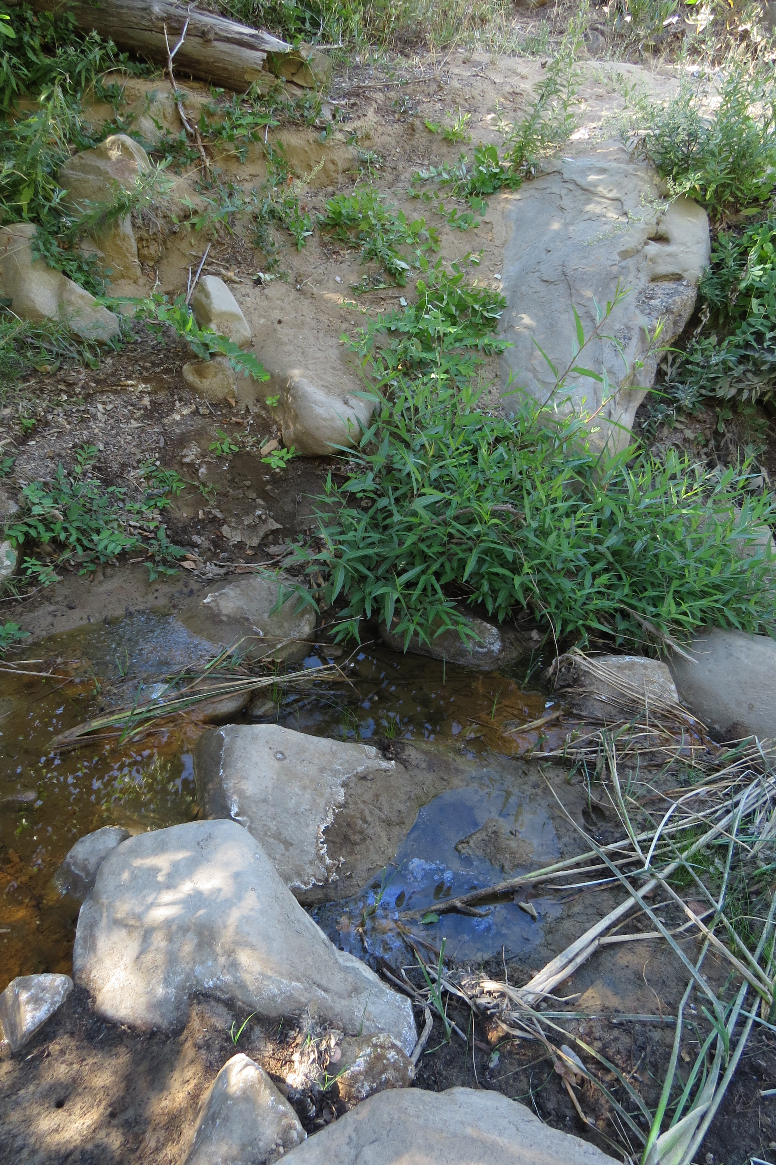
| Images: | Judell Canyon water at 4th trail crossing north of Heath Camp. Small amount but plenty for a good filter. Same as above: Judell Canyon water at 4th crossing north of Heath. Judell Canyon: some water, shallow, a short distance farther north than previous photos, visible from trail. Photo of the Judell Canyon while walking the trail. |
Judell Trail Survey - 04-06-2015 - by Hike Los Padres| Link: | Judell Trail |
| Date: | 04-06-2015 |
| Surveyor Name: | Hike Los Padres |
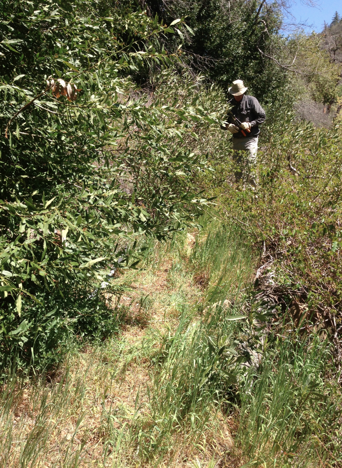
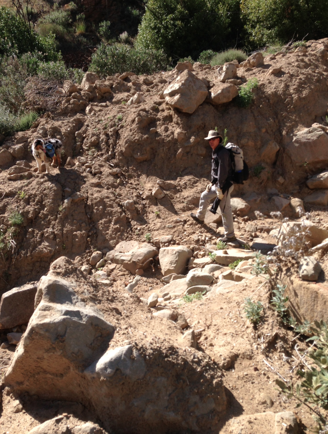
| Trail description: | The trail was difficult to find, but we have hiked it and rode it many times, so we knew where to go. Our first obstacle was at the junction of the Sierra Madre Road with the Judell Trailhead (Function Junction!). There is a pretty deep gully in the jeepway that would be extremely difficult for trucks and horse trailers to get down. It goes for about 200 ft before it evens out to a drivable road. This would be a fairly easy fix with a few volunteers and the right tools. The trail is very overgrown and needs lots of brushing, the tread is questionable in many spots, especially along the high trails and switchbacks,and there are at least 5 bigger trees that require a cross-cut saw prior to Heath camp. |
| Mode of transport: | Hike |
| Trail condition: | Hard to follow |
| Condition details: | Judell has not been used for many months. |
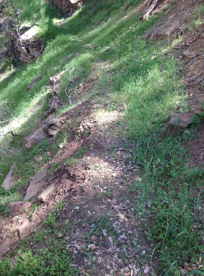
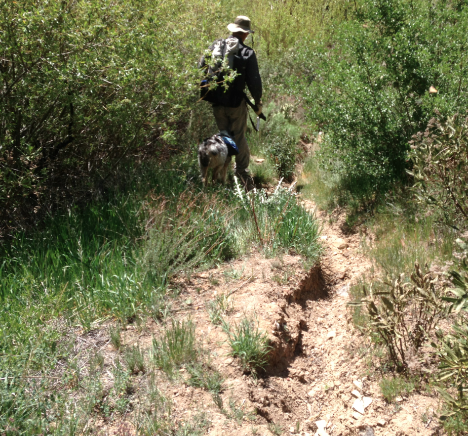
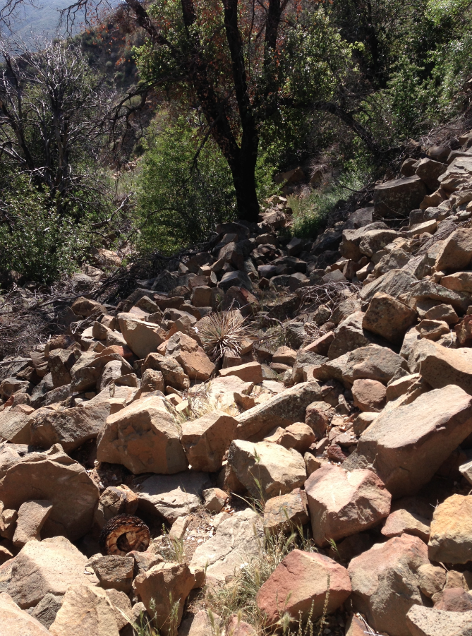
| Images: | Tread typical of the middle oak filled section of the Judell Some rutting that needs to be fixed, yes that is the trail Gets brushy in sections but is followable The large washout along the lower section. Work needed. The boulder field section just after the trail goes high on the west side. |
Judell Trail Survey - 03-09-2015 - by Nico| Link: | Judell Trail |
| Date: | 03-09-2015 |
| Surveyor Name: | Nico |
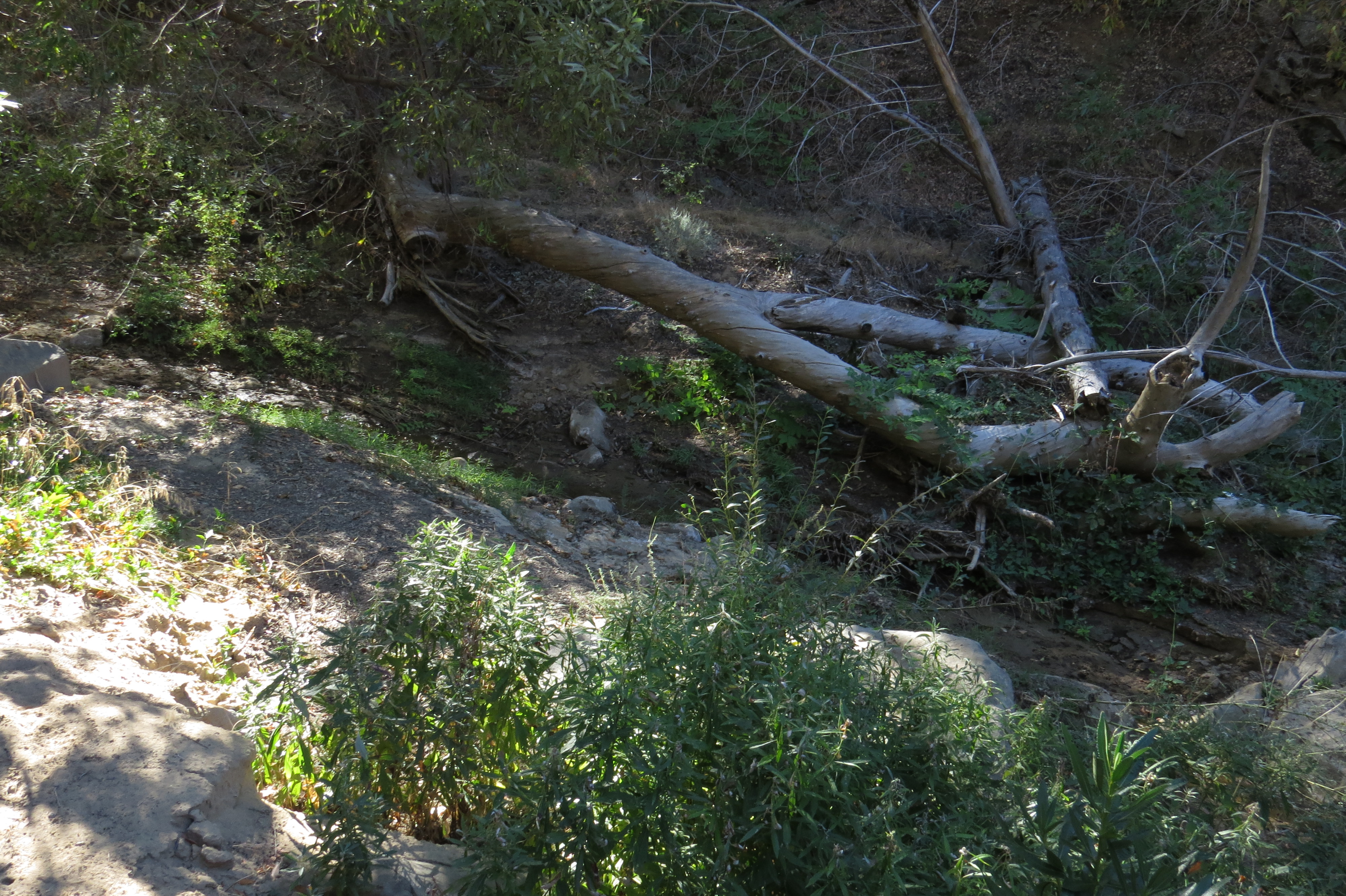
| Trail description: | Didn't see any running water at Oak Spring, just a little bit of standing water in the trough. Intermittent sections of flowing water along the lower half of Juddell Canyon; upper half was completely dry. Didn't look like the trail has seen too many feet in the recent past. Â Trail was a little brushy but easy enough to follow. Â There are about 20 tree falls across the trail, most can be handled with a handsaw but there's two or three larger trees laying across the trail that will require a sawyer team. All in all, it was a nice walk. |
| Mode of transport: | Hike |
| Trail condition: | Needs some work |
| Condition details: | Trail is a little brushy; some sections could use some tread work. Lots of tree falls. |
Judell Trail Survey - 06-21-2014 - by Los Padres Forest Association| Link: | Judell Trail |
| Date: | 06-21-2014 |
| Surveyor Name: | Los Padres Forest Association |
| Trail description: | All the downed trees have been removed by volunteers or forest good samaritans. Â Trail was in great shape. |
| Mode of transport: | Hike |
| Trail condition: | Good shape and easy to follow |
| People Seen: | 0 |
Judell Trail Survey - 05-20-2014 - by Los Padres Forest Association| Link: | Judell Trail |
| Date: | 05-20-2014 |
| Surveyor Name: | Los Padres Forest Association |
| Trail description: | Oak Spring – steady trickle |
| Mode of transport: | Array |
Judell Trail Survey - 05-03-2014 - by Hike Los Padres| Link: | Judell Trail |
| Date: | 05-03-2014 |
| Surveyor Name: | Hike Los Padres |
| Trail description: | All downed trees were removed from along the Judell Trail. |
| Mode of transport: | Stock |
| Trail condition: | Good shape and easy to follow |
 Survey / Report Form - Please click this box to open the form.