 Use Marker Groups
 Wolf 2002
Piru 2003
Day 2006
Zaca 2007
Gap 2008
La Brea 2009

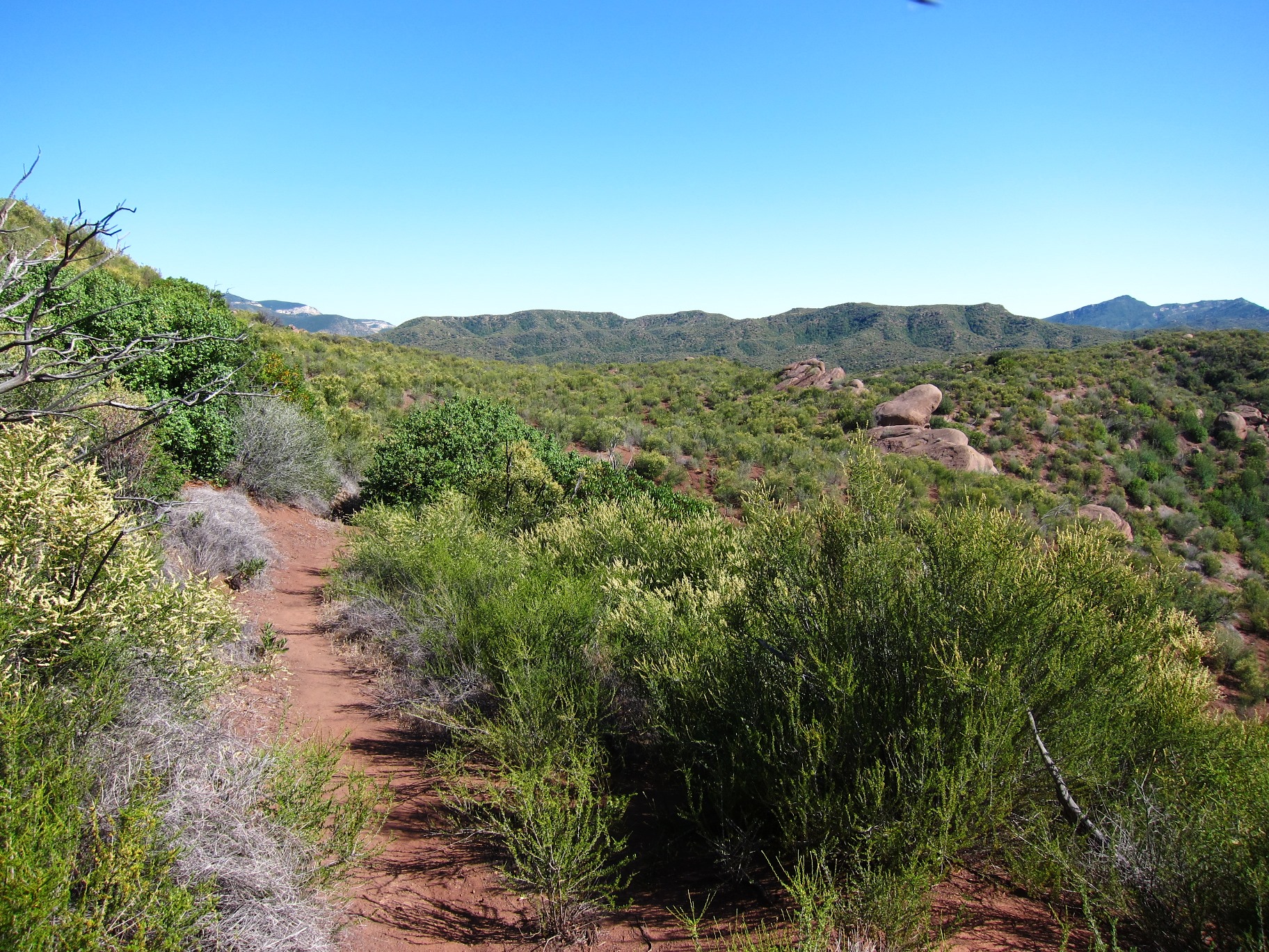
Take Highway 126 to Fillmore. Turn north on A Street/Goodenough Road and drive 14.1 miles to Dough Flat. This is a rough dirt road that is traveled by large oil trucks. Continue on to the end of the road at the Dough Flat trailhead. Sometimes the gate is locked and you have to walk an extra 5 miles to the trail head. From here, you enter the Sespe Wilderness and the Sespe Condor Sanctuary.
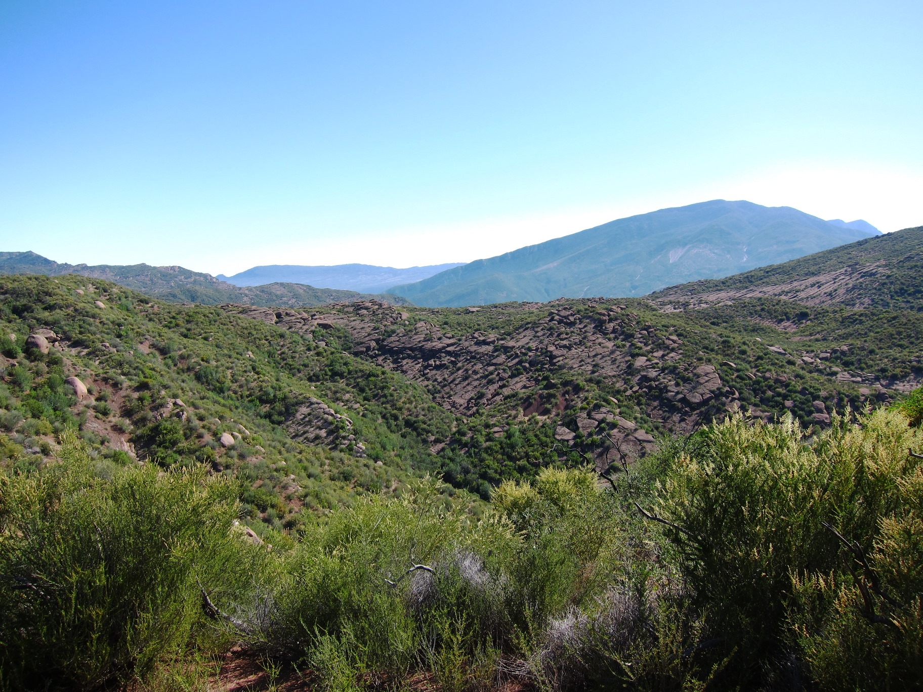
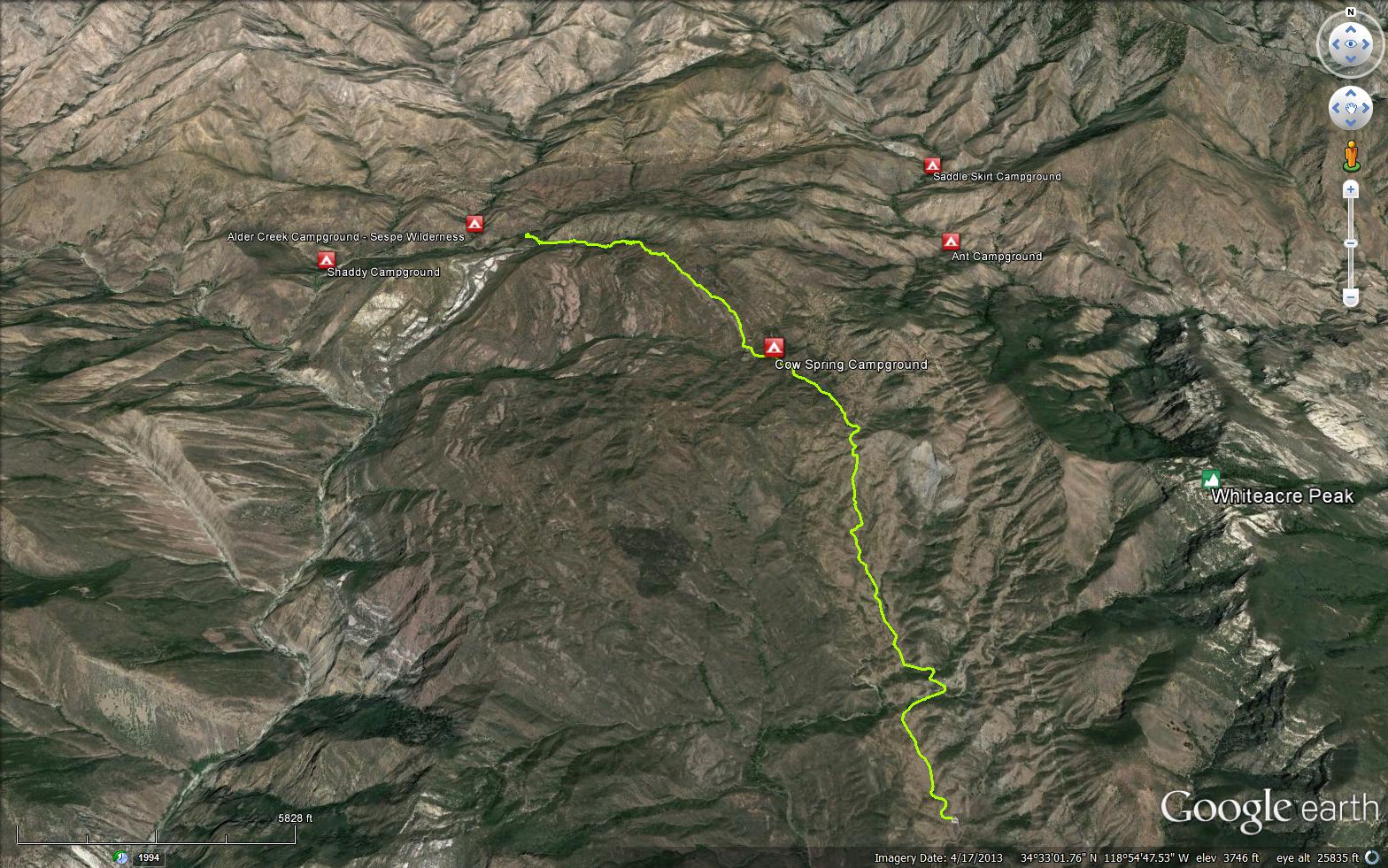
The Alder Creek Trail (20W11) starts from the Dough Flat trailhead, 2.5 miles north is the first trail junction. The trail to the right is the Bucksnort Trail (19W18), which ends at Ant Camp at the junction with the Agua Blanca Trail (19W10). Go left toward Alder Creek. Cow Spring is the first camp along the way, serious lack of shade can make this a hot camp during the summer and sometimes there is no water at the spring.
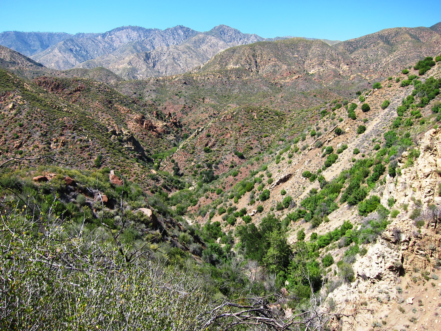
The next trail junction is 2.7 miles further. If you stay to the left, the trail will go down Alder Creek Trail to Alder Creek Camp after .6 miles. If there is no water there, continue to hike downstream 0.8 miles until the trail leaves the drainage bottom. Turn left and follow the creek for 350 yards to Shady Camp, which normally has year-round water. The Sespe River Trail (20W13) begins at the turnoff to Shady, where the main trail leaves Alder Creek.
Trail Junctions
Trail Camps
Creek Crossings
Springs Along The Trail
Cow Spring Camp - 3.50 Miles from Dough Flat


 Alder Creek Trail Survey - 03-30-2025 - by Laura Clay
| Link: | Alder Creek Trail |
| Date: | 03-30-2025 |
| Surveyor Name: | Laura Clay |
| Trail description: | Recent trail work made it clear and easy to follow. Plenty of water along the route we took to Cow Spring |
| Mode of transport: | Hike |
| Trail condition: | Good shape and easy to follow |
Alder Creek Trail Survey - 11-25-2024 - by Los Padres Forest Association| Link: | Alder Creek Trail |
| Date: | 11-25-2024 |
| Surveyor Name: | Los Padres Forest Association |
| Trail description: | LPFA volunteers completed 7 days of work on the Alder Creek Trail as part of a Working Vacation at Cow Spring Camp. The trail is now completely brushed from the trailhead until shortly before it reaches the East Fork of Alder Creek (34.57797, -118.93143), as well as a few slides cleared. The trail after this point is still in rough shape and will be the focus of a Spring 2025 LPFA Working Vacation based at Alder Creek Camp. Check out lpforest.org for more volunteer events! |
| Mode of transport: | Hike |
| Trail condition: | Needs some work |
| Condition details: | Great shape from the trailhead until where LPFA stopped work, hard to follow after that point. |
| Images: | |
Alder Creek Trail Survey - 12-17-2023 - by Dave Billybob| Link: | Alder Creek Trail |
| Date: | 12-17-2023 |
| Surveyor Name: | Dave Billybob |
| Trail description: | Thank you to the volunteers who recently cleared the trail. It's in great shape until the bottom of the hairpins. The last half mile or mile down to the creek gets a bit rougher but it's easy enough to follow. I hiked from Dough Flat to Sespe Hot Springs. |
| Mode of transport: | Hike |
| Trail condition: | Needs some work |
| Condition details: | Great shape for first 5 miles or so! |
Alder Creek Trail Survey - 10-11-2023 - by Los Padres Forest Association| Link: | Alder Creek Trail |
| Date: | 10-11-2023 |
| Surveyor Name: | Los Padres Forest Association |
| Trail description: | LPFA surveyed the Alder Creek Trail from Dough Flat to the junction with the Sespe River Trail/turnoff to Shady Camp to prepare for upcoming trail maintenance projects. The road to Dough Flat is in the best shape it's been. There is good water at Saputiwah (formerly sq___) spring. Stagnant but good in a pinch water at Cow Spring. Decent water in the drainage below Dripping Springs. Good water after a few crossings of East Fork Alder Creek. Excellent water in the main fork of Alder Creek. The trail is brushy from the Bucksnort Trail junction to Cow Spring, then brushy again from the end of the Stone Corral until the end of the trail. The crossings of East Fork Alder and Alder Creek are mostly flagged, but blown out. There is tread on the flats above the creek each time the trail leaves the creak bed. GPS and/or good navigation skills recommended in this section. The trail from 34.57606, -118.94566 to the Sespe Trail junction is largely washed out, but open and navigable. LPFA will be working this trail this fall and winter, come join us! volunteer@lpforest.org |
| Mode of transport: | Hike |
| Trail condition: | Needs some work |
| Condition details: | Overgrown and hard to follow in parts. |
Alder Creek Trail Survey - 10-13-2023 - by Anonymous Surveyor| Link: | Alder Creek Trail |
| Date: | 10-13-2023 |
| Surveyor Name: | Anonymous Surveyor |
| Trail description: | Hiked from Dough Flats Trailhead to the Bucksnort trail split. There was some water at Squaw spring but was hard to find a good flowing spot without getting deep in the bush. There was some more water at cow springs but mostly stagnant water. Did not hike past this point as it was 1000 ft decent down to camp shady and with the unknown water situation I did not want to take any chances. |
| Mode of transport: | Hike |
| Trail condition: | Hard to follow |
| Condition details: | Can lose the trail, if you have GPS and follow the trail via GPS you should have no problem. Gets very overgrown after the trail split towards Cow Spring |
Alder Creek Trail Survey - 06-15-2023 - by Los Padres Forest Association| Link: | Alder Creek Trail |
| Date: | 06-15-2023 |
| Surveyor Name: | Los Padres Forest Association |
| Trail description: | LPFA Trail Crew will be continuing our work along the Alder Creek Trail in 2023. Due to storm road damage, we weren't able to get out there as early in the season as we had hoped but we were able to crank out about a mile of trail work in June from Cow Springs down towards the Stone Corral. We'll be back out there as the weather allows in the hopes of brushing down to Alder Creek Camp and ideally up to Sespe Saddle. Lots to do out there! Thanks to SCE for the grant support making this happen. |
| Mode of transport: | Array |
| Trail condition: | Needs some work |
| Images: | |
Alder Creek Trail Survey - 09-02-2022 - by M. Baker| Link: | Alder Creek Trail |
| Date: | 09-02-2022 |
| Surveyor Name: | M. Baker |
| Trail description: | Gate to Dough Flat unlocked. Road from Fillmore to Dough Flat Trailhead passable by sedan, but not advisable. Trail in good shape and easy to follow from Dough Flat through Cow Springs on to Alder Creek Camp. Completely dry at both Cow Springs and Alder Creek Camp. Navigation from Alder Creek Camp to Shady requires utilizing the cairns to find the best trail, although simply following the direction of the creek will work as well. Several places that required pushing through overgrown brush, but not impassable. No water at Shady Camp. From Shady Camp over the ridge to the first crossing of Sepse Creek is about 3 miles. This crossing is about 500 ft of elevation gain followed by at least as much descent, with no shade and pushing through scrub brush the entire way up. This was the first opportunity to gather water - roughly 10 miles from Dough Flat trailhead. Water in Sespe Creek flowing and relatively clear. Would not recommend this route in the late summer months unless you enjoy the thrill of dipping below emergency water levels. |
| Mode of transport: | Hike |
| Trail condition: | Needs some work |
Alder Creek Trail Survey - 06-22-2022 - by anonymous| Link: | Alder Creek Trail |
| Date: | 06-22-2022 |
| Surveyor Name: | anonymous |
| Trail description: | Good shape to Cow Camp; overgrown in many places between Cow Camp and Shady Camp. Disappears at time; you're better off hiking in the creek bed. Trail was flagged in many places. |
| Mode of transport: | Hike |
| Trail condition: | Needs some work |
Alder Creek Trail Survey - 03-09-2021 - by Kathleen| Link: | Alder Creek Trail |
| Date: | 03-09-2021 |
| Surveyor Name: | Kathleen |
| Trail description: | We hiked east from the jnctn of the trail to Sespe Hot Springs and the Sespe River trail, out to Dough Flat (started at Piedra Blanca). From Sespe Hot Springs trail to where Alder Ck trail leaves the Sespe River drainage (sign there says Alder Camp 4 miles): trail a little hard to follow in places, particularly at 1st creek crossing you come to, but there are small cairns and we found our way without too much difficulty - helps to have a map. After final Sespe River crossing, at "Alder Camp 4 miles" sign: as it climbs out of Sespe River, trail is narrow, and washed out in a couple short spots, requiring caution to proceed safely - soil is loose, tread is mostly gone, and there is a pretty steep drop-off. Having said that, the 4 of us passed safely, with full packs on. From the saddle, descending into Alder Ck: overgrown with brush, but pretty easy to follow. In Alder Ck drainage: several cairns, and if you lose them you can find the trail again - just continue upstream; really, there is nowhere else to go. We had no trouble finding where the trail leaves Alder Ck to climb towards Dripping Springs. We did have a map and knew it was about a half mile upstream from Alder Camp, so we knew to watch for it. Even so, it was pretty clear to see. After that, while the trail is overgrown in places, particularly on north facing slopes, it is pretty easy to follow all the way out to Dough Flat. Probably wouldn't recommend for inexperienced hikers, but otherwise it was no problem. Camped at Alder Ck right where the trail first drops into Alder Ck (hiking east) - didn't go down to Shady Camp. There was water in Alder Ck. |
| Mode of transport: | Hike |
| Trail condition: | Needs some work |
| Images: | Trail dropping off the saddle east into Alder Creek Sign where trail begins to climb out of the Sespe River Climbing to the saddle from Sespe River A bit of trail finding in Alder Creek Heading for Cow Springs and Dough Flat, after climbing out of Alder Ck |
Alder Creek Trail Survey - 12-27-2020 - by Anonymous Surveyor| Link: | Alder Creek Trail |
| Date: | 12-27-2020 |
| Surveyor Name: | Anonymous Surveyor |
| Trail description: | The gate was surprisingly unlocked today! The trail to Cow Spring is in pretty good shape, but horribly overgrown and deteriorating once you get a bit past it. Plan on moving slowly and uncomfortably if you intend to make it to Alder Creek Camp. There were at least two points where fallen trees block the path, and the trail is mostly lost in East Fork Alder Creek. We did not progress past Alder Creek Camp. |
| Mode of transport: | Hike |
| Trail condition: | Needs some work |
| Condition details: | Overgrown and deteriorating between Cow Springs and Alder Creek Camp. At least two points where fallen trees block the path, and the trail is mostly gone in East Fork Alder Creek. |
Alder Creek Trail Survey - 11-15-2020 - by Nancy Aguilar| Link: | Alder Creek Trail |
| Date: | 11-15-2020 |
| Surveyor Name: | Nancy Aguilar |
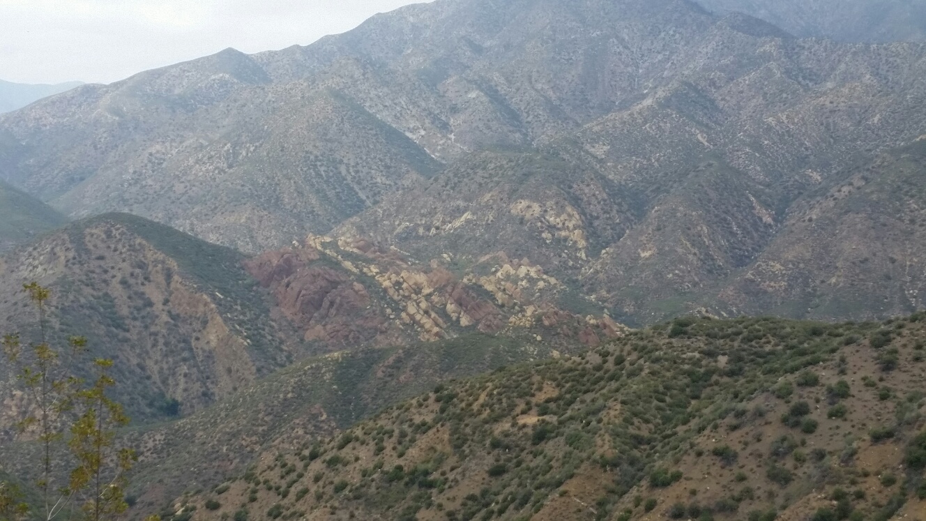
| Trail description: | We started from Dough Flats and made it to Shady Camp. Cow Springs had a small pool of clear stagnant water. The rock formations once you pass Cow Springs were amazing. I can see why they call it Dough Flats. The water was flowing at the bottom of Alder Creek to Shady. The trail needs some work once you get down to the creek but all in all it was easy to follow. |
| Mode of transport: | Hike |
| Trail condition: | Needs some work |
| Images: | Rock Formations Rock Formations To Shady Camp |
Alder Creek Trail Survey - 08-01-2020 - by David Porzio| Link: | Alder Creek Trail |
| Date: | 08-01-2020 |
| Surveyor Name: | David Porzio |
| Trail description: | The road to Dough Flat Th was closed but did open over the weekend. Trail to Cow Springs was in decent shape. Some overgrown parts but easy to follow. The trail from Cow Springs to Alder Creek was extremely overgrown in some parts with downed tress. It too 3 hours to go from Cow Springs to Alder Creek. Beyond Alder Creek to Shady was the same story. Overgrown trail that is easy to lose and requires backtracking.  |
| Mode of transport: | Hike |
| Trail condition: | Hard to follow |
| Condition details: | Cow Springs to Alder Creek |
| Images: | Downed trees More downed trees blocking trail to Alder Creek Overgrown trail Alder Creek Camp |
Alder Creek Trail Survey - 05-09-2020 - by Anonymous Surveyor| Link: | Alder Creek Trail |
| Date: | 05-09-2020 |
| Surveyor Name: | Anonymous Surveyor |
| Trail description: | Trail is in good shape with several small water crossings up until Cow Camp. There is substantial overgrown brush from Cow Camp to Alder Creek Camp. Long sleeves, pants, and a hat are highly recommended tto charge through the brush. A few of the springs are flowing on the way to Alder. Ticks and snakes are out and about. The water in the creek was low enough to walk the creek to the confluence right before Alder camp. Other hikers reported overgrown brush from Alder to Shady Camp. From Shady Camp to Sespe hotsprings involved 2 deep river crossings and several sketchy/washed out sections of trail along the hillside. It’s recommended to replace the 2 trail signs where the ttrail forks for Ant Camp and McDonald.  |
| Mode of transport: | Hike |
| Trail condition: | Needs some work |
| Images: | There’s a trail in there somewhere |
Alder Creek Trail Survey - 01-09-2020 - by Jim Kenney| Link: | Alder Creek Trail |
| Date: | 01-09-2020 |
| Surveyor Name: | Jim Kenney |
| Trail description: | The trail from Dough Flats to Cow Springs is well defined, cared for and overall easy to follow. As i traveled north on the trail it began to show a lack of use, and became harder to follow. There were a couple of minor tree blowdowns, a self made trail around water in the original trail and the brush began to become harder to navigate through. An example is a 34.56364, -118.90896. Once you reach the top and begin to switch back down to Alder Creek, pushing through the brush becomes more common place. On this day it was raining as we approach Dripping spring. When I arrived the ground was wet and slippery. The trail width has become narrow and downsloped, both toward the spring and falling off to the creek. The trail to the spring also looked had blowdowns across the trail. I decided based on the conditions it would be unsafe to continue to Alder Creek Camp. On a dry day it maybe possible to continue north with extreme care to avoid the sharp drop off and fall into the creek below.  |
| Mode of transport: | Hike |
| Trail condition: | Needs some work |
| Condition details: | Alder Creek from Dough Flats to mile 5.56 |
| Images: | |
Alder Creek Trail Survey - 07-27-2019 - by Los Padres Forest Association| Link: | Alder Creek Trail |
| Date: | 07-27-2019 |
| Surveyor Name: | Los Padres Forest Association |
| Trail description: | The LPFA partnered with Southern California Edison to install a new trailhead sign at Dough Flat, cleanup the trailhead, install regulation signs (no campfires, no target shooting), painted the outhouse and cleared the short trail up to the condor observatory. Good fun and great work by over 25 SCE volunteers. Here are some photos: |
| Mode of transport: | Array |
| Trail condition: | Good shape and easy to follow |
| Images: | Photo LPFA |
Alder Creek Trail Survey - 05-29-2019 - by Katie G| Link: | Alder Creek Trail |
| Date: | 05-29-2019 |
| Surveyor Name: | Katie G |
| Trail description: | Started at Dough Flat Gate. 2.5 mi to Trailhead. Steady climb for the next 3.5/4 mi to peak before dropping into Alder Creek. Trail is mostly clear until this point but upon decent and through Alder Camp, beware of poison oak. Also through the creek crossings, it's easy to lose the trail. At Shady Camp junction, ascending over the saddle is very steep. Then you have to bushwhack through lots of foliage at the top. But trail is obvious. Rest of trail to Coltrell Flats is pretty good but keep steady footing on the small track next to the cliffs. :) River crossings from Coltrell to Sespe Camp are difficult. Stray from the trail map and follow the cairns for the best way across. Prepare to get thigh-high wet. Sespe Camp and the Springs are a dream! A very tough hike. We did in 3 days staying at Sespe on the way there and Cow Springs on the way back. Dough Flat Gate was unlocked when we returned. Lol. |
| Mode of transport: | Hike |
| Trail condition: | Needs some work |
| Condition details: | Alder Creek backpacking to Sespe |
| Images: | Condor Sanctuary |
Alder Creek Trail Survey - 04-16-2019 - by Los Padres Forest Association| Link: | Alder Creek Trail |
| Date: | 04-16-2019 |
| Surveyor Name: | Los Padres Forest Association |
| Trail description: | Sharing a report from a backpacker: - Trail was wide open until the switchbacks down towards Alder - Some serious brushing is needed heading down the switchbacks through Dripping Spring - Alder Camp in great shape, good water - Bring bug repellent |
| Mode of transport: | Hike |
| Trail condition: | Needs some work |
Alder Creek Trail Survey - 11-18-2018 - by Christopher P. Lord| Link: | Alder Creek Trail |
| Date: | 11-18-2018 |
| Surveyor Name: | Christopher P. Lord |
| Trail description: | Trail from Dough Flat to the east fork of Alder Creek is easy to follow however would benefit from some maintenance. Brush is encroaching heavily in many spots beyond Stone Corral and below dripping Springs with at least one downed tree that would make stock passing difficult. Bucksnort junction sign needs replacing as does the junction sign at the East Fork with the northern leg. If I had more time I would have completed a proper trail Survey. To any trail crew leader reading this I would be more than happy to join on a return trip to replace the said signs. They are an eyesore. Water was available in the main stem of Alder Creek and at Dripping Springs. Squaw and Cow springs were dry.  https://christopherplord.blogspot.com/2018/11/dough-flat-to-sacred-cave-in-sespe.html |
| Mode of transport: | Hike |
| Trail condition: | Needs some work |
| Images: | Rusted and completely faded needs replacing bucksnort junction barely legible sign needs replacing at the east fork with Northern leg |
Alder Creek Trail Survey - 10-28-2018 - by Antonio Calderon| Link: | Alder Creek Trail |
| Date: | 10-28-2018 |
| Surveyor Name: | Antonio Calderon |
| Trail description: | From doughflat trailhead to junction with McDonald cabin the trail is in good condition and easy to follow. From this point on to shady camp the trail is sporadic. Basically walking on the creek bed all the way to shady. A lot of rock cairns guide you here. Was able to place more cairns and fixed a few that had fallen down. Alder creek camp and shady camp were clean and both will make nice places to spend the night. |
| Mode of transport: | Hike |
| Trail condition: | Good shape and easy to follow |
| Images: | Shady camp Sespe river trail connector Stone coral |
Alder Creek Trail Survey - 05-23-2017 - by Kevin Fox| Link: | Alder Creek Trail |
| Date: | 05-23-2017 |
| Surveyor Name: | Kevin Fox |
| Trail description: | From the Dough Flat trailhead to the junction with the Sespe River trail the Alder creek trail is clear and in good shape with no issues. Cow Spring had some water flowing and the camp showed little signs of use Dripping springs had water flowing but had considerable poison oak and a somewhat dangerous looking traverse to access. |
| Mode of transport: | Hike |
| Trail condition: | Good shape and easy to follow |
Alder Creek Trail Survey - 05-25-2017 - by Kara Hooper| Link: | Alder Creek Trail |
| Date: | 05-25-2017 |
| Surveyor Name: | Kara Hooper |
| Trail description: | The beginning of the trail, through the Cow Springs Campsite and the Stone Corral, is easy to follow. The decent down into the Alder drainage could use some brushing. Last year, in 2016, a group of Thacher students and I brushed and cleared as much as possible from Alder Camp to the trail junction with the Sespe Trail. This work held up well when we camp through it this year, which was nice to see. However, you have to do some inventing of the trail at times in the stretch from the McDonald Camp sign to Alder Camp. You are basically walking in the creekbed. |
| Mode of transport: | Hike |
| Trail condition: | Needs some work |
Alder Creek Trail Survey - 05-12-2017 - by C Erin| Link: | Alder Creek Trail |
| Date: | 05-12-2017 |
| Surveyor Name: | C Erin |
| Mode of transport: | Hike |
| Trail condition: | Needs some work |
| Condition details: | Trail is good for 3 miles after dough flat trailhead. The hill section down to alder creek trail needs some love. We saw some thacher high school students heading out to do trail work |
| Images: | |
Alder Creek Trail Survey - 04-11-2016 - by Nicolas M| Link: | Alder Creek Trail |
| Date: | 04-11-2016 |
| Surveyor Name: | Nicolas M |
| Trail description: | Running stream about 1.5 mile in in (looks like this one could dry soon). Water trickle at dripping spring in the descent to the gorge. Running water in most of the gorge. Stream was 1 inch deep average at the bottom, stronger at Shady with pretty strong waterfalls just behind shady (it had rained for 3 days the previous days). There is vegetation overgrowth in parts of the trail, on the descent to the gorge and in the gorge itself, slowing the pace quite a bit. Could use a trim!! The trail once at the bottom was tough to find and follow, making for extra slow progress as I was beelining and zigzaging all through it - Bless the trail angels that dotted it with rock cairns to make it easier to find. I would stay one day at the bottom to make more cairns and make the existing ones a little taller if I had the leisure. Many beautiful campsites along the gorge. I made it to shady and I can tell it's a well loved place. Warning, One big beehive at hip height in the rock face right by the trail 2/3rd of the descent - the trail goes about 4 feet from the hive, with no real options going wider. Walk peacefully and swiftly by it.. Also one big beehive in one of the camps - Â but there are many camps to choose from. |
| Mode of transport: | Hike |
| Trail condition: | Needs some work |
| Condition details: | Vegetation is overtaking the trail in sections. Finding - and staying on the trail in the gorge is tough. |
| Images: | Shady camp Maybe ? :) |
Alder Creek Trail Survey - 11-21-2015 - by Los Padres Forest Association| Link: | Alder Creek Trail |
| Date: | 11-21-2015 |
| Surveyor Name: | Los Padres Forest Association |
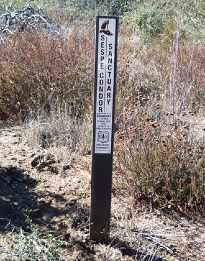
| Trail description: | Ojai Ranger District project to install carsonite Condor Sanctuary signs along the west boundary of the Alder Creek Trail. Â They are spaced every 1/4mile from the Dough Flat Trailhead to just past Cow Springs. Trail is in great shape to Cow Springs. And a report here from Valerie Norton about the project. |
| Mode of transport: | Array |
| Trail condition: | Good shape and easy to follow |
| Images: | Photo Ranger Heidi |
Alder Creek Trail Survey - 05-21-2015 - by Coyote Dave| Link: | Alder Creek Trail |
| Date: | 05-21-2015 |
| Surveyor Name: | Coyote Dave |
| Trail description: | Hiked Alder Creek Trail from Dough Flat to Alder Creek and continued on down Alder Creek to the Sespe. Â Trail was in great condition and easy to follow. Â No water at Squaw Flat but grape vines are starting to fruit. Â There is plenty of water at Cow Springs if you hike up the wash 30 yards or so. Â Dripping Springs was barely dripping but had water in the pools at its base. Â East Fork Alder Creek was dry. Â The main fork of Alder was flowing nicely all the way to the confluence with the Sespe. Â |
| Mode of transport: | Hike |
| Trail condition: | Good shape and easy to follow |
Alder Creek Trail Survey - 05-20-2015 - by Kara Hooper| Link: | Alder Creek Trail |
| Date: | 05-20-2015 |
| Surveyor Name: | Kara Hooper |
| Mode of transport: | Hike |
| Trail condition: | Hard to follow |
| Condition details: | from the junction with the MacDonald trail, the trail through the Alder Creekbed is hard to navigate. Also, once you get up out of the alder drainage and head into the Sespe, there is a very large slide that makes the trail difficult to navigate while on the side of the mountain. |
Alder Creek Trail Survey - 03-27-2015 - by Los Padres Forest Association| Link: | Alder Creek Trail |
| Date: | 03-27-2015 |
| Surveyor Name: | Los Padres Forest Association |
| Trail description: | A few reports from the Alder Creek Trail: - Back in December the CREW worked the first part of the trail from Dough Flat out to the Bucksnort Junction. - That portion of the trail is fantastic. - After leaving the Bucksnort the trail gets gradually worse but stays good until you get down to the McDonald Trail Junction. - After this point the trail gets much worse the short distance until you meet with the main Alder Creek Junction. - The trail is passable but needs lots of work from the McDonald Junction out to Alder Creek Camp and beyond to the Sespe |
| Mode of transport: | Hike |
| Trail condition: | Needs some work |
Alder Creek Trail Survey - 06-09-2014 - by M. Jones| Link: | Alder Creek Trail |
| Date: | 06-09-2014 |
| Surveyor Name: | M. Jones |
| Trail description: | Not much shade, full sun exposure on most of trail |
| Mode of transport: | Hike |
| Trail condition: | Good shape and easy to follow |
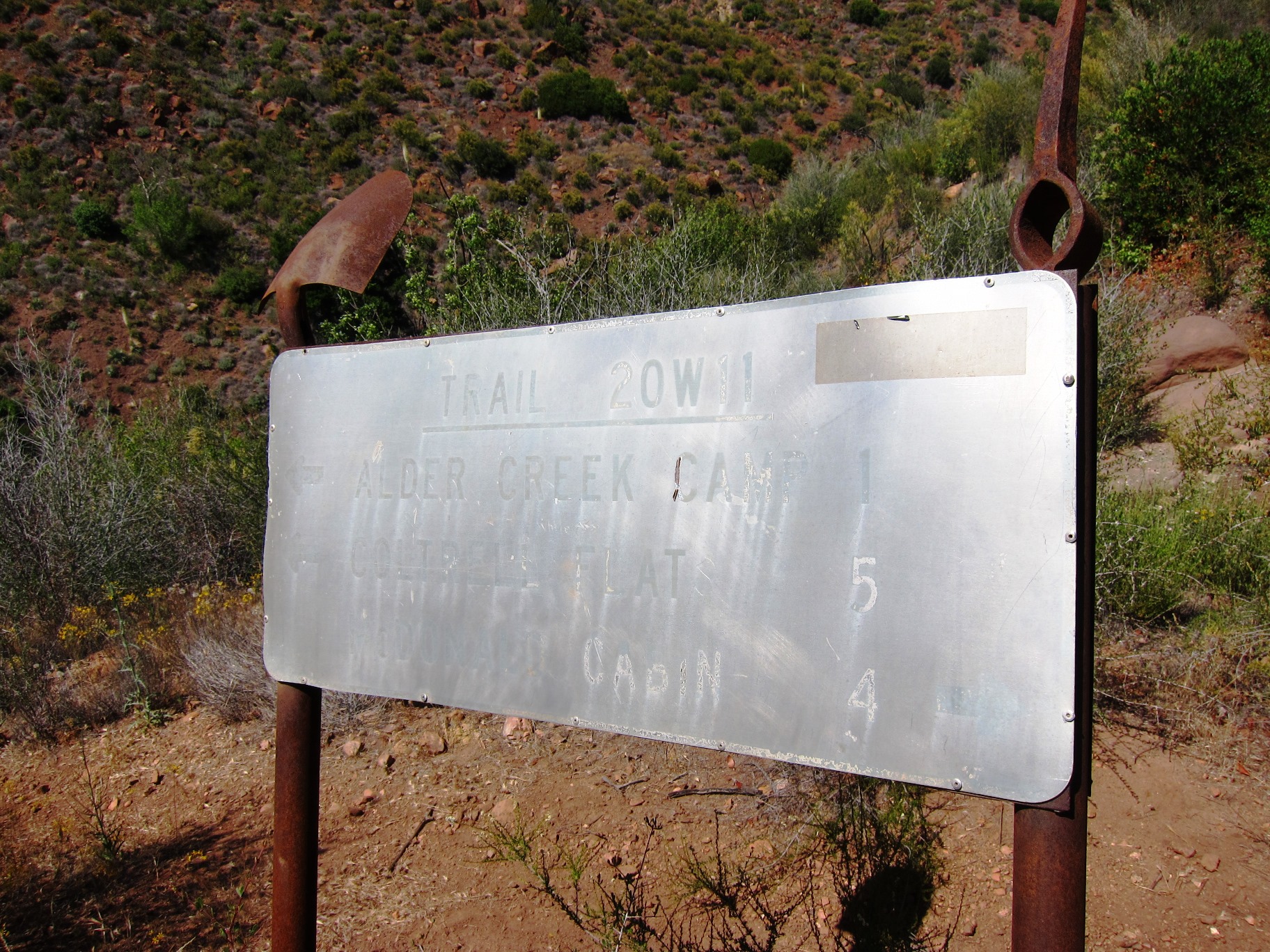
| Images: | Photo taken at approx. 4.5 mile mark, view south Photo taken at approx. 4.5 mile mark, view east toward Dough Flat Photo taken at approx. 5.5 mile mark, view north trail sign approx. 5.85 miles from Dough Flat |
Alder Creek Trail Survey - 06-09-2014 - by Los Padres Forest Association| Link: | Alder Creek Trail |
| Date: | 06-09-2014 |
| Surveyor Name: | Los Padres Forest Association |
| Trail description: | Dripping Spring Water Report:  June 9, 2014 The spring was "dripping", two large pools of water are present. Water quality ok, one pool had a film or sheen on the surface and smelled bad. Best place to pump would be the upper most small pool in the bed rock, water there was clean and clear. |
| Mode of transport: | Hike |
 Survey / Report Form - Please click this box to open the form.