 Use Marker Groups
 Wolf 2002
Piru 2003
Day 2006
Zaca 2007
Gap 2008
La Brea 2009

| Date | Surveyor | Water Report |
| 04-09-2021 | Christopher P. Lord | Stagnant |
| 02-20-2021 | Dylan | Dry |
| 06-29-2019 | Antonio Calderon | Flowing |
| 02-25-2016 | M Subbotin | Flowing |
| 10-02-2015 | Geoff | Trickle |
Bucksnort Spring is located just east of the Bucksnort Trail on the edge of the Sespe Condor Sanctuary. It has water year round during wet years but will dry up during the dry seasons or drought periods. The spring is along the Condor Trail.


 Bucksnort Spring Survey - 04-09-2021 - by Christopher P. Lord
| Link: | Bucksnort Spring |
| Date: | 04-09-2021 |
| Surveyor Name: | Christopher P. Lord |
| Camp Description: | https://christopherplord.blogspot.com/2021/04/the-agua-blanca-trail-dough-flat-to.html |
| Water Source: | Stagnant |
| Water Source Details: | |
| Weather Conditions: | |
| Images: | |
Bucksnort Spring Survey - 02-20-2021 - by Dylan| Link: | Bucksnort Spring |
| Date: | 02-20-2021 |
| Surveyor Name: | Dylan |
| Camp Description: | |
| Water Source: | Dry |
| Water Source Details: | Did not see any water at this spring |
| Weather Conditions: |
Bucksnort Spring Survey - 06-29-2019 - by Antonio Calderon| Link: | Bucksnort Spring |
| Date: | 06-29-2019 |
| Surveyor Name: | Antonio Calderon |
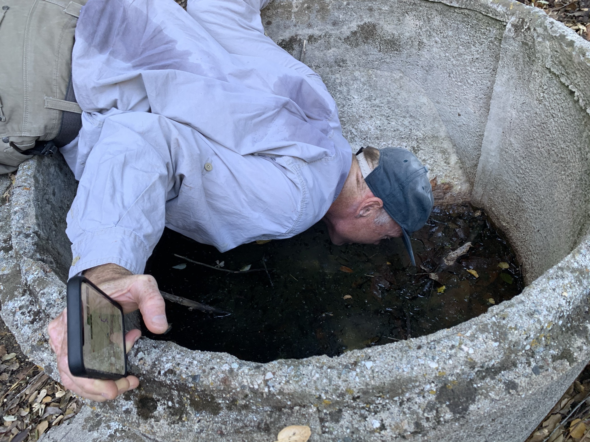
| Camp Description: | Stopped at Bucksnort Spring on our way back from Ant camp. We took a lunch break here and refilled our water bottles. There is a nice flat area with a fire ring with lots of shade. Spring was riddled with poison oak. The cistern had stagnant dirty water filled up with leaves. |
| Water Source: | Flowing |
| Water Source Details: | Ankle deep, cold with slow flow |
| Weather Conditions: | Sunny, hot in the low 90s |
| Images: | |
Bucksnort Spring Survey - 02-25-2016 - by M Subbotin| Link: | Bucksnort Spring |
| Date: | 02-25-2016 |
| Surveyor Name: | M Subbotin |
| Camp Description: | Spring is located at confluence of two small drainages and is identifiable from a distance by the lone, vertical Italian Cypress tree. Â There is a concrete cistern as well that contains stagnant water. Â Water quality from the spring is unknown |
| Water Source: | Flowing |
| Water Source Details: | shallow pools; pump or dig deeper in soft sand |
| Weather Conditions: | 70 & clear |
| Images: | Italian cypress from a distance concrete cistern flowing water |
Bucksnort Spring Survey - 10-02-2015 - by Geoff| Link: | Bucksnort Spring |
| Date: | 10-02-2015 |
| Surveyor Name: | Geoff |
| Camp Description: |
Access to the Bucksnort Spring will require you to trespass approximately 810 ft into the Sespe Condor Sanctuary. A much better water source is the Aqua Blanca Creek, if you can safely continue to hike the Bucksnort Trail without having to fill your water bottle. The location of the spring varies on different reference maps. This Internet site suggests the spring is located on a south facing slope on the north side of Stone Corral Creek, about 1,285 ft east of the Bucksnort Trail. I have not been to that location and therefore do not know if you will find water there. The location on the USGS topographic map suggests the spring is about 150 ft further downstream, near the intersection of the creek and a northeast-southwest trending drainage. I looked near this location but could not find any water. I found water in a south-north trending drainage about 970 ft east of the Bucksnort Trail. There is a well-used trail that parallels the creek on its south side, which leads to the drainage. It is basically at the first big trees that the trail leads to, and is about 200 ft west-southwest of the spring location shown on the USGS topographic map. The spring was a clear water trickle within the drainage. Would-be water pools were filled with leaf litter and decaying vegetation. The vegetation was easily pushed aside / removed to allow for collecting water. |
| Water Source: | Trickle |
| Water Source Details: | Clear water trickle, pools filled with leaf litter and decaying vegetation. |
| Weather Conditions: | Sunny, warm. |
| Images: | Looking south at the water trickle in the drainage. Water in the drainage downstream from the water trickle. |

 Survey / Report Form - Please click this box to open the form.