 Use Marker Groups
 Wolf 2002
Piru 2003
Day 2006
Zaca 2007
Gap 2008
La Brea 2009

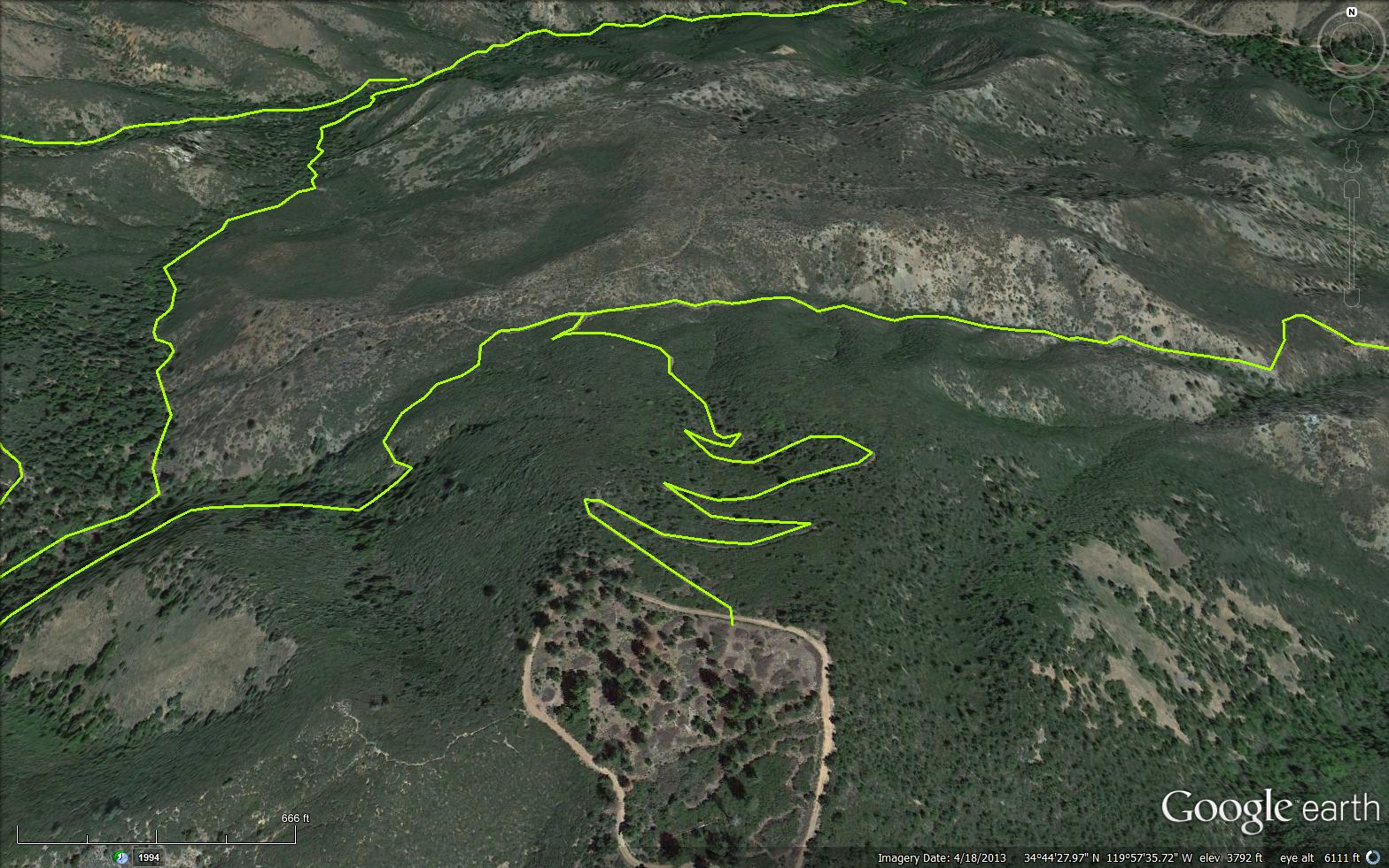
The Munch Canyon Connector Trail is a scenic .79 mile trail in Santa Barbara County. The trail connects the East Pinery Road (8N32) and the Munch Canyon Trail (29W04). Named after Mr. Munch who homesteaded in Sunset Valley. He built a cabin, then removed his claim and the Forest Service used the cabin as a winter Ranger Station for Edgar Davidson.
Please let us know if you have explored this trail recently.


 Munch Canyon Connector Trail Survey - 02-17-2024 - by ECDuzIt
| Link: | Munch Canyon Connector Trail |
| Date: | 02-17-2024 |
| Surveyor Name: | ECDuzIt |
| Trail description: | Trail is in pretty good shape. Brushing work was recently completed, some of the brush trimmings were on the trail and I threw them off the tread. A few small sections could use a minor amount of additional brushing work. Nice views! |
| Mode of transport: | Hike |
| Trail condition: | Good shape and easy to follow |
| Images: | |
Munch Canyon Connector Trail Survey - 04-26-2022 - by Stan Atchison| Link: | Munch Canyon Connector Trail |
| Date: | 04-26-2022 |
| Surveyor Name: | Stan Atchison |
| Trail description: | Hiked as part of a loop from East Pinery - White Rock - White Rock Connector - Munch Canyon - Munch Cyn Conn. - East Pinery. This one is pretty overgrown but I never felt like I was going to lose the trail. I did encounter a very large and upset rattle snake as the bottom of the switchbacks and had several ticks on me from the growth across the trail. |
| Mode of transport: | Hike |
| Trail condition: | Needs some work |
Munch Canyon Connector Trail Survey - 04-26-2021 - by Los Padres Forest Association| Link: | Munch Canyon Connector Trail |
| Date: | 04-26-2021 |
| Surveyor Name: | Los Padres Forest Association |
| Trail description: | The Munch Canyon Connector (29W10) was worked a good way down from the top but already has brush growing back into trail and could use another go. Unfortunately, they ran out of steam before the bottom of the trail and there are some rather thick stretches toward the lower end. The tread in places is still badly cratered by some horses that got on a too wet trail a couple of years ago. |
| Mode of transport: | Hike |
| Trail condition: | Needs some work |
Munch Canyon Connector Trail Survey - 12-06-2020 - by sbkah| Link: | Munch Canyon Connector Trail |
| Date: | 12-06-2020 |
| Surveyor Name: | sbkah |
| Trail description: | So starting from Davy Brown, there is moderate encroachment and several down trees that was fun to crawl over or under! Closer to the connector up to Pinnery became very brushy but followable. The section headed east after Pinnery Connector looked closed in but was flagged, we did not go that way! |
| Mode of transport: | Array |
| Trail condition: | Needs some work |
Munch Canyon Connector Trail Survey - 12-06-2020 - by Anonymous Surveyor| Link: | Munch Canyon Connector Trail |
| Date: | 12-06-2020 |
| Surveyor Name: | Anonymous Surveyor |
| Trail description: | The connector from Munch up to Pinnery Loop is very brushy but easy to follow. The tread at first is rutted by good as soon as switchbacks starts. Going up, the first half is closing in with scrub oak and requires pushing thru, then opens up. Someone had tried to cut back to clear, but needs finishing off. The very top before road is much better |
| Mode of transport: | Array |
| Trail condition: | Needs some work |
 Survey / Report Form - Please click this box to open the form.