 Use Marker Groups
 Wolf 2002
Piru 2003
Day 2006
Zaca 2007
Gap 2008
La Brea 2009

| Date | Surveyor | Water Report |
| 02-14-2021 | Antonio Calderon | Flowing |
| 12-05-2020 | Anonymous Surveyor | Trickle |
| 12-29-2019 | Christopher P. Lord | Flowing |
| 02-20-2019 | Anonymous Surveyor | Flowing |
| 02-16-2019 | Los Padres Forest Association | Flowing |
| 10-25-2018 | Los Padres Forest Association | Flowing |
| 06-10-2018 | Los Padres Forest Association | Trickle |
| 11-10-2017 | Oh Three | Flowing |
| 10-29-2017 | Peter | Trickle |
| 03-04-2017 | Craig R. Carey | Flowing |
| 01-16-2016 | Shaddus Maximus | Trickle |
| 04-07-2015 | Hike Los Padres | Trickle |
| 11-09-2014 | Los Padres Forest Association | Trickle |
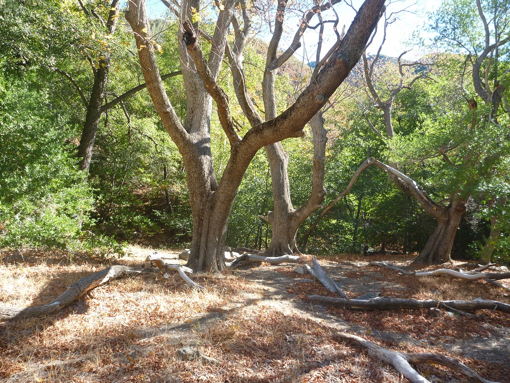
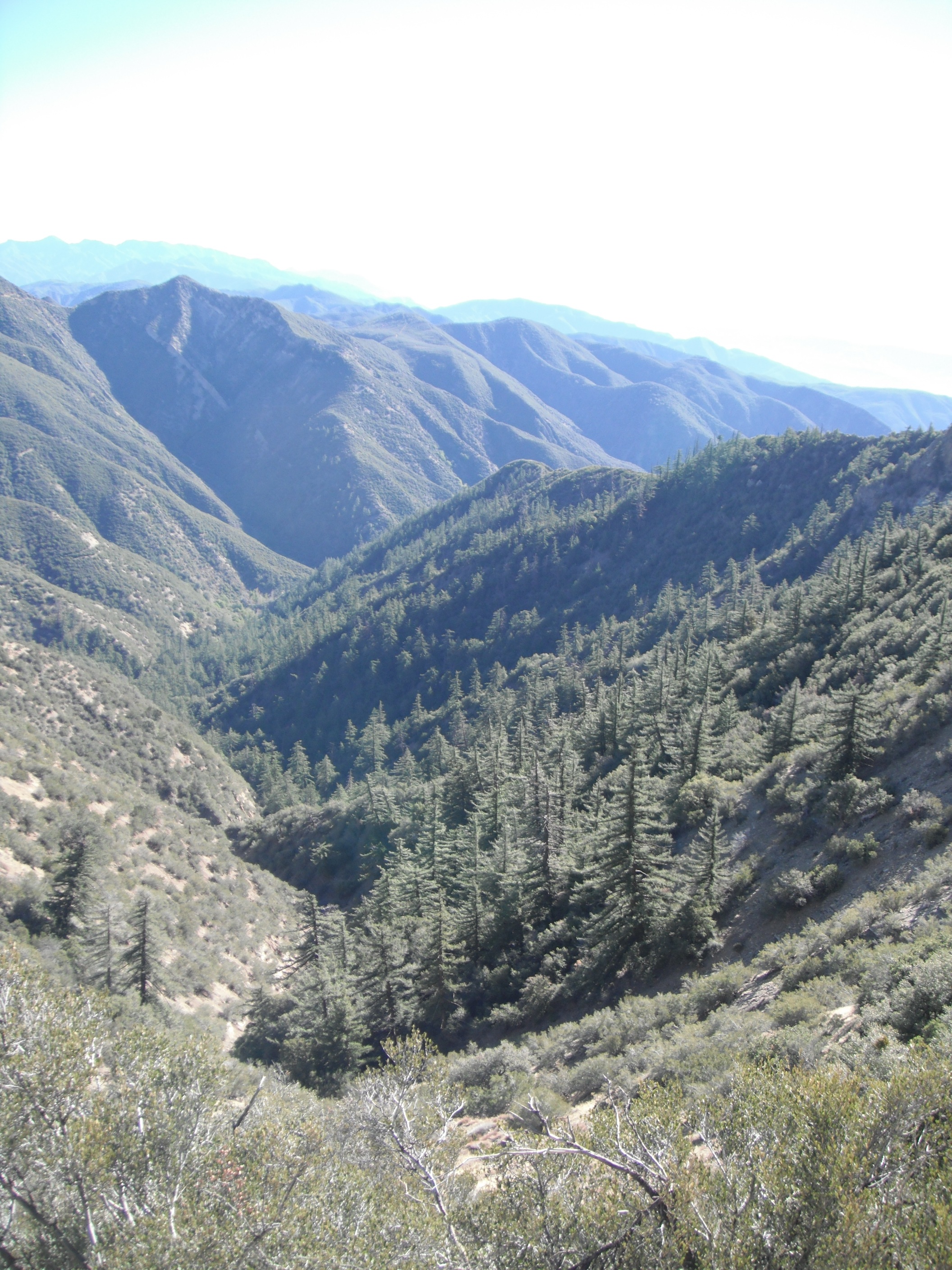
Named after the cluster of maple trees that call this part of the canyon home, Maple Camp is the highest camp along the Matilija Trail within the Matilija Wilderness. It has a few icecan stoves and is located near semi-reliable water. The camp is easiest accessed from the Cherry Creek Trailhead but is probably more commonly hiked to from the main Matilija Trailhead. The camp is very serene and pleasant, especially in the fall as the maples change colors and coat the ground in fallen leaves.
If you look at the overview canyon photo in this post, Maple is located at the bottom bend of the canyon. Great spot to say the least.


 Maple Camp Survey - 02-14-2021 - by Antonio Calderon
 | Link: | Maple Camp |
| Date: | 02-14-2021 |
| Surveyor Name: | Antonio Calderon |
| Camp Description: | Made our way to maple camp from lower matilija trailhead. Trail was in good shape to middle matillija. From middle Matilija to maple a bit of route finding is necessary. Beautiful trail with amazing views. Water wa flowing throughout the whole stretch. |
| Water Source: | Flowing |
| Water Source Details: | Good water flow |
| Weather Conditions: | 55 F windy sunny |
Maple Camp Survey - 12-05-2020 - by Anonymous Surveyor| Link: | Maple Camp |
| Date: | 12-05-2020 |
| Surveyor Name: | Anonymous Surveyor |
| Camp Description: | Beautiful site. Trail easy to lose going down/up hillside. Trial pretty overgrown in some areas. |
| Water Source: | Trickle |
| Water Source Details: | |
| Weather Conditions: | |
| Images: | |
Maple Camp Survey - 12-29-2019 - by Christopher P. Lord| Link: | Maple Camp |
| Date: | 12-29-2019 |
| Surveyor Name: | Christopher P. Lord |
| Camp Description: | Hiked up from matilija Trailhead to Maple Camp on Sunday 12/29/19. Camp Coordinates:   N34° 33' 43.2" W119° 21' 26.0" Water was flowing great and the Camp was covered in snow. A real winter wonderland. Site has a couple Ice Can Stoves and Steel grill grate. It was so nice up there I honestly never wanted to leave. Trail conditions detailed at the link below. |
| Water Source: | Flowing |
| Water Source Details: | |
| Weather Conditions: | |
| Images: | |
Maple Camp Survey - 02-20-2019 - by Anonymous Surveyor| Link: | Maple Camp |
| Date: | 02-20-2019 |
| Surveyor Name: | Anonymous Surveyor |
| Camp Description: | Maple camp is in fairly good condition. Water is flowing abundantly. Stayed there overnight. Pretty cold; 27 deg. when I woke up at 7 am. Came in through the north via Cherry Creek Road. |
| Water Source: | Flowing |
| Water Source Details: | Good flow |
| Weather Conditions: | Mid 30s on arrival (~4 pm), Mid 20s at night |
| Images: | My Campsite |
Maple Camp Survey - 02-16-2019 - by Los Padres Forest Association| Link: | Maple Camp |
| Date: | 02-16-2019 |
| Surveyor Name: | Los Padres Forest Association |
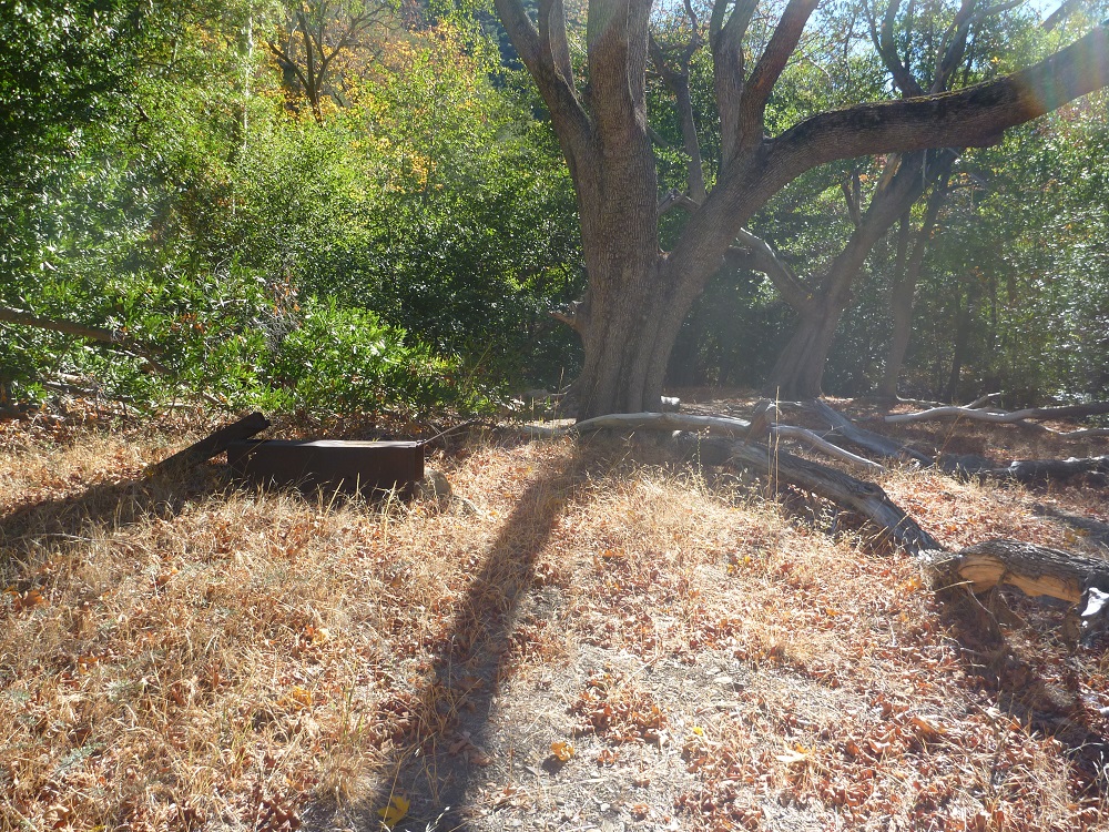
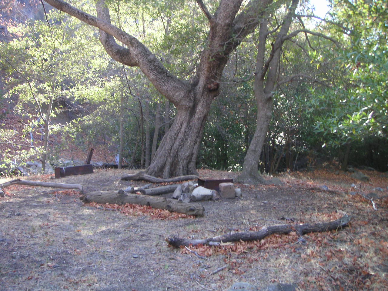
| Camp Description: | Maple looks fine. Nothing new to report. Ice cans remain, as do the other stove features. Lots of flat space to camp. |
| Water Source: | Flowing |
| Water Source Details: | Creek was ankle deep and flowing strong |
| Weather Conditions: | Snow flurries, cold, sunny, wind |
| Images: | Maple tree at Maple Camp Clear creek flowing strong, most of the water downstream was a light chocolate |
Maple Camp Survey - 10-25-2018 - by Los Padres Forest Association| Link: | Maple Camp |
| Date: | 10-25-2018 |
| Surveyor Name: | Los Padres Forest Association |
| Camp Description: | We surveyed Maple Camp on October 26 as part of a larger Thomas Fire trail inventory. Somehow, amazingly, Maple Camp was mostly spared by both the Thomas Fire but also the January 9 deluge. The raging water that night flowed around both sides of the campsite but did not cross the main camping area. Ice can stoves remain on site, maples alive and well and the fire rings intact. The trail to the camp from Ortega is followable but challenging - look for the fresh layer of flagging. The trail below Maple is gone and needs a lot of work. More on that to come..... |
| Water Source: | Flowing |
| Water Source Details: | Good water flowing through Maple Camp. |
| Weather Conditions: | Chilly in the shade and warm in the sun, mid 70's and sunny. |
| Images: | Approach to Maple, the water flowed around on both the left (normal creek) and the right. The ice can stoves at Maple, hanging tough. The creek is a bit challenging to get to, but once there you'll find nice water. |
Maple Camp Survey - 06-10-2018 - by Los Padres Forest Association| Link: | Maple Camp |
| Date: | 06-10-2018 |
| Surveyor Name: | Los Padres Forest Association |
| Camp Description: | Report from recent trail survey: Maple Camp is quite inundated with mostly small diameter downed trees. |
| Water Source: | Trickle |
| Water Source Details: | |
| Weather Conditions: |
Maple Camp Survey - 11-10-2017 - by Oh Three| Link: | Maple Camp |
| Date: | 11-10-2017 |
| Surveyor Name: | Oh Three |
| Camp Description: | Beautiful rarely used camp. It's a mere 45 minutes downhill from the trailhead, assuming you can drive the length of Cherry Creek Road. 4-wheel drive needed. Almost the entire camp is covered with grass. Only around the fireplace (NOT USED! due to Level III Fire Danger) is the vegetation trampled into raw dirt. We spread 15 people out over close to 100'. The moon didn't rise until midnight so we had the Milky Way, and shooting stars, above us. The creek is dry north (upstream) of the camp. Water starts flowing right where the fireplace is, but water starts flowing rather whole-heartedly. So water is actually between a trickle and "flowing." There's plenty of small pools to pump and filter. Our Scouts cooked their meals on the gravel and rocks down by the stream, to avoid having to clear 5' circles free of flammable materials in the camp. "Leave No Trace."Â Cuidado! The trail is overgrown and washed out both above and below the camp, so good trail skills are needed. Not at all impassible, it just requires paying attention. |
| Water Source: | Flowing |
| Water Source Details: | |
| Weather Conditions: | Slight clouds, 45 degrees at night. Perfect! |
| Images: | |
Maple Camp Survey - 10-29-2017 - by Peter| Link: | Maple Camp |
| Date: | 10-29-2017 |
| Surveyor Name: | Peter |
| Camp Description: | |
| Water Source: | Trickle |
| Water Source Details: | Dry but slightly flowing at the campsite. |
| Weather Conditions: |
Maple Camp Survey - 03-04-2017 - by Craig R. Carey| Link: | Maple Camp |
| Date: | 03-04-2017 |
| Surveyor Name: | Craig R. Carey |
| Camp Description: | The intrepid mountain men of Boy Scout Troop 111
(Ventura) backpacked the length of the Upper North Fork (from Cherry Creek Road
at Hwy 33 to lower Matilija TH) Friday 3/3 to Sunday 3/5. Maple camp in great shape (and green!); boys cleared some downfall to allow plenty of space. Great water. |
| Water Source: | Flowing |
| Water Source Details: | Fast and clear! |
| Weather Conditions: | Cool and sunny |
| Images: | Scouts clearing debris at Maple, courtesy Sr Avila Ice Can Stove at Maple, courtesy Sr Avila |
Maple Camp Survey - 01-16-2016 - by Shaddus Maximus | Link: | Maple Camp |
| Date: | 01-16-2016 |
| Surveyor Name: | Shaddus Maximus |
| Camp Description: | |
| Water Source: | Trickle |
| Water Source Details: | Barely a slight trickle of water immediately at Maple, but there are a few small pools from which you can filter. Much more water in the creek just below Maple. |
| Weather Conditions: |
Maple Camp Survey - 04-07-2015 - by Hike Los Padres| Link: | Maple Camp |
| Date: | 04-07-2015 |
| Surveyor Name: | Hike Los Padres |
| Camp Description: | As per the Ojai Ranger District: |
| Water Source: | Trickle |
| Water Source Details: | |
| Weather Conditions: |
Maple Camp Survey - 11-09-2014 - by Los Padres Forest Association| Link: | Maple Camp |
| Date: | 11-09-2014 |
| Surveyor Name: | Los Padres Forest Association |
| Camp Description: | While there is moving water at Maple, it emerges out of the ground and is only a trickle. A cup is needed to
gather the water and poor it into larger vessels. |
| Water Source: | Trickle |
| Water Source Details: | |
| Weather Conditions: | |
| Images: | Maple Camp Maple Camp |
 Survey / Report Form