 Use Marker Groups
 Wolf 2002
Piru 2003
Day 2006
Zaca 2007
Gap 2008
La Brea 2009

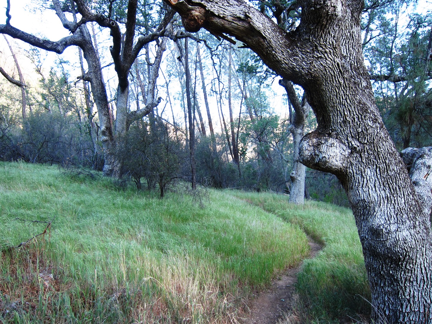
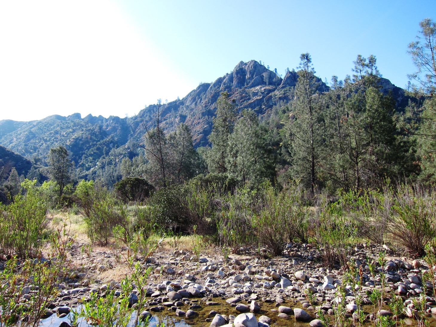
The East Trail (31W13.2) follows the Mazana canyon east to the narrows, then climbs over the Hurricane Deck at White Ledge to end at South Fork Guard Station on the Sisquoc River. Access the trial from Nira Campground via Sunset Valley Road.
MANZANA - A Spanish word for little apples. In the Manzana area it possibly refers to the large number of Manzanita bushes that grow along parts of the creek.


 Manzana Trail East (Upper) Survey - 01-28-2026 - by Anonymous Surveyor
| Link: | Manzana Trail East (Upper) |
| Date: | 01-28-2026 |
| Surveyor Name: | Anonymous Surveyor |
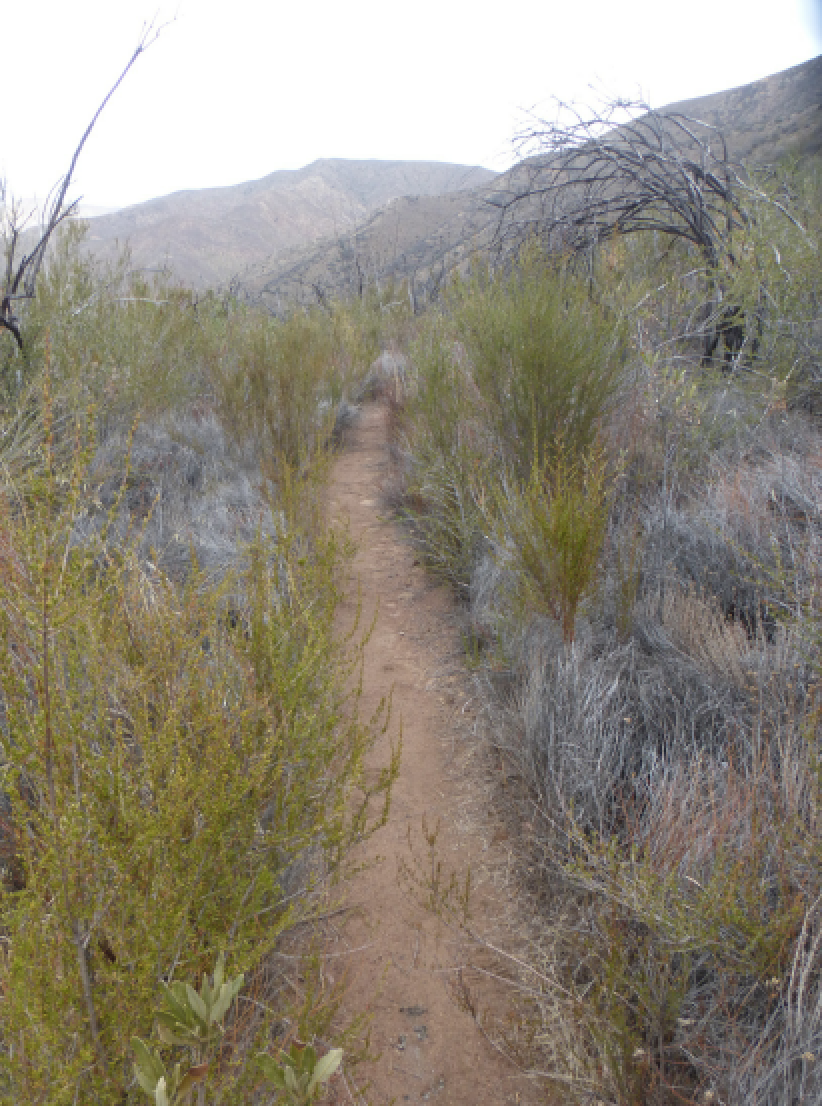
| Trail description: | The section between Alcove Camp and the confluence of White Ledge Creek and the SF Sisquoc had a few slightly challenging spots routefinding-wise, but otherwise pretty straightforward. Not really any significant bushwhacking or blow-outs. |
| Mode of transport: | Hike |
| Trail condition: | Good shape and easy to follow |
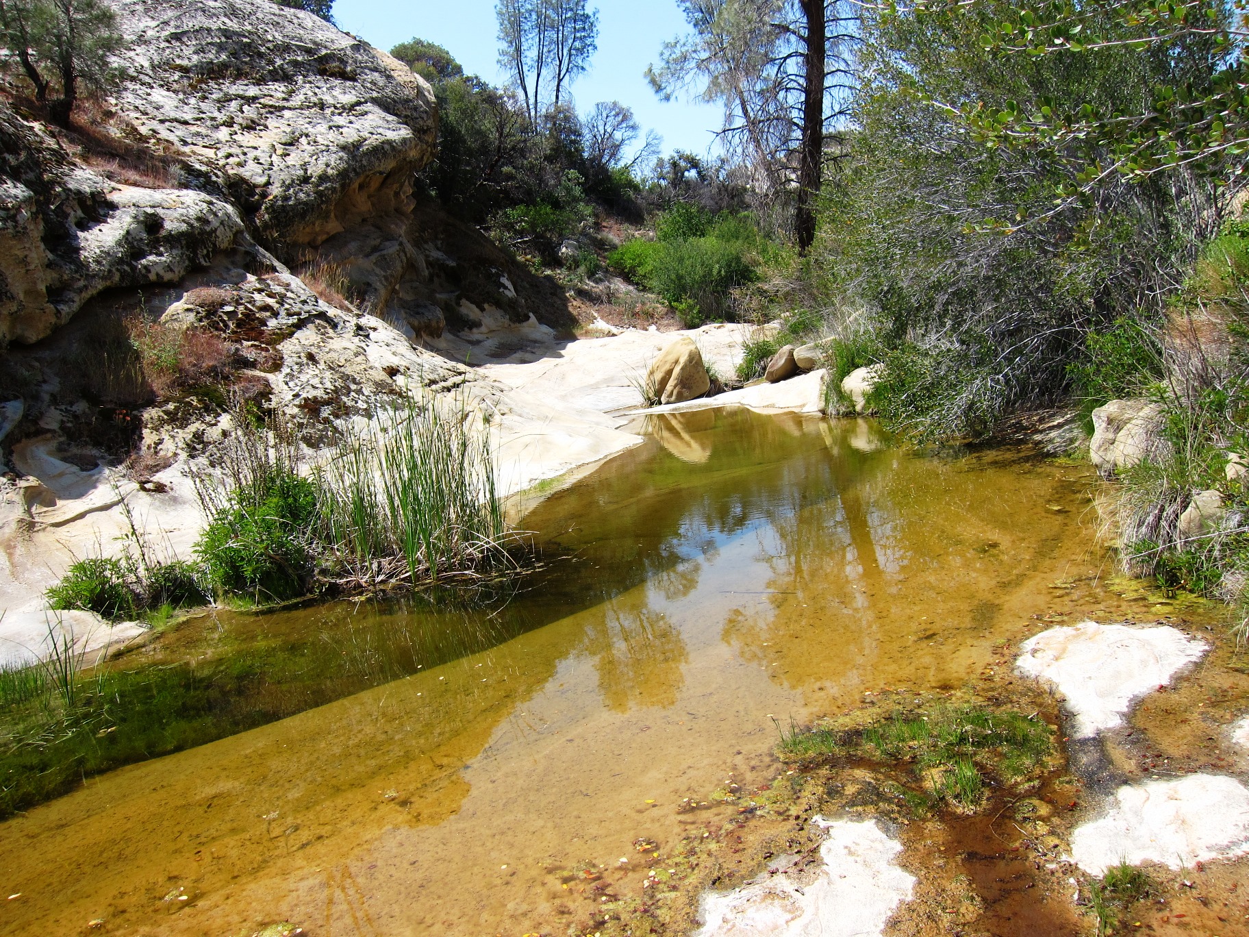
| Images: | Manzana Narrows falls and pool. Alcove Camp From under the Alcove. |
Manzana Trail East (Upper) Survey - 09-22-2024 - by Los Padres Forest Association| Link: | Manzana Trail East (Upper) |
| Date: | 09-22-2024 |
| Surveyor Name: | Los Padres Forest Association |
| Trail description: | Another interesting article by Dan McCaslin: https://www.noozhawk.com/dan-mccaslin-upper-manzana-creek-trail-offers-escape-from-fire-ravaged-backcountry/ Always nice to record these in the living history of the Los Padres. |
| Mode of transport: | Hike |
| Trail condition: | Good shape and easy to follow |
Manzana Trail East (Upper) Survey - 04-28-2024 - by Anonymous Surveyor| Link: | Manzana Trail East (Upper) |
| Date: | 04-28-2024 |
| Surveyor Name: | Anonymous Surveyor |
| Trail description: | Trail is in great shape to the narrows thanks to the trail crews. 15 crossings are ankle to thigh deep. |
| Mode of transport: | Hike |
| Trail condition: | Good shape and easy to follow |
Manzana Trail East (Upper) Survey - 04-21-2024 - by Ian Evans| Link: | Manzana Trail East (Upper) |
| Date: | 04-21-2024 |
| Surveyor Name: | Ian Evans |
| Trail description: | Erin Carroll's report is spot on, so not much to add. From Nira to Manzana Narrows your feet will get wet, and some crossings meant knee-high (or higher) rushing water. It's nice to see this much flow after the drought years. |
| Mode of transport: | Hike |
| Trail condition: | Good shape and easy to follow |
| Images: | Below Manana Camp. Rays Camp |
Manzana Trail East (Upper) Survey - 04-21-2024 - by Erin Carroll| Link: | Manzana Trail East (Upper) |
| Date: | 04-21-2024 |
| Surveyor Name: | Erin Carroll |
| Trail description: | South Fork to White Ledge can be a bit rough in some areas with a few downed trees, brushy sections, etc, but totally passable. White Ledge to Nira it is clear how much work LPFA has put into the trail. Bravo! My favorite section is White Ledge to Manzana Narrows. That is a special piece of trail. Some of the crossings are a little sketchy right now due to the strong water current. |
| Mode of transport: | Hike |
| Trail condition: | Good shape and easy to follow |
| Images: | |
Manzana Trail East (Upper) Survey - 04-20-2024 - by Daniel J. Hall| Link: | Manzana Trail East (Upper) |
| Date: | 04-20-2024 |
| Surveyor Name: | Daniel J. Hall |
| Trail description: | Went only from NIRA to Rays Camp. Trail in good shape and easy to follow. There were, however, a few minor brush and tread problems developing, primarily in the last mile before Rays Camp. Backpacked it April 16 - 18, only 3 to 5 days after the latest storm, and Manzana Creek was still running high and fast in places. However, the water was clear and there was lots of bright green grass on the mountainsides. Lost Valley, Fish and Rays Camps were all in good shape. For more detail see the captioned photos at https://tinyurl.com/23qymttq |
| Mode of transport: | Hike |
| Trail condition: | Good shape and easy to follow |
Manzana Trail East (Upper) Survey - 04-04-2024 - by Ryan Hubbard| Link: | Manzana Trail East (Upper) |
| Date: | 04-04-2024 |
| Surveyor Name: | Ryan Hubbard |
| Trail description: | It was quite ironic at exit when I saw the horse trailer at the Nira trailhead with "Trail Maintenance Project" passes on the dashboard, and one truck had the LPFA logo on the door. The workers were there clearing brush up to Happy Hunting (thanks!), but the horses they rode in on are doing major damage to the trail surface itself. One step forward, three back. Not efficient... The horses were being tied up at Alcove camp and were destroying the muddy trail in to the camp and all around the tie up zone. I know that horses have a place in the forest, but they really should be restricted until after the trails dry and can handle the heavy traffic. Just a couple of horses on those wet clay trails this week have done more damage in a few days than hikers would do in many years. |
| Mode of transport: | Hike |
| Trail condition: | Needs some work |
| Condition details: | Lots of damage to the trail surface from horses. Several spots on the steeper slopes where the horses have pushed the trail down the hill. |
Manzana Trail East (Upper) Survey - 01-27-2024 - by Tony G.| Link: | Manzana Trail East (Upper) |
| Date: | 01-27-2024 |
| Surveyor Name: | Tony G. |
| Trail description: | I hiked from Nira to Fish Camp and returned as part of an all day hike back up Davey Brown trail to the top at Figueroa Mountain Road. The water in Manzana Creek is flowing solidly. The crossings at Nira and at Fish Camp are possible to do with dry feet, although with the rains coming this week that may change. There was plenty of water flowing from Fish Creek as well. Also there was good flow coming out of Lost Valley and the creek that flows into the Manzana. I did not walk up Lost Valley but gauging from the flow in the creek, I am speculating that there is good water up the canyon, probably to the Twin Oaks camp. |
| Mode of transport: | Hike |
| Trail condition: | Good shape and easy to follow |
Manzana Trail East (Upper) Survey - 06-03-2023 - by Los Padres Forest Association| Link: | Manzana Trail East (Upper) |
| Date: | 06-03-2023 |
| Surveyor Name: | Los Padres Forest Association |
| Trail description: | Dan McCaslin article highlighting much of the LPFA work completed this spring along the Manzana: https://www.noozhawk.com/dan-mccaslin-hiking-along-the-roaring-manzana-creek-to-fish-creek-camp/ |
| Mode of transport: | Hike |
| Trail condition: | Needs some work |
Manzana Trail East (Upper) Survey - 06-04-2023 - by Anonymous Surveyor| Link: | Manzana Trail East (Upper) |
| Date: | 06-04-2023 |
| Surveyor Name: | Anonymous Surveyor |
| Trail description: | Nira to South Fork. Nira to Happy Hunting is in mostly good shape, after that the trail becomes very overgrown, creek crossings are difficult, and the trail is hard to follow. No rattlesnakes, however lots of other reptiles, very few ticks, poison oak is there but avoidable. |
| Mode of transport: | Hike |
| Trail condition: | Hard to follow |
| Condition details: | Happy Hunting to South Fork is very overgrown and hard to follow |
Manzana Trail East (Upper) Survey - 05-21-2023 - by Anonymous Surveyor| Link: | Manzana Trail East (Upper) |
| Date: | 05-21-2023 |
| Surveyor Name: | Anonymous Surveyor |
| Trail description: | 90% of the trail from Nira to manzana narrows is in great shape. A few small washouts and sections of brushy plants. poison oak begins after fish camp. No rattlesnake or tick sightings. Creek crossings were mostly low and had rocks or logs to hop across. Plenty of swimming holes. All camps were full |
| Mode of transport: | Hike |
| Trail condition: | Good shape and easy to follow |
Manzana Trail East (Upper) Survey - 05-04-2023 - by Jimmy Cooper| Link: | Manzana Trail East (Upper) |
| Date: | 05-04-2023 |
| Surveyor Name: | Jimmy Cooper |
| Trail description: | The trail to Manzana narrows is in good shape and easy to follow. Trail from Manzana Narrows to Happy Hunting ground needs a little work but is easy to follow. From Happy Hunting Ground to White Ledge is brushy in manny areas. Trail from White Ledge to Southfork Station is in bad shape. The trail is very brushy and there is a major washout of the trail about 1/4 of a mile before Lonnie Davis. |
| Mode of transport: | Hike |
| Trail condition: | Hard to follow |
| Condition details: | From Nira to Southfork Station |
Manzana Trail East (Upper) Survey - 04-29-2023 - by Dan Stocks| Link: | Manzana Trail East (Upper) |
| Date: | 04-29-2023 |
| Surveyor Name: | Dan Stocks |
| Trail description: | Hiked from Southfork out to Nira. The first part of trail is in rough shape. Multiple trees matted down, washouts, overgrown from the first stream crossing past the cabin to about a half mile after Lonnie Davis. Trail gets better but needs to be brushed to White Ledge. From White Ledge to Nira the trail is in pretty good shape. A washout at the bottom of the hill below the Alcove just before the narrows. Some unavoidable poison oak. Lots of water everywhere. I know this report is backwards from the way it gets hiked most of the time but that is the way we hiked it. Read it from the bottom up if your coming from Nira. |
| Mode of transport: | Hike |
| Trail condition: | Needs some work |
| Condition details: | Southfork Cabin to Nira |
Manzana Trail East (Upper) Survey - 04-23-2023 - by Chris Chirgwin| Link: | Manzana Trail East (Upper) |
| Date: | 04-23-2023 |
| Surveyor Name: | Chris Chirgwin |
| Trail description: | Hiked from Nira to Manzana Narrows on April 23. The trail is mostly in decent condition with a handful of areas around Manzana Camp that need some work. Most of the river crossing were knee deep. |
| Mode of transport: | Hike |
| Trail condition: | Needs some work |
| Condition details: | Hiked from Nira to Manzana Narrows on April 23, 2023 |
Manzana Trail East (Upper) Survey - 06-13-2022 - by M. Davidson| Link: | Manzana Trail East (Upper) |
| Date: | 06-13-2022 |
| Surveyor Name: | M. Davidson |
| Trail description: | Hiked from Nira trailhead to about a mile past Fish Creek camp. Trail in good condition except for a few spots on hillsides where man-made support is deteriorating. Trail was very easy to follow. Soon after Nira there were some fairly stagnant pools of water. Minimal flowing water in Manzana creek at Lost Valley camp, but enough to filter for drinking and cooking. Creek completely dry upstream from Lost Valley camp as far as I hiked. |
| Mode of transport: | Hike |
| Trail condition: | Needs some work |
Manzana Trail East (Upper) Survey - 04-23-2022 - by Ojai Valley School Lower Campus| Link: | Manzana Trail East (Upper) |
| Date: | 04-23-2022 |
| Surveyor Name: | Ojai Valley School Lower Campus |
| Trail description: | Trail is easy to follow for the average backpacker and in good condition. |
| Mode of transport: | Hike |
| Trail condition: | Good shape and easy to follow |
Manzana Trail East (Upper) Survey - 07-19-2021 - by Stan Atchison| Link: | Manzana Trail East (Upper) |
| Date: | 07-19-2021 |
| Surveyor Name: | Stan Atchison |
| Trail description: | Hiked from Nira to Fish Camp. Trail is in great shape. Several stagnant pools of water in the creek before Lost Valley Camp. Dry after that. |
| Mode of transport: | Hike |
| Trail condition: | Good shape and easy to follow |
Manzana Trail East (Upper) Survey - 02-06-2021 - by Kevin Varga| Link: | Manzana Trail East (Upper) |
| Date: | 02-06-2021 |
| Surveyor Name: | Kevin Varga |
| Trail description: | Great trail, the longest stretch without flowing water was less than a mile |
| Mode of transport: | Hike |
| Trail condition: | Good shape and easy to follow |
Manzana Trail East (Upper) Survey - 12-04-2020 - by John Borstelmann| Link: | Manzana Trail East (Upper) |
| Date: | 12-04-2020 |
| Surveyor Name: | John Borstelmann |
| Trail description: | Trail was great! Walked both ways from NIRA to South Fork. Water flowing between Ray's camp and Manzana Narrows camp. Some stagnant pools near Happy Hunting Ground camp and White Ledge camp but otherwise dry between Narrows and South Fork camp. |
| Mode of transport: | Hike |
| Trail condition: | Good shape and easy to follow |
Manzana Trail East (Upper) Survey - 11-28-2020 - by Duane Waite| Link: | Manzana Trail East (Upper) |
| Date: | 11-28-2020 |
| Surveyor Name: | Duane Waite |
| Trail description: | The Manzana Trail is its usual awesome self, though I need to remember that it is a hiking trail, not a running trail. No matter how hard I try, it takes a full two hours to "run" to Manzana Narrows, and it's less than seven miles! That being said, there are minor blowdowns between Lost Valley and Fish Camps, and a partial trail washout about 1/2 mile West of Fish Camp. |
| Mode of transport: | Hike |
| Trail condition: | Good shape and easy to follow |
Manzana Trail East (Upper) Survey - 10-13-2019 - by Tony G.| Link: | Manzana Trail East (Upper) |
| Date: | 10-13-2019 |
| Surveyor Name: | Tony G. |
| Trail description: | Did a quick overnight trip from Nira to Manzana Narrows Camp. Water was flowing the entire length with the exception of about one mile on either side of Fish Camp. Good flow at Lost Valley, Rays, Manzana and Manzana Narrows camps. Weather was clear, slightly breezy, highs low to mid 80's, lows upper 40's. Little brush overgrowth and a clear tread on the trail. |
| Mode of transport: | Hike |
| Trail condition: | Good shape and easy to follow |
Manzana Trail East (Upper) Survey - 06-06-2019 - by Anonymous Surveyor| Link: | Manzana Trail East (Upper) |
| Date: | 06-06-2019 |
| Surveyor Name: | Anonymous Surveyor |
| Trail description: | We planned to hike the trail through to White Ledge over the course of two nights, however an injury prevented us from making it that far. We did make it to Manzana Camp and the trail was very easy to follow. There were about 8 stream crossings on the way to Manzana Camp, many of which had logs placed for walking, and none of which were deeper than calf length. The area is still very verdant and alive, probably due to fairly recent rains. It was a beautiful hike. It is worth mentioning that the two days we were on this trail had some of the worst flies I've ever encountered. From dawn till dusk they were swarming anytime we stopped moving. Given that many seemed young, it's clear that this is probably just unfortunate timing of a recent hatch, and probably will disperse in a few days. I also picked four ticks off of me, so be sure to bring bug spray and possibly even a net for the flies. |
| Mode of transport: | Hike |
| Trail condition: | Good shape and easy to follow |
Manzana Trail East (Upper) Survey - 05-24-2019 - by Thomas Meissner| Link: | Manzana Trail East (Upper) |
| Date: | 05-24-2019 |
| Surveyor Name: | Thomas Meissner |
| Trail description: | Trail is good and easy to follow in most parts. On the descend into White Ledge Canyon about 1/2 mile before Happy Hunting Ground there is a short washout. A detour has been marked with flags. The narrow canyon stretch before White Ledge Camp has some flooding. The last mile before South Fork is a bit overgrown. |
| Mode of transport: | Hike |
| Trail condition: | Good shape and easy to follow |
Manzana Trail East (Upper) Survey - 02-23-2019 - by M Schless| Link: | Manzana Trail East (Upper) |
| Date: | 02-23-2019 |
| Surveyor Name: | M Schless |
| Trail description: | Hiked from Nira to Manzana Camp and back on Fri 2/22 and Sat 2/23. Trail is in great condition. First mile out of Nira had some flooding on trail on Friday but looks like it was worked on on Saturday before we walked out. Large downed Oak tree on the flat stretch after Sulphur Springs Canyon before heading uphill. Water crossings were knee deep for the deepest ones, and some required going upstream a bit to find slower moving water to cross through. Cold overnight at Manzana Camp at 23 degrees. |
| Mode of transport: | Hike |
| Trail condition: | Good shape and easy to follow |
| Images: | Coming from Fish Camp Up trail from blockage Trunk of the downed tree |
Manzana Trail East (Upper) Survey - 01-26-2019 - by Daniel Smith| Link: | Manzana Trail East (Upper) |
| Date: | 01-26-2019 |
| Surveyor Name: | Daniel Smith |
| Trail description: | Hiked out to fish camp for an overnight. Most of the trail looks good. On our way out i came up on a sycamore tree that had fallen across the trail near lost valley camp. Some slides as well. Probably worse since last night's rain. (02/02/19)Â |
| Mode of transport: | Hike |
| Trail condition: | Good shape and easy to follow |
| Images: | |
Manzana Trail East (Upper) Survey - 03-18-2017 - by Los Padres Forest Assocation| Link: | Manzana Trail East (Upper) |
| Date: | 03-18-2017 |
| Surveyor Name: | Los Padres Forest Assocation |
| Trail description: | Article posted in Noozhawk: |
| Mode of transport: | Hike |
| Trail condition: | Good shape and easy to follow |
Manzana Trail East (Upper) Survey - 12-30-2018 - by Erin C.| Link: | Manzana Trail East (Upper) |
| Date: | 12-30-2018 |
| Surveyor Name: | Erin C. |
| Trail description: | Manzana trail is in great shape. Just two downed oak trees between Manzana Camp and Fish Creek camp. Water is super plentiful, except around Fish Creek Camp, there is no surface water. |
| Mode of transport: | Hike |
| Trail condition: | Good shape and easy to follow |
| Images: | |
Manzana Trail East (Upper) Survey - 11-03-2018 - by Tony G.| Link: | Manzana Trail East (Upper) |
| Date: | 11-03-2018 |
| Surveyor Name: | Tony G. |
| Trail description: | Water found approximately 1/4 mi above Manzana Camp all the way to Manzana Narrows Camp. Some good deep pools. Also water found approximately 1/4 mi above Alcove Camp on Manzana Trail on the way to Happy Hunting Ground Camp. Water in this location is on the trail just before the narrows leading up to the plateau we call the "Chumash Upper World" . Saw no other parties in two days out and back from Nira |
| Mode of transport: | Hike |
| Trail condition: | Good shape and easy to follow |
Manzana Trail East (Upper) Survey - 05-22-2018 - by Los Padres Forest Association| Link: | Manzana Trail East (Upper) |
| Date: | 05-22-2018 |
| Surveyor Name: | Los Padres Forest Association |
| Trail description: | Recent Noozhawk article by Dan McCaslin featuring the Manzana Trail, enjoy! https://www.noozhawk.com/article/dan_mccaslin_white_ledge_formations_above_manzana_narrows_20180522 |
| Mode of transport: | Hike |
| Trail condition: | Good shape and easy to follow |
Manzana Trail East (Upper) Survey - 04-15-2018 - by alex stone| Link: | Manzana Trail East (Upper) |
| Date: | 04-15-2018 |
| Surveyor Name: | alex stone |
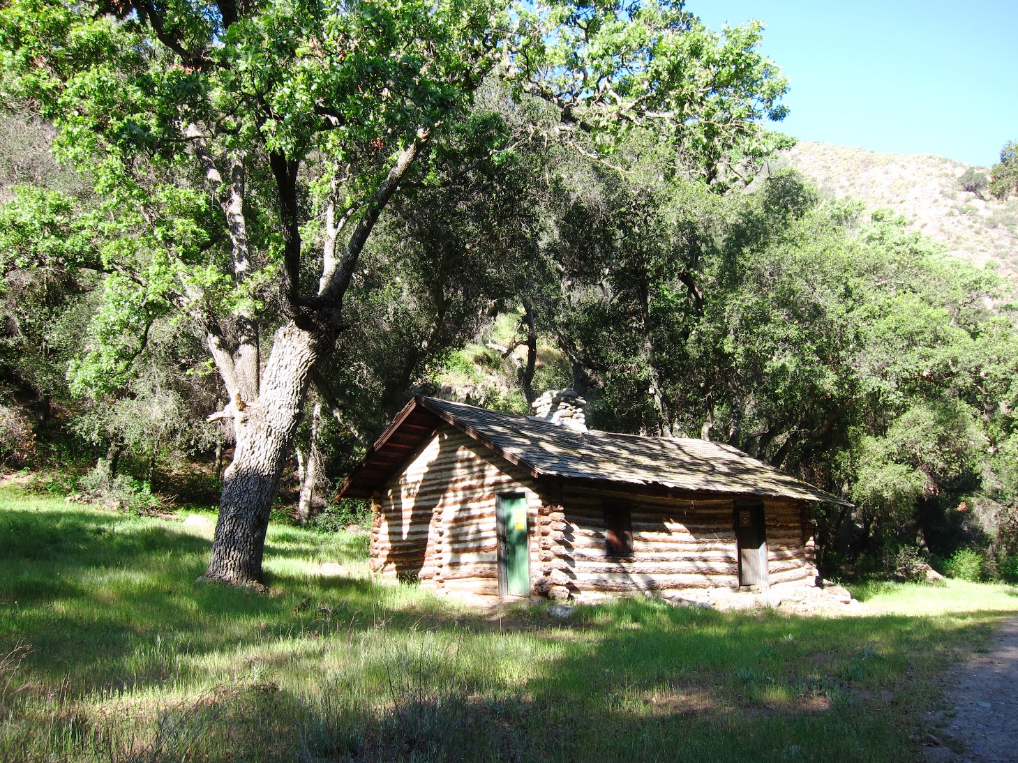
| Trail description: | Nira>South Fork Station .Plenty of Water to Nira to Narrows, oak tree down on trail before Big Cone Spruce trailhead, Water flowing at White Ledge and Happy Hunting campgrounds. Perfect time to explore the backcountry. The Cabin is in great shape lets hope it stays that way for years to come. Also the Sisquoc is flowing nicely. Thanks again Rik and Paul and the other folks who have made the cabin what it is today. |
| Mode of transport: | Hike |
| Trail condition: | Good shape and easy to follow |
| Images: | |
Manzana Trail East (Upper) Survey - 03-25-2018 - by Miner| Link: | Manzana Trail East (Upper) |
| Date: | 03-25-2018 |
| Surveyor Name: | Miner |
| Trail description: | Had I great backpack trip from Nira to Happy Hunting Grounds camp and back. Trail was easy to follow and there is plenty of water where you'd expect it and in some places you maybe weren't as it was even in several places near the high point between Manzana Narrows and Happy Hunting Grounds. Hard to keep your feet dry though.  A few small trees across the trail past Manzana Camp that are easy to get around. |
| Mode of transport: | Hike |
| Trail condition: | Good shape and easy to follow |
| Images: | Short distance east of Manzana Trail Camp (6 minute hike) 40 minutes hike east of Manzana Trail Camp in the narrows. I think it was just past Manzana Narrows Trail camp. |
Manzana Trail East (Upper) Survey - 1-12-2018 - by Los Padres Forest Association| Link: | Manzana Trail East (Upper) |
| Date: | 1-12-2018 |
| Surveyor Name: | Los Padres Forest Association |
| Trail description: | Trail is in great shape from NIRA to South Fork and holding up nicely after being worked in spring 2017 by LPFA crews. |
| Mode of transport: | Hike |
| Trail condition: | Good shape and easy to follow |
| Images: | Sign at Junction of Manzana and Sisquoc Trails Manzana Trail between White Ledge and Lonnie Davis |
Manzana Trail East (Upper) Survey - 01-27-2018 - by Andrew| Link: | Manzana Trail East (Upper) |
| Date: | 01-27-2018 |
| Surveyor Name: | Andrew |
| Trail description: | Manzana Creek running well between Manzana Narrows and Lost Valley with the exception of the area around Fish Creek Camp. Trail is in great shape. |
| Mode of transport: | Hike |
| Trail condition: | Good shape and easy to follow |
Manzana Trail East (Upper) Survey - 04-24-2017 - by Los Padres Forest Association| Link: | Manzana Trail East (Upper) |
| Date: | 04-24-2017 |
| Surveyor Name: | Los Padres Forest Association |
| Trail description: | Noozhawk author Dan McCaslin writes about his latest backpack along the upper Manzana Trail. Â Have at it: https://www.noozhawk.com/article/dan_mccaslin_happy_hunting_ground_camp_041917 |
| Mode of transport: | Hike |
| Trail condition: | Good shape and easy to follow |
Manzana Trail East (Upper) Survey - 02-13-2017 - by Los Padres Forest Association| Link: | Manzana Trail East (Upper) |
| Date: | 02-13-2017 |
| Surveyor Name: | Los Padres Forest Association |
| Trail description: | Trail report by Bard of Goleta from NIRA to Manzana Narrows along the Manzana Trail. Â Trail is good shape other than a few trees across the trail. Â Water flow was large, waist deep in places. |
| Mode of transport: | Hike |
| Trail condition: | Needs some work |
| Images: | Crossing just above Ray's Camp, photo Bard Downed branch across table at Manzana Camp, photo Bard Tree blocking trail at crossing between Manzana and Manzana Narrows, photo Bard Manzana Narrows Camp, photo Bard Alcove / Manzana Falls, photo Bard |
Manzana Trail East (Upper) Survey - 08-24-2016 - by Friend of B| Link: | Manzana Trail East (Upper) |
| Date: | 08-24-2016 |
| Surveyor Name: | Friend of B |
| Trail description: | My friend, in a couple of the photos (blonde gal - "Bre"), has become obsessed with finding the "M. Jones" that posted on 4-11-2015 and(?) 4-23-2015, if you have any information on this guy/gal, please e-mail findingm.jones@gmail.com. Thank you. |
| Mode of transport: | Hike |
| Trail condition: | Needs some work |
| Images: | |
Manzana Trail East (Upper) Survey - 08-24-2016 - by Bre Kapner| Link: | Manzana Trail East (Upper) |
| Date: | 08-24-2016 |
| Surveyor Name: | Bre Kapner |
| Trail description: | This is totally the same spot right? ... Thank you M. Jones! |
| Mode of transport: | Hike |
| Trail condition: | Needs some work |
| Condition details: | I'm not crazy ???? :D |
| Images: | |
Manzana Trail East (Upper) Survey - 08-24-2016 - by Bre Kapner| Link: | Manzana Trail East (Upper) |
| Date: | 08-24-2016 |
| Surveyor Name: | Bre Kapner |
| Trail description: | |
| Mode of transport: | Hike |
| Trail condition: | Needs some work |
| Images: | |
Manzana Trail East (Upper) Survey - 08-24-2016 - by Bre Kapner| Link: | Manzana Trail East (Upper) |
| Date: | 08-24-2016 |
| Surveyor Name: | Bre Kapner |
| Trail description: | More Pics! Side note, LOTS of poison oak. |
| Mode of transport: | Hike |
| Trail condition: | Needs some work |
| Images: | Leaving Horse Shoe. |
Manzana Trail East (Upper) Survey - 08-24-2016 - by Bre Kapner| Link: | Manzana Trail East (Upper) |
| Date: | 08-24-2016 |
| Surveyor Name: | Bre Kapner |
| Trail description: | I got home from my hike with my dad today, and stumbled upon one of the photos on this website! I was stunned to see that he had snapped a picture in almost the same EXACT location! Anyway, the area is suuuuper dry back there. We made it to the "Leaving Public Land" signs at the road, just a little further than Horse Shoe Bend, and then went back for lunch at the picnic tables there. There is no water at the swimming hole by Horse Shoe, and the creek is super dry except for a few places where the water is stagnant and dirty. Namely, Cold water. A trickle exists to feed into the pool here, but the water is still too gross for our liking, so we pressed on. Lots of bugs by any water source, tadpoles & mosquito larvae abound. Saw three deer, many tiny lizards and butterflies, two foxes, a rattle snake, hawks, and an eagle. The trail is more thickly overgrown with dry brush than I have ever seen it & there are stickers everywhere. It was very hot today, but given the Rey fire, the air quality was not poor until late afternoon. A few places exist where it may be difficult to follow the trail, especially in several of the dry creek crossings. The Yucca is all dry, and there have obviously been horses in the area recently. Bring LOTS of water if attempting this hike in the summer and be sure to wear good shoes, bring sunscreen and bug spray. |
| Mode of transport: | Hike |
| Trail condition: | Needs some work |
| Condition details: | Same picture, different date! |
| Images: | Same Place as one of the other photos! AMAZING! Succulent! Horse Shoe Picnic Table |
Manzana Trail East (Upper) Survey - 08-03-2016 - by Los Padres Forest Association| Link: | Manzana Trail East (Upper) |
| Date: | 08-03-2016 |
| Surveyor Name: | Los Padres Forest Association |
| Trail description: | Recent report from Santa Barbara Edhat. Â Seems there is still water out there if you look in the right places: http://www.edhat.com/site/tidbit.cfm?nid=172956 |
| Mode of transport: | Hike |
| Trail condition: | Good shape and easy to follow |
Manzana Trail East (Upper) Survey - 04-01-2016 - by Sonia Connors| Link: | Manzana Trail East (Upper) |
| Date: | 04-01-2016 |
| Surveyor Name: | Sonia Connors |
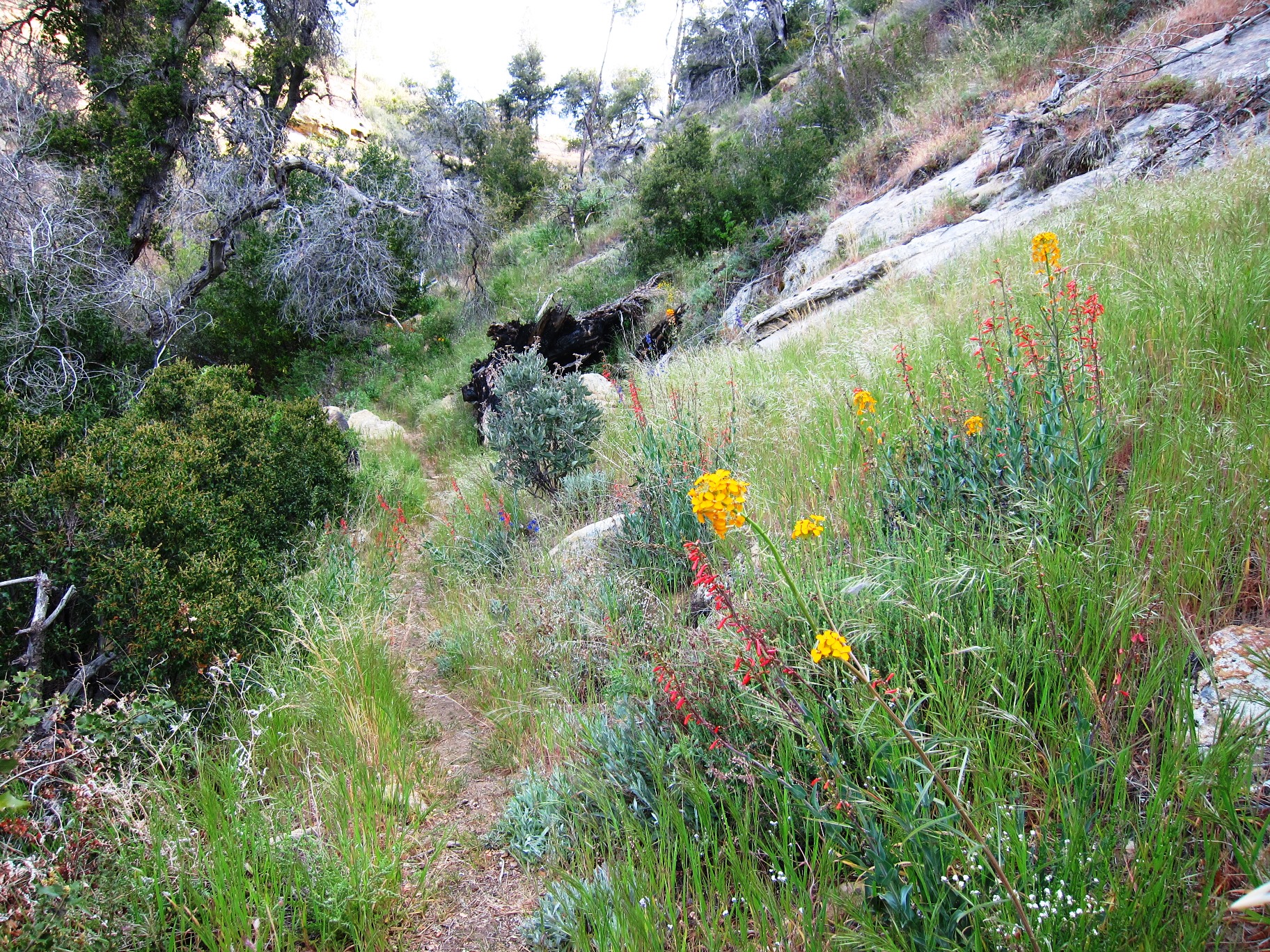
| Trail description: | Hike from South Fork to Nira. Â Trail was in excellent condition with plenty of water and many wildflowers! Â This steep trail between the Alcove and Manzana Narrows had big patches dense with poppies and chia - beautiful color combination! Â The section between White Ledge and the Alcove had creek crossing with water in it - and many tadpoles. Â Thank you to all that maintain this beautiful trail! |
| Mode of transport: | Hike |
| Trail condition: | Good shape and easy to follow |
| Images: | |
Manzana Trail East (Upper) Survey - 12-15-2015 - by Los Padres Forest Association| Link: | Manzana Trail East (Upper) |
| Date: | 12-15-2015 |
| Surveyor Name: | Los Padres Forest Association |
| Trail description: | Recent article by Dan McCaslin about the Lower Manzana Trail below NIRA Camp: http://www.noozhawk.com/article/dan_mccaslin_coldwater_camp_on_lower_manzana_creek |
| Mode of transport: | Hike |
| Trail condition: | Good shape and easy to follow |
Manzana Trail East (Upper) Survey - 11-04-15 - by Tom Plymale| Link: | Manzana Trail East (Upper) |
| Date: | 11-04-15 |
| Surveyor Name: | Tom Plymale |
| Trail description: | Took a quick walk out to Fish camp and back to check the trail after the storms 2 weeks ago. Overall the trail Is in good shape. The Manzana moved a lot of water and is silted in pretty good. Beyond Lost Valley camp there is a sycamore thats bent over the trail and  need  to be cut out. Further out there was a gully washer from a side drainage that  blew out a crossing. Stock will not be able to cross and would need an alternate route. It is fixable. Where the trail drops to cross the Manzana to Fish camp got blown out also but the trail is still visible. There is no flowing water. We may be able to send some folks in soon to take care of the tree and the crossings. |
| Mode of transport: | Hike |
| Trail condition: | Needs some work |
| Condition details: | Nira to Fish Camp |
Manzana Trail East (Upper) Survey - 10-04-2015 - by Los Padres Forest Association| Link: | Manzana Trail East (Upper) |
| Date: | 10-04-2015 |
| Surveyor Name: | Los Padres Forest Association |
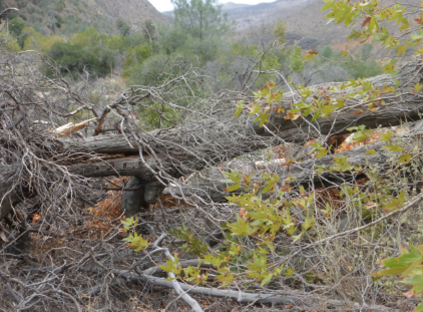
| Trail description: | Trail is in good shape from NIRA out to South Fork Station. Â There is no water between NIRA and Manzana Narrows. Â From the Narrows to South Fork there is only water at the spring above the switchbacks. Â We do not know if there is water at Lonnie Davis. Routes that are low and near the creek need burshing and tread. Â Routes that are upper need some slough tread work. But there are no blow outs. Section from Fish to Ray's camp needs the most bushing. There is a tree down before Ray's camp, 4ft crosscut needed. There is one small tree blocking the trail before Manzana camp. |
| Mode of transport: | Array |
| Trail condition: | Needs some work |
| Images: | Brushy section between Fish and Ray's - photo Beckstrand Downed tree before Manzana Camp - photo Beckstrand Downed tree before Ray's Camp - photo Beckstrand Closeup of tree at Ray's Camp - photo Beckstrand |
Manzana Trail East (Upper) Survey - 04-23-2015 - by M. Jones| Link: | Manzana Trail East (Upper) |
| Date: | 04-23-2015 |
| Surveyor Name: | M. Jones |
| Trail description: | Hiked the upper Manzana trail from Nira to about ¾ mile past White Ledge Camp. GPS said 27.6 mile day trip after some exploring in a unnamed drainage down canyon past White Ledge Camp. Overall trail is in good condition. There was water at Nira and Lost Valley camp site but none in the creek until Rays Camp. Manzana and the Narrows both and had good water. There was also a little flow about a ½ mile past the unofficial “alcove†camp in the drainage and at the waterfall before heading up to the top of white ledge canyon. There was no water at Happy Hunting Ground but was a small stagnant pool about a ¼ past the camp site. Where the trail enters the canyon ¾ of a mile before White Ledge Camp it can be hard to follow in places, rock ducts and flags mark the path through the creek bed sections. At this point there was also a little flowing water which continued all the way down canyon. |
| Mode of transport: | Hike |
| Trail condition: | Good shape and easy to follow |
| Images: | |
Manzana Trail East (Upper) Survey - 04-11-2015 - by M. Jones| Link: | Manzana Trail East (Upper) |
| Date: | 04-11-2015 |
| Surveyor Name: | M. Jones |
| Trail description: | Surveyed the lower Manzana trail from Sunset Valley road past Manzana Schoolhouse campground to the old Wells Homestead on the Horse Canyon La Brea trail Over-all the entire trail in in good condition and well-trimmed with easy traveling due to the low water levels. There are no obstructions, slip-outs, slides or trees blocking the trail.  At the time of survey there was low water at every crossing but one from Sunset Valley road to Dabney Cabin. Just below Dabney cabin had the most reliable, deepest pools of water which disappeared just after the Cody property Historic notes for the area: Dabney Cabin, 1914 Alder log cabin (Charles William Dabney). Used by the Dabney family for trout fishing, by Johnny Franzina on round-ups; lion trapper Paul Nogues from the early 1920’s until the 1940’sand by Midland school students. Saved by interested county residents from demolition by USFS in October 1969. (Ontiverous, Erlinda, pg.358 1990)  Wheat Homestead. H. P Wheet [Wheat] was born in April 1822, in New Hampshire. He died in 1903 and is buried in a eucalyptus grove in Oceano. His wife, Elizabeth, was born in Canada c1828 and s also buried in in Oceano (D. c1900) The Wheets lived in Michigan and Wisconsin before moving to California [Sears-Woon Family Genealogy] “Old man Wheet†wore his hair long, what little of it there was, as he was bald except for a little top-knot and a scanty fringe that extended to his shoulders. He had an extensive vocabulary of cuss words and chewed great quantities of tobacco which he would spit all over the floor. He despised doctors and medicine and claimed to have divine healing powers. Most of his relatives had great respect for him, but the rest of the folks looked upon him as a humbug [Santa Maria Historical-Society, c1905]. Hiram Preserved Wheat was one of the most prosperous and colorful of the pioneers. He claimed his home stead in 1885; could neither read nor write, and considered himself a healer…..He laid down the proper rules for diet; no pork, no lard, no coffee, and –most important—no milk for adults. One story he told of the cures he had concerned a man who had drank milk all his life. The patient was puffed up like a balloon, unable to walk. Old Man Wheat gave him a good pounding, and then squeezed his toes. The accumulated milk streamed out, he was able to walk and was cured [Jeannette Lyons, 1974]. |
| Mode of transport: | Hike |
| Trail condition: | Good shape and easy to follow |
| Images: | |
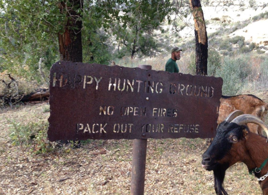
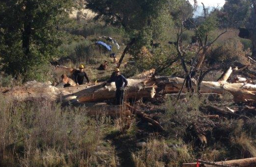
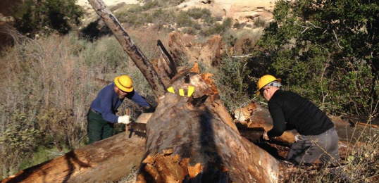
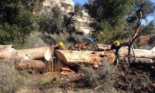
Manzana Trail East (Upper) Survey - 02-01-2015 - by Los Padres Forest Association| Link: | Manzana Trail East (Upper) |
| Date: | 02-01-2015 |
| Surveyor Name: | Los Padres Forest Association |
| Trail description: | VWR Mike Smith and crew headed out to Happy Hunting Ground with his goats to remove a 40" downed tree that was blocking the trail. Â The photos tell the story. Â Great work Mike and crew! |
| Mode of transport: | Array |
| Trail condition: | Good shape and easy to follow |
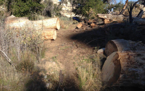
| Images: | The Happy Hunting Ground Sign The downed tree, ready for 4hours of cutting Using a 6ft crosscut saw on the largest cut Major cuts done, time to roll the logs off the trail BOOM! Trail all clear....... |
Manzana Trail East (Upper) Survey - 12-16-2014 - by Los Padres Forest Association| Link: | Manzana Trail East (Upper) |
| Date: | 12-16-2014 |
| Surveyor Name: | Los Padres Forest Association |
| Trail description: | The Manzana is now flowing again. Â Isn't rain a wonderful thing..... |
| Mode of transport: | Array |
| Trail condition: | Good shape and easy to follow |
Manzana Trail East (Upper) Survey - 04-16-2014 - by LPFA| Link: | Manzana Trail East (Upper) |
| Date: | 04-16-2014 |
| Surveyor Name: | LPFA |
| Trail description: | http://www.independent.com/news/2014/apr/16/manzana-day-hike-rays-camp/?on |
| Mode of transport: | Hike |
| Trail condition: | Good shape and easy to follow |
 Survey / Report Form - Please click this box to open the form.
.jpg)