 Use Marker Groups
 Wolf 2002
Piru 2003
Day 2006
Zaca 2007
Gap 2008
La Brea 2009

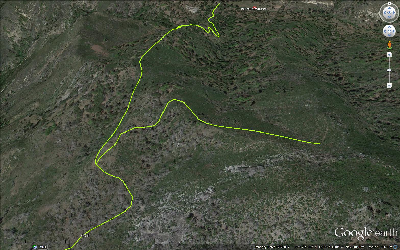
The Bear Basin Trail is located deep in the Ventana Wilderness in Monterey County. The trail connects the Carmel River Trail (3E03) and the Pine Ridge Trail (3E06) and the Black Cone Trail (3E14). From Pine Valley Camp the trail climbs up to a junction with Bear Basin Connector Trail (3E16) and then proceeds to Bear Basin Camp, after passing Bear Basin Camp the trail completes at the junctions of the Pine Ridge Trail (3E06) and the Black Cone Trail (3E14).
 Bear Basin Trail Survey - 10-13-2023 - by Chad Smith
| Link: | Bear Basin Trail |
| Date: | 10-13-2023 |
| Surveyor Name: | Chad Smith |
| Trail description: | Same condition as reported above by Clint in 03-27-2021: "Starting at Pine Valley Camp, up to the junction with Bear Basin
Connector trail. Some heavy brush encroaching on the trail, thicker as
we got higher up the hill. At the junction, Bear Basin Trail basically
ceases to exist..." I did not check the status of the Bear Basin Connector trail. |
| Mode of transport: | Hike |
| Trail condition: | Non existent |
Bear Basin Trail Survey - 03-27-2021 - by Clint Baechle| Link: | Bear Basin Trail |
| Date: | 03-27-2021 |
| Surveyor Name: | Clint Baechle |
| Trail description: | Starting at Pine Valley Camp, up to the junction with Bear Basin Connector trail. Some heavy brush encroaching on the trail, thicker as we got higher up the hill. At the junction, Bear Basin Trail basically ceases to exist, and Bear Basin Connector trail must be used to continue on to the Pine Ridge Trail. |
| Mode of transport: | Hike |
| Trail condition: | Needs some work |
| Condition details: | Brush encroaching, trail visible on the ground |
 Survey / Report Form - Please click this box to open the form.