 Use Marker Groups
 Wolf 2002
Piru 2003
Day 2006
Zaca 2007
Gap 2008
La Brea 2009

The Madulce Peak Trail is a 2.00 mile trail in the Dick Smith Wilderness in Santa Barbara County. The trail connects the Madulce Trail (28W09) and Madulce Peak. On the 1905 topographic map, the peak is called Strawberry Peak because of the wild strawberries that grow on Pine Creek at its north base. The name Madulce was substituted because the U. S. Geological map makers were told to use local names. A fire tower was constructed on top of the peak at the end of Trail. A storm severely damaged the tower so that Forest Service burned it to the ground. The Madulce Trail was and still is an important link between the Sisquoc River area and the Santa Barbara Canyon Trail to the Cuyama or down the Alamar and Mono Canyons to the coast. Please let us know if you have explored this trail recently.
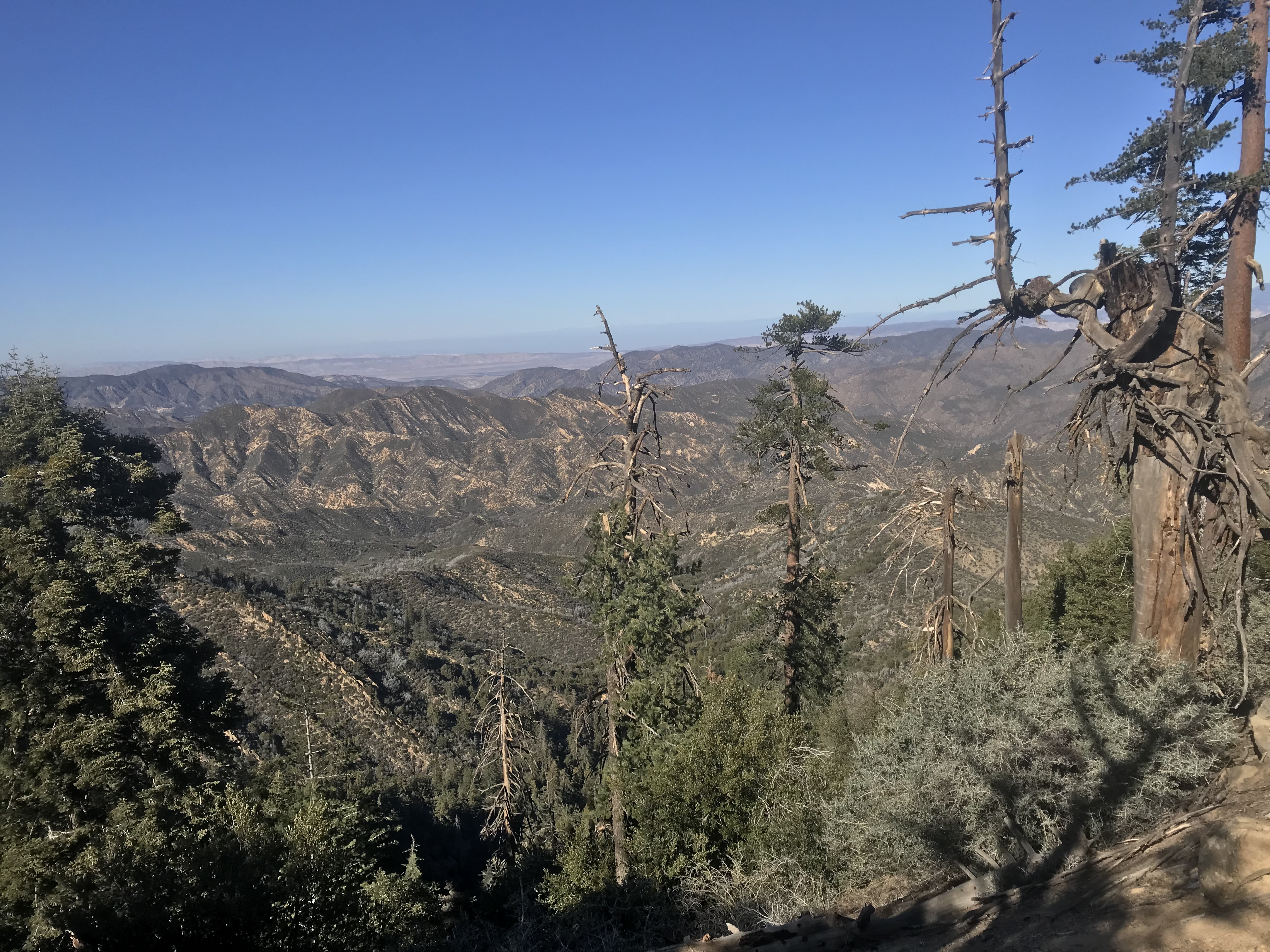
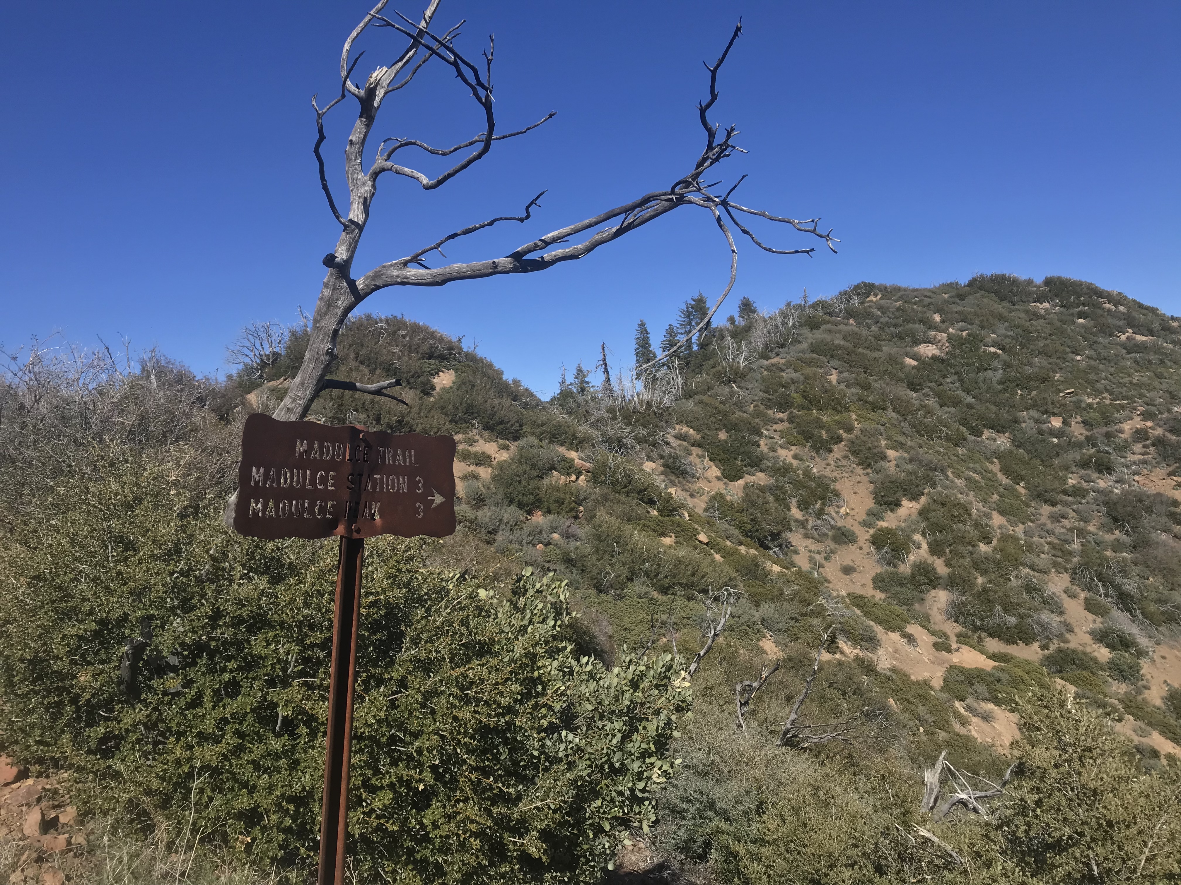
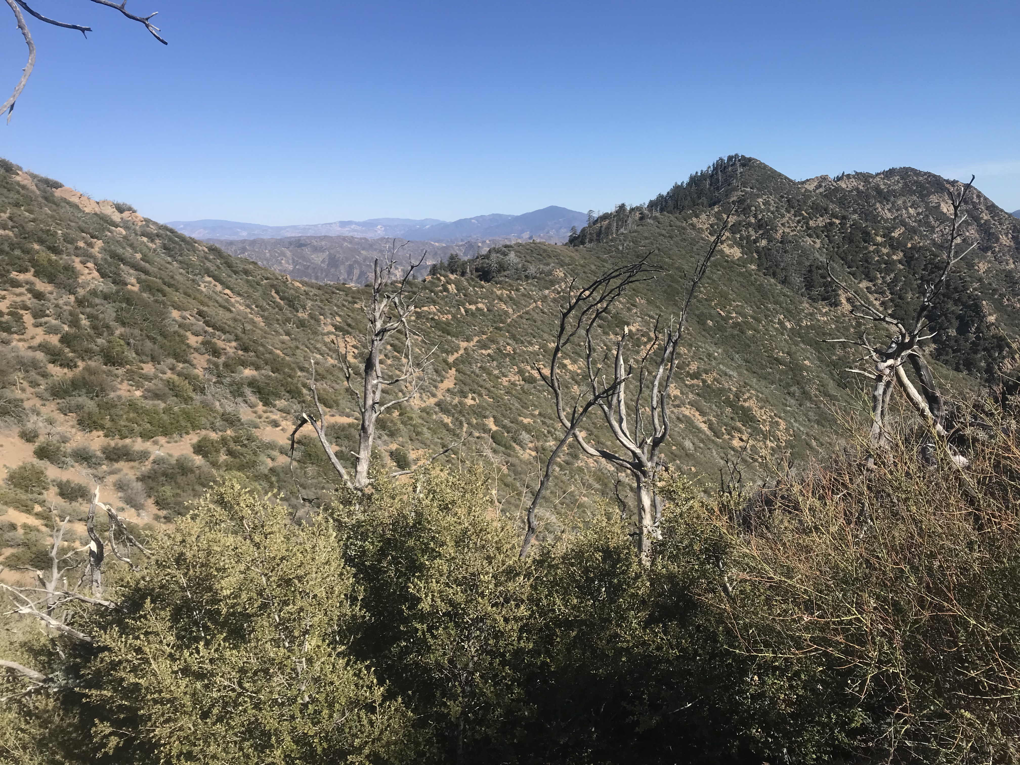


 Madulce Peak Trail Survey - 12-07-2024 - by Antonio Calderon
 | Link: | Madulce Peak Trail |
| Date: | 12-07-2024 |
| Surveyor Name: | Antonio Calderon |
| Mode of transport: | Hike |
| Trail condition: | Needs some work |
| Images: | |
Madulce Peak Trail Survey - 03-12-2022 - by Anonymous Surveyor| Link: | Madulce Peak Trail |
| Date: | 03-12-2022 |
| Surveyor Name: | Anonymous Surveyor |
| Trail description: | Hiked from the road to the peak junction. Trail is in good condition. Highly advise against going in the snow due to a narrow trail and severe drop offs. some nice views |
| Mode of transport: | Hike |
| Trail condition: | Good shape and easy to follow |
Madulce Peak Trail Survey - 01-24-2022 - by B Campbell| Link: | Madulce Peak Trail |
| Date: | 01-24-2022 |
| Surveyor Name: | B Campbell |
| Trail description: | We did not make it to the top due to losing the trail and running out of time. Lots of downed trees. We missed the beginning of the switchbacks and only made it about a mile and a half up. There are a few cairns and trail tags that help mark the way. Keep a keen eye out! |
| Mode of transport: | Hike |
| Trail condition: | Hard to follow |
Madulce Peak Trail Survey - 04-24-2021 - by Addison Jerlow| Link: | Madulce Peak Trail |
| Date: | 04-24-2021 |
| Surveyor Name: | Addison Jerlow |
| Trail description: | Easy to follow til your first ocean view, then still easy enough to follow but there are lots of downed trees.You might get to a point after rounding an oak-filled bend and entering a small clearing with lots of branches from a few down trees where it looks like the easy obvious trail you have been following either heads steeply up the ridge to your right or steeply down the canyon through numerous branch-y downed trees in front of you. It goes down into the canyon. I checked my GPS at this point and saw the trail on my Dick Smith map and my Topo Map app both said to go up. Up is wrong (although if you want to scramble across that large rectangular rock outcropping/ridge you see when looking toward Madulce from the east, maybe go the way I went). Somewhere near me was the "old" trail but I saw nothing resembling a trail. Eventually made it to the peak and took the proper trail down (again, different than the trail on the map) and when I returned to the drainage below my wrong turn I found some small cairns that where hidden behind fallen trees. I tried to make these cairns bigger and more conspicuous for those headed up the peak. Also, the new trail from this point on is steep and switchback-filled but goes by some HUGE pines and cool cave-filled boulders with much fewer downed trees. And the view from the top is fantastic. When in doubt trust the cairns, not your gps. |
| Mode of transport: | Hike |
| Trail condition: | Needs some work |
| Condition details: | Easy to follow for a bit, then lots of downed trees |
Madulce Peak Trail Survey - 03-29-2021 - by Louis Tremblay| Link: | Madulce Peak Trail |
| Date: | 03-29-2021 |
| Surveyor Name: | Louis Tremblay |
| Trail description: | Quite a few down trees (~20ish) after 2 miles from the sign, and trail gets hard to follow near the peak, but otherwise totally possible. Snow cover makes it even more challenging! |
| Mode of transport: | Hike |
| Trail condition: | Needs some work |
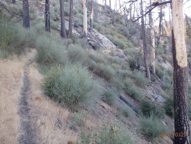
Madulce Peak Trail Survey - 10-26-2019 - by Steve Cypher| Link: | Madulce Peak Trail |
| Date: | 10-26-2019 |
| Surveyor Name: | Steve Cypher |
| Trail description: | Worked on this trail with Sierra Club HPS. Cut a few logs, cleared some brush, but there's lots more work to do. Pretty easy to follow until the high grassy slope below the ridge. Lots of logs lay across the slope and there's no following a trail. Be careful to note where you came from so you can get back. |
| Mode of transport: | Hike |
| Trail condition: | Needs some work |
| Condition details: | We did some work, but it's about like it's been. |
| Images: | |
Madulce Peak Trail Survey - 05-16-2018 - by Valerie Norton| Link: | Madulce Peak Trail |
| Date: | 05-16-2018 |
| Surveyor Name: | Valerie Norton |
| Trail description: | First, this trail is 2.5 miles. The peakbaggers indicate this on their write up, too. Loads of big trees are down. They are nearly all down onto the ground and someone has chipped a foothold in each to increase the chances of crossing each safely, even on the slope. While traveling across, the trail is very easy to follow. A couple ravine crosses require a little climbing of a few feet. Past the second is a spot where the trail crosses some sandstone and becomes very narrow which could use some attention before the tread vanishes. This spot felt dangerous. There are actually a few old blazes along this bit. As the trail turns to climb up to the ridge, it becomes a difficult to follow mess. There are multiple trails doing short switchbacks up the steep slope and plenty of potential to wander some other way. I did just that on the way down, but found myself again. There are no old blazes along this part. I saw no flagging, perhaps I was in the wrong spot. The main trail from above seemed to go through this area, too. There was a spot early on where trail looked to continue further before starting up. USGS map indicates climbing earlier, but it also indicates other details that are at odds with details on the ground. Once up on the ridge line, it is smooth sailing as long as one stays slightly low at first. Lots of details from my day can be found here. |
| Mode of transport: | Hike |
| Trail condition: | Needs some work |
| Condition details: | many huge trees and one slide spot and the whole route up to the ridge is difficult to follow |
Madulce Peak Trail Survey - 07-03-2016 - by Steve Cypher| Link: | Madulce Peak Trail |
| Date: | 07-03-2016 |
| Surveyor Name: | Steve Cypher |
| Trail description: | A large group from Sierra Club HPS worked on trail 7/3/16. Brush cleared, several small-medium sized logs removed. The tricky transition from traverse to switchbacks flagged & cairned. Still many large logs to climb over, and switchbacks just below ridge disappear, but trail is much easier to follow. |
| Mode of transport: | Hike |
| Trail condition: | Needs some work |
| Condition details: | Challenging trail but currently easy to follow. |
Madulce Peak Trail Survey - 05-24-2016 - by Steve Cypher| Link: | Madulce Peak Trail |
| Date: | 05-24-2016 |
| Surveyor Name: | Steve Cypher |
| Trail description: | Over 30 logs in the trail - some very large & complex. Several places have thick brush requiring bushwhacking. The switchbacks leading to the ridge are difficult to find, and you can easily follow the tracks of people who missed them. Â The switchbacks are faint and often lost beneath deadfall. The trail is flagged, so look carefully for flagging. |
| Mode of transport: | Hike |
| Trail condition: | Hard to follow |
| Condition details: | Rough, challenging trail |
Madulce Peak Trail Survey - 05-06-2015 - by Anonymous Surveyor| Link: | Madulce Peak Trail |
| Date: | 05-06-2015 |
| Surveyor Name: | Anonymous Surveyor |
| Trail description: | I read that this trail was worked on last fall, but it's hard to tell that it was because there are lots of down trees, areas where the trail is overgrown and one section that is washed out. |
| Mode of transport: | Hike |
| Trail condition: | Hard to follow |
| Condition details: | Many down trees, trail overgrown and hard to follow. |
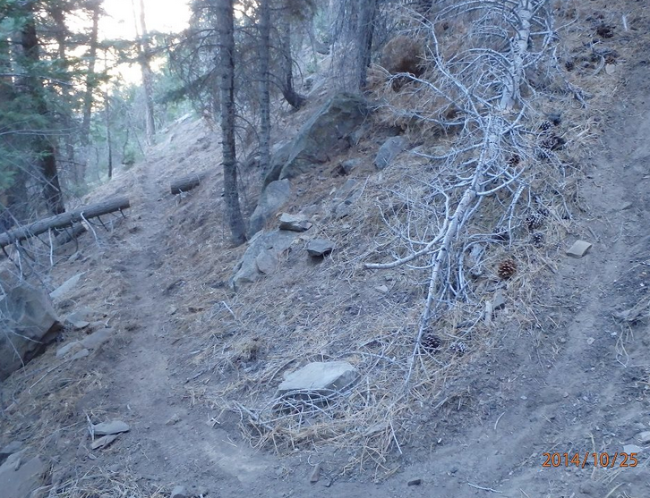
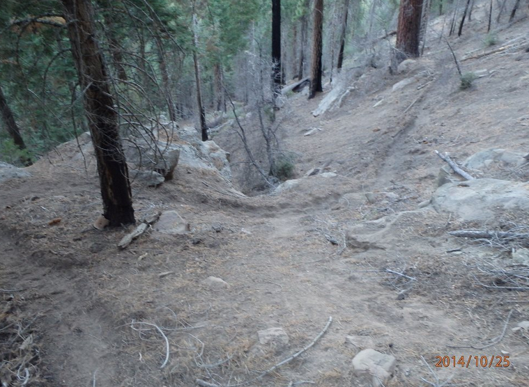
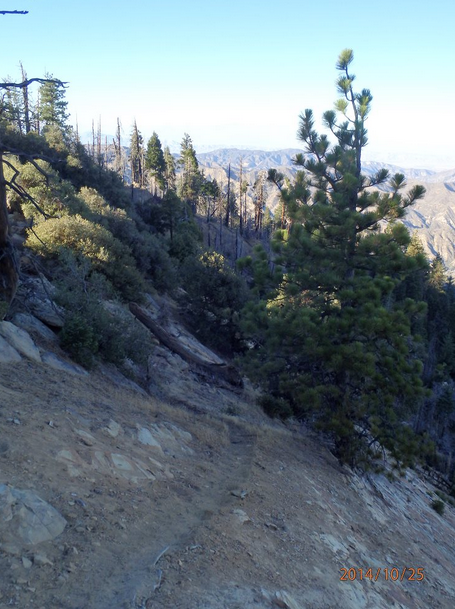
Madulce Peak Trail Survey - 10-25-2014 - by Los Padres Forest Association| Link: | Madulce Peak Trail |
| Date: | 10-25-2014 |
| Surveyor Name: | Los Padres Forest Association |
| Trail description: | The LPFA and 100 Peaks People organized a trail project on 10/25 to clear the trail from Buckhorn Road to Madulce Peak. Â We brushed the trail and worked on the tread over the entire trail. Â Great work was done BUT there are still many large downed trees that need to be logged out. Â More work is needed. Great time had by all and the views were awesome. Â The trail is now in the best shape its been in over the past decade or so. |
| Mode of transport: | Array |
| Trail condition: | Needs some work |
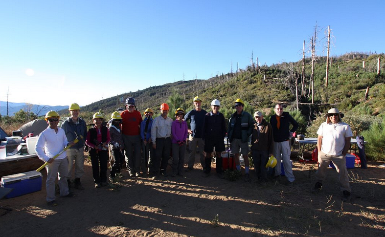
| Images: | The crew at Alamar Saddle |
 Survey / Report Form - Please click this box to open the form.