 Use Marker Groups
 Wolf 2002
Piru 2003
Day 2006
Zaca 2007
Gap 2008
La Brea 2009

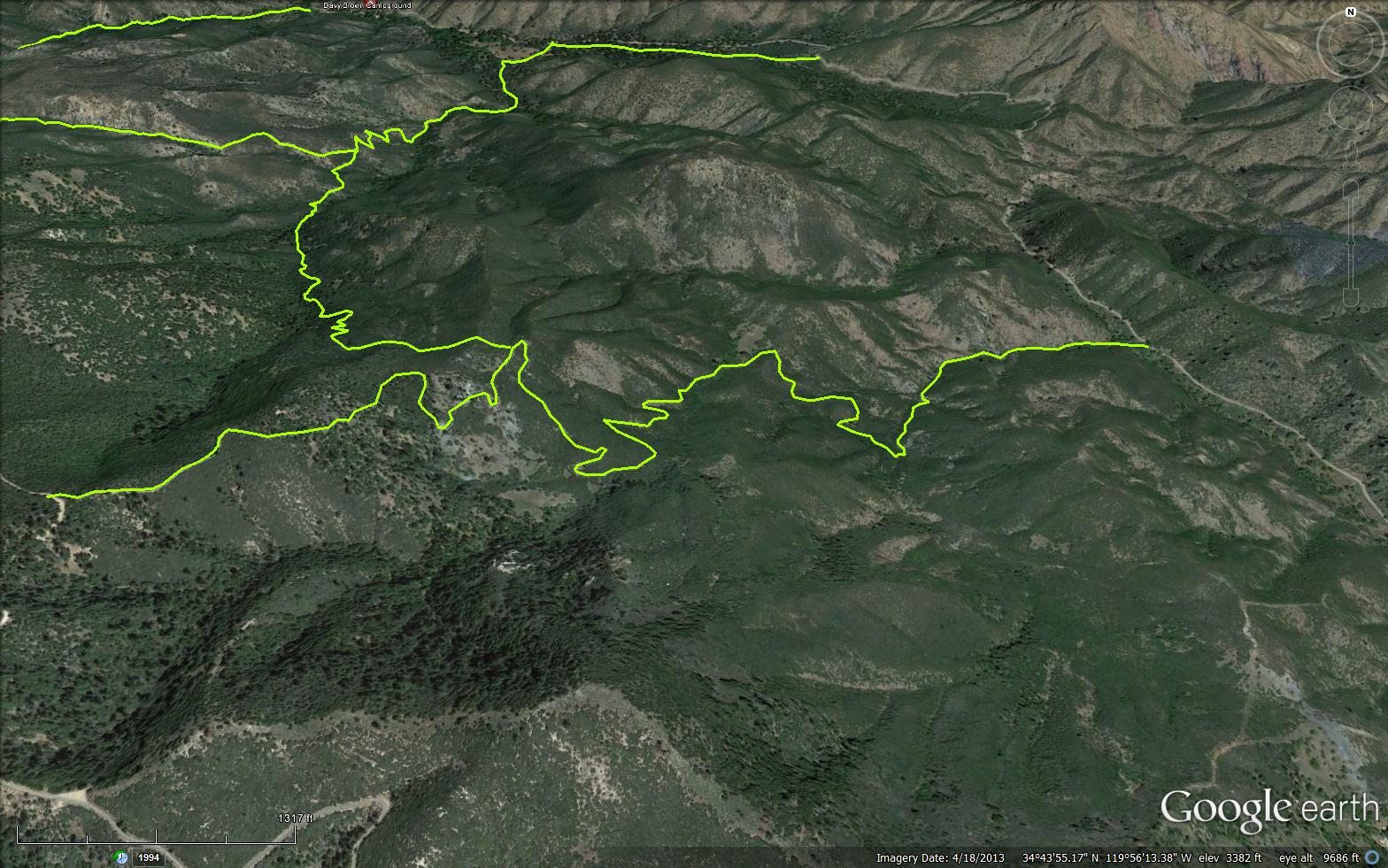
A short yet beautiful connector trail near Figueroa Mountain, the trail connects the Munch Canyon Trail (29W04) to the White Rock Trail (29W05).

 White Rock Connector Trail Survey - 04-26-2022 - by Stan Atchison
| Link: | White Rock Connector Trail |
| Date: | 04-26-2022 |
| Surveyor Name: | Stan Atchison |
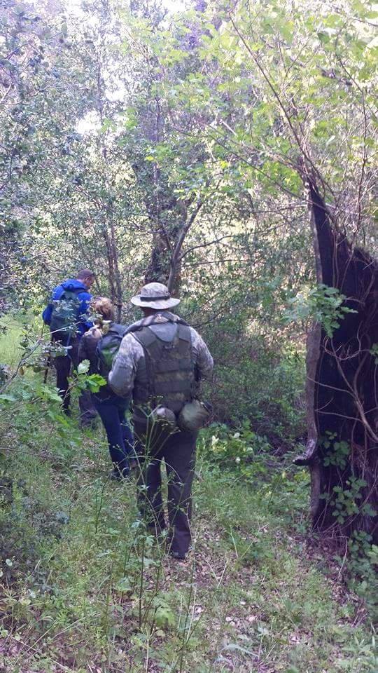
| Trail description: | Hiked as part of a loop from East Pinery - White Rock - White Rock Connector - Munch Canyon - Munch Cyn Conn. - East Pinery. This was where things started to get a little overgrown. The trail is still very easily identifiable but there is unavoidable poison oak and ceanothus that you must "push-through" No big deal if you aren't prone to oak! Could use some work but still a nice walk. Very tunnel-like under the head high brush at times. |
| Mode of transport: | Hike |
| Trail condition: | Needs some work |
White Rock Connector Trail Survey - 02-19-2022 - by Ari Songer| Link: | White Rock Connector Trail |
| Date: | 02-19-2022 |
| Surveyor Name: | Ari Songer |
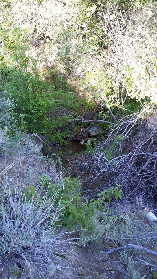
| Trail description: | On 2/19/2022 LPFA led a 4-person volunteer project on the Connector. We hiked down White Rock trail from E. Pinery and worked on brushing the East end of the Connector from the junction with White Rock Trail. The rest of the trail is free of brush and easy to follow. Could use some tread widening in areas where there is a steep side slope and the overhead brushing needs work for people on horseback, but overall the trail is in great shape. There was water in some of the crossings. Steep grade! |
| Mode of transport: | Hike |
| Trail condition: | Good shape and easy to follow |
White Rock Connector Trail Survey - 04-26-2021 - by Los Padres Forest Association| Link: | White Rock Connector Trail |
| Date: | 04-26-2021 |
| Surveyor Name: | Los Padres Forest Association |
| Trail description: | The White Rock Connector (29W07) has been cleared a stretch south from the Munch Connector junction, but gradually deteriorates with brush becoming more of an issue as the trail progresses. Toward the eastern end the brush starts to choke the trail. For most of the distance from the northern end a light maintenance pass would put it in good shape, but the eastern part would need serious brush cutting. I ran into one huge ceanothus that had fallen into and completely blocked the trail. It was a mess to cut through and the brush in the area was so thick and tall that it was a struggle to dispose of the cuttings. I did meet two mountain bikers descending this trail. |
| Mode of transport: | Hike |
| Trail condition: | Needs some work |
White Rock Connector Trail Survey - 04-14-2015 - by Meghan Sheen| Link: | White Rock Connector Trail |
| Date: | 04-14-2015 |
| Surveyor Name: | Meghan Sheen |
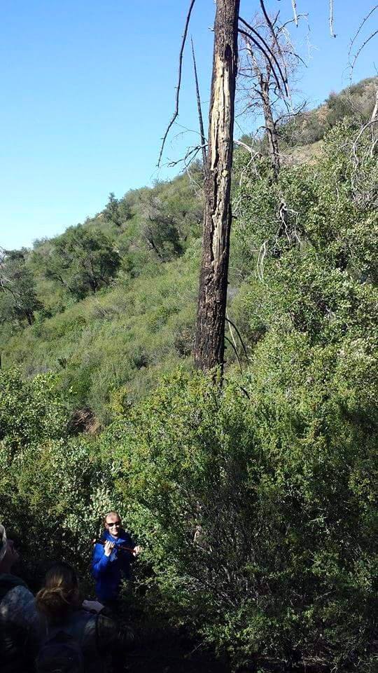
| Trail description: | First mile or so could use some very serious brushing. Trail itself is easy to follow but branches make it difficult. We made it through all the way to Munch Cyn. There is water along the trail, as well as a pretty substantial amount of poison oak. Last half towards Munch cyn looks recently brushed. Several burned out widowmaker trees along the route that are pretty unstable. Also important to note the actual trail mileage is (miles), not 2.32 as shown on the popup/title. |
| Mode of transport: | Hike |
| Trail condition: | Needs some work |
| Condition details: | Needs brushing, first mile or so from White rock. |
| Images: | down the trail watersource burned over trees More burned over trees |
 Survey / Report Form - Please click this box to open the form.