 Use Marker Groups
 Wolf 2002
Piru 2003
Day 2006
Zaca 2007
Gap 2008
La Brea 2009

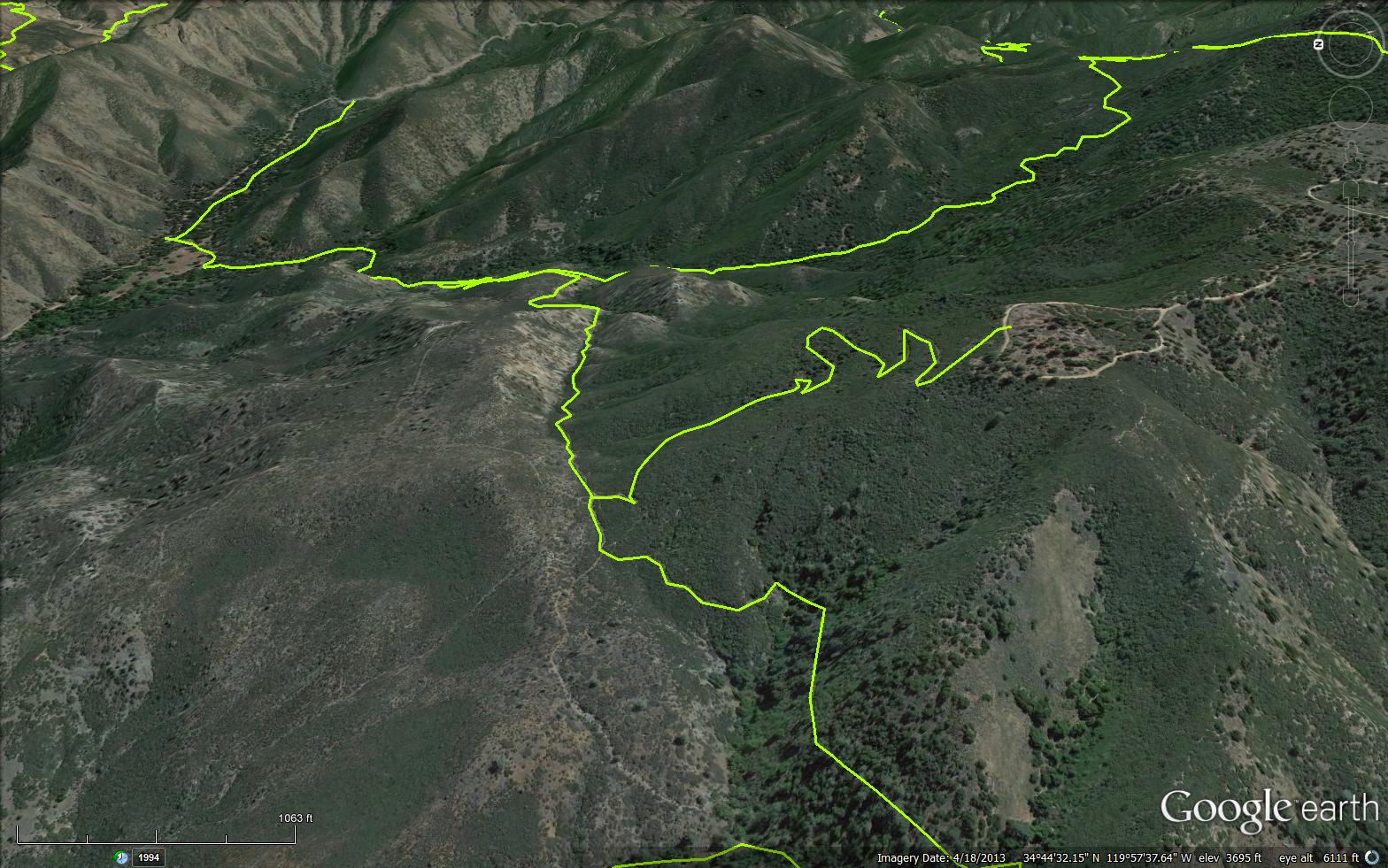
The Munch Canyon Trail is a 2.59 mile trail in the Non Wilderness Area Wilderness in Santa Barbara County. The trail connects the Sunset Valley Road (8N09) and the Fir Canyon Davy Brown Trail (29W03).
Named after Mr. Munch who homesteaded in Sunset Valley. He built a cabin, then removed his claim and the Forest Service used the cabin as a winter Ranger Station for Edgar Davidson. Please let us know if you have explored this trail recently.

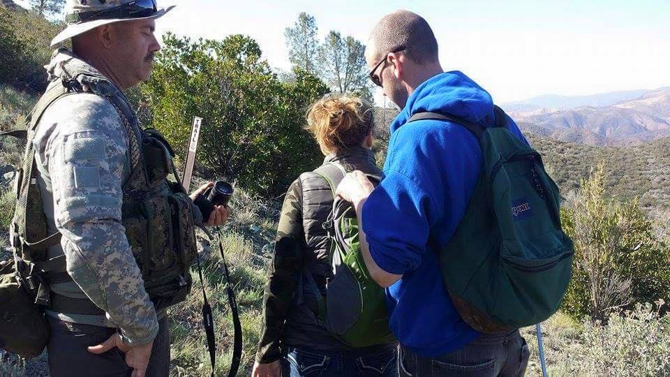


 Munch Canyon Trail Survey - 02-24-2024 - by Amy Findlay
| Link: | Munch Canyon Trail |
| Date: | 02-24-2024 |
| Surveyor Name: | Amy Findlay |
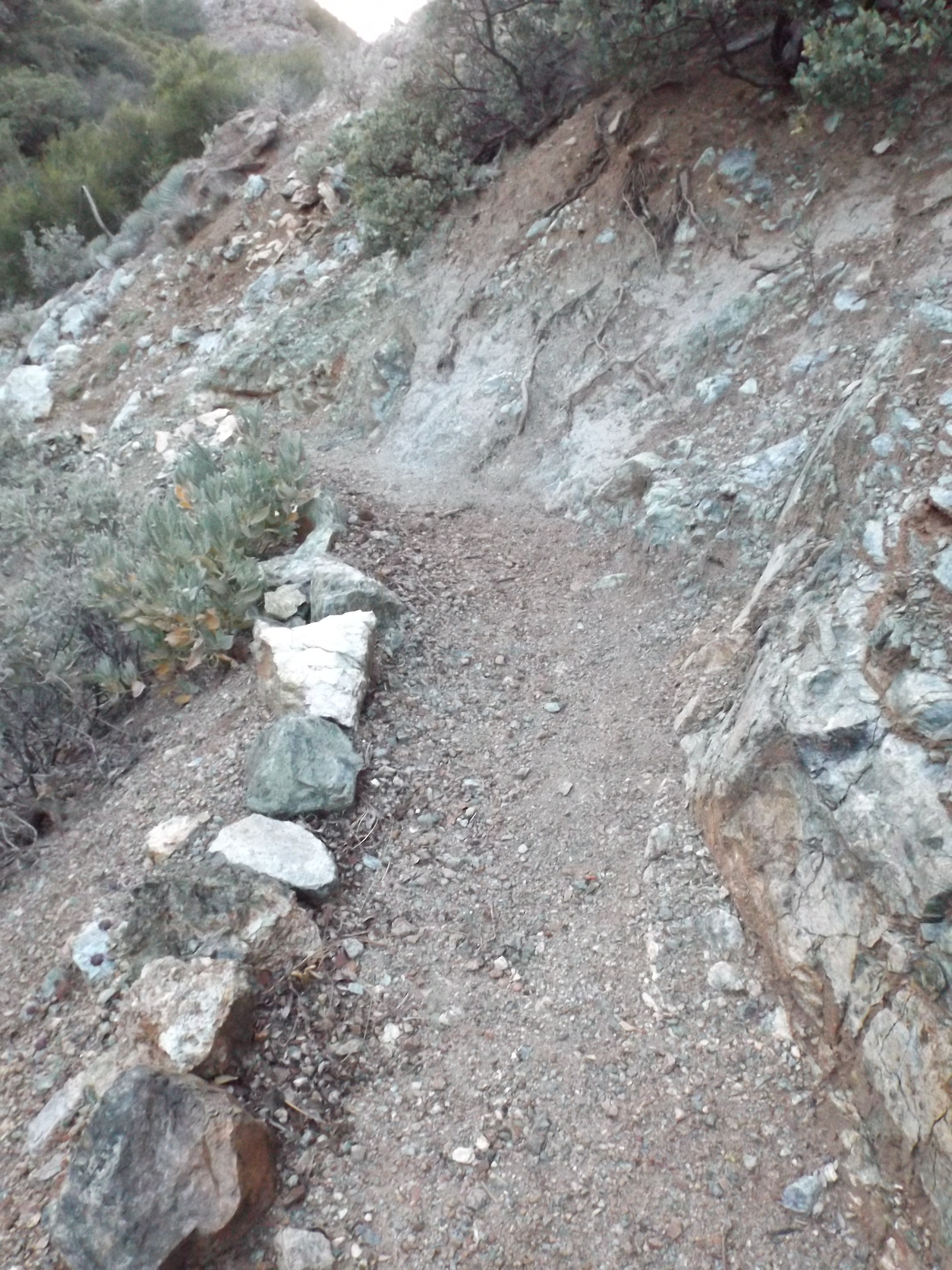
| Trail description: | We did the loop from the Ranger Peak pull-off and didn’t go all the way to the Davy Brown campsite. The trail is easy to follow. There’s some damage from recent storms, but not bad at all. There’s a decent amount of water in the creeks at the crossings, but we were able to cross with no problems. |
| Mode of transport: | Hike |
| Trail condition: | Good shape and easy to follow |
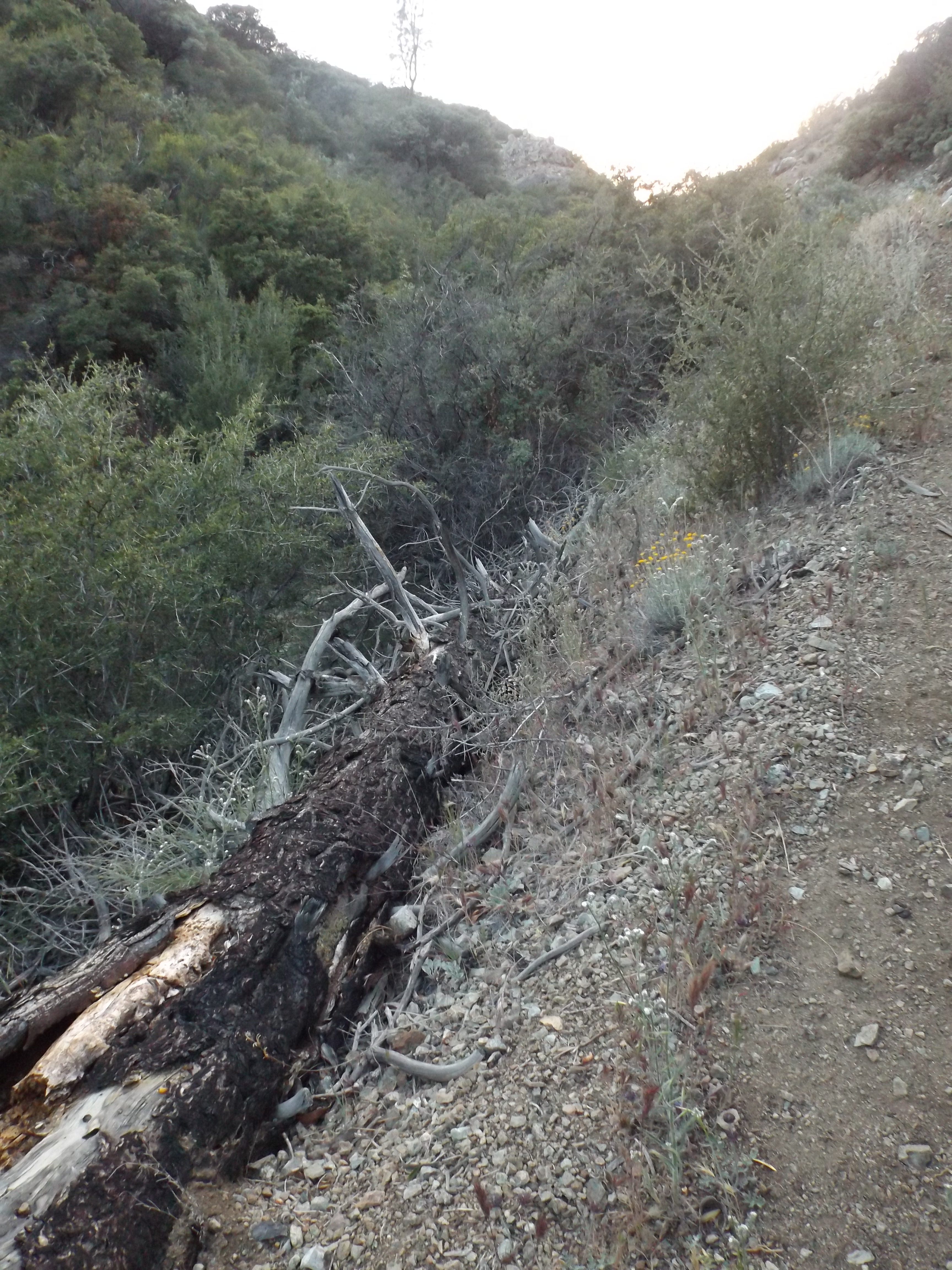
| Images: | The trail picks up on the other side of the creek with some damage, but passable. |
Munch Canyon Trail Survey - 02-17-2024 - by ECDuzIt| Link: | Munch Canyon Trail |
| Date: | 02-17-2024 |
| Surveyor Name: | ECDuzIt |
| Trail description: | It’s incredible how much brushing work has been recently completed on this trail. The brush is DENSE. The trail could still use another round of brushing work to be fully dialed in, but kudos to everyone who has worked on this trail! |
| Mode of transport: | Hike |
| Trail condition: | Good shape and easy to follow |
| Images: | |
Munch Canyon Trail Survey - 05-19-2023 - by EC DUZ IT| Link: | Munch Canyon Trail |
| Date: | 05-19-2023 |
| Surveyor Name: | EC DUZ IT |
| Trail description: | I attempted this trail from the bottom and didn't make it very far up. Snow from the Feb. storms has pushed down the chaparral into the trail. My dog could barely make it through, but I couldn't. Also at least one downed Grey Pine towards the bottom of the trail (likely more damages higher up on this trail, but I didn't make it up there). |
| Mode of transport: | Hike |
| Trail condition: | Needs some work |
| Condition details: | Needs some work |
| Images: | |
Munch Canyon Trail Survey - 04-26-2022 - by Stan Atchison| Link: | Munch Canyon Trail |
| Date: | 04-26-2022 |
| Surveyor Name: | Stan Atchison |
| Trail description: | Hiked as part of a loop from East Pinery - White Rock - White Rock Connector - Munch Canyon - Munch Cyn Conn. - East Pinery. This section was a hot climb up out of Munch Canyon. I should have known I was going to have to pay for all that descent. Trail was in good shape. |
| Mode of transport: | Hike |
| Trail condition: | Good shape and easy to follow |
Munch Canyon Trail Survey - 04-26-2021 - by Los Padres Forest Association| Link: | Munch Canyon Trail |
| Date: | 04-26-2021 |
| Surveyor Name: | Los Padres Forest Association |
| Trail description: | Munch Canyon (29W04) has been cleared roughly half way from the junction with The White Rock Connector. The western half is brushy. Met one hiker. |
| Mode of transport: | Hike |
| Trail condition: | Needs some work |
Munch Canyon Trail Survey - 04-18-2021 - by Anonymous Surveyor| Link: | Munch Canyon Trail |
| Date: | 04-18-2021 |
| Surveyor Name: | Anonymous Surveyor |
| Trail description: | Most streams were flowing, some trail surfaces kind of beat up by stock use when wet. |
| Mode of transport: | Hike |
| Trail condition: | Good shape and easy to follow |
Munch Canyon Trail Survey - 05-29-2018 - by Anonymous Surveyor| Link: | Munch Canyon Trail |
| Date: | 05-29-2018 |
| Surveyor Name: | Anonymous Surveyor |
| Trail description: | My boyfriend and I hiked the Munch Canyon trail via the Davy Brown campsite. There were parts that were very overgrown and the trail narrowed out so much that I wasn't sure if we were still on the trail. There was a site with a bunch of rusted metal (bed frames, a tractor, etc...), and we took a wrong turn here and ended up 0.5 miles on the wrong trail. A trail marker would be really helpful right there! |
| Mode of transport: | Hike |
| Trail condition: | Needs some work |
Munch Canyon Trail Survey - 12-31-2017 - by Valerie Norton| Link: | Munch Canyon Trail |
| Date: | 12-31-2017 |
| Surveyor Name: | Valerie Norton |
| Trail description: | Hiked it from east to west. Nice and clear all the way up to the junction with the connector to East Pinery except an easy walk around right at the start and a thick trunk that is also easy to walk around. Heading down to Davy Brown, there are a couple actually crossing the trail. The largest might be just over a foot wide. Tread is good except one spot of erosion just as it starts to climb away from the creek. Signs are missing at Sunset Valley and both connectors and I even managed not to notice the junction with the connector to White Rock while passing it. Found some rusty new signs at Davy Brown, though! |
| Mode of transport: | Hike |
| Trail condition: | Good shape and easy to follow |
Munch Canyon Trail Survey - 04-22-2015 - by Meghan Sheen| Link: | Munch Canyon Trail |
| Date: | 04-22-2015 |
| Surveyor Name: | Meghan Sheen |
| Trail description: | We took Munch Canyon Trail from Sunset Valley road all the way to Davy Brown Trail. It was in good shape, looks as though someone has recently brushed it all the way up. Some spots of loose rock and old washouts were a little slippery to negotiate but overall a good day hike. |
| Mode of transport: | Hike |
| Trail condition: | Good shape and easy to follow |
| Images: | |
Munch Canyon Trail Survey - 04-14-2015 - by Meghan Sheen| Link: | Munch Canyon Trail |
| Date: | 04-14-2015 |
| Surveyor Name: | Meghan Sheen |
| Trail description: | We covered a about a mile from Sunset Valley up to White Rock Connector. Trail was easy to follow and in good shape. Water in Munch Creek. Lots of alligator lizards out and about today. |
| Mode of transport: | Hike |
| Trail condition: | Good shape and easy to follow |
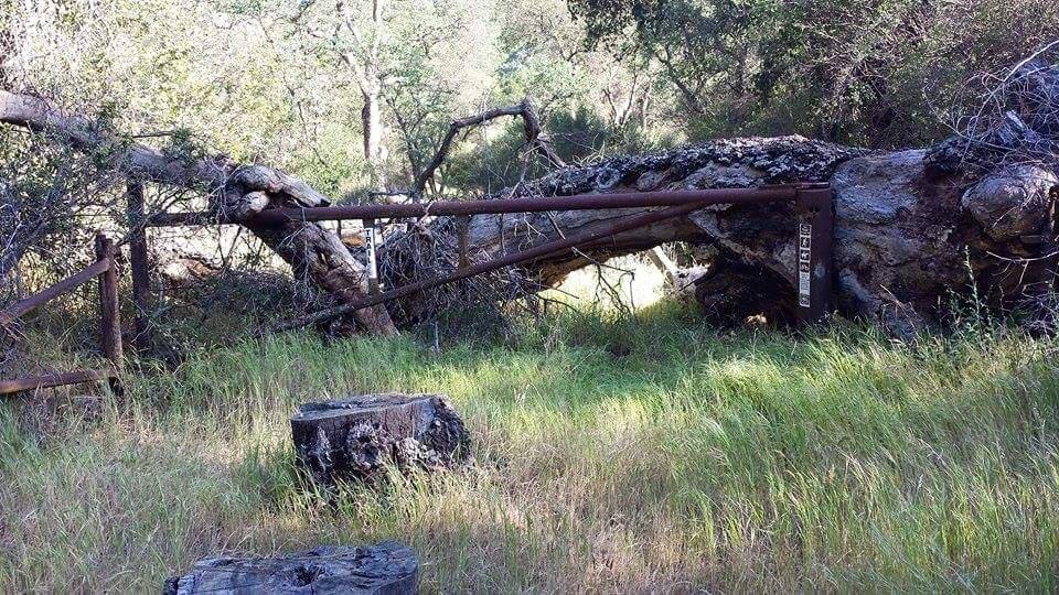
| Images: | old gate at base of trail us at the junction of munch canyon and white rock connector |
Munch Canyon Trail Survey - 01-21-2015 - by M. Jones| Link: | Munch Canyon Trail |
| Date: | 01-21-2015 |
| Surveyor Name: | M. Jones |
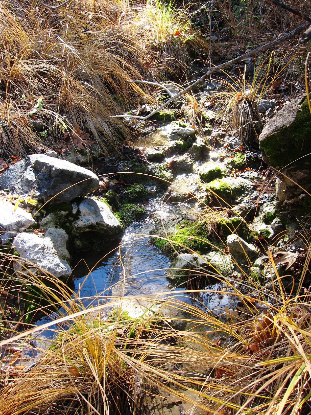
| Trail description: | A seemingly little used trail in good condition, a nice scenic hike up to the East Pinery Road or up to Figueroa Mountain Road. Other options include down Davy Brown Canyon with connector trails to west to the Willow Spring Figueroa Trail or on the way up the east and White Rock Canyon, On the day of the hike it was sunny and 61. Munch creek had flowing water about a mile from Sunset Valley |
| Mode of transport: | Hike |
| Trail condition: | Good shape and easy to follow |
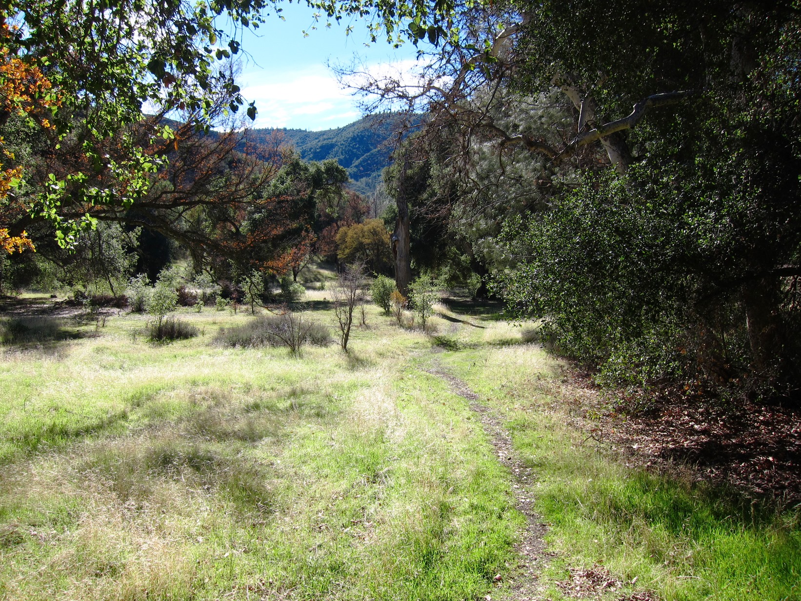
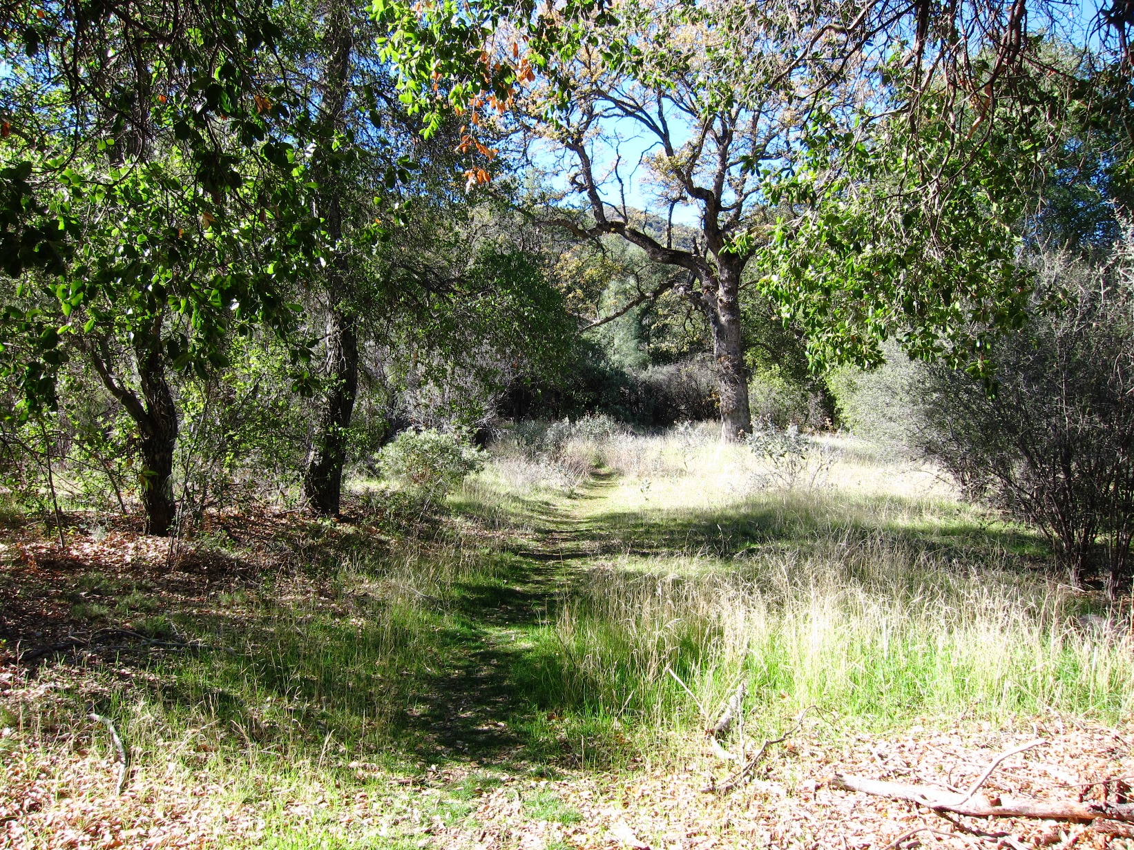
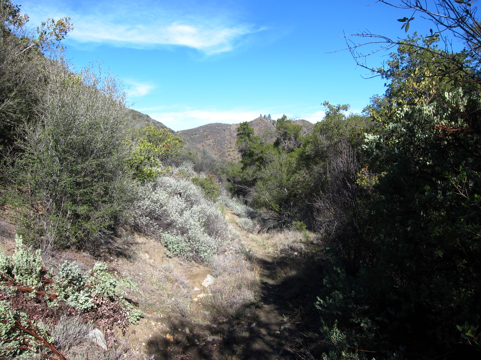
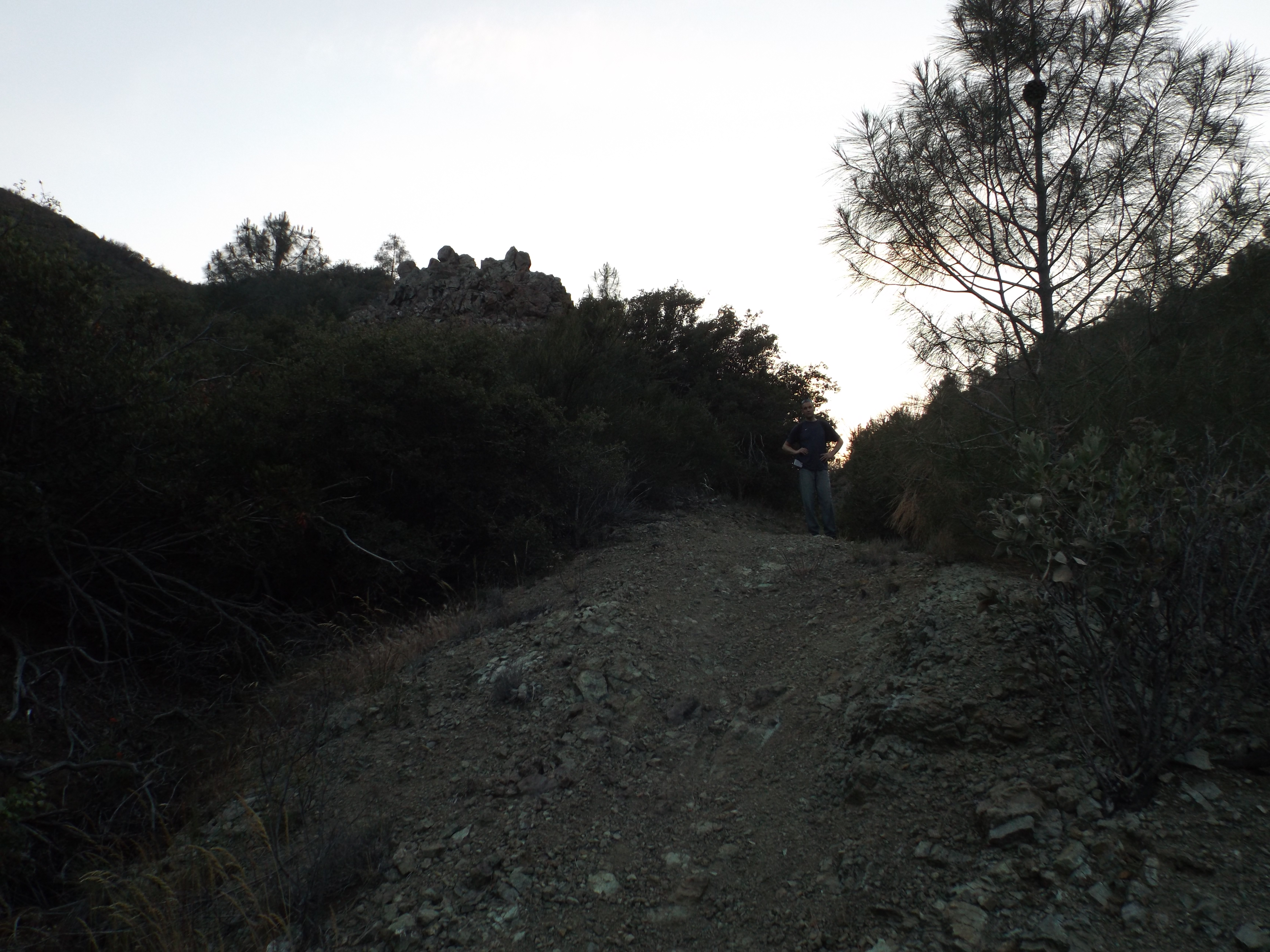
| Images: | Trail head at Sunset Valley Road Canyon bottom near trail head Trail up canyon Trail up canyon Munch Canyon Creek flowing about a mile from Sunset Valley on 011915 |
 Survey / Report Form - Please click this box to open the form.