 Use Marker Groups
 Wolf 2002
Piru 2003
Day 2006
Zaca 2007
Gap 2008
La Brea 2009

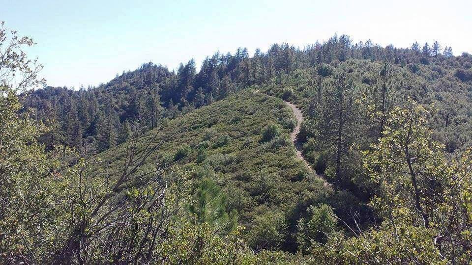
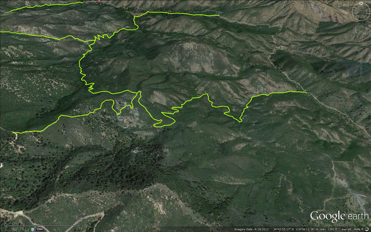
The White Rock Trail is a scenic 2.92 mile trail in the Non Wilderness Area Wilderness in Santa Barbara County. The trail connects Sunset Valley Road 8N09 to East Pinery Road 8N32.


 White Rock Trail Survey - 02-17-2024 - by ECDuzit
| Link: | White Rock Trail |
| Date: | 02-17-2024 |
| Surveyor Name: | ECDuzit |
| Trail description: | This trail is a gem. Great shape and amazing views towards the top. Great for hiking or mountain biking. |
| Mode of transport: | Hike |
| Trail condition: | Good shape and easy to follow |
| Images: | |
White Rock Trail Survey - 04-26-2022 - by Stan Atchison| Link: | White Rock Trail |
| Date: | 04-26-2022 |
| Surveyor Name: | Stan Atchison |
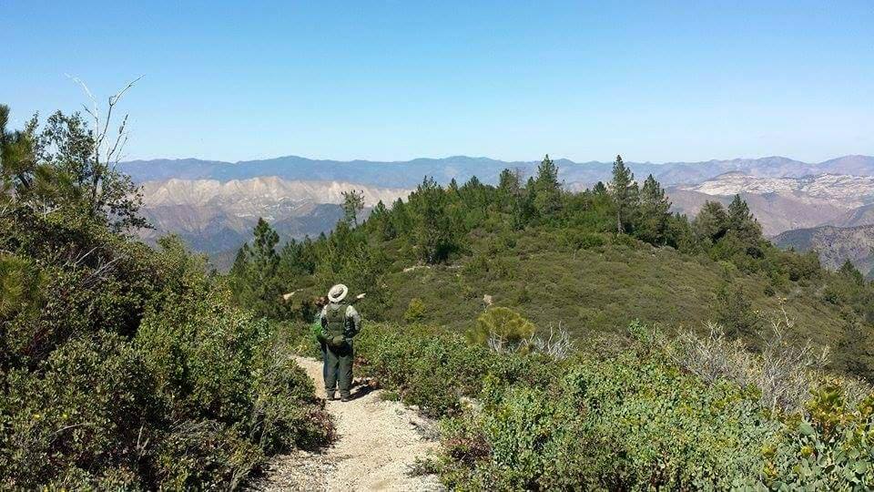
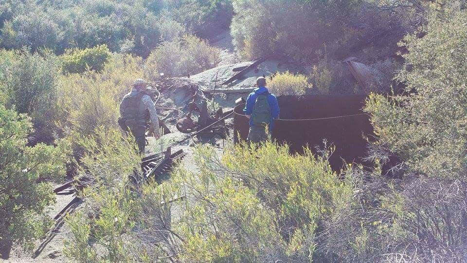
| Trail description: | Hiked as part of a loop from East Pinery - White Rock - White Rock Connector - Munch Canyon - Munch Cyn Conn. - East Pinery. The top section of White Rock to the connector is in fantastic shape and easily identifiable/passable. Cool old mining or homestead relics are still present. Beautiful trail. |
| Mode of transport: | Hike |
| Trail condition: | Good shape and easy to follow |
White Rock Trail Survey - 02-20-2022 - by Ari Songer| Link: | White Rock Trail |
| Date: | 02-20-2022 |
| Surveyor Name: | Ari Songer |
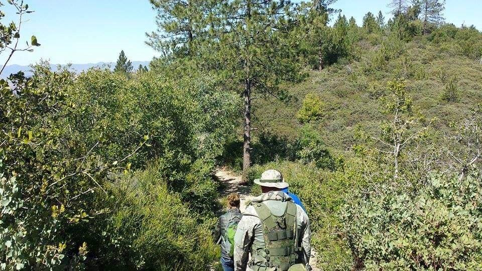
| Trail description: | Group of 20 UCSB students worked White Rock Trail just above the junction with the connector. The trail is in good shape overall, but still needs some brushing between E. Pinery and White Rock Connector. The lower section where chamise is most common should be worked in the next couple years by grubbing out chamise rather than hedging it. There are still erosion issues due to the placement of the trail, but not much has changed over the last few years. HUGE plot of chocolate lilies under the pine right past the junction with White rock connector. Amazing! |
| Mode of transport: | Hike |
| Trail condition: | Needs some work |
| Images: | |
White Rock Trail Survey - 04-26-2021 - by Los Padres Forest Association| Link: | White Rock Trail |
| Date: | 04-26-2021 |
| Surveyor Name: | Los Padres Forest Association |
| Trail description: | White Rock Trail (29W05) up to East Pinery road is in relatively good shape, but vegetation starting to grow in. It is obstructed by dense brush in a few stretches near the chrome mine. |
| Mode of transport: | Hike |
| Trail condition: | Needs some work |
White Rock Trail Survey - 03-02-2021 - by Oak Titmouse| Link: | White Rock Trail |
| Date: | 03-02-2021 |
| Surveyor Name: | Oak Titmouse |
| Trail description: | Easy to follow. Water is currently flowing. The ruins are cool. |
| Mode of transport: | Bicycle |
| Trail condition: | Good shape and easy to follow |
White Rock Trail Survey - 09-07-2021 - by Los Padres Forest Association| Link: | White Rock Trail |
| Date: | 09-07-2021 |
| Surveyor Name: | Los Padres Forest Association |
| Trail description: | Great photo of a mine along White Rock Canyon, compliments of the SYV Archives and the Lompoc Record: https://lompocrecord.com/lifestyles/throwback-thursday-los-padres-abandoned-mine-1972/article_a099b1cc-c534-58e3-babd-55061fa644a8.html |
| Mode of transport: | Hike |
| Trail condition: | Needs some work |
| Images: | |
White Rock Trail Survey - 02-13-2018 - by FP| Link: | White Rock Trail |
| Date: | 02-13-2018 |
| Surveyor Name: | FP |
| Trail description: | Parked car next to trailhead at Sunset Valley Rd. Moderate, 3-mile climb to East Pinery Gate along Figueroa Mtn. Rd. Then walked back down along the road to car. Pleasant walk on a wintery, cool, day. |
| Mode of transport: | Hike |
| Trail condition: | Good shape and easy to follow |
| Images: | approaching East Pinery Gate, the views are the best. Beautiful pine forest close to East Pinery Gate. Trail sign at junction of Forest Service Road 8N32 and White Rock trail. |
White Rock Trail Survey - 12-10-2016 - by Connor Culhane (CCCMB)| Link: | White Rock Trail |
| Date: | 12-10-2016 |
| Surveyor Name: | Connor Culhane (CCCMB) |
| Trail description: | Good shape, fun ride. Getting a little brushy in lower sections. I carried my bike through the muddy, clay soil parts in the middle. Connor Culhane (Central Coast Concerned Mountain Bikers) |
| Mode of transport: | Bicycle |
| Trail condition: | Good shape and easy to follow |
White Rock Trail Survey - 04-14-2015 - by Meghan Sheen| Link: | White Rock Trail |
| Date: | 04-14-2015 |
| Surveyor Name: | Meghan Sheen |
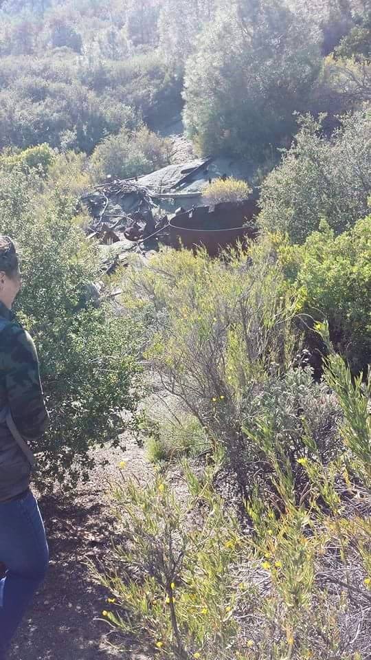
| Trail description: | Good trail, very easy to follow. Water in white rock canyon. Cool abandoned mine equipment and remnants of a mining cabin about .80 miles into the trail from Pinery road. |
| Mode of transport: | Hike |
| Trail condition: | Good shape and easy to follow |
| Images: | Trail shot trail shot trail shot mining remnants mining remnants |
 Survey / Report Form - Please click this box to open the form.