 Use Marker Groups
 Wolf 2002
Piru 2003
Day 2006
Zaca 2007
Gap 2008
La Brea 2009

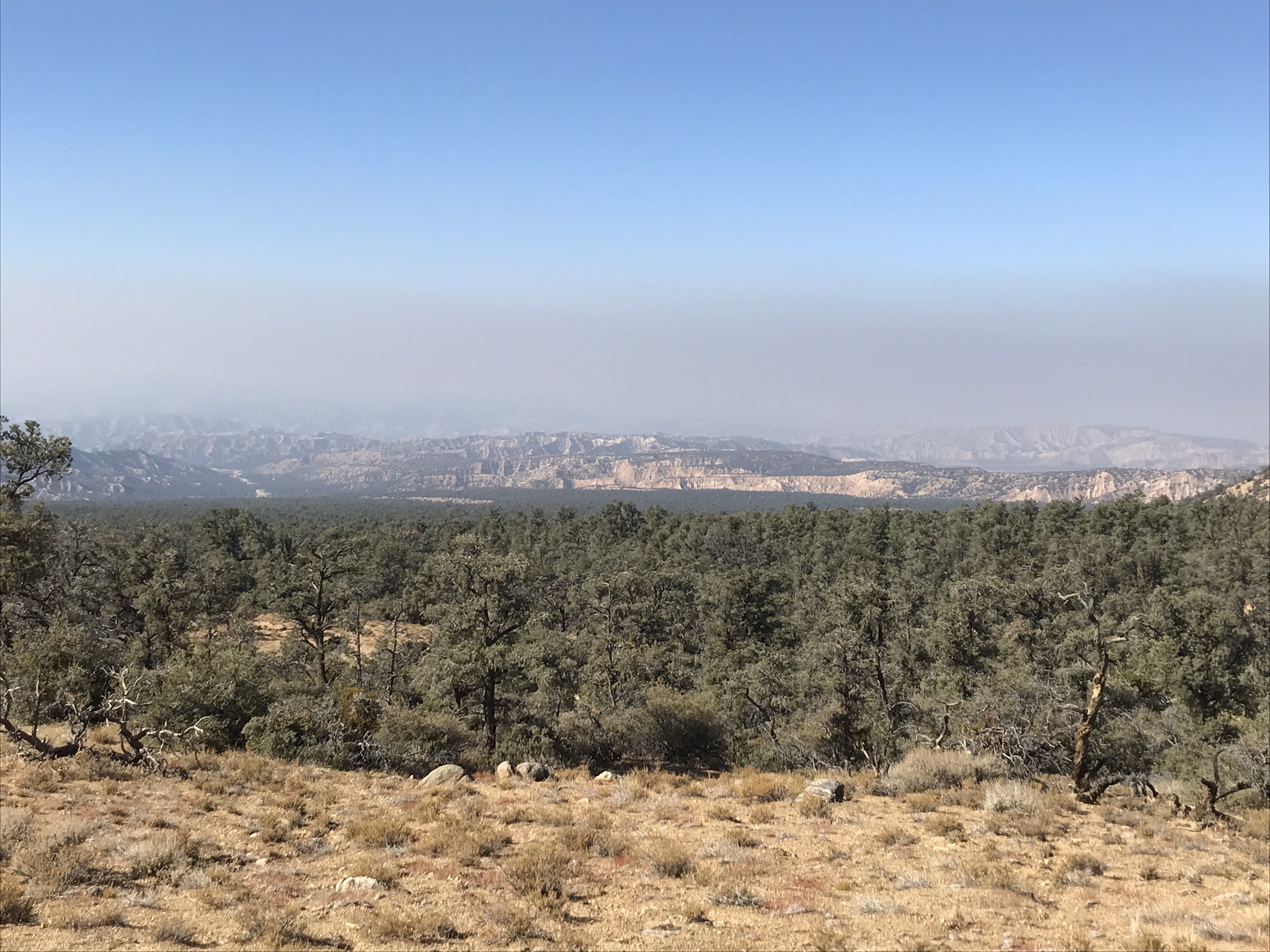
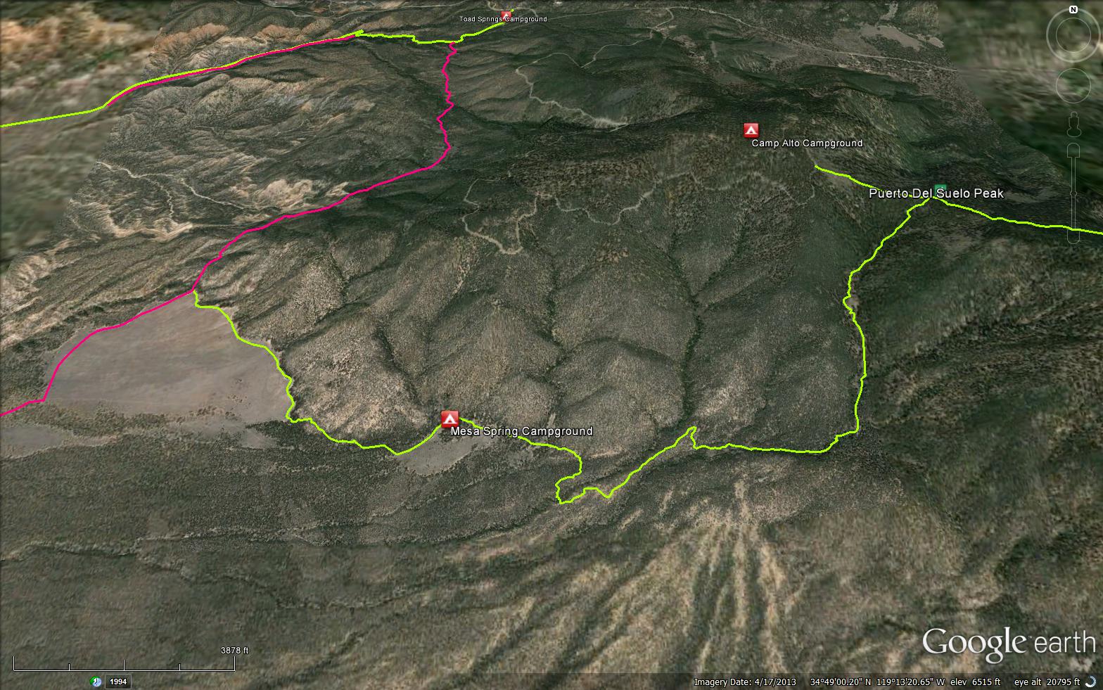
The San Emigdio Mesa Springs Trail is a 5.71 mile trail in the Chumash Wilderness in Ventura County . The trail connects the Toad Springs OHV Trail (22W01) to Puerto Del Suelo Peak - 7708 feet and the Mt Pinos - Tumamait Trail (21W03).


 San Emigdio Mesa Springs Trail Survey - 09-29-2023 - by Drew Helms
| Link: | San Emigdio Mesa Springs Trail |
| Date: | 09-29-2023 |
| Surveyor Name: | Drew Helms |
| Trail description: | I hiked the portion of this trail between the Toad Springs Trail and the Spring. This trail shows signs of not being used very much recently and there are parts where the trail is either a little washed out or overgrown to the point of being more of a general direction suggested by the map than a trail. This is ok along the toes of the hills out over the mesa, but once the trail goes into the woods on the way up to the spring, it gets hard to follow at points. Some trees are down over where the trail maybe should be. There is a point at 34.81113, -119.23593 where I lost the trail traveling in both directions and just had to wander a bit to re-discover it. The spring reservoir is in ok shape. Some branches in the water. |
| Mode of transport: | Hike |
| Trail condition: | Needs some work |
| Condition details: | Mostly good, some places hard to follow |
| Images: | Tank with some branches |
San Emigdio Mesa Springs Trail Survey - 12-11-2020 - by John Doe | Link: | San Emigdio Mesa Springs Trail |
| Date: | 12-11-2020 |
| Surveyor Name: | John Doe |
| Trail description: | Smooth sailing from Nettle Springs to Mesa Springs. A good topo or gps would be wise as there are many side trails and junctions, none of them have signs. Plenty of evidence of illegal OHV use, and to be fair one could ride in from a dispersed site on Apache Cyn without encountering a single “No Motor Vehicles” or wilderness boundary sign. I want to suggest installing a few but they’d probably end up used as targets. |
| Mode of transport: | Hike |
| Trail condition: | Good shape and easy to follow |
San Emigdio Mesa Springs Trail Survey - 10-18-2020 - by Antonio Calderon| Link: | San Emigdio Mesa Springs Trail |
| Date: | 10-18-2020 |
| Surveyor Name: | Antonio Calderon |
| Trail description: | From Cerro Noroeste to Mesa springs camp the trail is in fairly good shape with the exception of a few downed trees. |
| Mode of transport: | Hike |
| Trail condition: | Good shape and easy to follow |
| Images: | |
San Emigdio Mesa Springs Trail Survey - 11-11-2018 - by Christopher P. Lord| Link: | San Emigdio Mesa Springs Trail |
| Date: | 11-11-2018 |
| Surveyor Name: | Christopher P. Lord |
| Trail description: | By Los Padres standards this Trail is in excellent shape. Surveyed from Puerto Del Suelo down to Mesa Spring Camp. Removed and cleared a handful of trees under 12 inch diameter from the trail. Will hopefully return soon to remove the 4 larger trees that remain. A large pine has fallen and crushed the Trail Junction Sign at Tumamait and Mesa Spring Trail. Also trail Marker sign around a quarter mile east from Mesa Spring Camp is laying down in ruins. I will include pictures and way points with this report. https://christopherplord.blogspot.com/2018/11/cerro-noroeste-summit-to-mesa-spring.html |
| Mode of transport: | Hike |
| Trail condition: | Good shape and easy to follow |
| Images: | N34° 49.603' W119° 11.607' Crushed Trail junction sign N34° 48.613' W119° 12.165' 12 inch Downed Pine N34° 48.518' W119° 12.312' 27 inch Downed Pine N34° 48.532' W119° 12.425' 13 inch downed pine N34° 48.680' W119° 13.554' Need new trail Marker sign |
San Emigdio Mesa Springs Trail Survey - 10-06-2014 - by Donna Spencer| Link: | San Emigdio Mesa Springs Trail |
| Date: | 10-06-2014 |
| Surveyor Name: | Donna Spencer |
| Trail description: | From the top of the North Fork Trail through the canyon it will rough is spots due several down trees. Once past the canyon and entering the mesa area, pay close attention to trail. Due in fact to portions being overgrown by small plants and grasses. While at the Mesa Springs Campground, due treat the water from the tank spring (due to heavy overgrowth). Also the fire pits and tables are extremely overgrown with plants. From the Campground return to North Fork Trail, due to landslide concern in the Toad Springs Area. The Toad Spring Trail per the Forest Services is completely closed to all uses |
| Mode of transport: | Hike |
| Trail condition: | Needs some work |
San Emigdio Mesa Springs Trail Survey - 07-06-2019 - by Josh| Link: | San Emigdio Mesa Springs Trail |
| Date: | 07-06-2019 |
| Surveyor Name: | Josh |
| Trail description: | The trail has tons of fallen trees on it, most of which look very fresh (probably b/c of the super rainy winter we had). It was so overgrown that I wasn't sure whether I was actually walking on the trail or whether I was bushwhacking through a dry wash. Very difficult to follow. |
| Mode of transport: | Hike |
| Trail condition: | Hard to follow |
| Condition details: | LOTS of fallen trees, very overgrown, trail very hard to follow |
 Survey / Report Form - Please click this box to open the form.