 Use Marker Groups
 Wolf 2002
Piru 2003
Day 2006
Zaca 2007
Gap 2008
La Brea 2009

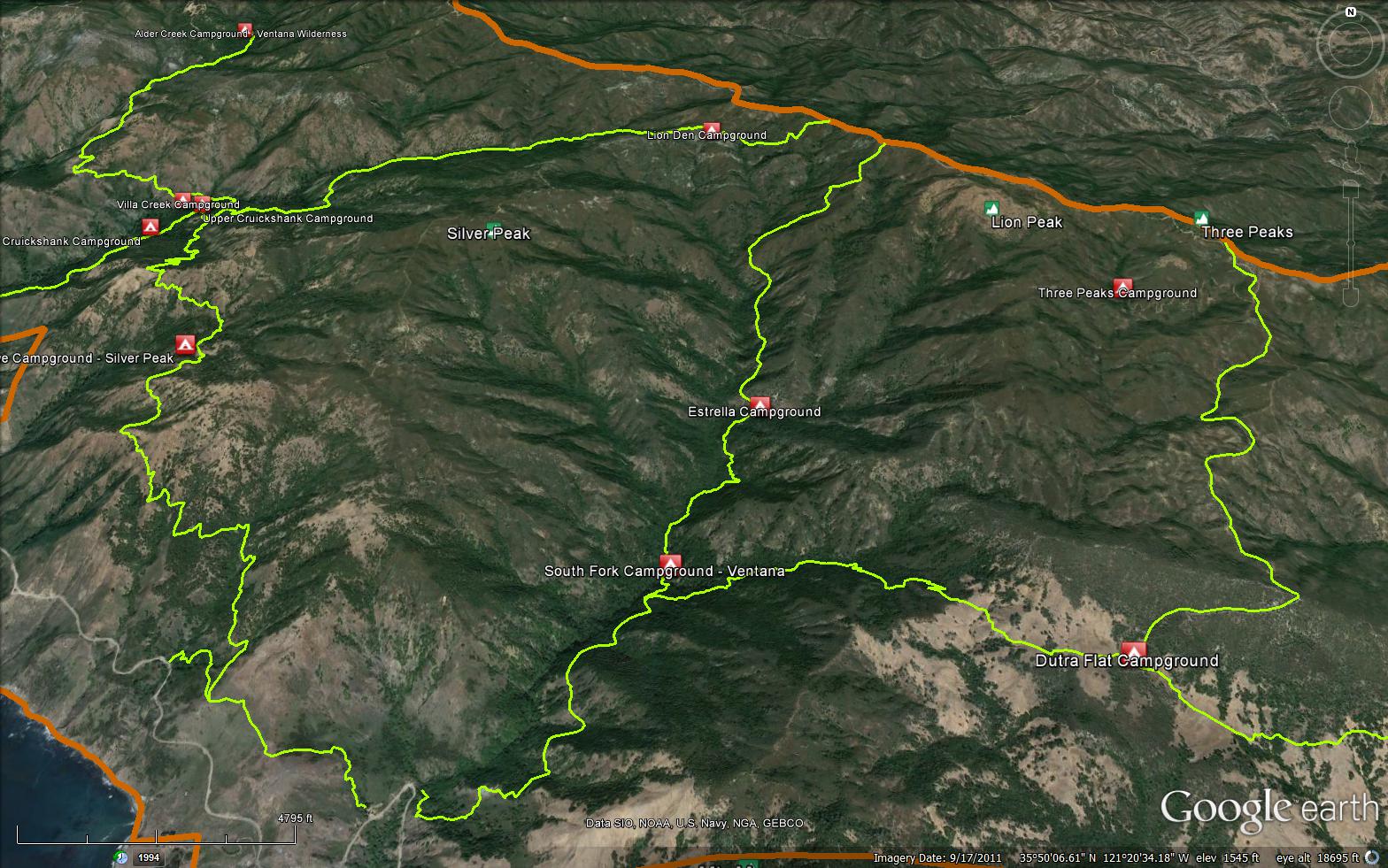
The Salmon Creek Trail is a scenic 5.00 mile trail in the Silver Peak Wilderness in Monterey County . The trail connects the South Coast Ridge Road (20S05.6) and the Highway 1. You can access the trail from Highway 1 at 35.81531, -121.35862. Please let us know if you have explored this trail recently.


 Salmon Creek Trail Survey - 12-21-2024 - by Rich Scholl
| Link: | Salmon Creek Trail |
| Date: | 12-21-2024 |
| Surveyor Name: | Rich Scholl |
| Trail description: | |
| Mode of transport: | Hike |
| Trail condition: | Good shape and easy to follow |
Salmon Creek Trail Survey - 12-13-2022 - by J| Link: | Salmon Creek Trail |
| Date: | 12-13-2022 |
| Surveyor Name: | J |
| Trail description: | The trail is still easy to follow but after the December storms there are some major trees down over the trail. I slowly pushed through but may not be passable by some. Due to the steep terrain going around is not an option. Scree section past Estrella was more than sketchy to cross due to slides. |
| Mode of transport: | Hike |
| Trail condition: | Needs some work |
| Condition details: | Easy to Follow but serious blowdowns and washouts |
Salmon Creek Trail Survey - 11-25-2018 - by Steve Cypher| Link: | Salmon Creek Trail |
| Date: | 11-25-2018 |
| Surveyor Name: | Steve Cypher |
| Trail description: | The trail is clear and well used from Hwy 1 to Estrella Camp. There are narrow spots and a place where you have to duck under a rock that don't meet FS stock-passable standards, but no problem for hikers. A little over a mile above Estrella Camp the trail gets brushy and narrow for about 1/2 mile, and the last 3/4 mile is better. The slide described previously had a path cut across it last year that you can still follow. This is a challenging trail, but it's in better shape than it's been in years. |
| Mode of transport: | Hike |
| Trail condition: | Needs some work |
| Condition details: | Challenging - not too bad |
| Images: | Not suitable for stock |
Salmon Creek Trail Survey - 09-14-2017 - by Anonymous Surveyor| Link: | Salmon Creek Trail |
| Date: | 09-14-2017 |
| Surveyor Name: | Anonymous Surveyor |
| Trail description: | There were many parts of the trail above Estrella camp and below the Coast Ridge road that were barely passable on foot - very overgrown and the trail surface was loose at times and would slide out from under you. There is a very loose slide that has made the trail disappear. There is another slide further down that does have a small path cut into it. |
| Mode of transport: | Hike |
| Trail condition: | Needs some work |
| Condition details: | Overgrown and landslide |
Salmon Creek Trail Survey - 07-29-2017 - by Anonymous Surveyor| Link: | Salmon Creek Trail |
| Date: | 07-29-2017 |
| Surveyor Name: | Anonymous Surveyor |
| Trail description: | Lower and upper part of the trail is fine. The middle is where the challenge is! |
| Mode of transport: | Hike |
| Trail condition: | Needs some work |
| Images: | |
Salmon Creek Trail Survey - 04-16-2017 - by Robert Gunn| Link: | Salmon Creek Trail |
| Date: | 04-16-2017 |
| Surveyor Name: | Robert Gunn |
| Trail description: | On April 13th we completed a Highway 1 closure-modified 3 day backpack loop through the southern section of Silver Peaks Wilderness. Salmon Creek trail is clear and in good condition from the trailhead to the junction with Spruce Creek trail. |
| Mode of transport: | Hike |
| Trail condition: | Good shape and easy to follow |
Salmon Creek Trail Survey - 06-14-2016 - by Los Padres Forest Association| Link: | Salmon Creek Trail |
| Date: | 06-14-2016 |
| Surveyor Name: | Los Padres Forest Association |
| Trail description: | Article in the SB Independent about the Salmon Creek Trail, by Richie Demaria: http://www.independent.com/news/2016/jun/14/salmon-creek-trail/ |
| Mode of transport: | Hike |
| Trail condition: | Good shape and easy to follow |
Salmon Creek Trail Survey - 02-14-2015 - by Anonymous Surveyor| Link: | Salmon Creek Trail |
| Date: | 02-14-2015 |
| Surveyor Name: | Anonymous Surveyor |
| Trail description: | After estrella it gets thin on parts of the trail and planta overgrowing the trail on some parts definetly all uphill basically until you get to the fire road. Its ablut 2.5 miles but it feels like 4Â |
| Mode of transport: | Hike |
| Trail condition: | Needs some work |
| Condition details: | A little overgrown |
 Survey / Report Form - Please click this box to open the form.