 Use Marker Groups
 Wolf 2002
Piru 2003
Day 2006
Zaca 2007
Gap 2008
La Brea 2009

| Date | Surveyor | Water Report |
| 05-28-2022 | Smitty | Flowing |
| 04-01-2022 | Adam Donald | Flowing |
| 11-19-2021 | Los Padres Forest Association | Flowing |
| 06-19-2021 | John Smith | Flowing |
| 03-05-2021 | Anonymous Surveyor | Flowing |
| 05-09-2020 | Peter C | Flowing |
| 04-12-2020 | James | Flowing |
| 07-04-2019 | Casey P | Flowing |
| 05-28-2019 | Chris B | Flowing |
| 11-05-2018 | Jonathan Rocque | Flowing |
| 02-23-2018 | Los Padres Forest Association | Flowing |
| 07-15-2017 | Los Padres Forest Association | Flowing |
| 06-10-2017 | Anonymous Surveyor | Flowing |
| 06-02-2017 | Anonymous Surveyor | Flowing |
| 12-04-2016 | Anonymous Surveyor | Flowing |
| 08-11-2016 | Anonymous Surveyor | Trickle |
| 06-04-2016 | Los Padres Forest Association | Flowing |
| 05-24-2016 | Los Padres Forest Association | Flowing |
| 04-23-2016 | Ben Crop | Flowing |
| 11-21-2015 | Melissa Ellis | Trickle |
| 11-10-2015 | Valerie Norton | Flowing |
Since the closure of Romero Camuesa Road (5N15.1) to vehicular traffic, Alder Creek Camp has become much more remote than it once was. Although only about 1.2 miles from the North Franklin Trailhead, the camp now must be accessed 8.8 miles away at the South Franklin Trailhead in Carpinteria. It can also be accessed via long road walks or bike/hike combo from Romero Saddle and Matilija Canyon Road. As of 2021, the camp contains a new picnic table, sign, and space for a few tents.
This camp was undoubtedly named on behalf of the local Alder Tree population, which exists here because of a permanent water supply. The flume north of camp carries water from Alder Creek into Jameson Lake, the water supply for Montecito. The site was originally established as a camp of "Dad Ramey" (or possibly, "Ramie"), a Carpinterian who built the Alder Creek Trail in order to connect the Franklin Canyon Trail with Juncal Marietta Divide Trail, and the Santa Ynez River at Billiard Flats. The site was then further developed by the Civilian Conservation Corps for the Forest Service.


 Alder Creek Camp - Santa Barbara County Survey - 05-28-2022 - by Smitty
| Link: | Alder Creek Camp - Santa Barbara County |
| Date: | 05-28-2022 |
| Surveyor Name: | Smitty |
| Camp Description: | Camp was pretty overgrown and there was a gauntlet of poison oak on the trail both above and below the camp. Fire pit shove was intact and the picnic table is in really good shape. Franklin trail needs love. |
| Water Source: | Flowing |
| Water Source Details: | Pretty good flow just downhill from the camp. |
| Weather Conditions: |
Alder Creek Camp - Santa Barbara County Survey - 04-01-2022 - by Adam Donald| Link: | Alder Creek Camp - Santa Barbara County |
| Date: | 04-01-2022 |
| Surveyor Name: | Adam Donald |
| Camp Description: | Camp is clear and in good shape, though the ground is somewhat rocky in places. Nice sign. No water in the creek uphill from camp, but easy access to a nice flow of water in the creek just downhill from camp. |
| Water Source: | Flowing |
| Water Source Details: | Creek is flowing starting ~100 yards below camp |
| Weather Conditions: | Warm during the day, cool but not cold at night |
| Images: | |
Alder Creek Camp - Santa Barbara County Survey - 11-19-2021 - by Los Padres Forest Association| Link: | Alder Creek Camp - Santa Barbara County |
| Date: | 11-19-2021 |
| Surveyor Name: | Los Padres Forest Association |
| Camp Description: | LPFA partnered with Scout Troop 50 to restore the camp at Alder. There is once again a table, sign, some cleared space and a redone fire ring. Great work scouts! Enjoy........ |
| Water Source: | Flowing |
| Water Source Details: | We've never heard of Alder being completely dry, there is usually water in the drainage downstream from the camp. |
| Weather Conditions: |
Alder Creek Camp - Santa Barbara County Survey - 06-19-2021 - by John Smith| Link: | Alder Creek Camp - Santa Barbara County |
| Date: | 06-19-2021 |
| Surveyor Name: | John Smith |
| Camp Description: | Franklin Trail, from Carpinteria High School to Jameson Lake Water Water flowing about 200ft down the trail from Alder Camp. (Approx. 34.475648,-119.497419). Enough to fill the water bottle. Further down (towards Jameson Lake), the flow gets stronger, there are some very small waterfalls. Shade No shade from Carpinteria High School to Alder Creek. Nice and shady from Alder Camp to Murietta Juncal Rd. No shade on Murietta Juncal Rd. Trail Trail is in passable condition from Carpinteia High School to Alder Camp. A stretch from Alder Camp to Murietta Juncal Rd is overgrown. Trail is marked with tape. Going towards Jameson Lake is doable, going uphill, it's harder to see the tape. Have to cross a couple of fallen logs. |
| Water Source: | Flowing |
| Water Source Details: | |
| Weather Conditions: | |
| Images: | Alder Creek, about 200ft down from Alder Creek Camp |
Alder Creek Camp - Santa Barbara County Survey - 03-05-2021 - by Anonymous Surveyor| Link: | Alder Creek Camp - Santa Barbara County |
| Date: | 03-05-2021 |
| Surveyor Name: | Anonymous Surveyor |
| Camp Description: | Camp was in rough shape a lot of over grown brush |
| Water Source: | Flowing |
| Water Source Details: | it was flowing down the canyon from camp |
| Weather Conditions: |
Alder Creek Camp - Santa Barbara County Survey - 05-09-2020 - by Peter C| Link: | Alder Creek Camp - Santa Barbara County |
| Date: | 05-09-2020 |
| Surveyor Name: | Peter C |
| Camp Description: | On a bike trip, I carried/wheeled my bike down from Divide Peak OHV road, down Franklin Trail to Alder Creek and then to Jameson Lake. The trail was very overgrown above the campsite, not rideable though. That part of the trail was ok and not too hard to follow.  However, below the campsite things are a different matter. Trail is washed out in many places, including spots high above creek, and was also severely overgrown to the point of not be locatable in many areas.  Washouts required descending to creek and then scrambling up slopes through vegetation. Had to carry, instead of wheel, the bike through long sections. In all, about 40% of the lower part was not on trail, but instead bushwhacking or creek hopping. |
| Water Source: | Flowing |
| Water Source Details: | Flowing strongly 1/4 mile below Alder Creek campsite |
| Weather Conditions: | 75 and sunny |
Alder Creek Camp - Santa Barbara County Survey - 04-12-2020 - by James| Link: | Alder Creek Camp - Santa Barbara County |
| Date: | 04-12-2020 |
| Surveyor Name: | James |
| Camp Description: | Trail is faint, easy to lose in a few spots, lots of poison oak in camp. |
| Water Source: | Flowing |
| Water Source Details: | Creek flowing very well |
| Weather Conditions: |
Alder Creek Camp - Santa Barbara County Survey - 07-04-2019 - by Casey P| Link: | Alder Creek Camp - Santa Barbara County |
| Date: | 07-04-2019 |
| Surveyor Name: | Casey P |
| Camp Description: | Camp was pretty overgrown and hard to find. Â Beware the hazard trees. Â And there were flies. Â Other than those minor adventure-making aspects, a very enjoyable stop. |
| Water Source: | Flowing |
| Water Source Details: | Water flowing at the junction just South (downstream) of camp |
| Weather Conditions: | |
| Images: | The Humboldt Lilies in bloom Camp site view from a tree |
Alder Creek Camp - Santa Barbara County Survey - 05-28-2019 - by Chris B| Link: | Alder Creek Camp - Santa Barbara County |
| Date: | 05-28-2019 |
| Surveyor Name: | Chris B |
| Camp Description: | Access up to camp through Franklin trail coming from Jameson Lake is heavily washed out in parts and heavily overgrown. Can be incredibly difficult to ascend up through the creek and valley; trail needs to be remarked and cleared. Heavy on bugs. |
| Water Source: | Flowing |
| Water Source Details: | Water flowing steadily, easy access for filtration |
| Weather Conditions: |
Alder Creek Camp - Santa Barbara County Survey - 11-05-2018 - by Jonathan Rocque| Link: | Alder Creek Camp - Santa Barbara County |
| Date: | 11-05-2018 |
| Surveyor Name: | Jonathan Rocque |
| Camp Description: | Camp is in very bad shape relative to the last
pictures posted. The fire devastated many of the trees and there were
downed trunks and branches all around. There's clear evidence of mud and
debris flows through camp. There wasn't a single readily accessible flat
campsite and we managed to clear a small area near the fire pit.  This camp needs some serious rehabilitation and can be improved by clearing the debris, cutting downed trees and leveling a few sites.  On the bright side, many burned trees have new growth from the roots and several oaks are greening up again. In addition, the creek was flowing well which was appreciated after 10 mile hike to camp. |
| Water Source: | Flowing |
| Water Source Details: | Water is flowing gently through the creek |
| Weather Conditions: | Very warm, 80s during the day and high 50s at night |
| Images: | Fire pit and downed tree The old crapper. Life sprouting from a dead tree Looking up through camp from the North entrance Trail visible on the left and blocked by downed branches Debris in path |
Alder Creek Camp - Santa Barbara County Survey - 02-23-2018 - by Los Padres Forest Association| Link: | Alder Creek Camp - Santa Barbara County |
| Date: | 02-23-2018 |
| Surveyor Name: | Los Padres Forest Association |
| Camp Description: | Scouted North Franklin Trail and Alder Creek in February as part of a BAER assessment. Alder Creek Camp was pretty messed up. Water was flowing good through camp but there were a lot of dead snag trees around camp that could be hazardous. Keep an eye on those and camp in safe locations. |
| Water Source: | Flowing |
| Water Source Details: | |
| Weather Conditions: | Chilly and windy |
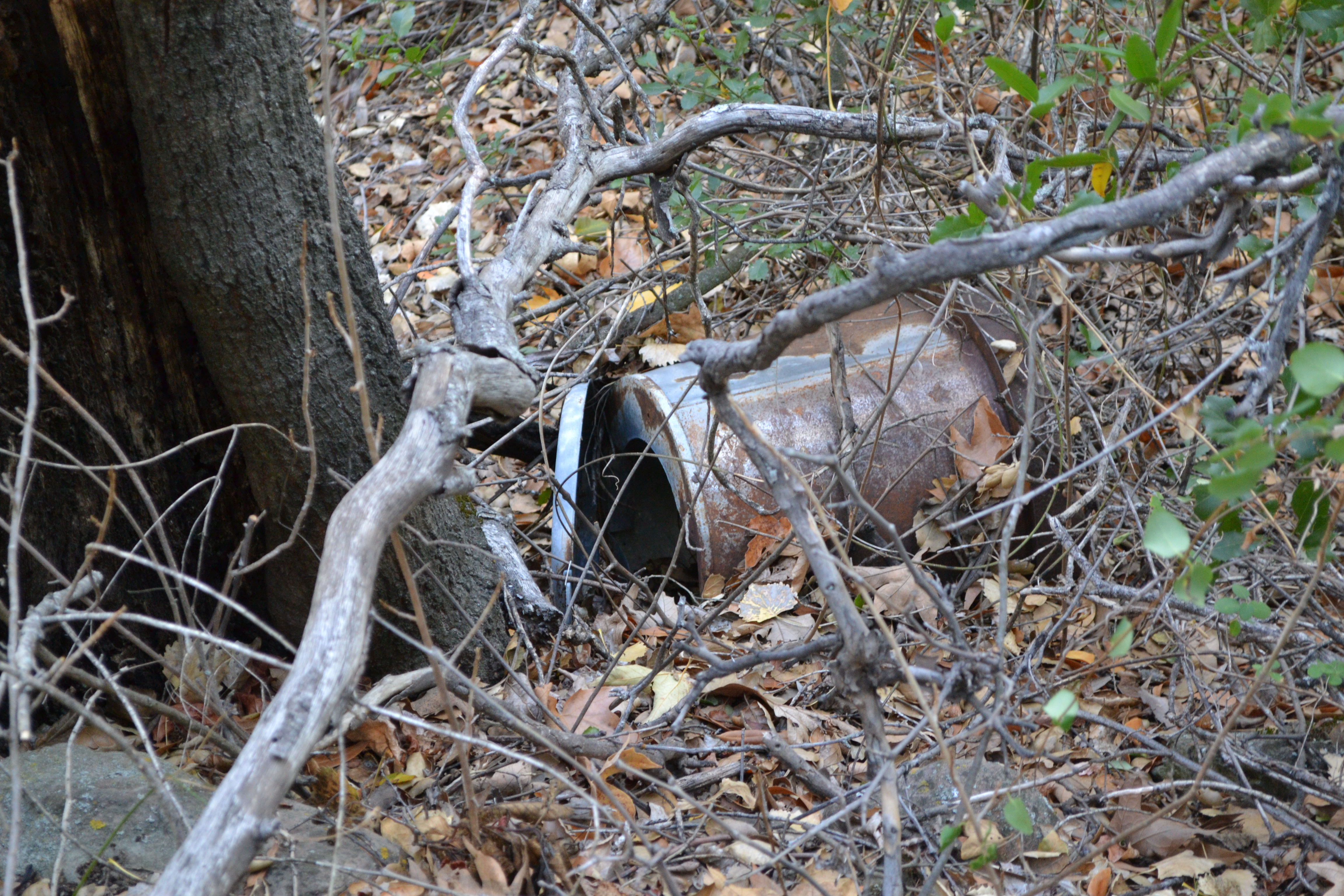
| Images: | The "new" shovel burned Alder showing the hazard trees The old toilet, which is pretty much in the trail |
Alder Creek Camp - Santa Barbara County Survey - 07-15-2017 - by Los Padres Forest Association| Link: | Alder Creek Camp - Santa Barbara County |
| Date: | 07-15-2017 |
| Surveyor Name: | Los Padres Forest Association |
| Camp Description: | Alder was clean and tidy but its usual dark self with not a lot of room to spread out. Â Water was flowing both in the creek below the camp and the tributary just down stream from the camp. The camp crapper is located in the trail about 10 yards above the camp. Â Would be nice to move that and install it in a more appropriate place. |
| Water Source: | Flowing |
| Water Source Details: | |
| Weather Conditions: | mid-90's, hot and smoky from the Whittier Fire |
| Images: | Crapper in the Trail |
Alder Creek Camp - Santa Barbara County Survey - 06-10-2017 - by Anonymous Surveyor| Link: | Alder Creek Camp - Santa Barbara County |
| Date: | 06-10-2017 |
| Surveyor Name: | Anonymous Surveyor |
| Camp Description: | Creek still flowing well. Poison oak on the trail, and around the campsite is a drag. We cleared some, but there is plenty more.... We were there the same day as the private plane crash nearby, hope pilot recovers well. |
| Water Source: | Flowing |
| Water Source Details: | |
| Weather Conditions: |
Alder Creek Camp - Santa Barbara County Survey - 06-02-2017 - by Anonymous Surveyor| Link: | Alder Creek Camp - Santa Barbara County |
| Date: | 06-02-2017 |
| Surveyor Name: | Anonymous Surveyor |
| Camp Description: | Bugs were relentless |
| Water Source: | Flowing |
| Water Source Details: | Still flowing pretty strong |
| Weather Conditions: |
Alder Creek Camp - Santa Barbara County Survey - 12-04-2016 - by Anonymous Surveyor| Link: | Alder Creek Camp - Santa Barbara County |
| Date: | 12-04-2016 |
| Surveyor Name: | Anonymous Surveyor |
| Camp Description: | |
| Water Source: | Flowing |
| Water Source Details: | At the camp is dry but flowing nicely just downtrail from the camp. |
| Weather Conditions: | |
| Images: | |
Alder Creek Camp - Santa Barbara County Survey - 08-11-2016 - by Anonymous Surveyor| Link: | Alder Creek Camp - Santa Barbara County |
| Date: | 08-11-2016 |
| Surveyor Name: | Anonymous Surveyor |
| Camp Description: | Spot for a 1 person tent that is flat, anything bigger the ground is pretty slanted. Plenty of firewood around and rocks for sitting. The Santa Inez river was dry as well as the surrounding area, once near Alder Creek water was clear and flowing. The creek near the campsite had a strong sulfur-egg odor, but water further down was clean and clear. The trail Alder Creek is decently maintained but about 1 mile up  with a very sketchy area where rocks and shale make passing treacherous--still accessible--but do so with care. |
| Water Source: | Trickle |
| Water Source Details: | Trickle in some, Flowing further down the trail |
| Weather Conditions: | MIld 70-80 degrees |
| Images: | the campsite back down the trail |
Alder Creek Camp - Santa Barbara County Survey - 06-04-2016 - by Los Padres Forest Association| Link: | Alder Creek Camp - Santa Barbara County |
| Date: | 06-04-2016 |
| Surveyor Name: | Los Padres Forest Association |
| Camp Description: | Water still flowing nicely in both the tributary and the main creek. Â Water also along most of the course of the trail. |
| Water Source: | Flowing |
| Water Source Details: | |
| Weather Conditions: | Low 90's and HOT but not that hot, certainly doable and shady at the camp. |
Alder Creek Camp - Santa Barbara County Survey - 05-24-2016 - by Los Padres Forest Association| Link: | Alder Creek Camp - Santa Barbara County |
| Date: | 05-24-2016 |
| Surveyor Name: | Los Padres Forest Association |
| Camp Description: | Hiked up to Alder Creek Camp from the Jameson Trailhead in order to scout the trail for an upcoming trail project. Â The camp was clean and in great shape. Â It has received some recent special attention courtesy of a MTF special task force. Â Water was flowing nicely in both the main creek as well as the nearby downstream tributary. Â Great camp, lots of shade, nice place to go when the weather heats up. |
| Water Source: | Flowing |
| Water Source Details: | |
| Weather Conditions: | High 70's, warm, slight breeze, pleasant. |
| Images: | Newly fashioned shovel at camp, courtesy MTF. The Camp Creek flowing nicely in nearby tributary. The Camp 2 |
Alder Creek Camp - Santa Barbara County Survey - 04-23-2016 - by Ben Crop| Link: | Alder Creek Camp - Santa Barbara County |
| Date: | 04-23-2016 |
| Surveyor Name: | Ben Crop |
| Camp Description: | The lower approach trail was overgrown. Â We did out best to clear the way and added cairns where the trail changed due to down trees. Â So much poison oak! Â The allergic should beware; it was everywhere and there was no way to hike the trail to the camp without interacting with it. Â It was even growing in the campsite itself. |
| Water Source: | Flowing |
| Water Source Details: | Small stream about 6 inches deep, no signs of slowing; plenty of water at the lower end of the trail. |
| Weather Conditions: | Very windy, 70deg F at noon, 40 deg F at night |
| Images: | |
Alder Creek Camp - Santa Barbara County Survey - 11-21-2015 - by Melissa Ellis| Link: | Alder Creek Camp - Santa Barbara County |
| Date: | 11-21-2015 |
| Surveyor Name: | Melissa Ellis |
| Camp Description: | We tried to access Alder Creek Camp from the Franklin Trail connector off of the Divide Peak OHV trail with the hopes of looping back. Unfortunately we never made it to the camp. The Franklin Trail from Divide Peak is completely overgrown, we found an area that most likely was once the trail head where there was evidence of long ago sawed off branches but the shrubs have since grown to over 6 feet high. Down the canyon some we could again see a hint of a trail under the power lines but no path to get there. Some trail clearing with hack saws and the like is required to make this passable again. |
| Water Source: | Trickle |
| Water Source Details: | unknown (couldn't submit form without picking a water source option) |
| Weather Conditions: |
Alder Creek Camp - Santa Barbara County Survey - 11-10-2015 - by Valerie Norton| Link: | Alder Creek Camp - Santa Barbara County |
| Date: | 11-10-2015 |
| Surveyor Name: | Valerie Norton |
| Camp Description: | Camp is just a small clearing along trail with rock fire ring and a couple built flat spots. Â Water can be found below the camp about a tenth of a mile and comes down a different canyon. Â Water in the bottom near the flume is flowing much better, but by the camp it is a clear stream even if the flow is a bit light. Â There was a toilet, but now the seat is loose and there are no clues as to where it should be. |
| Water Source: | Flowing |
| Water Source Details: | low flow, but clear |
| Weather Conditions: | cooler than surroundings |
| Images: | |
 Survey / Report Form