 Use Marker Groups
 Wolf 2002
Piru 2003
Day 2006
Zaca 2007
Gap 2008
La Brea 2009

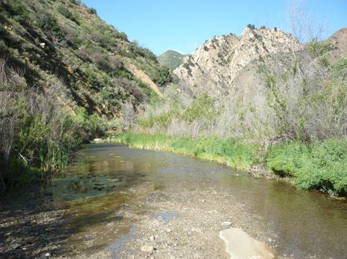
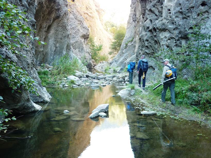
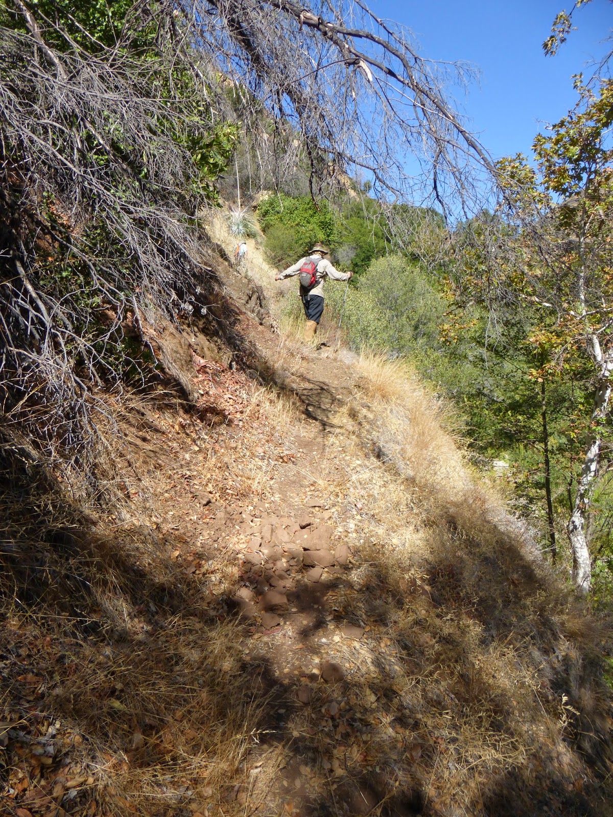
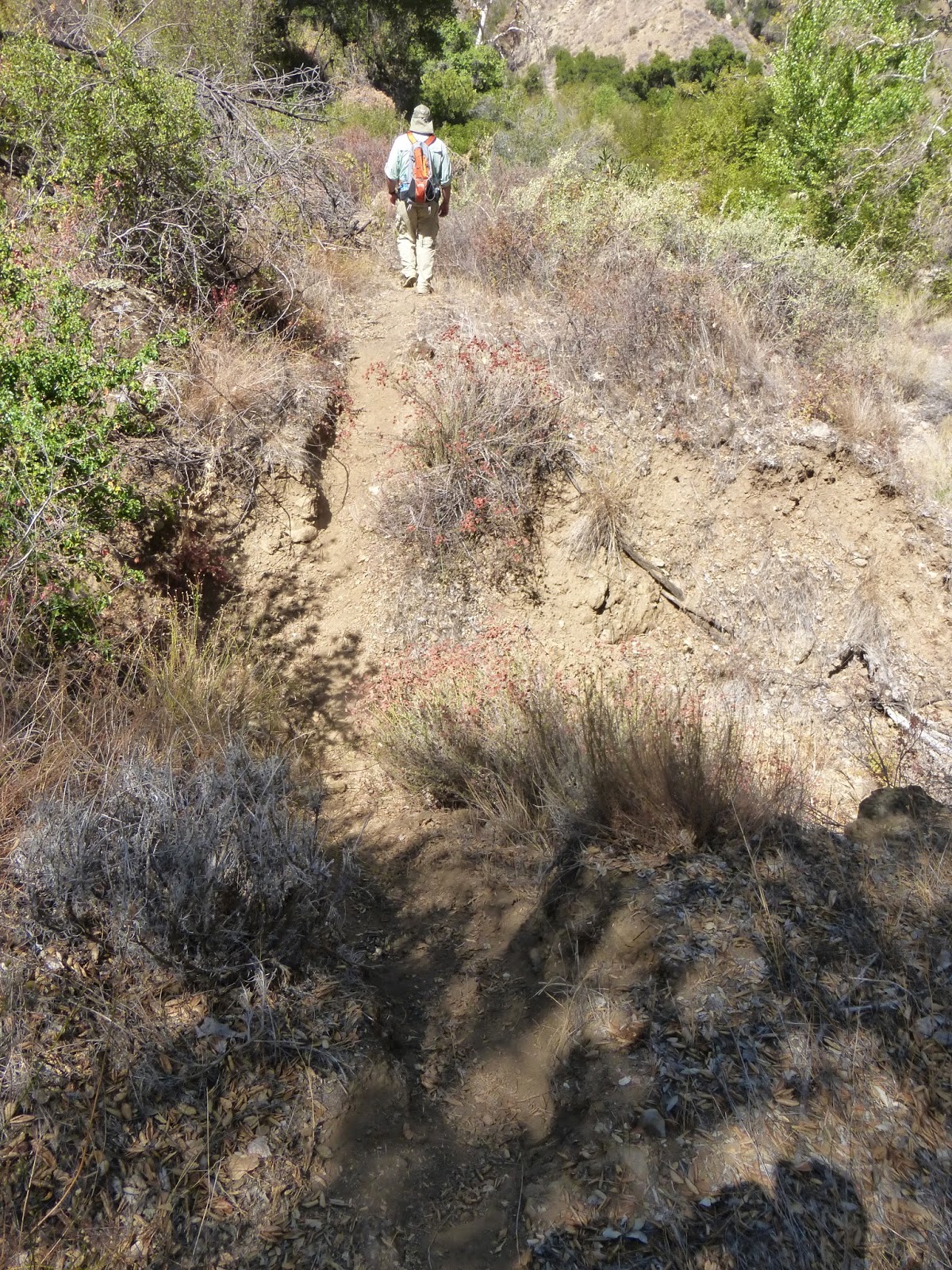
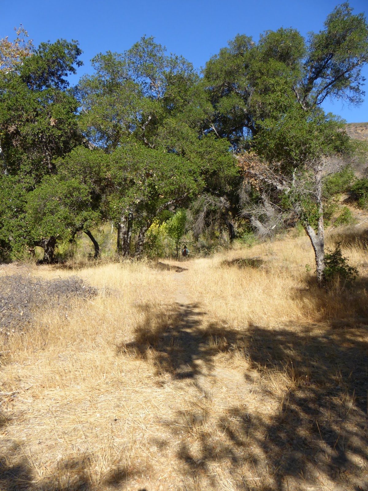
In the 1930's the U. S. Forest Service, using C.C.C. (Civilian Conservation Corps) labor, improved an old Chumash trail that followed Agua Blanca Creek up the canyon. It was a popular trail because of the good hunting and fishing in the canyon. The trail begins at Festers Camp at the junction of the canyon with Piru Creek. Following up the canyon it comes to the Devils Gateway which is a narrow cliff cut through a conglomerate rock ridge. There is a trail over the ridge but it is rocky and steep. It is best to go up through the pools in the bottom of Devils Gate. Just beyond the narrows is a junction with the Pot Hole Trail that crosses the creek and climbs to reach the old Whitaker cabin and Pot Hole. Just beyond the trail junction is Log Cabin Camp. The cabin is long gone but a trail camp is located at the site. Continuing on up the Agua Blanca Creek the trail will pass a historic campsite called Hollister Camp. It was named for an early day U. S. Forest Ranger who had a camp beside the creek. Next comes Cove Camp on the left hand side of the creek. The trail beyond Cove Camp has not been maintained in many years and is more of a route than a trail at this point.
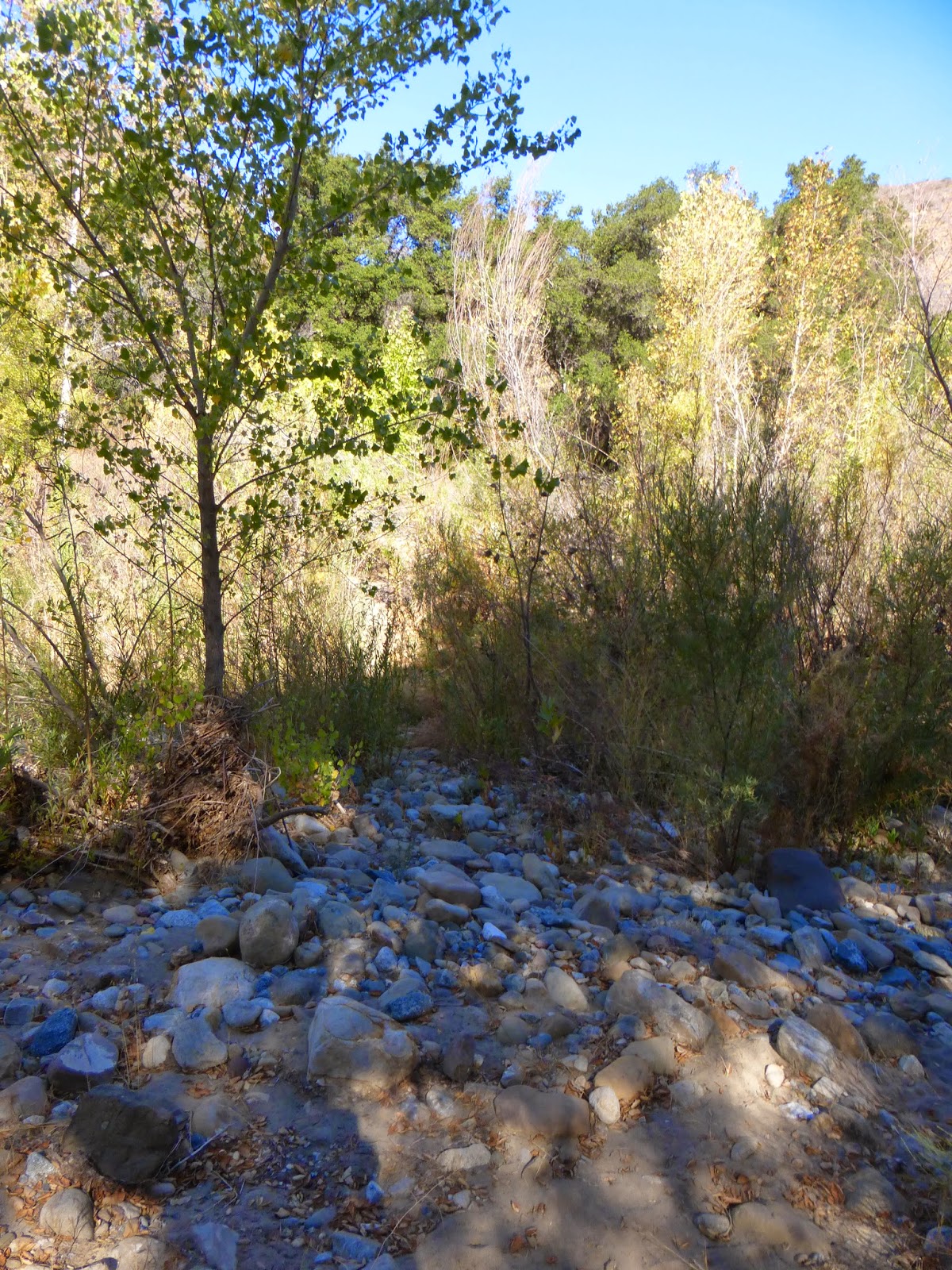
A short distance beyond this camp is Big Narrows. Here the creek cuts through a ridge of cobblestone to form a "U" like narrows. The walls of the cliff are very tall and numerous pools form as the creek descends through the narrows. There is an old trail that climbs over the ridge on the west side of the narrows but it is more enjoyable to go through the narrow part of the canyon.
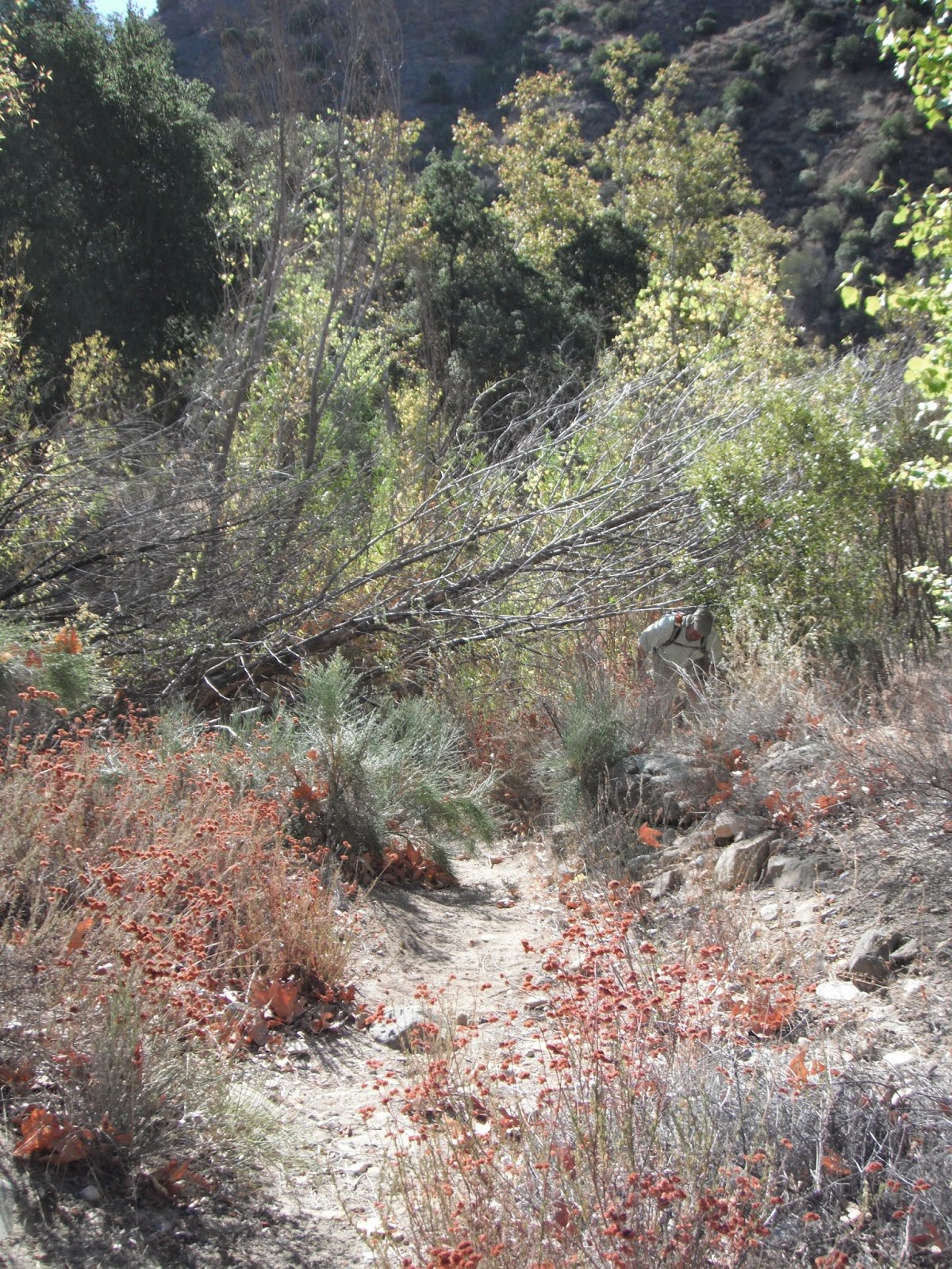
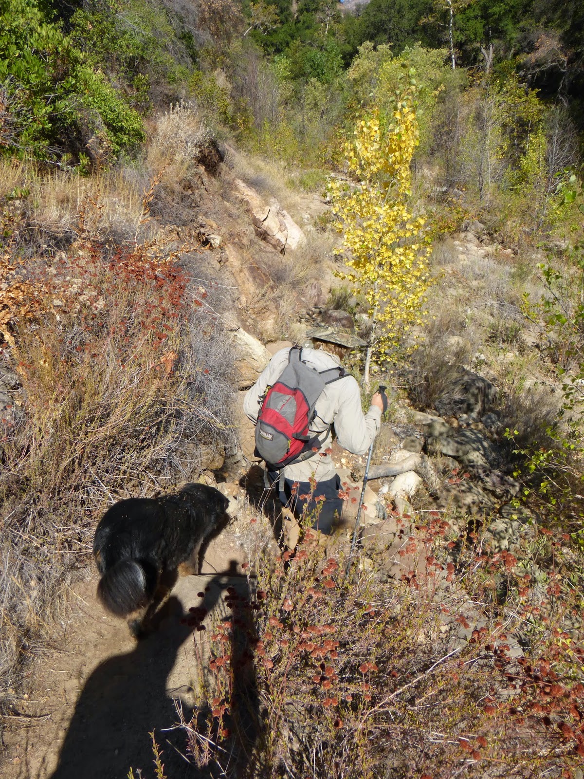
Further up the creek the trail reaches Ant Camp where a trail comes in from Dough Flat and Fillmore. The Agua Blanca Trail used to continue up the creek passing two old hunting camps, Saddle Skirt and Borracho Spring, to finally climb to the top of Cobblestone Mountain but the trail beyond Ant Camp has not received any maintenance and is now a wall of dense brush, poison oak, and washouts from floods.
From Highway 126 turn north on Piru Canyon Road. Drive 6 miles to Lake Piru Gatehouse and let them know you plan to hike the Agua Blanca Trail. There is no fee for accessing the Forest Service Trailhead, but they will give you a parking pass and ask a few questions about your trip.
Continue past the boat launch ramp to the Pothole Trailhead (34.511726, -118.762658) on Piru Canyon Road. Park and continue down the road past the locked gate for another 2.8 miles until a junction just before it reaches Agua Blanca Creek. At the junction, turn left (west) to the Agua Blanca Trail where the single track and Sespe Wilderness begin.
Log Cabin Camp above Devil's Gateway is 3.1 miles from the start of the single track. The Pothole Trail (18W04) intersects the trail near Log Cabin Camp. Continuing on the Agua Blanca Trail is barely passable for hiking and is definitely not recommended for horseback riders. Poison oak along the trail is unavoidable. The Agua Blanca Trail is one of the most scenic trails on the Ojai Ranger District.


 Agua Blanca Trail Survey - 05-28-2026 - by Holden A. Branch
| Link: | Agua Blanca Trail |
| Date: | 05-28-2026 |
| Surveyor Name: | Holden A. Branch |
| Trail description: | "Camp Agua Blanca" (end of road, start of trail) to Log Cabin is in good condition, it's a beautiful walk. However, you really gotta look at the map all the time because the trail goes up on the ridges of the river bank. it's marked, however it's easy to get off if you're rockhopping, and when you go astray it's not fun. Pothole trailhead up the road is not a fun walk. Be prepared to take shoes off for that section. |
| Mode of transport: | Hike |
| Trail condition: | Good shape and easy to follow |
Agua Blanca Trail Survey - 04-04-2026 - by Anonymous Surveyor| Link: | Agua Blanca Trail |
| Date: | 04-04-2026 |
| Surveyor Name: | Anonymous Surveyor |
| Trail description: | |
| Mode of transport: | Hike |
| Trail condition: | Needs some work |
| Images: | |
Agua Blanca Trail Survey - 04-04-2026 - by Anonymous Surveyor| Link: | Agua Blanca Trail |
| Date: | 04-04-2026 |
| Surveyor Name: | Anonymous Surveyor |
| Trail description: | Brushy but in good condition. Some new flagging would be helpful at the crossings but still pretty easy to follow. Poison oak present |
| Mode of transport: | Hike |
| Trail condition: | Needs some work |
Agua Blanca Trail Survey - 03-21-2026 - by Jonathan Rocque| Link: | Agua Blanca Trail |
| Date: | 03-21-2026 |
| Surveyor Name: | Jonathan Rocque |
| Trail description: | Hiked from the Pothole Trailhead parking lot up the road to the Agua Blanca trail. The trail was great up to Log Cabin Camp. From there, the trail had obvious washouts and there was lots of evidence of flash flooding from the heavy rains a few years ago. Very scenic the whole time and then we just got tired of creek walking and made a trail camp somewhere between Log Cabin and Cove Camps. |
| Mode of transport: | Hike |
| Trail condition: | Hard to follow |
Agua Blanca Trail Survey - 01-31-2026 - by Jonathan Maguire| Link: | Agua Blanca Trail |
| Date: | 01-31-2026 |
| Surveyor Name: | Jonathan Maguire |
| Trail description: | I took the Potholes trail to the Log Cabin Camp and then the Agua Blanca trail back to the lot for a nice loop. The potholes trail is findable and in decent condition. It first follows a fire break steeply up a ridge. As such it is very grassy with no shade whatsoever. There are also excellent views as a result. I was very surprised at how few ticks I brushed off given the grassy vegetation. Seems like this section could easily become overgrown and/or tick infested but it wasn't on this fine late January day. At one point I found myself wishing for switchbacks and noticed some on the next ridge. I couldn't find whatever trail that is on the maps and, though I looked, I also couldn't find any connection to it on my route. I also looked briefly for it when i returned to the lot but couldn't find anything there either. Hopefully a new improved route is in the works. After climbing up the steep shadeless firebreak the trail follows various ridge tops. Beautiful views can be enjoyed in every direction here. Eventually the trail descends into the big pothole. There is plenty of what I've heard people call "deer weed" but I've come to think of as "tick weed" growing into the trail here, so more ticks. The pothole itself is really nice with lots of large mature oaks. The quantity of small flies kept me moving at a good pace. I thought of stopping here to eat but the flies were quite aggressive. I soon came to log cabin camp which looks nice enough with plenty of level spots around to pitch a tent and a rock fire ring with a few rocks around to sit on. The cabin itself is surely occupied by critters so personally I wouldn't spend any time in it. There were more flies here than anywhere else on the whole route so I stayed a few seconds to take a photo before they shooed me away. Next I moved quickly through a short buggy section that follows and crosses a drainage several times down to Agua Blanca creek itself. Several sections looked like they'd slip out soon due to undercutting along the embankment but they were still intact on this day. Between the pothole and Aqua Blanca there a couple large trees/branches that have fallen across the trail but easy enough to climb over. I crossed the Agua Blanca creek for the first of countless times and found the Agua Blanca trail ascending to the right just on the other side thanks to orange tape flagging that trail crews must have left tied to a tree. Most of the crossings I used had this tape and between that and my GPS I was able to stick to the trail with minimal backtracking. The tape is deteriorating in places and may be gone already at a couple crossings so if this is the main way for people to find the trail then it probably needs replacing soon. Just after the first crossing the trail enters the creek and the narrows, which were beautiful and full of water. Traversing in and around the creek is a lot of fun and made me forget about the flies which were ever-present but not as bad as at the pothole or cabin. I brought water shoes which I would think essential for this hike and wore pants that convert to shorts. From start to finish while in the creek the water I waded through was no more than 2 feet deep. You could find deeper water if you wanted to but you could also avoid it. There were also a few large trees/branches that have fallen across the trail but easy enough to climb through. Traveling through and around the creek was fun but also made for a slower pace. After a few fun miles the trail/creek section ends and a dirt road picks up at Rancho Agua Blanca, and there is signage indicating that you are now on private property. Further down the road I entered another more well-kept ranch in a large green open field marked with no trespassing signs. Hopefully some sort of easement exists for hikers to pass through these properties. Several hundred feet away there were 6 or 8 cows and at least one bull and one calf and they all turned towards me and stared for a bit. I was forced to realize that I wasn't sure how to handle an encounter with a bull in an open field. Thankfully the bull and calf turned and trotted into the bushes towards the creek and the others followed. A passed through the area where the cows once stood and soon came to cross the creek again. It was probably 30 feet across here and 1-2 feet deep with a good current, lots of water. Never saw the cows again. After this crossing the road peters out and becomes unfindable. I don't know how the owners of those private properties have any vehicular access through here. There are no more orange flags either so the navigation is only by GPS and footprints. After hiking through what felt more like a river bed than a creek and doing some backtracking to find crossings that were shallow enough and with a gentle enough current, I did reach a paved toad in decent condition for the remainder of the walk back to the lot. The views of the canyon, mountains, creek and lake from this section are some of the best of the whole hike. This was an awesome loop hike and I'd definitely do it again. According to my GPS the route I took, which included some backtracks, was about 12 miles and about 2100' of cumulative ascent - almost all of the ascent in the first few miles. It took me about 5.5 hours including a few quick breaks. I counted 47 ticks that I brushed off me, most of them on the Agua Blanca trail, but these were one or two at a time. I was never covered in countless of them as I have been elsewhere. I didn't see any poison oak but it was January so I assume it was dormant. No animal encounters save the cows and one small snake by the creek; no humans whatsoever. Lots of flowers. I took some pictures to upload but couldn't get the upload to work. |
| Mode of transport: | Hike |
| Trail condition: | Needs some work |
| Condition details: | Some orange tags marking creek crossing are deteriorating and some may be gone. A section of what the map marks as "road" is completely gone so you must follow the creek and GPS. |
Agua Blanca Trail Survey - 04-13-2025 - by Anonymous Surveyor| Link: | Agua Blanca Trail |
| Date: | 04-13-2025 |
| Surveyor Name: | Anonymous Surveyor |
| Trail description: | All the work that the trail crew has been doing has paid off...great job! Easy to follow. A little brushy. Water is ankle deep. Saw a snake swimming and a few fish. Hiked ccw. Did not stop at Log Cabin. Poison oak is fresh on the climb up to the cabin. |
| Mode of transport: | Hike |
| Trail condition: | Good shape and easy to follow |
Agua Blanca Trail Survey - 03-16-2025 - by Laura Clay| Link: | Agua Blanca Trail |
| Date: | 03-16-2025 |
| Surveyor Name: | Laura Clay |
| Trail description: | 3/15-3/16 Pothole trail to Log Cabin Camp, back to parking via Agua Blanca Trail Pothole trail: fairly steep with no shade, but in good condition. Last portion uphill has lots of bushes to push through but trail is mostly defined. Some spots where "trail" splits from visual/gps trail, but all meets up in the end. Log Cabin camp: lots of flat ground and wood for fires (when permitted). Water is NOT close to camp at all, at least closest we could find was walking down to Agua Blanca creek probably .3 miles and uphill on the way back to camp was annoying. Plenty of water right now. Lots of critters in the metal cabin skittering throughout the night, noisy frogs, and lack of any seating for the campfire ring made this a very average but not great campsite. Agua Blanca trail: We made our way downhill back to the parking area, almost immediately had to get our feet wet which made the decision to walk through the pools in Devil's Gateway (where the canyon walls are high on both sides) easy. Got wet up to about knees. Rest of trail back fairly simple to follow with orange flagging at creek crossings, obvious recent maintenance helped. Some poison oak, but didn't seem too crazy (yet). HOWEVER, our dog was with us and we brushed off 5 ticks plus pulled 6+ more that had bitten. So beware! Last ~2-2.5 miles on dirt then paved road with no shade, a little demoralizing. |
| Mode of transport: | Hike |
| Trail condition: | Good shape and easy to follow |
Agua Blanca Trail Survey - 10-26-2024 - by Alan Coles| Link: | Agua Blanca Trail |
| Date: | 10-26-2024 |
| Surveyor Name: | Alan Coles |
| Trail description: | We cleared the trail to Devil's Gateway. It is easily passable with a few rough spots that we hope to fix in the near future. Trail can sometimes be hard to find at stream crossings so look for orange flags. Stream is flowing well but still easy to cross. You need to wade through the Gateway in 12" water for about 30' to reach Log Cabin Camp. |
| Mode of transport: | Hike |
| Trail condition: | Needs some work |
| Condition details: | Passable to Devil's Gateway |
| Images: | Devil's Gateway showing water level |
Agua Blanca Trail Survey - 11-12-2023 - by Los Padres Forest Association| Link: | Agua Blanca Trail |
| Date: | 11-12-2023 |
| Surveyor Name: | Los Padres Forest Association |
| Trail description: | LPFA Trail project led by Alan Coles surveyed and cleared the first two miles of the trail up from the Lake Piru side. Lots of trail obstructions, downed trees, slides, steep creek ramps and washouts. We fixed what we could but more work is certainly needed. Great water flowing throughout the creek. Led by Alan, we will be back out there throughout the winter as the weather allows. If you'd like to come along and help out, please email us at VOLUNTEER@LPForest.org - thanks! |
| Mode of transport: | Array |
| Trail condition: | Needs some work |
| Images: | Group photo next to the Sespe Wilderness sign ~ those bears sure love those wilderness signs! Volunteers re-benching one of the higher sections of the Agua Blanca Trail below the Devil's Gateway. |
Agua Blanca Trail Survey - 11-04-2023 - by Jaime Santana| Link: | Agua Blanca Trail |
| Date: | 11-04-2023 |
| Surveyor Name: | Jaime Santana |
| Trail description: | This report is for the section of Agua Blanca from Ant camp to Log Cabin. I also did bucksnort and pothole trail - go check those trails for my report on those section. Regarding the section from Ant Camp to Cove camp: The trail portions of the trail are pretty much non-existent, most times you are better off just going straight through the creek, sometimes if you do follow a trail it ends up being a bear trail that ends and you have to backtrack. You will be forced to go around the creek often however due to downed trees and there are a few very difficult sections, one nearly impassable due to a large downed tree and washout from an intersecting canyon. you can complete it without gear but will need to look around for creative routes around obstacles. Needless to say it is pretty rough going given the storm conditions but it possible to do if you have the determination and the physical strength to scramble over logs and rocks. The big narrows itself is totally fine, there is no debris or blockage and it is amazing. When I went November 2023 the big narrows would sometimes force you in water about 3 or so feet deep, just pull your pack up and you will be fine. I would rate this section as very rough because of the amount of storm debris navigation and downed trees. Regarding cove camp to log cabin: This section is easier than the Ant camp to Cove camp section. There is still debris and the occassional downed tree, but the canyon is wider and so it usually easy to navigate around things. This section could be enjoyable to your average hiker and is very doable. You can occassionally cut a river bend by following a flagged trail, but sometimes those end in dead ends due to impassable erosion. River is usually your best bet when in doubt |
| Mode of transport: | Hike |
| Trail condition: | Hard to follow |
Agua Blanca Trail Survey - 06-21-2023 - by Alex Siapkas| Link: | Agua Blanca Trail |
| Date: | 06-21-2023 |
| Surveyor Name: | Alex Siapkas |
| Trail description: | Trail needs work its very overgrown and in some places nonexistent from landslides and downed trees. Still extremely beautiful. Easiest to bring rain boots and go straight up the creek. |
| Mode of transport: | Hike |
| Trail condition: | Needs some work |
| Images: | |
Agua Blanca Trail Survey - 12-04-2022 - by Mike Maki| Link: | Agua Blanca Trail |
| Date: | 12-04-2022 |
| Surveyor Name: | Mike Maki |
| Trail description: | This report is for the section from the end of the dirt road from Piru Creek to Log Cabin Camp. First trail maintenance trip with Alan Coles of the fall. Very little work was needed. No significant trees down and did some tread work. Trail is in great shapw with good water in the creek. Lots of cherry pit loaded bear scat. Beautiful fall colors. Log cabin camp in good shape. |
| Mode of transport: | Hike |
| Trail condition: | Good shape and easy to follow |
| Images: | Agua Blanca Creek at Pothole Trail crossing View Up Agua Blanca Creek View Up Agua Blanca Creek Devil's Gateway |
Agua Blanca Trail Survey - 05-06-2022 - by Anonymous Surveyor| Link: | Agua Blanca Trail |
| Date: | 05-06-2022 |
| Surveyor Name: | Anonymous Surveyor |
| Trail description: | We backpacked up Agua Blanca all the way to Dough Flat May 5-7,
2022. The best part was the Devil's Gateway. As
described by others, it's "OK" up to Hollister, but very hard to follow
in places (thanks for the flagging tape!). The routes shown on the
default Gaia GPS map are reasonably accurate, but after Hollister, the
old trail marking tape in places goes through such steep, impassable
sections it almost seemed like a cruel joke,and there is more than 50%
chance that walking up the creek is easier than many of the old trails.
The quantity of poison oak is daunting but we managed with minimal
infection. Cove Camp stoves are so rusted and damaged as to be unusable
and others have made regular stone fire rings. Oh yes, the trail sign at
Pothole says 4 miles to Cove Camp. It's really only 2.6, but it feels
like 4!
Above Cove camp, the canyon is so narrow that GPS is not very
accurate and we mostly didn't use it, as the creek was "easier" than
many of the land sections, but by no means easy. It didn't really get
better until 0.7 miles below Ant Camp, but still vastly overgrown and
tough to find.
The sign at Ant Camp is also wrong: it says 2 miles to the next trail junction and 4 miles to Dough Flat, but it's really 2+4=6!
After Ant Camp, the Bucksnort trail is existent but also hard to follow
in a few places, some people clearly have shortcut bad sections. We are 4
experienced off-trail bushwhacking backpackers and canyoneers and this
was the hardest backpack we have ever been on. Expected a pretty relaxed
but hard 2.5 day backpack, but took 3 long days, perhaps an extra 6-8
hours and wish we had brought an extra meal.
There were no
places that required any gear or technical skill, just grit and
determination. Hand sanitizer and soap or Tecnu are really a must for
poison oak. Loppers can help but often easier to wack it with a stick or
your pole. |
| Mode of transport: | Hike |
| Trail condition: | Hard to follow |
| Condition details: | flagging tape helpful, creek is often best choice |
Agua Blanca Trail Survey - 01-29-2022 - by Los Padres Forest Association| Link: | Agua Blanca Trail |
| Date: | 01-29-2022 |
| Surveyor Name: | Los Padres Forest Association |
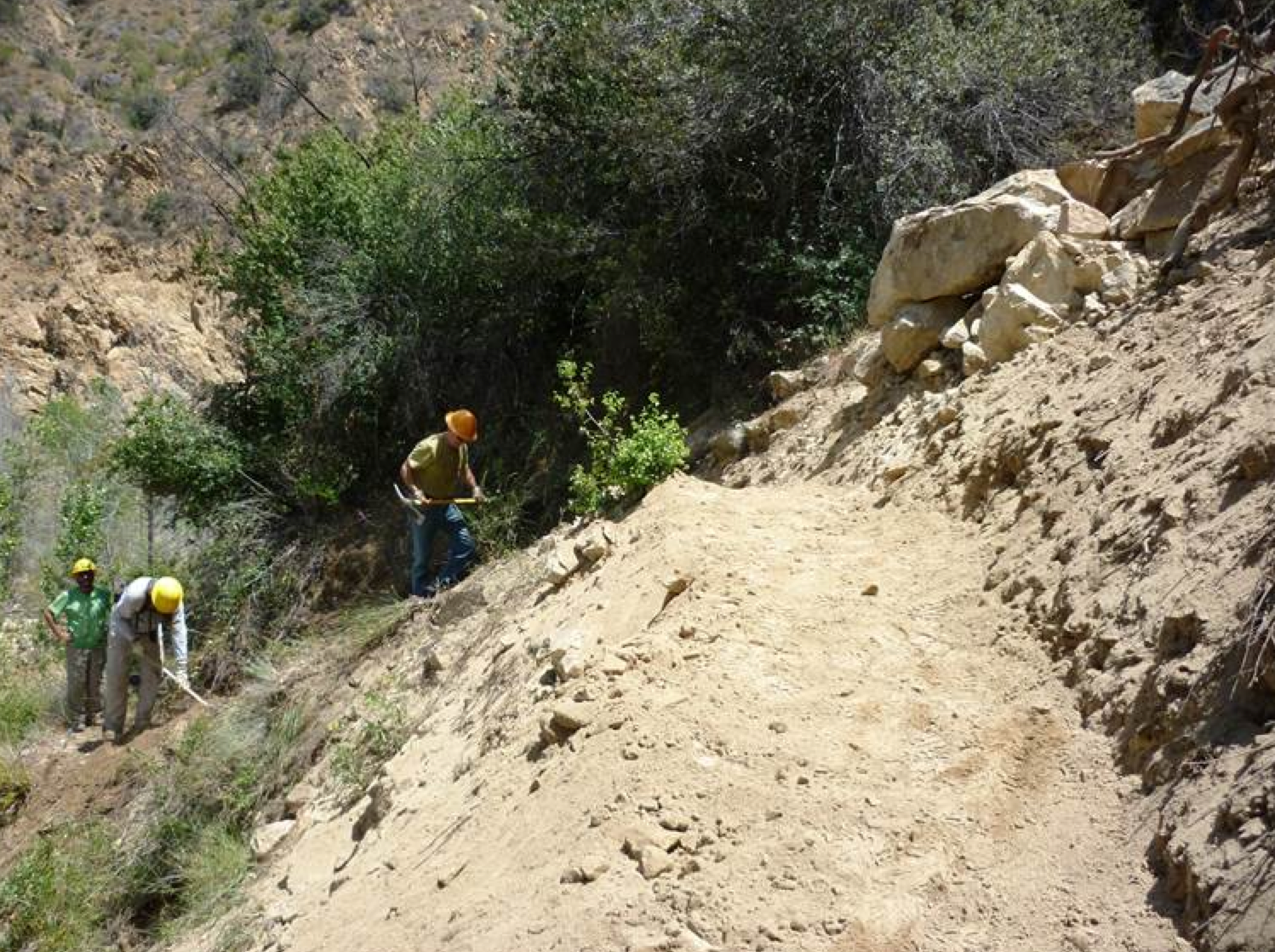
| Trail description: | Agua Blanca Trail Repair, Saturday, 1/29/22 Alan Coles Our crew of 8 included 7 seasoned crew members. We met 8 am at Temescal and drove to the Piru Canyon Ranch. After our safety orientation, we set off with the usual tread and sawyer tools. About 0.5 miles from the cars, we cleared a fallen oak tree and made the trail more visible in an area damaged by floods (above). We also moved some rocks to make the ascent down to the area safer. We also improved the trail in an area where route was not clearly defined due to a deep rut. We also worked on other areas of the trail that needed slough cleared off the trail, vegetation cut back and better identification of the route. Some crew members went through the Devil’s Gateway to Log Cabin Camp to check for fallen trees but they reported the route mostly clear. They did report recent motorcycle tracks in the wilderness coming in from the Potholes Trail, a recurring problem. We have made significant improvements to the trail this season that should keep hikers safe and on the correct route. TRAIL IS GOOD TO LOG CABIN, ABOVE THAT REMAINS ROUGH. |
| Mode of transport: | Array |
| Trail condition: | Needs some work |
Agua Blanca Trail Survey - 02-05-2022 - by Mike Maki| Link: | Agua Blanca Trail |
| Date: | 02-05-2022 |
| Surveyor Name: | Mike Maki |
| Trail description: | Three days two nights at Log Cabin Camp working the Agua Blanca Trail upstream from Log Cabin. Trail is in pretty good shape up the the bench mark on the rock before Holister (site). After that it is difficult to find and follow. I did some brushing and flagging of creek crossing and trail up to the sandy and rocky section of the trail near "PB 37" on the Forest Serivce map. I would recommend hiking the creek at this time. It is mostly free and clear. |
| Mode of transport: | Hike |
| Trail condition: | Hard to follow |
| Condition details: | Section Above Log Cabin Camp |
| Images: | Flagging at stream crossing up from Log Cabin More flagging at stream crossing Trail flagging further up Down Oak 34.549953, -118.824272 |
Agua Blanca Trail Survey - 10-30-2021 - by Mike Maki| Link: | Agua Blanca Trail |
| Date: | 10-30-2021 |
| Surveyor Name: | Mike Maki |
| Trail description: | Spent the day working the Agua Blanca Trail with the legend Alan Coles. Trail is in great shape to Log Cabin Camp and up to the tin shed at Pot Hole. No water down low but surprisingly good flow above 1400ft contour in Agua Blanca and the creek up to Pot Hole. |
| Mode of transport: | Hike |
| Trail condition: | Good shape and easy to follow |
Agua Blanca Trail Survey - 04-09-2021 - by Christopher P. Lord| Link: | Agua Blanca Trail |
| Date: | 04-09-2021 |
| Surveyor Name: | Christopher P. Lord |
| Trail description: | I wont reiterate the details as this blog post most pretty much sums it up. https://christopherplord.blogspot.com/2021/04/the-agua-blanca-trail-dough-flat-to.html |
| Mode of transport: | Hike |
| Trail condition: | Needs some work |
| Images: | |
Agua Blanca Trail Survey - 04-10-2021 - by Addison Jerlow| Link: | Agua Blanca Trail |
| Date: | 04-10-2021 |
| Surveyor Name: | Addison Jerlow |
| Trail description: | Hiked from Dough Flat to Ant Camp, then followed Agua Blanca Creek/Trail downstream to Cove, then all the way out at Kesters Cabin and road walked out to the Potholes trailhead (4/09 - 4/11). There was some sort of trail for pretty much all of Agua Blanca. Trail was hardest to follow from around Tin Can Cabin Flat until the mouth of the narrows and we walked the creek for most of that section. Trail from eastern end of the narrows to Log Cabin was easy enough to follow but gps definitely helped finding when the trail cut away from the creek. Lots of flags and cairns from Cove onward, most helpful but some misleading. A little tricky picking the right route right before Log Cabin. Trail from Log Cabin to Kesters in excellent shape. Shocked to say the first time I have ever had to continue on from a target camp in the LP because it was full was at Cove Camp. A group of 6 or so had done our same route about an hour ahead of us all day. Also, good flow in all of Agua Blanca Creek, but getting pretty slow and algae-filled already in parts for how early it is. |
| Mode of transport: | Hike |
| Trail condition: | Needs some work |
| Condition details: | In very good shape for a trail that isn't actually a trail |
Agua Blanca Trail Survey - 03-27-2021 - by Alan Coles| Link: | Agua Blanca Trail |
| Date: | 03-27-2021 |
| Surveyor Name: | Alan Coles |
| Trail description: | Came in on Potholes, exit through AB. Fixed a few fallen trees and made crossings easier to find. Some hikers are losing the trail and going up the canyon bottom. Needs additional brushing and tread work in places. Unattended fire at Log Cabin. Backpackers, please use common sense. We had 3 major fires at this location in the last 10 years. |
| Mode of transport: | Hike |
| Trail condition: | Needs some work |
| Condition details: | Survey and trail work |
Agua Blanca Trail Survey - 11-14-2020 - by Alan Coles| Link: | Agua Blanca Trail |
| Date: | 11-14-2020 |
| Surveyor Name: | Alan Coles |
| Trail description: | We cleared fallen trees, did some brushing and tread work from end of road to Devil's Gateway. Also worked on Potholes Trail from Agua Blanca to Potholes Spring. Trail is in pretty good shape with the usual rough spots at the stream crossings. Water level was low but mostly flowing in the canyon. I would caution anyone camping at Log Cabin to stay away from oak trees which are dropping major limbs everywhere. |
| Mode of transport: | Hike |
| Trail condition: | Needs some work |
| Condition details: | Trail Crew Report |
Agua Blanca Trail Survey - 01-11-2020 - by Alan Coles| Link: | Agua Blanca Trail |
| Date: | 01-11-2020 |
| Surveyor Name: | Alan Coles |
| Trail description: | We worked the trail from Kesters to the Devil's Gateway removing several logs and clearing brush. We flagged the stream crossings and made the trail easier to find. Trail is much better but needs more brushing and tread work. One 16" step-over oak about 100 yards past the wilderness sign. Please be aware of water releases from Pyramid Dam may make crossing Piru Creek dangerous. |
| Mode of transport: | Hike |
| Trail condition: | Needs some work |
| Condition details: | Trail crew work |
Agua Blanca Trail Survey - 01-20-2019 - by Christopher P. Lord| Link: | Agua Blanca Trail |
| Date: | 01-20-2019 |
| Surveyor Name: | Christopher P. Lord |
| Trail description: | Followed the Agua Blanca Trail from Potholes junction down to Kester's Cabin. Trail was in good shape aside from 2 downed trees below the Gateway. The trail disappears at some of the creek crossings however flagging helps tremendously and with some keen observation it's very easy to pick back up again. Water was flowing nicely in the creek. The lower road crossings were a raging river with waist high depths and fast currents. Use caution in these spots. All in all a great day "Lost In The Los Padres" You can read the full write up at the link below. https://christopherplord.blogspot.com/2019/01/potholes-to-agua-blanca-loop.html |
| Mode of transport: | Hike |
| Trail condition: | Needs some work |
| Images: | Devils Gateway Lower road crossing Agua Blanca Sespe Wilderness sign |
Agua Blanca Trail Survey - 04-15-2018 - by Craig R. Carey| Link: | Agua Blanca Trail |
| Date: | 04-15-2018 |
| Surveyor Name: | Craig R. Carey |
| Trail description: | Troop 111 (Ventura) traveled the lower section of the Agua Blanca this past weekend. Rough in many places but we spent some time to clear numerous trees and do some lopping. Flagged well enough to be followable if you're deliberate. Great water! Various images courtesy TLJ/NDH/JJ/BBJ. |
| Mode of transport: | Hike |
| Trail condition: | Needs some work |
| Images: | |
Agua Blanca Trail Survey - 02-02-2018 - by Los Padres Forest Association| Link: | Agua Blanca Trail |
| Date: | 02-02-2018 |
| Surveyor Name: | Los Padres Forest Association |
| Trail description: | We scouted and flagged the Agua Blanca Trail from Log Cabin to Ant Camp in order to support a Condor Trail grant program. We spent a ton of time trying to follow and flag the trail as much as possible. We were able to follow the trail approximately 80% of the time and laid flags at each crossing or significant point along that trail. While the trail was not easy to follow, it was easier than expected. Much of the traffic along the Agua Blanca follows the creek and there is a layer of cairns along the creek to follow but there are also good sections of trails to follow as well. Look for blazes on trees to assist following the trail. We were able to find trail that led to all the known campsites along the Agua Blanca other than Tin Can Cabin, couldn't find that one. Where we lost the trail was really bad and frustrating creek hopping. We also investigated the high route that bypasses the Big Narrows but opted to go through the Big Narrows, which goes for a long way! If you are going to attempt the Agua Blanca, give yourself at least two days to get from Ant to Piru and take it slow, enjoy the scenery, choose the path you like best and be safe. |
| Mode of transport: | Hike |
| Trail condition: | Hard to follow |
Agua Blanca Trail Survey - 01-15-2018 - by MSubbotin| Link: | Agua Blanca Trail |
| Date: | 01-15-2018 |
| Surveyor Name: | MSubbotin |
| Trail description: | Volunteers mounted existing wilderness sign on new post and cleared downed trees including one 14" oak. Water flowing in creek. Ankle deep water through Devil's Gateway. The trail is brushy and overgrown along most of its length, and the tread is narrow with considerable slough; but hard to follow in only a few locations, usually when in creek bottom. Those unfamiliar with the trail would find locations of opposing sides of creek crossings challenging to locate. |
| Mode of transport: | Hike |
| Trail condition: | Needs some work |
| Condition details: | Volunteer maintenance project from Piru Creek to Log Cabin Camp |
| Images: | New post for existing Sespe Wilderness sign final cut on oak tree 1/4 mile below Devils Gateway |
Agua Blanca Trail Survey - 06-14-2017 - by Kevin K| Link: | Agua Blanca Trail |
| Date: | 06-14-2017 |
| Surveyor Name: | Kevin K |
| Trail description: | Creek was easy to walk and relatively open from Ant Camp to big Narrows.  Had to do some searching but there are some small saw cuts and rock stacks to mark the route.  Maybe a mile or so from Ant Camp there is an actual trail down Agua Blanca but it disappears and you are rock hopping.  Water was flowing good along the entire Agua Blanca from Ant to Big Narrows except for one or two very short sections of creek bed.  Overall I'd  it is a moderate difficulty hike. |
| Mode of transport: | Hike |
| Trail condition: | Good shape and easy to follow |
| Images: | |
Agua Blanca Trail Survey - 05-11-2017 - by Anonymous Surveyor| Link: | Agua Blanca Trail |
| Date: | 05-11-2017 |
| Surveyor Name: | Anonymous Surveyor |
| Trail description: | I day-hiked the Agua Blanca trail from Ant Camp to Pothole Spring and back, making it from Pothole Spring back to Ant Camp in 4 hours. Along the way there were a lot of broken branches, saw-cuts, rock stacks, and footprints in the sand and grass; plus a few sun-bleached ribbons scattered between them which I have a good eye for spotting (because they're micro-trash). I never felt like I was lost or bushwhacking. The junctions to Pothole Spring and Dough Flat trails were obvious to find and well-marked too. This trail has amazing scenery and was a great wilderness experience! |
| Mode of transport: | Hike |
| Trail condition: | Good shape and easy to follow |
Agua Blanca Trail Survey - 03-18-2017 - by Alan Coles| Link: | Agua Blanca Trail |
| Date: | 03-18-2017 |
| Surveyor Name: | Alan Coles |
| Trail description: | Pictures for previous survey. |
| Mode of transport: | Hike |
| Trail condition: | Needs some work |
| Images: | Typical trail condition. Another example of trail. Devils Gateway. Wading required but not difficult. Log Cabin Camp Log Cabin Camp |
Agua Blanca Trail Survey - 03-18-2017 - by Alan Coles| Link: | Agua Blanca Trail |
| Date: | 03-18-2017 |
| Surveyor Name: | Alan Coles |
| Trail description: | We scouted Agua Blanca Trail from Blue Point to Log Cabin Camp. We cleared the crossings of branches and debris, cleared some minor slides, cut a few small trees out of the trail and flagged the important locations. Otherwise the trail is in the same shape that it has been in for several years. It is not difficult to follow if you are able to find it. The trail is overgrown with deep grass in places. Going through the Devil's Gateway was not difficult and wading was below the knees. Beautiful area now with abundant flowers. |
| Mode of transport: | Hike |
| Trail condition: | Needs some work |
| Condition details: | Trail scout and repair |
Agua Blanca Trail Survey - 03-10-2017 - by Mike Maki| Link: | Agua Blanca Trail |
| Date: | 03-10-2017 |
| Surveyor Name: | Mike Maki |
| Trail description: | This is for the section from Log Cabin Camp to Ant Camp. If you were to try and actually follow the "Trail" it would be hard to follow. I had a hard time trying to find any reasonable trace of the trail and ended up walking in the creek for most of the section. Recent flooding has obliterated where the trail would cross  the stream but it also scoured out the stream channel so it was fairly easy to travel up the stream. Some choke points occurred but noting major stopping you. I'd estimate it took me about 8 hours to go from Log Cabin Camp to Ant Camp. Big Narrows was beautiful. Hike pics |
| Mode of transport: | Hike |
| Trail condition: | Hard to follow |
| Condition details: | Recent flooding has obliterated visible crossings. Overgrown |
| Images: | Walk up the creek when open like this One of the easier debris piles to get around |
Agua Blanca Trail Survey - 05-22-2016 - by Alan Coles| Link: | Agua Blanca Trail |
| Date: | 05-22-2016 |
| Surveyor Name: | Alan Coles |
| Trail description: | Removed trees and better defined trail at stream crossings from Piru Creek to Devil's Gateway. Trail is passable and easy to follow but lack of use has allowed grass to obscure the path. I noticed some false trails in the canyon bottom indicating that some hikers cannot find the true trail which is above the canyon bottom alternating on the north and south sides. This might explain the previous erroneous report. We have placed flagging to help locate the crossings. |
| Mode of transport: | Hike |
| Trail condition: | Needs some work |
Agua Blanca Trail Survey - 04-17-2016 - by Daniel Meinzer| Link: | Agua Blanca Trail |
| Date: | 04-17-2016 |
| Surveyor Name: | Daniel Meinzer |
| Trail description: | Trail from Piru Creek to Log Cabin is bush-wacking and rock-hopping most of the way. Â Trail has been washed out and is mostly non-existent. Â Trail picks up occasionally closer to Piru Creek. Â Where there is a trail, there are markers. Â Watch out for poison ivy and stinging nettle. |
| Mode of transport: | Hike |
| Trail condition: | Non existent |
| Images: | |
Agua Blanca Trail Survey - 12-11-2015 - by Los Padres Forest Association| Link: | Agua Blanca Trail |
| Date: | 12-11-2015 |
| Surveyor Name: | Los Padres Forest Association |
| Trail description: | VWR's Mark and Mickey removed a large fallen oak from the lower part of the trail before the wilderness boundary. Â The AB trail is in fair shape and makes a great weekend loop trip along with the recently worked Pothole Trail. Information courtesy of the Ojai Ranger District. |
| Mode of transport: | Array |
| Trail condition: | Needs some work |
Agua Blanca Trail Survey - 11-15-2015 - by Mark Subbotin| Link: | Agua Blanca Trail |
| Date: | 11-15-2015 |
| Surveyor Name: | Mark Subbotin |
| Trail description: | Ojai Ranger Dist. recon/survey; hiked from Kester Cabin to Log Cabin Camp through the Devils Gateway. Â Creek crossings were flagged. Â Trail is generally easy to follow, but be extra alert at creek crossings to pick up trail on opposite side and where trail climbs back out of creek bottom onto south slope. Â Devils Gateway had knee high water. Â Water flowing at Log Cabin Camp and up Potholes Trail to Potholes Cabin. Â |
| Mode of transport: | Hike |
| Trail condition: | Needs some work |
| Images: | Devils Gateway |
Agua Blanca Trail Survey - 05-10-2015 - by Los Padres Forest Association| Link: | Agua Blanca Trail |
| Date: | 05-10-2015 |
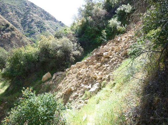
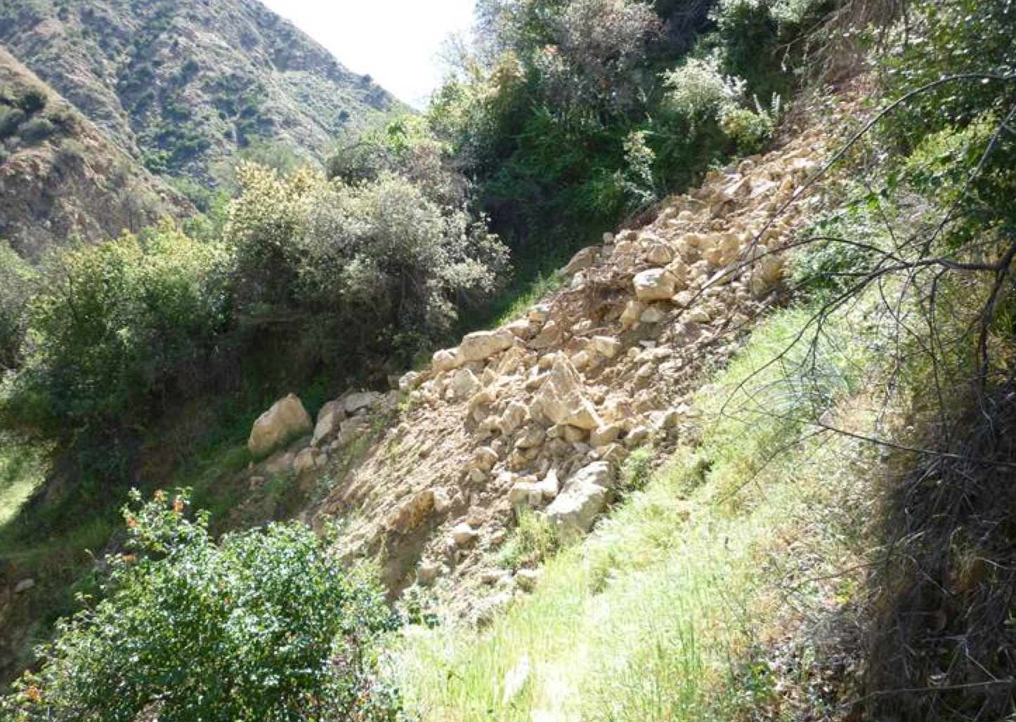
| Surveyor Name: | Los Padres Forest Association |
| Trail description: | The Ojai Ranger District VWR's cleared the large rock slide along Agua Blanca Trail. Â See before and after photos. |
| Mode of transport: | Array |
| Trail condition: | Needs some work |
| Images: | Photo Ranger Heidi Photo Ranger Heidi |
Agua Blanca Trail Survey - 04-11-2015 - by Los Padres Forest Association| Link: | Agua Blanca Trail |
| Date: | 04-11-2015 |
| Surveyor Name: | Los Padres Forest Association |
| Trail description: | Report from the Ojai Ranger District - There are some downed trees, none larger than 15" in diameter. - Water levels on the AB were good - Brush quite thick in many areas - Tread is fair except for a rockslide that is about 2.5miles up the single track Hoping to schedule a project to clear the slide. |
| Mode of transport: | Array |
| Trail condition: | Needs some work |
| Images: | Water at second crossing, photo Ranger Heidi The new slide, photo Ranger Heidi |
 Survey / Report Form - Please click this box to open the form.