Turner Creek Trail - Los Padres National Forest
Trail Distance 1.21 Miles
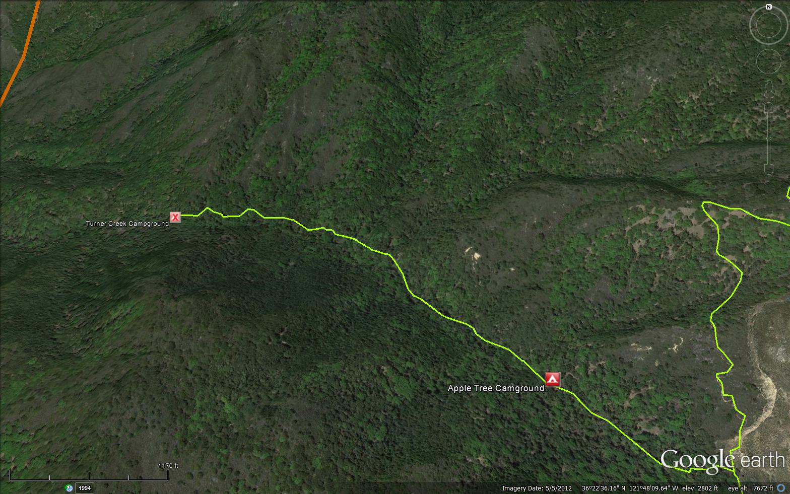
The Turner Creek Trail is a short 1.21 mile connector trail in the Ventana Wilderness in Monterey County .The trail connects Skinner Ridge Trail 1E04 to the Turner Creek Camp (2500 feet).
Trail Details
- Trail #: 1E02
- Wilderness Area: Ventana
- County: Monterey County
- Ranger District: Monterey Ranger District
- Trail-head Latitude: 36.3696
- Trail-head Longitude: -121.79437
- Water Sources: Turner Creek
- Trail Condition: Kind of Good - Little to no bushwacking and easily followable
- Topo Maps:
``
``
``
``
``
Activities & Features: - Backpacking
- Day Hiking
- Panoramic Views
- Wildlife Viewing
- Wilderness Camping
Trail Stats
- Total Elevation Gain: + 70 feet.
- Total Elevation Loss: - 635 feet.
- Overall Average Slope Gain: + 6 %.
- Overall Average Slope Loss: - 11 %.
- Kilometers: (km)
- Meters: (m)
- Miles: (mi)
- Feet: (ft)
- Average Slope: (%)
Trail Camps
- Apple Tree 2960 feet
- Turner Creek 2500 feet
Submitted Trail Reports
-
 Turner Creek Trail Survey - 01-13-2015 - by troop 97 bsa
| Link: | Turner Creek Trail |
| Date: | 01-13-2015 |
| Surveyor Name: | troop 97 bsa |
| Trail description: | Â a real fine excelent overnighter would be to car pool it to White Rock Gun Club then hike up to Turner Creek early summer when its flowing, Â then come out down Devil's Peak and down hill to Botcher's Gap. Â Car pool home..... |
| Mode of transport: | Hike |
| Trail condition: | Good shape and easy to follow |
Leave A Trail Report
-
 Survey / Report Form - Please click this box to open the form.
Last Updated: Monday, February 29, 2016
 Use Marker Groups
