 Use Marker Groups
 Wolf 2002
Piru 2003
Day 2006
Zaca 2007
Gap 2008
La Brea 2009

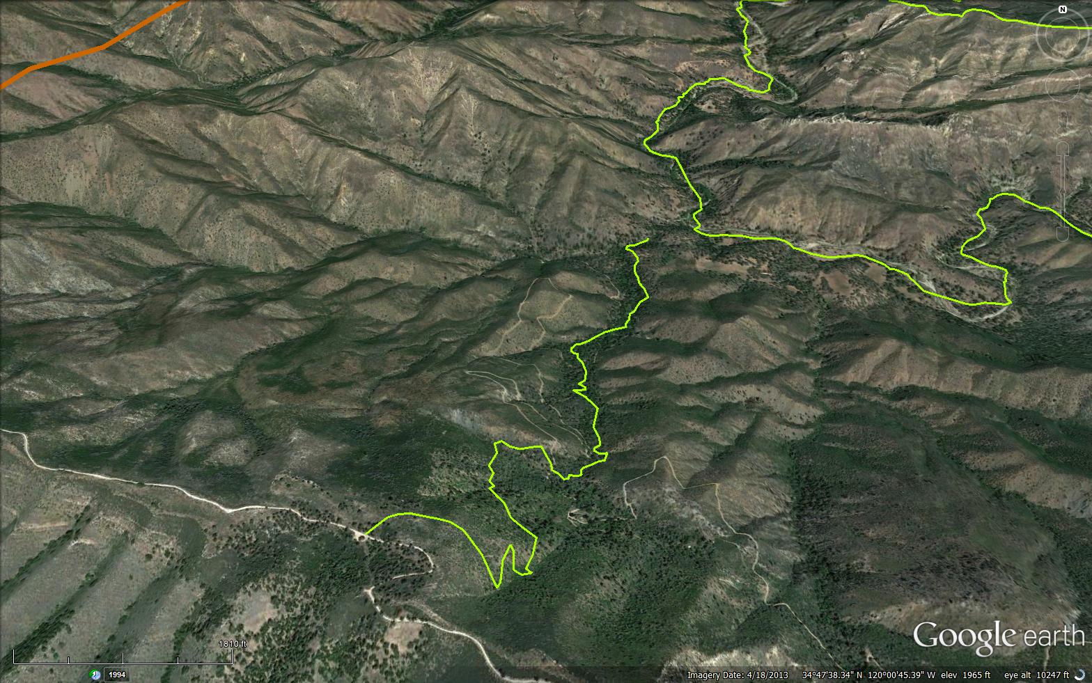
The Sulphur Spring Trail is a scenic 2.32 mile trail in Santa Barbara County. The trail connects the Zaca Peak Trail (30W18) with the Manzana Trail (30W13)


 Sulphur Spring Trail Survey - 02-02-2022 - by Stan A
| Link: | Sulphur Spring Trail |
| Date: | 02-02-2022 |
| Surveyor Name: | Stan A |
| Trail description: | Trail is in great condition. Hiked through to Manzana Schoolhouse. Ran into an employee of the Cody Ranch. Nice guy. Bear sighting that morning, but no luck for me. 7 river crossings, easily passable. Great day. |
| Mode of transport: | Hike |
| Trail condition: | Good shape and easy to follow |
Sulphur Spring Trail Survey - 01-24-2022 - by Nathan Seaford| Link: | Sulphur Spring Trail |
| Date: | 01-24-2022 |
| Surveyor Name: | Nathan Seaford |
| Trail description: | Top third of the trail down from Cedros Saddle is in great condition--thank you trail workers! Middle third, starting after the first road crossing is more overgrown with lots of poison oak that is just starting to leaf out; still very follow-able. Last third or so down to the Manzana is in good condition and easy to follow. Significantly steep grade the whole way. |
| Mode of transport: | Hike |
| Trail condition: | Good shape and easy to follow |
Sulphur Spring Trail Survey - 03-14-2021 - by Nate| Link: | Sulphur Spring Trail |
| Date: | 03-14-2021 |
| Surveyor Name: | Nate |
| Trail description: | Followable but the top portion from Cedros Saddle definitely needs work. |
| Mode of transport: | Hike |
| Trail condition: | Needs some work |
| Condition details: | Needed machete work from Cedros Saddle down to 8N03 |
Sulphur Spring Trail Survey - 08-07-2020 - by Los Padres Forest Association| Link: | Sulphur Spring Trail |
| Date: | 08-07-2020 |
| Surveyor Name: | Los Padres Forest Association |
| Trail description: | The LPFA Trail Crew spent a week in August 2020 working the lower portion of the Sulphur Spring Trail. The work was primarily clearing poison oak and downed trees from the trail corridor. We'll be back soon to continue work up towards Cedros Saddle. Stay tuned.... |
| Mode of transport: | Array |
| Trail condition: | Needs some work |
Sulphur Spring Trail Survey - 05-26-2018 - by Paul Cronshaw| Link: | Sulphur Spring Trail |
| Date: | 05-26-2018 |
| Surveyor Name: | Paul Cronshaw |
| Trail description: | We camped at Cedros Saddle and removed 21 downed trees between the saddle and the 2nd road crossing. LOTS of poison oak. |
| Mode of transport: | Hike |
| Trail condition: | Needs some work |
| Condition details: | Trail needs to be brushed and some trad work. |
| Images: | |
Sulphur Spring Trail Survey - 01-31-2017 - by Los Padres Forest Association| Link: | Sulphur Spring Trail |
| Date: | 01-31-2017 |
| Surveyor Name: | Los Padres Forest Association |
| Trail description: |
Sulphur Spring Trail January 31, 2017 Survey of top 1.2 miles of trail. The trail was generally in good shape except for downed trees. It only needs occasional minor tread repair. There is thick chaparral for the first ¾ of the first switch to the east, but afterwards only sporadic brush issues. Lower down the trail passes through large amounts of poison oak, often 6-8 foot tall bushes. While it was relatively clear now with the leaves off, a significant amount of pruning will probably be required to keep the path open after it leafs out. Report by: Blakley |
| Mode of transport: | Hike |
| Trail condition: | Needs some work |
| Images: | Dry oak fallen across trail in an awkward location in a gully with no viable reroute. 28†dia. A 18â€dia maple trunk and burl in trail. It will probably be very difficult to remove, but there isn’t a good alternative. There is a 10’ cliff on the uphill side and a steep, rocky drop on the other. |
 Survey / Report Form - Please click this box to open the form.