 Use Marker Groups
 Wolf 2002
Piru 2003
Day 2006
Zaca 2007
Gap 2008
La Brea 2009

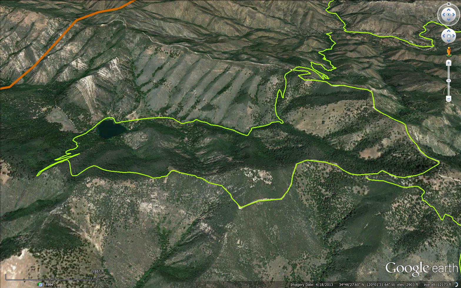
Located in the Figueroa Mountain area. The trail follows a ridge top west from the Zaca Peak Road. The west end of the trail drops down to the privately-owned Zaca Lake Resort. Unobstructed views of the Santa Ynez Valley and Zaca Lake basin are found along this route. This trail may be hard to locate since the 1995 Marre Fire.


 Zaca Peak Trail Survey - 11-23-2019 - by Tony G.
| Link: | Zaca Peak Trail |
| Date: | 11-23-2019 |
| Surveyor Name: | Tony G. |
| Trail description: | Hiked up Coulter Ridge from the High Country Loop on the Midland property, across the ridge heading East on the Zaca trail to the connector heading south to the summit of Grass Mountain then down to the base of Midland and Figueroa Road. The scramble up Coulter Ridge and across to Zaca Trail was loose and a bushwack in parts with lots of deadfall. The portion of the Zaca trail I hiked was in decent shape and easily passable as most of the poison oak has dropped it's leaves and you can easily negotiate the downed trees. Weather was sunny and about 70 degrees. |
| Mode of transport: | Hike |
| Trail condition: | Needs some work |
Zaca Peak Trail Survey - 06-09-2018 - by Tony G| Link: | Zaca Peak Trail |
| Date: | 06-09-2018 |
| Surveyor Name: | Tony G |
| Trail description: | Hiked from Zaca Ridge Rd. to Grass Mountain summit. The connector was in good shape and passable, only a few scratches on my bare legs in shorts through the Manzanita shrubs. |
| Mode of transport: | Hike |
| Trail condition: | Good shape and easy to follow |
Zaca Peak Trail Survey - 02-01-2018 - by Erin C.| Link: | Zaca Peak Trail |
| Date: | 02-01-2018 |
| Surveyor Name: | Erin C. |
| Trail description: | We tried to hike this trail from the top down from the Catway fire road, but only first half mile or so is doable. After that, there is a sign saying "Zaca Ridge Trail. Trail maintained by SBCOF.org I tried a google search for them, but I could not find who SBCOF.org actually is? Anyways, the trail gets really overgrown after that sign, so we turned around and go to the top of a no name peak that is the peak right west of Zaca Peak (a trail up to that peak was visible and passable).  This trail could be a very beautiful hike, but it looks like a forgotten trail for sure.  |
| Mode of transport: | Hike |
| Trail condition: | Hard to follow |
| Images: | Beginning of trail from the top is "ok". This is where we turned around. Trail marker where trail meets the Catway road. Zaca Ridge Trail sign |
Zaca Peak Trail Survey - 11-02-2017 - by FP| Link: | Zaca Peak Trail |
| Date: | 11-02-2017 |
| Surveyor Name: | FP |
| Trail description: | I hiked from the end of the road at Zaca Peak down to Zaca Lake. The dirt road leading to the parking spot next to Zaca Peak from the Figueroa Mtn, turnoff is long and bumpy. I parked my car in the parking area next to Zaca Peak, where the road ends. There is a great view from there. The trails starts off clear enough. About 1-2 miles from where you leave your car, there is a fork where I put a sign I found in the overgrown area of the trail, lying on the ground. It has an arrow pointing towards Zaca Ridge trail.. The trail is quite overgrown through this area until it starts descending towards Zaca Lake. From here on, the trail becomes very hard to follow. It is clearly abandoned, much like many of the buildings in Zaca Lake, although I think they still rent their cabins to groups. (Online reviews of those cabins and management leave much to be desired -- too bad; someone should buy this place and return it to its original charm.) Because the trail is so overgrown, contact with poison oak is just about inevitable. It's all over the place. |
| Mode of transport: | Hike |
| Trail condition: | Hard to follow |
| Condition details: | Overgrown, hard to follow |
| Images: | View of Zaca Lake from Zaca Ridge trail What's left of the Zaca Lodge after 2016 fire Lucho taking a break Cabin |
Zaca Peak Trail Survey - 10-07-2017 - by M. Jones| Link: | Zaca Peak Trail |
| Date: | 10-07-2017 |
| Surveyor Name: | M. Jones |
| Trail description: | Hiked down the Zaca Peak trail from the north side
off the Old Catway Jeep Road across from the Sulphur Spring trial head. Trail
needs some work, there is a down tree crossing trail about a 1/4 mile down the trial (@ N  34.779959°, W 120.019119°) that needs to be
cut and another tree just past that location which fell over with its root ball
blocking the trail at the junction where the trail heads west (@ N  34.779959°, W 120.019119°). Trails need a re-route
around the fallen tree or saw cut and reconstruction. Â Trail down from ridge is narrow and overgrown
in places, lopper work and water bars are needed. No water flowing at “Zaca Springâ€, this spring is
unnamed on topo-map and is impounded with spring box. |
| Mode of transport: | Hike |
| Trail condition: | Needs some work |
| Images: | View west from trail Tree blocking trail "Zaca Spring" box. No flowing water |
 Survey / Report Form - Please click this box to open the form.