Welcome To Hike Los Padres!
User Log In or Sign Up
Use Marker Cluster
Markers: Use Marker Groups
Time used: ms
Routes
    Trails
    OHV Trails
    Forest Roads
    Streams
Wildfire Layers
    Wolf 2002
    Piru 2003
    Day 2006
    Zaca 2007
    Gap 2008
    La Brea 2009
Forest Layers
    Forest Boundary
    Wilderness Areas
    Ranger Districts
    Counties
    Topographic Outlines
    Trailheads
    OHV Trailheads
Helpful Hints
    ↣ Right click the map for location data. ↣ Click a stream for Water Stats.

Stony Creek Trail - Los Padres National Forest
Trail Distance 1.85 Miles

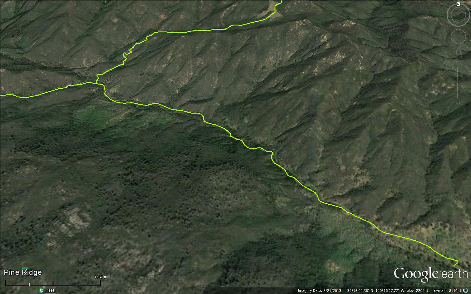
The Stony Creek Trail is a short  1.85 mile connector trail in the Garcia Wilderness in San Luis Obispo County . The trail starts from Stoney Creek Campground and connects to the Caldwell Trout Creek Trail (15E06).

Trail Details

  • Trail #: 16E07
  • Wilderness Area: Garcia
  • County: San Luis Obispo County
  • Ranger District: Santa Lucia Ranger District
  • Trail-head Latitude: 35.20997
  • Trail-head Longitude: -120.25929
  • Trail Condition: Kind of Good - Little to no bushwacking and easily followable
  • Topo Maps:
  • Activities & Features:
    • Backpacking
    • Day Hiking
    • Horseback Riding
    • Wildlife Viewing
    • Wilderness Camping


Trail Stats

  • Total Elevation Gain: + 196 feet.
  • Total Elevation Loss: - 456 feet.
  • Overall Average Slope Gain: + 4 %.
  • Overall Average Slope Loss: - 7 %.
  • Kilometers: (km)
  • Meters: (m)
  • Miles: (mi)
  • Feet: (ft)
  • Average Slope: (%)
Upload Images Aerial Overview Image Login to Download GPS File
Survey This Trail

Survey Photos:


  • Anonymous Surveyor - 05-24-2020

Submitted Trail Reports

Stony Creek Trail Survey - 05-24-2020 - by Anonymous Surveyor
Link: Stony Creek Trail
Date: 05-24-2020
Surveyor Name:Anonymous Surveyor
Trail description:
Mode of transport:Hike
Trail condition:Needs some work
Condition details:Somewhat technical trail; poison oak encroaching and major deadfall blocking trail 0.2 miles down from caldwell mesa.
Images:

deadfall .2 miles down from caldwell mesa
Stony Creek Trail Survey - 06-21-2014 - by janti
Link: Stony Creek Trail
Date: 06-21-2014
Surveyor Name:janti
Trail description:Explored in from Huasna road past gate to campground and a mile or so past there. beautiful place.

Wish the Husna access was 100% legal and not lame and grey.
Mode of transport:Bicycle
Trail condition:Good shape and easy to follow


Leave A Trail Report

Survey / Report Form - Please click this box to open the form.


Last Updated: Monday, February 29, 2016


Join Mailing List
×
Get updates on conditions, surveys and more...


Current Weather »


L.P.N.F. Contacts »

  • Forest Headquarters
    Phone: (805) 968-6640
  • Mt. Pinos District
    Phone: (661) 245-3731
  • Ojai Ranger District
    Phone: (805) 646-4348
  • Santa Barbara District
    Phone: (805) 967-3481
  • Santa Lucia District
    Phone: (805) 925-9538
  • Monterey District
    Phone: (831) 385-5434