 Use Marker Groups
 Wolf 2002
Piru 2003
Day 2006
Zaca 2007
Gap 2008
La Brea 2009

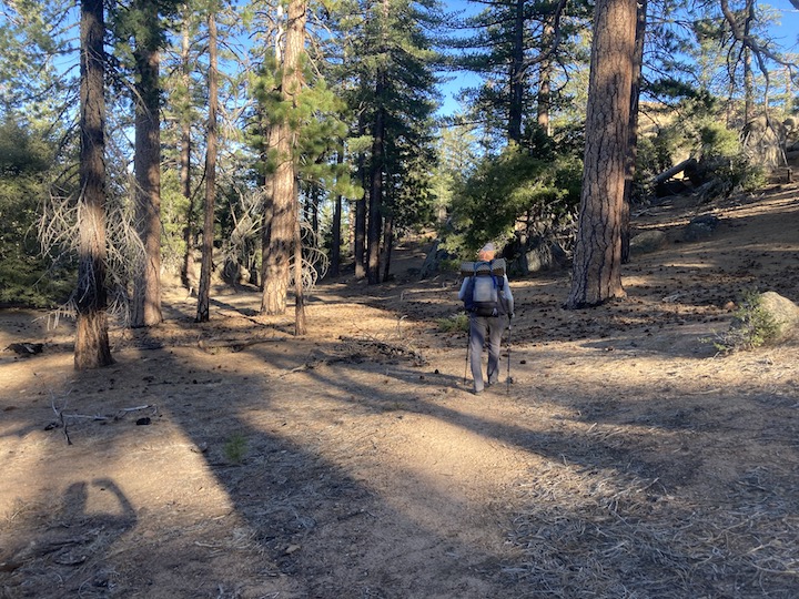
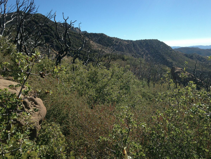
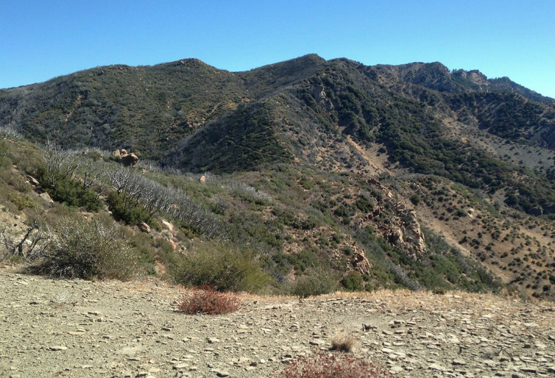
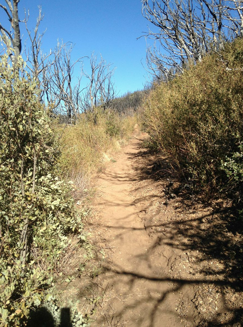
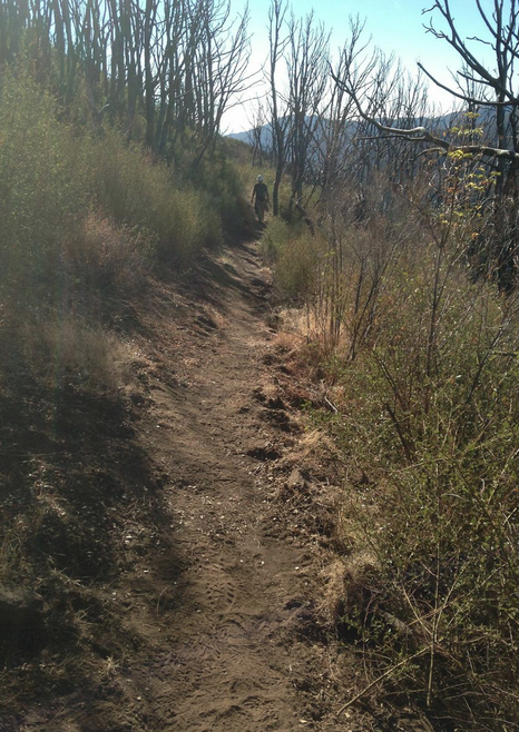
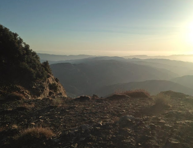
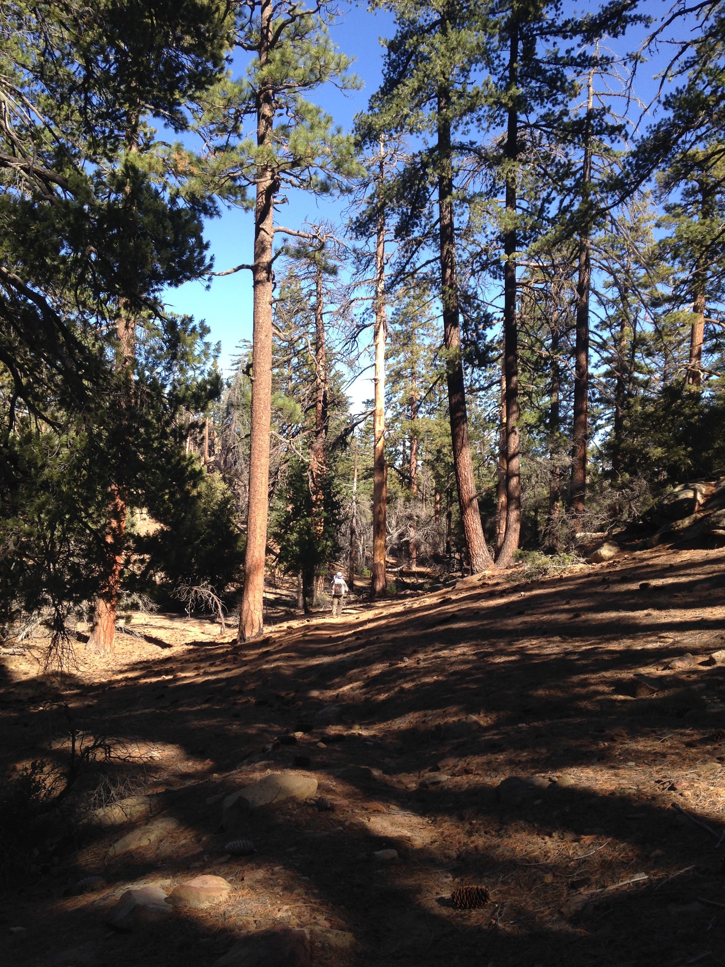
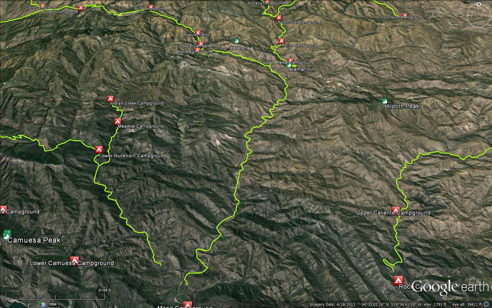
The Mission Pine Trail connects Cachuma Mountain Forest Road (8N08.2) and Buckhorn Forest Road (9N11.4). The trail is in the San Rafael Wilderness, So remember no mountain biking is allowed on any wilderness trails.


 Mission Pine Trail Survey - 01-01-2025 - by Brian D'Amour
| Link: | Mission Pine Trail |
| Date: | 01-01-2025 |
| Surveyor Name: | Brian D'Amour |
| Trail description: | Hiked westward from the Buckhorn Road. Trail is generally easy to follow and in great shape all the way. The only section that could use some work is a small stretch about a mile east of Mission Pine Basin. There are some moments where you really have to push through the brush to continue along the trail. Also, if you are travelling east be aware that there is a trail junction just past Mission Pine Basin, with a Trail sign pointing north. Don't follow the trail in the direction of the sign as it will take you off the ridge as it leads down to the Sisquoc at Mansfield Camp. Stayed near Mission Pine Springs (still flowing) on 1/1 and hiked out to Cachuma Saddle on 1/2. Great sunset and sunrise from the trail this time of year. |
| Mode of transport: | Hike |
| Trail condition: | Needs some work |
| Condition details: | Trail is mostly in great shape. Some areas between West Big Pine and Mission Pine Basin need to be trimmed. |
Mission Pine Trail Survey - 06-29-2024 - by Erin C| Link: | Mission Pine Trail |
| Date: | 06-29-2024 |
| Surveyor Name: | Erin C |
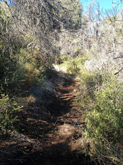
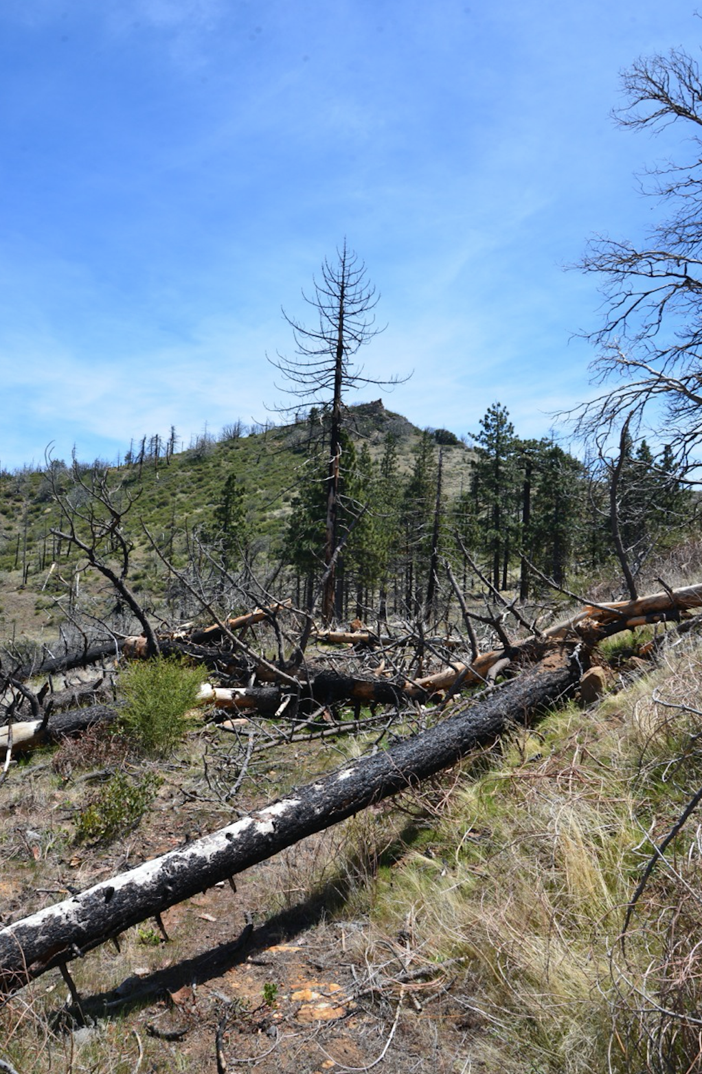
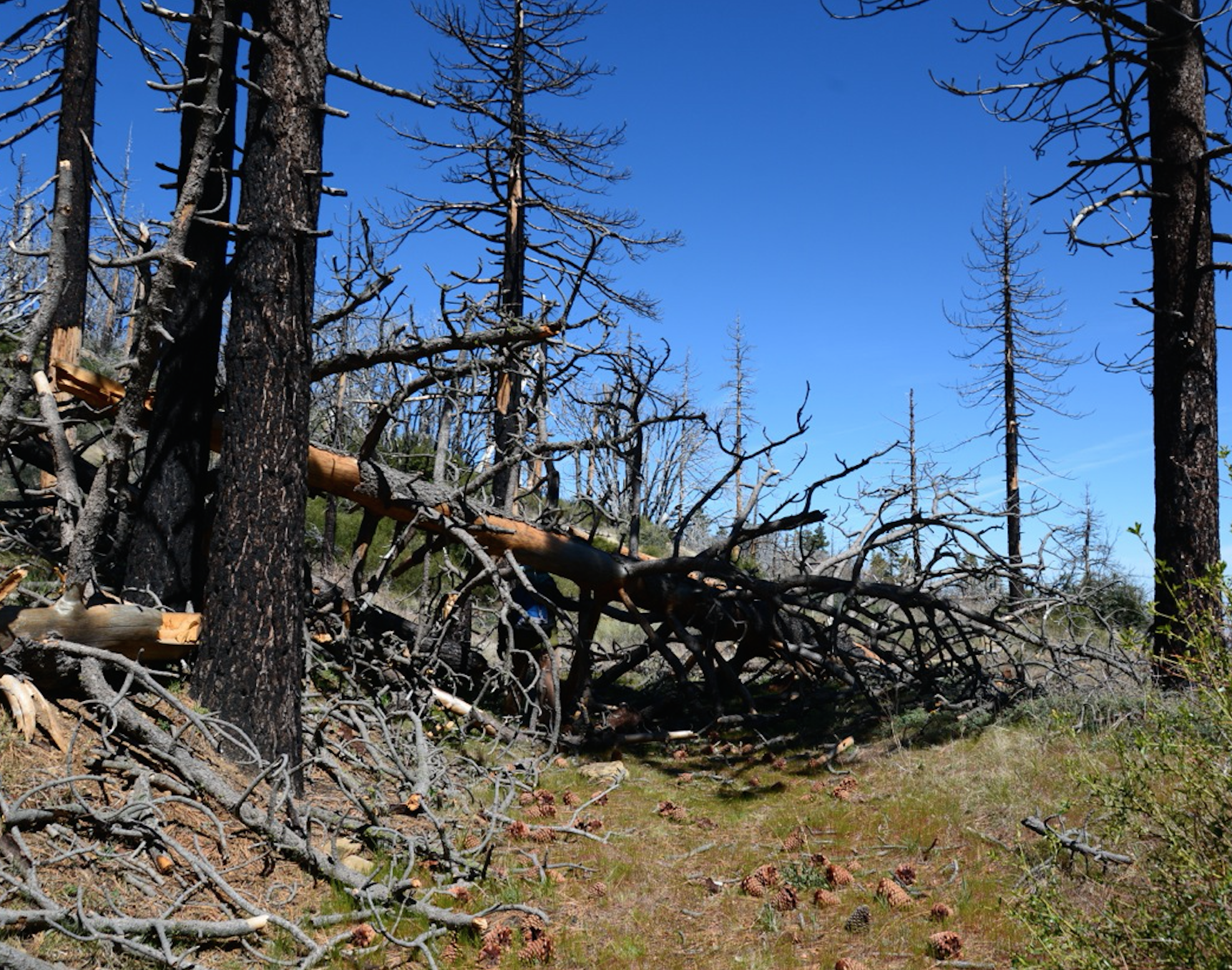
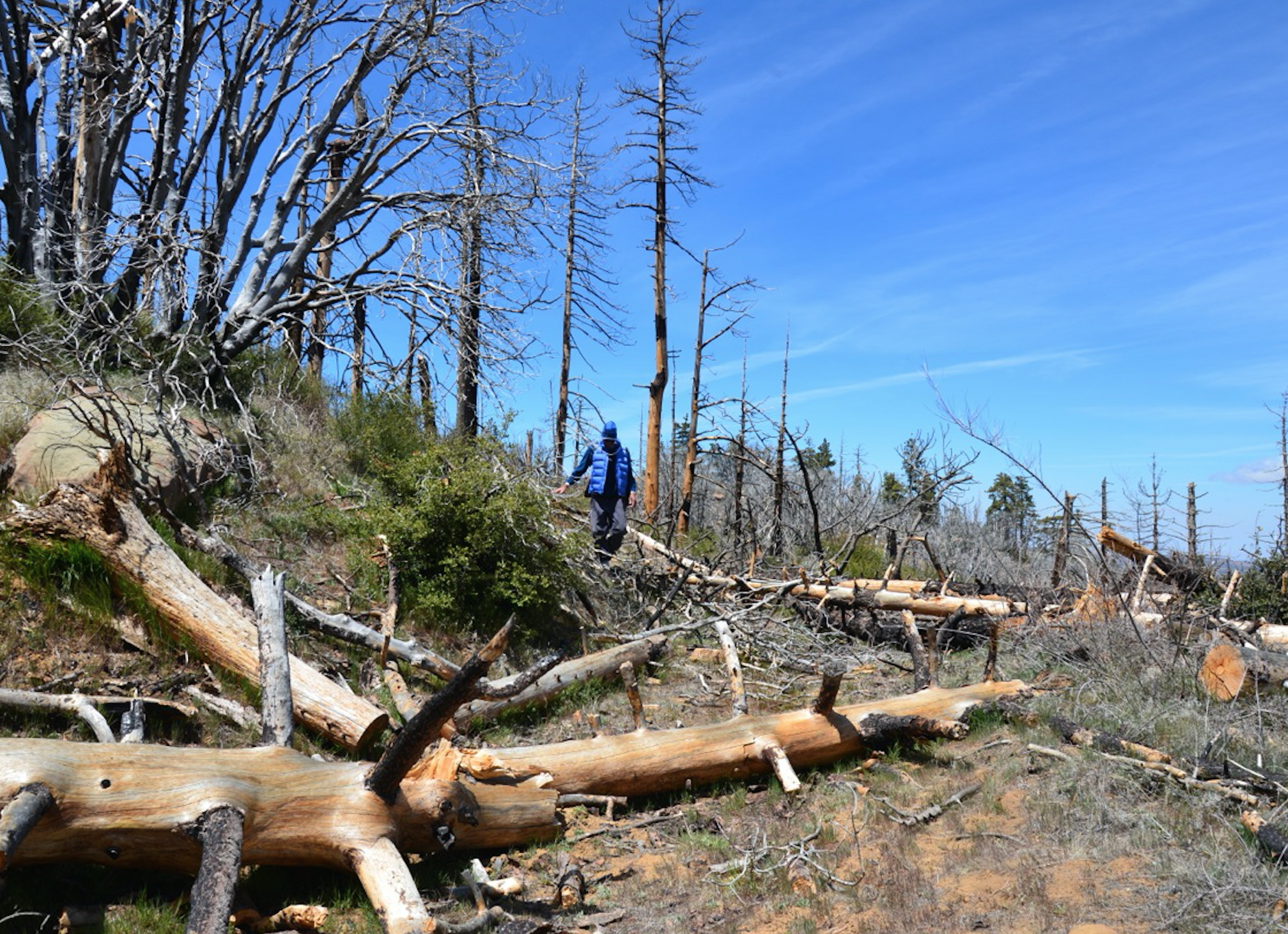
| Trail description: | This survey is from late June 2024 (the weekend before the Lake Fire broke out). Mission Pine Trail is easy to follow, but there are some downed trees, all of which are pretty easy to walk around. Near San Rafael Peak the trail is a bit overgrown with Ceanothus and needs some trimming. I made it from the top of McKinley Forest Road (via mountain bike) then I hiked to Mission Pine basin. I did not hike from Mission Pine basin to West Big Pine. I camped at Mission Pine Springs and the water was flowing well. I imagine that spring will be flowing all year this year. Mission Pine Springs is a lovely campground with a nice green meadow. Saw some cool Stream Orchids growing near the spring. This area is very unique with all the unique sandstone boulders and conifers, a very special place. I am glad this area did not burn in the Lake Fire. |
| Mode of transport: | Hike |
| Trail condition: | Good shape and easy to follow |
| Images: | |
Mission Pine Trail Survey - 03-02-2024 - by Michael McGurk| Link: | Mission Pine Trail |
| Date: | 03-02-2024 |
| Surveyor Name: | Michael McGurk |
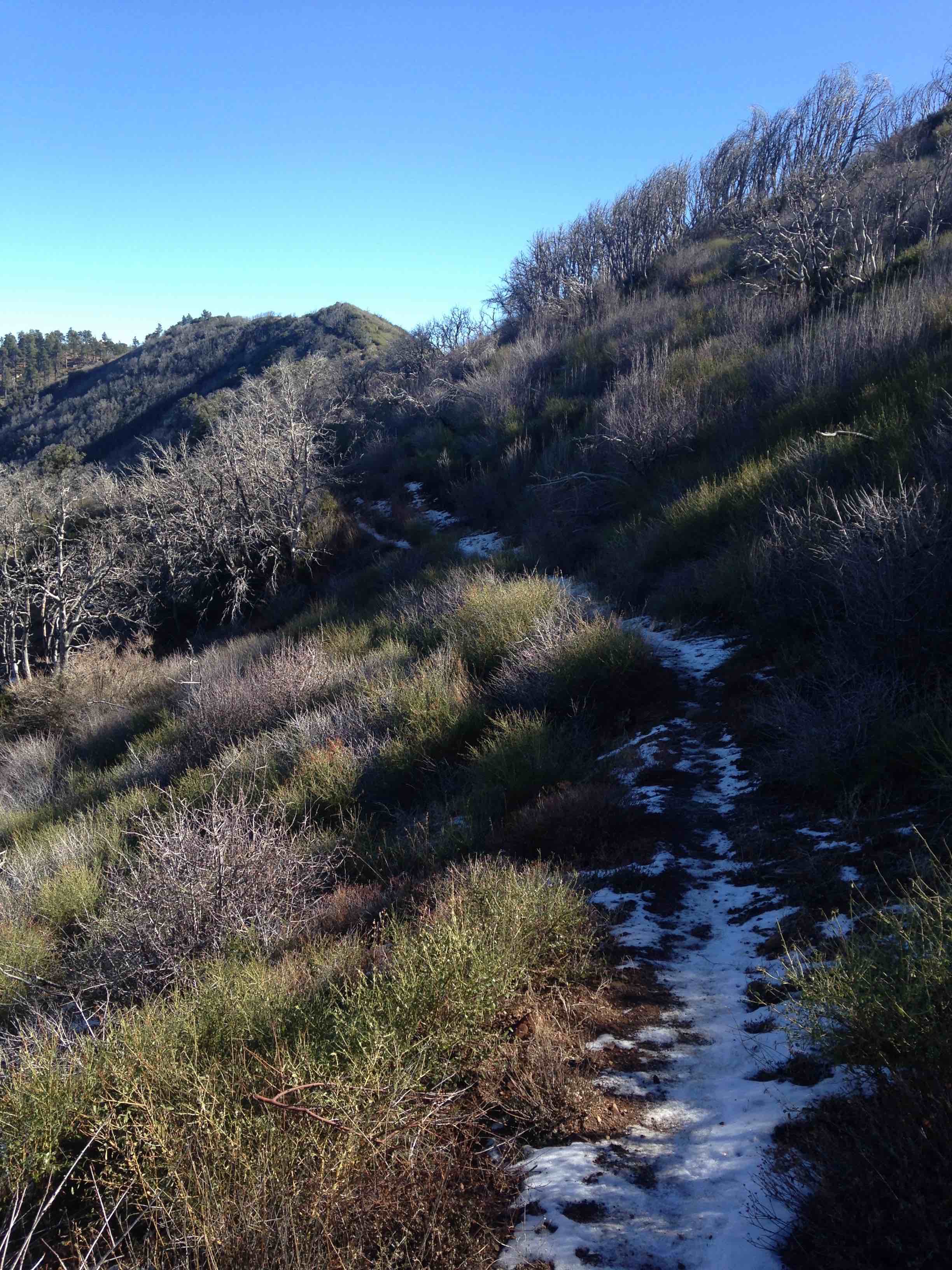
| Trail description: | trail is clear and easy to follow even in the snow. The trail is clear to mission pine basin and any blowdown is navigable. the eastern portion from mission pine basin to bigpine is brushy and a moderate bushwack nothing that had you crawling on hands and knees. there is snow on the eastern portion. |
| Mode of transport: | Hike |
| Trail condition: | Good shape and easy to follow |
Mission Pine Trail Survey - 05-30-2022 - by Los Padres Forest Association| Link: | Mission Pine Trail |
| Date: | 05-30-2022 |
| Surveyor Name: | Los Padres Forest Association |
| Trail description: | The LPFA led a friendly weekend of trail work along the Mission Pine Trail focusing the work on the section between San Rafael Mtn and Mission Pine Spring. We cleared all downed trees along that section (13 of them) and brushed out the few sections that were starting to reach out across the trail again. The trail is great along this section! Future work will need to be done along the section that drops directly down into Mission Pine Basin. It is starting to get rutted in a few spots thanks to a downed tree which fell parallel to the trail and is stopping water from sheeting off the trail. It will need erosion control sometime soon. Read more about this trip here: https://www.independent.com/2022/06/08/the-friendships-of-nature/ |
| Mode of transport: | Array |
| Trail condition: | Good shape and easy to follow |
Mission Pine Trail Survey - 07-04-2022 - by Los Padres Forest Association| Link: | Mission Pine Trail |
| Date: | 07-04-2022 |
| Surveyor Name: | Los Padres Forest Association |
| Trail description: | The LPFA led a group of 15 volunteer peak baggers who helped maintain the far western portion of the Mission Pine Trail from McKinley Saddle up to San Raf Mtn. The work consisted mainly of brushing and high-limbing. This section of the trail looks great! Thanks to everyone who helped over the hot July 4th weekend! |
| Mode of transport: | Array |
| Trail condition: | Good shape and easy to follow |
Mission Pine Trail Survey - 06-11-2022 - by Los Padres Forest Association| Link: | Mission Pine Trail |
| Date: | 06-11-2022 |
| Surveyor Name: | Los Padres Forest Association |
| Trail description: | The exceptional LPFA volunteers returned to the eastern Mission Pine Trail in June 2022 and wrapped up the final 0.3 miles of thick brush within the Rattlesnake Cyn drainage. The entire MP Trail has now been brushed over the past 4 years. Top to bottom, east to west, the MPT is likely in the best shape it's been in many decades. Go get some! |
| Mode of transport: | Array |
| Trail condition: | Needs some work |
Mission Pine Trail Survey - 05-21-2022 - by Addison Jerlow| Link: | Mission Pine Trail |
| Date: | 05-21-2022 |
| Surveyor Name: | Addison Jerlow |
| Trail description: | Great shape from Buckhorn Road to just past Rattlesnake Canyon. Tape and tread through the overgrown section. One pretty bad slide after the trail begins to drop West towards the basin. Don't know how much longer that will be passable. Cairns easy enough to follow all the way to Fall Canyon junction. Lots of wildflowers in the basin right now! |
| Mode of transport: | Hike |
| Trail condition: | Needs some work |
Mission Pine Trail Survey - 05-24-2021 - by Los Padres Forest Association| Link: | Mission Pine Trail |
| Date: | 05-24-2021 |
| Surveyor Name: | Los Padres Forest Association |
| Trail description: | The LPFA spent 4+ weeks working the Mission Pine Trail in 2021 starting from West Big Pine and pushing through the Rattlesnake Drainage. We were able to clear to standard all but about 0.3 miles of the trail on the far west side of Rattlesnake. The trail should be in great shape other than that final 0.3 while we are planning on finishing in spring 2022. Work along the trail started in November 2020 and concluded in May 2021. Extra thanks to the runners who helped haul water out to the Rattlesnake spike camp. |
| Mode of transport: | Array |
| Trail condition: | Needs some work |
Mission Pine Trail Survey - 02-25-2021 - by Los Padres Forest Association| Link: | Mission Pine Trail |
| Date: | 02-25-2021 |
| Surveyor Name: | Los Padres Forest Association |
| Trail description: | Hiked the entire Mission Pine Trail from east to west in February 2021. The trail was in great shape from Windy Gap (Buckhorn Road) to West Big Pine and then slowly deteriorated as one drops down into the Rattlesnake Drainage. The trail was really bad throughout the Rattlesnake Drainage and up the other side. Expect to push, search and occasionally get skewered through here. From the western edge of Rattlesnake to Mission Pine Basin was in fine shape, holding up nicely from the work on a previous LPFA Working Vacation. The trail out of MPB is a little rutted with some downed trees but is very followable through the three climbs over to Mission Pine Spring. From Mission Pine Spring to McKinley was snowy but easy to follow. BEWARE of the western facing snow slopes along San Rafael Mountain as they can be sketchy and treacherous. All in all the trail was fine other than the Rattlesnake portion. And of course, the world class views! |
| Mode of transport: | Array |
| Trail condition: | Needs some work |
Mission Pine Trail Survey - 02-05-2022 - by Stephen S| Link: | Mission Pine Trail |
| Date: | 02-05-2022 |
| Surveyor Name: | Stephen S |
| Trail description: | I hiked from Buckhorn Road to Mission Pine Basin. There is 1-2 miles of trail west of the big descent / switchbacks at the top of Rattlesnake Canyon that is overgrown and slow. Cairns are very helpful in the mile approaching Mission Pine Basin. On section that is pretty washed out as well. |
| Mode of transport: | Hike |
| Trail condition: | Hard to follow |
Mission Pine Trail Survey - 04-29-2021 - by Ted Merrill| Link: | Mission Pine Trail |
| Date: | 04-29-2021 |
| Surveyor Name: | Ted Merrill |
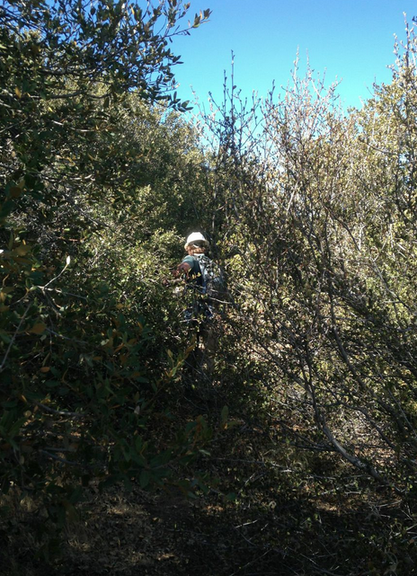
| Trail description: | Starting from the east end, we hiked the entire trail. The first 1.4 miles is an old road cut, very fast going... we spent the night at the end of the road cut, a great place to camp with a marvelous view (no water of course). Following was maybe a mile or two of ten foot wide cleared corridor. Then the "fun" began. There were long stretches of ceanothis that had regrown to the point that it was necessary to push and shove to get through, with many a scratch to the skin... before long this really could be impassible. The stretches cumulatively were at least a mile, and we were probably slowed down an hour or so. We also lost the trail quite a few times... some helpful people had left flags and cairns, but it wasn't enough. As we approached Mission Pine Basin Camp we left the ceanothis behind and things went well from there (although it is hot and exposed!). A quarter of a mile before Mission Pine Spring there was a wonderful stream with great water flow and holes big enough to sit in and soak. We were both somewhat dehydrated at that point and this felt like heaven. The scenery from there to Mt San Rafael was like being in the Sierras. |
| Mode of transport: | Hike |
| Trail condition: | Hard to follow |
| Condition details: | Almost impassible due to ceanothis grow-back |
Mission Pine Trail Survey - 04-05-2021 - by Oak Titmouse| Link: | Mission Pine Trail |
| Date: | 04-05-2021 |
| Surveyor Name: | Oak Titmouse |
| Trail description: | The section from west big pine to mission pine basin is badly overgrown. Very slow going, plan accordingly (it took me 4.5 hours). Type III fun. The section from mission pine basin to san rafael peak is glorious. easy to follow and beautiful scenery. |
| Mode of transport: | Hike |
| Trail condition: | Hard to follow |
Mission Pine Trail Survey - 12-30-2020 - by Anonymous Surveyor| Link: | Mission Pine Trail |
| Date: | 12-30-2020 |
| Surveyor Name: | Anonymous Surveyor |
| Trail description: | Trail was thoroughly overgrown and hard to follow (some may say it was non-existent) around Rattlesnake Cyn, between Mission Pine Basin and West Big Pine. Otherwise, this trail is stunning. |
| Mode of transport: | Hike |
| Trail condition: | Needs some work |
| Condition details: | Passed the entirety of trail from McKinley through West Big Pine |
Mission Pine Trail Survey - 12-26-2020 - by Brad Anderson| Link: | Mission Pine Trail |
| Date: | 12-26-2020 |
| Surveyor Name: | Brad Anderson |
| Trail description: | Trail is in excellent shape! No downed trees or bushwhacking here. Easy to follow. |
| Mode of transport: | Hike |
| Trail condition: | Good shape and easy to follow |
Mission Pine Trail Survey - 05-25-2020 - by Bingo Wathen| Link: | Mission Pine Trail |
| Date: | 05-25-2020 |
| Surveyor Name: | Bingo Wathen |
| Trail description: | Trail is great from Windy Gap to West Big Pine. Between West Big Pine and MPB trail is very overgrown in parts, sometimes manageable and other times easy to get lost. Lots of bushwhacking. Bring lots of water if you attempt. Between MPB and McKinley Saddle trail pretty easy to follow. Just look for the rock piles. |
| Mode of transport: | Hike |
| Trail condition: | Needs some work |
| Condition details: | Hiked from Windy Gap to McKinley Saddle |
Mission Pine Trail Survey - 05-11-2020 - by rich scholl| Link: | Mission Pine Trail |
| Date: | 05-11-2020 |
| Surveyor Name: | rich scholl |
| Trail description: | excellent to mps. needed some ceanothus and small down tree clearance right after mps. tree and root ball blocking trail 1/2 mile past mps-easy work around. |
| Mode of transport: | Hike |
| Trail condition: | Good shape and easy to follow |
Mission Pine Trail Survey - 05-02-2020 - by Jarrett Smith| Link: | Mission Pine Trail |
| Date: | 05-02-2020 |
| Surveyor Name: | Jarrett Smith |
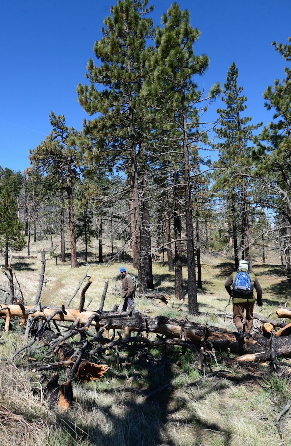
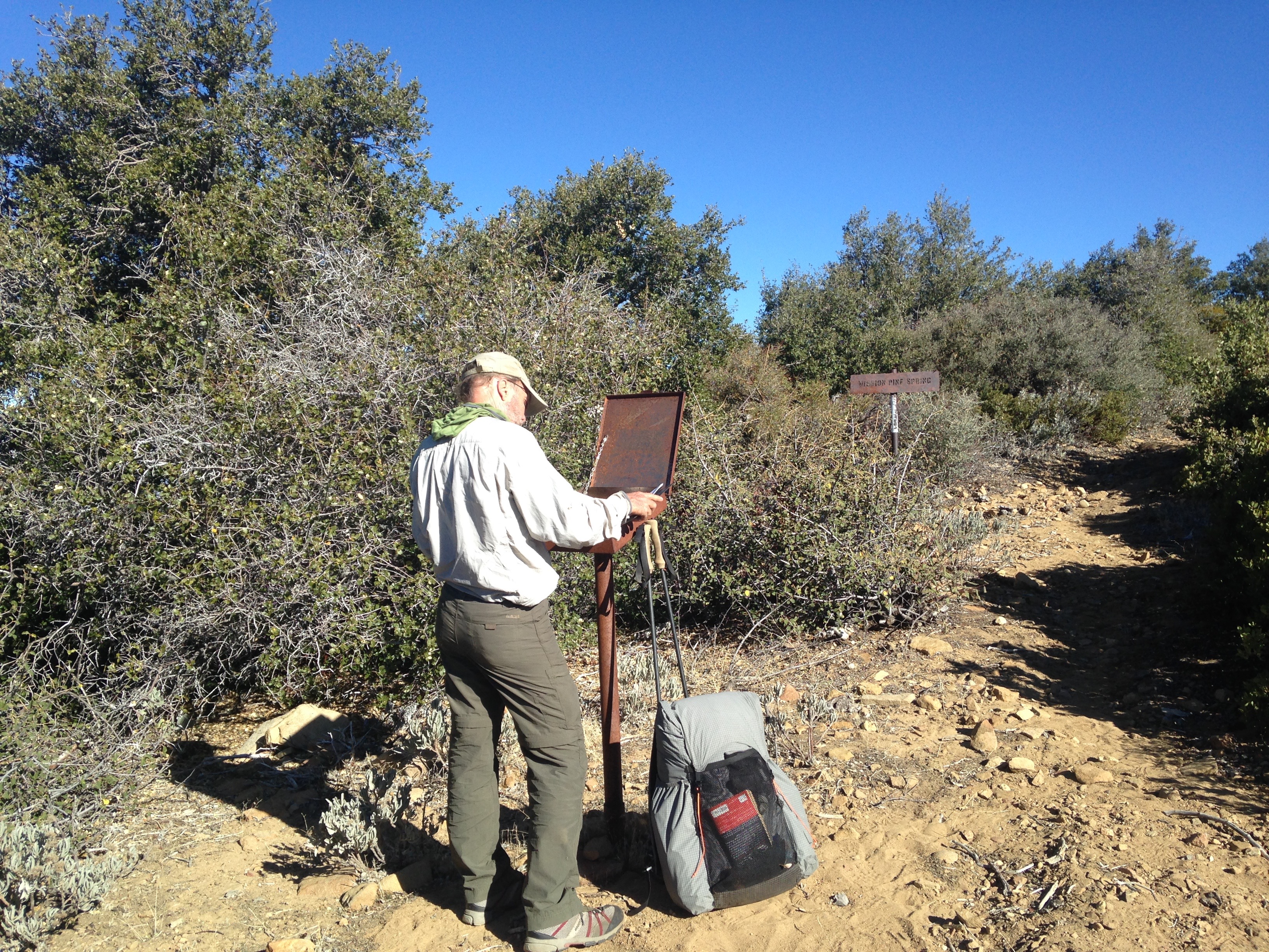
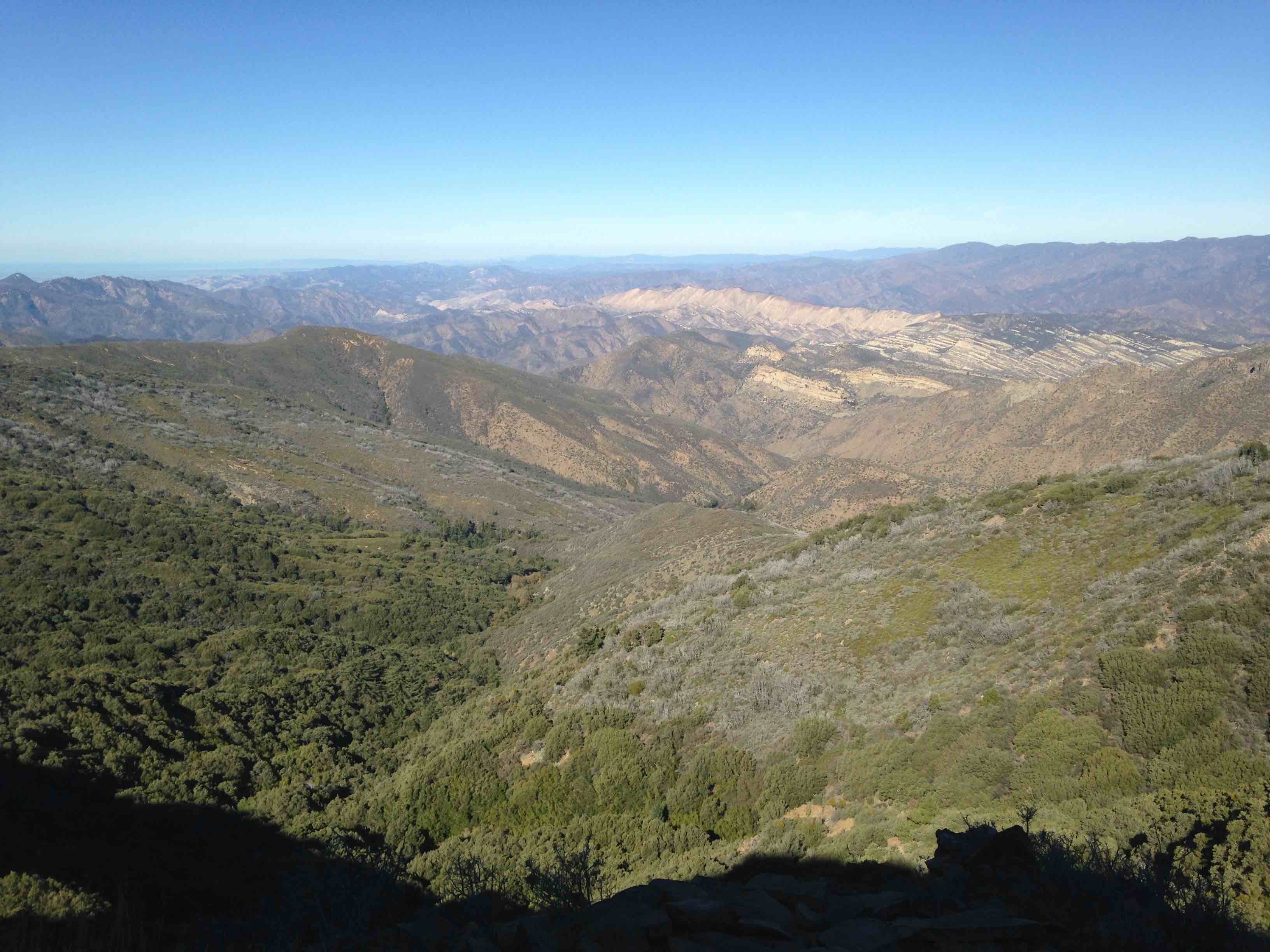
| Trail description: | Hiked from trailhead at McKinley Saddle to Mission Pine Springs Camp. The trail is in relatively good shape. The first 1/2 mile needs minor brushing. Then the rest of the way to camp there relatively spread out, light spots that could be brushed. Tread can use a bit of work in certain sections. In the first mile, there are sections where the slope of the trail is beginning to blend in with the back slope. A couple of spots could use drainages to avoid rutting as well. As part of an LPFA volunteer project, a new sign is installed at the trailhead at McKinley Saddle. Additionally, there were multiple trees cleared off the trail on the hike in and out. Overall, the trail is a good hike. Just some minor things that can be attended to soonish. The views of the Manazana drainage and the Deck on the hike up to San Rafael, along with the descent from San Rafael into the numerous pines is fantastic. Would highly suggest getting out here to enjoy the scenery before it gets too hot. |
| Mode of transport: | Hike |
| Trail condition: | Needs some work |
| Images: | New sign in place at trailhead at McKinley Saddle Trail among the pines Section of trail cleared! |
Mission Pine Trail Survey - 01-09-2020 - by Anonymous Surveyor| Link: | Mission Pine Trail |
| Date: | 01-09-2020 |
| Surveyor Name: | Anonymous Surveyor |
| Trail description: | Mostly in good condition from McKinley Saddle to MPS. Some very heavily overgrown sections between Big Pine and Mission Pine Basin, makes for slow travel and can be very hard to follow with a good amount of snow on the ground |
| Mode of transport: | Hike |
| Trail condition: | Needs some work |
Mission Pine Trail Survey - 02-18-2020 - by Anonymous Surveyor| Link: | Mission Pine Trail |
| Date: | 02-18-2020 |
| Surveyor Name: | Anonymous Surveyor |
| Trail description: | Do not know if the trail is clear all the way to Big Pine Mt or condition. Â ANYONE ? |
| Mode of transport: | Hike |
| Trail condition: | Needs some work |
Mission Pine Trail Survey - 07-06-2019 - by Los Padres Forest Association| Link: | Mission Pine Trail |
| Date: | 07-06-2019 |
| Surveyor Name: | Los Padres Forest Association |
| Trail description: | LPFA surveyed the eastern side of the Mission Pine Trail from Windy Gap out to West Big Pine in advance of an upcoming trail project. There were about 6 downed trees and quite a bit of brushy sections that were starting to get pretty bad. We'll be back in August to clear the trees and brush. Stay tuned...... Sure is pretty up there..... |
| Mode of transport: | Hike |
| Trail condition: | Needs some work |
| Images: | |
Mission Pine Trail Survey - 05-05-2019 - by Diane Soini| Link: | Mission Pine Trail |
| Date: | 05-05-2019 |
| Surveyor Name: | Diane Soini |
| Trail description: | There are a few fallen big trees beyond Mission Pine Spring, otherwise the trail is clear and in good shape to Mission Pine Basin. The trail becomes faint beyond the junction with Fall Canyon. Some helpful person has left ducks here and there. A GPS is useful at times. As you near West Big Pine the trail becomes very brushy until you reach the portion of the trail that looks like it used to be a road. |
| Mode of transport: | Hike |
| Trail condition: | Needs some work |
| Condition details: | Mostly good trail |
Mission Pine Trail Survey - 04-15-2018 - by Los Padres Forest Association| Link: | Mission Pine Trail |
| Date: | 04-15-2018 |
| Surveyor Name: | Los Padres Forest Association |
| Trail description: | ValHikes recently backpacked the Mission Pine Trail and documented it in two parts within her blog. Good descriptions of the trail, water conditions and what you might expect to see along the Mission Pine: http://valhikes.blogspot.com/2018/04/san-rafael-san-rafael-mountain.html http://valhikes.blogspot.com/2018/04/san-rafael-west-big-pine-mountain.html |
| Mode of transport: | Hike |
| Trail condition: | Good shape and easy to follow |
Mission Pine Trail Survey - 11-03-2017 - by Anonymous Surveyor| Link: | Mission Pine Trail |
| Date: | 11-03-2017 |
| Surveyor Name: | Anonymous Surveyor |
| Trail description: | I am going to Mountain bike this trail because thats what i want to do! Â If it is ok for a horse, its ok for my bike. Â |
| Mode of transport: | Bicycle |
| Trail condition: | Good shape and easy to follow |
Mission Pine Trail Survey - 09-24-2017 - by Los Padres Forest Association| Link: | Mission Pine Trail |
| Date: | 09-24-2017 |
| Surveyor Name: | Los Padres Forest Association |
| Trail description: | LPFA is getting ready to host a Working Vacation at Mission Pine Spring in October 2017 and spent a day scouting the trail to make sure there are no downed trees that would block stock travel. Â The trail is in great shape up to San Rafael Mtn due to 3-4 trail projects this summer spent on the first 1.5miles of the trail. Â Above that is in great shape as well. Â We cleared one downed tree out to MPS but other than that and small sections of manzanita encroachment the trail is in excellent shape! Â Probably the best its been in decades. The trail gets overgrown shortly after MPS and the focus of the Working Vacation will be to brush out beyond MPS towards the Basin. Â INFO@LPForest.org if you'd like to help on the trail project. |
| Mode of transport: | Hike |
| Trail condition: | Good shape and easy to follow |
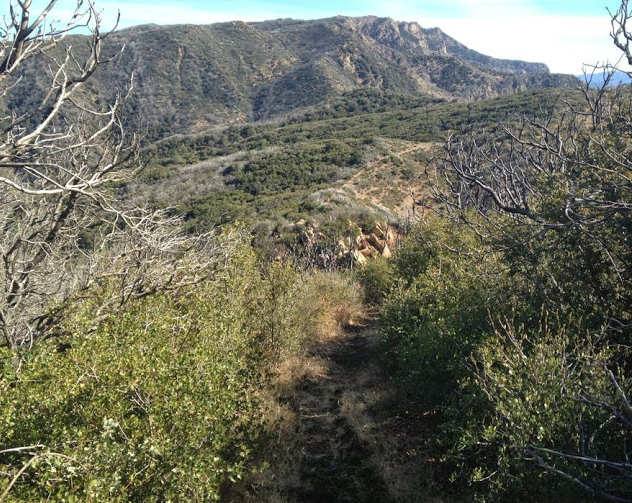
| Images: | Great views of Big Pine and the Basin from just past San Rafael. Trail up to San Raf is excellent, showing great tread work completed this summer. Great views into the Manzana from along the trail as well. 3-4 largish downed trees just past MPS Camp, they will be removed during the Working Vacation. New wilderness sign at McKinley Saddle. |
Mission Pine Trail Survey - 10-31-2016 - by Los Padres Forest Association| Link: | Mission Pine Trail |
| Date: | 10-31-2016 |
| Surveyor Name: | Los Padres Forest Association |
| Trail description: | LPFA led a 10-day Working Vacation performing trail work from McKinley Saddle out to the Rattlesnake Canyon drainage past Mission Pine Basin. Â We spiked at Mission Pine Basin Camp and worked out from there. Â We also worked the top mile of the Santa Cruz Trail down from the Basin. The trail is in really nice shape to Mission Pine Spring, it then becomes a little brushy in sections but very passable all the way to West Big Pine. Â It is stock passable at the moment. Â Water at Mission Pine Spring, no water at Mission Pine Basin. Â We scouted the Fall Canyon Trail and while it remains passable, it is getting real brushy. More photos available at the LPFA Facebook page here: https://www.facebook.com/LosPadresForestAssociation/posts/619910411467220?notif_t=like¬if_id=1481555349387696 |
| Mode of transport: | Array |
| Trail condition: | Needs some work |
Mission Pine Trail Survey - 05-29-2016 - by Duane Waite| Link: | Mission Pine Trail |
| Date: | 05-29-2016 |
| Surveyor Name: | Duane Waite |
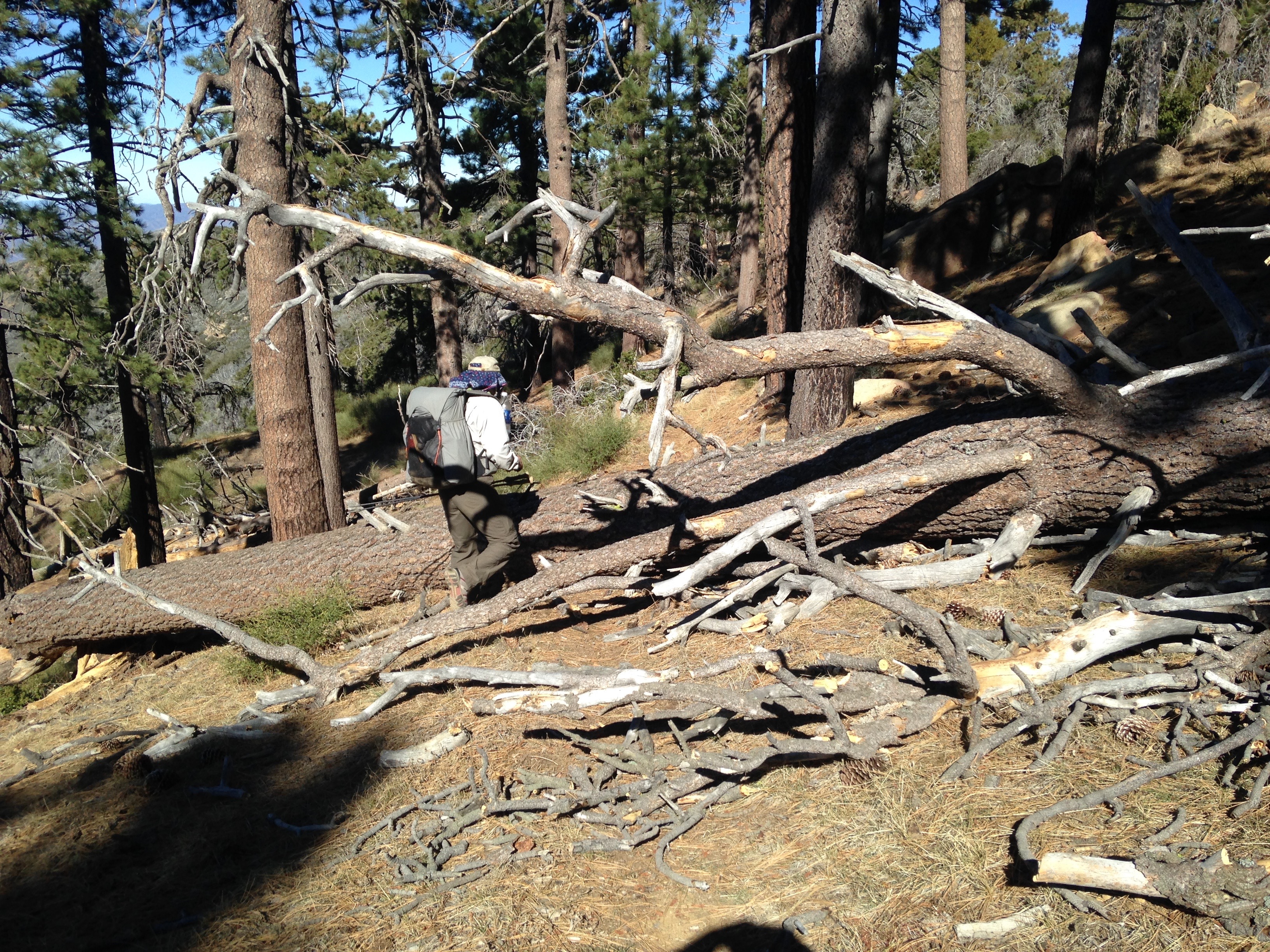
| Trail description: | Hiked from McKinley Springs to Mission Pine Springs. The trail is in good shape except for near the summit where the tread can be difficult to spot. There are a few blow downs. The largest, about 18 inches in diameter, lies a quarter mile behind the San Rafael summit. I followed a set of mountain bike tracks up the trail from McKinley Saddle all the way down to Mission Pine Springs. There is no wilderness marker or sign at the trail head, so it's either missing or was stolen. Either way, some mountain bikers took it as a sign that what they did was ok. |
| Mode of transport: | Hike |
| Trail condition: | Good shape and easy to follow |
| Images: | Mountain bike tracks between San Rafael Summit and Mission Pine Springs |
Mission Pine Trail Survey - 02-27-2016 - by Anonymous Surveyor| Link: | Mission Pine Trail |
| Date: | 02-27-2016 |
| Surveyor Name: | Anonymous Surveyor |
| Trail description: | Hiked the far east end of the trail from Windy Gap to West Big Pine and back. Â Easy to follow the entire way if perhaps a little brushy at times. Â A couple of small tree falls across the trail but no major impediment to travel. |
| Mode of transport: | Hike |
| Trail condition: | Good shape and easy to follow |
Mission Pine Trail Survey - 11-21-2015 - by Paul Cronshaw| Link: | Mission Pine Trail |
| Date: | 11-21-2015 |
| Surveyor Name: | Paul Cronshaw |
| Trail description: | Trail is in good condition and easy to follow. There are 4 downed trees between San Rafael Mountain and Mission Pine Springs ranging in size from 14 - 28". Â A 5th tree is hung up across trail about 1/4 mile below Mission Pine Springs Camp. |
| Mode of transport: | Hike |
| Trail condition: | Needs some work |
| Condition details: | 4 downed trees |
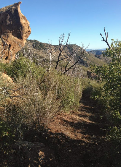
| Images: | Register at McKinley Saddle marks the western end of the Mission Pine Trail Downed Tree #2 near San Rafael Peak Hiking in the solitude of big pines. A Sierra Nevada experience! View to the East: Manzana River and Hurricane Deck. Snow on trail traversing the northern slope of San Rafael Mountain. |
Mission Pine Trail Survey - 05-02-2015 - by Los Padres Forest Association| Link: | Mission Pine Trail |
| Date: | 05-02-2015 |
| Surveyor Name: | Los Padres Forest Association |
| Trail description: | Like sands through the hourglass, trees continue to fall. Â Another 15-20 downed pines were seen along the Mission Pine Trail between the Buckhorn Rd and West Big Pine. Â Most were in the 18-30" range. A project is planned to remove these trees later this spring. |
| Mode of transport: | Array |
| Trail condition: | Needs some work |
| Images: | photo Humphrey photo Humphrey photo Humphrey photo Humphrey photo Humphrey |
Mission Pine Trail Survey - 02-15-2015 - by Curt Cragg| Link: | Mission Pine Trail |
| Date: | 02-15-2015 |
| Surveyor Name: | Curt Cragg |
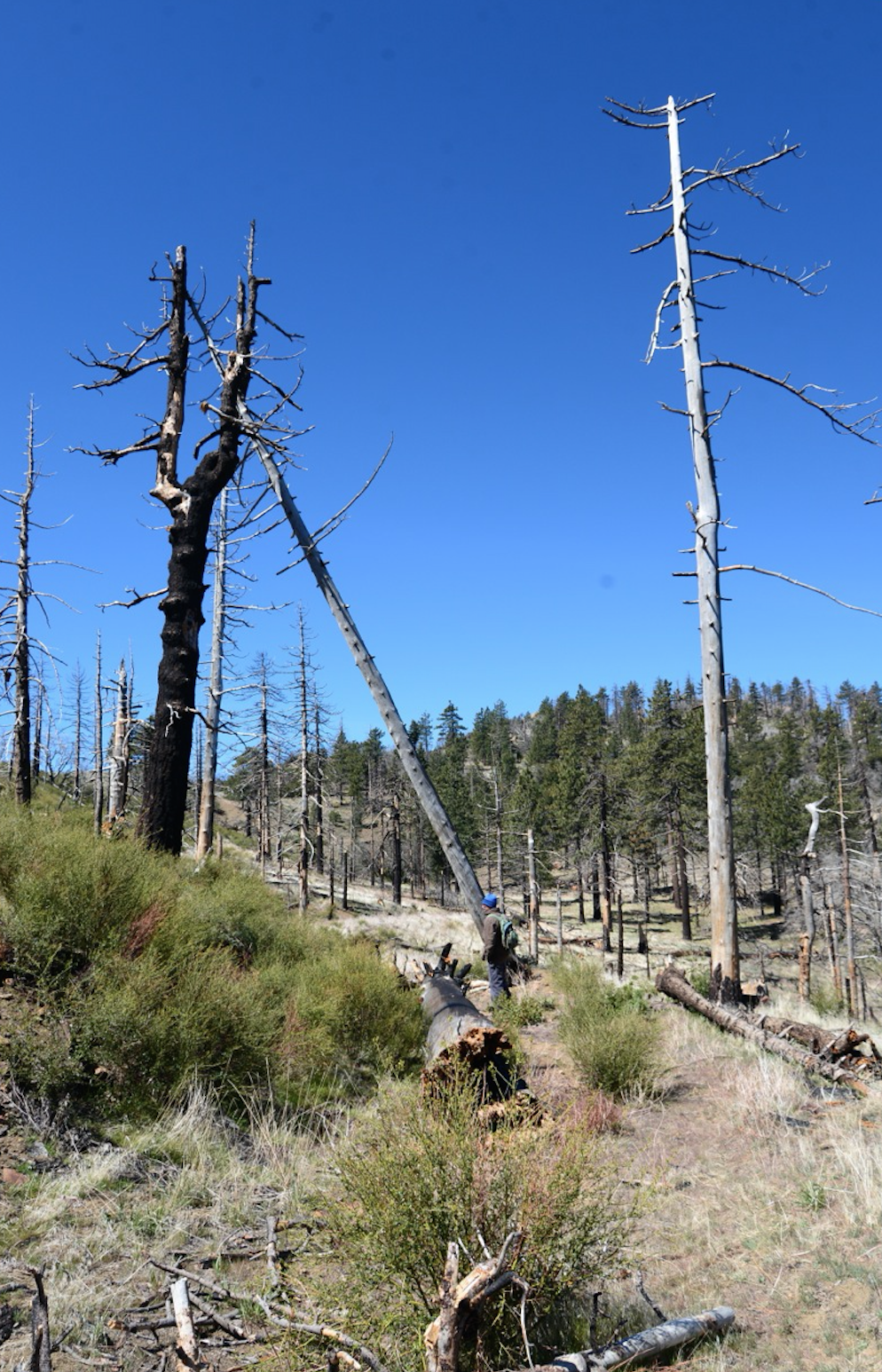
| Trail description: | McKinley Saddle to MP Basin VWR Trail Recon Hike Sunday, February 15, 2015 VWR’s:  Curt Cragg and Skip Boyland Objective:  Drive up McKinley fire road from Cachuma Saddle to look at road conditions.  Check McKinley Spring Camp.  Hike from McKinley Saddle to Mission Pine Basin to check on trail conditions and tree falls from prior report in anticipation of trail project scheduled for February 27-March 1, 2015 McKinley Fire Road Condition:  Excellent, no major washouts, tree falls or slide areas. McKinley Springs Camp:  Full.  There was a bachelor party group of 13 backpackers from the L.A. area camping at McKinley Spring.  They did an excellent job of cleaning up trash left by previous campers.  We hauled out trash so that they did not have to pack it down the road.  Counseled them on making sure that they soak their campfire tomorrow when they leave. Mission Pine Trail from McKinley Saddle to Mission Pine Spring:  The first mile to two miles to San Rafael peak needs brush work and some tread repair which we will address on the upcoming trail project.  There are four tree falls past San Rafael Peak on the trail leading down into MP Spring camp that need to be cleared (see photos).  All can be addressed with a 4’ crosscut saw.  There are two tree falls just past the camp that also need to be cleared.  Areas of flowing water along the trail from recent rain storm. Mission Pine Spring Camp:  Empty.  Camp is in good condition.  Bears have been chewing on the picnic table.  Water flow at spring is excellent and very fresh. Mission Pine Trail from MP Spring to MP Basin:  First two miles past the tree falls near the camp, trail is in generally good condition with the need for some tread repair and brush work, but not overgrown.  From two miles east to MP Basin camp there are several areas that need brush work, tread repair and tree clearing.  The switchbacks leading into the MP Basin drainage probably need the most work.  Most of the tree falls are match sticks, but there are a few larger trees that need to be cleared.  This will be the primary focus of the trail project on Saturday, February 28th. Mission Pine Basin Camp: Empty.  The trail junction from the MP Trail to the MP Camp has been lost and needs signage.  It is unclear where to leave the trail to hike to the camp and the trail to the camp is hard to follow due to brush and tree falls.  There are several tree falls across the trail that passed the camp as well.  The camp is showing promising signs of new pine tree growth, but the campsite is barren and has several hazard trees that need to be dropped.  There was water in the drainage around MP Basin Camp. Link to photos:  https://www.dropbox.com/sh/ve2f5zw2zr4l992/AACO9PCItZcwbEDd56S12DYya?dl=0 |
| Mode of transport: | Hike |
| Trail condition: | Good shape and easy to follow |
Mission Pine Trail Survey - 02-7-2015 - by Los Padres Forest Association| Link: | Mission Pine Trail |
| Date: | 02-7-2015 |
| Surveyor Name: | Los Padres Forest Association |
| Trail description: | We got a great report from Jenn and Tim who hiked Mission Pine on the week of 2/7. Â Great views, didn't see a soul, fantastic weather! Â They did report seeing 36 downed trees from Mission Pine Basin to McKinley Saddle. Â None of the trees were over 20" in diameter. |
| Mode of transport: | Hike |
| Trail condition: | Needs some work |
Mission Pine Trail Survey - 11-25-2014 - by Shaddus Maximus | Link: | Mission Pine Trail |
| Date: | 11-25-2014 |
| Surveyor Name: | Shaddus Maximus |
| Trail description: | Awesome work recently done on this trail! Thanks to the volunteers who recently lopped brush back, making the trail wide and easy to follow. One one small section just east of Mission Pine Basin that's a little overgrown, but still very manageable and easy to navigate. |
| Mode of transport: | Hike |
| Trail condition: | Good shape and easy to follow |
Mission Pine Trail Survey - 11-15-2014 - by Los Padres Forest Association| Link: | Mission Pine Trail |
| Date: | 11-15-2014 |
| Surveyor Name: | Los Padres Forest Association |
| Trail description: | The LPFA and VWR led a second of three projects to open up the Mission Pine Trail. Â This project started at Windy Gap and headed West towards Mission Pine Basin. Â A crew of 10 volunteers worked on the trail over two days. Â They were able to work past the Rattlesnake Canyon Saddle, which is where they left off last time, and continued work to within 1.5miles of Mission Pine Basin! Â AWESOME! Picture provided by the Beeman. Â Big thanks to VWR Leader Curt Cragg for organizing the efforts. |
| Mode of transport: | Array |
| Trail condition: | Needs some work |
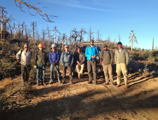
| Images: | VWR Crew lineup Looking good, nice work! Looking back towards West Big Pine, WOW! This rock marked the top of the worst section, it is now clear. It's hard to beat the views from the Mission Pine Trail |
Mission Pine Trail Survey - 10-02-2014 - by Los Padres Forest Association| Link: | Mission Pine Trail |
| Date: | 10-02-2014 |
| Surveyor Name: | Los Padres Forest Association |
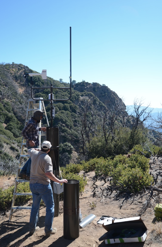
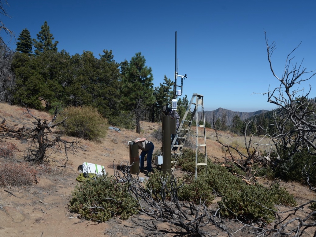
| Trail description: | Ran into the SB County Hydrology people working on the weather station near Windy Gap (West Big Pine). Â If you've ever noticed that West Big Pine gets less rain than anywhere else in the area, it's because it gets the most snow compared to anywhere else in the area. |
| Mode of transport: | Array |
| Trail condition: | Good shape and easy to follow |
| Images: | Photo Humphrey Photo Humphrey |
Mission Pine Trail Survey - 10-22-2014 - by Los Padres Forest Association| Link: | Mission Pine Trail |
| Date: | 10-22-2014 |
| Surveyor Name: | Los Padres Forest Association |
| Trail description: | The LPFA hosted a trail project to clear the trail from Windy Gap west towards Mission Pine Basin. Â We were able to get to the bottom of the Rattlesnake Canyon Switchbacks. Â The trail is good to that point. Â Unfortunately the worst part of the trail is from the Rattlesnake Basin up the next mile. Â We are hoping to schedule a followup trip to start on that part of the trail in the next few weeks. Â More to come...... Thanks to all the volunteers who helped: Â Curt Cragg, Mike Smith, Beeman, Rik C, James Wapotich, etc..... |
| Mode of transport: | Array |
| Trail condition: | Needs some work |
| Images: | That is the trail, west side of Rattlesnake Basin. Photo courtesy Beeman Looking back at the Rattlesnake Switchbacks. Photo courtesy Beeman Bushwhacking along East Mission Pine Trail. Photo courtesy Beeman And after two days of trail work. Photo courtesy Beeman So rewarding! Photo courtesy Beeman |
Mission Pine Trail Survey - 08-30-2014 - by Los Padres Forest Association| Link: | Mission Pine Trail |
| Date: | 08-30-2014 |
| Surveyor Name: | Los Padres Forest Association |
| Trail description: | From Windy Gap west towards West Big Pine the trail could still use some brushing for the first half mile, otherwise it's in great shape with no downed trees. We saw a very healthy black bear but he spooked and ran away quickly. We
checked the peak register and a large forest service group passed
through in early August. |
| Mode of transport: | Hike |
| Trail condition: | Needs some work |
Mission Pine Trail Survey - 09-29-2014 - by Los Padres Forest Association| Link: | Mission Pine Trail |
| Date: | 09-29-2014 |
| Surveyor Name: | Los Padres Forest Association |
| Trail description: | No trees across the trail and the road is in decent shape. The trail from McKinley Saddle to San Rafael summit has become too brushy for shorts. Lots of bear fresh bear tracks & scat from Cachuma Peak all the way to the piney summit of San Rafael Mtn. |
| Mode of transport: | Hike |
| Trail condition: | Needs some work |
| Condition details: | Toejam Report |
| Number of trees down: | 0 |
Mission Pine Trail Survey - 05-03-2014 - by bardley| Link: | Mission Pine Trail | |
| Date: | 05-03-2014 | |
| Surveyor Name: | bardley | |
| Trail description: |
| |
| Mode of transport: | Hike | |
| Trail condition: | Good shape and easy to follow |
Mission Pine Trail Survey - 05-02-2014 - by bardley| Link: | Mission Pine Trail |
| Date: | 05-02-2014 |
| Surveyor Name: | bardley |
| Trail description: | Mission Pine Trail from McKinley Saddle to Mission Pine Spring camp is in great shape. There are a few areas where some lopping might be in order. There are cairns placed that help make the trail easy to follow. There is water flowing from the pipe at Mission Pine Spring Camp filling my liter bottle in < 15 seconds. There were numerous hazard trees around the camp that were felled by the work group. After the tree felling, the trail was rerouted slightly and wooden curbs placed to delineate the trail. This weekend - May 2-4, 2014 a group of volunteers worked the trail from Mission Pine Spring Camp almost to Mission Pine Basin. I believe over 20 trees were removed that were blocking the trail. Hours were also spent brushing the trail. It is in great shape too. |
| Mode of transport: | Hike |
| Trail condition: | Good shape and easy to follow |
 Survey / Report Form - Please click this box to open the form.