 Use Marker Groups
 Wolf 2002
Piru 2003
Day 2006
Zaca 2007
Gap 2008
La Brea 2009

| Date | Surveyor | Water Report |
| 03-04-2024 | Michael McGurk | Flowing |
| 06-19-2022 | Hugh Ranson | Stagnant |
| 05-20-2022 | Addison Jerlow | Stagnant |
| 05-16-2021 | Rick Hayes | Trickle |
| 04-05-2021 | Oak Titmouse | Trickle |
| 02-25-2021 | Los Padres Forest Association | Flowing |
| 11-24-2020 | BD | Stagnant |
| 05-25-2020 | Bingo Wathen | Flowing |
| 10-26-2019 | Craig R. Carey | Stagnant |
| 06-22-2018 | Los Padres Forest Association | Flowing |
| 05-29-2018 | Anonymous Surveyor | Stagnant |
| 05-16-2018 | Valerie Norton | Trickle |
| 05-19-2017 | MSchless | Trickle |
| 04-01-2017 | Littleredridingwood | Trickle |
| 11-06-2016 | Cameron D | Trickle |
| 08-14-2016 | Los Padres Forest Association | Flowing |
| 07-16-2016 | Jasonn Beckstrand | Trickle |
| 02-13-2016 | James | Trickle |
| 06-07-2015 | Los Padres Forest Association | Stagnant |
| 05-09-2015 | Los Padres Forest Association | Trickle |
| 04-29-2015 | Jeff B. | Trickle |
| 03-30-2015 | Shaddus Maximus | Trickle |
| 02-15-2015 | Heather | Trickle |
| 11-25-2014 | Shaddus Maximus | Stagnant |
| 09-30-2014 | Los Padres Forest Association | Stagnant |
| 06-15-2014 | Los Padres Forest Association | Dry |
| 11-13-2009 | M. Jones | Flowing |
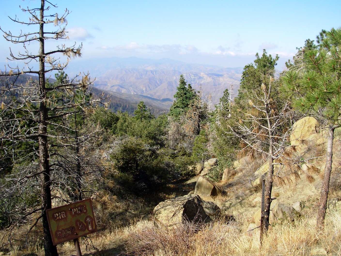
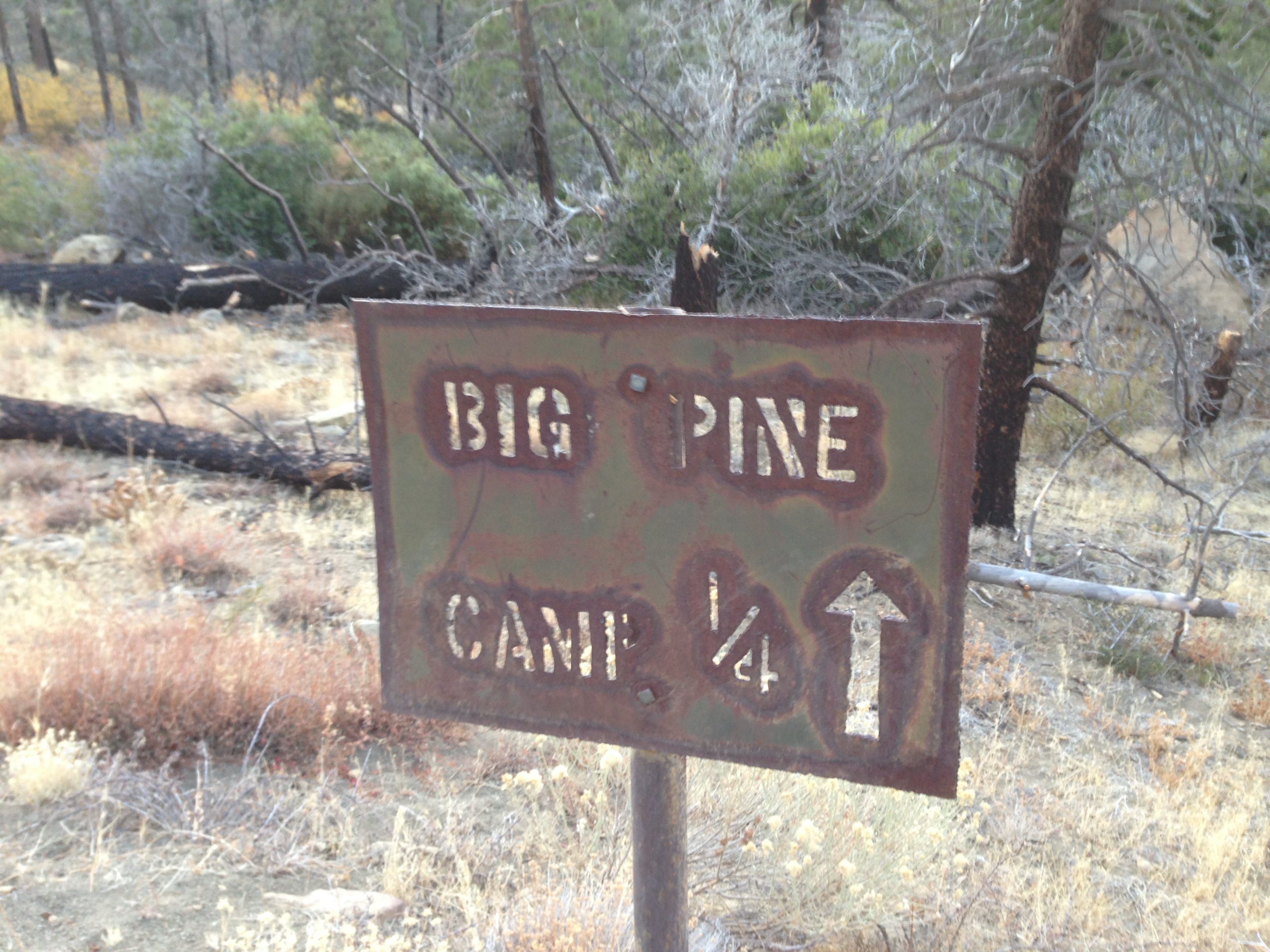
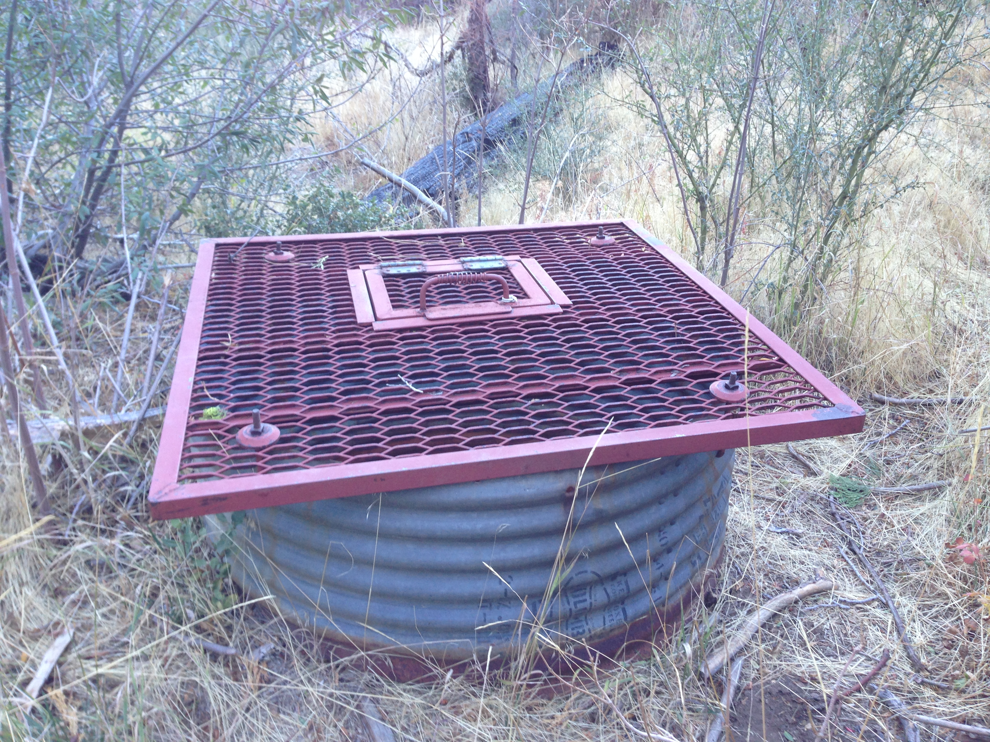
Big Pine Camp (aka Big Pine Spring Camp) is located about 1/4mile down off the Buckhorn Rd on the western flank of Big Pine Mtn in the San Rafael Wilderness. Big Pine Camp has a very reliable spring which helps fill up a large metal sub-terranean spring tank. In order to access the water you must lower a bucket into the tank and pull the water out within the bucket. That being said, there is usually enough water flowing out of the ground nearby that you don't need to use the tank water.
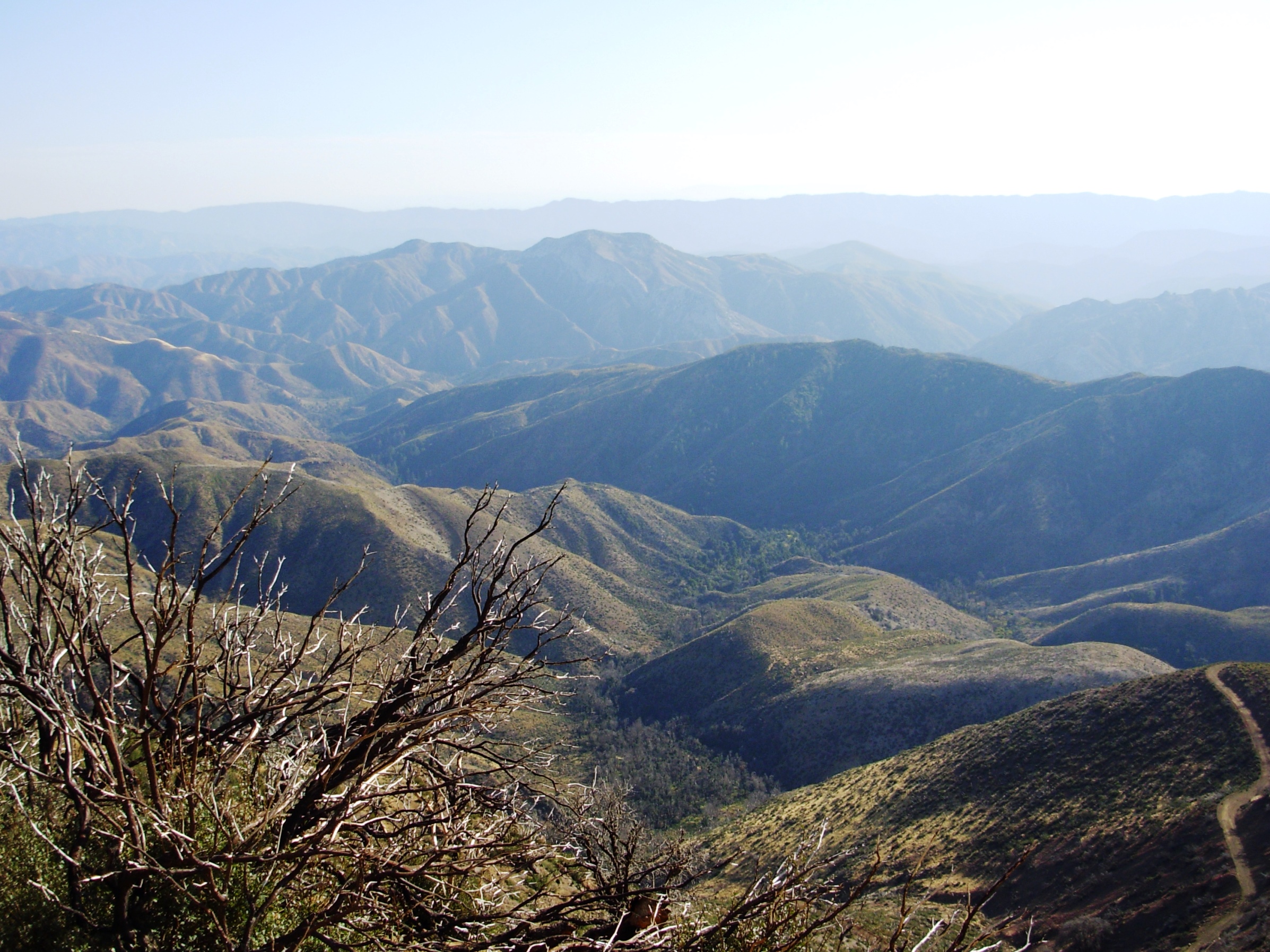
The camp is the only reliable water between Upper Bear and Bluff Camp and as a result sees a good amount of traffic, mostly from hunters, peak baggers or bikepackers crossing the Los Padres on the Buckhorn Road. There are great views of the upper Sisquoc River Valley. There is cell reception is nearby as well.
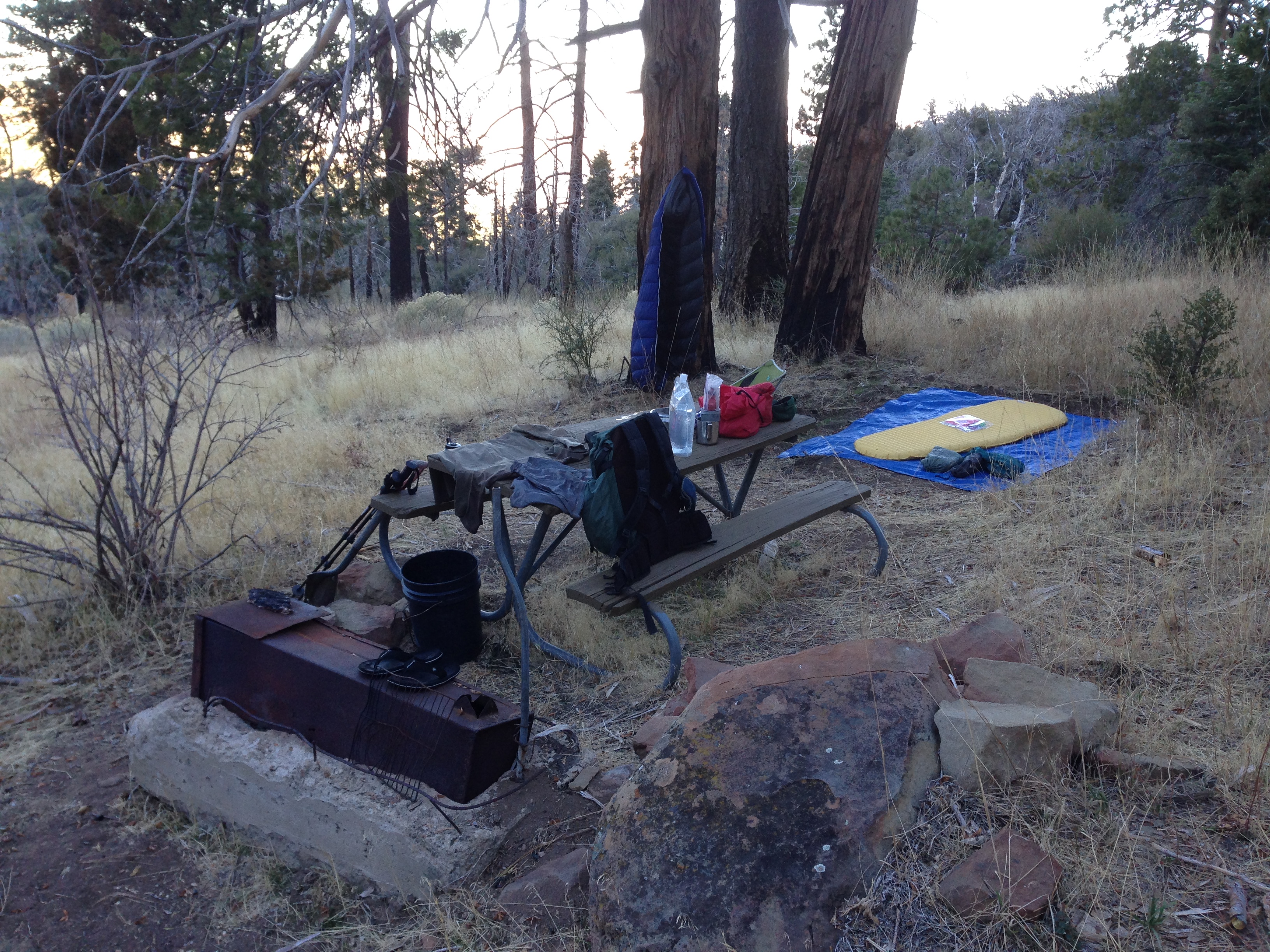
NOTE: There are a few hazard trees in the camp, please pick your camping spot wisely. The safest camp is located directly above the spring near some oak trees.


 Big Pine Camp Survey - 03-04-2024 - by Michael McGurk
| Link: | Big Pine Camp |
| Date: | 03-04-2024 |
| Surveyor Name: | Michael McGurk |
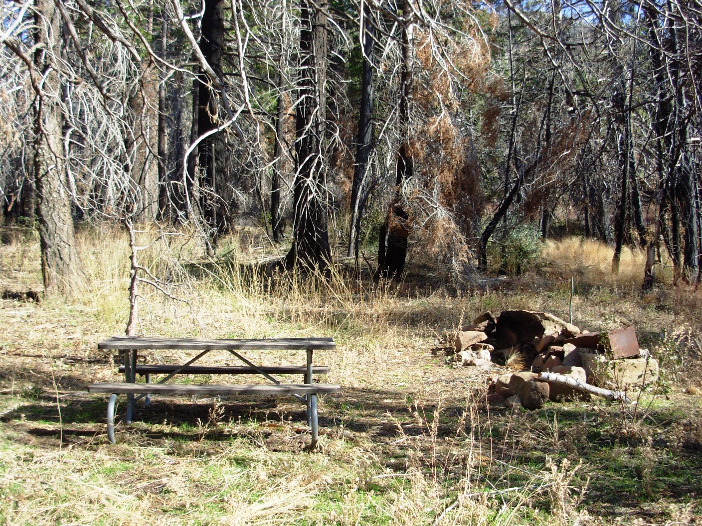
| Camp Description: | The camp is derelict with abundant over growth and downed trees. the picnic table is unharmed. found the remnants of a wooden spring box under a large blowdown but could not find the others. The camp was snowed in and had about 3 to 4 inches of snow covered. |
| Water Source: | Flowing |
| Water Source Details: | derelict |
| Weather Conditions: | rain and snow 32. |
Big Pine Camp Survey - 06-19-2022 - by Hugh Ranson| Link: | Big Pine Camp |
| Date: | 06-19-2022 |
| Surveyor Name: | Hugh Ranson |
| Camp Description: | |
| Water Source: | Stagnant |
| Water Source Details: | |
| Weather Conditions: |
Big Pine Camp Survey - 05-20-2022 - by Addison Jerlow| Link: | Big Pine Camp |
| Date: | 05-20-2022 |
| Surveyor Name: | Addison Jerlow |
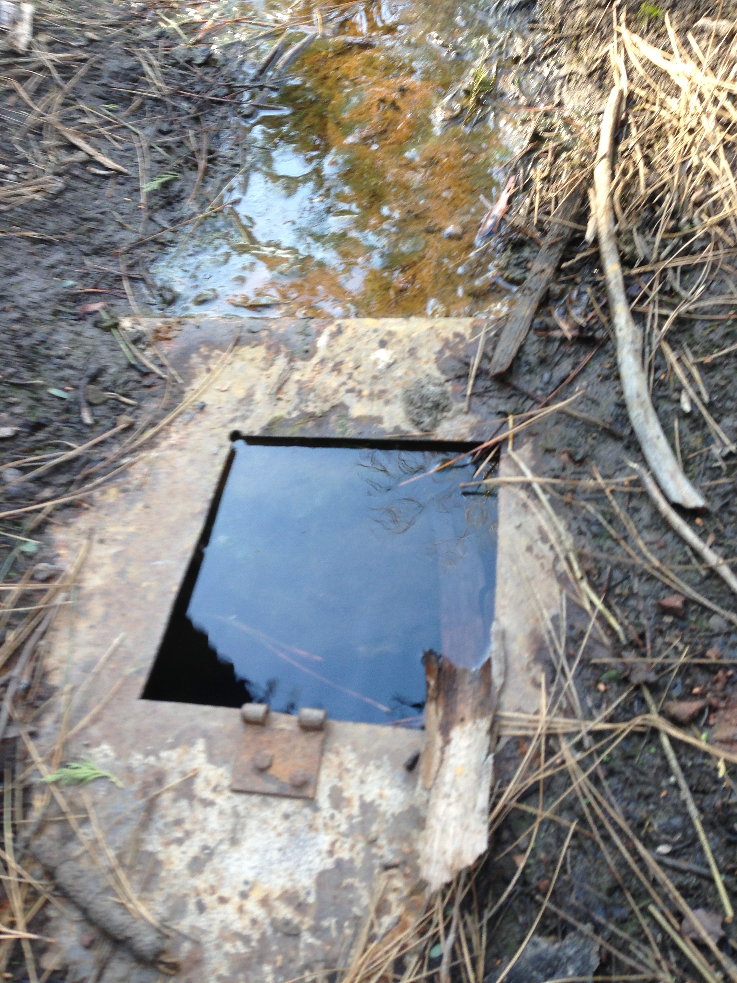
| Camp Description: | Saw bear #3 of the day bathing in the black bin below the spring pipe as I arrived! Lower metal cylinder with bucket is empty. Black bin is green and bear-y. Pipe has no flow. Wood lid basin is full but has a gnarly sulfur/metal taste to it. A little hard to stomach but ice cold. Camp above the spring is in good shape with a table. Room for 2 tents if you move the table. |
| Water Source: | Stagnant |
| Water Source Details: | |
| Weather Conditions: | low 70s, mid 40s |
| Images: | |
Big Pine Camp Survey - 05-16-2021 - by Rick Hayes| Link: | Big Pine Camp |
| Date: | 05-16-2021 |
| Surveyor Name: | Rick Hayes |
| Camp Description: | 2 upper rectangular basins were full. Small trickle in the bottom one. The circular well below was low, stagnant and gross. I filled up from the wooden lid rectangular basin. 100% need a water filter |
| Water Source: | Trickle |
| Water Source Details: | |
| Weather Conditions: |
Big Pine Camp Survey - 04-05-2021 - by Oak Titmouse| Link: | Big Pine Camp |
| Date: | 04-05-2021 |
| Surveyor Name: | Oak Titmouse |
| Camp Description: | |
| Water Source: | Trickle |
| Water Source Details: | |
| Weather Conditions: |
Big Pine Camp Survey - 02-25-2021 - by Los Padres Forest Association| Link: | Big Pine Camp |
| Date: | 02-25-2021 |
| Surveyor Name: | Los Padres Forest Association |
| Camp Description: | Repaired spring box and water access is working great. Good flowing water into the small trough and easy to pull water out of the metal culvert tank. Some of the campsites have hazard trees, one campsite up the small draw and above the spring source is probably the best place to camp. |
| Water Source: | Flowing |
| Water Source Details: | |
| Weather Conditions: |
Big Pine Camp Survey - 11-24-2020 - by BD| Link: | Big Pine Camp |
| Date: | 11-24-2020 |
| Surveyor Name: | BD |
| Camp Description: | |
| Water Source: | Stagnant |
| Water Source Details: | Stagnant, but lots of water in the hole |
| Weather Conditions: |
Big Pine Camp Survey - 05-25-2020 - by Bingo Wathen| Link: | Big Pine Camp |
| Date: | 05-25-2020 |
| Surveyor Name: | Bingo Wathen |
| Camp Description: | Water in tank, but also flowing from nearby spring |
| Water Source: | Flowing |
| Water Source Details: | |
| Weather Conditions: |
Big Pine Camp Survey - 10-26-2019 - by Craig R. Carey| Link: | Big Pine Camp |
| Date: | 10-26-2019 |
| Surveyor Name: | Craig R. Carey |
| Camp Description: | Troop 111 (Ventura) reworked the tread, fixed the trailhead sign, removed several downed trees en route to camp, and cleaned up the best site (the shaded site just upstream from spring) — stove cleaned out, table moved from far end of old camps to here, tent flats clean up, horseshoe pit clean up, fallen fir tree removed. The other sites aren't very desirable these days. Lots of down and hazard trees, but this one site is now in fantastic shape. |
| Water Source: | Stagnant |
| Water Source Details: | Water in well is about 8 feet down, wasn't able to retrieve bucket. |
| Weather Conditions: | Smoky from recent fires, warm. |
| Images: | Cleaning up Camp. |
Big Pine Camp Survey - 06-22-2018 - by Los Padres Forest Association| Link: | Big Pine Camp |
| Date: | 06-22-2018 |
| Surveyor Name: | Los Padres Forest Association |
| Camp Description: | Water was flowing good from the spring as well as within the tank. |
| Water Source: | Flowing |
| Water Source Details: | |
| Weather Conditions: | Not that hot, 80's! |
| Images: | |
Big Pine Camp Survey - 05-29-2018 - by Anonymous Surveyor| Link: | Big Pine Camp |
| Date: | 05-29-2018 |
| Surveyor Name: | Anonymous Surveyor |
| Camp Description: | Several of the sites need work. One of the stoves has a fallen tree on top. |
| Water Source: | Stagnant |
| Water Source Details: | Plenty of water in the well. |
| Weather Conditions: |
Big Pine Camp Survey - 05-16-2018 - by Valerie Norton| Link: | Big Pine Camp |
| Date: | 05-16-2018 |
| Surveyor Name: | Valerie Norton |
| Camp Description: | Found water at the spring, so did not proceed further because water is what I needed. I scooped it from within the box through the square hole. There is dirt preventing opening this top further. Flow is small but solid. |
| Water Source: | Trickle |
| Water Source Details: | |
| Weather Conditions: |
Big Pine Camp Survey - 05-19-2017 - by MSchless| Link: | Big Pine Camp |
| Date: | 05-19-2017 |
| Surveyor Name: | MSchless |
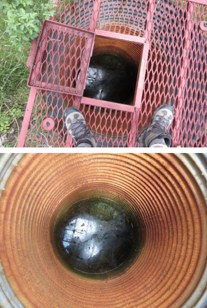
| Camp Description: | Grated "tank" has a bunch of bugs and stuff on the surface with water about 5-6 ft below the grate. Lots of hazard trees around. Counted 5 different ice can stoves, but only one site below a big oak just up the drainage from the spring is safe to camp. Big deadfall tree across the picnic table which basically confirms the danger of camping at that "main" site. Lots of bear sign including scat and scratches below the big oak where we camped. Beautiful sunset over the Sisquoc. |
| Water Source: | Trickle |
| Water Source Details: | Spring is trickle/flowing with good clear water |
| Weather Conditions: | High 40s overnight |
Big Pine Camp Survey - 04-01-2017 - by Littleredridingwood | Link: | Big Pine Camp |
| Date: | 04-01-2017 |
| Surveyor Name: | Littleredridingwood |
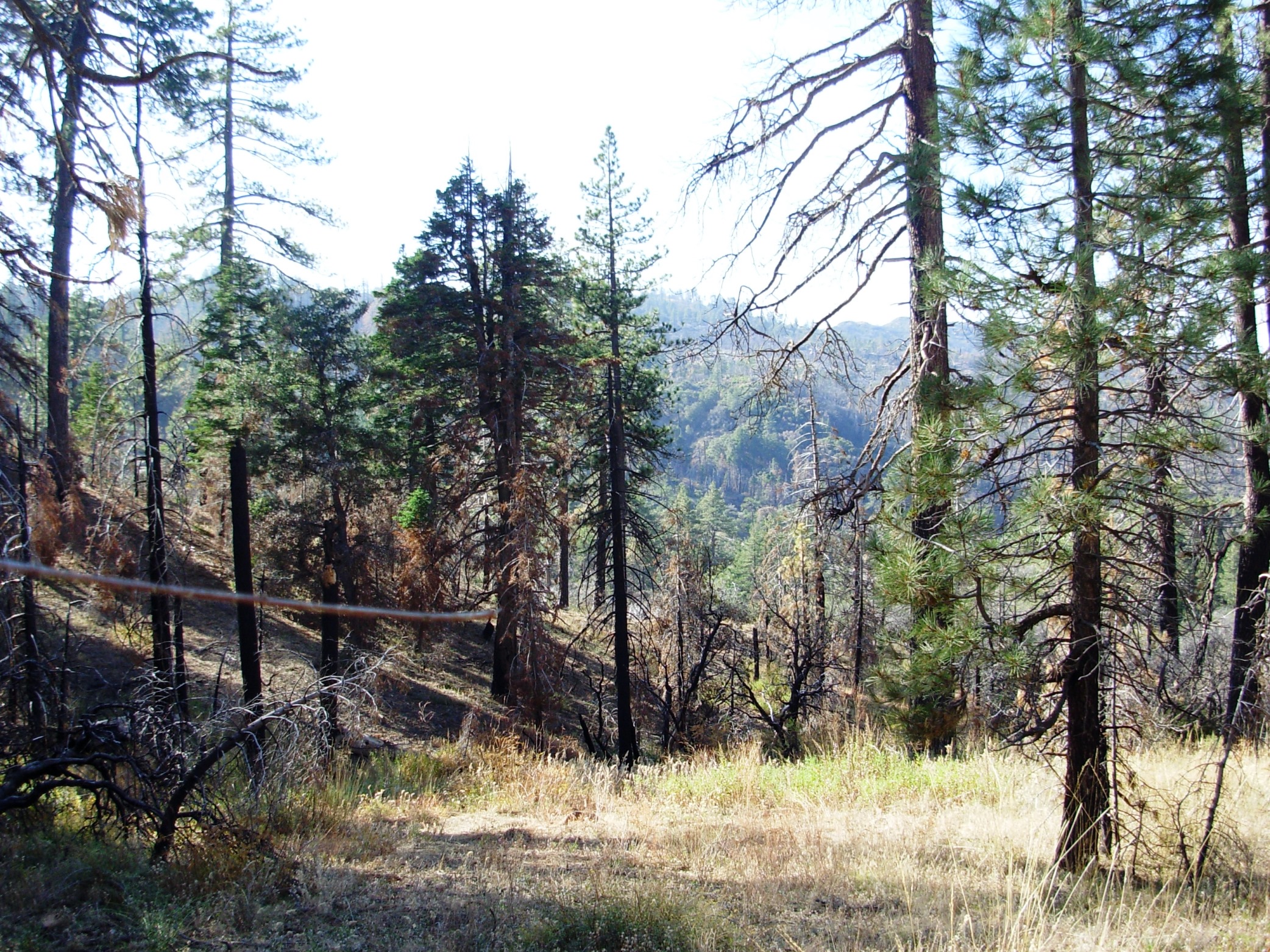
| Camp Description: | While I didn't actually find/stay at this camp, I scouted the road from buckhorn/Sierra Madre intersection,  to Big Pine Mtn/windy gap. Road washed out/Rockfall  in many places,  a few large trees down, blocking road/trail. |
| Water Source: | Trickle |
| Water Source Details: | |
| Weather Conditions: | Sunny,65 |
| Images: | Rock fall a few miles in from sierra Madre rd. Large tree down at the sisquoc trailhead towards bear camps. Multiple trees down before big pine mtn/windy gap Looking south west towards cachuma, West big pine to the right? West dry canyon rd washed out... |
Big Pine Camp Survey - 11-06-2016 - by Cameron D| Link: | Big Pine Camp |
| Date: | 11-06-2016 |
| Surveyor Name: | Cameron D |
| Camp Description: | The subterranean tank had fairly clean water. Lots of bugs on the surface but after skimming those off (and filtering) the water looked and tasted good. I poked around the area and didn't see the spring. It might be dry or just trickling, but more likely I just missed it since I wasn't really looking. Trail to campground from road was a bit grown over and there were a lot of different use paths. Still easy enough to find the way down since all the options probably worked. Campground itself was somewhat overgrown and had lots of 'widow makers'. The whole area rests on a hill as well, but the site I stayed at had two nearby cut-outs of level ground (big enough for 1). |
| Water Source: | Trickle |
| Water Source Details: | Spring tank was fine, did not locate other sources |
| Weather Conditions: |
Big Pine Camp Survey - 08-14-2016 - by Los Padres Forest Association| Link: | Big Pine Camp |
| Date: | 08-14-2016 |
| Surveyor Name: | Los Padres Forest Association |
| Camp Description: | Good water flowing below the spring tank as well as within the spring tank. Â A scout project is planned for later in 2016 to relocate one of the campsites, fix the trail down to the camp and make some improvements to the spring tank water collection system. |
| Water Source: | Flowing |
| Water Source Details: | |
| Weather Conditions: | mid-90's and HOT HOT HOT! |
Big Pine Camp Survey - 07-16-2016 - by Jasonn Beckstrand| Link: | Big Pine Camp |
| Date: | 07-16-2016 |
| Surveyor Name: | Jasonn Beckstrand |
| Camp Description: | |
| Water Source: | Trickle |
| Water Source Details: | spring was clear and clean located 20 feet north of the well, next to the trail. |
| Weather Conditions: | 85 |
| Images: | Spring is full and clear and about 4 feet deep well has water but easier just to go to the spring |
Big Pine Camp Survey - 02-13-2016 - by James| Link: | Big Pine Camp |
| Date: | 02-13-2016 |
| Surveyor Name: | James |
| Camp Description: | Campsite is very overgrown, and lots of dead trees in the area. Â Originally was planning on camping here, but decided it would not be prudent to camp under so many dead trees during a windstorm. There was 1 picnic table, and 4 ice can stoves. Well had water |
| Water Source: | Trickle |
| Water Source Details: | Water in well |
| Weather Conditions: |
Big Pine Camp Survey - 06-07-2015 - by Los Padres Forest Association| Link: | Big Pine Camp |
| Date: | 06-07-2015 |
| Surveyor Name: | Los Padres Forest Association |
| Camp Description: |
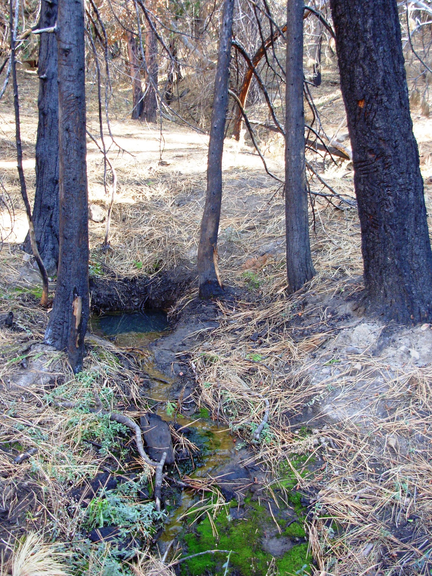
VWR PATROL We successfully found the springbox this trip. There are a few feet of water in the bottom of the pipe that can be reached with the five gallon bucket and rope. The rust line on the pipe wall suggests that the water is very low from previous years. The seep up on the road has all but dried up. We photographed five stove sites. |
| Water Source: | Stagnant |
| Water Source Details: | Some water within the springbox tank |
| Weather Conditions: | |
| Images: | Collage, Jenkins Springbox, Jenkins |
Big Pine Camp Survey - 05-09-2015 - by Los Padres Forest Association| Link: | Big Pine Camp |
| Date: | 05-09-2015 |
| Surveyor Name: | Los Padres Forest Association |
| Camp Description: | One 18" downed tree along the trail between Buckhorn and the camp. Â Camp was clean and looked good. Â No water in the creek or drainage but the spring most likely had water. |
| Water Source: | Trickle |
| Water Source Details: | |
| Weather Conditions: |
Big Pine Camp Survey - 04-29-2015 - by Jeff B.| Link: | Big Pine Camp |
| Date: | 04-29-2015 |
| Surveyor Name: | Jeff B. |
| Camp Description: | |
| Water Source: | Trickle |
| Water Source Details: | A sufficient trickle of good, clear, cold water. |
| Weather Conditions: |
Big Pine Camp Survey - 03-30-2015 - by Shaddus Maximus | Link: | Big Pine Camp |
| Date: | 03-30-2015 |
| Surveyor Name: | Shaddus Maximus |
| Camp Description: | |
| Water Source: | Trickle |
| Water Source Details: | Water is accessed from a spring just downhill from the main camp w/ picnic table. |
| Weather Conditions: | |
| Images: | |
Big Pine Camp Survey - 02-15-2015 - by Heather| Link: | Big Pine Camp |
| Date: | 02-15-2015 |
| Surveyor Name: | Heather |
| Camp Description: | Not a lot of water flowing, but deep and clear at the source just above the large round water container with the grate over it. I would happily filter from there in its current state. |
| Water Source: | Trickle |
| Water Source Details: | |
| Weather Conditions: |
Big Pine Camp Survey - 11-25-2014 - by Shaddus Maximus | Link: | Big Pine Camp |
| Date: | 11-25-2014 |
| Surveyor Name: | Shaddus Maximus |
| Camp Description: | To be clear, this is Big Pine Spring camp, located just west of Big Pine Mountain. Some of the photos above appear to refer to a different Big Pine campground. |
| Water Source: | Stagnant |
| Water Source Details: | Water available in well next to the one established site with picnic table. Must use a bucket with rope attached to pull up water. (Bucket w/ rope are at the campsite.) |
| Weather Conditions: | Freezing overnight temps here. |
| Images: | There is one main campsite with picnic table here but several other places to pitch a tent, too. The spring at Big Pine Spring camp. |
Big Pine Camp Survey - 09-30-2014 - by Los Padres Forest Association| Link: | Big Pine Camp |
| Date: | 09-30-2014 |
| Surveyor Name: | Los Padres Forest Association |
| Camp Description: | We cleared the trail to Big Pine Camp. There is a 24 inch tree very close to the road that someone still needs to cut out. We limbed the tree so the trail is still usable for now. We were able to clear all other obstructions including a 12 inch tree. At camp we painted the table, leveled two tent sites, and generally cleaned things up. |
| Water Source: | Stagnant |
| Water Source Details: | The well still has water although it's low. |
| Weather Conditions: | Hot and Windy |
Big Pine Camp Survey - 06-15-2014 - by Los Padres Forest Association| Link: | Big Pine Camp |
| Date: | 06-15-2014 |
| Surveyor Name: | Los Padres Forest Association |
| Camp Description: | |
| Water Source: | Dry |
| Water Source Details: | No water in the spring at Big Pine Spring Campground |
| Weather Conditions: |
Big Pine Camp Survey - 11-13-2009 - by M. Jones| Link: | Big Pine Camp |
| Date: | 11-13-2009 |
| Surveyor Name: | M. Jones |
| Camp Description: | Historical highlight: Because of its spring and protected location, this
site replaced the Windy Gap Camp used by the first visitors to the area. The Hartman
brothers used it as a hunting camp until the Forest was closed during World War
II. It was also used by the Civilian Conservation Corp during the construction
of the Buckhorn Road. During this time the spring was boxed in with a
corrugated iron culvert pipe. Since the water in it is often contaminated, it’s
better to go west down the little draw to the bottom of the camp area where
there is another spring. Should this be dry, go about 2/10’s of a mile
northwest through the old horse corral to the big spring. (Source A Camper
Guide to the Tri-County Area, Robert Burtness 1981). |
| Water Source: | Flowing |
| Water Source Details: | OK when we were there, best to always filter water |
| Weather Conditions: | 65* and sunny |
| Images: | |

 Survey / Report Form