 Use Marker Groups
 Wolf 2002
Piru 2003
Day 2006
Zaca 2007
Gap 2008
La Brea 2009

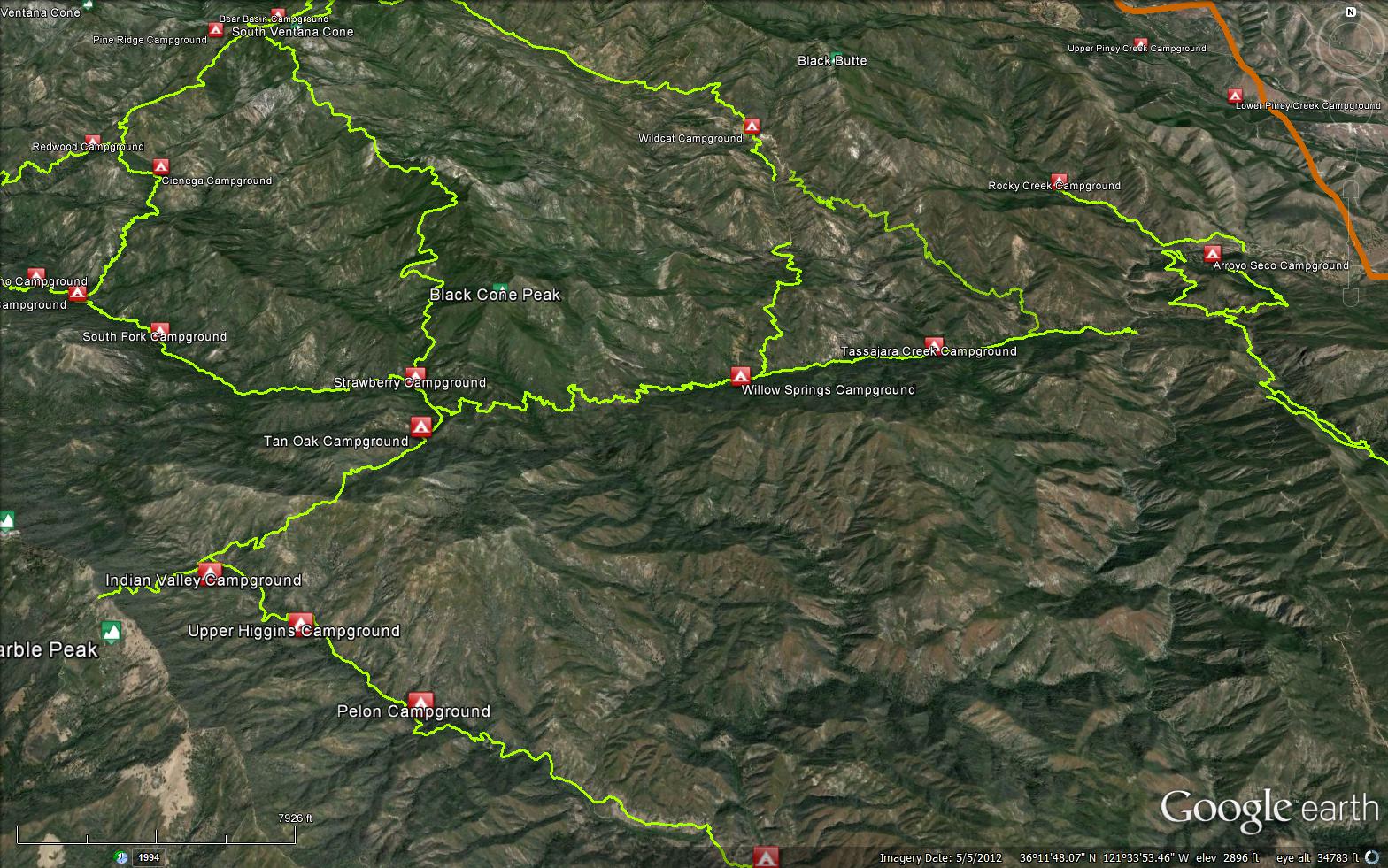
The Marble Peak Trail is a scenic 13.14 mile trail in the Ventana Wilderness in Monterey County . The trail connects the Coast Ridge Road (20S05.2) to the Arroyo Seco Road. The Marble Peak Trail has numerous trail junctions, from Arroyo Seco Road the first junction is the, Horse Pasture Trail (4E05), then the second junction is the Tony Trail (4E06), then the third junction is the South Fork Trail (3E09), and finally the last junction is with the Lost Valley Trail (4E08). Please let us know if you have explored this trail recently.
 Marble Peak Trail Survey - 11-20-2025 - by Anonymous Surveyor
| Link: | Marble Peak Trail |
| Date: | 11-20-2025 |
| Surveyor Name: | Anonymous Surveyor |
| Trail description: | Trail work is being done over 3weekends in December 2025 from Arroyo Seco to Willow Springs camp |
| Mode of transport: | Hike |
| Trail condition: | Needs some work |
Marble Peak Trail Survey - 03-20-2021 - by Jon D| Link: | Marble Peak Trail |
| Date: | 03-20-2021 |
| Surveyor Name: | Jon D |
| Trail description: | Trail is wide and well maintained until you get to Tassajahara Creek Camp. After that, it is possible to follow but there is poison oak encroaching on much of the trail and it takes some ballarina-ing to make it work. We camped at Tony Camp, near the Tony Trail, which gets you out of the thicket and onto some switchbacks, unfortunately, the hot springs are being managed by a private company and are closed for COVID. |
| Mode of transport: | Hike |
| Trail condition: | Good shape and easy to follow |
 Survey / Report Form - Please click this box to open the form.