 Use Marker Groups
 Wolf 2002
Piru 2003
Day 2006
Zaca 2007
Gap 2008
La Brea 2009

| Date | Surveyor | Water Report |
| 05-31-2022 | Gavin McDonald | Dry |
| 04-28-2022 | Ojai Valley School Lower Campus | Flowing |
| 03-11-2022 | Susie T | Flowing |
| 02-12-2022 | Danny Trudeau | Flowing |
| 11-20-2021 | Diane Soini | Dry |
| 06-10-2021 | Anonymous Surveyor | Dry |
| 05-29-2021 | Stephen S | Dry |
| 05-28-2021 | James Wapotich | Dry |
| 06-01-2020 | Addison Jerlow | Flowing |
| 05-09-2020 | Denbe Denbe | Flowing |
| 10-26-2018 | Conor W | Dry |
| 04-27-2018 | Matt Inman-Ojai Valley School | Flowing |
| 03-29-2018 | Shaddus Maximus | Flowing |
| 12-27-2015 | Jaems Wapotich | Dry |
| 08-09-2015 | Chris Ferrier | Dry |
| 05-12-2015 | Los Padres Forest Association | Flowing |
| 02-13-2015 | Shaddus Maximus | Flowing |
| 01-03-2015 | Anonymous Surveyor | Flowing |
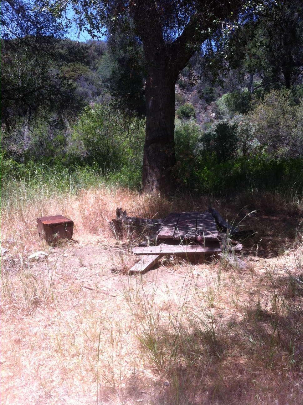
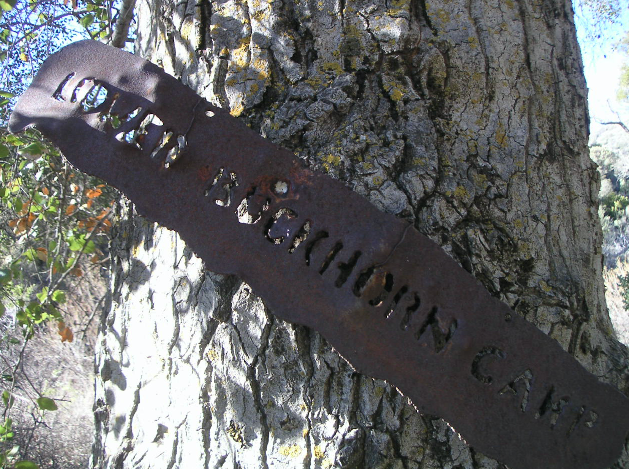
Lower Buckhorn Camp is located on the Buckhorn Trail (27W12), just outside the Dick Smith Wilderness boundary. The camp is known historically as a deer hunting camp, used by both the Chumash and early Californians. Lower Buckhorn has somewhat reliable water but does dry up during the summer. The camp is seldom used but quite nice and peaceful. For most people its a stop along the route to Indian Creek and the wonders that lie up that drainage.


 Lower Buckhorn Camp Survey - 05-31-2022 - by Gavin McDonald
| Link: | Lower Buckhorn Camp |
| Date: | 05-31-2022 |
| Surveyor Name: | Gavin McDonald |
| Camp Description: | Although I didn't look around extensively, a quick look indicated this camp was dry. There is some stagnant water further downstream Indian Creek. There are also some stagnant pools at Meadow Camp, and then some trickling water further upstream the Indian Creek within a mile from Meadow Camp. Trail was in great shape all the way from Indian Canyon trailhead to Indian Creek Camp - thank you LPFA! |
| Water Source: | Dry |
| Water Source Details: | |
| Weather Conditions: | Hot days, cool nights, clear skies |
Lower Buckhorn Camp Survey - 04-28-2022 - by Ojai Valley School Lower Campus| Link: | Lower Buckhorn Camp |
| Date: | 04-28-2022 |
| Surveyor Name: | Ojai Valley School Lower Campus |
| Camp Description: | |
| Water Source: | Flowing |
| Water Source Details: | Not may favorite camp as it just feels a little exposed, but hey it might work for you. |
| Weather Conditions: |
Lower Buckhorn Camp Survey - 03-11-2022 - by Susie T| Link: | Lower Buckhorn Camp |
| Date: | 03-11-2022 |
| Surveyor Name: | Susie T |
| Camp Description: | Camp not well used. LPFA Trail crew and working vacation scheduled for this month. |
| Water Source: | Flowing |
| Water Source Details: | flowing but low levels |
| Weather Conditions: | 70 degrees, clear, cold nights |
Lower Buckhorn Camp Survey - 02-12-2022 - by Danny Trudeau | Link: | Lower Buckhorn Camp |
| Date: | 02-12-2022 |
| Surveyor Name: | Danny Trudeau |
| Camp Description: | |
| Water Source: | Flowing |
| Water Source Details: | |
| Weather Conditions: |
Lower Buckhorn Camp Survey - 11-20-2021 - by Diane Soini| Link: | Lower Buckhorn Camp |
| Date: | 11-20-2021 |
| Surveyor Name: | Diane Soini |
| Camp Description: | The camp is pretty disappointing. Burned out, trash stuffed in the fire grill and scattered around. |
| Water Source: | Dry |
| Water Source Details: | There was some water in the creek about 1/4 mile south of the Pie Canyon Jeepway sign |
| Weather Conditions: | Warm for fall |
| Images: | |
Lower Buckhorn Camp Survey - 06-10-2021 - by Anonymous Surveyor| Link: | Lower Buckhorn Camp |
| Date: | 06-10-2021 |
| Surveyor Name: | Anonymous Surveyor |
| Camp Description: | |
| Water Source: | Dry |
| Water Source Details: | |
| Weather Conditions: |
Lower Buckhorn Camp Survey - 05-29-2021 - by Stephen S| Link: | Lower Buckhorn Camp |
| Date: | 05-29-2021 |
| Surveyor Name: | Stephen S |
| Camp Description: | |
| Water Source: | Dry |
| Water Source Details: | Creek appeared dry directly at the camp from my quick look around. Still some water downstream at the previous crossing. |
| Weather Conditions: |
Lower Buckhorn Camp Survey - 05-28-2021 - by James Wapotich| Link: | Lower Buckhorn Camp |
| Date: | 05-28-2021 |
| Surveyor Name: | James Wapotich |
| Camp Description: | Dry, but usable just upstream, better than at Meadow |
| Water Source: | Dry |
| Water Source Details: | |
| Weather Conditions: |
Lower Buckhorn Camp Survey - 06-01-2020 - by Addison Jerlow| Link: | Lower Buckhorn Camp |
| Date: | 06-01-2020 |
| Surveyor Name: | Addison Jerlow |
| Camp Description: | I could not find this camp. tons of annual and fire-follower growth in the area. ended up camping in the bench just after the crossing where Buckhorn Creek merges with Indian Creek (this is where i’m basing this water report on). |
| Water Source: | Flowing |
| Water Source Details: | slow, shallow and a little warm. 2-4 inches deep |
| Weather Conditions: |
Lower Buckhorn Camp Survey - 05-09-2020 - by Denbe Denbe| Link: | Lower Buckhorn Camp |
| Date: | 05-09-2020 |
| Surveyor Name: | Denbe Denbe |
| Camp Description: | The trail from Mono Camp to Lower Buckhorn Camp is very well maintained. It was obvious that the upper part of the trail (betwenn Mono and Lower Buckhorn)  was recently cleared. The camp is, however, fully overgrown and hardly recognizable as a camp. The trail between Lower and Middle Buckhorn camp is fully overgrown and very hard to follow. Water was available in abundance. |
| Water Source: | Flowing |
| Water Source Details: | Camp overgrown, hardly recognizeable as a camp |
| Weather Conditions: | hot |
| Images: | downstream of Lower Buckhorn Lower Buckhorn the camp (Lower Buckhorm) |
Lower Buckhorn Camp Survey - 10-26-2018 - by Conor W| Link: | Lower Buckhorn Camp |
| Date: | 10-26-2018 |
| Surveyor Name: | Conor W |
| Camp Description: | |
| Water Source: | Dry |
| Water Source Details: | Small, isolated, stagnant pools down creek between Lower Buckhorn and Camuesa Rd. |
| Weather Conditions: |
Lower Buckhorn Camp Survey - 04-27-2018 - by Matt Inman-Ojai Valley School| Link: | Lower Buckhorn Camp |
| Date: | 04-27-2018 |
| Surveyor Name: | Matt Inman-Ojai Valley School |
| Camp Description: | This whole area has burned and there is no shade in site. Regrowth has taken over the trail to Lower Buckhorn and there is virtually nothing left. It is more effective to simply walk in the creek from the trailhead. |
| Water Source: | Flowing |
| Water Source Details: | Creek is silted in but water is flowing on the surface. |
| Weather Conditions: |
Lower Buckhorn Camp Survey - 03-29-2018 - by Shaddus Maximus| Link: | Lower Buckhorn Camp |
| Date: | 03-29-2018 |
| Surveyor Name: | Shaddus Maximus |
| Camp Description: | Buckhorn also burned in the August 2016 Rey Fire. As such, there is no shade here. |
| Water Source: | Flowing |
| Water Source Details: | |
| Weather Conditions: |
Lower Buckhorn Camp Survey - 12-27-2015 - by Jaems Wapotich| Link: | Lower Buckhorn Camp |
| Date: | 12-27-2015 |
| Surveyor Name: | Jaems Wapotich |
| Camp Description: | No water at Lower Buckhorn, however there is water flowing in Buckhorn Creek, starting below the first crossing along the trail all the way up to the site of Upper Buckhorn Camp |
| Water Source: | Dry |
| Water Source Details: | |
| Weather Conditions: |
Lower Buckhorn Camp Survey - 08-09-2015 - by Chris Ferrier| Link: | Lower Buckhorn Camp |
| Date: | 08-09-2015 |
| Surveyor Name: | Chris Ferrier |
| Camp Description: | The table at Buckhorn was indeed very old. No water there. |
| Water Source: | Dry |
| Water Source Details: | |
| Weather Conditions: |
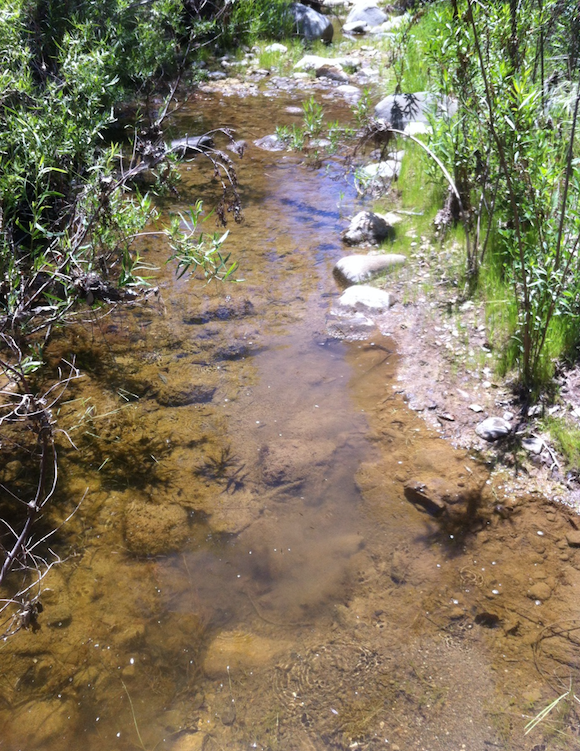
Lower Buckhorn Camp Survey - 05-12-2015 - by Los Padres Forest Association| Link: | Lower Buckhorn Camp |
| Date: | 05-12-2015 |
| Surveyor Name: | Los Padres Forest Association |
| Camp Description: | Visited Lower Buckhorn on a VWR trail patrol. Â The table at the camp keep dropping each year. Â It is now about 2ft off the ground, which actually made for a nice napping height. Â The camp didn't appear to have been used recently. Â There was water next to the camp and it was flowing better than expected. Â For more details on the trip, check here: http://arcg.is/1PG7dwg The LPFA is planning a trail project up the Buckhorn later in May 2015. Â The crew will be based out of Lower Buckhorn and the camp should get cleaned up pretty nicely as a result. |
| Water Source: | Flowing |
| Water Source Details: | |
| Weather Conditions: | 70 degrees and perfect! Light breeze, no bugs. |
| Images: | Water situation at Lower Buckhorn Camp |
Lower Buckhorn Camp Survey - 02-13-2015 - by Shaddus Maximus | Link: | Lower Buckhorn Camp |
| Date: | 02-13-2015 |
| Surveyor Name: | Shaddus Maximus |
| Camp Description: | |
| Water Source: | Flowing |
| Water Source Details: | |
| Weather Conditions: | |
| Images: | |
Lower Buckhorn Camp Survey - 01-03-2015 - by Anonymous Surveyor| Link: | Lower Buckhorn Camp |
| Date: | 01-03-2015 |
| Surveyor Name: | Anonymous Surveyor |
| Camp Description: | Fire pit. Picnic table, but picnic table was collaspsed. |
| Water Source: | Flowing |
| Water Source Details: | Buckhorn creek was flowing |
| Weather Conditions: | Sunny, 60s during the day |
 Survey / Report Form