 Use Marker Groups
 Wolf 2002
Piru 2003
Day 2006
Zaca 2007
Gap 2008
La Brea 2009

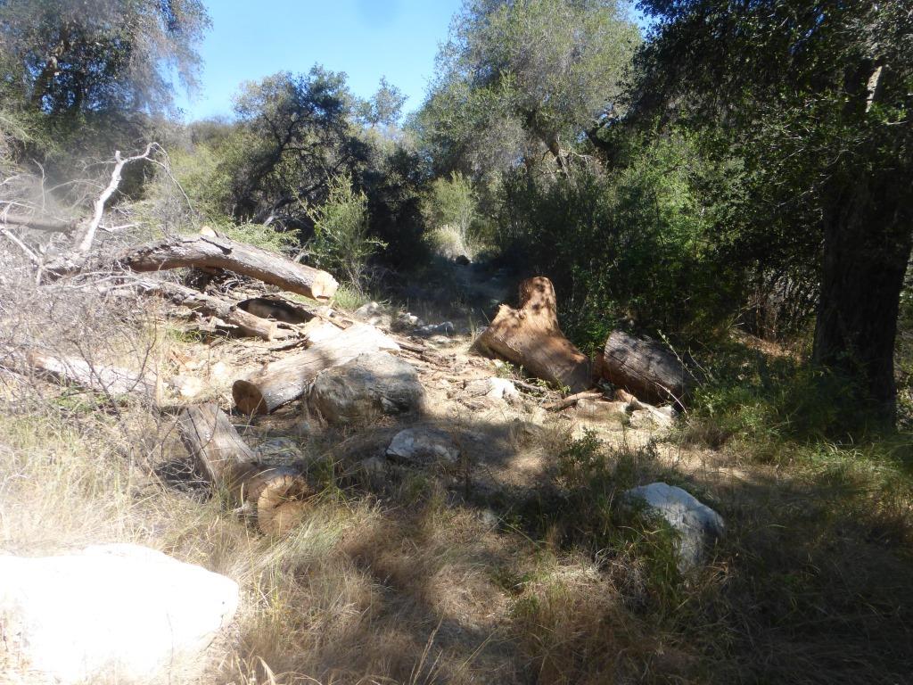
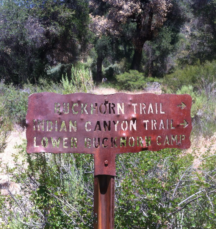
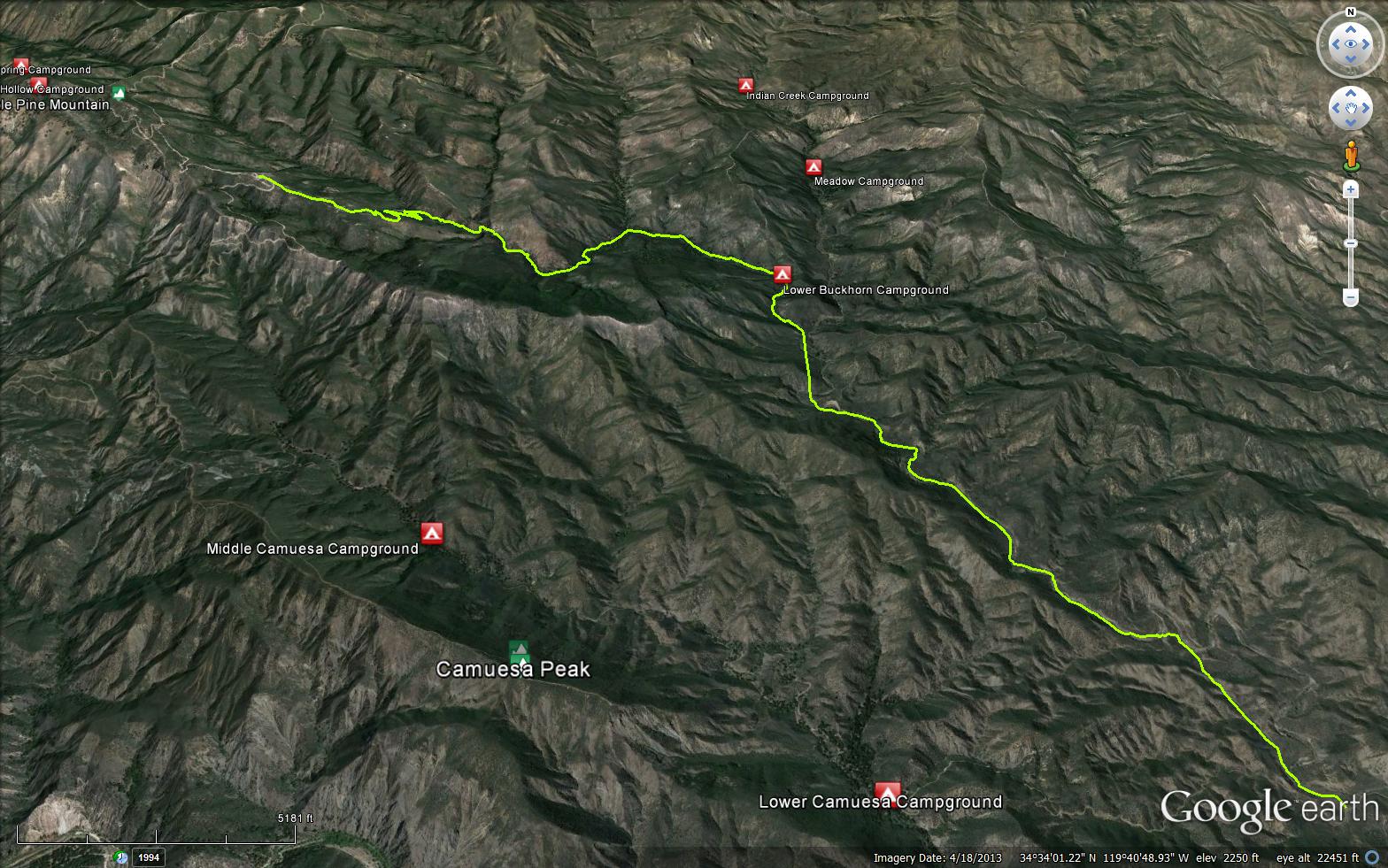
The Buckhorn Trail connects Buckhorn Road with the Indian Creek Trailhead. Historically is was a very well used trail by hunters and for forest users connecting larger sections of the forest. In more recent history it was commonly used by mountain bikers, even being recognized as an "epic ride" by some mountain biking organizations. Since the 2007 Zaca Fire, it has become overgrown and is no longer passable for mountain bikers. The Buckhorn is really a tale of two trails: the lower section from the Indian TH to Lower Buckhorn is open, mostly clear and sees quite a bit of use (mostly people passing on their way to Indian Creek. Whereas the upper section, above Lower Buckhorn Camp, is very overgrown and doesn't see much activity. There is very reliable water in the upper sections while the lower sections tend to dry up each summer.
The Santa Barbara Mountain Bike Trail Volunteers have made opening the Buckhorn Trail a priority in 2015 and beyond. While it will take a lot of time to reopen the trail, it appears that it will be mountain bikeable again sometime in the near future.


 Buckhorn Trail Survey - 05-11-2024 - by Rick Hayes
| Link: | Buckhorn Trail |
| Date: | 05-11-2024 |
| Surveyor Name: | Rick Hayes |
| Trail description: | Biked up Buckhorn road, dropped down buckhorn trail. Trail was fine for 2 miles until the switchbacks at the first creek. Lots of poison oak, downed trees, lost the trail twice even with Gaia app. Pink flagging exists. Once hit creek I walked the dry creek bed (Upper buckhorn creek) instead of the marked trail. Made it to middle buckhorn creek (lots of water) and explored up that to Buck camp. Then backtracked same way. |
| Mode of transport: | Hike |
| Trail condition: | Needs some work |
| Condition details: | Biked up Buckhorn road, dropped down buckhorn trail |
Buckhorn Trail Survey - 02-26-2022 - by Quentin Williams| Link: | Buckhorn Trail |
| Date: | 02-26-2022 |
| Surveyor Name: | Quentin Williams |
| Trail description: | I rode by indian creek trailhead on romero camuesa on a bicycle. There was lots of water flowing in indian creek and mono creek. We filtered at mono and you definitely could have filtered at indian creek. Beautiful day in the backcountry. |
| Mode of transport: | Bicycle |
| Trail condition: | Hard to follow |
| Condition details: | Did not hike trail. Only reporting on water flow in indian and mono creek. |
| Images: | |
Buckhorn Trail Survey - 11-21-2021 - by Diane Soini| Link: | Buckhorn Trail |
| Date: | 11-21-2021 |
| Surveyor Name: | Diane Soini |
| Trail description: | Hiked from Camuesa road near Mono up to Lower Buckhorn Camp. I've always called this trail Indian Creek trail. Water was bone dry but there were some pools about a quarter mile from the Pie Canyon Jeepway sign. The trail was easy to follow. The fall colors of the poplars was pretty but mostly this whole area looks burned out and dry. |
| Mode of transport: | Hike |
| Trail condition: | Good shape and easy to follow |
| Images: | Fall colors |
Buckhorn Trail Survey - 05-29-2021 - by Stephen S| Link: | Buckhorn Trail |
| Date: | 05-29-2021 |
| Surveyor Name: | Stephen S |
| Trail description: | HIked in from Cold Spring Saddle to Camuesa Road and up Indian Canyon / Buckhorn Trail headed for Lower Buckhorn and Meadow Camps. Overall the trail was followable with the help of the blue/white flagging which was all over the place. It was probably followable without it, but would have made it a much slower experience. There was water in many spots along the way in gentle flowing streams, small pools, with some stagnant areas. |
| Mode of transport: | Hike |
| Trail condition: | Needs some work |
Buckhorn Trail Survey - 04-24-2020 - by Los Padres Forest Association| Link: | Buckhorn Trail |
| Date: | 04-24-2020 |
| Surveyor Name: | Los Padres Forest Association |
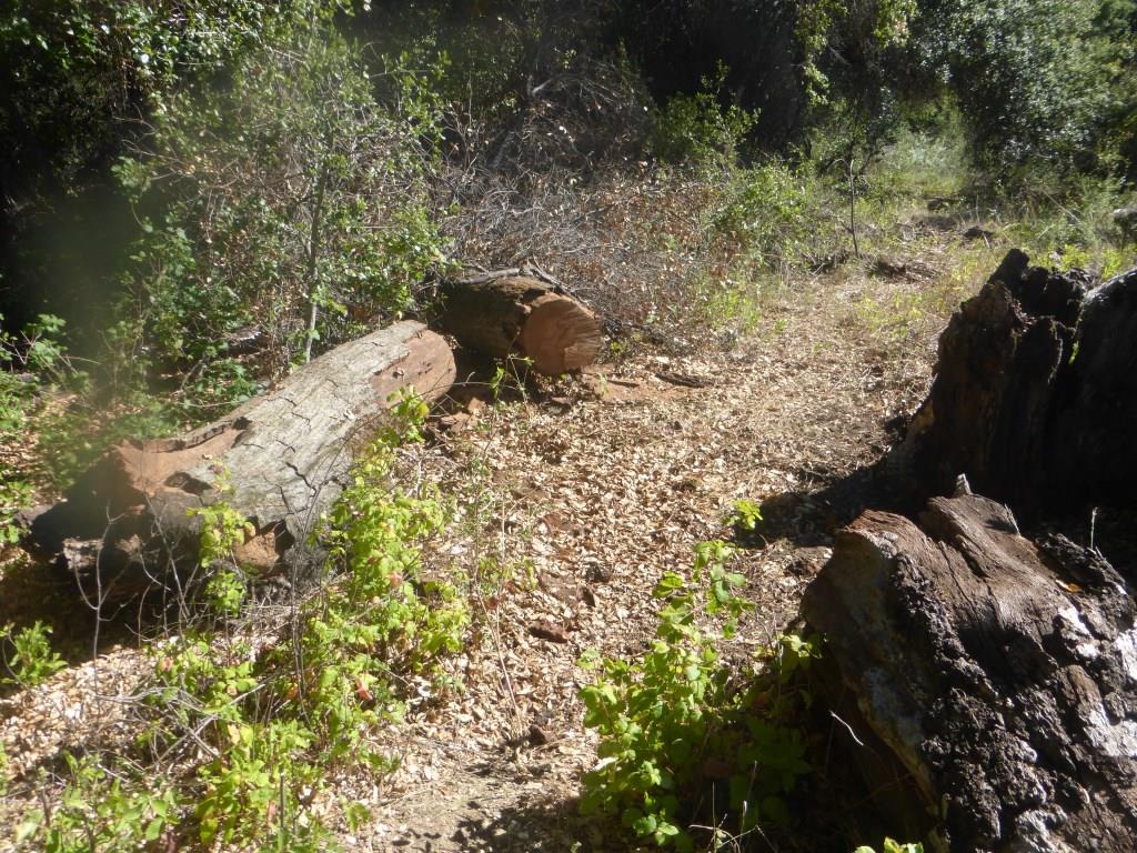
| Trail description: | LPFA survey of the lower portion of the Buckhorn Trail. The LPFA Trail Crew worked on brushing the trail in November 2019 and February 2020 and the trail is clear and faint but followable from the lower trailhead up to the confluence of Indian and Buckhorn Creeks. The LPFA Trail Crew will be back in May 2020 to complete the trail work up to Lower Buckhorn Camp. Above Lower Buckhorn the trail is very overgrown and hard to follow. Lots of water and the creek crossings are not passable without getting your feet a little wet. |
| Mode of transport: | Hike |
| Trail condition: | Needs some work |
| Images: | Trail flagged and mostly open but faint and narrow in spots Lots of great water everywhere right now |
Buckhorn Trail Survey - 03-04-2018 - by Kerry Burns| Link: | Buckhorn Trail |
| Date: | 03-04-2018 |
| Surveyor Name: | Kerry Burns |
| Trail description: | Trail is utterly destroyed after the top section. Very overgrown up top unfortunately but the tread was still there for the most part until it reached buckhorn creek at which point the trail was gradually nonexistent the further one got towards Indian Creek and the burn scars. It eventually became most expedient to just ride down the Indian Creek bed as that has become just a sort of alluvial plain since the Thomas Fire floods, absolute carnage, it will be a decade at least before this is "passable". As it currently stands its a true death march and I would not recommend it but for the most experienced and also idiotic of walkers. Sad state of things in our backcountry, we really lost a gem of an area here. |
| Mode of transport: | Bicycle |
| Trail condition: | Non existent |
Buckhorn Trail Survey - 09-29-2016 - by Los Padres Forest Association| Link: | Buckhorn Trail |
| Date: | 09-29-2016 |
| Surveyor Name: | Los Padres Forest Association |
| Trail description: | The Buckhorn Trail received a lot of attention in 2016. It started with a LPFA chain saw crew working from the Buckhorn Road to the creek crossing clearing the brush. Next up was weeks of work by SBMTV working on the tread down through this section. By summer 2016 the trail was looking fantastic and hopes were high that the trail would once again return to its glory days from previous decades.  Then came the Rey Fire which burned up most of the trail in August 2016. Below is a BEFORE, AFTER, AFTER & AFTER photo of a section of the upper trail. A) What it looked like before the chain saw crew B) After the brush was cleared C) After the SBMTV tread (awesome, right?) D) After Rey Fire |
| Mode of transport: | Hike |
| Trail condition: | Needs some work |
| Images: | |
Buckhorn Trail Survey - 12-18-2016 - by Anonymous Surveyor| Link: | Buckhorn Trail |
| Date: | 12-18-2016 |
| Surveyor Name: | Anonymous Surveyor |
| Mode of transport: | Array |
| Trail condition: | Needs some work |
| Condition details: | Upper buckhorn burned in the Rey fire but is holding up nicely. It looks like someone left their tools on the trail, which appear to have survived the fire. The trail gets over grown once you reach the first creek. |
| Images: | |
Buckhorn Trail Survey - 08-02-2016 - by Los Padres Forest Association| Link: | Buckhorn Trail |
| Date: | 08-02-2016 |
| Surveyor Name: | Los Padres Forest Association |
| Trail description: | Got a report from a hiker who took the Buckhorn Trail from the bottom up towards Indian Creek. Â There is no flowing water but a few isolated pools that still have water in them. Â Could use some brushing but otherwise the trail is in good shape up to Lower Buckhorn Camp. |
| Mode of transport: | Hike |
| Trail condition: | Needs some work |
Buckhorn Trail Survey - 08-09-2015 - by Chris Ferrier| Link: | Buckhorn Trail |
| Date: | 08-09-2015 |
| Surveyor Name: | Chris Ferrier |
| Trail description: | The LPFA trail work in May was obvious. Some of the cuttings, however were in the middle of the trail. As with any LP trail, additional brush clearing would be a be a help. We were grateful for the work that was done. It was clear that this was a big effort. No water along the Buckhorn between the Indian Trailhead and Lower Buckhorn. |
| Mode of transport: | Hike |
| Trail condition: | Needs some work |
Buckhorn Trail Survey - 05-30-2015 - by Jasonn Beckstrand| Link: | Buckhorn Trail |
| Date: | 05-30-2015 |
| Surveyor Name: | Jasonn Beckstrand |
| Trail description: | Trail maintenance work on Buckhorn Trail. Â This hasn't happened in over 15 years. The trail work started at Camuesa Rd and the Buckhorn Trail head. This is the first of many multi-group run projects to open this trail back up for all users. First project was to come in to log out the down trees that prevent horse and mountain bikes from enjoying the trail. Â There was also a lot off brushing. There will be 4 or more follow up projects throughout the next couple of years. The goal is to re-open this once popular trail for everyone to enjoy. |
| Mode of transport: | Hike |
| Trail condition: | Hard to follow |
| Condition details: | The first 4 miles to Lower Buckhorn need some work. But beyond lower buckhorn the trail fades away to almost nonexistent |
| Images: | |
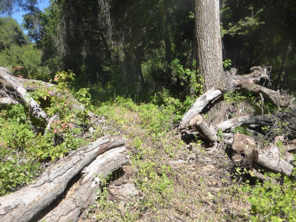
Buckhorn Trail Survey - 05-12-2015 - by Los Padres Forest Association| Link: | Buckhorn Trail |
| Date: | 05-12-2015 |
| Surveyor Name: | Los Padres Forest Association |
| Trail description: | The LPFA scouted the Buckhorn Trail in advance of an upcoming trail project. Â We'll be out there in late May 2015 clearing the brush and mainly logging out any fallen trees. Â The trail is quite nice from the lower trailhead up to Lower Buckhorn. Â From there up to the road is a different story. Â It's brushy, covered by PO in certain places, lots of downed trees and somewhat hard to follow. Â The last bit up through the chaparral to the road is very overgrown. Â Be sure to look for the flagging and it is recommended that you go down the trail rather than up the trail. Â All that being said, its a beautiful canyon, very wild and well worth exploring. Â Here are some photos from the trail patrol: |
| Mode of transport: | Array |
| Trail condition: | Needs some work |
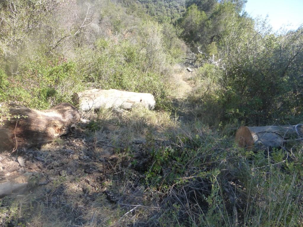
Buckhorn Trail Survey - 01-05-2015 - by Los Padres Forest Association| Link: | Buckhorn Trail |
| Date: | 01-05-2015 |
| Surveyor Name: | Los Padres Forest Association |
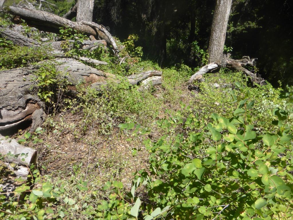
| Trail description: | Some photos from the anonymous report showing the size of some of the trees and brush along the Buckhorn Trail. |
| Mode of transport: | Bicycle |
| Trail condition: | Hard to follow |
| Images: | |
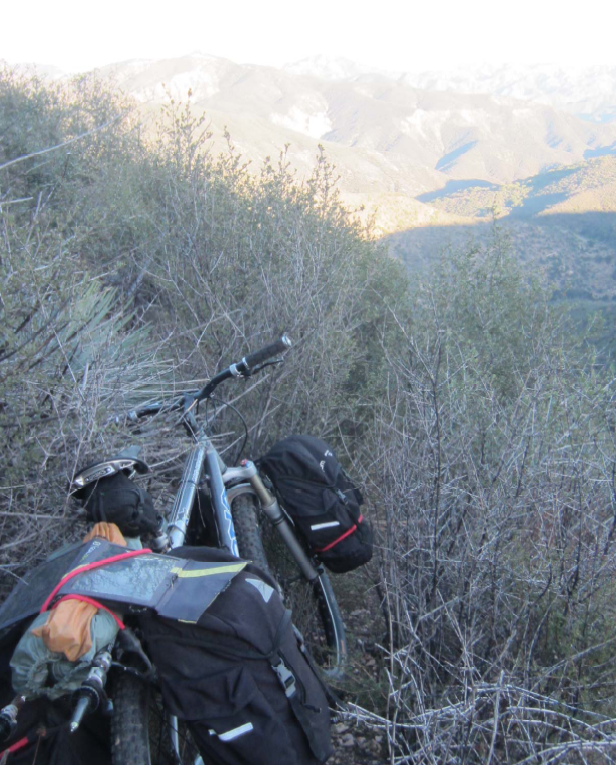
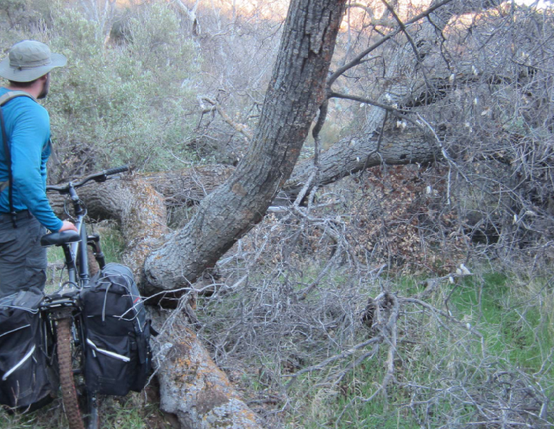
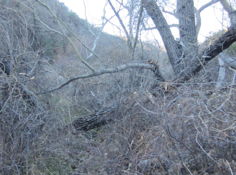
Buckhorn Trail Survey - 01-04-2015 - by Anonymous Surveyor| Link: | Buckhorn Trail |
| Date: | 01-04-2015 |
| Surveyor Name: | Anonymous Surveyor |
| Trail description: | Mountain biked down from buckhorn road to lower buckhorn camp. Trail is overgrown & very faint in some places. Lots of fallen trees, etc. |
| Mode of transport: | Bicycle |
| Trail condition: | Hard to follow |
| Condition details: | Very hard to follow in some points. Overgrown almost everywhere else |
Buckhorn Trail Survey - 05-25-2014 - by Los Padres Forest Association| Link: | Buckhorn Trail |
| Date: | 05-25-2014 |
| Surveyor Name: | Los Padres Forest Association |
| Trail description: | There were some pools along the trail but it will be dry very soon. |
| Mode of transport: | Hike |
| Trail condition: | Needs some work |
| Condition details: | The trail was good from the Indian Mono Trailhead up to Meadow Camp. Could use some brushing and a little tread work but overall in good shape. |
 Survey / Report Form - Please click this box to open the form.