 Use Marker Groups
 Wolf 2002
Piru 2003
Day 2006
Zaca 2007
Gap 2008
La Brea 2009

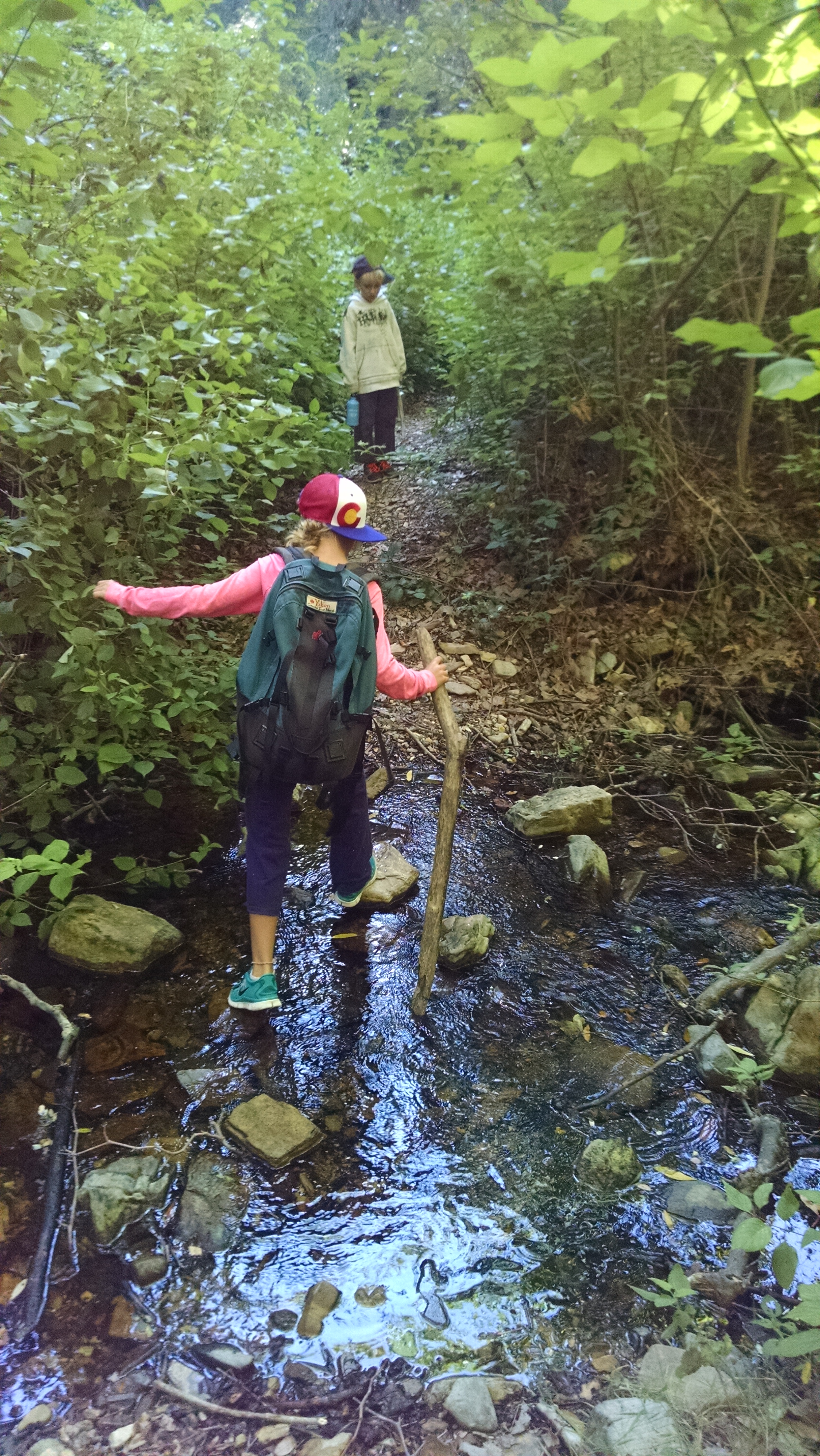
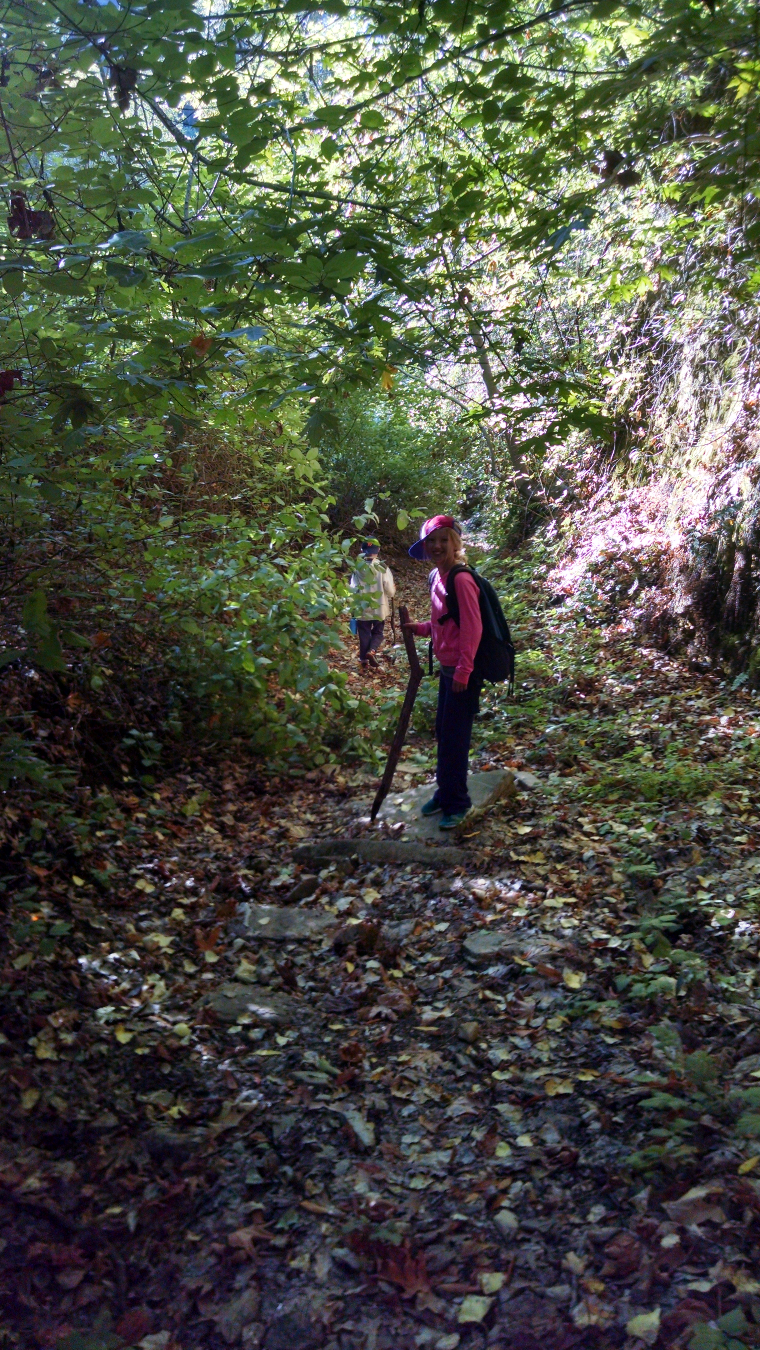
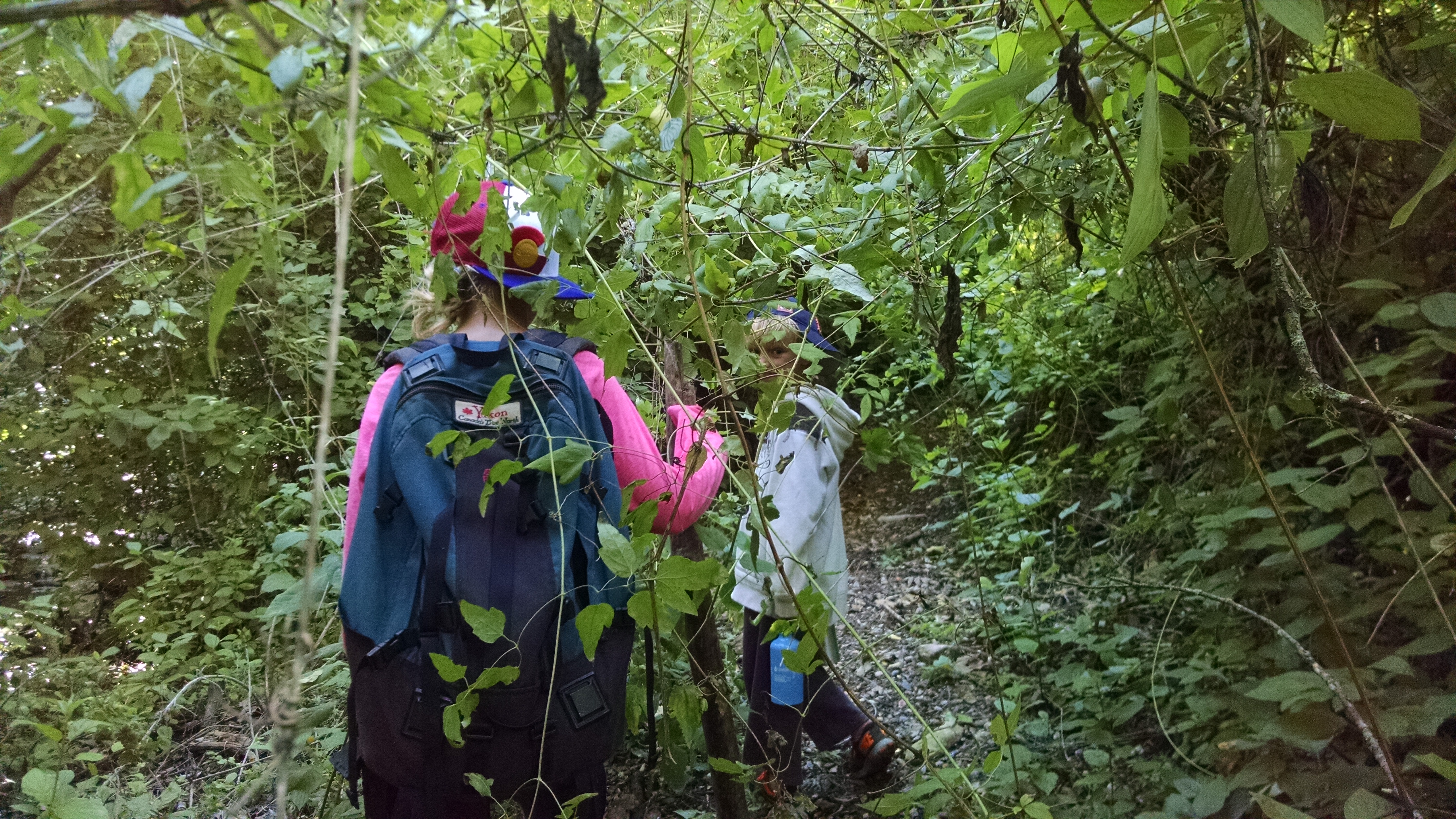
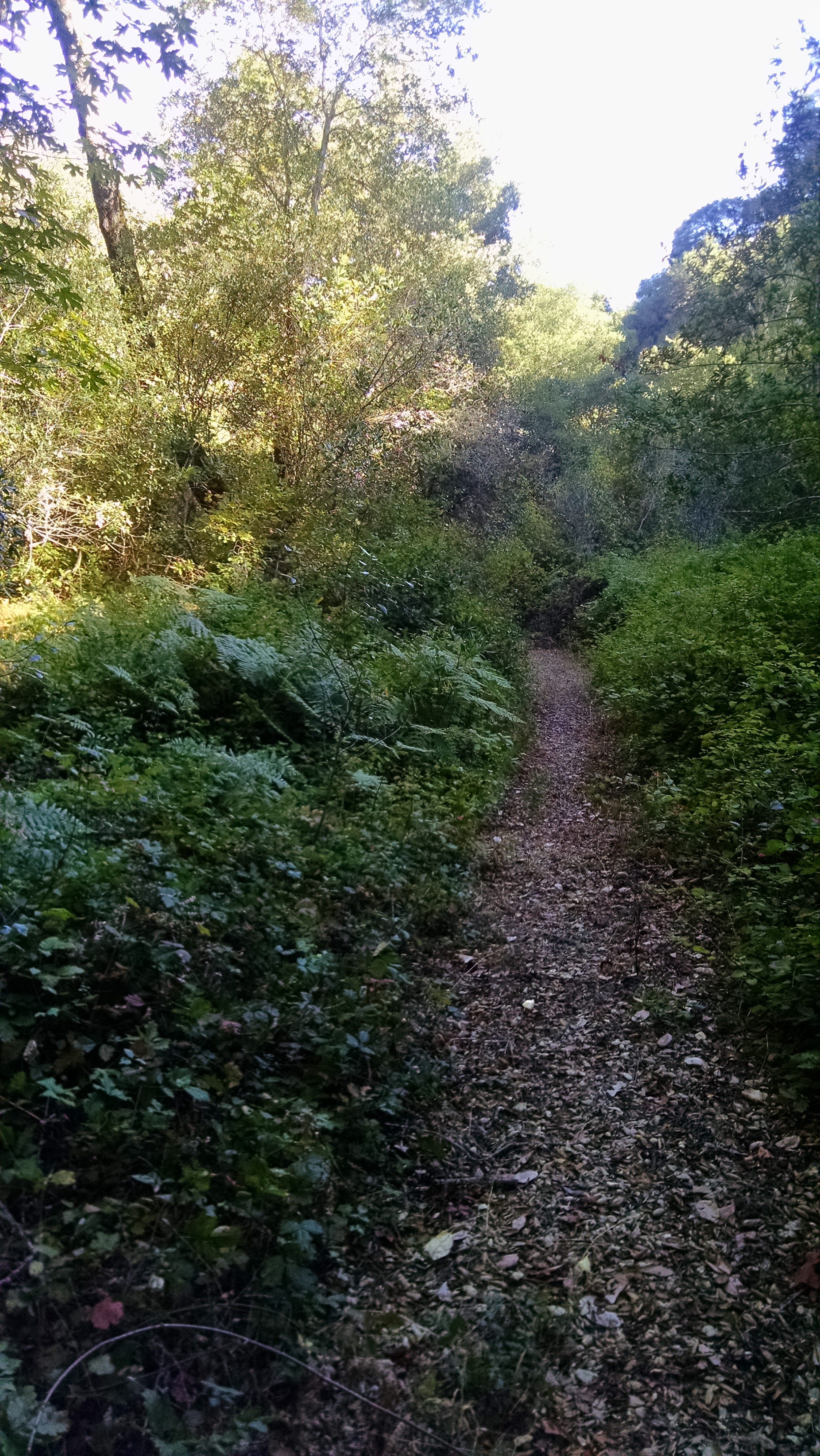
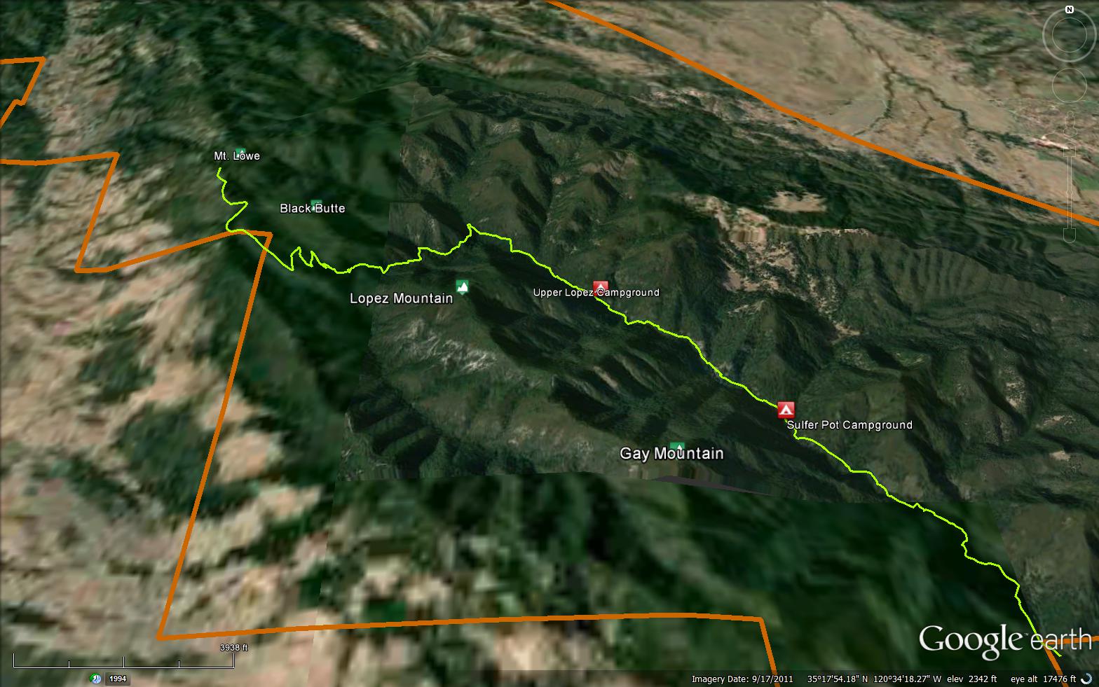
The Lopez Canyon Trail is a scenic 6.61 mile trail in the Santa Lucia Wilderness in San Luis Obispo County . The trail head is located off the Upper Lopez Canyon Road at 35.27929, -120.54034. Please let us know if you have explored this trail recently.


.JPG)


 Lopez Canyon Trail Survey - 02-01-2025 - by Big Mike
| Link: | Lopez Canyon Trail |
| Date: | 02-01-2025 |
| Surveyor Name: | Big Mike |
| Trail description: | 6.5 miles in 4 hours. no bueno mis babysitos |
| Mode of transport: | Hike |
| Trail condition: | Hard to follow |
Lopez Canyon Trail Survey - 10-26-2024 - by Peter| Link: | Lopez Canyon Trail |
| Date: | 10-26-2024 |
| Surveyor Name: | Peter |
| Trail description: | I came back to mark the trail with pink trail tape. The trail maintenance I did in Nov. & Dec. of 2023 has held up nicely. I hung pink trail tape throughout the trail and placed more rocks and logs over a couple of creeks to make for easier crossings. I still highly recommend a long sleeve shirt, pants, good shoes/boots, a mosquito net, and trekking poles for this trail. There are still a lot of washouts, but overall Iâd say the trail is in good condition and easy to see and follow, especially the first half of the trail. Youâll see more and more pink trail tape that I hung up the further you get into the trail to help guide you through sections where the trail is not so easy to see and follow. With the pink trail tape and the use of a GPS map, you should be golden to get through this trail. Be aware though that I did not mark the trail with pink tape all the way to Upper Lopez Camp. I stopped at the wide open flat space thatâs before Upper Lopez Camp. I didnât bother going to ULC as itâs not worth the bushwhacking, time and effort to get there. That section is way too overgrown and has lots of huge down trees and needs major work from the Forest Service. If youâre planning to camp, I would advise to just stay at this wide open flat space with the make shift fire ring. |
| Mode of transport: | Hike |
| Trail condition: | Needs some work |
| Condition details: | Overall the trail is in good condition, but the end stretch just before getting to Upper Lopez Camp needs major trail work from the Forest Service. |
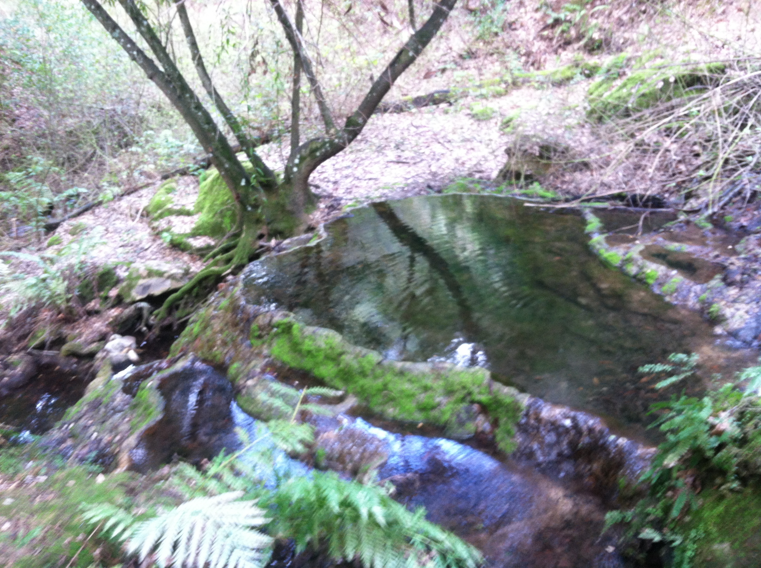
| Images: | Creek crossing with pink trail tape hung up ahead. Another creek crossing to continue on trail. Need to climb over this down tree to continue on trail above. Trail gets pretty overgrown in sections, keep an eye out for the pink trail tape to lead you through. Nice open space with rocks for a fire ring, perfect for camping. Trail tape ends here. |
Lopez Canyon Trail Survey - 10-26-2024 - by Peter| Link: | Lopez Canyon Trail |
| Date: | 10-26-2024 |
| Surveyor Name: | Peter |
| Trail description: | Accidental duplicate, please delete. |
| Mode of transport: | Hike |
| Trail condition: | Needs some work |
| Condition details: | Accidental duplicate, please delete. |
Lopez Canyon Trail Survey - 05-06-2024 - by Aaron| Link: | Lopez Canyon Trail |
| Date: | 05-06-2024 |
| Surveyor Name: | Aaron |
| Trail description: | What an adventure! Trail conditions are still brutal; lots of downed trees, poison oak, disappearing trail, no signage, oh and even more poison oak! Definitely not a trail for the faint of heart but the change in landscape and isolation are hard to find anywhere in this area. Lots of water in the creek but youâll have to walk through all the crossings, so plan on wet feet. Would be nice to help get the trail back into useable shape but Iâll have to wait for all my skin to grow back after bushwhacking through poison oak. Also, as a previous commenter mentioned, the trail needs major equipment work to remove some 50 or so downed trees on the trail. Definitely not recommended until the trail gets cleaned up. |
| Mode of transport: | Hike |
| Trail condition: | Hard to follow |
| Images: | Upper lopez camp Sulfur pots camp South of Sulfur pots |
Lopez Canyon Trail Survey - 12-16-2023 - by Peter| Link: | Lopez Canyon Trail |
| Date: | 12-16-2023 |
| Surveyor Name: | Peter |
| Trail description: | I scouted the trail on November 11, 2023 with the intention to backpack overnight at Upper Lopez Camp in the future. I saw reports/reviews here and on All Trails of the bad condition of the trail and the need for maintenance, so I brought some tools (hand shears, pruning saw, loppers) with me to do some clearing on my way through. I cut back a lot of overgrowth in a lot of sections, cut/removed fallen trees/branches from the trail entirely and made some fallen trees that were too big to remove with hand tools passable by making holes/paths through/under them. I also pulled logs over to the creek in several places to make crossings easier. On this trip in November, I made it about 0.5 mile from Upper Lopez Camp, but turned back as it was getting late in the day and didn't want to hike back in the dark. There are washouts throughout and the trail is generally unstable as you get further into it, so good hiking shoes/boots and trekking poles are good to have if you don't want to be falling and slipping all the time. I returned on December 16, 2023 to make it to Upper Lopez Camp this time. I brought tools with me again to do more trail maintenance beyond where I last made it to. I made it to Upper Lopez Camp, but it was ABSOLUTELY BRUTAL and not worth the amount of bushwhacking, effort, and time it takes to make it there, so I definitely recommend not to even try. In fact, there is a nice wide open flat space with a make shift fire ring that makes a perfect camp spot before getting to Upper Lopez Camp, but even getting to this spot it takes some bushwhacking, scrambling and time to make your way through sections. I used a GPS app (Gaia GPS) with an actual map of the trail on both trips, but on this trip it was evident that a GPS app is absolutely necessary to not get lost as all of a sudden you're on a semi visible trail and next thing you know you're in a jungle with no trail in sight and repeat. Without a GPS map, you will get lost. Also, beyond the wide open spot with the make shift fire ring, the "trail" is absolutely horrendous. There are LOTS of HUGE fallen trees all over the place that leave you no choice, but to climb up and around them on to steep unstable hillside, then back down, then back up, repeat. This is where having good shoes/boots and trekking poles to steady yourself are absolutely necessary as it's pretty dangerous and very easy to get hurt. I think it goes without saying, but pants, long sleeves and even a mosquito net for your face/head are highly recommended. There are some trees with with initials and the number 4 carved into them on the path to ULC if that's helpful. Upper Lopez Camp itself was in decent shape. The metal fire ring is still there and there is a shovel and rake too. The picnic table is in good condition. The stream runs right next to the camp which is convenient for filtering water. But like I mentioned before, it's not worth trying to make it to this camp. Stay at the nice wide open flat spot with the make shift fire ring. There's plenty of space for several tents and it's open to the sky so you can get nice views of the stars at night. Upper Lopez Camp is pretty much under all tree cover. Fun fact, as you get a few miles into the trail keep an eye out for pink trail tape marking where to go. It is definitely helpful so thank you to the person who put them up. It must have been years ago as the tape is clearly aged and deteriorating with the weather. I detached and re-attached the tape in areas where the trail has shifted to make it easier to spot, and also put up bits that fell to the ground in areas that weren't marked at all, but could definitely use it to help guide people through. In some sections where it's not clear where to go, I laid out logs and tree branches in a line on the ground to signal what direction to go in, so hopefully that catches people's eyes to help them out. Next time I go, I will bring some trail tape with me to mark the trail to the nice wide open camp spot I talked about to make it easier for people to find their way there. There's swarms of ladybugs covering trees all over throughout the trail, super cool! I came across 2 black bears (and lots of their scat throughout the trail), one on a hillside a couple of miles into the trail and another on the Mt. Lowe dirt road when I was hiking out in the evening. They both ran off when I yelled at them, but I had bear spray on me just in case. |
| Mode of transport: | Hike |
| Trail condition: | Needs some work |
| Condition details: | The end stretch of the trail to Upper Lopez Camp needs MAJOR work, like Forest Service needs to come in with chainsaws/machinery level work. |
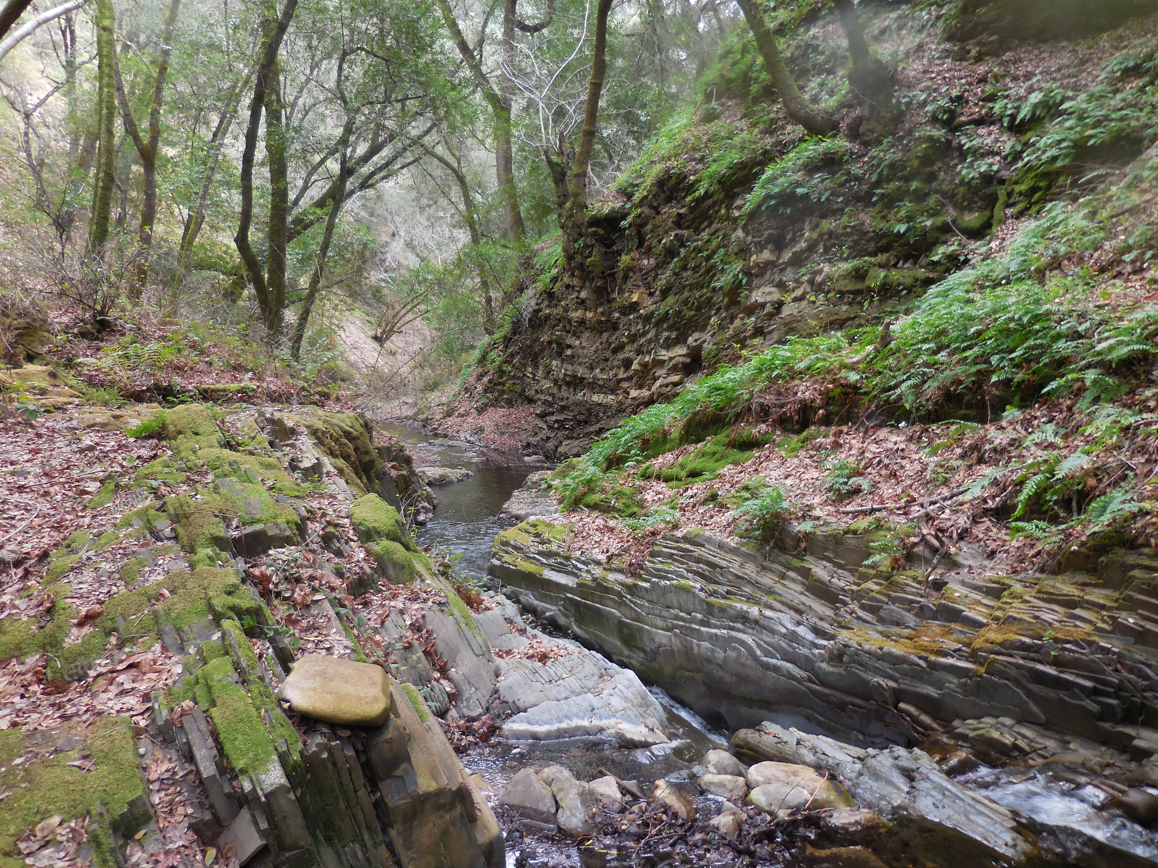
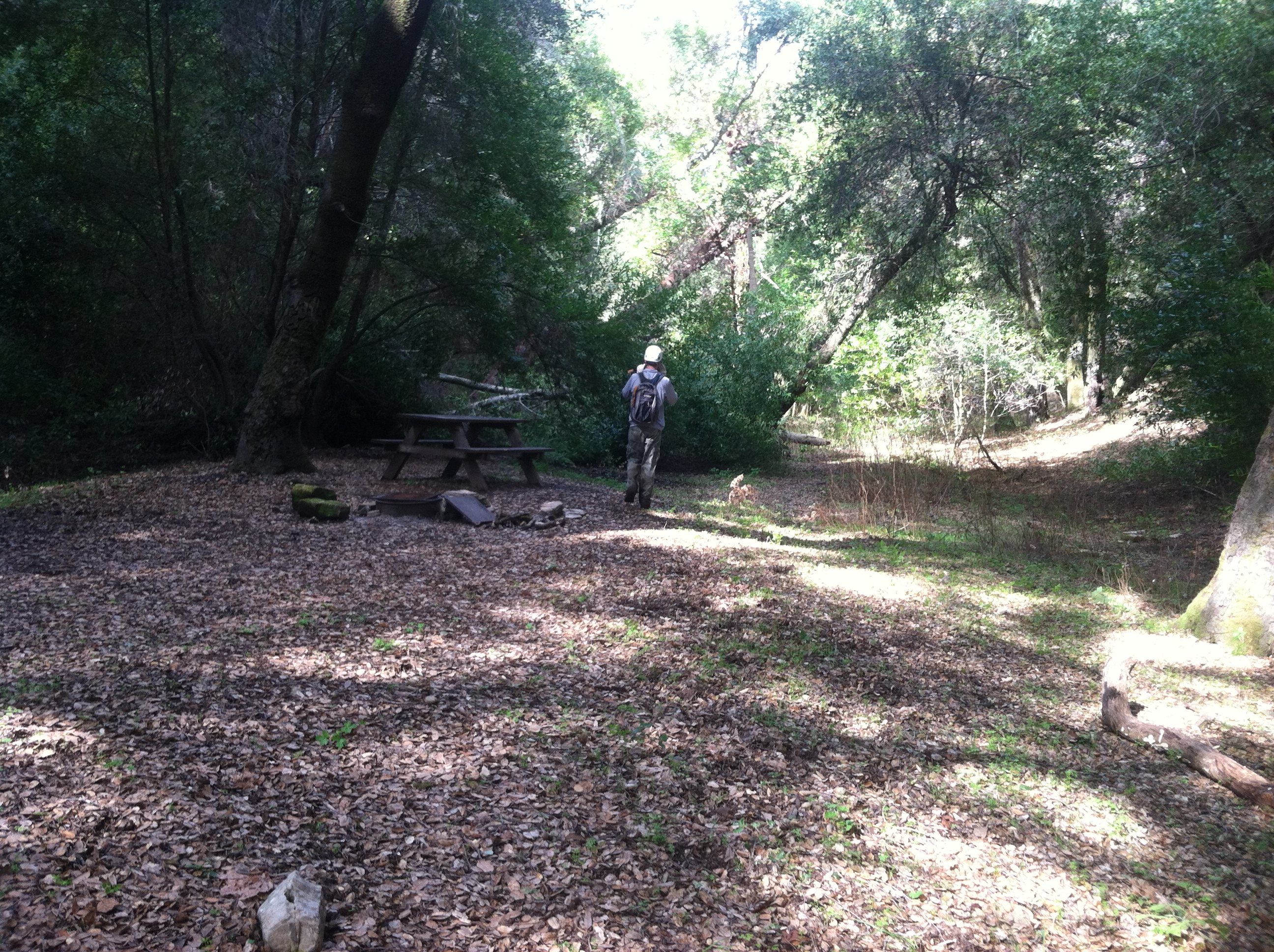
| Images: | About 5/6 switchbacks in, the trail leads you through a dry creek bed for awhile. Pink trail tape hanging from tree across from creek where I placed some logs for crossing. Lots of ladybugs! Nice open spot w/ make shift fire ring. Great alternative camp site to ULC which is further ahead. Upper Lopez Camp as of 12/16/2023. Brutal journey to get there. Camp at the spot before ULC instead! |
Lopez Canyon Trail Survey - 09-30-2023 - by Zach Teske | Link: | Lopez Canyon Trail |
| Date: | 09-30-2023 |
| Surveyor Name: | Zach Teske |
| Trail description: | Trail is in good condition for the first two miles from Lopez TH accessed off East Cuesta Ridge Rd. Once you get down near the creek, after a few hundred yards, the trail becomes overgrown with poison oak and tree falls. Trail is in need of maintenance to restore easier access to Lopez Campground without having to walk through unavoidable poison oak overgrowth. Creek was flowing good so no issues with water resupply! |
| Mode of transport: | Hike |
| Trail condition: | Hard to follow |
| Condition details: | Overgrown |
Lopez Canyon Trail Survey - 02-06-2022 - by Los Padres Forest Association| Link: | Lopez Canyon Trail |
| Date: | 02-06-2022 |
| Surveyor Name: | Los Padres Forest Association |
| Trail description: | LPFA volunteers cleared the trail up to Sulphur Pot Camp. The trail is open to there but quickly becomes hard to follow above that. We hope to be back soon to continue working up this beautiful canyon. |
| Mode of transport: | Hike |
| Trail condition: | Needs some work |
Lopez Canyon Trail Survey - 08-16-2021 - by Los Padres Forest Association| Link: | Lopez Canyon Trail |
| Date: | 08-16-2021 |
| Surveyor Name: | Los Padres Forest Association |
| Trail description: | LPFA Trail Crew spent two weeks clearing the trail from the lower trailhead up to just below Sulphur Pots Camp. Lots of brushing, clearing poison oak and logging out a few downed trees. |
| Mode of transport: | Hike |
| Trail condition: | Needs some work |
Lopez Canyon Trail Survey - 01-20-2021 - by Koontz and Gamiz| Link: | Lopez Canyon Trail |
| Date: | 01-20-2021 |
| Surveyor Name: | Koontz and Gamiz |
| Trail description: | We hiked in from Cuesta pass (first 4 miles are on unpaved road, but still scenic. We then hiked down through to lopez canyon and there were quite a few deadfalls that we had to hike around. Someone had flagged them recently with orange flagging tape, but I could see how those might not hold up.  A little work and this trail would be amazing.  We had free flowing water to filter and dispersed camping sites along little lopez canyon. We passed the "Lopez Canyon Campsite" which is technically closed due to Covid 19 (I think) but it would probably only accomodate 1 group anyway. We hiked on to sulfur pots, which was also clearly marked on USGS quads. Room for two campsites.  Both sites had picnic tables.. which beats sitting on a bear box.  The section from there had like 30 river crossings, some of which could be stepped across with stepping stones, but my shoes got wet (wool socks = no problem). My hiking partner had boots (and consequently dry feet).  |
| Mode of transport: | Hike |
| Trail condition: | Needs some work |
| Condition details: | Hiked from Cuesta pass to Mt. Lowe to Big Falls |
| Images: | Sulphur pots campsite sign Brad Edwards Eagle scout project (table at sulphur pots) Creek view Upper Lopez camp sign Trail head on Mt. Lowe |
Lopez Canyon Trail Survey - 04-19-2020 - by Timmy tim slim jim| Link: | Lopez Canyon Trail |
| Date: | 04-19-2020 |
| Surveyor Name: | Timmy tim slim jim |
| Trail description: | I should have been able to see upper Lopez camp. Hiked for 1.5 hours from the trailhead down into the canyon but after that amount of time never saw the trail camp. Slow going as the trail climbs way up out of the canyon and then gradually descends back to the river via side canyons. Plenty of water but the oak and overgrowth made this hike less than enjoyable. Saw some quail, deer, ÃÂ Gray squirrels.ÃÂ |
| Mode of transport: | Hike |
| Trail condition: | Hard to follow |
| Condition details: | Over grown and oaky. Deer trails and communal trails along slopes cross cross one another. |
Lopez Canyon Trail Survey - 05-11-2019 - by Paul E| Link: | Lopez Canyon Trail |
| Date: | 05-11-2019 |
| Surveyor Name: | Paul E |
| Trail description: | Once down in the canyon, the trail is heavily overgrown with poison oak and other vegetation. Several fallen trees obscure the trail at points. Would highly recommend hiking in long pants and sleeves and footwear that can handle multiple stream crossings. |
| Mode of transport: | Hike |
| Trail condition: | Needs some work |
Lopez Canyon Trail Survey - 06-04-2018 - by Los Padres Forest Assocation| Link: | Lopez Canyon Trail |
| Date: | 06-04-2018 |
| Surveyor Name: | Los Padres Forest Assocation |
| Trail description: | Read more for information on accessing Sulphur Pot Camp and Upper Lopez Camp: Trail Quest: Santa Lucia Wilderness |
| Mode of transport: | Hike |
| Trail condition: | Needs some work |
Lopez Canyon Trail Survey - 03-07-2018 - by Mike Maki| Link: | Lopez Canyon Trail |
| Date: | 03-07-2018 |
| Surveyor Name: | Mike Maki |
| Trail description: | Hiked as part of a section hike of the Condor Trail. Last of four days from Hwy 166 to Hwy 101 (up canyon). Plenty of water in the creek. It would be hard to complete this section of the trail without getting wet. Plan on using shoes and socks that don't retain a lot of water. Trail is easy enough to follow but poison oak and vegetation are encroaching. Lots of newts crossing the trail. Saw one banana slug. Trail out of the canyon is in better shape in regards to poison oak, but several large oaks down. One very large. All crossable. I was worried about veg growth in this canyon before I hiked it but was pleasantly surprised. Even the hike up the hill out of the canyon is a nice grade. Some cutting that looked less than a year old. Thanks to whoever did it! |
| Mode of transport: | Hike |
| Trail condition: | Needs some work |
| Condition details: | Easy to follow but poison oaks and oter veg is encroaching. |
| Images: | Typical crossing in lower section Typical poison oak and vegetation encroachment Trail sign pointing to abandoned route? Not the way I came. Down oak Largest down oak |
Lopez Canyon Trail Survey - 02-24-2017 - by Anonymous Surveyor| Link: | Lopez Canyon Trail |
| Date: | 02-24-2017 |
| Surveyor Name: | Anonymous Surveyor |
| Trail description: | I hiked in from Mt Lowe Side. I followed the switchbacks down the hillside till the trail met up with a partially running stream ÃÂ At this point the trail shared space with the intermittant stream bed. ÃÂ This year was a exceptionally wet winter and the trail was mush at this point and too overgrown to continue. ÃÂ There are several downed trees blocking the path and lots of encroached overgrowth making the tail very narrow in places. ÃÂ This trail needs some attention to be feasible again. ÃÂ i cleared a flew blockages where i could, however, the main blockage was too large for me to deal with without tools. ÃÂ 5" plus logs across pathway near trail head down about 1/8th of a mile. ÃÂ I did not reach the first camp, turned back because the trail was too overgrown |
| Mode of transport: | Hike |
| Trail condition: | Hard to follow |
| Images: | downed trees trail turns to intermittent streambed |
Lopez Canyon Trail Survey - 07-26-2015 - by Anonymous Surveyor| Link: | Lopez Canyon Trail |
| Date: | 07-26-2015 |
| Surveyor Name: | Anonymous Surveyor |
| Trail description: | The 1-06-15 report should be 7/26/15 |
| Mode of transport: | Hike |
| Trail condition: | Needs some work |
| Condition details: | The 1-06-15 report should be 7/26/15 |
Lopez Canyon Trail Survey - 01-06-2015 - by Anonymous Surveyor| Link: | Lopez Canyon Trail |
| Date: | 01-06-2015 |
| Surveyor Name: | Anonymous Surveyor |
| Trail description: | The trailmap above is deceptive. The actual parking area/trailhead is shared with the Big Falls trailhead. There is approximately a mile of easement access across private property (mainly camping sites and a couple shacks). Like other said driving to the lower trailhead involves about 12 significant creek crossings. 4WD not required, but high clearance is if you want to keep the inside of your car dry. Most of them are at least a foot deep, if not a few inches more, and you will have all 4 tires in the water at the same time. A Subaru could certainly make it across, but you might get wet. Trail conditions get quickly overgrown. I was up there about 9 months ago (11/2014) and it was significantly more overgrown. Lots of PO. But its dang cool. |
| Mode of transport: | Hike |
| Trail condition: | Needs some work |
| Images: | |
Lopez Canyon Trail Survey - 04-22-2015 - by Anonymous Surveyor| Link: | Lopez Canyon Trail |
| Date: | 04-22-2015 |
| Surveyor Name: | Anonymous Surveyor |
| Trail description: | I planned a trip to backpack on this trail and it turned out to not work. ÃÂ First if you enter from the northwest, you have to hike in an extra 4 miles due to closed gate. ÃÂ I planned to drive in on the south east due to ranger recommendation. ÃÂ I was not able to make it due to running water (Yes water in CA ruined my trip LOL ) crossing the road. ÃÂ I later learned that there were several river crossings. ÃÂ So if you plan to take this hike from the High Lopez road then be ready to have a high clearance 4x4 vehicle.ÃÂ |
| Mode of transport: | Hike |
| Trail condition: | Hard to follow |
Lopez Canyon Trail Survey - 03-22-2015 - by Nathan Claud| Link: | Lopez Canyon Trail |
| Date: | 03-22-2015 |
| Surveyor Name: | Nathan Claud |
| Trail description: | Passed through on way from Rinconada to the top of the grade.ÃÂ The trail is easy to follow however it could use some machete work.ÃÂ ÃÂ A group of pack mules had come through and they did some clipping bout mostly at the higher level.ÃÂ ÃÂ The poison oak is unavoidable.ÃÂ Water is good in most of the creek.ÃÂ There is one area low in the canyon where the creek is non existent but it picks up again above portrero creek.ÃÂ The trail is marked in a few spots with pink ribbons. |
| Mode of transport: | Hike |
| Trail condition: | Needs some work |
| Condition details: | Lots of poison oak encroaching on trail. |
Lopez Canyon Trail Survey - 02-21-2015 - by Curt Cragg| Link: | Lopez Canyon Trail |
| Date: | 02-21-2015 |
| Surveyor Name: | Curt Cragg |
| Trail description: | The trail does still need some work, but it is probably in the best shape that it has been in for some time thanks to some recent trail projects including the one we did today with LPFA clearing fallen trees off of the trail. ÃÂ Be prepared for poison oak thoough. ÃÂ There is plenty of it and it is just starting to bloom so it is likely to get worse through the spring and early summer. ÃÂ Water flow is excellent in the creek and both camps, Sulpher Pots and Upper Lopez are in great shape. |
| Mode of transport: | Hike |
| Trail condition: | Good shape and easy to follow |
| Images: | |
Lopez Canyon Trail Survey - 02-15-2014 - by Steve| Link: | Lopez Canyon Trail |
| Date: | 02-15-2014 |
| Surveyor Name: | Steve |
| Trail description: | To get to the trailhead, you must park your car on 101, and walk about 100 feet to a gate that is locked. It says "private property", but all hikers must climb over the gate and follow the road for 4 miles to the trailhead. The road is not well marked, but the trailhead is. Be careful of poison oak on the trail and campsite. Also, the hike back is up, up, up for several miles. Be well rested. |
| Mode of transport: | Hike |
| Trail condition: | Needs some work |
| Condition details: | Trail needs better signage at intersections |
| Number of trees down: | 2 |
| People Seen: | 6 |
 Survey / Report Form - Please click this box to open the form.