 Use Marker Groups
 Wolf 2002
Piru 2003
Day 2006
Zaca 2007
Gap 2008
La Brea 2009

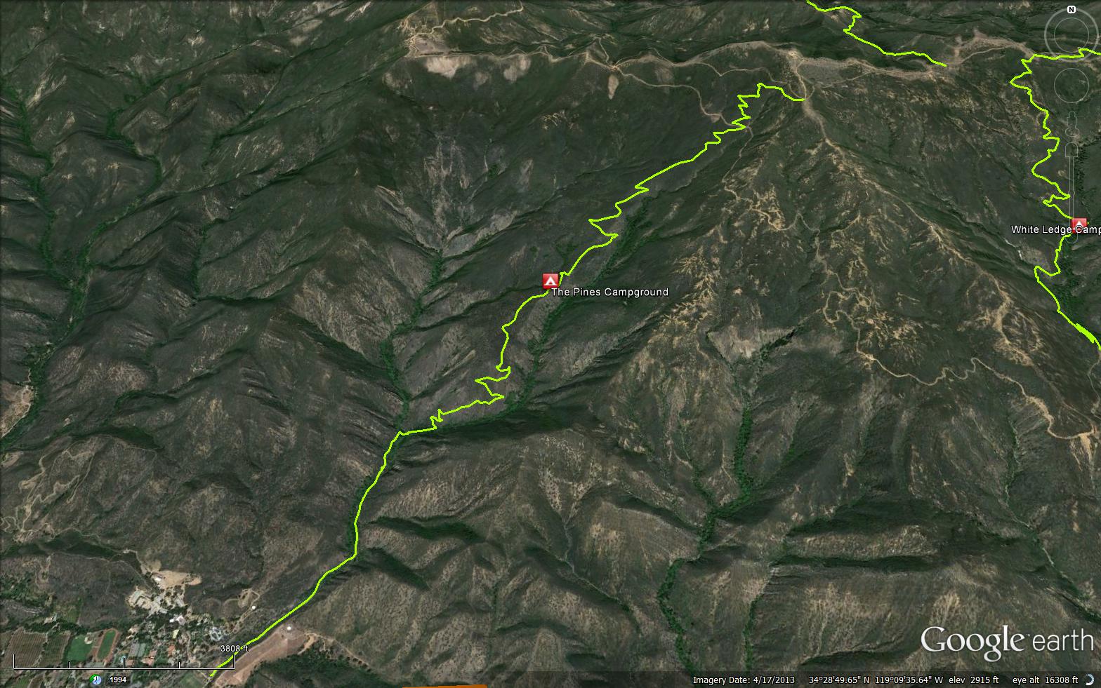
The Horn Canyon Trail begins just before you enter Thacher School, be sure to follow the 'HC' signs that point you to where the single track begins. Once on the trail, you cross the creek a few times before a steep climb up to The Pines Camp (2.7miles) and ultimately Nordhoff Ridge Rd.
The Pines Camp has three campsites set underneath Coulter pine trees that were planted after the 1948 fires. A few of the trees were lost during the Wheeler Fire of 1985 and most of the others were starved out during the drought of 2012-2016. Water is sometimes available at a spring behind the camp. Note that The Pines Camp was closed in 2015 due to hazard trees.
Horn Canyon Trail is most commonly used as a dayhike route but can be part of a larger trip into the Sespe or looped in as part of a long mountain bike ride with other nearby trails.


 Horn Canyon Trail Survey - 11-02-2024 - by Erin C
| Link: | Horn Canyon Trail |
| Date: | 11-02-2024 |
| Surveyor Name: | Erin C |
| Trail description: | Rode up Gridley and went down Horn Canyon Trail. The upper part of the trail and lower part of the trail are pretty good. The middle section of the trail is now overgrown in some sections. The Chamise, Laurel Sumac and other vegetation has grown back quickly over the last 2 years and this trail now needs some brushing work. |
| Mode of transport: | Bicycle |
| Trail condition: | Needs some work |
| Images: | upper part of the trail is pretty good upper part of the trail is pretty good middle section of the trail needs brushing work |
Horn Canyon Trail Survey - 04-30-2023 - by Andy| Link: | Horn Canyon Trail |
| Date: | 04-30-2023 |
| Surveyor Name: | Andy |
| Trail description: | Trail through Pine Camp was well maintained and recently cleared. Pine camp is in fine shape, saw people camped there. From Pine Camp to Sisar Rd is tight but passable. The biggest challenge is lack of water baffles/steps on the ridge trail above Pine Camp, leading to a deep trench. |
| Mode of transport: | Hike |
| Trail condition: | Good shape and easy to follow |
Horn Canyon Trail Survey - 05-07-2022 - by Anonymous Surveyor| Link: | Horn Canyon Trail |
| Date: | 05-07-2022 |
| Surveyor Name: | Anonymous Surveyor |
| Trail description: | For the first 1.5 miles or so from the Thacher School trailhead, until shortly after the trail leaves the creek and canyon bottom, the trail is good and maintained. After that, all the way to it’s end at Chief Peak Road it has become completely unmaintained and without exaggeration almost impassible and unfollowable in many places, dangerous with the state of the trail tread, rock impediments, and vegetation growth, and requiring major work to put it mildly. With all the regeneration after the Thomas Fire in 2017, it's reverting to wild land that won't be usable at all in a short time. Also, The Pines camp is completely overgrown, in very poor shape, and should no longer be considered or advertised as a camp. |
| Mode of transport: | Hike |
| Trail condition: | Hard to follow |
| Condition details: | Between Hard to follow and Non existent |
Horn Canyon Trail Survey - 01-15-2022 - by Jeff Langille| Link: | Horn Canyon Trail |
| Date: | 01-15-2022 |
| Surveyor Name: | Jeff Langille |
| Trail description: | The guide books mostly have an old description of this trail that tell you to park beyond the Thacher School grounds. However, the school has gates and locks them. The trailhead has been moved about a third of a mile down the creek off of McAndrew Rd. The trailhead is clearly marked in google maps and from the road, and there was adequate off road parking. New section of trail is nice, following the creek through rocky riparian habitat. Signs then direct you through what appears to be a right of way along fenced property lines until you hit the old trailhead. We hiked to where the first main tributary flows into the creek, a little more than 2 miles up from the new trailhead. Trail well maintained, several stream crossings were not difficult, plenty of water. My nine year old had no trouble going this far, and had plenty of fun at our stop along the stream crossing. Several nice views into the Ojai valley on the way down. Lovely place to spend a few hours. |
| Mode of transport: | Hike |
| Trail condition: | Good shape and easy to follow |
Horn Canyon Trail Survey - 12-26-2021 - by Daniel Feinberg| Link: | Horn Canyon Trail |
| Date: | 12-26-2021 |
| Surveyor Name: | Daniel Feinberg |
| Trail description: | Downed tree after last creek crossing before the steps. |
| Mode of transport: | Hike |
| Trail condition: | Good shape and easy to follow |
| Images: | Downed tree |
Horn Canyon Trail Survey - 01-25-2021 - by Dan Whelan | Link: | Horn Canyon Trail |
| Date: | 01-25-2021 |
| Surveyor Name: | Dan Whelan |
| Trail description: | Hazard tree right before the last water crossing. A sycamore that is rotted at the bottom fell over the trail and is hung up in an Oak tree. |
| Mode of transport: | Hike |
| Trail condition: | Needs some work |
| Condition details: | Hazard tree |
| Images: | Base of tree Over trail Over trail |
Horn Canyon Trail Survey - 01-01-2021 - by Ron Wean| Link: | Horn Canyon Trail |
| Date: | 01-01-2021 |
| Surveyor Name: | Ron Wean |
| Trail description: | The new trail provides a rocky beginning and adds approximately one mile to hike. The lower trail from the old trailhead is in good condition. There is still a good flow of water in the creek. Shortly before reaching the Pines the trail becomes very brushy and midway through the old Pines campground there is a large tree fall directly in the trail. Around through the brush or through the tree your choice! I only went a short way beyond the tree so can’t speak for what lies above. |
| Mode of transport: | Hike |
| Trail condition: | Needs some work |
| Condition details: | Horn Canyon to the Pines via new trailhead at McAndrew Rd. |
Horn Canyon Trail Survey - 11-27-2020 - by Dan Whelan| Link: | Horn Canyon Trail |
| Date: | 11-27-2020 |
| Surveyor Name: | Dan Whelan |
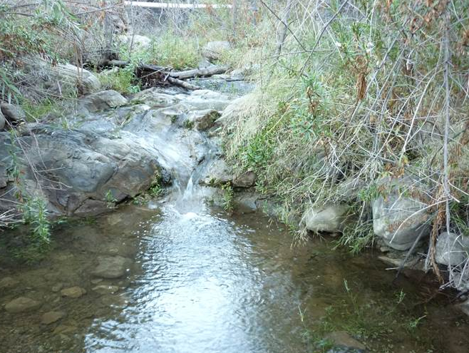
| Trail description: | I hiked the trail from Thatcher up to Pines Camp ground. There is water flowing in all the creek crossings above Thatcher and the trail in this area is very good. Very little brush touching you as you hike, the tread is mostly excellent, and no downed trees or logs across the trail. From the canyon bottom through the switchbacks is also mostly good. Most of the issue would be low growing annual plants raking your legs. After leaving the switchbacks things change quite a bit. The trail is still easy to follow however it is quite over grown. I had to push through the brush in some spots and most of this area the brush on each side of the trail was touching the other side. One more good rain year might leave this area impassable. |
| Mode of transport: | Hike |
| Trail condition: | Needs some work |
| Condition details: | see description |
Horn Canyon Trail Survey - 03-01-2020 - by Antonio Calderon| Link: | Horn Canyon Trail |
| Date: | 03-01-2020 |
| Surveyor Name: | Antonio Calderon |
| Trail description: | From trailhead to Nordhoff Ridge, trail is in good shape and easy to follow. Creek was flowing at all crossings. Poodle dog bush is heavily present after the pines camp but avoidable. Continuation of the trail after sisar junction is a bit brushy but nothing too bad. Â |
| Mode of transport: | Hike |
| Trail condition: | Good shape and easy to follow |
| Images: | Trail sign at Nordhoff Ridge Typical trail Sisar junction |
Horn Canyon Trail Survey - 06-14-2019 - by Thomas Fredrickson| Link: | Horn Canyon Trail |
| Date: | 06-14-2019 |
| Surveyor Name: | Thomas Fredrickson |
| Trail description: | The trail is easy to follow from the trailhead to Sisar Road. The creek is flowing strong. There is a fair amount of poison oak right by trail in the first mile, but it can be easily avoided. The tread of the trail is clear to the Pines Camp (closed), but it is a bit overgrown on the side. Poodle Dog Bush: There are a few of these below the Pines, including one just a few hundred yards from the trailhead. However, they do not present a problem until the last half mile until you intersect Sisar Road. That last half mile is full of Poodle Dog Bush, currently flowering, and up to 6 feet tall. Some are growing directly in the trail in such abundance that it is impossible to get around without touching them. In most cases, you can get by untouched if you are very careful (if it's windy, that will be even more difficult). However, we encountered a mature plant in the middle of the trail in about six locations, with a forest of Poodle Dog Bush on both sides. In these cases, we knocked down enough of the bush by placing rocks on the stems to clear a minimal path and continue on our way. |
| Mode of transport: | Hike |
| Trail condition: | Needs some work |
Horn Canyon Trail Survey - 05-05-2019 - by Los Padres Forest Association| Link: | Horn Canyon Trail |
| Date: | 05-05-2019 |
| Surveyor Name: | Los Padres Forest Association |
| Trail description: | Report from the Great Bardley of Ojai: - The trail has no obstructions. - Water flowing at the four crossings. - Poison oak, as usual, above the fourth crossing. - The pines camp has a few poodle-dog bushes. no new fallen trees. with the overcast sky, difficult to tell if the pine needles up high are green or brown. - Poodle dog begins in earnest above the pines camp and continues almost all the way to the hines peak road trailhead. it is currently easy to avoid although there are a few places where it may later block the trail. - Above the pines camp the trail itself is a rut in most sections with rocks covering the tread. not a smooth or stable journey for hikers. |
| Mode of transport: | Hike |
| Trail condition: | Good shape and easy to follow |
Horn Canyon Trail Survey - 03-09-2019 - by Anonymous Surveyor| Link: | Horn Canyon Trail |
| Date: | 03-09-2019 |
| Surveyor Name: | Anonymous Surveyor |
| Trail description: | Traveled via Horn Canyon to Chief Peak on Saturday. From The Trail-Head at Thatcher school all the way up to the junction with Sisar Road is in is in great shape and easy to follow. Water is really moving along Thatcher Creek, unless you have perfected the trekking pole catapult method expect to get your boots wet on the crossing's. weather is beautiful right now. My only gripe would be the condition of the junction sign at Sisar. Yes I'm a stickler for ugly signs. While I would love to install a new one at the very least this one could use some new decals. If you want to read more about the days details you can click the link below.  https://christopherplord.blogspot.com/2019/03/chief-peak-by-way-of-horn-canyon.html |
| Mode of transport: | Hike |
| Trail condition: | Good shape and easy to follow |
| Images: | Horn Canyon & Sisar Road Junction sign Thatcher Creek 03/09/2019 |
Horn Canyon Trail Survey - 09-12-2018 - by Los Padres Forest Assocation| Link: | Horn Canyon Trail |
| Date: | 09-12-2018 |
| Surveyor Name: | Los Padres Forest Assocation |
| Trail description: | Trail has been burned by the Thomas Fire, but is easy to follow. A few of the pines at "the Pines" camp remain. No water was found at the camp, but there was water in the creek lower down. Read more here on Moments in Dirt and Ink: Thanks for sharing Valerie! |
| Mode of transport: | Hike |
| Trail condition: | Good shape and easy to follow |
Horn Canyon Trail Survey - 03-13-2017 - by Los Padres Forest Association| Link: | Horn Canyon Trail |
| Date: | 03-13-2017 |
| Surveyor Name: | Los Padres Forest Association |
| Trail description: | Report from D. Jackson: Horn Canyon:
From Thacher School trailhead to the last (3rd or 4th stream
crossing)…..Very good condition. Then, excellent shape climbing up the
many wooden trail steps to the East, 1/4 mile up to the first
switchback……due to very recent work using small shovels. I wouldn’t be
surprised if it was the students from the Thacher School who did the
good work. Beyond the switchback to the left and climbing on to the
Pines CG, the trail could use some brushing….as it is getting narrow in
places. Also, the last 1/2 mile to the Pines….the long step section (due
to the recent storm runoff) is very rocky and could use some smoothing.
The Pines CG is in good shape….due to the very good work by the crews
that came in to clear the dead pines. |
| Mode of transport: | Hike |
| Trail condition: | Needs some work |
Horn Canyon Trail Survey - 07-16-2016 - by Los Padres Forest Association| Link: | Horn Canyon Trail |
| Date: | 07-16-2016 |
| Surveyor Name: | Los Padres Forest Association |
| Trail description: | The lower trailhead for Horn Canyon Trail was changed in July 2016 from the parking area within Thacher School to the street just outside Thacher. Â You'll notice it when you see it and soon you'll probably forget that the old trailhead was ever an option. Â We're reporting this information within HikeLosPadres for historical purposes. Â Good stuff to keep and report. This was reported by Heidi of the Ojai Ranger District. |
| Mode of transport: | Hike |
| Trail condition: | Good shape and easy to follow |
Horn Canyon Trail Survey - 01-08-2017 - by Josh Lee Pasholk| Link: | Horn Canyon Trail |
| Date: | 01-08-2017 |
| Surveyor Name: | Josh Lee Pasholk |
| Trail description: | We went hiking on a Sunday after the rain. There were quite a few other hikers on the trail and there must have been horses hours before as we saw lots of fresh horse droppings. A few mountain bikers as well Horn Canyon is a steep unforgiving hike in many ways. It doesn't mess around at all. I'd estimate that the elevation gain from the trailhead to The Pines campground where we went is about 1500 to 1700 feet in just 2 or 3 miles, which is a lot. The trail was pretty muddy in some sections especially where it's torn up from the horses. This is pretty expected and didn't deter us in the least. Other than that it was easy to follow and wasn't slippery other than the ground being a little soft in places. Check out more info and pictures on my blog! If you'd like, you can sign up for my newsletter. Right now I'm having them go out once a week, every Monday. I may change that as it might be too much. Please leave any feedback as a comment on my site! Thanks!! |
| Mode of transport: | Hike |
| Trail condition: | Good shape and easy to follow |
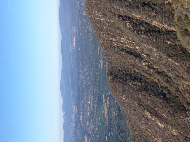
| Images: | Trailhead. First Creek Crossing. Trekking up the last section before The Pines. Second Creek Crossing. View from near The Pines |
Horn Canyon Trail Survey - 01-02-2017 - by Craig R. Carey| Link: | Horn Canyon Trail |
| Date: | 01-02-2017 |
| Surveyor Name: | Craig R. Carey |
| Trail description: | Walked the Horn Cyn Trail en route to the Morgan Barnes today. Route's in great shape aside from all the dog leavings along the trail (CARRY IT OUT, FOLKS!). Good water in the first and second crossings. |
| Mode of transport: | Hike |
| Trail condition: | Good shape and easy to follow |
| Images: | |
Horn Canyon Trail Survey - 12-06-2014 - by Los Padres Forest Association| Link: | Horn Canyon Trail |
| Date: | 12-06-2014 |
| Surveyor Name: | Los Padres Forest Association |
| Trail description: | The Ojai Ranger District led a trail project up Horn Canyon from the trailhead to The Pines Campground. Â Headed up by Ranger Heidi, they were able to lop and clear the trail. Â There was good water in the creek but no water at the camp. |
| Mode of transport: | Array |
| Trail condition: | Good shape and easy to follow |
| Images: | Second Crossing, photo Ranger Heidi |
Horn Canyon Trail Survey - 10-11-2014 - by JO| Link: | Horn Canyon Trail |
| Date: | 10-11-2014 |
| Surveyor Name: | JO |
| Trail description: | Started our hike at 6:30 AM. Â Needed our headlamps for about 20 minutes. Â Arrived at the Pines Campground around 9:30 AM. Â Nearly half the pine trees are dead or dying. Â No water coming out of the plastic pipe. Â We hike to the spring source and found the spring collection box. Â The top has been smashed in and there is quite a bit of silt and debris in the box. Â A new box is needed preferably a metal box. Â This would be a great project for a high school metal shop class, maybe Thacher High School. Â Somebody had left a nice looking hammock in the camp. |
| Mode of transport: | Hike |
| Trail condition: | Good shape and easy to follow |
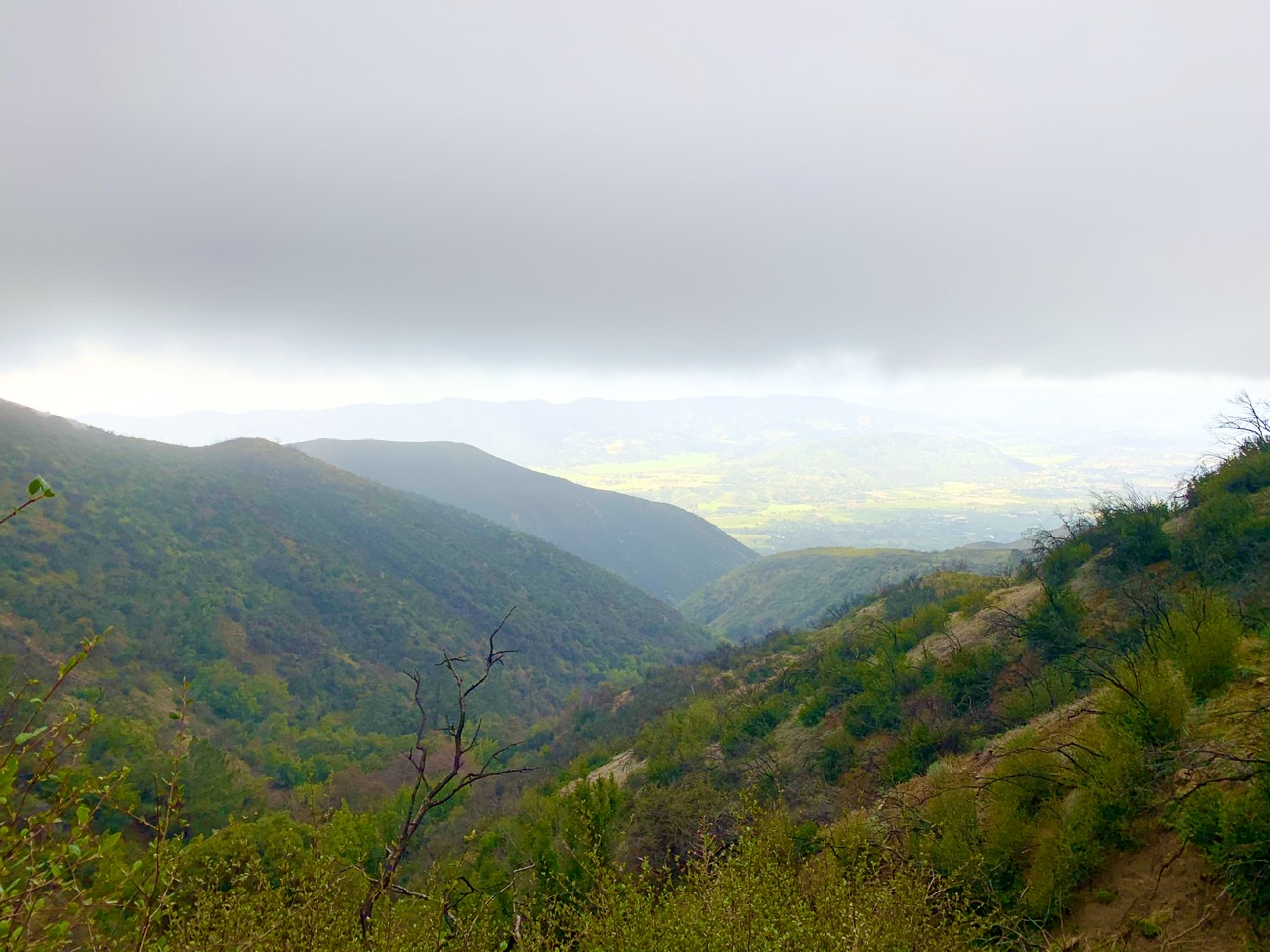
| Images: | view of Ojai valley from Horn Canyon trail |
 Survey / Report Form - Please click this box to open the form.