 Use Marker Groups
 Wolf 2002
Piru 2003
Day 2006
Zaca 2007
Gap 2008
La Brea 2009

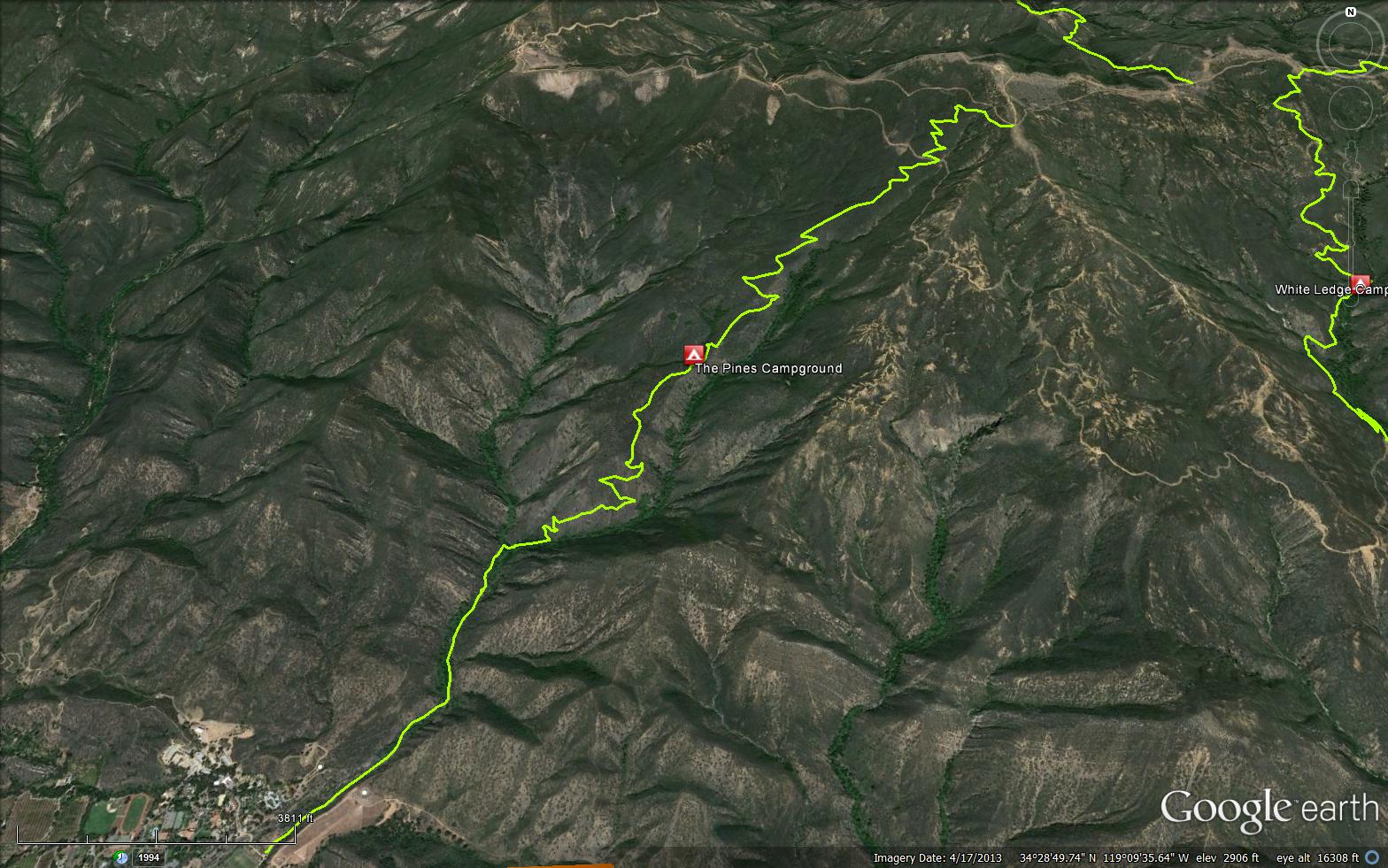
This trail starts in Ojai at the north end of Gridley Road and ends on top of Nordhoff Ridge. The relatively gentle climb from Ojai to the ridge makes this one of the more popular trails in the area and is an excellent choice for a day hike.


.JPG)


 Gridley Trail Survey - 12-23-2023 - by Anonymous Surveyor
| Link: | Gridley Trail |
| Date: | 12-23-2023 |
| Surveyor Name: | Anonymous Surveyor |
| Trail description: | Trail still looks great after all the rain. |
| Mode of transport: | Hike |
| Trail condition: | Good shape and easy to follow |
Gridley Trail Survey - 07-06-2023 - by Anonymous Surveyor| Link: | Gridley Trail |
| Date: | 07-06-2023 |
| Surveyor Name: | Anonymous Surveyor |
| Trail description: | Trail was in good shape, saw several mountain bikers. Backpacked from Gridley Trailhead to Gridley Spring Camp one day, and then from Gridley Spring Camp up to the top the second day before travelling down the Pratt Trail. Lots of water and shade at Gridley Spring. |
| Mode of transport: | Hike |
| Trail condition: | Good shape and easy to follow |
| Images: | |
Gridley Trail Survey - 06-23-2023 - by Anonymous Surveyor| Link: | Gridley Trail |
| Date: | 06-23-2023 |
| Surveyor Name: | Anonymous Surveyor |
| Trail description: | Trail is in great shape. We've seen 2 different rattlesnakes in the rocks of 2 adjacent slide areas near the lower part of the trail. One was on the trail and moved under a rock right next to the trail and continued to watch us (we ended up going around). The other was about a foot off the trail sunning itself on a rock at shoulder height. It eventually uncoiled itself and moved around the nearby rocks before hiding in a crevice right next to the trail (we went around it too). |
| Mode of transport: | Hike |
| Trail condition: | Good shape and easy to follow |
Gridley Trail Survey - 05-06-2023 - by Anonymous Surveyor| Link: | Gridley Trail |
| Date: | 05-06-2023 |
| Surveyor Name: | Anonymous Surveyor |
| Trail description: | Trail looks great the whole way. Flowers everywhere. Just watch out for bikers uncontrollably flying down the narrow trails, we almost got hit a few times. |
| Mode of transport: | Hike |
| Trail condition: | Good shape and easy to follow |
Gridley Trail Survey - 03-24-2023 - by Anonymous Surveyor| Link: | Gridley Trail |
| Date: | 03-24-2023 |
| Surveyor Name: | Anonymous Surveyor |
| Trail description: | The trail is generally in great condition. However, about a mile and a half up there's a slide that's covered 10-15 feet of trail. It's mildly challenging, but possible, to cross it by climbing uphill about 10 feet and then making your way across (there are already footholds and packed trail forming there). There were bikers on the trail, so they were somehow able to get their bikes across it too. |
| Mode of transport: | Hike |
| Trail condition: | Non existent |
| Condition details: | Slide over section of trail |
| Images: | Trail Slide |
Gridley Trail Survey - 03-19-2023 - by Anonymous Surveyor| Link: | Gridley Trail |
| Date: | 03-19-2023 |
| Surveyor Name: | Anonymous Surveyor |
| Trail description: | Trail is in great condition. Crew was brushing lower part of the trail on 3/18/23. Water was available until about 1 mile from ridge road. |
| Mode of transport: | Hike |
| Trail condition: | Good shape and easy to follow |
Gridley Trail Survey - 05-25-2020 - by John Johnson Jr.| Link: | Gridley Trail |
| Date: | 05-25-2020 |
| Surveyor Name: | John Johnson Jr. |
| Trail description: | Did this trail last week for the fifth time this spring. Somewhat challenging for a person my age (72), but worth the views. I am positing because I saw a mountain lion dash across the trail. Good-sized, but wasn't interested in me. Was chasing something, I imagine a rodent. A reminder to my self to get off the mountain before dusk. |
| Mode of transport: | Hike |
| Trail condition: | Needs some work |
| Condition details: | A bit overgrown in places. |
Gridley Trail Survey - 03-25-2020 - by bardley| Link: | Gridley Trail |
| Date: | 03-25-2020 |
| Surveyor Name: | bardley |
| Trail description: | Gridley Trail is wide open without obstruction. Strong water flow at Gridley Spring. Gridley Spring horse trough has a heavy vinyl liner with a hose that provides water from the flowing spring water. Many waterfalls seen down in Gridley Canyon. *My Gaia app says this trail is 5.90 miles long* *Trailhead sign says 6 miles* |
| Mode of transport: | Hike |
| Trail condition: | Good shape and easy to follow |
Gridley Trail Survey - 07-02-2018 - by Thomas Fredrickson| Link: | Gridley Trail |
| Date: | 07-02-2018 |
| Surveyor Name: | Thomas Fredrickson |
| Mode of transport: | Hike |
| Trail condition: | Good shape and easy to follow |
Gridley Trail Survey - 01-06-2017 - by Josh Pasholk| Link: | Gridley Trail |
| Date: | 01-06-2017 |
| Surveyor Name: | Josh Pasholk |
| Trail description: | Hiked up to Gridley Springs camp after a day of rain. Ground was still pretty wet with sitting water here and there. Not too muddy on the trail for the most part. Lots of cars on the trailhead. Saw plenty of hikers and mountain bikers. Very cold in the shade, getting down to around 48 degrees. Trail was in really good shape. Saw the Ojai fritillary just sprouting up in many areas. I want to hike back up and check on the progress soon! Check out my blog post on this hike for more pictures if you'd like! |
| Mode of transport: | Hike |
| Trail condition: | Good shape and easy to follow |
| Images: | Trail Head Rocky Steps Looking up the canyon Ojai fritillary View from up there |
Gridley Trail Survey - 12-23-2015 - by HikeLosPadres| Link: | Gridley Trail |
| Date: | 12-23-2015 |
| Surveyor Name: | HikeLosPadres |
| Trail description: | Rode the first few miles of the trail up from the trailhead. Â Trail was in great shape, the cool air was perfect for riding and the views were their usual spectacular selves. Â We could hear water down in the creek but there was no safe way to get down to it. Â We saw a few other mountain bikers and some hikers. |
| Mode of transport: | Bicycle |
| Trail condition: | Good shape and easy to follow |
| Images: | |
Gridley Trail Survey - 02-15-2015 - by Donna Spencer| Link: | Gridley Trail |
| Date: | 02-15-2015 |
| Surveyor Name: | Donna Spencer |
| Trail description: | This trail has no issues, I did it a shuttle hike. I had my DAD drop me off at the trail head and hike to the Nordoff Ridge Road and got picked up at the bottom of the Howard Creek Trailhead. The views from the Nordoff Roas was spectacular from the Pacific Ocean and surrounding mountain area.  Just be on the look out for mountain bikers.   |
| Mode of transport: | Hike |
| Trail condition: | Good shape and easy to follow |
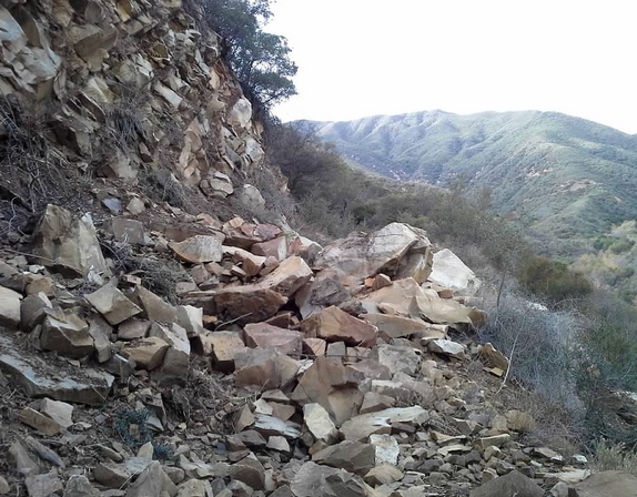
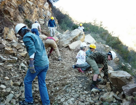
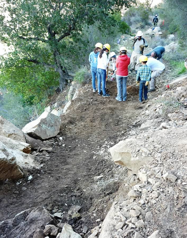
Gridley Trail Survey - 12-28-2014 - by Los Padres Forest Association| Link: | Gridley Trail |
| Date: | 12-28-2014 |
| Surveyor Name: | Los Padres Forest Association |
| Trail description: | The Ojai Ranger District teamed up with local Ventura based Girl and Boy Scouts to help remove a slide section of the Gridley Trail. Â Great stuff. Â Thanks to everyone for their hard work. Â For more volunteer opportunities contact the Ojai Ranger District or INFO@LPForest.org. |
| Mode of transport: | Array |
| Trail condition: | Good shape and easy to follow |
| Images: | Before During After |
 Survey / Report Form - Please click this box to open the form.