 Use Marker Groups
 Wolf 2002
Piru 2003
Day 2006
Zaca 2007
Gap 2008
La Brea 2009

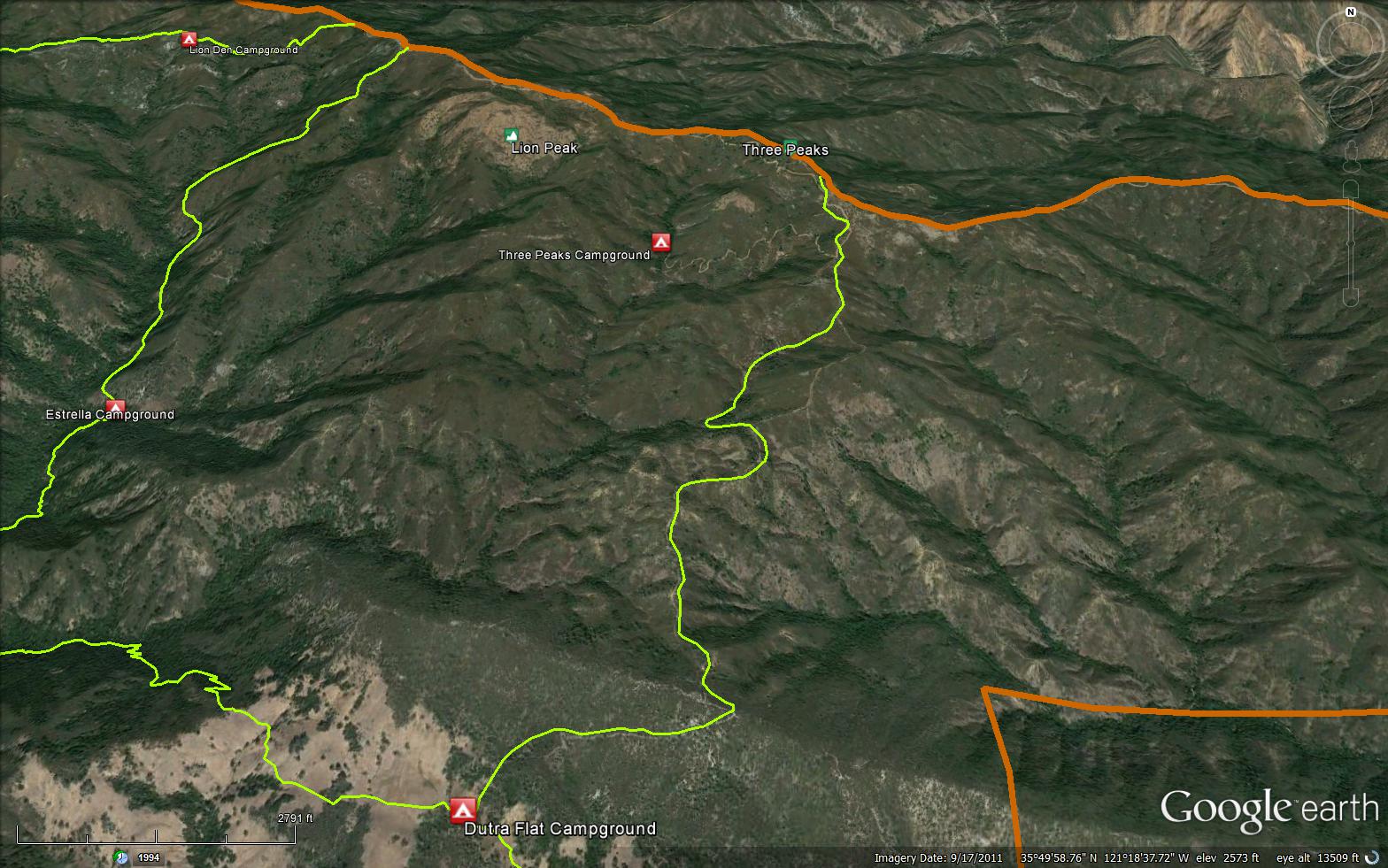
The Durta Flat Trail is a 3 mile trail in the Silver Peak Wilderness, located in Monterey County. The trail connects the Spruce Creek Trail and the South Coast Road (20S05.7).
.jpg)


 Dutra Trail Survey - 04-15-2024 - by Rob
| Link: | Dutra Trail |
| Date: | 04-15-2024 |
| Surveyor Name: | Rob |
| Trail description: | Dutra trail is an old ranch/mining road that has overgrown with manzanita, chaparral, and a few pine trees. It’s pretty easy to follow; it‘s very rocky from dutra flats north to the top of the first large hill. Once you get to the top and start heading north, it flattens out into undulating hills of dirt track and moderate vegetation growth into the trail. iI’s still possible to find the trail, though The last two hills before 3 peaks camp are basically 200ft elevation and 100 ft, straight up. Good news is that you can see Hearst castle from the top on a clear day. |
| Mode of transport: | Hike |
| Trail condition: | Needs some work |
| Condition details: | Moderately Encroached |
| Images: | Southern Trailhead View to the south |
Dutra Trail Survey - 01-07-2024 - by Steve Cypher| Link: | Dutra Trail |
| Date: | 01-07-2024 |
| Surveyor Name: | Steve Cypher |
| Trail description: | The trail is pretty easy to follow but tight brush requires stooping and pushing through in several places. |
| Mode of transport: | Hike |
| Trail condition: | Needs some work |
| Condition details: | Brushy trail. |
Dutra Trail Survey - 07-22-2020 - by Katie Mendenhall| Link: | Dutra Trail |
| Date: | 07-22-2020 |
| Surveyor Name: | Katie Mendenhall |
| Trail description: | Trail is clear all the way to the top where it meets the dirt road. Could use some minimal maintenance trimming back sticky plants on the climb out of Dutra Camp. |
| Mode of transport: | Hike |
| Trail condition: | Good shape and easy to follow |
Dutra Trail Survey - 04-28-2019 - by Steve Cypher| Link: | Dutra Trail |
| Date: | 04-28-2019 |
| Surveyor Name: | Steve Cypher |
| Trail description: | Volunteers cleared tight brushy sections on both ends of the trail. The upper end of the trail is now signed. The fire break walk in the middle section of the trail is a little brushy and the tread is faint, so make sure you know what the map says. |
| Mode of transport: | Hike |
| Trail condition: | Good shape and easy to follow |
| Images: | Signage at north end of trail Volunteers clearing the trail Trail follows a fire break View hiking towards Dutra Flat |
Dutra Trail Survey - 03-18-2017 - by Steve Cypher| Link: | Dutra Trail |
| Date: | 03-18-2017 |
| Surveyor Name: | Steve Cypher |
| Trail description: | VWA & LPFA volunteers cleared the first 1.5 miles of the trail out of Dutra Flat Camp through the brushy section on the north side of the ridge. The trail past the barbed wire cairn and up the old road bed through the first few switchbacks is obvious for now. The trail through the brush north of the ridge is narrow, but it looks like a trail. After that it's an obvious fire break that follows the top of the ridge. p.s. If hiking from the Coast Ridge Rd towards Dutra Flat, follow the road down the hill to Three Peaks Camp for 0.3 miles to where it turns sharply to the right. The trail goes straight and follows a fire break on top of a ridge. |
| Mode of transport: | Hike |
| Trail condition: | Needs some work |
| Condition details: | Freshly cleared, good for now. |
Dutra Trail Survey - 01-06-2015 - by Carter Wilson| Link: | Dutra Trail |
| Date: | 01-06-2015 |
| Surveyor Name: | Carter Wilson |
| Trail description: | Lots of bush wacking and scraped shins. From the Dutra Flat side follow the beaten grass instead of the dirt trail. The dirt trail leads to Spruce creek trail. Once on Dutra Trail watched for down trees as the trail can be hard to follow. |
| Mode of transport: | Hike |
| Trail condition: | Hard to follow |
| Condition details: | From the Dutra Flat the sign directs you around a tree then back onto Spruce Creek Trail. |
 Survey / Report Form - Please click this box to open the form.