 Use Marker Groups
 Wolf 2002
Piru 2003
Day 2006
Zaca 2007
Gap 2008
La Brea 2009

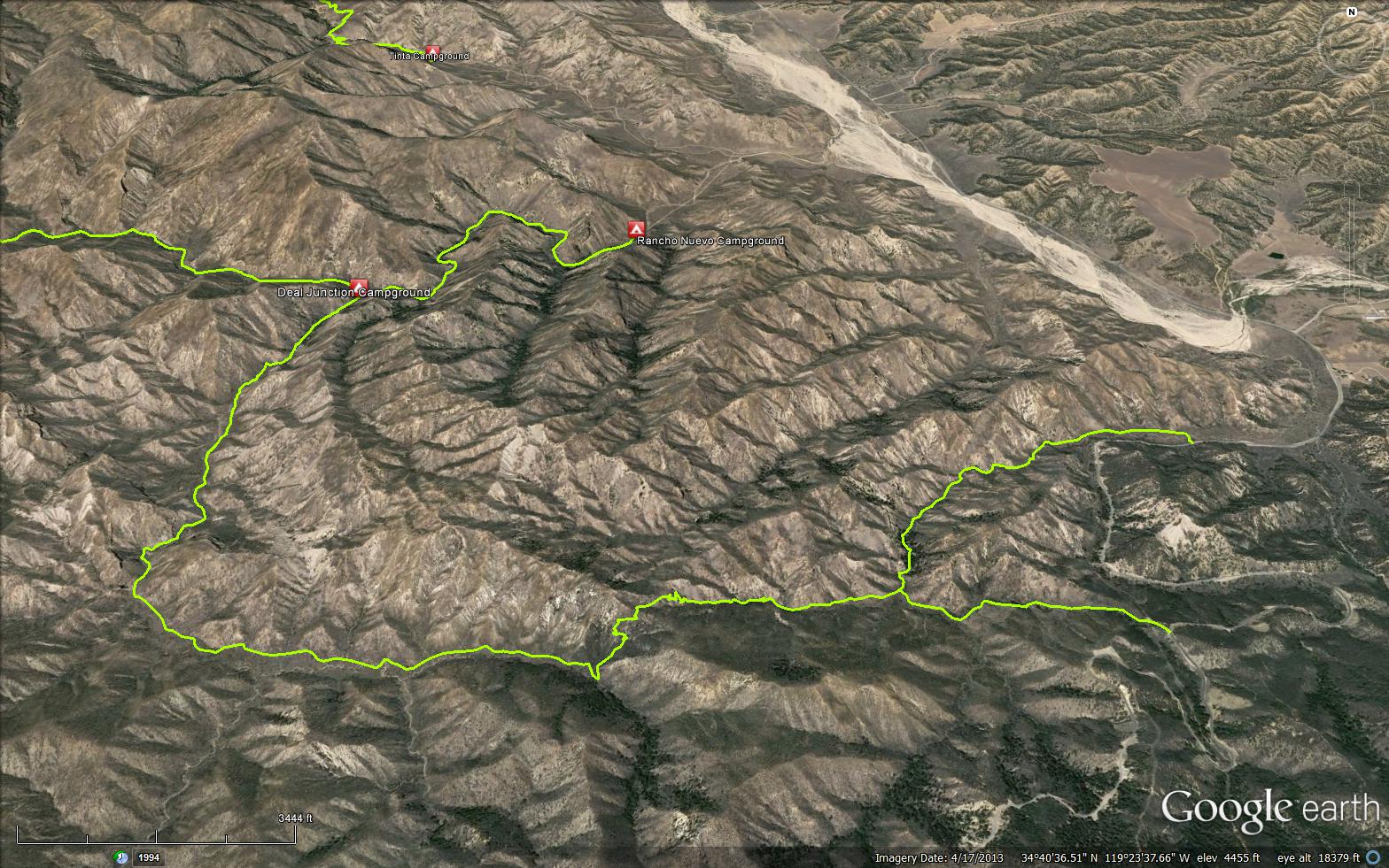
The Deal Connector Trail is a short connector trail just outside the Dick Smith Wilderness, located in Ventura County. The trail starts from the Highway 33 and then joins with the Deal Trail (24W04) after 1 mile.
 Deal Connector Trail Survey - 03-14-2022 - by bardley
| Link: | Deal Connector Trail |
| Date: | 03-14-2022 |
| Surveyor Name: | bardley |
| Trail description: | over all, the trail is open and easy to follow. be aware, there is no signage at the deal connector / mine camp trail junction. at the junction if you were to go straight you would end up at mine camp. the connector actually makes a sharp right-hand turn downhill at the junction. the signage at the deal connector / deal trail junction is new and mt pinos ranger district plastic. |
| Mode of transport: | Hike |
| Trail condition: | Needs some work |
Deal Connector Trail Survey - 04-05-2020 - by Louis Tremblay| Link: | Deal Connector Trail |
| Date: | 04-05-2020 |
| Surveyor Name: | Louis Tremblay |
| Trail description: | good shape, no real problems. |
| Mode of transport: | Hike |
| Trail condition: | Good shape and easy to follow |
Deal Connector Trail Survey - 06-29-2015 - by Volunteer Wilderness Ranger| Link: | Deal Connector Trail |
| Date: | 06-29-2015 |
| Surveyor Name: | Volunteer Wilderness Ranger |
| Trail description: | Super volunteer Mickey cut out three trees along the Deal Connector Trail. Â The trail is clear from Hwy 33 to Bear Trail. Â The trail could use some brushing but is in great shape. |
| Mode of transport: | Array |
| Trail condition: | Good shape and easy to follow |
Deal Connector Trail Survey - 02-02-2014 - by Subbotin| Link: | Deal Connector Trail |
| Date: | 02-02-2014 |
| Surveyor Name: | Subbotin |
| Trail description: | Trail easy to follow from Deal Connector Trailhead, but watch for sharp right hand turn to north, otherwise you head straight to Mine Camp. |
| Mode of transport: | Hike |
| Trail condition: | Good shape and easy to follow |
 Survey / Report Form - Please click this box to open the form.