 Use Marker Groups
 Wolf 2002
Piru 2003
Day 2006
Zaca 2007
Gap 2008
La Brea 2009

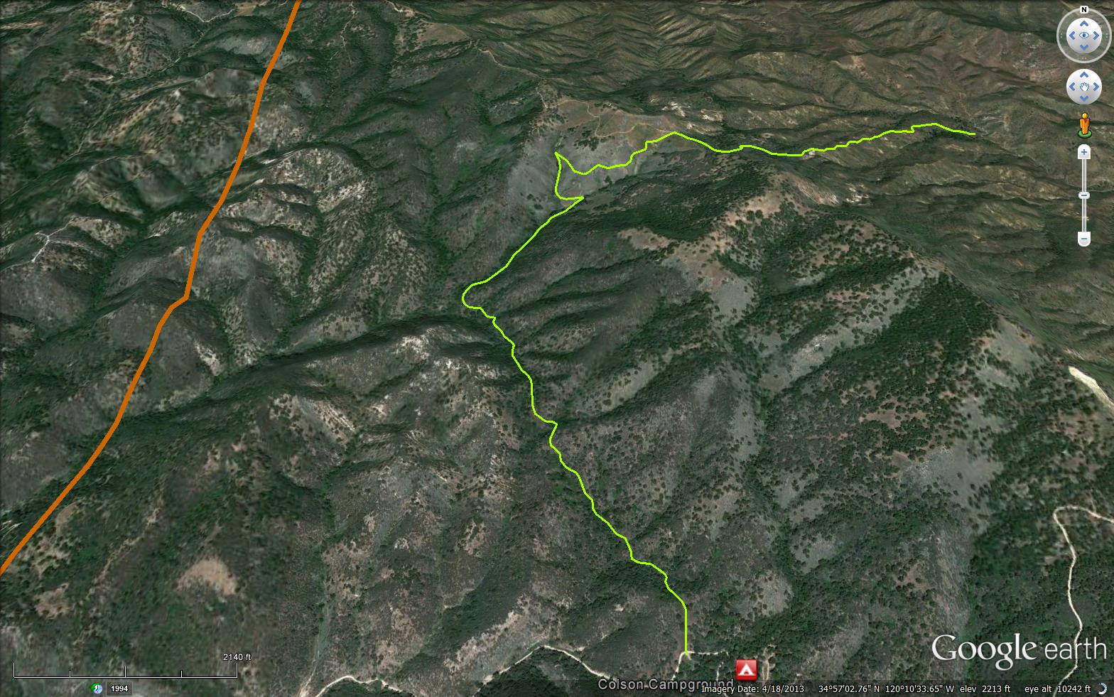
The Buckhorn Ridge Trail is a scenic 1.82 mile trail outside of Santa Maria in Santa Barbara County. The trail starts at Colson Campground and connects to the Bear Canyon Connector Trail (31W17).
Please let us know if you have explored this trail recently.


 Buckhorn Ridge Trail Survey - 04-01-2021 - by Alex Lowe
| Link: | Buckhorn Ridge Trail |
| Date: | 04-01-2021 |
| Surveyor Name: | Alex Lowe |
| Trail description: | Hiked this on 1 Apr 2021. Started at the trailhead where there is a turnout on the road about 1/4 mile west of Colson Campground. The first half mile was nice. Then brush started to encroach on the trail and it soon became very overgrown. There was lots of poison oak. The trail deteriorated into a cattle trail and would disappear briefly in the undergrowth. But we managed to follow it for about a mile or more, but finally lost it. We didn't try to backtrack and find it because it's clear that you're in a dry creek gully and the route goes up the gully so we just labored onward, now completely bushwhacking. We reached the point where the map shows the trail leaving the gully and contouring west into an adjacent canyon. We spent more than an hour bushwhacking around this area, going in circles, trying to find the trail that would take us the last 300 yards to Peach Tree Spring, without luck. Discouraged, we gave up and hiked east cross-country up the side of the canyon until we got out of the brush and undergrowth. Then we walked a quarter-mile or so north and found an old ranch road. We followed this south for about three miles back to Colson Cyn Road. |
| Mode of transport: | Hike |
| Trail condition: | Hard to follow |
| Condition details: | Hard to follow, perhaps non existent. |
| Images: | View of trailhead parking spot from start of trail. First quarter mile of trail looks inviting. (Classic bait-and-switch). Giant ceanothus in bloom Searching the bushes for a trail |
 Survey / Report Form - Please click this box to open the form.