 Use Marker Groups
 Wolf 2002
Piru 2003
Day 2006
Zaca 2007
Gap 2008
La Brea 2009

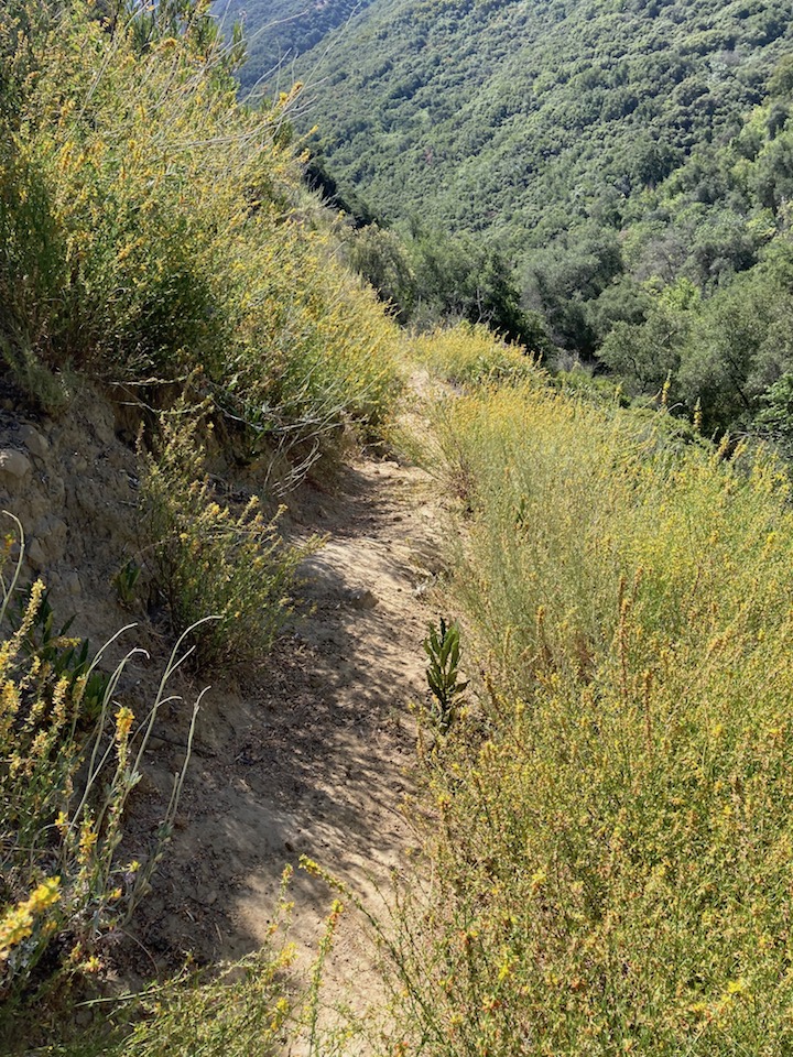
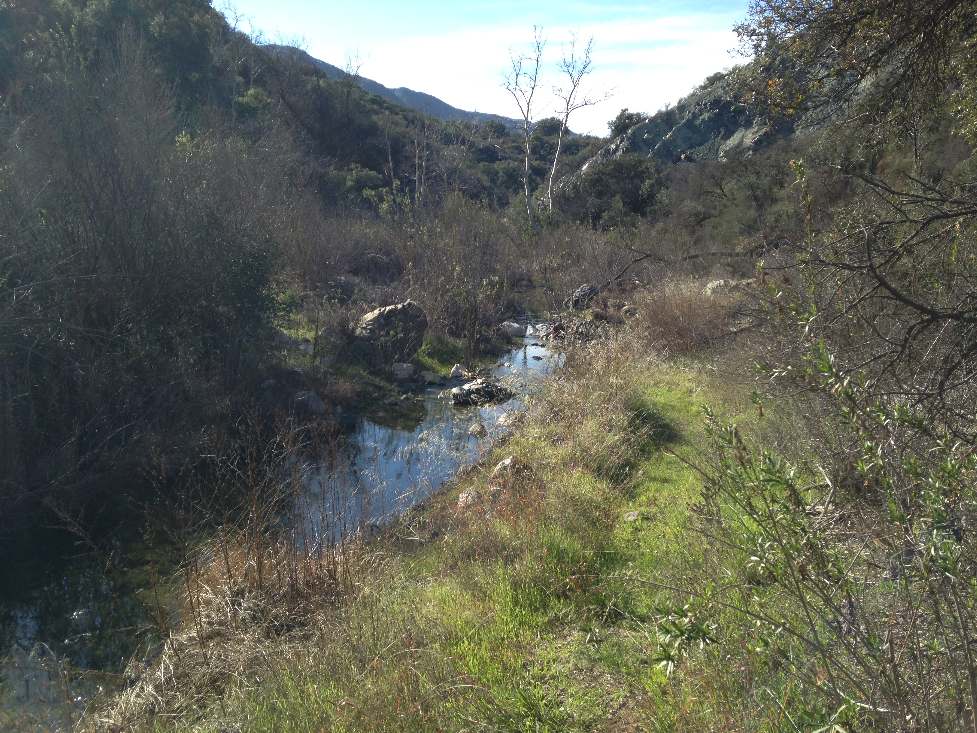
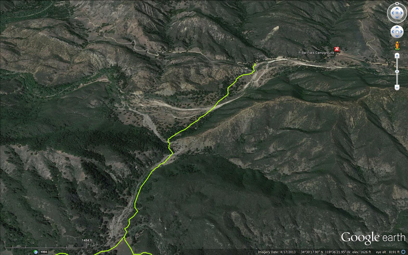
Blue Canyon gets its name from the blue-green serpentine formations found along its 5 mile length. The canyon runs directly along the Santa Ynez Fault. This is a relatively narrow canyon with several overnight camps along it and a stream that flows year round. Beyond Cottam Camp a number of options are available. You can walk to the car camps at P-Bar Flats and Mid-Santa Ynez, continue down the Santa Ynez River to the Mono Trail and Mono Debris Dam, or make your way up to Forbush Flat.
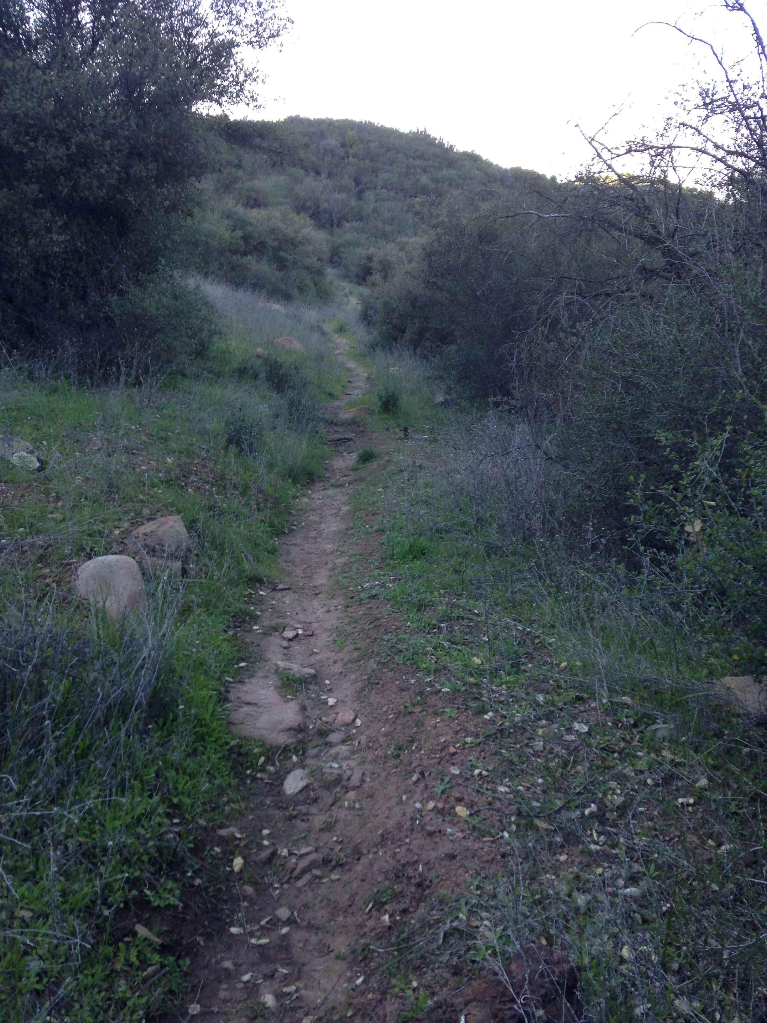
If only for a short hike to the first creek crossing, a mile downstream, Blue Canyon is as colorful as its name. The trail wanders along the right side of the canyon, with colorful rock outcroppings along the way. It then drops down into an equally colorful creekbed and meanders along the creek for a half mile to Upper Blue Canyon Camp, providing a place to stay for the night that isn’t too far from your car.
Though it is overgrown in places, the next 2.7 miles to Blue Canyon Camp are equally pretty. The canyon is narrow, the creek small but year round, and overhead alders, oaks and sycamore trees provide ample shading. Cottam Camp is a little more than a mile below Blue Canyon Camp. From there it is another mile further to the Santa Ynez River.
Probably the nicest thing about the Blue Canyon Trail is that it leads out into most of the upper river canyon. Below Cottam Camp you can cross the river and walk either to P-Bar Flats or Mid-Santa Ynez camp. A mile downstream you can reach the bottom of the Cold Springs Trail or cross the river and connect with the Mono Trail, which leads to Mono Camp. It’s also possible to take a connector trail up to Forbush Flats and hike from there up to the crest.
Ray Ford - http://www.sboutdoors.com/blue-canyon.html


 Blue Canyon Trail Survey - 02-28-2025 - by Rob Guzzon
| Link: | Blue Canyon Trail |
| Date: | 02-28-2025 |
| Surveyor Name: | Rob Guzzon |
| Trail description: | Backpacked out to Cottam. Blue Canyon trail from Forbush to Cottam is in pretty good shape, but could use a haircut. One member of the group went for a run east from Cottam and up Romero trail. Section of Blue Canyon trail east of Cottam is more overgrown than west of Cottam, and could use some work. |
| Mode of transport: | Hike |
| Trail condition: | Needs some work |
| Condition details: | Tread in decent shape, could use a haircut |
Blue Canyon Trail Survey - 12-27-2024 - by Zachary Caipang| Link: | Blue Canyon Trail |
| Date: | 12-27-2024 |
| Surveyor Name: | Zachary Caipang |
| Trail description: | We started off on the Cold Spring Trail going north from East Camino Cielo. After a steady mile and a half decline through a mixture of forested and chaparral trail, we hit the fork at Forbush Flat Camp, where we turned east to head down onto the Blue Canyon Trail towards Cottam Camp. The trail took us to overgrown switchbacks that scaled the side of a cliff until we eventually made it into the canyon floor. The stream bed appeared to be dry on our trek along the canyon floor. We only made it 2 miles along the Blue Canyon Trail until we hit an overgrown section of trail right before the Cottam Camp, which was heavily covered with poison oak. It was at this point when we decided to turn back and head back to East Camino Cielo. The temperatures for this hike were perfect as the mountains were shrouded with fog. This unfortunately covered up a lot of the spectacular views of the Santa Barbara backcountry. |
| Mode of transport: | Hike |
| Trail condition: | Needs some work |
| Condition details: | The trail was overgrown, especially on the approach to Cottam Camp, where we encountered poison oak. There's also sections of the switchbacks descending into Blue Canyon, where the trail is slightly blown out. |
| Images: | The view looking east after descending the switchbacks into Blue Canyon |
Blue Canyon Trail Survey - 06-10-2024 - by Henk Aling| Link: | Blue Canyon Trail |
| Date: | 06-10-2024 |
| Surveyor Name: | Henk Aling |
| Trail description: | I hiked Cold Springs Trailhead -> Forbush Flat -> Romero Trail -> Camino Cielo. The trail down to Forbush was fine. The hill descent down to Blue Canyon was sketchy. I brought my machete and started cutting down the overgrowth and it improved dramatically. I believe it is now as hikeable as it ever was, still a bit sketchy as usual of course. From there on the hike to Cottam Camp was fine - and beautiful too, with water everywhere! On to the Romero Trail I had some trouble with the last major creek crossing finding the trail but if you just assume it's across from where the trail enters the creek it's actually not that hard to find. I walked back on the road and got a hitchhike that saved me an hour's walk. Overall, the trail needs some light trimming but nothing structural. I could have done it but wanted to save my energy getting out of the hole around noon, which was exhausting enough. |
| Mode of transport: | Hike |
| Trail condition: | Needs some work |
| Condition details: | The trail could use some light trimming, descent to Blue Canyon improved. |
Blue Canyon Trail Survey - 05-26-2024 - by Piper| Link: | Blue Canyon Trail |
| Date: | 05-26-2024 |
| Surveyor Name: | Piper |
| Trail description: | The hill near the junction with Cold Spring and Forbush was in better condition than I expected after the heavy storms this winter. It had a few sketchy sections but was not too death-defying to walk up hill. Could be a little difficult going down hill. Definitely needs work to be safe. Only hiked between Forbush and Cottam so I can't say how the rest of the trail looks. |
| Mode of transport: | Hike |
| Trail condition: | Needs some work |
| Condition details: | The hill near the junction with Cold Spring and Forbush needs work |
Blue Canyon Trail Survey - 12-16-2023 - by EC DUZ IT| Link: | Blue Canyon Trail |
| Date: | 12-16-2023 |
| Surveyor Name: | EC DUZ IT |
| Trail description: | This report is for West Blue Canyon Trail only, from the Santa Ynez River to Forbush Camp. Trail is rough, but passable. Some of the creek crossings are confusing if you don't know the trail. Glad I was on foot, I would not want to ride this on my bike right now. Plenty of water flowing at Cottam Camp and in the SY River. Lots of deep ruts, washouts, etc. Trail needs drainage features and tread work. The steep switchback section (closer to Forbush) that we worked on in January 2018 held up pretty well though. |
| Mode of transport: | Hike |
| Trail condition: | Needs some work |
| Images: | |
Blue Canyon Trail Survey - 12-03-2022 - by Rick James| Link: | Blue Canyon Trail |
| Date: | 12-03-2022 |
| Surveyor Name: | Rick James |
| Trail description: | My first time riding east Blue Canyon since the Thomas Fire. The trail is a mixed bag right now. Fun chunk then some sketchy sections and some creek crossings. Still beautiful and rugged as it always has been/ It sure would be nice to build some small bridges to avoid dismounting at the small streams that have some pretty deep ruts. The trail between Blue Canyon Camp and Cottam Camp needs a lot of brushing and is currently being worked on. LPFA perhaps? |
| Mode of transport: | Bicycle |
| Trail condition: | Needs some work |
| Images: | The sketchy part Needs a small bridge? |
Blue Canyon Trail Survey - 06-24-2022 - by Paul Cronshaw| Link: | Blue Canyon Trail |
| Date: | 06-24-2022 |
| Surveyor Name: | Paul Cronshaw |
| Trail description: | Recent brushing has expanded the trail corridor from Blue Canyon Camp to Upper Blue Canyon Camp. Only water resource on this trail section between the two camps at Upper Blue Canyon Camp. |
| Mode of transport: | Hike |
| Trail condition: | Good shape and easy to follow |
| Images: | |
Blue Canyon Trail Survey - 05-18-2022 - by Paul Cronshaw| Link: | Blue Canyon Trail |
| Date: | 05-18-2022 |
| Surveyor Name: | Paul Cronshaw |
| Trail description: | The trail section from Cold Saddle to Forbush Camp is in excellent condition with good tread and no encroaching brush. Lots of wildflowers. The section from Forbush to Cottam Camps has OK tread through at the switchbacks with encroaching deerweed. The remaining section has encroaching poison oak and other plants;good tread. Needs some brushing. The section from Cottom to Blue Canyon Camps has mild to moderate encroaching brush;good tread. Needs brushing. There is a downed tree at the last creek crossing before the Blue Canyon/North Romero junction. Not stock passable. |
| Mode of transport: | Hike |
| Trail condition: | Needs some work |
| Condition details: | I hiked from Cold Springs Saddle to Blue Canyon and up North Romero Trail back to Cold Springs Saddle. |
| Images: | Downed tree before the Blue Canyon/North Romero Junction Switchback section with encroaching deerweed plants Trail section between Cottam and Blue Canyon Camps. |
Blue Canyon Trail Survey - 03-30-2022 - by Addison Jerlow| Link: | Blue Canyon Trail |
| Date: | 03-30-2022 |
| Surveyor Name: | Addison Jerlow |
| Trail description: | Easy to follow from Forbush to Cottam Camps but losing tread/sliding on the one exposed switchback section shortly after Forbush on the decent into Blue Canyon. |
| Mode of transport: | Hike |
| Trail condition: | Needs some work |
Blue Canyon Trail Survey - 05-15-2021 - by Los Padres Forest Association| Link: | Blue Canyon Trail |
| Date: | 05-15-2021 |
| Surveyor Name: | Los Padres Forest Association |
| Trail description: | LPFA spent quite a few weeks working the Blue Canyon Trail between March and May 2021. We started with some volunteer projects working out from Forbush, partnered with some scout troops to work the middle section, a school group to work out from Cottam and wrapped it up with two weeks of LPFA Trail Crew work coming in from the eastern saddle. We've got about 300 yards remaining to brush just east of the Romero Junction that we'll get to very soon. Stay tuned. This trail hasn't been this good in many many years. Enjoy..... https://www.instagram.com/p/CNDVzSGl4t-/ |
| Mode of transport: | Array |
| Trail condition: | Needs some work |
Blue Canyon Trail Survey - 02-22-2020 - by Jasonn Beckstrand| Link: | Blue Canyon Trail |
| Date: | 02-22-2020 |
| Surveyor Name: | Jasonn Beckstrand |
| Trail description: | Troop 26 was out working the trail between Blue Canyon Camp and Cottam Camp. 1/2 mile section of trail work was completed. The is 1/2 mile of work needed from where we brushed to Cottam Camp.  And there is also some light brushing from where we worked to Blue Canyon Camp. From Blue Canyon Camp to the trail head to the east. There has not been any brushing done. Just logging out of down trees. |
| Mode of transport: | Hike |
| Trail condition: | Needs some work |
| Condition details: | Troop 26 work between Blue Canyon and Cottam camps |
| Images: | Trail Maintenance Complete work Scrub Oak Brushing |
Blue Canyon Trail Survey - 02-09-2020 - by Anonymous Surveyor| Link: | Blue Canyon Trail |
| Date: | 02-09-2020 |
| Surveyor Name: | Anonymous Surveyor |
| Trail description: | Hiked this section this weekend and camped at Blur Canyon. At Cottom, ticks were out in force and once got all the way thru my girlfriends clothes, and many got on our dog. To Blue Canyon Camp from Cottom was more overgrown, and Blue Canyon had ticks, but not as much as Cottom. River flowing, although low - easily accessible from Blue Canyon Camp |
| Mode of transport: | Hike |
| Trail condition: | Needs some work |
| Condition details: | Overgrown from Cottom to Blue Canyon |
Blue Canyon Trail Survey - 02-01-2020 - by Rob Guzzon| Link: | Blue Canyon Trail |
| Date: | 02-01-2020 |
| Surveyor Name: | Rob Guzzon |
| Trail description: | Ran the entire Blue Canyon trail from Forbush to Romero Camuesa. It was beautiful with lots of new grass growth and water throughout. Overall the trail needs some work. Forbush -> Cottam: trail was in pretty good condition and easy to follow. Some poison oak, but manageable. Cottam -> Blue Canyon: more overgrown but still fairly easy to follow. Blue Canyon -> Romero Camuesa: Immediately after the junction with the Romero singletrack, we lost the trail and ended up following the creek, rejoining the trail shortly (maybe a 10th of a mile later). We lost the trail on another 2 occasions, at creek crossings, but were able to regain it without too much trouble. Much of this section is very overgrown, and there are some sections of trail that need shoring up. |
| Mode of transport: | Array |
| Trail condition: | Needs some work |
| Condition details: | Brushing needed throughout, especially east of Blue Canyon camp. The same section needs some more extensive trail work due to washouts. |
| Images: | Near Cottam camp Lost the trail near the junction with the Romero singletrack Better section east of Blue Canyon Between Cottam and Blue Canyon Overgrown section east of Blue Canyon |
Blue Canyon Trail Survey - 08-03-2019 - by Stephen S| Link: | Blue Canyon Trail |
| Date: | 08-03-2019 |
| Surveyor Name: | Stephen S |
| Trail description: | We hiked the full length of Blue Canyon Trail from Forbush Flat and it could definitely use some work with some sections being hard to follow and/or non existent. Forbush -> Cottam: Needs some work, but was fairly easy to follow. Quite a bit of Poison Oak about mid way to Cottam. Cottam -> Blue Canyon: Brushy with some downed trees/branches in the way. We cleared some small stuff that our hand saw could take care of. Found our first water approaching Blue Canyon Camp. Blue Canyon -> Upper Blue Canyon: Hard to follow/Non existent... Maybe we missed the trail somewhere after Romero Canyon junction, but we just followed the creek after losing what we thought to be the trail. Ended up connecting back up with the trail after where Upper Blue Canyon camp would have been and didn't go back to try and find it. Upper Blue Canyon -> Blue Canyon Saddle: Pretty brushy and a section that was a bit washed out. |
| Mode of transport: | Hike |
| Trail condition: | Hard to follow |
Blue Canyon Trail Survey - 06-03-2019 - by Anonymous Surveyor| Link: | Blue Canyon Trail |
| Date: | 06-03-2019 |
| Surveyor Name: | Anonymous Surveyor |
| Trail description: | Rode from Camino Cielo to Forebush to Cottam. Brushy and lots of PO. Still lots of flowing water at Cottam. A few spots would be hard to follow if you didnt know the route already. |
| Mode of transport: | Bicycle |
| Trail condition: | Needs some work |
Blue Canyon Trail Survey - 04-19-2019 - by Los Padres Forest Association| Link: | Blue Canyon Trail |
| Date: | 04-19-2019 |
| Surveyor Name: | Los Padres Forest Association |
| Trail description: | Recent trail report shared with the LPFA from a mountain biker who did the Romero - Blue Canyon - Cold Spring loop: I dropped in from North Romero and then took a left towards Cottam
camp. North Romero is very rutted and fairly overgrown, but passable.Â
Blue Canyon trail to Cottam camp is fairly over grown as well, but
rideable. There was one downed tree aND Lots of PO as you can imagine. Very lush as well, water still
flowing in the river both in Blue Canyon and at Cottam camp. Bugs are
also starting to come out, which is to be expected.  Now
the trail from Cottam camp to Forbush is in really bad shape. It appears several horses came down it
when the trail was very wet and basically destroyed the trail. They
left huge holes in the trail that have now dried and make the trail
extremely difficult to ride and or hike on. We had to push our bikes up
most of the last 1/2 mile to Forbush. This is the third time that
I have come across this type of damage in the back country. It is
really a shame that people don't have the knowledge, or care to ride on
these trails when they are wet and can be damaged so easily. I am not
sure what the solution to this problem is other then better eduction. The trail from Forbush to East Camino Cielo is awesome, kudos to whoever has been maintaining it.  |
| Mode of transport: | Bicycle |
| Trail condition: | Needs some work |
Blue Canyon Trail Survey - 11-10-2018 - by Paul Cronshaw| Link: | Blue Canyon Trail |
| Date: | 11-10-2018 |
| Surveyor Name: | Paul Cronshaw |
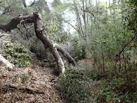
| Trail description: | Parked at the closed gate at Romero Saddle and hiked East Camino Cielo road down to the intersection with the North Romero Trail, Steep descent to junction of the Blue Canyon Trail. Hiked up stream to the trailhead at Blue Canyon Saddle and back to Forbush trail junction. The Blue Canyon Creek is dry. Some standing pools of water after the campsite that is located about 1/4 mile past Cottam towards Forbush. The access point is identified where the creek is 10 feet from trail and a large oak. Trail is in better condition than I had anticipated. There are brushy sections that need to be cleared out. Some of the creek crossings are confusing but I flagged both sides of the crossings.  There are two downed trees along this section of trail, both can be seen in the photo section uploaded by the person who has a bike in the photos. |
| Mode of transport: | Hike |
| Trail condition: | Needs some work |
| Images: | Dry Blue Canyon Creek Tree Hugging New Trail sign at Blue Canyon Saddle Pickup sticks Camping at Cottam |
Blue Canyon Trail Survey - 10-13-2018 - by Jonathan Rocque| Link: | Blue Canyon Trail |
| Date: | 10-13-2018 |
| Surveyor Name: | Jonathan Rocque |
| Trail description: | This is a fun trail and needs some work between Cottam and Blue Canyon Camp and even more work between Blue Canyon Camp and Upper Blue Canyon Camp. The trail is a bit difficult to pick up on the other side of some creek crossings due to overgrown foliage. There are also several obstructions due to fallen trees and rocks. Where long pants as there are a lot of super sharp plants in the path. |
| Mode of transport: | Hike |
| Trail condition: | Needs some work |
| Images: | Overgrown |
Blue Canyon Trail Survey - 02-5-2018 - by Los Padres Forest Association| Link: | Blue Canyon Trail |
| Date: | 02-5-2018 |
| Surveyor Name: | Los Padres Forest Association |
| Trail description: | Blue Canyon Trail has a large slide near the junction with Forbush/Cold Spring Trail. Upper Blue Canyon from Cottam to Romero has sustained some damage as a result of the Thomas Fire floods. The upper portion of Blue Canyon drainage burned and the January 9 flooding carried much debris down the canyon and across sections of trail. It is passable but expect some route finding. |
| Mode of transport: | Bicycle |
| Trail condition: | Needs some work |
| Images: | |
Blue Canyon Trail Survey - 09-11-2017 - by Jared Bresee| Link: | Blue Canyon Trail |
| Date: | 09-11-2017 |
| Surveyor Name: | Jared Bresee |
| Trail description: | Overgrown in places with stickerbrush and poison oak, wear pants. |
| Mode of transport: | Hike |
| Trail condition: | Good shape and easy to follow |
Blue Canyon Trail Survey - 07-04-2017 - by Anonymous Surveyor| Link: | Blue Canyon Trail |
| Date: | 07-04-2017 |
| Surveyor Name: | Anonymous Surveyor |
| Trail description: | Started on the trail at cold spring saddle, lots of poison oak but the trail was in good shape until the switch backs further down in the canyon. Both forebush flats and cottam campgrounds were in good shape but no water in the creeks until blue canyon campground. There's a tree down across the trail between cottam and blue canyon campgrounds but it was easy to get over. We hiked out the Romero trail, very steep but easy to follow with great views. |
| Mode of transport: | Hike |
| Trail condition: | Needs some work |
| Condition details: | Tree down over the trail between cottam and blue canyon campsites, also lots of poison oak covering the trail on the north west end |
Blue Canyon Trail Survey - 06-19-2017 - by Anonymous Surveyor| Link: | Blue Canyon Trail |
| Date: | 06-19-2017 |
| Surveyor Name: | Anonymous Surveyor |
| Trail description: | The trail down from Forbush to Blue Canyon was eroding in some areas making it difficult to traverse down the switchbacks into the canyon. |
| Mode of transport: | Hike |
| Trail condition: | Needs some work |
| Condition details: | Blue Canyon from Forbush |
Blue Canyon Trail Survey - 06-10-2017 - by Seedubyuh| Link: | Blue Canyon Trail |
| Date: | 06-10-2017 |
| Surveyor Name: | Seedubyuh |
| Trail description: | The section from Forbush Camp to Cottam Camp is in "lightly traveled" condition. The trail is largely overgrown, putting you in close proximity to Poison Oak and thistles. Some sections of the trail are eroded, particularly as you initially descend from Forbush Camp into the canyon. Â Â |
| Mode of transport: | Hike |
| Trail condition: | Needs some work |
Blue Canyon Trail Survey - 03-08-2017 - by Los Padres Forest Association| Link: | Blue Canyon Trail |
| Date: | 03-08-2017 |
| Surveyor Name: | Los Padres Forest Association |
| Trail description: | George Williams ran all of Blue Canyon (from Romero-Juncal to Romero-Camuesa, or whatever those roads are called). Basically passable, but with a couple of low priority things that could be improved. |
| Mode of transport: | Array |
| Trail condition: | Needs some work |
| Images: | Upper Blue Canyon The old landslide got worse and is undercutting the trail bed a little. N34.4914927, W119.5846066 Upper Blue At a stream crossing, a tree has fallen across the trail, took me a while to figure out where the trail had been (but getting around it was easy once I did that) N34.4916616,W119.5907165 Blue between Romero and Cottam Large tree across trail, well defined path around tree N34.4938072,W119.6055800 Blue between Romero and Cottam debris on trail, not really an issue except it is immediately followed by a downed tree (next shot) N34.4948203,W119.6084772 Blue between Romero and Cottam immediately after previous shot N34.4948203, W119.6084772 |
Blue Canyon Trail Survey - 02-25-2017 - by Veronique Lisi| Link: | Blue Canyon Trail |
| Date: | 02-25-2017 |
| Surveyor Name: | Veronique Lisi |
| Trail description: | The switchbacks right after forbush camp have slided and the trail is no longer passable at this place: 34.496963, -119.634166 |
| Mode of transport: | Hike |
| Trail condition: | Needs some work |
| Images: | Slided trail, unsafe to cross if at all possible View of the switchbacks from the top |
Blue Canyon Trail Survey - 03-25-2016 - by Los Padres Forest Association| Link: | Blue Canyon Trail |
| Date: | 03-25-2016 |
| Surveyor Name: | Los Padres Forest Association |
| Trail description: | Recent blog post from ValHikes, well worth the read for anyone heading into Blue Canyon. Â Actually, well worth the read for anyone: http://valhikes.blogspot.com/2016/03/blue-canyon.html?utm_source=feedburner&utm_medium=email&utm_campaign=Feed%3A+MomentsInDirtAndInk+%28Moments+in+Dirt+and+Ink%29 |
| Mode of transport: | Hike |
| Trail condition: | Good shape and easy to follow |
Blue Canyon Trail Survey - 02-26-2016 - by Los Padres Forest Association| Link: | Blue Canyon Trail |
| Date: | 02-26-2016 |
| Surveyor Name: | Los Padres Forest Association |
| Trail description: | VWR sawyer crew removed all downed trees along the Blue Canyon Trail between Escondido Trailhead and Cottam Camp. Â See photos for specifics. |
| Mode of transport: | Array |
| Trail condition: | Good shape and easy to follow |
| Images: | BEFORE AFTER BEFORE AFTER |
Blue Canyon Trail Survey - 01-23-2016 - by Los Padres Forest Association| Link: | Blue Canyon Trail |
| Date: | 01-23-2016 |
| Surveyor Name: | Los Padres Forest Association |
| Trail description: | Recent Noozhawk article by Dan McCaslin about a hike down into Blue Canyon and beyond. Â Worth a read if you are looking to explore the area: http://www.noozhawk.com/homes_lifestyle/article/dan_mccaslin_upper_santa_ynez_river_via_blue_cottam_camps |
| Mode of transport: | Hike |
| Trail condition: | Needs some work |
Blue Canyon Trail Survey - 02-14-2015 - by Paul Cronshaw| Link: | Blue Canyon Trail |
| Date: | 02-14-2015 |
| Surveyor Name: | Paul Cronshaw |
| Trail description: | Except for the two downed trees, the trail corridor from the Blue Canyon Trailhead to Cottam Camp is in good condition.  I restored the tread on a few small slides.  There is flowing water at all the creek crossings.  Contrary to a previous survey there were no ticks. |
| Mode of transport: | Hike |
| Trail condition: | Needs some work |
| Condition details: | Two downed trees need to be removed |
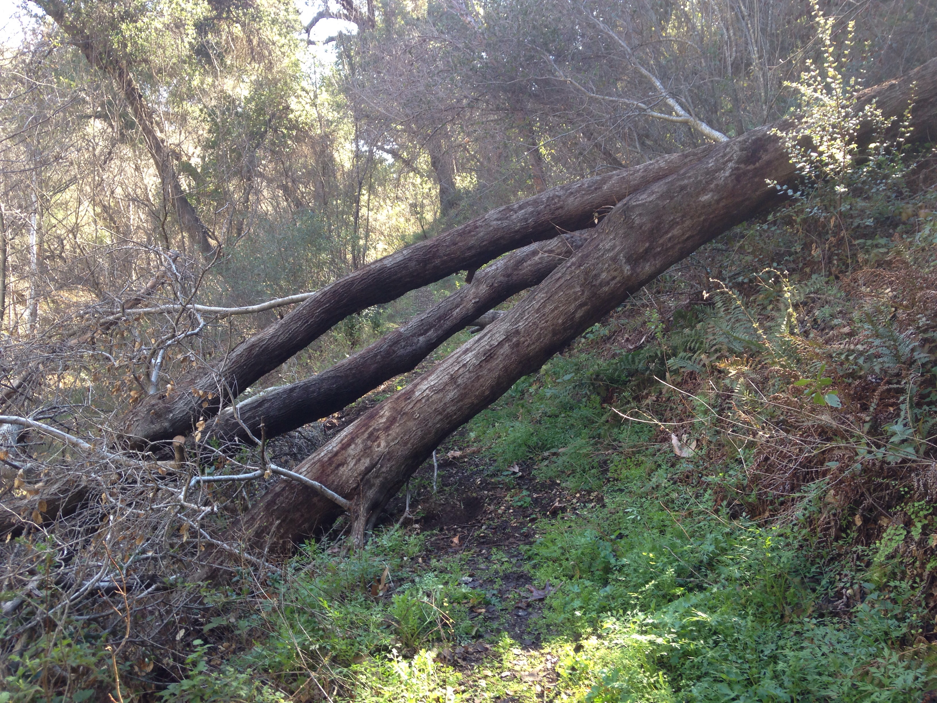
| Images: | This is the largest downed tree located about 1/2 mile before Upper Blue Canyon Camp Second downed tree located 1/2 mike before Blue Canyon Camp Water in the Blue Canyon Creek Section of trail before Cottam Camp |
Blue Canyon Trail Survey - 01-07-2015 - by FP| Link: | Blue Canyon Trail |
| Date: | 01-07-2015 |
| Surveyor Name: | FP |
| Trail description: | Trail is in good condition. Beautiful old trees along the creek with water running right now. But ticks are a BIG problem. I pulled out 8 from various spots on my body (some of which I will let you guess...). This trail might be a better option when the soil is not damp. |
| Mode of transport: | Hike |
| Trail condition: | Good shape and easy to follow |
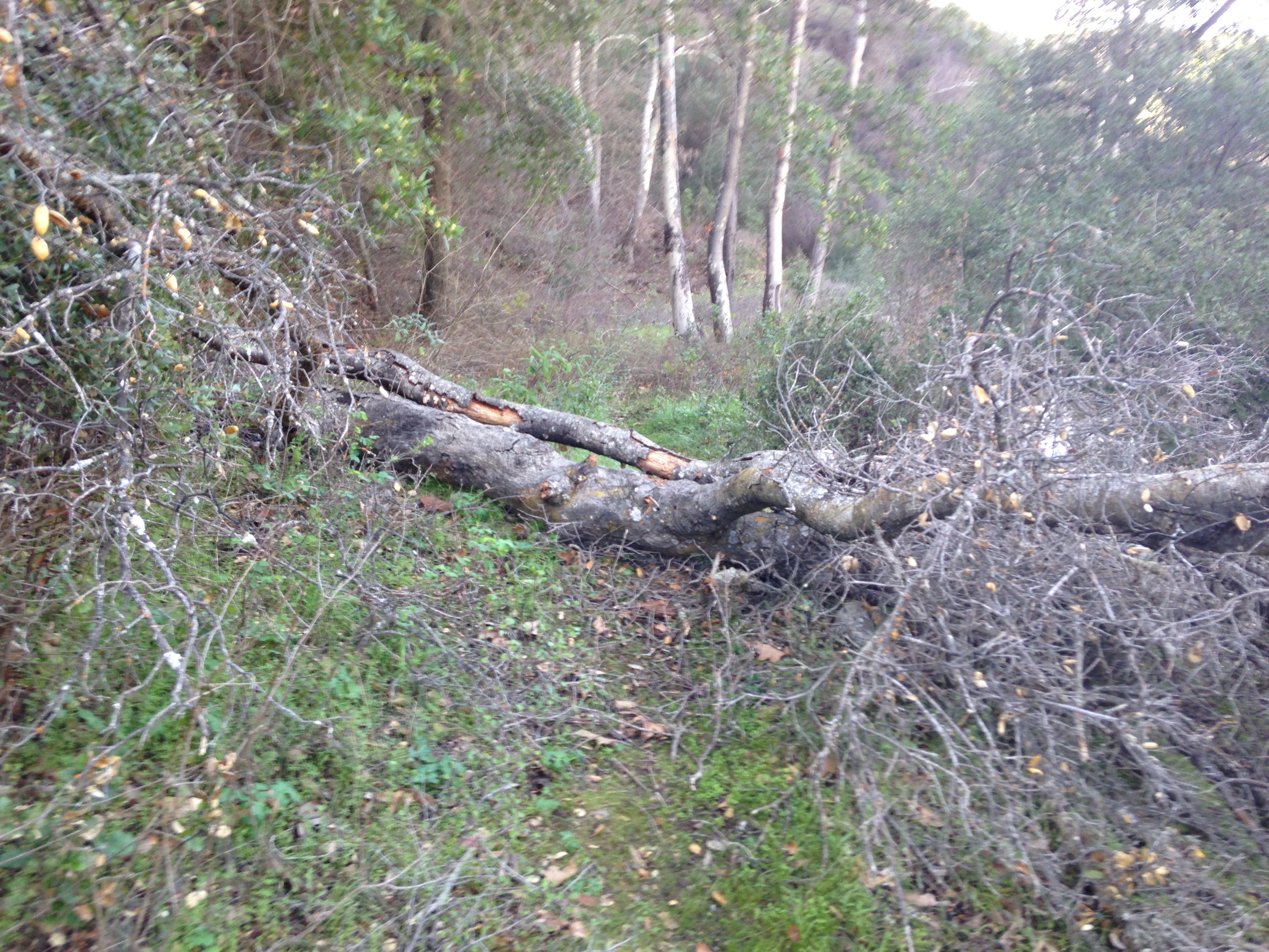
Blue Canyon Trail Survey - 03-09-2014 - by Bryan Conant| Link: | Blue Canyon Trail |
| Date: | 03-09-2014 |
| Surveyor Name: | Bryan Conant |
| Trail description: | Large downed tree along Blue Canyon. |
| Mode of transport: | Hike |
| Trail condition: | Needs some work |
| Number of trees down: | 1 |
| Images: | |
 Survey / Report Form - Please click this box to open the form.