 Use Marker Groups
 Wolf 2002
Piru 2003
Day 2006
Zaca 2007
Gap 2008
La Brea 2009

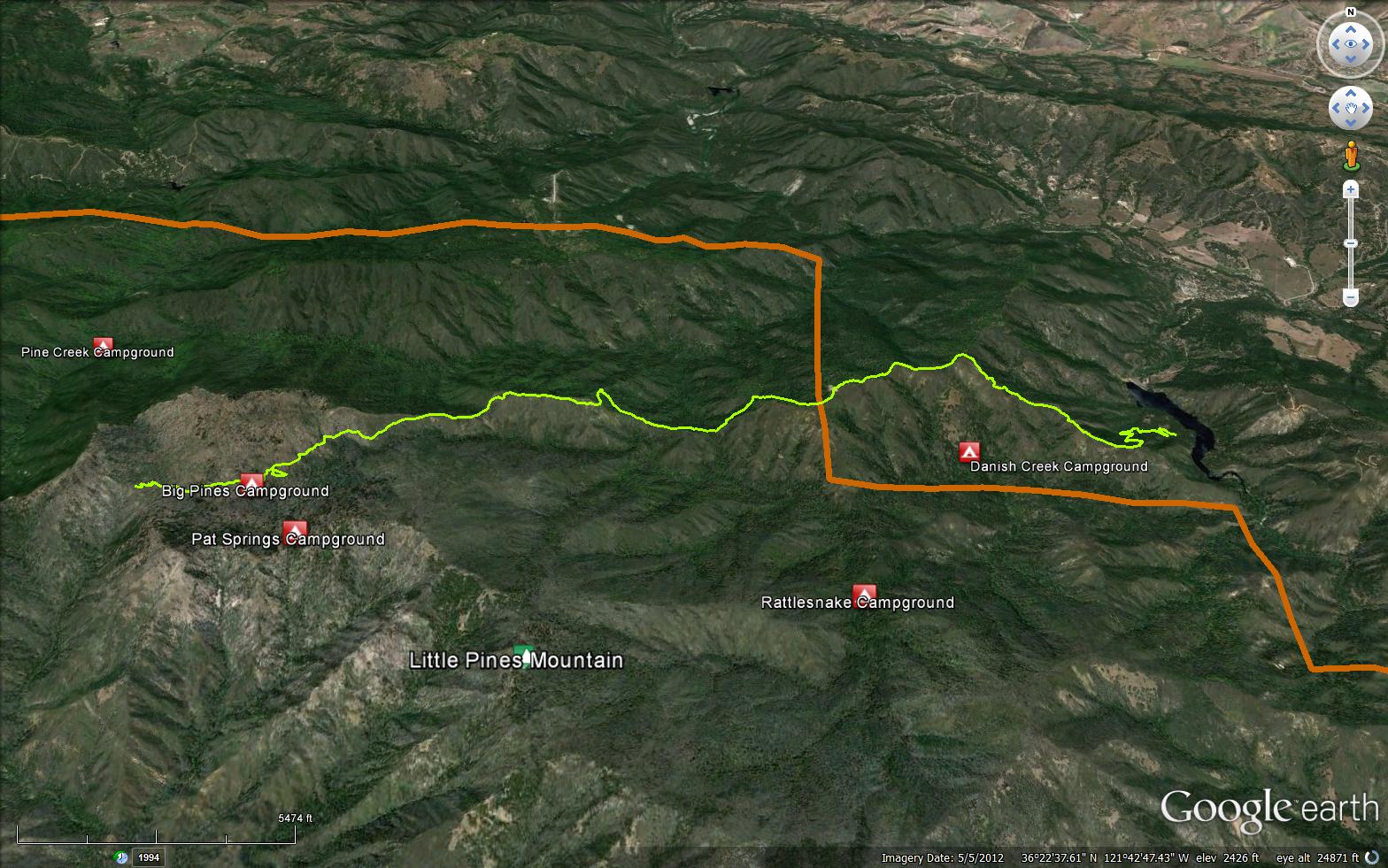
The Big Pine Trail is a scenic 7.60 mile trail in the Ventana Wilderness in Monterey County . The trail connects the Skinner Ridge Trail (1E04) and the Carmel River Trail (3E03). Please let us know if you have explored this trail recently.


 Big Pine Trail Survey - 07-07-2021 - by Andy L
| Link: | Big Pine Trail |
| Date: | 07-07-2021 |
| Surveyor Name: | Andy L |
| Trail description: | We hiked the Big Pine Trail from Los Padres Reservoir to the upper headwaters of the Danish Creek on 7/2/21. Water still flowing pretty strong in Danish Creek, even at the Big Pine Trail's upper terminus. Some sections of this trail have largely disappeared, including many steep inclines and declines on the side of mountains. We would've gotten lost had it not been for CalTopo and GPS. Much of the trail is overgrown with thick, spiny shrubs and trees. Towards the end of the trail, one must be prepared to wade through very scratchy vegetation, including poison oak, in order to find the path. No clear intersection of trail with Danish Creek. Feel free to email me if you have any questions. |
| Mode of transport: | Hike |
| Trail condition: | Hard to follow |
| Condition details: | Very Challenging Trail // Trail Non-Existent In Sections |
Big Pine Trail Survey - 12-30-2015 - by Anonymous Surveyor| Link: | Big Pine Trail |
| Date: | 12-30-2015 |
| Surveyor Name: | Anonymous Surveyor |
| Trail description: | Trail is very overgrown – pants a must; should also wear gators and longs sleeve shirt. Water only available at the top. Great views all the way up. The trail disappears for a small section - stay on top of the ridge and it'll be easy to spot again. Good amount of snow and ice near Pat Spring. |
| Mode of transport: | Hike |
| Trail condition: | Hard to follow |
| Condition details: | Trail is very overgrown and can disappear from your feet if you're not careful |
| Images: | |
 Survey / Report Form - Please click this box to open the form.