 Use Marker Groups
 Wolf 2002
Piru 2003
Day 2006
Zaca 2007
Gap 2008
La Brea 2009

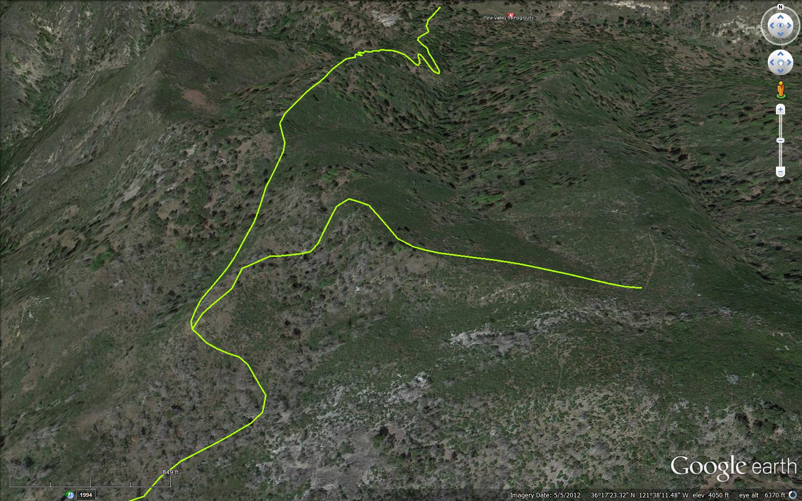
A very short .5 mile connector trail in the Ventana Wilderness. The trail connects Bear Basin Trail (3E11) and the Pine Ridge Trail (3E06).
 Bear Basin Connector Trail Survey - 03-27-2021 - by Clint Baechle
| Link: | Bear Basin Connector Trail |
| Date: | 03-27-2021 |
| Surveyor Name: | Clint Baechle |
| Trail description: | Brush encroaching on trail, heavily in some places, some downfall trees to climb over and a few places to crawl beneath the thick brush. |
| Mode of transport: | Hike |
| Trail condition: | Needs some work |
Bear Basin Connector Trail Survey - 05-25-2020 - by Willie Adams| Link: | Bear Basin Connector Trail |
| Date: | 05-25-2020 |
| Surveyor Name: | Willie Adams |
| Trail description: | |
| Mode of transport: | Hike |
| Trail condition: | Needs some work |
| Condition details: | Very bushy, with multiple downed trees. A challenge to get from the Pine Ridge trail down to pine valley |
Bear Basin Connector Trail Survey - 01-07-2015 - by matthew mcgurk| Link: | Bear Basin Connector Trail |
| Date: | 01-07-2015 |
| Surveyor Name: | matthew mcgurk |
| Trail description: | Other than trees down with use trails being established this is a well clear trail with defined tread |
| Mode of transport: | Hike |
| Trail condition: | Good shape and easy to follow |
 Survey / Report Form - Please click this box to open the form.