 Use Marker Groups
 Wolf 2002
Piru 2003
Day 2006
Zaca 2007
Gap 2008
La Brea 2009

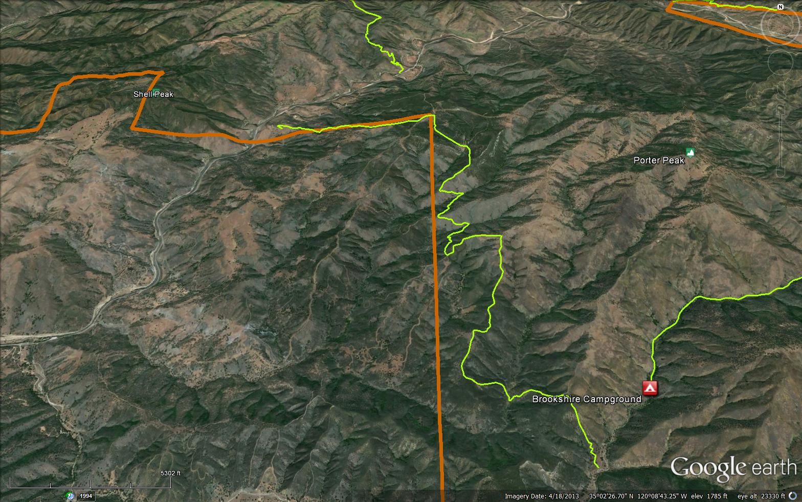
The Willow Spring Trail is a scenic 8.45 mile trail in Northern Santa Barbara County. The trail connects Highway 166 to Pine Canyon Road near Brookshire Campground.
Please let us know if you have explored this trail recently.


 Willow Spring Trail Survey - 07-04-2024 - by Zachary Caipang
| Link: | Willow Spring Trail |
| Date: | 07-04-2024 |
| Surveyor Name: | Zachary Caipang |
| Trail description: | I started this hike the morning of f July 4 at 0700. The trail consists of constant switchbacks all the way to the top of the ridge. The whole way was overgrown with tall grass but not much else. Any poison oak I saw was well off the side of the trail. I would suggest wearing pants when doing this trail because of all the tall grass and I was constantly pulling stickers out of my clothing. The trail is decently shaded due to the oak groves you hike through, but I would still suggest starting this hike early because this area can get pretty hot. The views were awesome throughout the hike as you get cool views of the 166 and the Cuyama Valley to the northeast. |
| Mode of transport: | Hike |
| Trail condition: | Good shape and easy to follow |
| Images: | Views of the mountains to the northeast while climbing Hiking through the tall grass and oak groves |
Willow Spring Trail Survey - 09-04-2022 - by P A| Link: | Willow Spring Trail |
| Date: | 09-04-2022 |
| Surveyor Name: | P A |
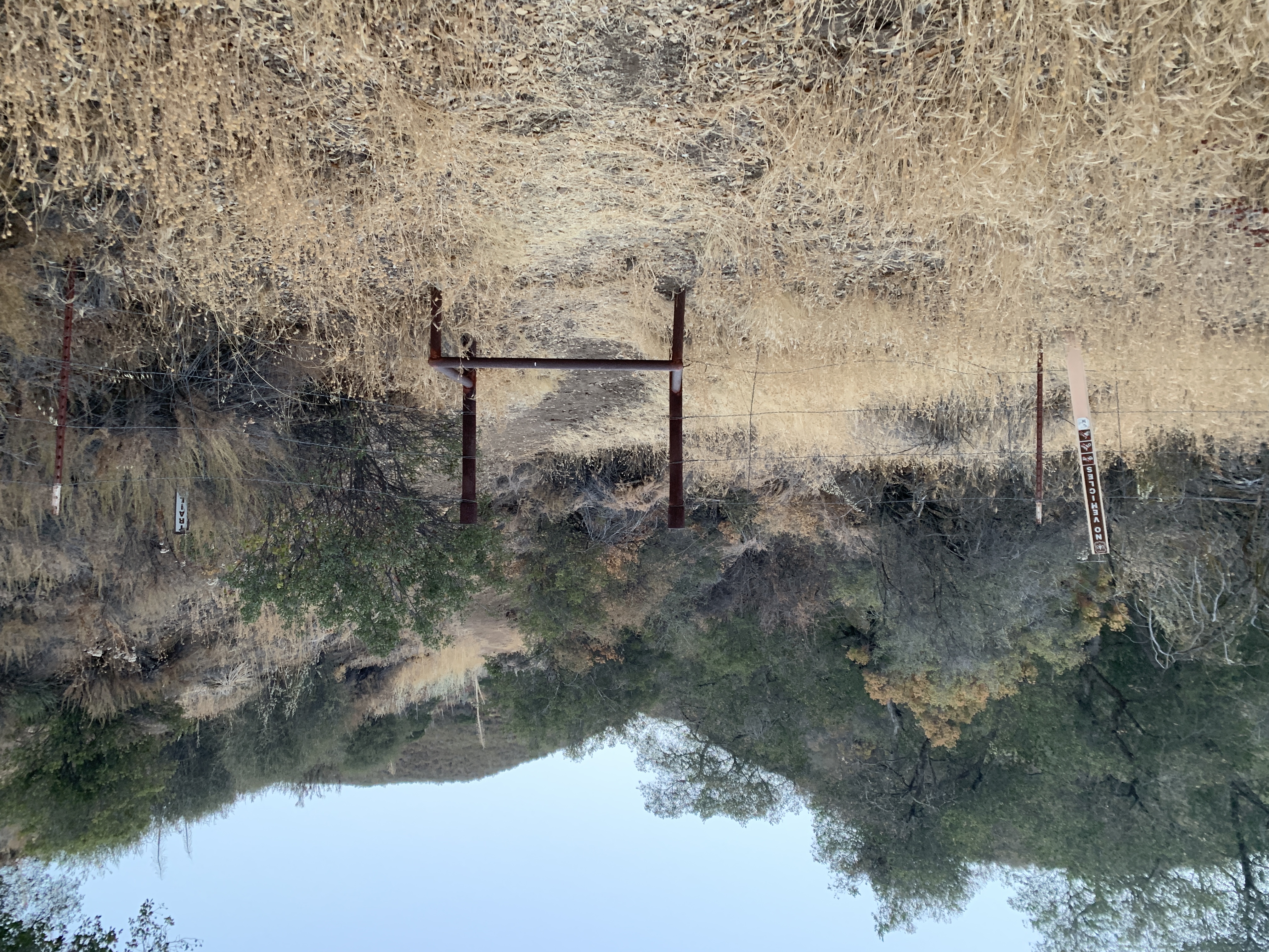
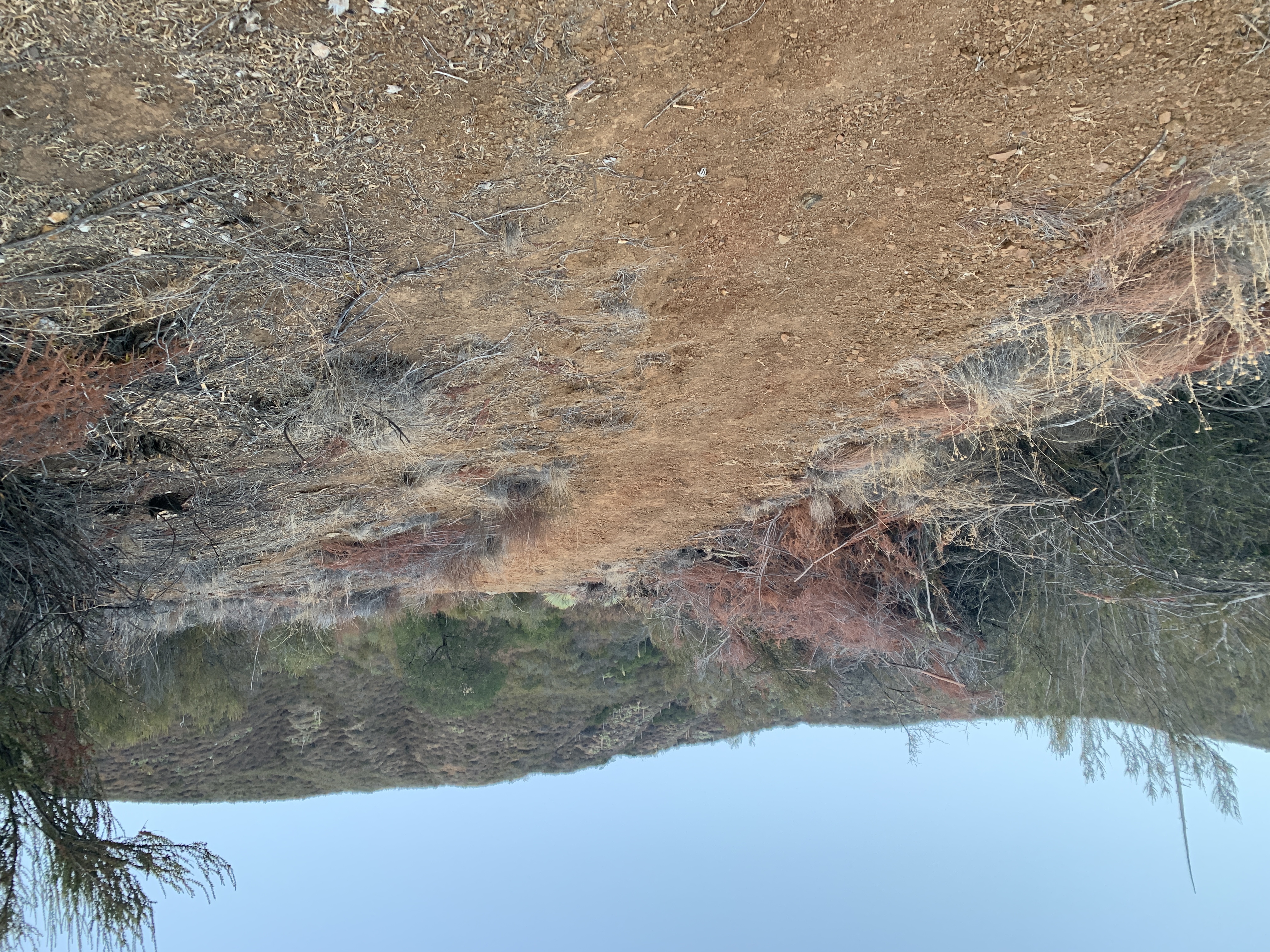
| Trail description: | Revisited the trail from the east end. Before this trip, I had sought permission from the LPFA (Los Padres Forest Association) to do some trimming and received an OK. I had my lopper and pruner in hand. The very first part of the trail is widely cleared. That had been done by someone prior to my visit in August. But quickly, at perhaps 1/3 or 1/4 mile in, it becomes quite overgrown, as pictured. All photos were taken about .3 to .7 miles in, roughly and of the trail. Look hard and you can maybe see it through the overgrowth. Note that as pictured, in the GPX route shown and available on the website, the section with a yellow X on it does not exist. I'm not sure if this is a mapping error or if Mother Nature reclaimed it. The red line shows the passable path. I spent about 3 hours hacking away at the worst of it in the 1st mile, but, you can hardly tell I was there. lol. The trail still needs some TLC. |
| Mode of transport: | Hike |
| Trail condition: | Hard to follow |
| Condition details: | Still overgrown. But I made it a little better. |
| Images: | Section with yellow X does not exist. Red line shows route I had to hike. Such growth. Growth. Believe it or not, there's the trail under there. Wear long sleeves and long pants. |
Willow Spring Trail Survey - 08-06-2022 - by P A| Link: | Willow Spring Trail |
| Date: | 08-06-2022 |
| Surveyor Name: | P A |
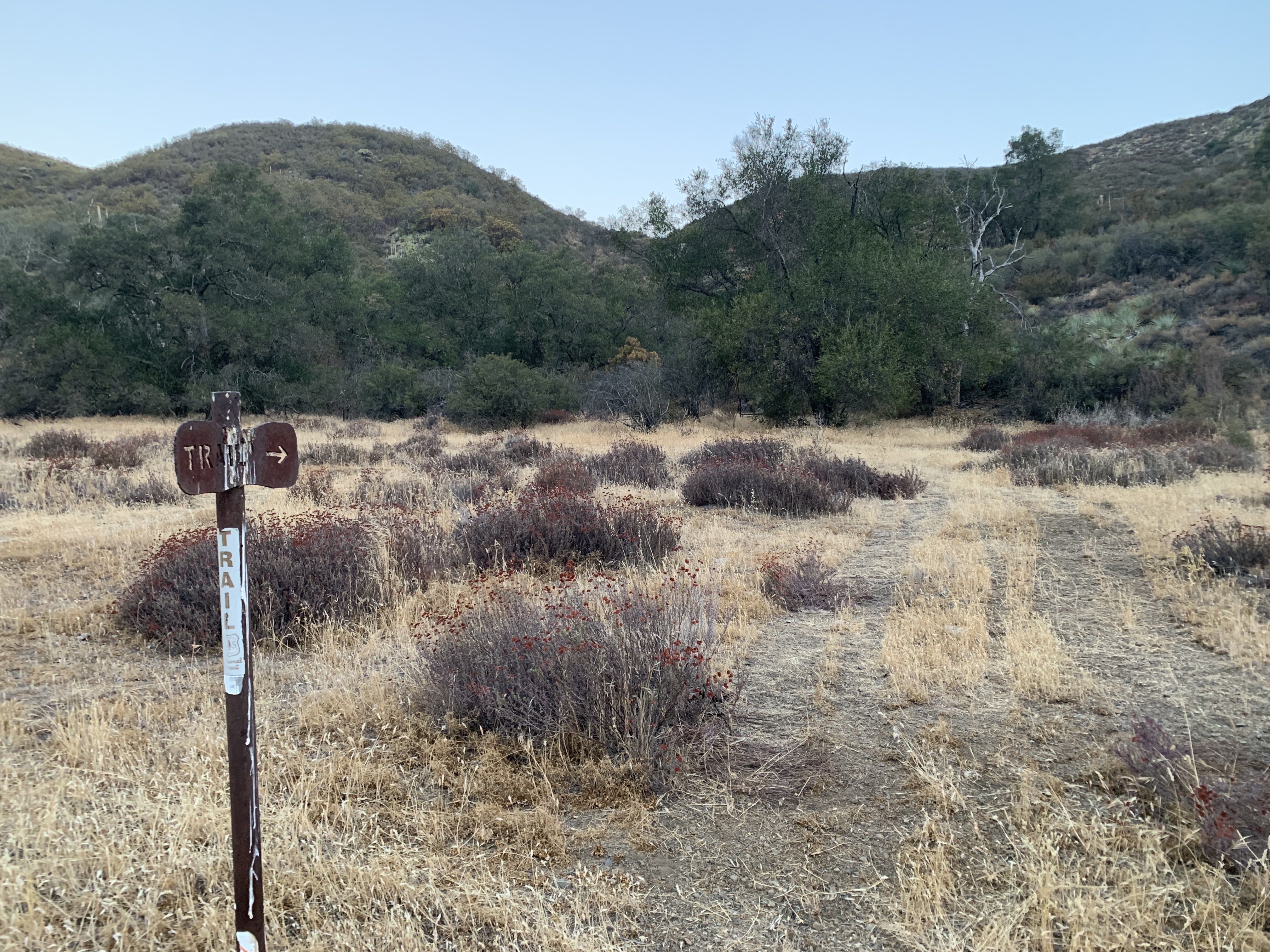
| Trail description: | I hiked west from Pine Springs Road near the Brookshire Campground. The trailhead is somewhat hard to find, as there's no signs other than a small "TRAIL" sign. There was a temporary wire corral setup. The trail at the beginning was OK, but it quickly transitioned to being very overgrown. Unless I completely missed a way to go straight, the track shown is plain old wrong for a section. Some parts are extremely overgrown. Not until you reach the main fireroads does it get better. I spent a lot of time trying to hunt down which way the trail went and then bushwhacking my way through.. Next time I will bring a machete.. (j/k). More like a pruner. I only ended up going in a little over 2.5 miles. |
| Mode of transport: | Hike |
| Trail condition: | Hard to follow |
| Condition details: | OK at the very beginning. Then, poor signage, overgrown. |
Willow Spring Trail Survey - 03-20-2021 - by Spazimal| Link: | Willow Spring Trail |
| Date: | 03-20-2021 |
| Surveyor Name: | Spazimal |
| Trail description: | Correction: trails leaving Willow Spring head northeast and southeast. I'm a big dope and said west in error, because I put my left shoe on my right foot. |
| Mode of transport: | Hike |
| Trail condition: | Good shape and easy to follow |
Willow Spring Trail Survey - 03-20-2021 - by Spazimal| Link: | Willow Spring Trail |
| Date: | 03-20-2021 |
| Surveyor Name: | Spazimal |
| Trail description: | Hiked to Willow Spring then northwest on 31W16 on the forest service map.The trail from the trailhead on 166 to Willow Spring is mostly very easy to follow. There are a few places where it gets a little faint so you may need a map to find the spring. The spring was flowing at a trickle. The water trough was empty as the feed pipe is broken.Tried to follow what is left of the Willow Spring trail (according to the NF map) to the southwest. This was some bushwhacking that got worse as the trail traces became more faint. Turned back at the first ridge. The trail to the northwest from the spring (31W16) was much more clear, but faint trails head off in many directions. At the ridge above the spring this trail joins a dirt "road" offering a nice ramble among oaks. Turned back when we could see a corral and a junction with Old Sierra Madre Road. Approximately 4.8 miles one way. |
| Mode of transport: | Hike |
| Trail condition: | Good shape and easy to follow |
Willow Spring Trail Survey - 10-20-2019 - by Donny/SAPPER Cedear (service dog)| Link: | Willow Spring Trail |
| Date: | 10-20-2019 |
| Surveyor Name: | Donny/SAPPER Cedear (service dog) |
| Trail description: | We didn't hike the whole thing but are planning on it. Trail was easy to follow and I liked the easy incline climb. I am a beginner hiker, so I am trying to get my cardio up to go further, my plan was to make it to willow springs but I think I started to late in the day. Me and my battle buddy didn't start till 100. I am planning on doing this again soon. I am a disabled veteran with PTSD so getting out helps me to kind of get away from it all just me and my battle. I will be working this trail for a couple of weeks. I might even make it a couple of days and just trail camp. If anyone has some good ideas for me I would like to here. The trail was easy to follow just a lot of horse crap but no big deal. Â |
| Mode of transport: | Hike |
| Trail condition: | Good shape and easy to follow |
Willow Spring Trail Survey - 10-14-2017 - by Nate| Link: | Willow Spring Trail |
| Date: | 10-14-2017 |
| Surveyor Name: | Nate |
| Trail description: | I have reviewed this trail before, and the trail is still in decent repair except for all the cow patties you will have to dodge. Willow Spring however is pretty dry. It is pretty much a mud puddle at this point. The cow trough has no water in it, and we were forced to turn around do to the water issue. |
| Mode of transport: | Hike |
| Trail condition: | Good shape and easy to follow |
Willow Spring Trail Survey - 05-28-2017 - by Mike Maki| Link: | Willow Spring Trail |
| Date: | 05-28-2017 |
| Surveyor Name: | Mike Maki |
| Trail description: | Use the data files at http://www.condortrail.com/maps.html and you get through this relatively easy. This was the last day of a four day Condor Trail section hike and I had concerns. I had spent much of the previous three days doing some cross country with some difficulty and knew there was a fair amount of cross country in this section. By following the GPS data from http://www.condortrail.com/maps.html I was able to stay out of the thick vegetation and was able to find the road beds with ease. This turned out to be much easier than anticipated. There are a few steep hills to climb but they are short and some full of Yucca. The section from Willow Spring to the trailhead at Hwy 166 is well travelled and easy to follow. Pics from this section of the Condor Trail. |
| Mode of transport: | Hike |
| Trail condition: | Needs some work |
| Condition details: | This is in regards to the section from below Brookshire Camp north to Willow Spring |
| Images: | View back down to Pine Canyon where trail starts Typical trail condition Looking back at route coming from Lake Ridge Looking ahead towards Yucca hill to climb above Aliso Creek Yucca Challenging hillside |
Willow Spring Trail Survey - 05-02-2017 - by Russ| Link: | Willow Spring Trail |
| Date: | 05-02-2017 |
| Surveyor Name: | Russ |
| Trail description: | I ride Willow Springs at least 2 times a week. I believe it is the Santa Maria areas best single track and a good challenge for those experienced to the back-country. The easy W.S. loop is once you get to the grassy-top area, ranch gate on your right, proceed along the defined single track about 500' to the top of the hill where the oaks are and turn right. The trail becomes clearer in about 200' until it becomes an old road, and eventually a cattle trail. Follow down to the creek where the srping water-catch traugh sits in the trees (I did drink from this and it was awesome!). Continue the loop, cross the creek and make a left back up going east. It becomes an old road and as you get near the top it veres to the left, joining another old road. Continue heading north and follow back to the top knoll where you began the loop. It is about 3 miles from bottom to top and the loop adds another 2.5 miles. I can ride this on a Mt Bike, so a hiker can do this easily. On Fridays I have all day to explore and have been as far as Treplett Mt by way of Old Sierra Madre Rd, past Plowshare, and down the road to Pine Flat CG, over Treplett and beyond, but there was not way to find the Willow Springs trail at Brooksirea CG, so I risked tresspassing to get back to 166. I would REALLY like the forest service to rally local hiker and Mt Bikers to clear the entire Willow Springs trail to Brookshire camp, perhaps a loop option to get back up Porter Pk or the peak just north of it. But the Horshoe Springs area is almost unreachable unless you live in Pine Canyon or have a motor on your machine. |
| Mode of transport: | Array |
| Trail condition: | Needs some work |
| Condition details: | Willow Springs loop... |
| Images: | Spring time at the Willow The Willow Spring 4-21-2017 8.5 miles from W.S. trailhead is this north view, (2.5 miles shy of Sierra Madre Rd) |
Willow Spring Trail Survey - 04-16-2017 - by Anonymous Surveyor| Link: | Willow Spring Trail |
| Date: | 04-16-2017 |
| Surveyor Name: | Anonymous Surveyor |
| Trail description: | Perfect day for this trail: not too not, still some wildflowers. We had the same problem as the previous poster once we reached the high meadow. The trail becomes lost in the grass. The trail to the spring picks up at the corner of the fence and follows the fenceline downhill to your right. This trail is a lovely way to get a feel for the Santa Barbara backcountry. |
| Mode of transport: | Hike |
| Trail condition: | Good shape and easy to follow |
Willow Spring Trail Survey - 02-04-2017 - by Anonymous Surveyor| Link: | Willow Spring Trail |
| Date: | 02-04-2017 |
| Surveyor Name: | Anonymous Surveyor |
| Trail description: | Trail at the start from highway 166 is easy to follow and only has one path. Atfter about 2 miles the trail goes from oak to a brush type tree that looks like manzanita. Continue up and through a gate at about 2600 ft and it opens up to high, reasonably flat pasture land. At this point, it is a great spot to stop and rest and enjoy the views, but the trail, which was so easy to follow becomes obscure because of a dirt road and we never found the original path. |
| Mode of transport: | Hike |
| Trail condition: | Good shape and easy to follow |
| Images: | view from the pasture at the top |
Willow Spring Trail Survey - 02-07-2014 - by Anonymous Surveyor| Link: | Willow Spring Trail |
| Date: | 02-07-2014 |
| Surveyor Name: | Anonymous Surveyor |
| Trail description: | Willow Springs Trail CCCMB is pleased to announce that the construction of the bottom 3/4 mile of Willow Springs Trail was completed during the week of December 9-14. CCCMB designed the trail, and construction was done in cooperation with the Los Padres Nat'l Forest, Forest Trails Alliance (i.e. Zachi Anderson) and San Luis Open Parks Open Space and Trails Foundation (SLOPOST). Despite the fact that Willow Springs Trail is a full hour from SLO, off Hwy 166 East of Santa Maria, CCCMB and SLOPOST invested heavily in the project because the new trail provides a practical and fun route to the top of the Sierra Madre Ridge and to the back country trails on its south side. We also see this as a way to provide more trail access for our friends in Santa Maria. The entire 4 to 5 mile trail is a back-country ride with a steady climb to the top of the ridge. The trail goes through Oak savannah with grand views over the Cuyama River and far to the north. The Forest Service and CCCMB are asking all cyclists and equestrians to stay off the new trail until it gets rain. |
| Mode of transport: | Bicycle |
| Trail condition: | Needs some work |
| Condition details: | CCCMB Trail Project to work the first 3/4mile from Hwy 166 to the old road |
 Survey / Report Form - Please click this box to open the form.