 Use Marker Groups
 Wolf 2002
Piru 2003
Day 2006
Zaca 2007
Gap 2008
La Brea 2009

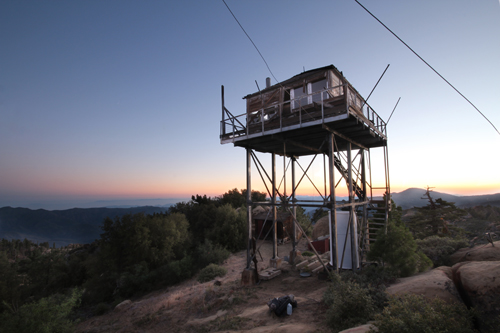
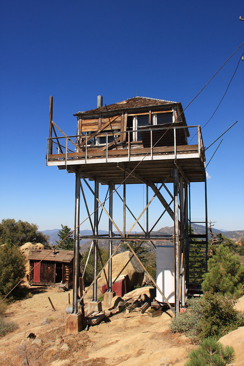
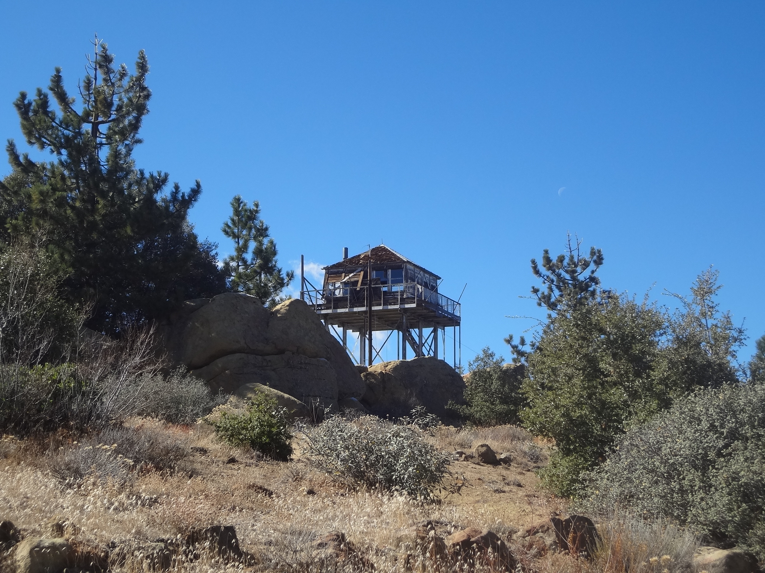
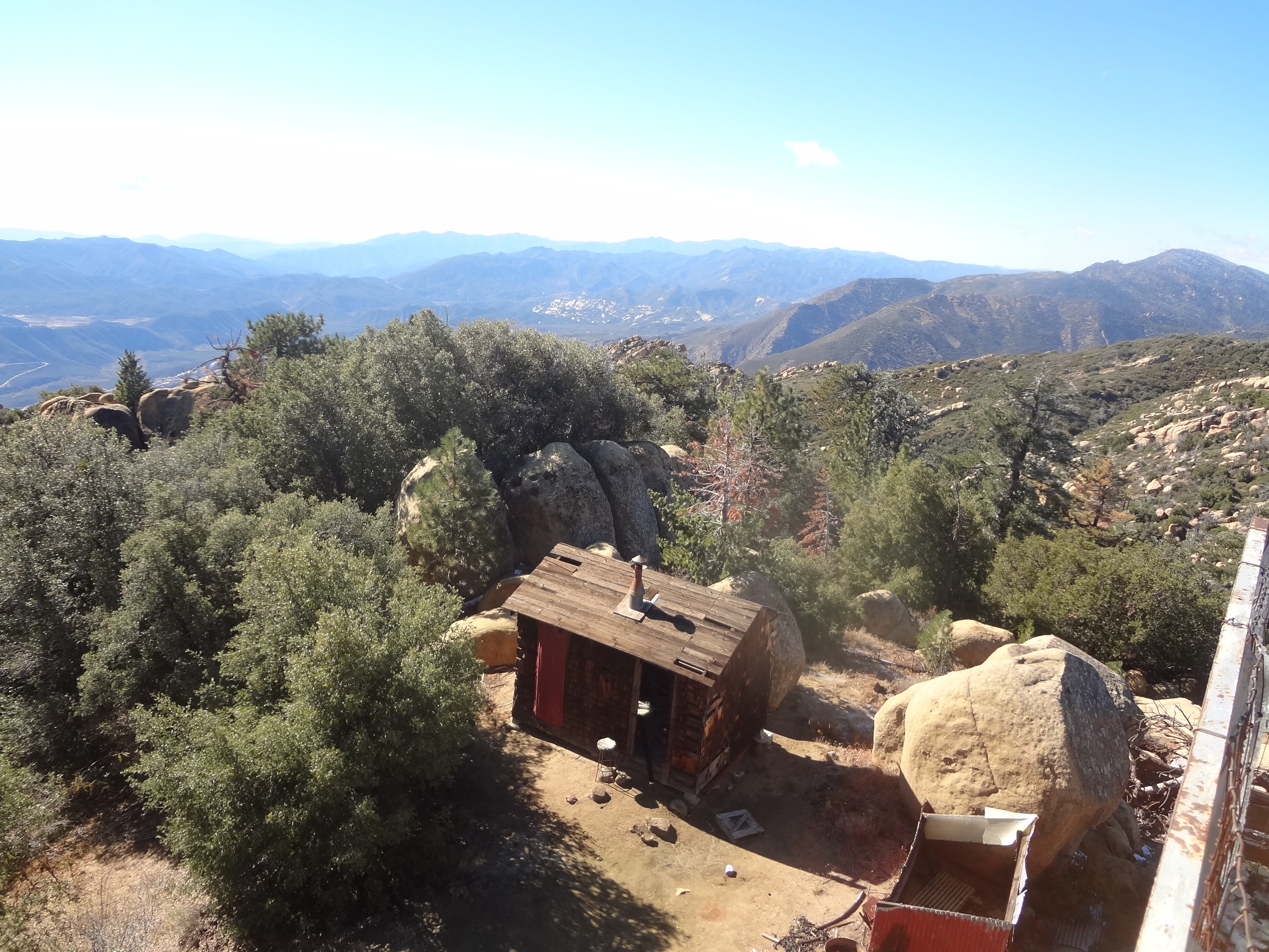
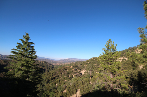
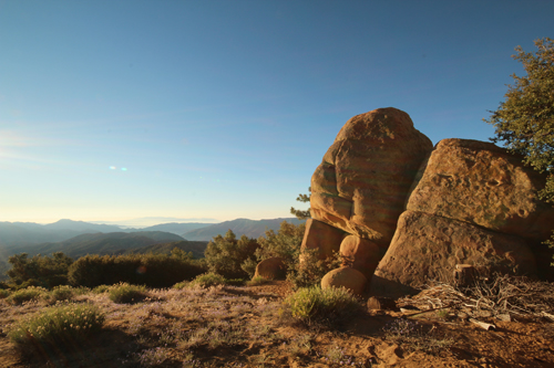
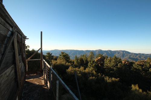
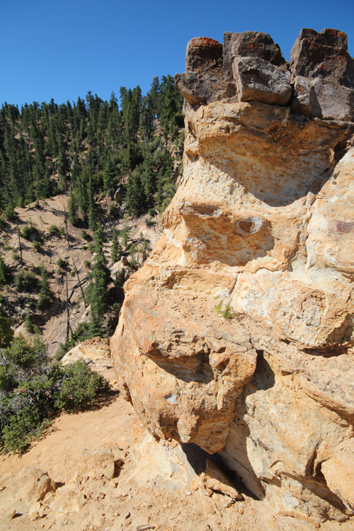
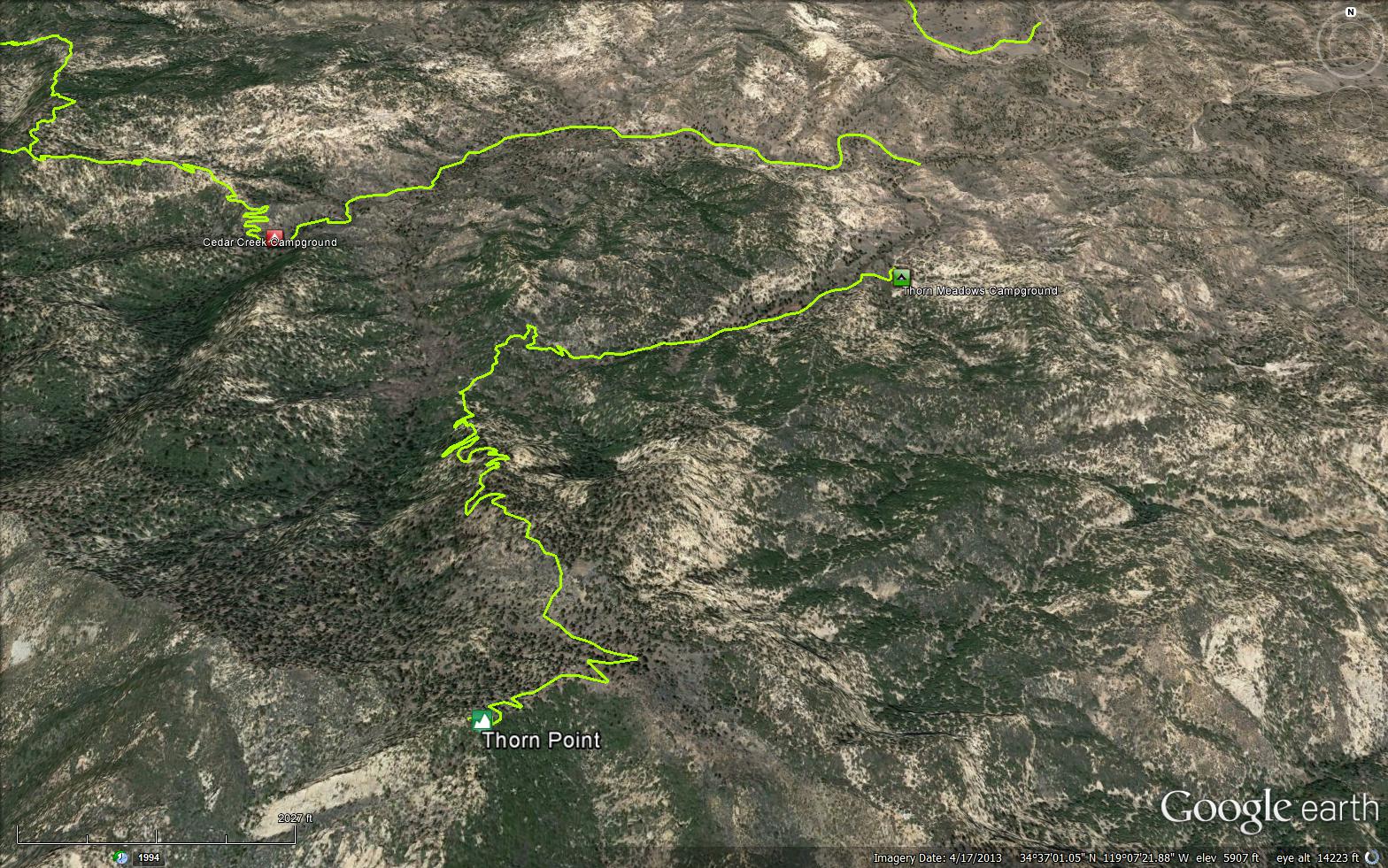
Thorn Point is located in the Sespe Wilderness, within the Los Padres National Forest. About 20 miles southwest of Frazier Park, 90 miles from Los Angeles. This peak has a Lookout tower is very weathered has seen better days, but the tower can still be accessed via a small ladder. This is one of the last Lookout towers still standing in the Los Padres, it would be nice to see this tower restored. The tower gives you a 360 view that is very spectacular, best seen in early hours of the morning but is also a great place to watch the sunset. The Thorn Point trail has interesting rock formations, large pine tress, and views in all directions, the trail is good shape and easy to follow.
W. H. Thorn was an early day surveyor with the U. S. Geological Survey that mapped the central Ventura County area in 1905. Both the meadow, camp and point were named for him. During a drought cattlemen brought their cattle up to find feed and water. The Snedden Land and Cattle Company ran cattle in this area along Piru Creek.
Thorn Camp was established in 1961. At the camp there are 3 camp sites with tables and stove,one is across the creek. No water or toilets available. There is a public horse corral. The camp and meadow are located at the start of the steep horse Trail 21 W07 which leads from the end of the right fork of Grade Valley Road. The trails goes up the north tee of the mountain to reach the abandoned Thorn Lookout.
When the lookout was manned during the fire season a pack train of Forest Service mules made the trip carrying supplies, mail and water to the lookout person. The tower is in poor shape and no longer manned during the fire season.
No Trail Camps, But you can dry camp at the top of the peak.
Trailhead Campground: Thorn Meadows Campground


 Thorn Point Trail Survey - 11-29-2020 - by Molly Troup
| Link: | Thorn Point Trail |
| Date: | 11-29-2020 |
| Surveyor Name: | Molly Troup |
| Trail description: | Fantastic trail! Easy to follow and easy to social distance on this trail. Passed only two other people starting off when we finished. |
| Mode of transport: | Hike |
| Trail condition: | Good shape and easy to follow |
Thorn Point Trail Survey - 05-29-2020 - by Mike Maki| Link: | Thorn Point Trail |
| Date: | 05-29-2020 |
| Surveyor Name: | Mike Maki |
| Trail description: | Finally got a chance to hike Thorn Point. A favorite of my friend Teresa Norris. Parked at the minor road washout just a 1/4 mile or so from the old guard station. Trail was easy enough to follow. A little brushy. I can see why this is a favorite. Had a great time. Some pics |
| Mode of transport: | Hike |
| Trail condition: | Good shape and easy to follow |
Thorn Point Trail Survey - 05-23-2020 - by Anonymous Surveyor| Link: | Thorn Point Trail |
| Date: | 05-23-2020 |
| Surveyor Name: | Anonymous Surveyor |
| Trail description: | The trail has brushy spots and some downed trees in the beginning and is easy to follow up the switchbacks. Some wildflowers were blooming. No water on the trail. |
| Mode of transport: | Hike |
| Trail condition: | Good shape and easy to follow |
Thorn Point Trail Survey - 04-26-2020 - by Tom Weisel| Link: | Thorn Point Trail |
| Date: | 04-26-2020 |
| Surveyor Name: | Tom Weisel |
| Trail description: | |
| Mode of transport: | Hike |
| Trail condition: | Good shape and easy to follow |
| Images: | Four of these on the road in Water a little before the tower |
Thorn Point Trail Survey - 07-05-2019 - by Christopher P. Lord| Link: | Thorn Point Trail |
| Date: | 07-05-2019 |
| Surveyor Name: | Christopher P. Lord |
| Trail description: | Connected Thorn Point to Cedar Peak On Friday 07/05/19. First half mile of Thorn point (21W07) is in need of major brushing and some tread repair, after that it is smooth sailing and wide open the rest of the way. I counted a total of 5 downed trees Between the trailhead at Thorn Meadows to the old lookout tower. For further detail see the blog link below. |
| Mode of transport: | Hike |
| Trail condition: | Needs some work |
| Condition details: | Sunny skies with temps in the 80's |
| Images: | Thorn Point Trailhead Fascinating geology along the trail Thorn Point Fire Lookout Tower Outbuildings adjacent the tower View North from the tower toward Mt Pinos |
Thorn Point Trail Survey - 06-29-2019 - by Thomas Fredrickson| Link: | Thorn Point Trail |
| Date: | 06-29-2019 |
| Surveyor Name: | Thomas Fredrickson |
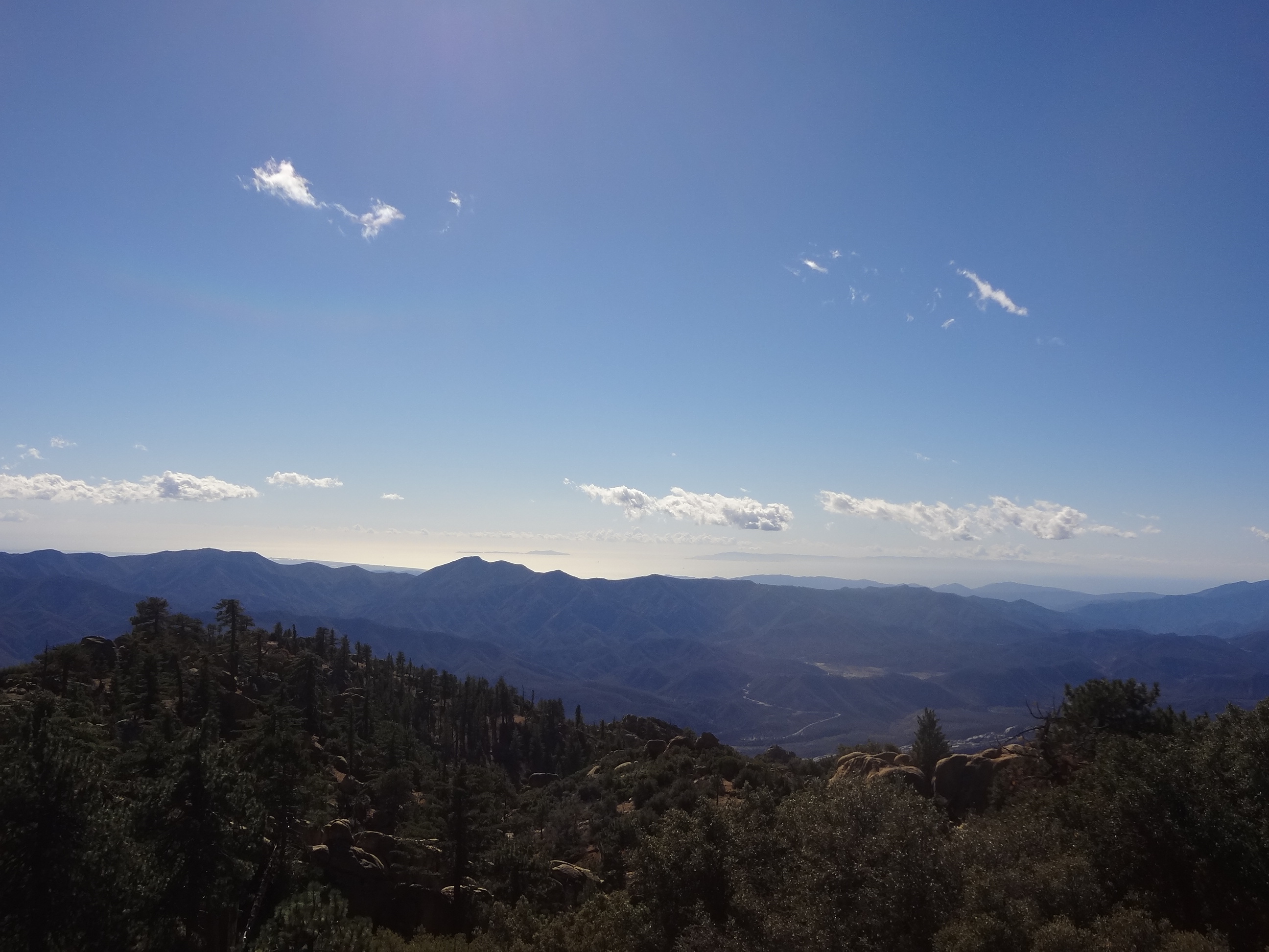
| Trail description: | The road out to Thorn Meadow is closed about a half mile from the Thorn Point Trailhead due to severe water damage (see photo). Before that, the road crosses a few creeks with about 6"-12" of water. The first half mile of the trail requires some light to moderate bushwhacking, and we temporarily lost the trail twice. I wore long pants and sleeves and brushed off two ticks. After the trail climbs from the creek (dry), the trail is very clear and in great shape all the way to the lookout tower. Thorn Point is magnificent. The lookout tower is very neat, and the view it provides is one of the best I have found in Los Padres. You can see the Topa Topa Mountains, Nordhoff Ridge, Rose Valley and Piedra Blanca, Mt. Pinos, and a few of the Channel Islands. |
| Mode of transport: | Hike |
| Trail condition: | Needs some work |
| Condition details: | Mild/Moderate Bushwacking in the first half mile |
| Images: | This is the road! |
Thorn Point Trail Survey - 09-01-2018 - by The Lost Padre| Link: | Thorn Point Trail |
| Date: | 09-01-2018 |
| Surveyor Name: | The Lost Padre |
| Trail description: | Downed trees 1/3 mile in are still there across the trail. I'm willing to help remove them if someone's got a cross cut ! There are a few places ascending the ridge where the trail could use some minor tread work. A beautiful 70 degree day up top :) |
| Mode of transport: | Hike |
| Trail condition: | Good shape and easy to follow |
| Images: | |
Thorn Point Trail Survey - 11-22-2017 - by Los Padres Forest Association| Link: | Thorn Point Trail |
| Date: | 11-22-2017 |
| Surveyor Name: | Los Padres Forest Association |
| Trail description: | Trail is in good shape. Starts a little brushy, two down trees, including one that is half cut??, nice tread other than along one section. The trail switchbacks along a variety of terrain, differing views, change of drainages and fantastic views. One of the best the Los Padres has to offer. And then the lookout tower.  |
| Mode of transport: | Hike |
| Trail condition: | Good shape and easy to follow |
| Images: | Trailhead Sign was there in late November. BOO whomever took it! Downed Tree #1 Downed Tree #2, would love to hear why the cut wasn't finished. Beautiful trail, lots of variation. |
Thorn Point Trail Survey - 01-06-2018 - by David Silva| Link: | Thorn Point Trail |
| Date: | 01-06-2018 |
| Surveyor Name: | David Silva |
| Trail description: | Hiked to Thorn Point before the gate is closed for the season. Road is in good condition with the exception of a couple basketball sized holes along the route. Piru Creek was at least 18 inches deep along the road crossing.  Immediately starting the hike i notice the Sespe Wilderness sign was missing. No trace of it whatsoever and the post was fully intact. Having just seen it in June, I assume someone took it.   Along the trail, there are a few downed trees about 1/4 mile in. Some appear to be an unfinished job. Nothing that can't be easily stepped over or ducked under to continue on. The rest of the route is clear and easily defined all the way to the tower. Expected to see more than normal amount widlife due to the Thomas Fire. Did see plenty of wildlife tracks and one deer sighting.  Overall, great hike on a cool, clear day. |
| Mode of transport: | Hike |
| Trail condition: | Good shape and easy to follow |
| Images: | Piru Creek crossing along Grade Valley Rd Sespe Wilderness sign missing Sespe Wilderness sign (Taken June 23, 2017) Downed tree approx. .26 mile from trailhead "Un-finished" downed trees approx. .34 mile from trailhead |
Thorn Point Trail Survey - 05-04-2017 - by Dave Burnett| Link: | Thorn Point Trail |
| Date: | 05-04-2017 |
| Surveyor Name: | Dave Burnett |
| Trail description: | Hiked to Thorn Point with two friends shortly after gate was opened allowing access to Grade Valley Road. Â Road was in fairly good shape. Â Able to cross the four streams so hike started at the trailhead at Thorn Meadows campground rather at the first crossing. Â Great day for a hike. Â Cool to start at 8 am, but warmed up as the day went on. Â Clear most of the time. Â Trail is clear with only one small tree down. Â In good shape all the way with a couple of spots sloped due to minor slides. Â Easy to get across these. Â Returned to trailhead about 1 pm. |
| Mode of transport: | Hike |
| Trail condition: | Good shape and easy to follow |
| Images: | At the Tower View to the South. |
Thorn Point Trail Survey - 11-25-2016 - by Craig R. Carey| Link: | Thorn Point Trail |
| Date: | 11-25-2016 |
| Surveyor Name: | Craig R. Carey |
| Trail description: | Day trip to Thorn Point lookout with Troop 201 Lady Mountaineers. Cold, breezy, perfect day. Trail is outstanding condition — a few recently-downed trees have been removed in the lower section (thx VWRs!). No obstacles to top. See also https://www.flickr.com/photos/umotamba/albums/72157675849954530 |
| Mode of transport: | Hike |
| Trail condition: | Good shape and easy to follow |
| Images: | |
Thorn Point Trail Survey - 10-27-2016 - by Dave Burnett| Link: | Thorn Point Trail |
| Date: | 10-27-2016 |
| Surveyor Name: | Dave Burnett |
| Trail description: | Trail is in very good shape. Â A single log to easily step over about 1/4 mile from trailhead, otherwise clear. Â No washouts. Â Easily able to drive all the way to the trailhead unlike this time last year, when we chose not to try to get past the stream crossing that is ~2 miles from the trailhead. Â Excellent weather. Â Although cloudy overhead, the horizontal visibility was good in all directions. Â Started hike about 8 am with jacket that came off in the first mile. Â Shirt sleeve weather at the tower by 11 am. Â Spent about an hour at the tower before heading back to the trailhead |
| Mode of transport: | Hike |
| Trail condition: | Good shape and easy to follow |
| Images: | View toward Rose Valley Big pine cones Tower is open. Unfortunately not well kept. Lots of trash. |
Thorn Point Trail Survey - 05-08-2016 - by Erin C.| Link: | Thorn Point Trail |
| Date: | 05-08-2016 |
| Surveyor Name: | Erin C. |
| Trail description: | This is my new favorite short hike in the Los Padres. Absolutely beautiful trail! Â Tread is a bit "chunky" but easy to follow. Â For Los Padres wilderness trail standards I would give this trail an 8.5 / 10. Â The lookout tower area is trashed. The summit would have a lot more appeal to me if there were no lookout tower or dilapidated outhouse at all and it was just simply restored back to its natural state. Â Just my 2 cents. Â |
| Mode of transport: | Hike |
| Trail condition: | Good shape and easy to follow |
| Images: | |
Thorn Point Trail Survey - 03-27-2016 - by United Trail Maintainers of California| Link: | Thorn Point Trail |
| Date: | 03-27-2016 |
| Surveyor Name: | United Trail Maintainers of California |
| Trail description: | Cleared the trail of trees. Trail in good condition. |
| Mode of transport: | Stock |
| Trail condition: | Good shape and easy to follow |
Thorn Point Trail Survey - 11-04-2015 - by Dave Burnett| Link: | Thorn Point Trail |
| Date: | 11-04-2015 |
| Surveyor Name: | Dave Burnett |
| Trail description: |
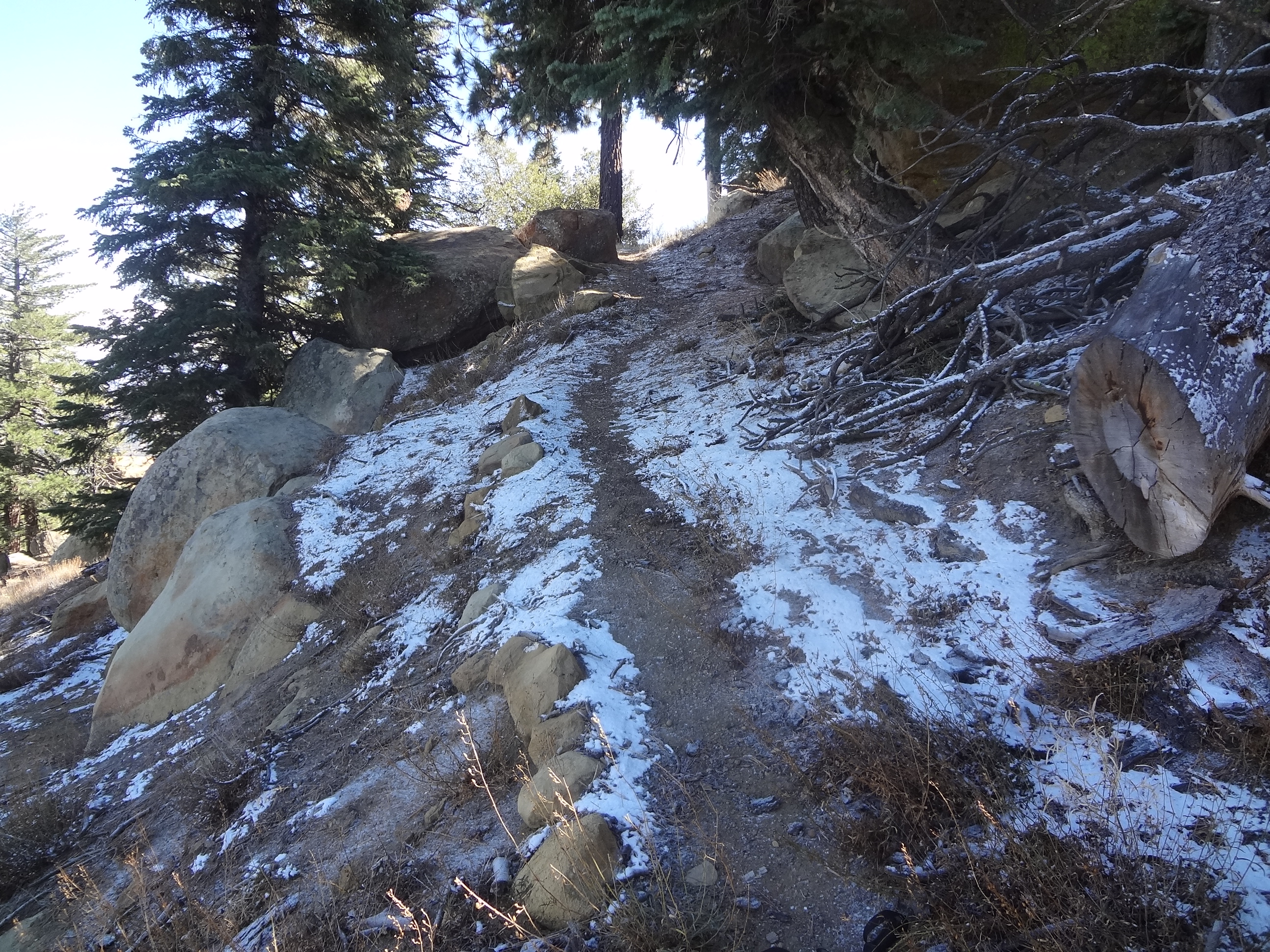
Thorn Point Hike           Hike started at the last stream crossing, ~4,830 ft elev before turning onto Forest Road 7N038, adding about 1.8 miles each way to the hike. This 1.8 miles is an easy hike to the Thorn Point trailhead. The first 1.6 miles on the trail is undulating, but only a slight additional gain to ~5,400 ft elev. At 1.6 miles from the trailhead the trail steepens significantly, following switchbacks generally to the south to an elevation of 6,575 ft at 3.1 miles from the trailhead. The remaining 0.6 miles climbs ~360 ft to the tower at 6,935 ft. Total distance from the car is 5.6 miles and an elevation gain of ~2,100 feet mostly in the last third of the hike.           The entire trail is very easy to follow, so navigation is not much of an issue. Lots of great views and rest stop locations along the way. Trail is in very good shape, although there are a few fallen trees blocking the way in the first mile from the trailhead. These are easy to get around or over. There was no sign of any water along the trail.           This hike was strenuous, but very pleasant and rewarding. Starting at 9 am, the temp was about 37 degrees at the car. By noon at the tower, the temp was about 45 with light wind. There was a small amount of snow at the higher elevations on protected north slopes. The snow was delivered by the storm two days before our hike. Views at the Tower were spectacular. Tower is in poor repair but felt safe to climb. Look out for rusty nails and broken boards, though. Careful where you step on the walkway. It feels sturdy, but there could be weak spots.            After about an hour at the Tower and signing the summit register, we headed back to the car at 1 pm. A lot easier going down! We arrived at the car at 4 pm. There are a number of geocaches along the road to the trailhead which I was happy to find. This added about 45 minutes to the hike back.            In addition to views at the Tower, much of the trail also affords views of massive rock formations and a variety of types of vegetation. It is hard to believe this trail gets so little use. We saw no one else on the trail and the prior signatures on the summit register were from late September. The big drawback is likely the long drive to the trailhead along the mostly unpaved road from Lockwood Valley Road. |
| Mode of transport: | Hike |
| Trail condition: | Good shape and easy to follow |
| Images: | Thorn Point Lookout Light dusting of snow near summit in protected location View to Anacapa & Santa Cruz Islands - about 45 miles SW. Ranger accomodations |
Thorn Point Trail Survey - 06-27-2015 - by Donna Spencer| Link: | Thorn Point Trail |
| Date: | 06-27-2015 |
| Surveyor Name: | Donna Spencer |
| Trail description: |  From start to finish this hike has a little bit of everything. This hike was great for geology / plant life / and ever changing views. This hike also is a great workout, straight up ever changing switch backs. The tower area can serve as a great overnight camp site. I did see that previous overnighters have used the old water tank base as a fire pit. I also saw a well used shovel and broom on the side of the tower supply shed. Just be careful numerous rusted nails and broken glass in the area. However you will be treated to a Gods Eye View of the area from the tower. This one is must hike trail. Further do bring water (due to water in the creek has a heavy alkali presence and extremely dry past the creek. |
| Mode of transport: | Hike |
| Trail condition: | Good shape and easy to follow |
Thorn Point Trail Survey - 06-12-2014 - by Fred| Link: | Thorn Point Trail |
| Date: | 06-12-2014 |
| Surveyor Name: | Fred |
| Trail description: | Very steep in places. Serious workout for me. Bring water. |
| Mode of transport: | Hike |
| Trail condition: | Good shape and easy to follow |
| People Seen: | 1 |
 Survey / Report Form - Please click this box to open the form.