 Use Marker Groups
 Wolf 2002
Piru 2003
Day 2006
Zaca 2007
Gap 2008
La Brea 2009

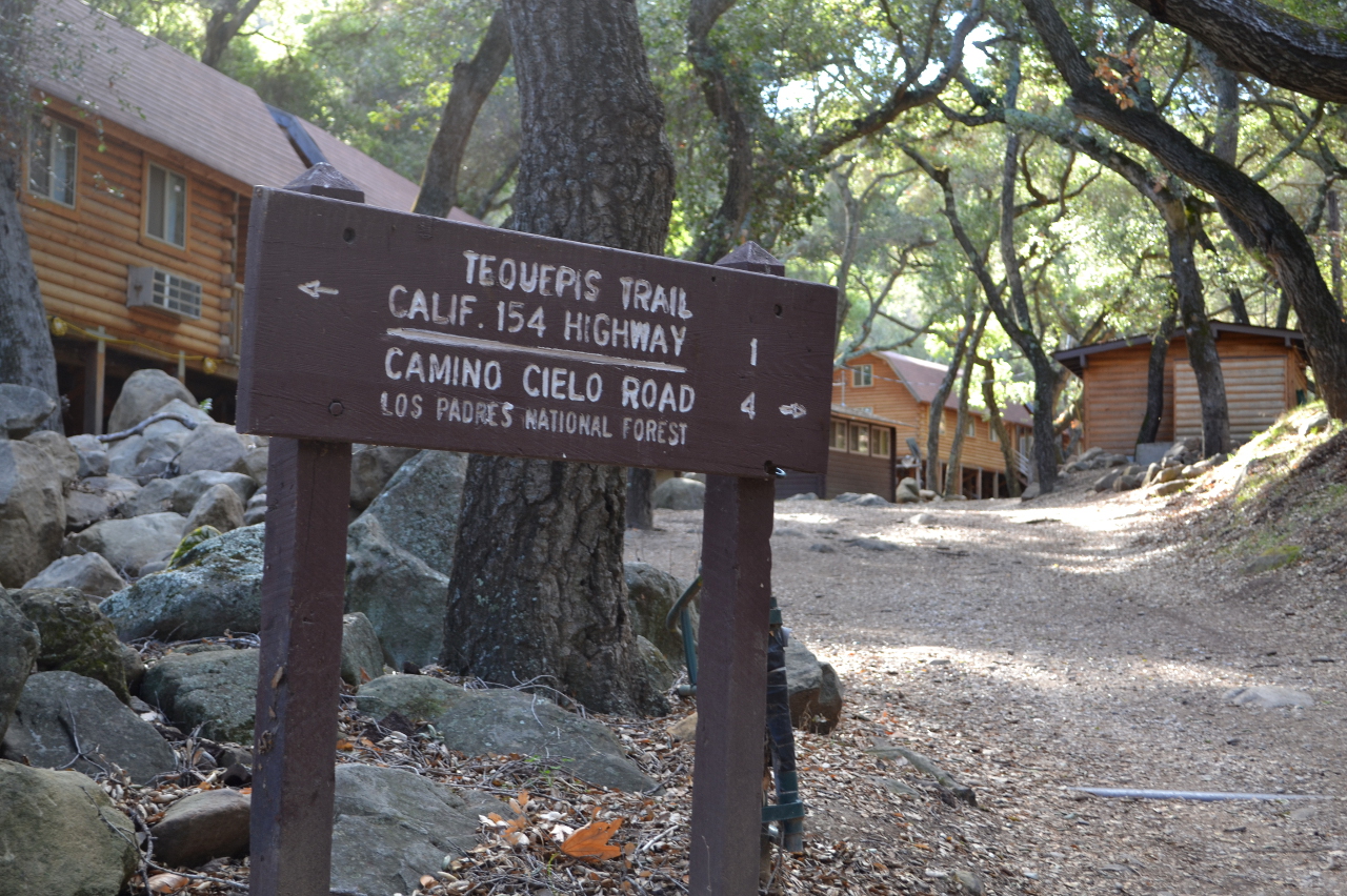
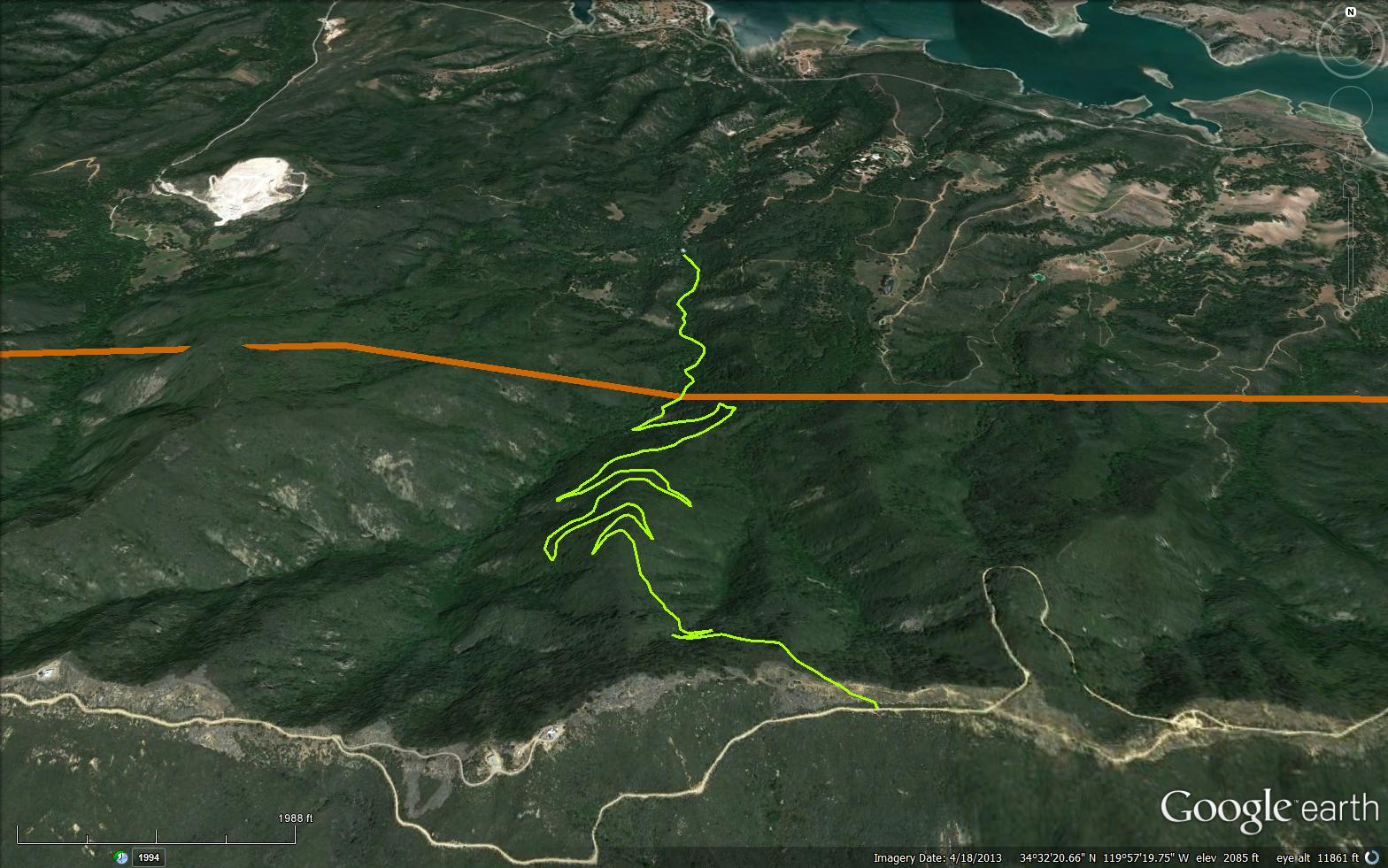
Tequepis is the name of an Indian village located at the north of the canyon and the Santa Ynez River. The site of the village is now covered by Lake Cachuma. The canyon descends from the Santa Ynez Mountains to the south shore of Lake Cachuma. In the early days, the Step family filed several homesteads further up the canyon on which the Knight family had filed. Later, Camp Drake Boy Scout Camp was established. Later the Scouts moved down the canyon and the old camp became Camp Cielo. The Tequepis Trail 29W06 climbs steeply by way of several switch backs to reach West Camino Cielo road just east of Broadcast Peak. Years ago the south part was known as the Gato Trail and extended all the way to the ocean. This part of the trail is no longer maintained or in use as it crosses private property.


 Tequepis Trail Survey - 12-30-2024 - by Dan Reynolds
 | Link: | Tequepis Trail |
| Date: | 12-30-2024 |
| Surveyor Name: | Dan Reynolds |
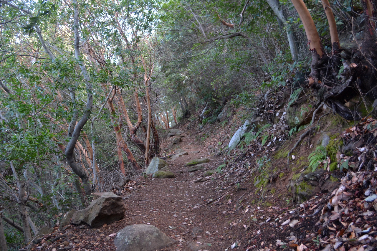
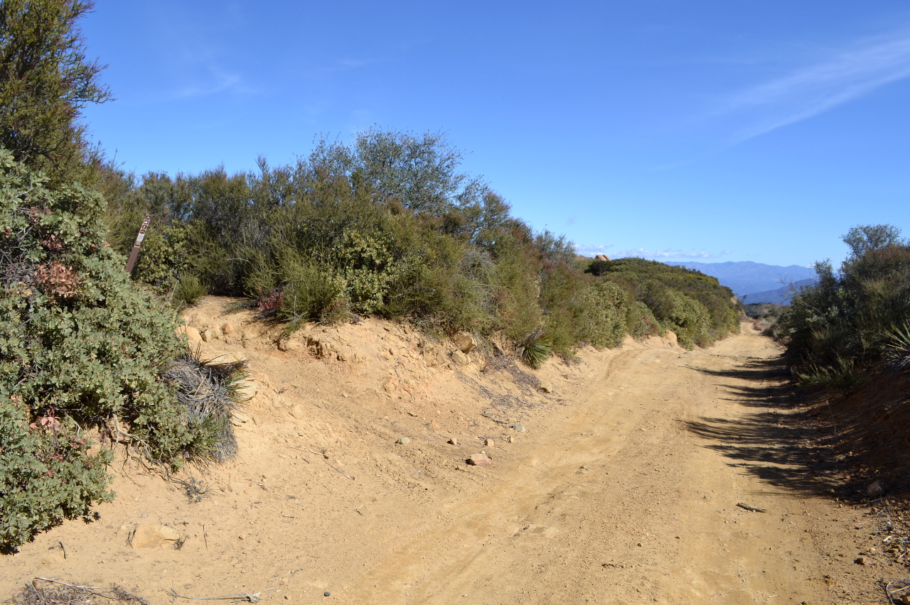
| Trail description: | This is a challenging trail with great rewards. The first mile is along the creek that still has running water. Very nice to see. Once you are out of the trees along the creek the trail gets steep. There are many switchbacks that take a little of the steepness out of the uphill hike. The views also distract from steep uphill hike. Push yourself to get to the top. It is very rewarding with a feeling of accomplishment. The trail is easy to follow. The creek crossings are very manageable. The trail has been maintained recently. See my YouTube video here of my hike that was filmed over three visits to the trail: Get out there and enjoy! |
| Mode of transport: | Hike |
| Trail condition: | Good shape and easy to follow |
Tequepis Trail Survey - 09-22-2024 - by Steve Miley| Link: | Tequepis Trail |
| Date: | 09-22-2024 |
| Surveyor Name: | Steve Miley |
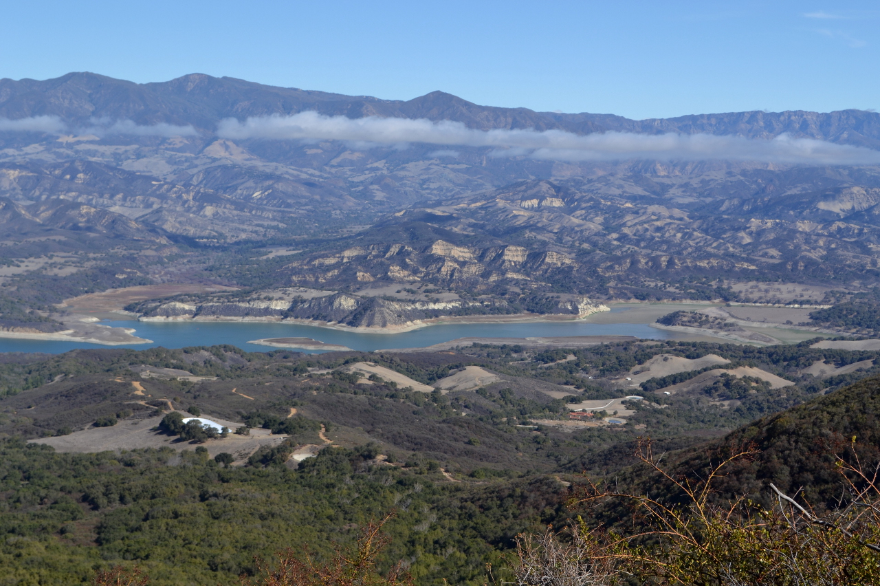
| Trail description: | There has been quite a bit of trail maintenance, the trail is in great shape with no brush squeezing you in on the trail. Creek crossings during the first mile, the 2nd mile is probably the steepest. At the top, there is an amazing oak tree offering shade and a view over Lake Cachuma. This hike goes up the mountain, pretty impressive. we saw 2 mountain bikers, 2 runners, and a few groups of hikers. exposed trail in the later afternoon, though some sections with shade. |
| Mode of transport: | Hike |
| Trail condition: | Good shape and easy to follow |
| Images: | example of trail width, brush cut back. Lake Cachuma view |
Tequepis Trail Survey - 06-10-2023 - by Mielikki| Link: | Tequepis Trail |
| Date: | 06-10-2023 |
| Surveyor Name: | Mielikki |
| Trail description: | Trail is in excellent shape (thanks to those who must have worked on it recently). Creek crossings easy, but water is still flowing rapidly. |
| Mode of transport: | Hike |
| Trail condition: | Good shape and easy to follow |
Tequepis Trail Survey - 12-26-2022 - by Katy Ayer| Link: | Tequepis Trail |
| Date: | 12-26-2022 |
| Surveyor Name: | Katy Ayer |
| Trail description: | Just a beautiful hike. Trail well maintained. Once we reached the ridge road, we took the steep scramble up to the radio tower and then walked the c. 3/4 mile along the road back to the trail junction. |
| Mode of transport: | Hike |
| Trail condition: | Good shape and easy to follow |
Tequepis Trail Survey - 01-01-2022 - by Emily Maynard| Link: | Tequepis Trail |
| Date: | 01-01-2022 |
| Surveyor Name: | Emily Maynard |
| Trail description: | Trail is well maintained but with some recent downed trees in some areas, easy to walk under or around. Creek is full of water with recent rains. Always a satisfying hike. |
| Mode of transport: | Hike |
| Trail condition: | Good shape and easy to follow |
| Images: | View of Lake Cachuma and Santa Ynez river valley Playing around a madrone tree |
Tequepis Trail Survey - 02-12-2021 - by Los Padres Forest Association| Link: | Tequepis Trail |
| Date: | 02-12-2021 |
| Surveyor Name: | Los Padres Forest Association |
| Trail description: | LPFA Trail Crew cleared 4-5 downed trees along the top of Tequepis in the madrone zone. Happy to help! |
| Mode of transport: | Hike |
| Trail condition: | Needs some work |
| Images: | |
Tequepis Trail Survey - 12-31-2020 - by Anonymous Surveyor| Link: | Tequepis Trail |
| Date: | 12-31-2020 |
| Surveyor Name: | Anonymous Surveyor |
| Trail description: | Trail in excellent condition. Not too crowded - encountered 5 groups in 6 hours. Magnificent views at top. |
| Mode of transport: | Hike |
| Trail condition: | Good shape and easy to follow |
Tequepis Trail Survey - 06-08-2020 - by Anonymous Surveyor| Link: | Tequepis Trail |
| Date: | 06-08-2020 |
| Surveyor Name: | Anonymous Surveyor |
| Trail description: | |
| Mode of transport: | Hike |
| Trail condition: | Good shape and easy to follow |
| Images: | Typical condition of trail, viewing north from mid-section of Tequepis trail toward Lake Cachuma |
Tequepis Trail Survey - 05-20-2018 - by Los Padres Forest Association| Link: | Tequepis Trail |
| Date: | 05-20-2018 |
| Surveyor Name: | Los Padres Forest Association |
| Trail description: | The Tequepis trail burned in the 2017 Whittier Fire and was closed from July 2017 - Spring 2018. The trail was just recently reopened with access available once again from both the West Camino Cielo trailhead as well as the Cirlcle V trailhead. SBMTV hosted a volunteer project on May 20 and cleared / reestablished most of the trail. It is back in good shape for riding or hiking. There is one tree remaining across the trail near the bottom. |
| Mode of transport: | Bicycle |
| Trail condition: | Needs some work |
Tequepis Trail Survey - 06-08-2017 - by Jim Young| Link: | Tequepis Trail |
| Date: | 06-08-2017 |
| Surveyor Name: | Jim Young |
| Trail description: | Broadcast Peak and Santa Ynez Peak via Tequepis trail. 12.2 mi. total included ~0.5 mi. wandering around at trail head. Total time was 4 hrs, 45 min. Total elevation gain (as reported by GPS) was 3400'. Vertical gain was 3120'. Parked at small "Los Padres" designated are just below Circle V camp gate. Weather started as typical June overcast, but cleared to become quite warm. Trail was shady and cool for ~1.5 mi, then breaks out into chaparral with great  open views of Lake Cachuma and the back country. At the crest,  I scrambled up  the motorcycle hill climb track to Broadcast Peak. Footing was sketchy due to steepness with no switchbacks and loose dirt and rocks . Continued West on Camino Cielo road to another OHV trail on the ridge leading up to Santa Ynez Peak. Had lunch sitting under all the antenna equipment. Returned to Tequepis trail via Camino Cielo. On the descent, encountered about 25 young hikers on their way up. There's very little shade on the trail, so bring lots of sun protection and water. I expected to be disappointed about using Camino Cielo to complete the hike, but saw no one on the road. I was probably fortunate because it was a weekday. Views of Gaviota Coast are spectacular and worth the hike or drive. PS-This is my first trip report, so feedback is appreciated. Mistakenly put into Santa Ynez Peak as camp survey, twice :-( ) |
| Mode of transport: | Hike |
| Trail condition: | Good shape and easy to follow |
Tequepis Trail Survey - 10-15-2016 - by Matt Grant| Link: | Tequepis Trail |
| Date: | 10-15-2016 |
| Surveyor Name: | Matt Grant |
| Trail description: | Well maintained and traveled trail. No water in creeks however small day hike. |
| Mode of transport: | Hike |
| Trail condition: | Good shape and easy to follow |
Tequepis Trail Survey - 01-30-2015 - by Mark Cooper| Link: | Tequepis Trail |
| Date: | 01-30-2015 |
| Surveyor Name: | Mark Cooper |
| Trail description: | The trail is in beautiful condition. Â Thanks to the volunteers who made it happen! |
| Mode of transport: | Hike |
| Trail condition: | Good shape and easy to follow |
Tequepis Trail Survey - 02-10-2014 - by Valerie Norton| Link: | Tequepis Trail |
| Date: | 02-10-2014 |
| Surveyor Name: | Valerie Norton |
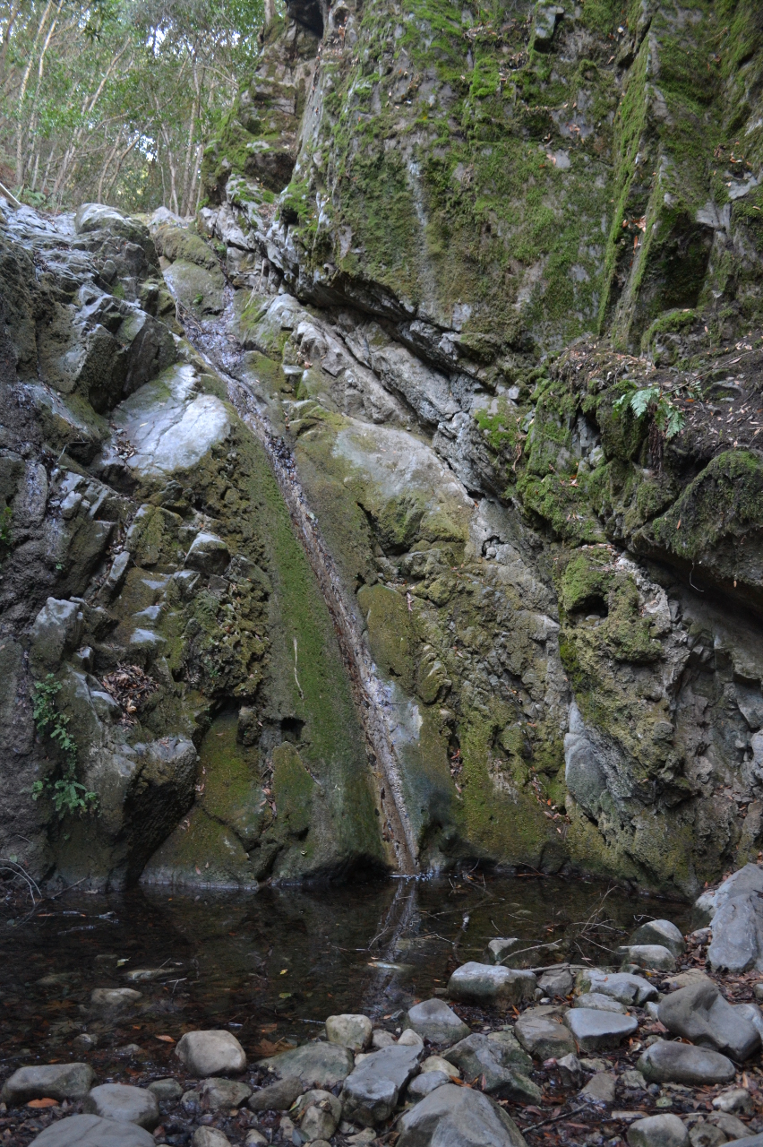
| Trail description: | Unique vegetation and exquisite lake views combine to make this a special trail. It can be accessed from the bottom through a private camp (park in the lot outside the gate and just keep to the right of way) or from the top by W. Camino Cielo (technically a 4WD road here, little parking and poorly signed). I hiked it from the bottom, stopped by the little waterfall on the way, and grabbed Santa Ynez and Broadcast peaks at the top. |
| Mode of transport: | Hike |
| Trail condition: | Good shape and easy to follow |
| People Seen: | 2 |
| Images: | N/A 0 0 0 0 |
 Survey / Report Form - Please click this box to open the form.