 Use Marker Groups
 Wolf 2002
Piru 2003
Day 2006
Zaca 2007
Gap 2008
La Brea 2009

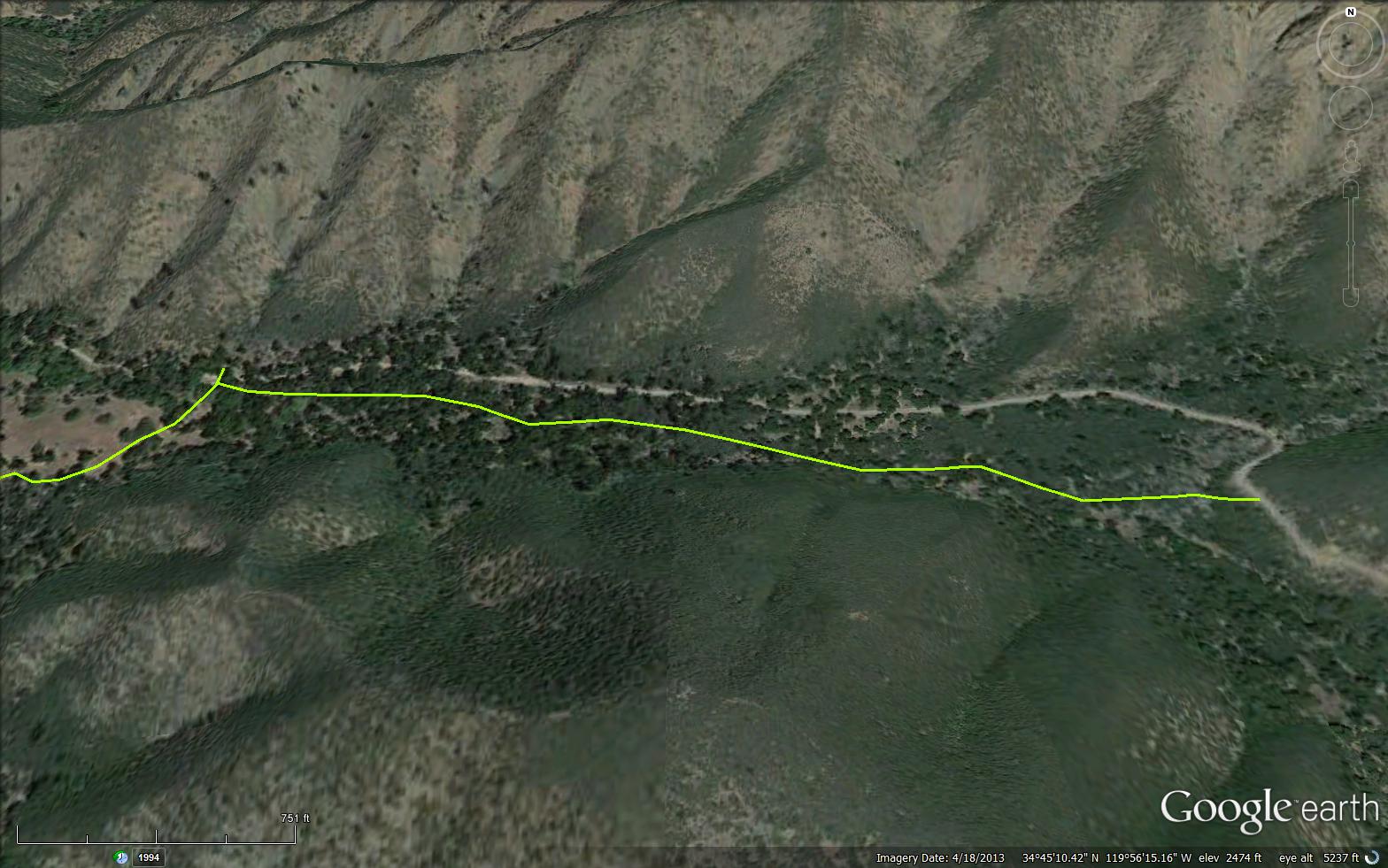
The Sunset Valley Trail is a short 1.3 mile trail that follows the Sunset Valley Road. The trail connects Sunset Valley Road near the Fish Creek Saddle to the Munch Canyon Trail (29W04). Sunset Valley Trail can be used as a great connector trail looping together White Rock or Munch and also a terrific short beginner mountain bike trail. Mr. Munch homesteaded in Sunset Valley. He built a cabin, then removed his claim and the Forest Service used the cabin as a winter Ranger Station for Edgar Davidson.


 Sunset Valley Trail Survey - 02-18-2024 - by ECDuzit
| Link: | Sunset Valley Trail |
| Date: | 02-18-2024 |
| Surveyor Name: | ECDuzit |
| Trail description: | This trail is totally passable but just needs some minor brushing and deadfall removal. I moved some of the smaller branches/trees by hand, but there’s a few medium sized ones that need a saw. Also there is still a “tunnel” of chaparral from the 2023 blizzard that requires ducking or crawling to pass through. |
| Mode of transport: | Hike |
| Trail condition: | Needs some work |
| Images: | |
Sunset Valley Trail Survey - 05-19-2023 - by EC DUZ IT| Link: | Sunset Valley Trail |
| Date: | 05-19-2023 |
| Surveyor Name: | EC DUZ IT |
| Trail description: | I attempted this trail from campsite #12 at Davey Brown Campground and didn't make it very far up. The bottom part of the trail is pretty good, but quickly becomes crappy. Poison Oak encroaching the trail. Trail is hard to see in some locations due to grass growth. A few downed trees too, but those are not too hard to walk around. Snow from the Feb. storms has pushed down the chaparral into the trail. I barely made it through. I cut my losses and hiked back to my campsite on the pavement. |
| Mode of transport: | Hike |
| Trail condition: | Needs some work |
| Condition details: | Needs some work |
| Images: | |
Sunset Valley Trail Survey - 09-01-2022 - by Los Padres Forest Association| Link: | Sunset Valley Trail |
| Date: | 09-01-2022 |
| Surveyor Name: | Los Padres Forest Association |
| Trail description: | The LPFA completely cleared and restored the Sunset Valley Trail in Summer 2022 as part of our 2022 Fig Mtn program of work. In total 2022 the LPFA restored over 13miles of trails along Fig Mtn in 2022. This trail was basically completely gone before we began working on it. Enjoy! |
| Mode of transport: | Array |
| Trail condition: | Good shape and easy to follow |
Sunset Valley Trail Survey - 01-07-2023 - by Erin C.| Link: | Sunset Valley Trail |
| Date: | 01-07-2023 |
| Surveyor Name: | Erin C. |
| Trail description: | The GPS file that you can download from Hikelospadres.com is not correct. Here is the correct GPS file: https://ridewithgps.com/trips/110742192 Trail is in great shape with the exception of a few large dead oak trees that have fallen down from the recent storms. Would be a piece of cake to remove with a good chainsaw. This trail handles the rain very well. The tread is just nice green grass right now with no mud! |
| Mode of transport: | Bicycle |
| Trail condition: | Good shape and easy to follow |
| Images: | |
Sunset Valley Trail Survey - 08-11-2022 - by Anonymous Surveyor| Link: | Sunset Valley Trail |
| Date: | 08-11-2022 |
| Surveyor Name: | Anonymous Surveyor |
| Trail description: | LPFA Trails Tuesday crew completed the work started in February (See Ari's following trail survey). We cut 5 downed trees, brushed and cleared grass along the trail. Trail is now open for use. Please go hike this little known trail and make it part of the other trails in this area: White Rock - White Rock Connector - Munch Canyon - Munch Canyon Connector. |
| Mode of transport: | Hike |
| Trail condition: | Good shape and easy to follow |
| Images: | Tree 2 BEFORE clearing Tree 2 AFTER clearing |
Sunset Valley Trail Survey - 02-22-2022 - by Ari Songer| Link: | Sunset Valley Trail |
| Date: | 02-22-2022 |
| Surveyor Name: | Ari Songer |
| Trail description: | LPFA crew logged out 10+ downed trees along the trail, but didn't have time to complete cutting in the lower grassy section where the trail meets up with Munch Canyon trail. The trail is easy to find from the top down, but is lacking definition in the lower part due to social trails around large downed trees. Continued work should start from the lower section and focus on defining the route through the meadows. Tread on the upper tenth of a mile is very narrow. https://www.gaiagps.com/map/?loc=14.4/-119.9416/34.7454&pubLink=PewjU63aD5QTe4pHPc7UoCok&trackId=0fb75193fb72ac0092b757717d942745 |
| Mode of transport: | Hike |
| Trail condition: | Needs some work |
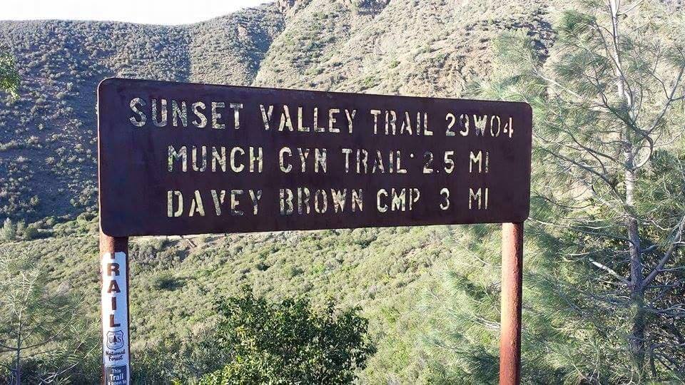
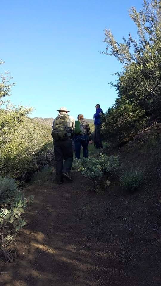
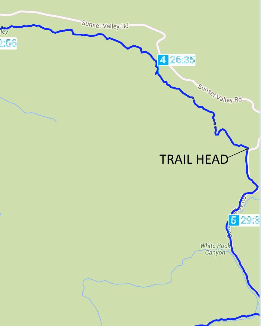
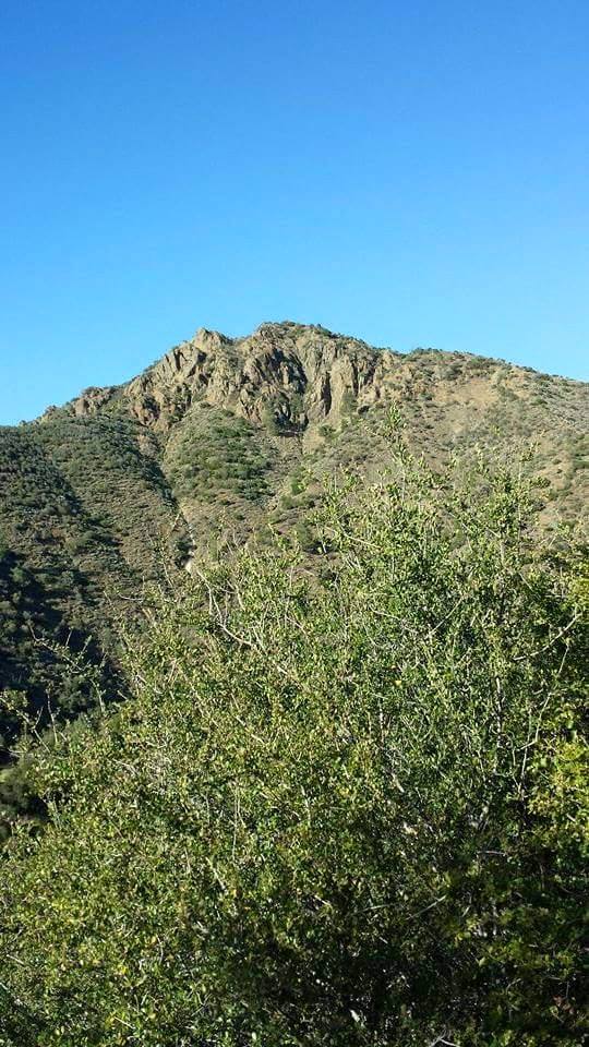
Sunset Valley Trail Survey - 04-14-2015 - by Meghan Sheen| Link: | Sunset Valley Trail |
| Date: | 04-14-2015 |
| Surveyor Name: | Meghan Sheen |
| Trail description: | Map incorrect, Sunset Valley trail is 2.5 miles from Sunset Valley road to Munch Canyon. Trail is in good shape, well maintained and easy to follow. Has been recently brushed and several downed trees cut back. I have attached picture of sign at trailhead and gps mapping of current route. |
| Mode of transport: | Hike |
| Trail condition: | Good shape and easy to follow |
| Images: | Trailhead at sunset valley rd showing milage to munch canyon trail ascending from sunset valley to sunset valley rd Map of actual trailhead to munch cyn good view from sunset valley |
 Survey / Report Form - Please click this box to open the form.