 Use Marker Groups
 Wolf 2002
Piru 2003
Day 2006
Zaca 2007
Gap 2008
La Brea 2009

| Date | Surveyor | Water Report |
| 10-28-2020 | Oh Three | Dry |
| 01-29-2019 | Carol Day | Dry |
| 11-11-2015 | Dave Burnett | Dry |
| 11-09-2014 | Valerie Norton | Dry |
Slide Mountain - 4631 feet


 Slide Mountain Survey - 10-28-2020 - by Oh Three
| Link: | Slide Mountain |
| Date: | 10-28-2020 |
| Surveyor Name: | Oh Three |
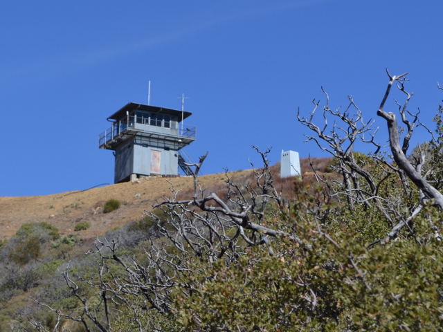
| Camp Description: | Daughter & I hiked Slide Mountain, it’s a beautiful easy trail, other than the nonstop steady gradient uphill for 5 miles! We saw one deer hunter (I had a “quickclot” in my hip pocket, just in case), and one very athletic friendly hiker. Other than that, nothing but wonderful views & solitude. Great views of Cobblestone & etc. We cached 2 water bottles at the parking spot where the dirt road turns into single track, which was the perfect spot for our downhill break. |
| Water Source: | Dry |
| Water Source Details: | Other than Piru Creek (flowing), no water on the trail |
| Weather Conditions: | |
| Images: | Intimidating view from old Hwy 99 5 miles after you start! |
Slide Mountain Survey - 01-29-2019 - by Carol Day| Link: | Slide Mountain |
| Date: | 01-29-2019 |
| Surveyor Name: | Carol Day |
| Camp Description: | There are some nice picnic sites at Frenchman's Flat and an outhouse. Â There is also an outhouse not far past the locked gate and also at the lookout tower. Â The turnoff from the old road to the dam is not signed, but there is a locked gate, Â The road/trail is in good shape, as is the lookout. Â We saw a bobcat (crossed the trail, then a face on view) on our way up. Â |
| Water Source: | Dry |
| Water Source Details: | No water on the trail; plenty in Piru Creek |
| Weather Conditions: | cold to cool and cloudy, but with pretty good visibility |
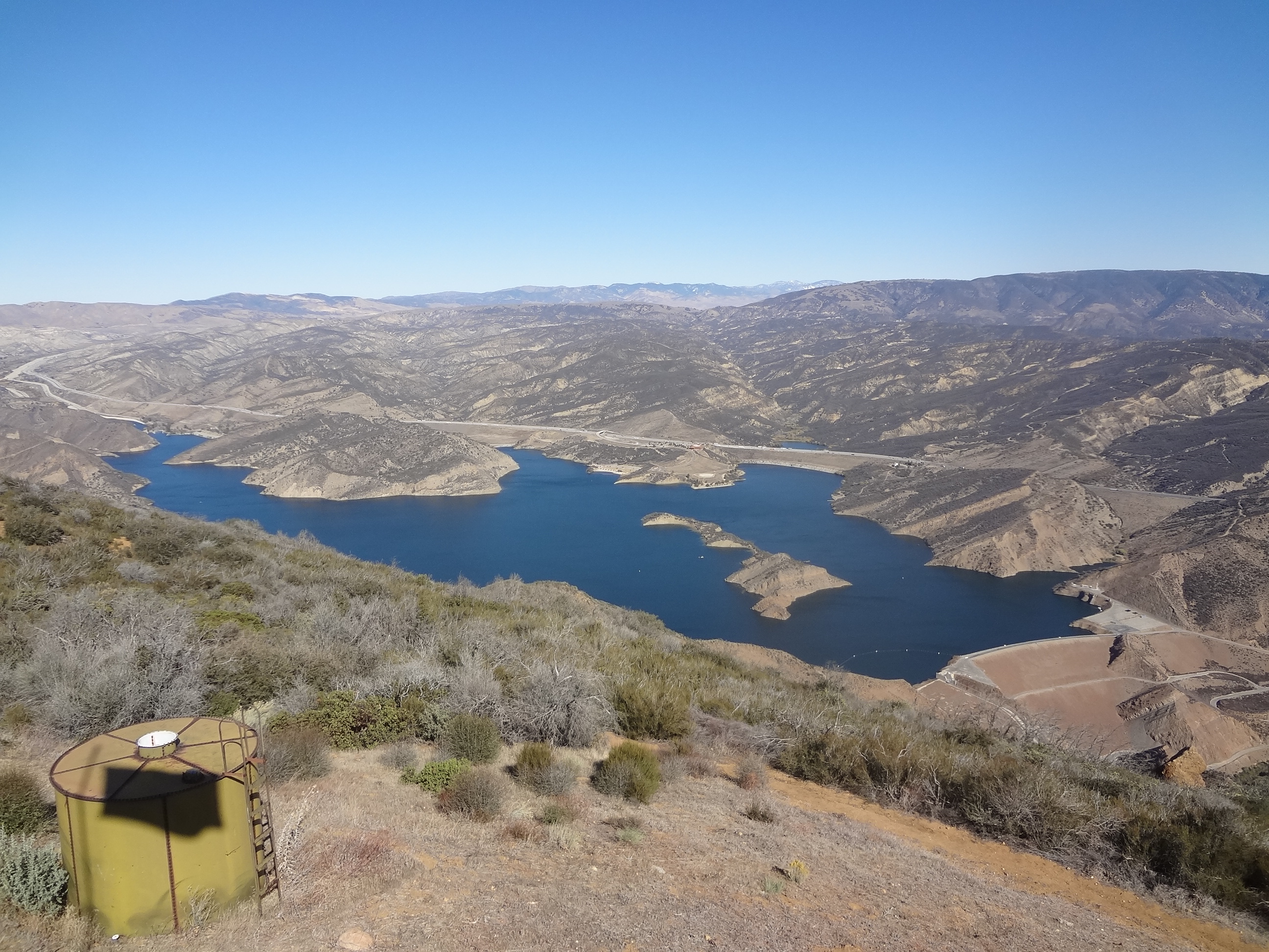
| Images: | View of Piru Lake View of Pyramid Lake from the peak Slide Mountain Lookout Interior of Lookout |
Slide Mountain Survey - 11-11-2015 - by Dave Burnett| Link: | Slide Mountain |
| Date: | 11-11-2015 |
| Surveyor Name: | Dave Burnett |
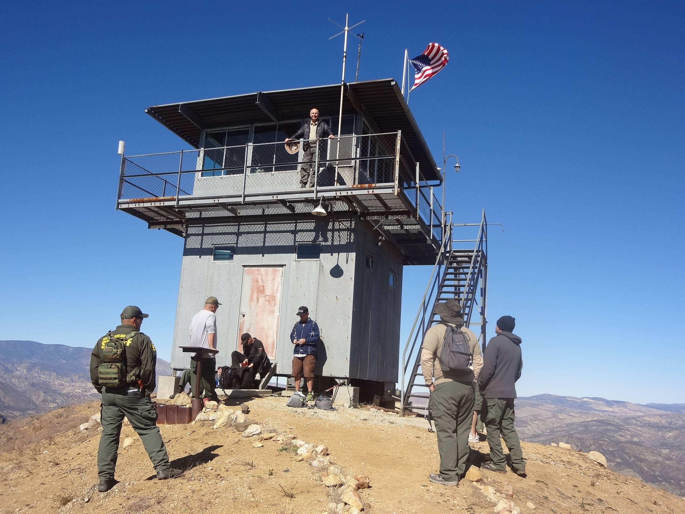
| Camp Description: | Veterans Day
Hike to Slide Mountain Lookout Tower           Slide Mountain was a popular hike
today. Besides myself and a friend, 8
members of the LA County Sheriff’s Department and 2 other were hiking at about
the same time. The Tower was manned by a
volunteer on this date. I am told that
the flag flying is generally an indication that a volunteer is present. We started at the locked gate at Frenchmans Flat Campground
at 8 am and returned at 2 pm on 11/11/15, Veterans Day. Good weather, though chilly and breezy to
start, changing to very pleasant on the hike.Â
Breezy at the Tower, but comfortable temps. Â Â Â Â Â Â Â Â Â Trail was in good to very good condition
the whole way: Distance    Elevation  Comments on segment to this distance  0.00           2,070        Starting point (First gate is here)  1.75          2,205        Golden State Hwy (paved)                    (Second gate is
here)  2.75          2,945        Dirt road, driveable (If you have a key to                    the gates - we did not)  3.65          3,540        Not driveable, but very good, steep
trail  5.72          4,604        Good steep trail, steep drop-offs in
places Distances are from my gps.Â
Elevations are from my mapping program and disagree slightly from the
official elevations. Some of the guys from the Sheriff’s Department were
discussing the feasibility of mountain biking this trail. I believe they decided it would not be a very
good idea, especially the last couple of miles. Great views all around.Â
Took several pictures of interest that I am posting. Â I realize this form is for a Camp Survey. Â However, there was no way I could find to submit a Trail Survey for this trail. Â I will resubmit if necessary. |
| Water Source: | Dry |
| Water Source Details: | A spring is listed along the trail. I did not view it so do not know if it is usable/ |
| Weather Conditions: | Cool to start, Very pleasant, though breezy at the Tower |
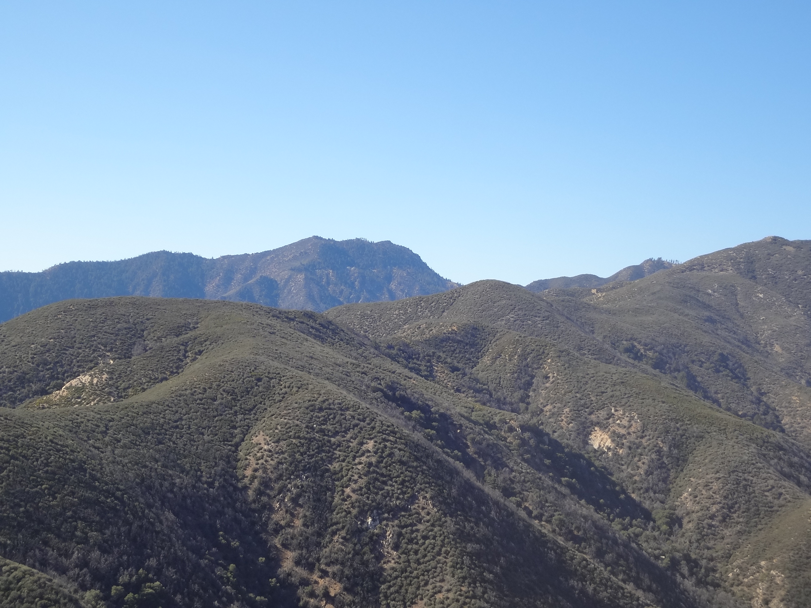
| Images: | At the Tower with some of the other hikers also resting and having lunch. Pyramid Lake from the Tower Cobblestone and Dome Mountains |
Slide Mountain Survey - 11-09-2014 - by Valerie Norton| Link: | Slide Mountain |
| Date: | 11-09-2014 |
| Surveyor Name: | Valerie Norton |
| Camp Description: | Hiked to the top as a part of an expedition up both Slide and Dome Mountains. Â After rebuilding the trail, the volunteers for the lookout have been keeping it in fine shape. Â My trip write up can be found here. Â Once the trail hits the ridge, mountain biking is often illegal as the other side of the ridge is Sespe Wilderness. |
| Water Source: | Dry |
| Water Source Details: | no local sources |
| Weather Conditions: |

 Survey / Report Form - Please click this box to open the form.