 Use Marker Groups
 Wolf 2002
Piru 2003
Day 2006
Zaca 2007
Gap 2008
La Brea 2009

| Date | Surveyor | Water Report |
| 03-30-2020 | C Goodyear | Dry |
| 03-28-2020 | Pete LaFave | Flowing |
| 03-31-2019 | Christopher P. Lord | Dry |


 Santa Paula Peak Survey - 03-30-2020 - by C Goodyear
| Link: | Santa Paula Peak |
| Date: | 03-30-2020 |
| Surveyor Name: | C Goodyear |
| Camp Description: | Went up via the Santa Paula Creek Trail from Thomas Aquinas college; I'm guessing the boot prints I was tracking off and on were Pete LaFave's, since he surveyed the same route two days prior. The trail was cake all the way to Big Cone Camp, then passable and pretty well-flagged up the East Fork to Cienega Camp. (I swapped the trekking poles for work gloves and sometimes a machete through that chunk.) Going up the north face of the peak was pretty brutal, though. The first few hundred meters out of Cienega Camp are flagged, but eventually it becomes indistinguishable from critter tracks and frequently overgrown and/or slid out. After I lost the trace, I wound up making a best-guess and just smearing up-slope until I reconnected, but that shit is risky and super taxing. Near the top of the slope, there's about a 10 meter chunk where the trail is completely washed out by loose scree and talus. I crossed by clambering around above it, but even that was unnerving; one wrong move, and you're riding a sharp, splintery gravel slide down a hundred feet or so. I wouldn't recommend traversing it without a buddy and a basic safety line, to be honest. Epic views from the peak were well worth the beating it took to getting there; could see all the way out to San Nicolas and Santa Barbara Islands in the SW and Mt. Baldy in the SE. On the way back down to Cienega, I flagged the trail in orange ribbon to leave it less of a puzzle for the next visitors. |
| Water Source: | Dry |
| Water Source Details: | Peak is bone dry, but all creeks and streams below are flowing. |
| Weather Conditions: | Clear skies, ~65° F |
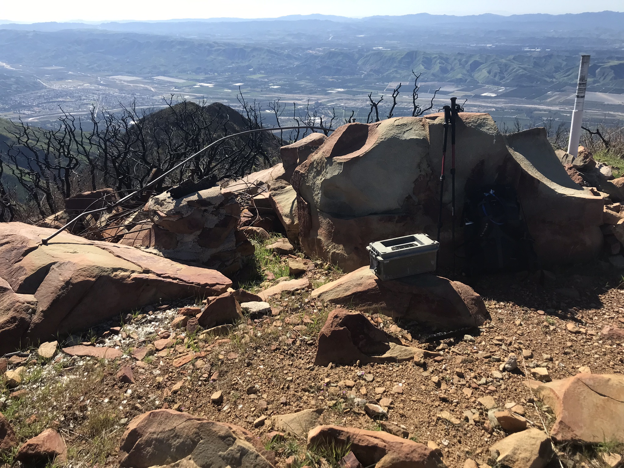
| Images: | Washed out trail section near the top of the north slope (looking east/up). I can't stress enough how super-sketchy it felt crossing this alone with no ropes. Other side/top of the washout (looking west/down). Fire lookout ruins on the peak. San Nicolas Island is just poking out above the haze, way out on the center horizon, and Santa Barbara Island is a little to the left of that.. Santa Paula, Ventura, Anacapa Island and Santa Cruz Island. |
Santa Paula Peak Survey - 03-28-2020 - by Pete LaFave| Link: | Santa Paula Peak |
| Date: | 03-28-2020 |
| Surveyor Name: | Pete LaFave |
| Camp Description: | Reached the peak using the East Fork trail. Started from Thomas Aquinas College trailhead around dawn and made quick progress through Big Cone Camp. Always sad to see the graffiti... Turned right into the East Fork section and found it passable as long as I followed the pink flags and cairns. After several miles boulder hopping up East Fork, the pink flags lead one out of the creek valley floor up a number of switchbacks on what felt like a game trail. After a while the trail becomes hard to follow. My advice: 1) follow the pink flags and if it feels like a trail, it likely is the trail. After navigating some large downed burnt trees, you'll eventually find a slid-out section. Make it past this and you're set. You'll eventually hit the saddle which gives you great views down to Fillmore and into the Sespe. You can reach the peak easily from there. 18.5 miles round trip, but well worth it for the views. |
| Water Source: | Flowing |
| Water Source Details: | Healthy water flow in area creeks from recent rains |
| Weather Conditions: | 60 degrees and partly cloudy |
Santa Paula Peak Survey - 03-31-2019 - by Christopher P. Lord| Link: | Santa Paula Peak |
| Date: | 03-31-2019 |
| Surveyor Name: | Christopher P. Lord |
| Camp Description: | Visited the Peak on Sunday. The Thomas fire burn area has really made travel up to the summit much more wide open. If you have been planning a visit now is a great time. The 360 degree views are hard to beat. Summit has USGS marker, register box and a memorial Plaque. Some evidence of the old Fire tower can still be seen. The closest water I found nearby was about a mile away from Boulder Creek off the abandoned San Cayetano Mtn route 20W15. Further details can be found at the link below. |
| Water Source: | Dry |
| Water Source Details: | |
| Weather Conditions: | |
| Images: | |

 Survey / Report Form - Please click this box to open the form.