Welcome To Hike Los Padres!
User Log In or Sign Up
Use Marker Cluster
Markers: Use Marker Groups
Time used: ms
Routes
    Trails
    OHV Trails
    Forest Roads
    Streams
Wildfire Layers
    Wolf 2002
    Piru 2003
    Day 2006
    Zaca 2007
    Gap 2008
    La Brea 2009
Forest Layers
    Forest Boundary
    Wilderness Areas
    Ranger Districts
    Counties
    Topographic Outlines
    Trailheads
    OHV Trailheads
Helpful Hints
    ↣ Right click the map for location data. ↣ Click a stream for Water Stats.

Rocky Ridge Trail - Los Padres National Forest
Trail Distance 5.54 Miles

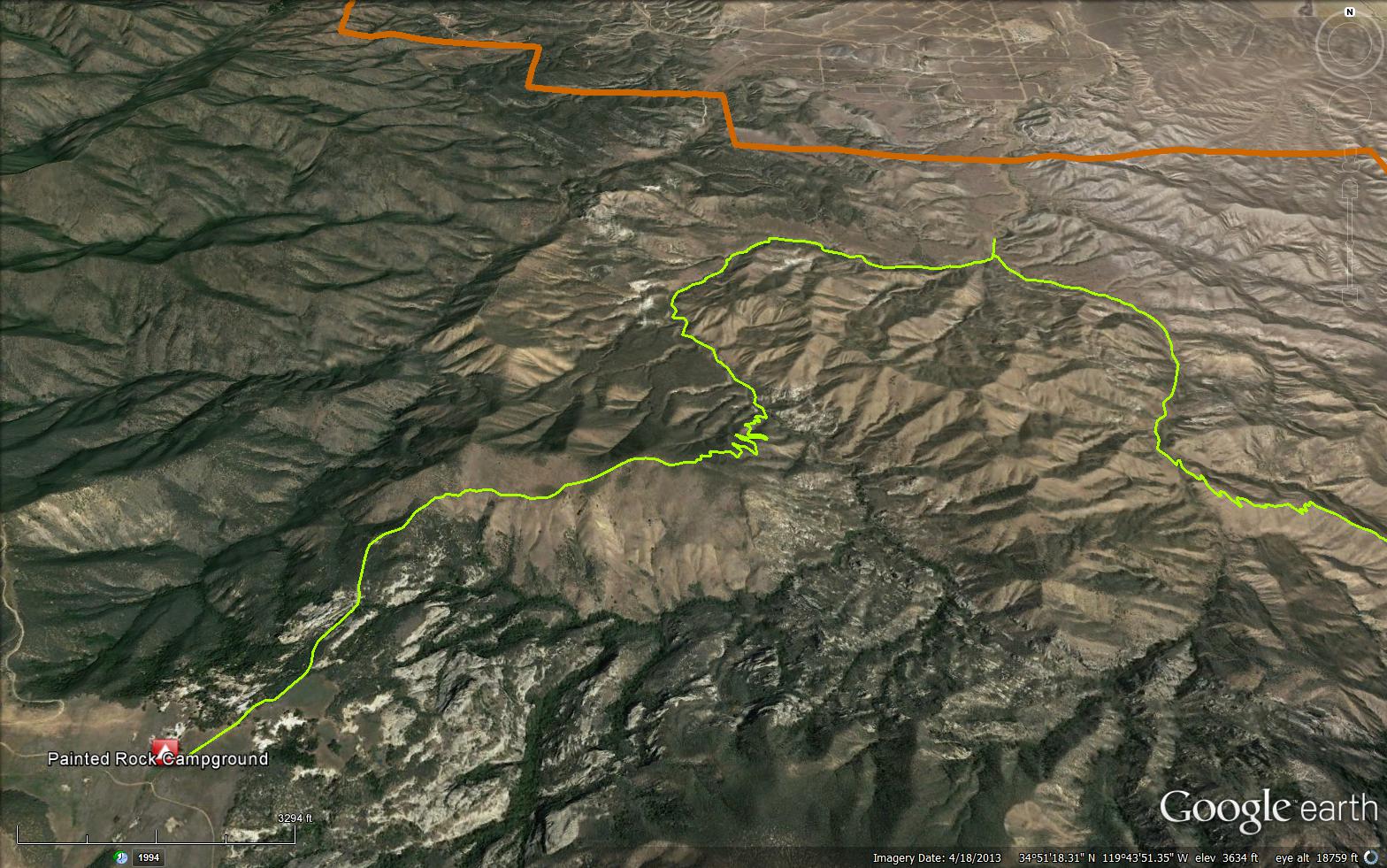
The Rocky Ridge Trail is a scenic 5.54 mile trail in the Non Wilderness Area Wilderness in Santa Barbara County. The trail has great views of the Cuyama Valley and the Caliente Range while you climb up to the Sierra Madre Road and the Painted Rock Camp. Please let us know if you have explored this trail recently.

Trail Details

  • Trail #: 27W04
  • Wilderness Area: Non Wilderness Area
  • County: Santa Barbara County
  • Ranger District: Mt. Pinos Ranger District
  • Trail-head Latitude: -119.70896
  • Trail-head Longitude: 34.87368
  • Water Sources: No Water Available
  • Trail Condition: Kind of Good - Little to no bushwacking and easily followable
  • Topo Maps:
  • Activities & Features:
    • Backpacking
    • Camping
    • Day Hiking
    • Horseback Riding
    • Panoramic Views
    • Peak
    • Wildlife Viewing


Trail Stats

  • Total Elevation Gain: + 2617 feet.
  • Total Elevation Loss: - 599 feet.
  • Overall Average Slope Gain: + 12 %.
  • Overall Average Slope Loss: - 6 %.
  • Kilometers: (km)
  • Meters: (m)
  • Miles: (mi)
  • Feet: (ft)
  • Average Slope: (%)

Trail Camps

Painted Rock Camp - (4650 feet)

Upload Images Aerial Overview Image Login to Download GPS File
Survey This Trail

Survey Photos:


  • T bone - 02-27-2019

  • T bone - 02-27-2019

  • T bone - 02-27-2019

  • T bone - 02-27-2019

  • T bone - 02-27-2019

Submitted Trail Reports

Rocky Ridge Trail Survey - 02-27-2019 - by T bone
Link: Rocky Ridge Trail
Date: 02-27-2019
Surveyor Name:T bone
Trail description:Took Rocky Ridge trail down into lower Lion Canyon and then hiked up Lion Canyon back to the road.  Rocky Ridge trail is in great shape until the switchbacks leading down to Lower Lion Canyon.
Mode of transport:Hike
Trail condition:Needs some work
Images:


Leave A Trail Report

Survey / Report Form - Please click this box to open the form.


Last Updated: Wednesday, February 24, 2016


Join Mailing List
×
Get updates on conditions, surveys and more...


Current Weather »


L.P.N.F. Contacts »

  • Forest Headquarters
    Phone: (805) 968-6640
  • Mt. Pinos District
    Phone: (661) 245-3731
  • Ojai Ranger District
    Phone: (805) 646-4348
  • Santa Barbara District
    Phone: (805) 967-3481
  • Santa Lucia District
    Phone: (805) 925-9538
  • Monterey District
    Phone: (831) 385-5434