 Use Marker Groups
 Wolf 2002
Piru 2003
Day 2006
Zaca 2007
Gap 2008
La Brea 2009

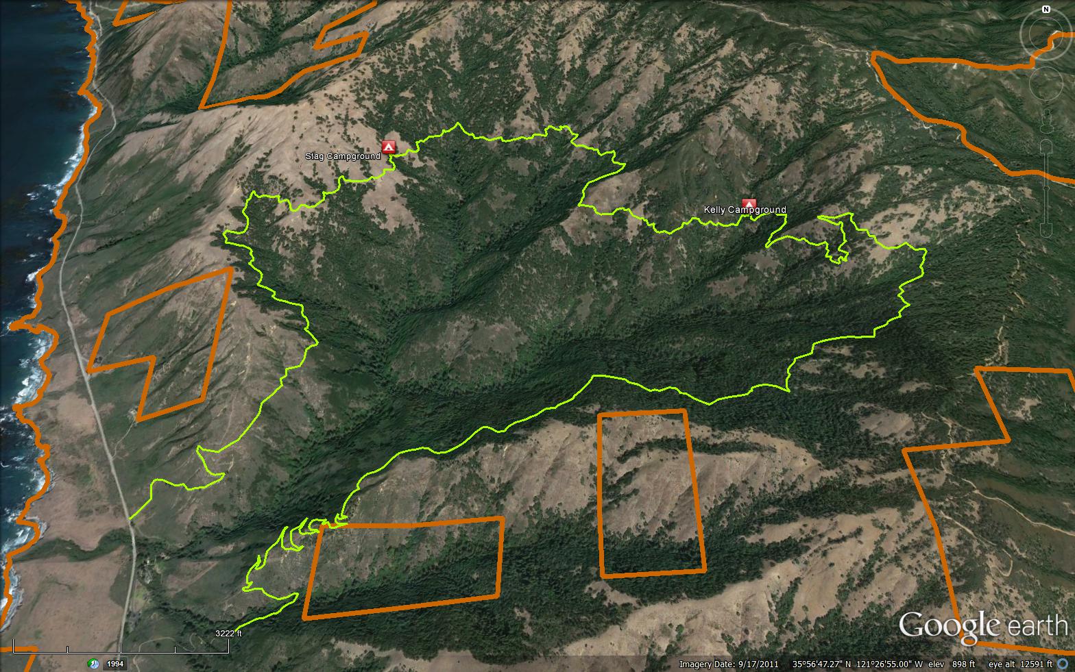
The Prewitt Loop Trail is a 11.42 mile loop trail in Monterey County . The trail connects the located off the Highway 1 near the Pacific Valley Ranger Station. Please let us know if you have explored this trail recently.

 Prewitt Loop Trail Survey - 05-24-2019 - by College Hiker
| Link: | Prewitt Loop Trail |
| Date: | 05-24-2019 |
| Surveyor Name: | College Hiker |
| Trail description: | This trail is not properly maintained, and should not be advertised as a loop trail until it is. We began from the south end and arrived at what we thought was Kelly camp after 3 hours of backpacking and set up camp for the night. The next day, it was hard to find the trail from this area, but eventually we did and hiked for about two hours and did eventually find Kelly camp. We pushed on from there about another hour, and then lost the trail completely. We had no choice but to return to Kelly camp in the cover of darkness. All the while along the trail we were constantly slipping, losing the trail, and trudging through overgrowth and poison oak. That being said, for a day hike the first two miles of the south loop can provide nice views, but only those two. |
| Mode of transport: | Hike |
| Trail condition: | Hard to follow |
| Condition details: | Trail is overgrown along several stretches with mostly poison oak. Many fallen trees. Trail also completely disappears several times, easy to get lost. |
| Images: | An example of the overgrowth. |
Prewitt Loop Trail Survey - 04-30-2016 - by Hiking Guy| Link: | Prewitt Loop Trail |
| Date: | 04-30-2016 |
| Surveyor Name: | Hiking Guy |
| Trail description: | Consistent poison oak growth for the norther 6 miles of the loop. Â Dozens of downed trees and growth of grass have obscured the trail around the middle ridge area, and it is difficult to follow. |
| Mode of transport: | Hike |
| Trail condition: | Hard to follow |
| Condition details: | THICK with poison oak and stinging nettle. Dozens of fallen trees |
 Survey / Report Form - Please click this box to open the form.