 Use Marker Groups
 Wolf 2002
Piru 2003
Day 2006
Zaca 2007
Gap 2008
La Brea 2009

| Date | Surveyor | Water Report |
| 07-10-2021 | Christopher P. Lord | Flowing |
| 04-11-2021 | Oh Three | Flowing |
Camp located north of Cuddy Valley along Pleito Creek. Pleito Creek Camp is surrounded by some large peaks including Antimony and Escapula. It appears to be accessed via an OHV road. More information is needed.


 Pleito Creek Campground Survey - 07-10-2021 - by Christopher P. Lord
| Link: | Pleito Creek Campground |
| Date: | 07-10-2021 |
| Surveyor Name: | Christopher P. Lord |
| Camp Description: | https://christopherplord.blogspot.com/2021/07/antimony-peak-to-pleito-creek-campground.html |
| Water Source: | Flowing |
| Water Source Details: | Spring Pipe Flowing at a rate of 30 seconds per liter |
| Weather Conditions: | |
| Images: | |
Pleito Creek Campground Survey - 04-11-2021 - by Oh Three| Link: | Pleito Creek Campground |
| Date: | 04-11-2021 |
| Surveyor Name: | Oh Three |
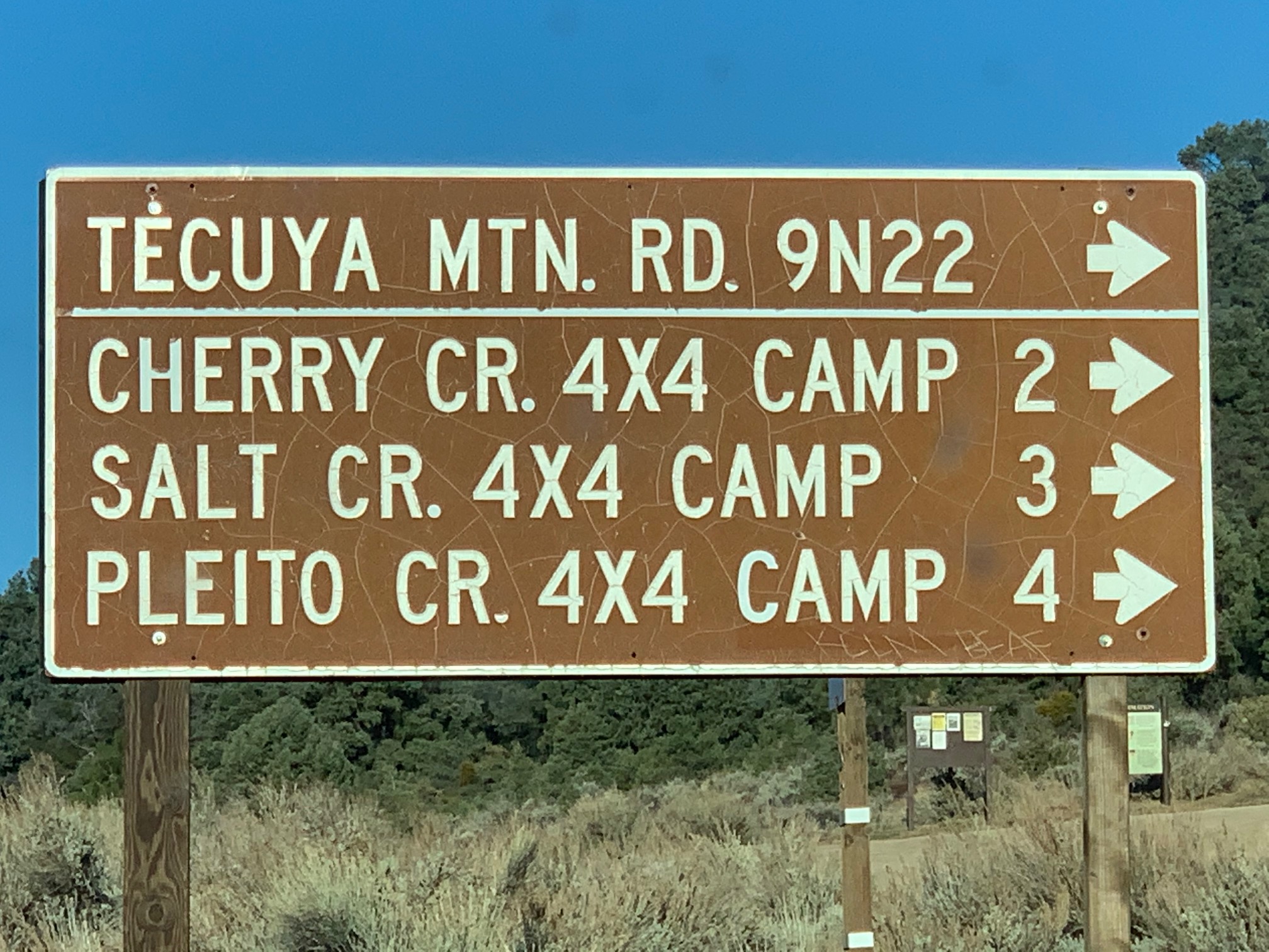
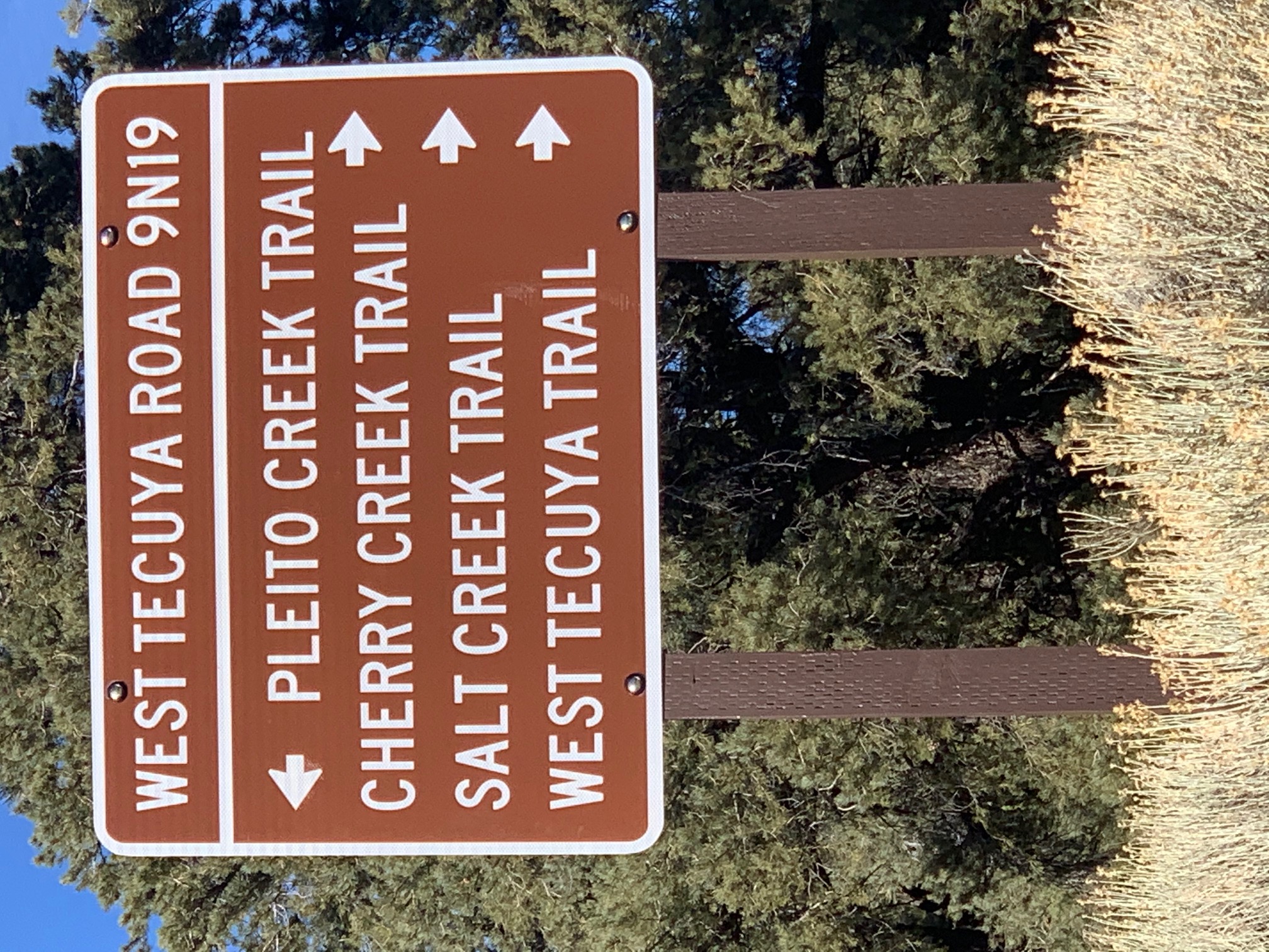
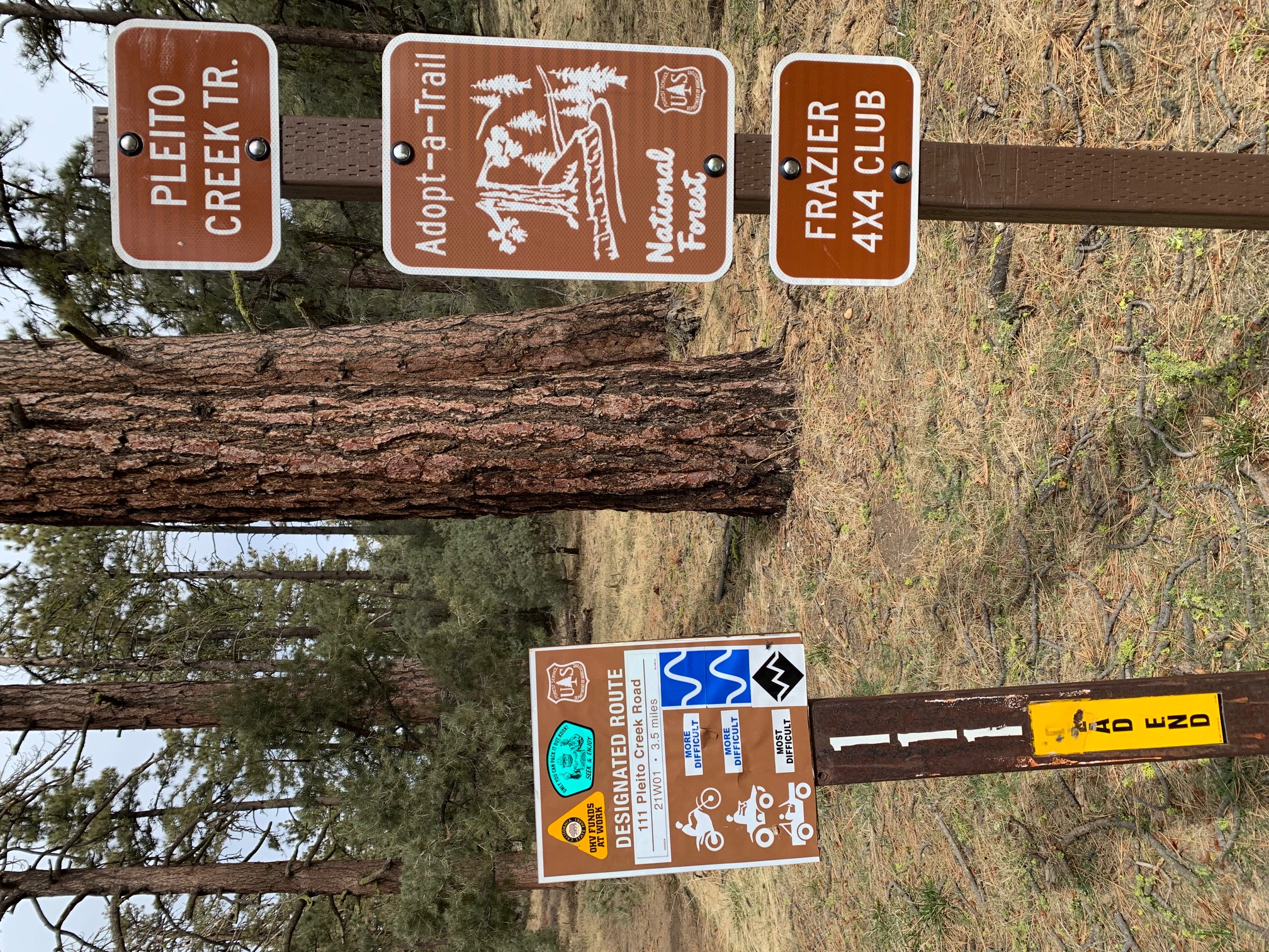
| Camp Description: | Forest Service Road 9N22 is on Cuddy Valley Road 11.0 miles from I-5 Frazier Park exit. Hike a little over 1 mile and 500 feet elevation up to the Tecuya Ridge Road sign. Turn left (west). Stay on main ridge road to OHV Trail 111 Sign. Pleito Creek Trail, like Salt and Cherry Creeks, is a STEEP descent into a north drainage leading ultimately into Wind Wolves Preserve. Pleito Creek Trail is 21W01 and OHV Trail 111. I buy OHV trail maps (CTUC, etc) because OHV trails make great winter hikes when motorbikes are nominally banned. Pleito Creek CG has two campsites, each with a picnic table and metal firepit. There's some trees/brush separating the two sites. Great water flow into a clean water trough. You start at 5,690, Pleito Creek TH is 6,430, and Pleito Creek CG is 5,170. All three (Cherry, Salt and Pleito Creek) are reverse profile hikes, where day 2 has more uphill than day 1. But all 3 drainages have HUGE old trees, both pine and oak, and are worth visiting. What's in a name? NGS map spelling is Pleto Creek CG, Plieto Creek Trail, and Pleito Creek for the actual creek. Signage (see my photos) are all Pleito, which is Spanish for lawsuit. Since Wind Wolves is the old John Fremont rancho, there must be an interesting (litigious) history to this now seldom-visited wilderness. I assume NGS's creative spelling is just a copyright trap. This hike lacks the loop option afforded by the connecting Cherry and Salt Creek drainages. |
| Water Source: | Flowing |
| Water Source Details: | Steady flow into a clean water trough |
| Weather Conditions: | Clear, no moon, nice chill, no snow or ice left |
| Images: | Pleito Creek CG Sign Pleito Creek CG (South) Pleito Creek CG Water Trough NGS Map (Pleito, Pleto, Plieto) |
 Survey / Report Form