 Use Marker Groups
 Wolf 2002
Piru 2003
Day 2006
Zaca 2007
Gap 2008
La Brea 2009

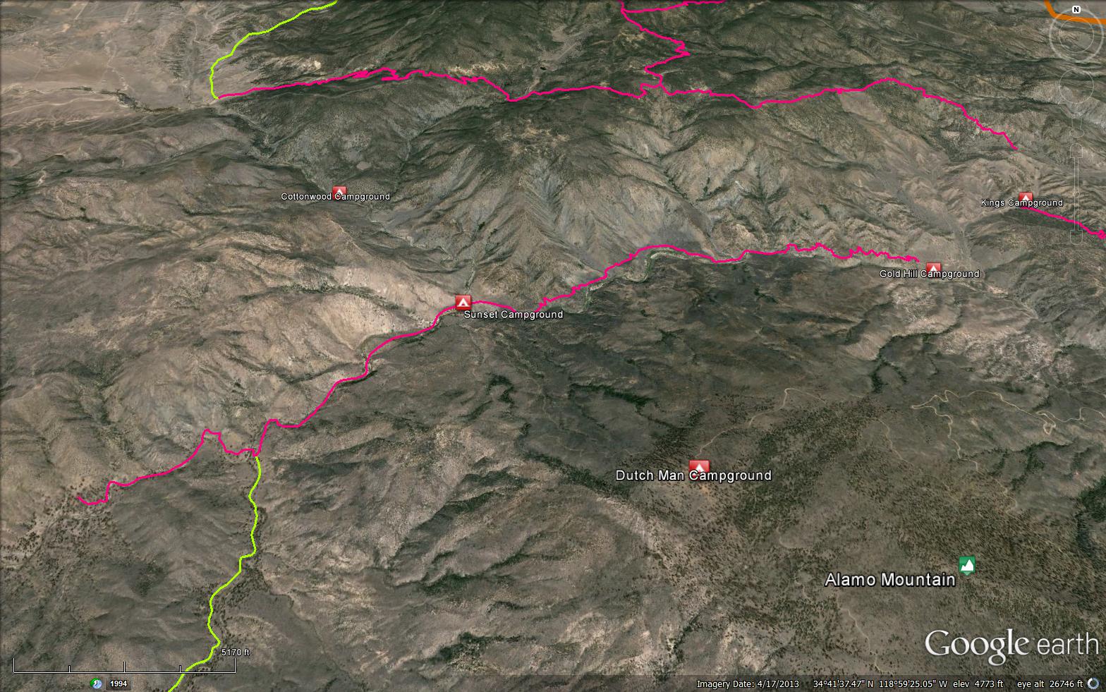
Motorcycle trail from Goldhill Campground. Trail follows Piru Creek and meets Halfmoon Trail 2 miles south of Sunset Campground. This trail provides connections with Lockwood Trail, Miller Jeep Road, and Gold Hill Campground.


 Piru OHV Trail Survey - 10-28-2024 - by Los Padres Forest Association
| Link: | Piru OHV Trail |
| Date: | 10-28-2024 |
| Surveyor Name: | Los Padres Forest Association |
| Trail description: | LPFA Trail Crew brushed the trail completely from its junction with the Halfmoon Trail until Gold Hill Road as part of a CA State OHV Grant. It's as clear as it gets. Get after it! |
| Mode of transport: | Hike |
| Trail condition: | Good shape and easy to follow |
| Images: | |
Piru OHV Trail Survey - 12-31-2022 - by Los Padres Forest Association| Link: | Piru OHV Trail |
| Date: | 12-31-2022 |
| Surveyor Name: | Los Padres Forest Association |
| Trail description: | As part of a LPNF OHV grant, the LPFA Trail Crew spent over a month working on the eastern part of the Piru Creek Trail. We rebuilt failed retaining walls and brushed the trail to the second creek crossing. Really pretty part of the forest. Go check it out! |
| Mode of transport: | Array |
| Trail condition: | Needs some work |
| Images: | Reparing the old destroyed landing mat cribwalls. Work completed on this particular section. Another section of landing mat wall repaired. |
Piru OHV Trail Survey - 06-15-2018 - by Ryan Dee| Link: | Piru OHV Trail |
| Date: | 06-15-2018 |
| Surveyor Name: | Ryan Dee |
| Trail description: | Some areas are overgrown, you can still follow just fine, but bush-whacking.  Fun trail, with plenty of technically challenging and/or narrow sections.  There are several areas that are quite overgrown... would be good to spend a few days in there cutting back some bushes... |
| Mode of transport: | O.H.V. |
| Trail condition: | Needs some work |
| Condition details: | Some areas are overgrown, you can still follow just fine, but bush-whacking |
Piru OHV Trail Survey - 11-14-2016 - by Oh Three| Link: | Piru OHV Trail |
| Date: | 11-14-2016 |
| Surveyor Name: | Oh Three |
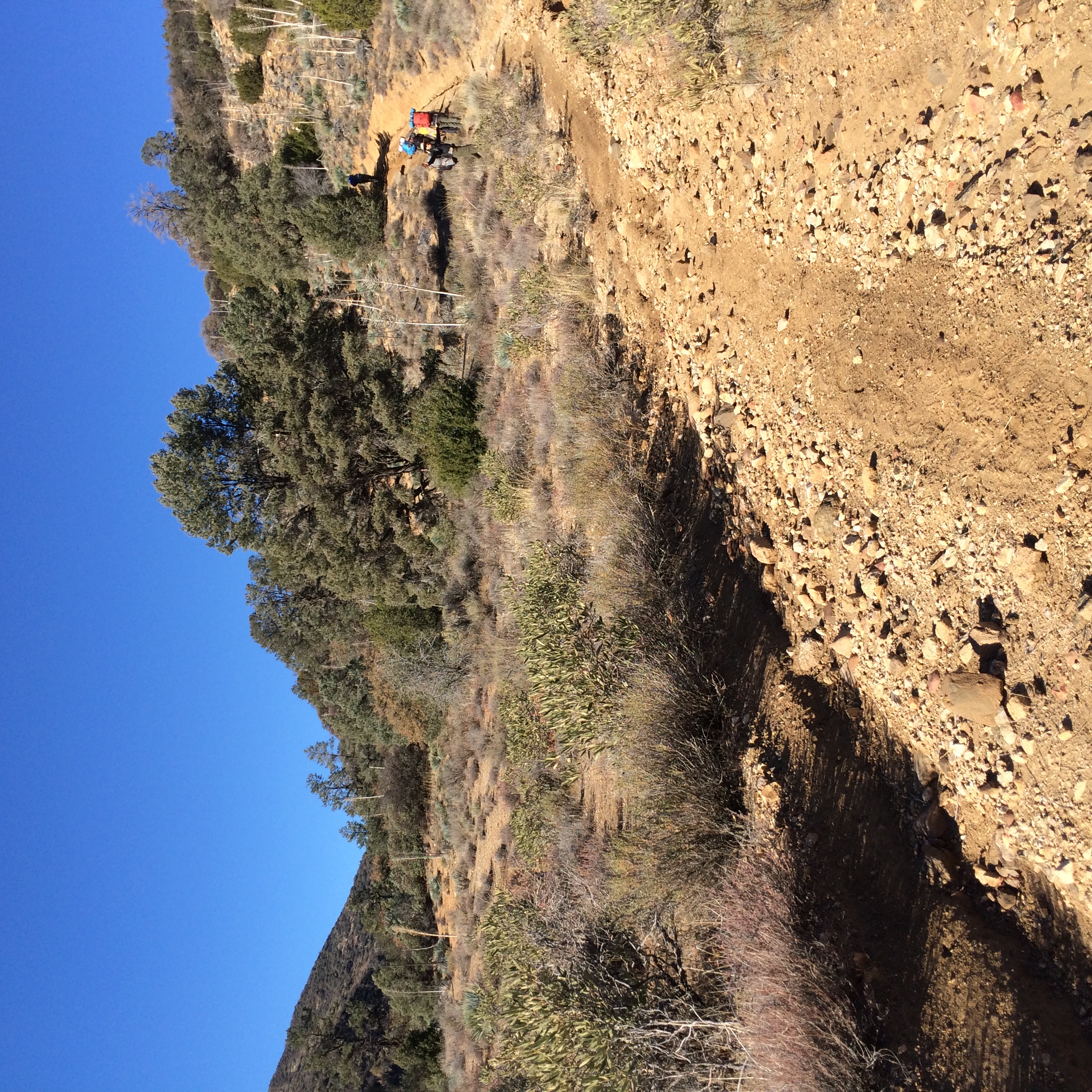
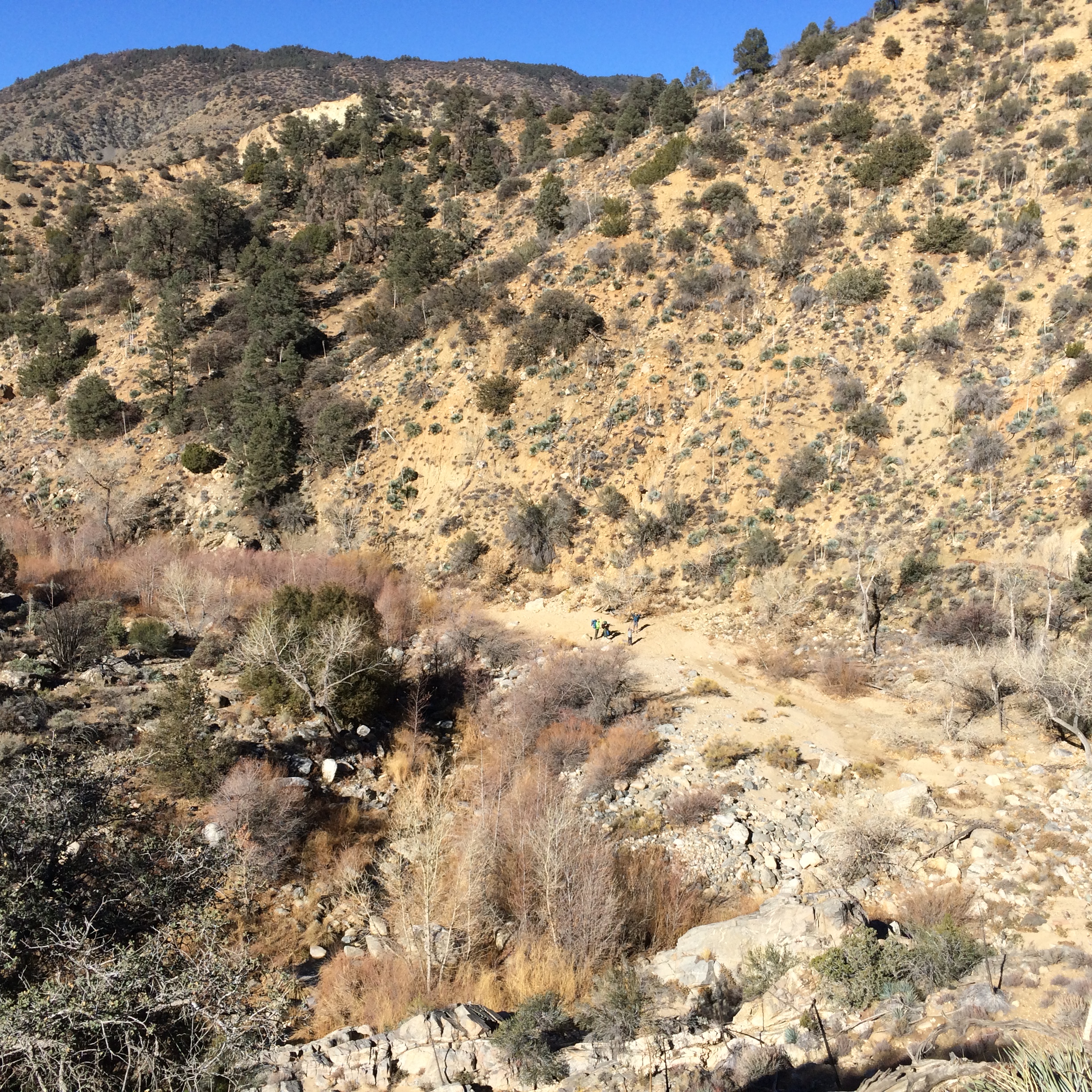
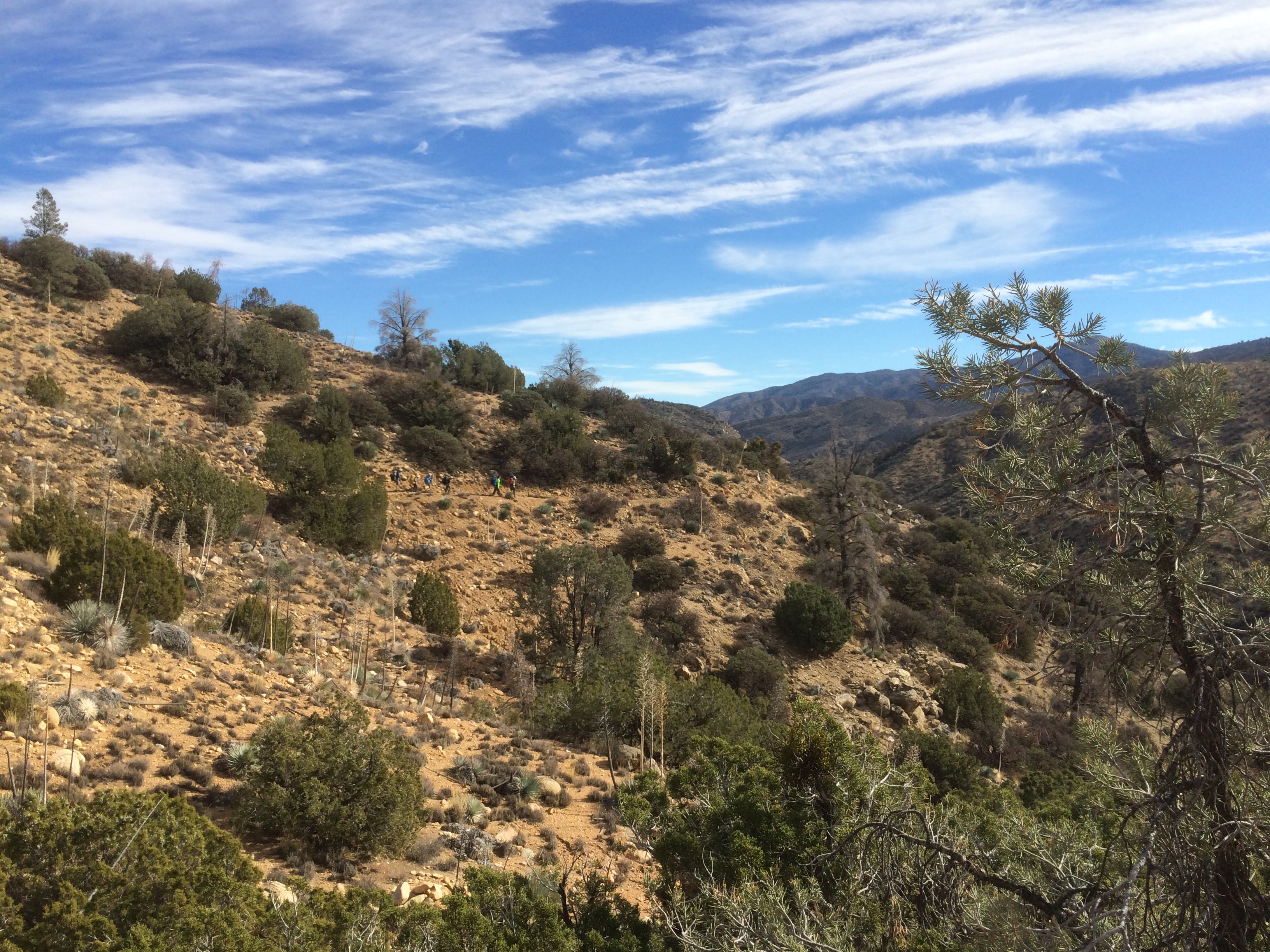
| Trail description: | Piru Creek trail, 20W07 is actually a good backpacking or day hike trail, especially in the Winter after the other access roads are closed for Lockwood Valley, Alamo Mountain, etc. There are some of those annoying long up and down bumps that you find on motorcycle trails. You can access 20W07 year around on Gold Hill road through Hungry Valley OHV. It's 4.8 miles from start to Sunset Camp. See separate review. Then another 1.9 miles to junction with Stone House trail. I haven't done the last segment to Halfmoon Camp. The trail is wonderful to Sunset (very slightly overgrown in parts), and then good to Stonehouse trail. Right after Sunset Camp, there's a wash from the north that basically wipes out the trail. Do NOT follow gypsy motorcycle trail up the mountain. That knucklehead just looped around, u-turned, and came back. Just cross the wash on your own, then head downhill to the brush along the creek to find the trail again. The trail is obvious once you cross that wash. From Sunset to Stonehouse it's good, all the fallen trees have been cut away. The trail leaves the creek a few times but it's not hard to follow. You have the giant pines in there. Jeffrey pines? Beautiful rock cliffs. Little or no water right now. Fill up at Lockwood Creek at Sunset Camp, which is flowing strong. I've taken Boy Scouts from Gold Hill to Sunset each of past 2 years, and it's well received. *Easy* enough for the youngest, and wild scenic and varied enough for the older Scouts. There were fresh mountain lion prints, and I've seen them twice in the past on this trail. Cuidado! |
| Mode of transport: | Hike |
| Trail condition: | Good shape and easy to follow |
| Images: | |
 Survey / Report Form - Please click this box to open the form.